MAP DETAILS | |
|---|---|
| TITLE | Mount Vaca |
| STATE | California |
| LOCATION | Vicinity of Fairfield, 45 miles north of San Francisco |
| SERIES | 15-minute |
| SURVEYED | 1948 and 1951 Aerial and Field Survey |
| EDITION | 1951 |
| PRINTED | 1967 |
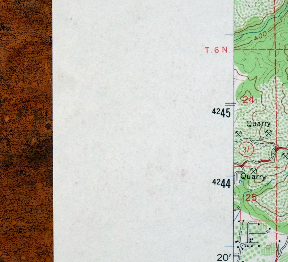
| PRINT NOTES | Thick paper stock, includes woodland tint (green to indicate vegetated areas). A reddish tint is used to indicate urban areas where only landmark buildings are shown. |
| SCALE | 1:62500 |
| CONTOUR INTERVAL | 80 feet |
| SHEET DIMENSIONS | 17 x 21 inches |
| MAP DIMENSIONS | 13 3/4 x 17 1/2 inches |
| COVERAGE AREA | 14 x 17 miles |
| SHEET CONDITION For maps of this vintage, effort is made to note all visible flaws, no matter how minor. | |
| OVERALL CONDITION | Very Good |
| SHEET NOTES | lightly handled, never folded |
| MAP AREA | no markings, no blemishes |
| COLLARS | no wear or tears, no markings, no blemishes |
 | |
| MAP COVERAGE Quadrangle extent overlaid on current basemap. | |
| PLACENAMES Depending on map series and survey date, all of the features listed below may not be shown on this map. This list contains features that currently exist or historically existed within the area covered by the map. The list can be used as a reference to determine if this map covers your area of interest. Placenames are listed alphabetically next to each feature type. | |
| CITIES AND TOWNS (CURRENT) | Fairfield, Green Valley, Suisun City, and Vacaville |
| COUNTIES COVERED | Napa, Solano, and Yolo |
| FEDERAL LAND UNITS | Lake Berryessa |
| RIVERS AND STREAMS | Alamo Creek, Capell Creek, Dry Arroyo, Dug Road Creek, Encinosa Creek, English Creek, Gordon Valley Creek, Green Valley Creek, Kreuse Creek, Laguna Creek, Ledgewood Creek, McCune Creek, Middle Creek, Milliken Creek, Murphy Creek, Oak Moss Creek, Pleasant Creek, Pleasants Creek, Putah Creek, Putah South Canal, Sarco Creek, Soda Creek, Stoney Creek, Suisun Creek, Suisun Slough, Suscol Creek, Sweany Creek, Tulucay Creek, White Creek, Wild Horse Creek, and Wooden Valley Creek |
| WATER BODIES | Lagoon, Lake Berryessa, Lake Curry, Lake Frey, Lake Madigan, Lake Marie, Leoma Lakes, Milliken Reservoir, Moskowitz Reservoir, Mud Lake, and Suisun Reservoir |
| Populated Place: Atlas, Bucktown, Mankas Corner, Tolenas, and Green Valley. Locations: Bar B Ranch, Chimiles Farm Center, Green Valley Picnic Ground, Munson Ranch, Peña House Historic Site, Pioneer Ranch, Rhine School, Alamo Plaza Shopping Center, Dickson Hill Water Treatment Plant, Geri Towne Shopping Center, Green Valley Golf Club, Mission Village Shopping Center, Napa Valley Country Club, Rancho Solano Municipal Golf Course, Solano Mall Shopping Center, Twin Sisters Gun Club, and Waterman Water Treatment Plant. Administrative Boundaries: Chimiles, Suisun, Tolenas, City of Fairfield, and Vacaville Division. Mountain Ranges: English Hills and Vaca Mountains. Mountains, Peaks, and Summits: Bull Hill, Dunns Peak, Ephlin Hill, Lemon Hill, Mount George, Mount Vaca, Okell Hill, Putnam Peak, Red Mountain, Signal Hill, Sugarloaf, Twin Sisters, and Steiger Hill. Valleys and Canyons: Bull Canyon, Burrell Canyon, Capell Valley, Cherry Glen, Cherry Valley, Chimney Canyon, Coleman Canyon, Cook Canyon, Daglia Canyon, Decke Canyon, East Bull Canyon, East Chapman Canyon, East Mitchel Canyon, Foss Valley, Gates Canyon, Gordon Valley, Government Trail Canyon, Johnson Canyon, Kreuse Canyon, Lagoon Valley, Little Valley, Miller Canyon, Negro Canyon, Pleasants Valley, Seventy Acre Canyon, Soda Valley, Steele Canyon, Stone Trough Canyon, Suisun Valley, Weldon Canyon, West Bull Canyon, West Chapman Canyon, West Mitchel Canyon, Wild Horse Canyon, Wild Horse Valley, and Wooden Valley. Parks: Dover Park, Alamo Creek Park, Hillview Park, Laurel Creek Park, Lee Bell Park, Linear Park, Mankas Park, North Orchard Park, Sunrise Park, Tabor Park, Veterans Park, and Wood Creek Park. Drainages: Dug Road Creek, Encinosa Creek, Gordon Valley Creek, Laguna Creek, Middle Creek, Murphy Creek, Oak Moss Creek, Pleasants Creek, Soda Creek, Soda Springs Creek, South Fork English Creek, Spencer Creek, Stoney Creek, White Creek, Wild Horse Creek, Wooden Valley Creek, Wragg Creek, McCoy Creek, and Miller Canyon Creek. Churches: Community Presbyterian Church and Orchard Avenue Baptist Church. Post Office: Fairfield Post Office. Hospitals: Fairfield Medical Arts Center, Kaiser Permanente Medical Center, and NorthBay Medical Center. Lakes and Ponds: Crystal Lake, Lagoon, and Leoma Lakes. Buildings: Fairfield-Suisun Community Branch Solano County Public Library, Fairfield City Hall, Fairfield Civic Center, California Highway Patrol Golden Gate Division - Solano, Cordelia Fire Protection District Station 3, Fairfield Fire Department Station 37, Fairfield Fire Department Station 40, Fairfield Fire Department Station 41, Fairfield Police Department, Napa County Fire Department Station 14 Capell Valley, Napa County Fire Department Station 22 Gordon Valley, Suisun Fire Protection District Station 32, Vacaville Fire Department Station 71, and Vacaville Fire Protection District Station 68. Waterfalls: Green Valley Falls. Dams: Gordon Valley Dam, B J Robinson 2410 Dam, Dickson Hill 1052 Dam, Giles 448 Dam, Green Valley Lake 447 Dam, Lake Curry 14 Dam, Lake Frey 14-003 Dam, Lake La Verne 1414 Dam, Lake Madigan 14-002 Dam, Lake Marie 1-006 Dam, Milliken 7 Dam, Moskowite 416 Dam, Municipal 21 Dam, Olson 1410 Dam, Pennsylvania Creek 1-033 Dam, Putah Diversion Dam, Thompson 2411 Dam, and Timberhill Lake 419 Dam. Gaps: Pearl Gap. Airports: Blake Sky Park. Census: Green Valley Census Designated Place and Moskowite Corner Census Designated Place. Schools: Anna Kyle Elementary School, Atlas Peak School, Blue Mountain School, Capell Elementary School, Cleo Gordon Elementary School, David Weir Preparatory Academy, Dover School, Fairfield High School, Fairfield School, Fairview Elementary School, Gomer School, Gordon Valley School, Hemlock Elementary School, Mount George Elementary School, Oakdale School, Pleasants Valley School, Public Safety Academy, Willis Jepson Middle School, Wooden Valley Elementary School, Accolade Christian School, Alamo Elementary School, Charles L Sullivan Middle School, Dover Academy for International Studies, Fairfield-Suisun Adult School, Fairfield - Suisun Adult School, Falls Elementary School, Grange Middle School, H Glenn Richardson Education Complex, Holy Spirit School, K I Jones Elementary School, Mary Bird High School, Orchard Elementary School, Sem Yeto Continuation High School, Solano Christian Academy, and Suisun Valley K - 8 School. Ridges: Blue Ridge, Pleasants Ridge, and Wragg Ridge. Reservoirs and Tanks: Lake Curry, Lake Frey, Lake Madigan, Lake Marie, Milliken Reservoir, Moskowitz Reservoir, Mud Lake, and Suisun Reservoir. Flats: Adams Flat, Bear Flat, Jack Rabbit Flat, Pumpkin Flat, Snow Flat, and Wind Flat. Towers: KUIC-FM (Vacaville). Pillars: Buzzard Rock, Jenkins Rock, and Raney Rock. Springs: Tindle Spring and Tolenas Springs. Cemetery: Fairmont Memorial Park and Saint Alphonsus Catholic Cemetery. | |
| SHIPPING AND RETURNS | |
 This map sheet will be carefully rolled in a sturdy tube and shipped via the US Postal Service. If you find that the sheet you receive is not as described in the listing, you may ship it back to us for a refund of the purchase price. | |
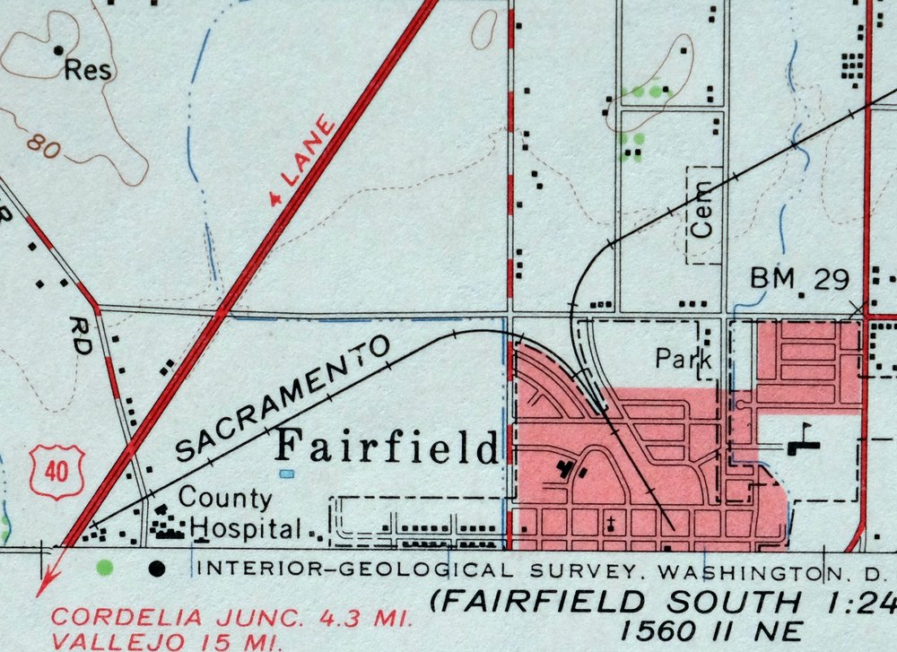
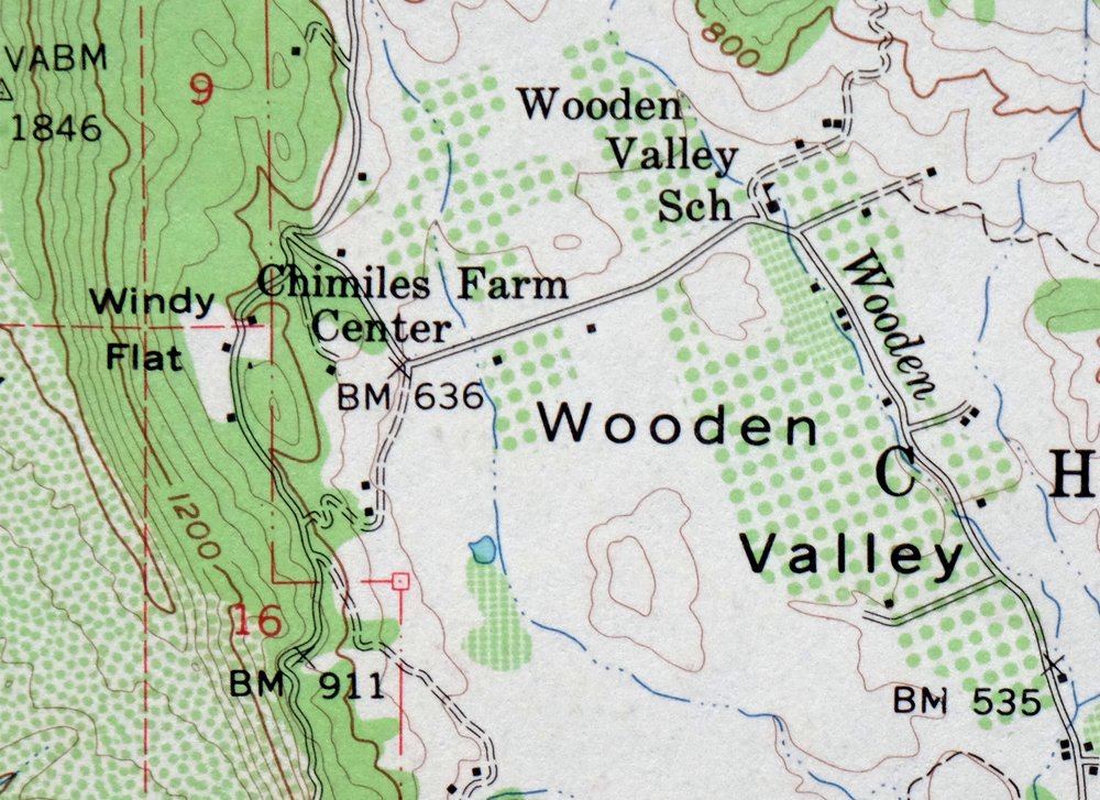
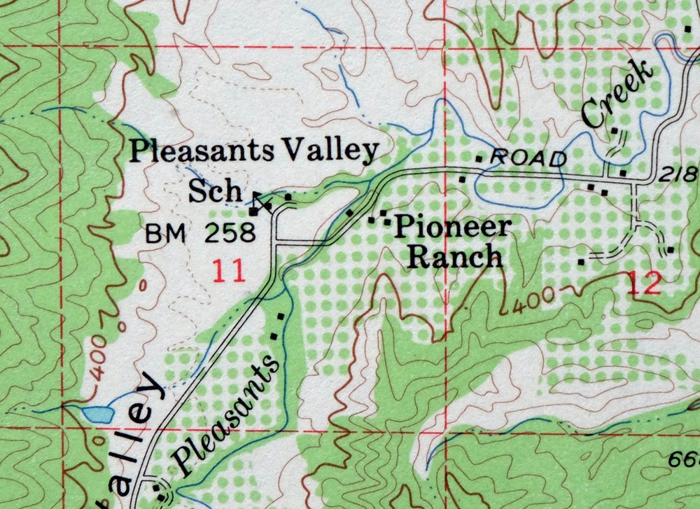
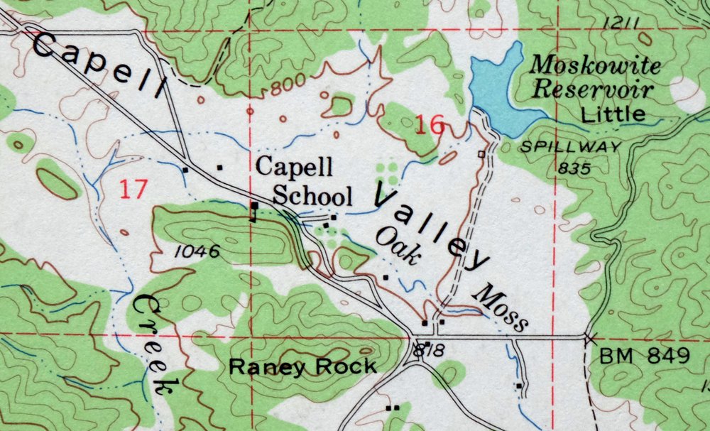
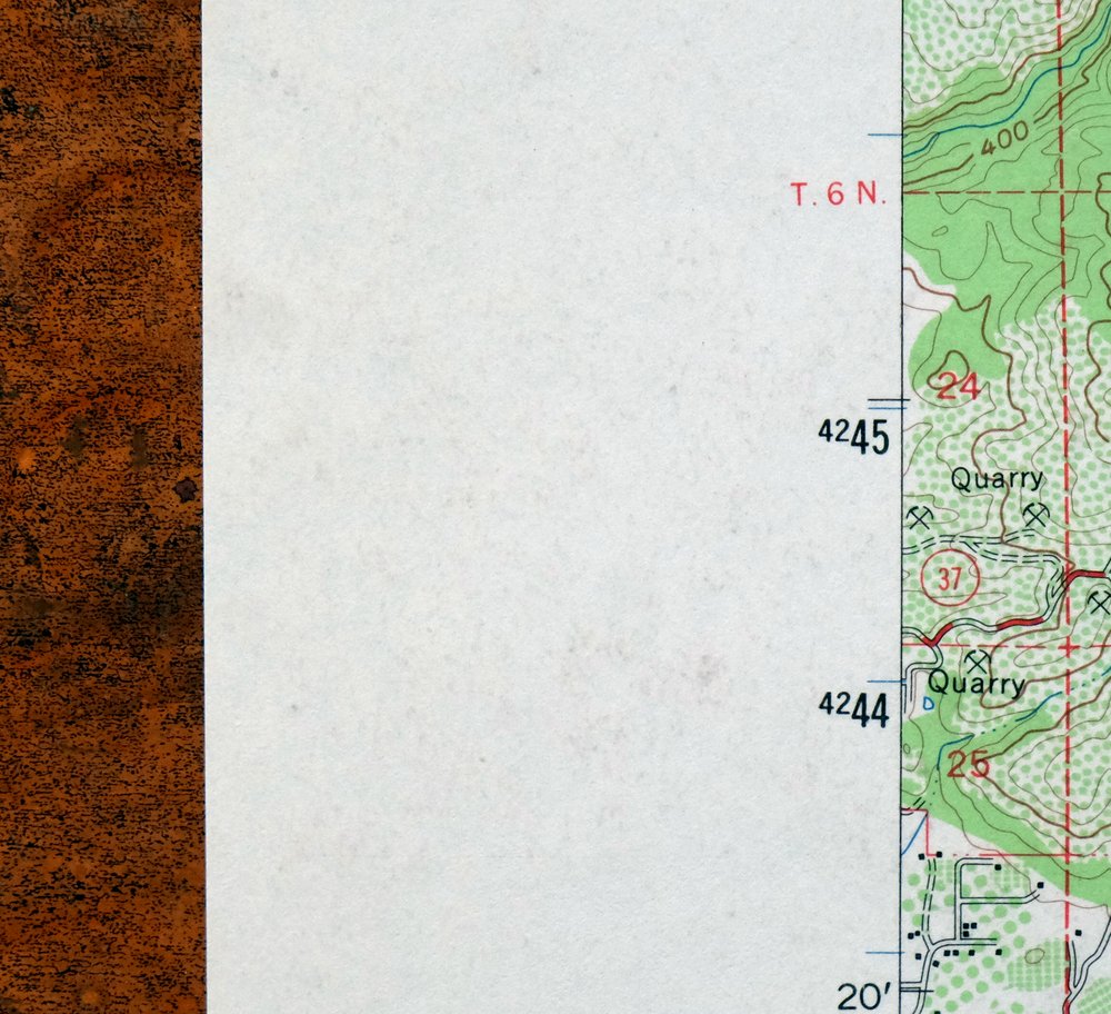
Mount Vaca California Fairfield Vacaville USGS Topo Map 1967
$40
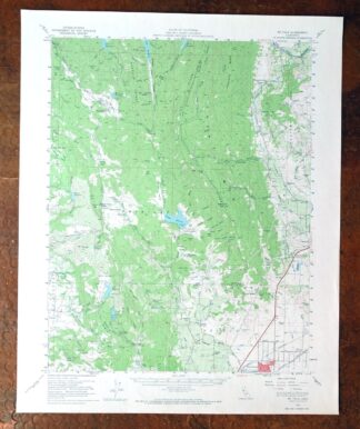
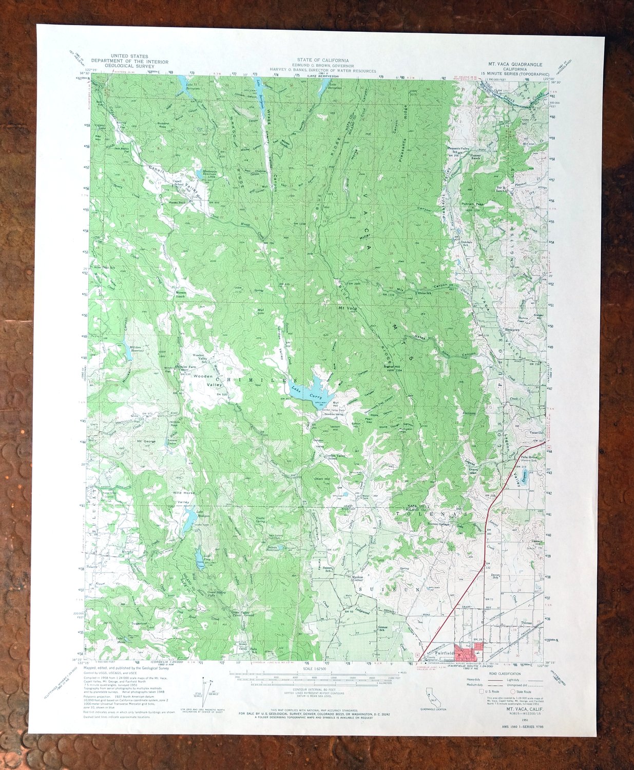
This USGS 15-minute topographic map is a 1951 edition printed in 1967, in very good condition on thick stock, lightly handled and never folded. The quad sits in the hills north of Fairfield and takes in the area around Vacaville, Suisun City, and Green Valley, spanning parts of Napa, Solano, and Yolo counties, with a portion of Lake Berryessa within its bounds. Mount Vaca and the surrounding coast-range ridges give the sheet its name and its 80-foot contour lines trace terrain that rises well above the valley floor to the east. Having never been folded and printed on heavier stock, this sheet has been kept flat and clean and would frame well.
In stock
This vintage sheet is a 1951 edition of the Mount Vaca California USGS topographic map. It is an original 59-year-old 1967 United States Geological Survey print in very good condition.
HOW THIS MAP CAN BE USED
In addition to making a fascinating conversation piece, this sheet would look great in a frame or on display, make a unique and prized gift for anyone interested in this area, be perfect as a reference for genealogy studies or general historical research, or fill that missing piece in your collection. Maps of this vintage are printed on durable stock and are well-suited for outdoor activities and recreation of all kinds, including hiking, backpacking, hunting, rafting and kayaking, backcountry skiing, geocaching, general exploration, treasure hunting, etc.
FEATURES SHOWN ON THE MAP
The Mount Vaca 15-minute map shows cities and towns, roads, railroads, utilities and energy infrastructure, rivers, creeks, elevation contour lines, public land survey lines, county, state, and other administrative boundaries as they existed at the time of the survey in 1948 and 1951. A reddish tint is used on this sheet to indicate urban areas where only landmark buildings are depicted. Outside of those areas, all known structures (houses, businesses, churches, schools, barns, cabins, etc) are shown.
A VALUABLE HISTORICAL RECORD
Maps from the 15-minute series for the continental United States are no longer produced or printed by the USGS and original prints are becoming increasingly difficult to find. They are a valuable historical record for an area, as they contain many placenames and features that have been dropped from more recent maps.
Nearby maps
-
Pittsburg California Concord Fairfield USGS Topo Map 1965
$38 Add to cart -
Lakeport California Lucerne Nice USGS Topo Map 1977 Vintage
$44 Add to cart -
Port Chicago California Concord Martinez USGS Topo Map 1956
$38 Add to cart -
Petaluma Point California Novato USGS Topographic Map 1951
$30 Add to cart -
San Quentin California Richmond Tiburon USGS Topo Map 1980
$46 Add to cart -

San Rafael California Mill Valley Tiburon USGS Topo Map 1966
$60 Add to cart -
Point Bonita California Sausalito USGS Topographic Map 1955
$44 Add to cart -
Hunters Point California Oakland USGS Topographic Map 1969
$38 Add to cart -
San Francisco South California USGS 7.5-Min Topo Map 1975
$47 Add to cart -

Newark California Fremont Hayward USGS Topo Map 1948 Vintage
$47 Add to cart -

Redwood Point California Fremont Hayward USGS Topo Map 1948
$24 Add to cart -
Palo Alto California Redwood City Ladera USGS Topo Map 1969
$45 Add to cart -
Mindego Hill California Palo Alto USGS Topo Map 1980 Vintage
$32 Add to cart -
Gridley California Oroville Live Oak USGS Topo Map 1959
$37 Add to cart -
Stonyford California USGS 15-Min Topo Map 1967 Vintage
$39 Add to cart -
Fruto California Stony Creek Nye Creek USGS Topo Map 1944
$30 Add to cart -

Cressey California Livingston Delhi USGS Topo Map 1948
$23 Add to cart -

Richardson Springs California Chico Nord USGS Topo Map 1966
$35 Add to cart -

Merced California Planada USGS 15-Min Topo Map 1963 Vintage
$18 Add to cart -

Jawbone Ridge California Buck Meadows USGS Topo Map 1949
$27 Add to cart -
Panther Spring California USGS 15-Min Topo Map 1970 Vintage
$36 Add to cart -

Kinsley California USGS 7.5-Min Topographic Map 1949 Vintage
$32 Add to cart -
Sierraville California Calpine Loyalton USGS Topo Map 1969
$40 Add to cart -

Chowchilla California Le Grand El Nido USGS Topo Map 1962
$20 Add to cart