MAP DETAILS | |
|---|---|
| TITLE | Petaluma Point |
| STATE | California |
| LOCATION | Vicinity of San Rafael, 20 miles north of San Francisco |
| SERIES | 7.5-minute |
| SURVEYED | 1948 and 1949 Aerial and Field Survey |
| EDITION | 1951 |
| PRINTED | 1951 |
| PRINT NOTES | Thick paper stock |
| SCALE | 1:24000 |
| CONTOUR INTERVAL | 20 feet |
| SHEET DIMENSIONS | 22 x 27 inches |
| MAP DIMENSIONS | 18 x 22 3/4 inches |
| COVERAGE AREA | 7 x 9 miles |
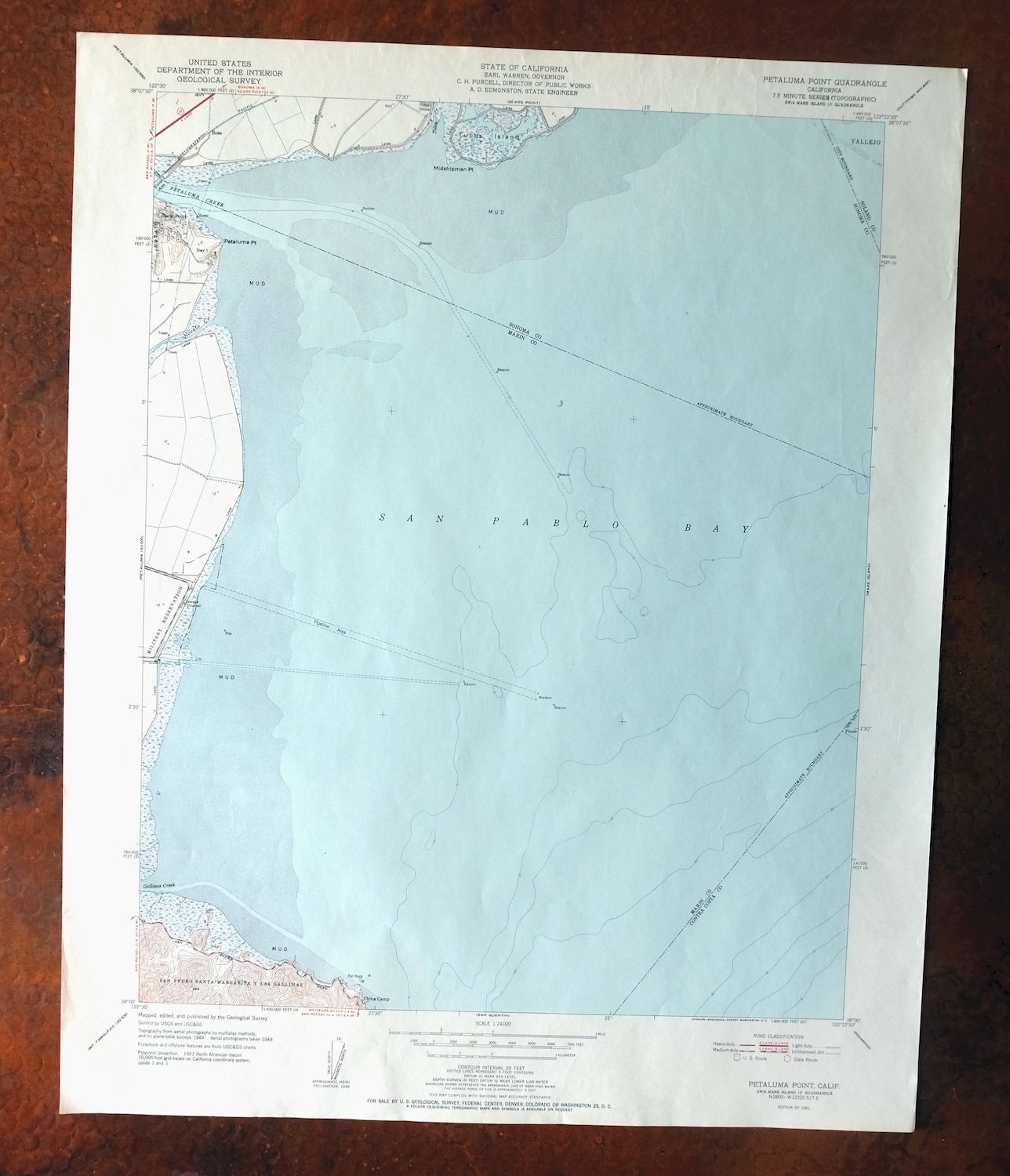
| MAP NOTES | Includes bay depths and bottom characteristics. |
| SHEET CONDITION For maps of this vintage, effort is made to note all visible flaws, no matter how minor. | |
| OVERALL CONDITION | Very Good |
| SHEET NOTES | lightly handled, never folded |
| MAP AREA | no wear, no markings, very minor blemishes |
| COLLARS | no markings, no blemishes, minor edge handling |
| MAP COVERAGE Quadrangle extent overlaid on current basemap. | |
| PLACENAMES Depending on map series and survey date, all of the features listed below may not be shown on this map. This list contains features that currently exist or historically existed within the area covered by the map. The list can be used as a reference to determine if this map covers your area of interest. Placenames are listed alphabetically next to each feature type. | |
| CITIES AND TOWNS (CURRENT) | Black Point-Green Point, Novato, San Rafael, and Santa Venetia |
| COUNTIES COVERED | Marin and Sonoma |
| FEDERAL LAND UNITS | San Pablo Bay National Wildlife Refuge |
| RIVERS AND STREAMS | Miller Creek, Novato Creek, and Petaluma River |
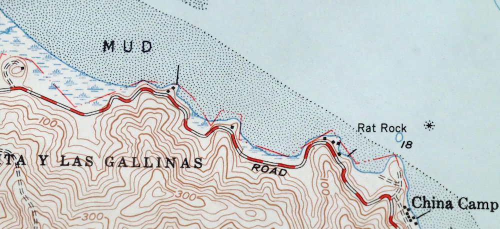
| Locations: Back Ranch Meadows Campground, Buckeye Point Picnic Area, China Camp, China Camp Point Picnic Area, Port Sonoma Marina, and Weber Point Picnic Area. Mountains, Peaks, and Summits: Bullet Hill, Chicken Coop Hill, and Turtle Back. Parks: China Camp Historic Area. Trails: Back Ranch Meadows Fire Trail, Jakes Island Trail, Miwok Fire Trail, Pickleweed Marsh Trail, Ridge Fire Trail, and Shoreline Trail. Drainages: Gallinas Creek, Miller Creek, Novato Creek, Petaluma River, and Tolay Creek. Islands: Day Island and Jakes Island. Capes: Buckeye Point, China Camp Point, Five Pine Point, Midshipman Point, Petaluma Point, and Weber Point. Bays: Rat Rock Cove and San Pablo Bay. Bars: Bullhead Flat and Rat Rock. Flats: Back Ranch Meadows and Miwok Meadows. | |
| SHIPPING AND RETURNS | |
 This map sheet will be carefully rolled in a sturdy tube and shipped via the US Postal Service. If you find that the sheet you receive is not as described in the listing, you may ship it back to us for a refund of the purchase price. | |

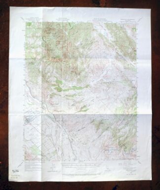
Petaluma Point California Novato USGS Topographic Map 1951
$30
Printed in its year of first publication, 1951, this 7.5-minute USGS topographic sheet is in very good condition—lightly handled and never folded, on thick stock. It takes in the northern reach of San Rafael and Novato in Marin and Sonoma counties, extending to the marshy edge of San Pablo Bay, where part of the San Pablo Bay National Wildlife Refuge falls within the quad boundaries; the smaller communities of Santa Venetia and Black Point-Green Point sit within the quad area as well. The map records bay depths and bottom characteristics along the water, a detail that reflects how closely tied this stretch of shoreline was to the bay itself.
In stock
This vintage sheet is a 1951 edition of the Petaluma Point California USGS topographic map. It is an original 75-year-old United States Geological Survey print in very good condition.
HOW THIS MAP CAN BE USED
In addition to making a fascinating conversation piece, this sheet would look great in a frame or on display, make a unique and prized gift for anyone interested in this area, be perfect as a reference for genealogy studies or general historical research, or fill that missing piece in your collection. Maps of this vintage are printed on durable stock and are well-suited for outdoor activities and recreation of all kinds, including hiking, backpacking, hunting, rafting and kayaking, backcountry skiing, geocaching, general exploration, treasure hunting, etc.
FEATURES SHOWN ON THE MAP
The Petaluma Point 7.5-minute map shows cities and towns, roads, paths, railroads, utilities and energy infrastructure, rivers, creeks, elevation contour lines, public land survey lines, county, state, and other administrative boundaries as they existed at the time of the survey in 1948 and 1949. All known structures (houses, businesses, churches, schools, barns, cabins, etc) are also shown.
A VALUABLE HISTORICAL RECORD
This map is from the 7.5-minute series, the most detailed series that is widely available from the USGS. The 1951 Petaluma Point map is a valuable historical record for the area. It contains some placenames and features that have been dropped from more recent maps.
Nearby maps
-
San Quentin California Richmond Tiburon USGS Topo Map 1980
$46 Add to cart -

San Rafael California Mill Valley Tiburon USGS Topo Map 1966
$60 Add to cart -
Point Bonita California Sausalito USGS Topographic Map 1955
$44 Add to cart -
Port Chicago California Concord Martinez USGS Topo Map 1956
$38 Add to cart -
San Francisco South California USGS 7.5-Min Topo Map 1975
$47 Add to cart -
Hunters Point California Oakland USGS Topographic Map 1969
$38 Add to cart -
Mount Vaca California Fairfield Vacaville USGS Topo Map 1967
$40 Add to cart -
Pittsburg California Concord Fairfield USGS Topo Map 1965
$38 Add to cart -

Redwood Point California Fremont Hayward USGS Topo Map 1948
$24 Add to cart -

Newark California Fremont Hayward USGS Topo Map 1948 Vintage
$47 Add to cart -
Palo Alto California Redwood City Ladera USGS Topo Map 1969
$45 Add to cart -
Mindego Hill California Palo Alto USGS Topo Map 1980 Vintage
$32 Add to cart -
Lakeport California Lucerne Nice USGS Topo Map 1977 Vintage
$44 Add to cart -
Stonyford California USGS 15-Min Topo Map 1967 Vintage
$39 Add to cart -
Gridley California Oroville Live Oak USGS Topo Map 1959
$37 Add to cart -

Cressey California Livingston Delhi USGS Topo Map 1948
$23 Add to cart -
Fruto California Stony Creek Nye Creek USGS Topo Map 1944
$30 Add to cart -

Merced California Planada USGS 15-Min Topo Map 1963 Vintage
$18 Add to cart -

Richardson Springs California Chico Nord USGS Topo Map 1966
$35 Add to cart -

Chowchilla California Le Grand El Nido USGS Topo Map 1962
$20 Add to cart -

Jawbone Ridge California Buck Meadows USGS Topo Map 1949
$27 Add to cart -
Greenfield California Salinas River USGS Topo Map 1973
$30 Add to cart -

Kinsley California USGS 7.5-Min Topographic Map 1949 Vintage
$32 Add to cart -

Firebaugh California Mendota USGS Topo Map 1947 Vintage
$18 Add to cart