MAP DETAILS | |
|---|---|
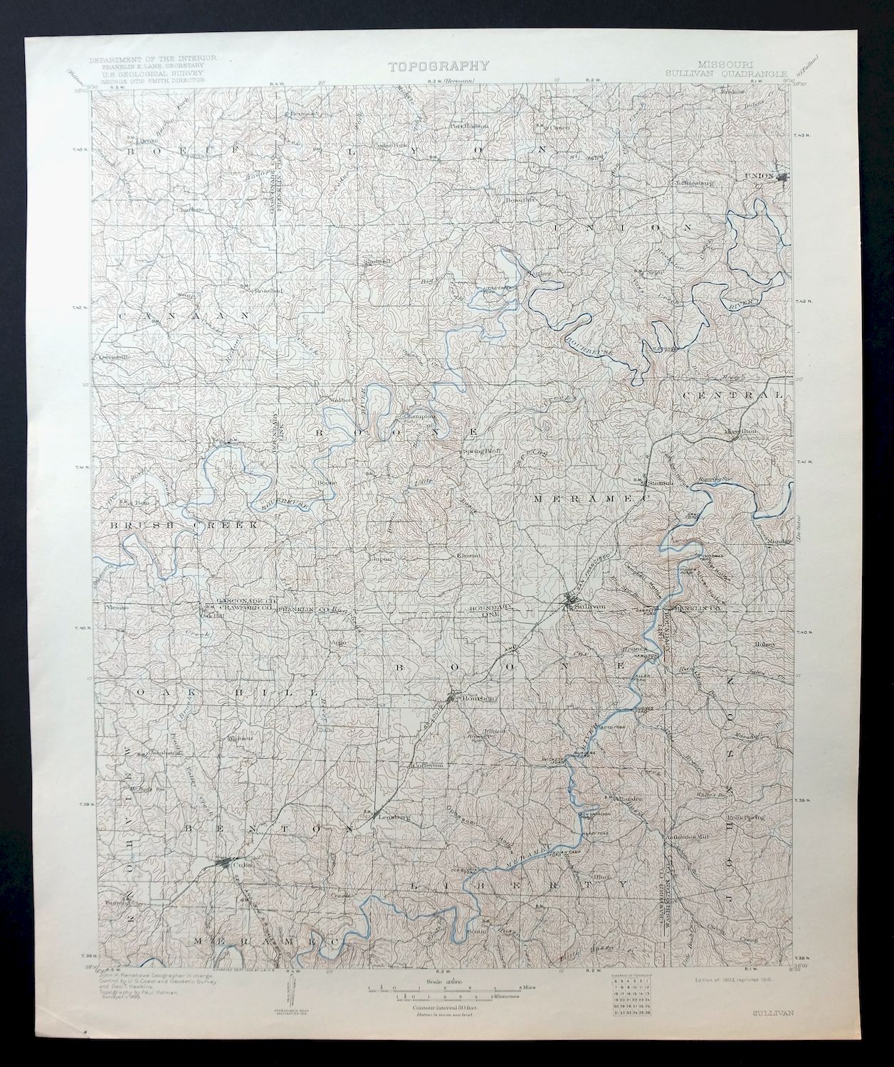
| TITLE | Sullivan |
| STATE | Missouri |
| LOCATION | 65 miles southwest of Saint Louis |
| SERIES | 30-minute |
| SURVEYED | 1899 Field Survey |
| GEOGRAPHER | John H. Renshawe |
| ENGRAVED | 1902 |
| EDITION | 1903 |
| PRINTED | 1916 |
| PRINT NOTES | Thick paper stock |
| SCALE | 1:125000 |
| CONTOUR INTERVAL | 50 feet |
| SHEET DIMENSIONS | 16 x 20 inches (approximate) |
| MAP DIMENSIONS | 13 3/4 x 17 1/2 inches |
| COVERAGE AREA | 27 x 35 miles |
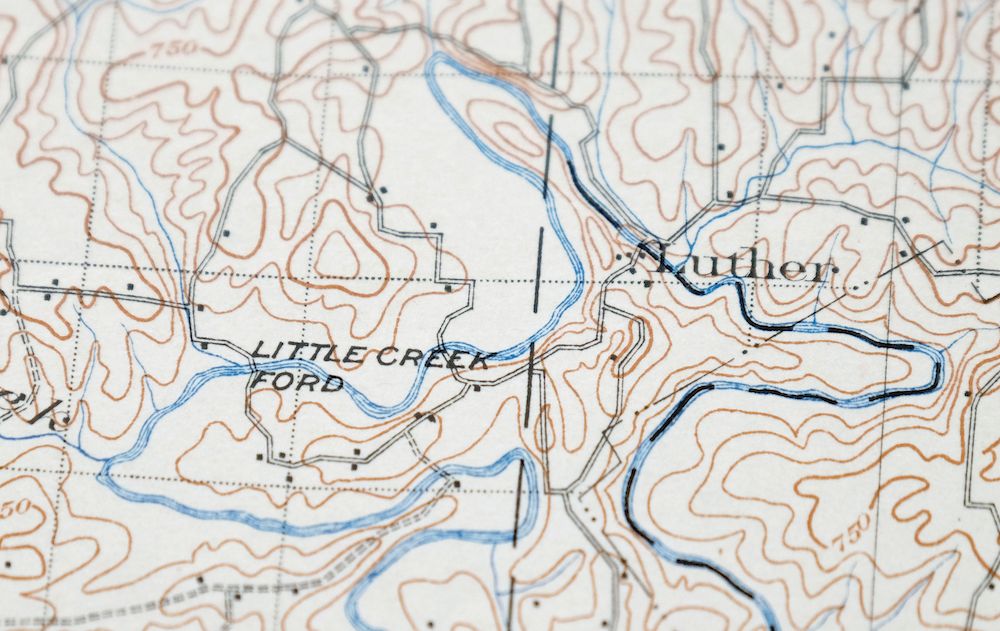
| MAP NOTES | Informative historical snapshot of a portion of east-central Missouri including dozens of old river crossing names, 'fords', on the Meramec and Bourbeuse Rivers. |
| SHEET CONDITION For maps of this vintage, effort is made to note all visible flaws, no matter how minor. | |
| OVERALL CONDITION | Excellent |
| SHEET NOTES | very lightly handled, never folded, smooth and flat |
| MAP AREA | flawless map area |
| COLLARS | no wear or tears, no markings, no blemishes |
| MAP COVERAGE Quadrangle extent overlaid on current basemap. | |
| BACKSIDE LEGEND | |
 A map summary is printed on the back side of the Sullivan sheet similar to the one shown in the picture. It outlines the history, purpose, and status of the USGS mapping program at the time of the printing in 1916. It also provides instructions on how to read contour lines and a description of how they are used to depict the terrain. At the bottom of the page is a legend showing all of the symbols used to represent the cultural, relief, and water features found on the map. | |
| PLACENAMES Depending on map series and survey date, all of the features listed below may not be shown on this map. This list contains features that currently exist or historically existed within the area covered by the map. The list can be used as a reference to determine if this map covers your area of interest. Placenames are listed alphabetically next to each feature type. | |
| CITIES AND TOWNS (CURRENT) | Bourbon, Cuba, Drake, Gerald, Leasburg, Leslie, Miramiguoa Park, Oak Grove, Oak Hill, Owensville, Rosebud, Saint Cloud, St. Clair, St. Cloud, Stanton, Sullivan, Union, and West Sullivan |
| COUNTIES COVERED | Crawford, Franklin, Gasconade, and Washington |
| FEDERAL LAND UNITS | Mark Twain National Forest |
| RIVERS AND STREAMS | Ashley Branch, Audrain Branch, Ausbin Creek, Barren Fork, Big Branch, Big Creek, Big Hollow Branch, Big River Creek, Binsbacker Creek, Black Oak Branch, Block Branch, Blue Springs Creek, Bobs Creek, Boehms Creek, Boeuf Creek, Boone Creek, Bourbeuse River, Brazil Creek, Brush Creek, Brushy Branch, Brushy Fork, Buescher Creek, Carter Creek, Clates Creek, Courtois Creek, Crows Creek, Dan Branch, Dierking Branch, Dry Branch, Dry Creek, Dry Fork, Elm Spring Branch, Fenton Creek, Fox Creek, Gal Branch, Greens Creek, Hamby Branch, Hamilton Creek, Happy Sock Creek, Harman Creek, Hecht Creek, Hinch Branch, Hoosier Creek, Indian Creek, Johns Branch, Langejammer Creek, Lick Creek, Little Boone Creek, Little Bourbeuse River, Little Brazil Creek, Little Courtois Creek, Little Creek, Little Spring Creek, Logan Branch, Lollar Branch, Long Branch, Marys Creek, McDade Branch, Meramec River, Middle Fork, Nicks Branch, Northcut Branch, Pine Branch, Pleasant Valley Creek, Prairie Creek, Pruett Creek, Red Oak Creek, Rocky Branch, Roth Creek, Saint Johns Creek, Second Creek, Shoal Creek, Soap Creek, Souder Creek, Spring Creek, Stater Creek, Third Creek, Threemile Creek, Voss Creek, Webber Creek, West Branch Threemile Creek, Whites Creek, and Winsel Creek |
| WATER BODIES | Boo-Boos Lake, Camp Mo-Val and Camp Tambo Lake, Crote Mac Lake, Daizy Vally Reservoir, Dorson Lake, Flamingo Lakes, Forester Lake, Fred Weber Lake, Frerichs Lake Section 22, Gould Lake, Hartnett Lake, Hickory Lake, Holmstrom North Lake, Indian Lake, Jank Lake, Kamler Lake, Keeney Lake, Kozlowski Lake, Matthews Lake, Melody Lake, Mineral Lake, Nolie Lake North, Nolie Lake South, Number 72 Reservoir, Oscar F Juergons Lake, Pea Ridge Tailings Pond, Pine Lake, Skinner-Sorth-Koch-Kreider Lake, Stubblefield Lake, Sutter Lake, and Tea Lakes |
| Locations: Bird Sanctuary, Camp Mihaska, Camp Mo-Val, Camp Tambo, Casco, Cedar Grove School, Davis Ford, Garrett Ford, Hardy Ford, Harrison Ford, Landtown, New Beach, Old Hamilton Works, Reedville School, and Sullivan Country Club. Administrative Boundaries: Township of Benton, Township of Boone, Township of Boone, Township of Brush Creek, Township of Canaan, Township of Johnson, Township of Knobview, Township of Liberty, Township of Lyon, Township of Meramec, Township of Oak Hill, and Township of Union. Mountains, Peaks, and Summits: Bald Hill, Fair View Hill, Flint Hill, Lea Hill, Lone Hill, and Mineral Hill. Valleys and Canyons: Avery Hollow, Bennett Hollow, Bowman Hollow, Campbell Hollow, Copper Hollow, Dutch Hollow, Gamble Hollow, Grant Hollow, Greens Hollow, Greer Hollow, Harman Valley, Hazel Hollow, Iron Hollow, Little Wet Hollow, Miller Hollow, Murphy Hollow, Opossum Hollow, Primrose Hollow, Pump Hollow, Silver Hollow, Sleepy Hollow, Twin Springs Hollow, Wet Hollow, and Wildcat Hollow. Parks: Huzzah State Wildlife Management Area, International Friendship Park, Iroquois Park, Lions Park, and Meramec State Park. Drainages: Cicero Creek, Ashley Branch, Audrain Branch, Ausbin Creek, Barren Fork, Beaver Creek, Bessen River, Big Branch, Big Creek, Big Hollow Branch, Big River Creek, Binsbacker Creek, Black Oak Branch, Blairs Creek, Bass Branch, Block Branch, Blue Springs Creek, Bobs Creek, Boehms Creek, Boone Creek, Bouse Creek, Brazil Creek, Brush Creek, Buescher Creek, Carter Creek, Clates Creek, Courtois Creek, Crows Creek, Dan Branch, Dierking Branch, Doss Branch, Dry Branch, Dry Creek, Dry Fork, Elm Spring Branch, Fox Creek, Frolke Branch, Gal Branch, Greens Creek, Hamby Branch, Hamilton Creek, Happy Sock Creek, Harman Creek, Harris Branch, Hecht Creek, Hinch Branch, Hobo Branch, Huzzah Creek, Hyde Branch, Johns Branch, Jordan Branch, Kelly Branch, Kriete Creek, Langejammer Creek, Lick Creek, Little Boone Creek, Little Bourbeuse River, Little Brazil Creek, Little Creek, Little Spring Creek, Logan Branch, Lollar Branch, Long Branch, Lyman Creek, Martin Branch, Marys Creek, May Branch, McDade Branch, Middle Fork, Nicks Branch, Northcut Branch, Opossum Creek, Payne Branch, Pin Oak Creek, Pine Branch, Pleasant Valley Creek, Prairie Creek, Red Oak Creek, Rocky Branch, Roth Creek, Skinner Creek, Soap Creek, Souder Creek, Spring Creek, Stater Creek, Threemile Creek, Voss Creek, Webber Creek, West Branch Threemile Creek, Whites Creek, and Winsel Creek. Mines: Blanton Copper Mine, Blanton Limonite Bank, Blanton Specular Iron Bank, Bleeding Hill Copper Mines, Bleeding Hill Iron Bank, Carter Lead Mine, Clapps Iron Mine, Copper Hill Mine, Griffith Iron Mine, Hibler Lead Diggings, Hiblers Lead Diggings, Hinch Copper Mine, Hinchs Lead Diggings, Hobo Iron and Sulphur Mines, Iron Ridge Number One Iron Bank, Iron Ridge Number Two Iron Bank, Isabella Iron Bank, Isgreeg Lead Mine, Isgrigs Lead Diggings, J.P. Card and Companys Iron Bank, Knox Number Two Iron Mine, Lockhart Lead Mine, Luke Bluff Lead Mine, Mineral Hill Lead Mines, Old Christy Mine, Old Copper Hill Iron Bank, Pea Ridge Mine, Pinnel Iron Mine, Primrose Hill Iron Bank, Railroad Iron Mine, Ransom Lead Diggings, Red Hill Lead Diggings, Rich Hill Lead Diggings, Rives Copper Mine, Romine Lead Mine, Rueppele Mine, Rutledge Lead Diggings, Scotia Number One Iron Bank, Scotia Number Two Iron Bank, Senator Bucklands Iron Bank, Soulard Lead Mine, Sullivan Lead Mine, Sullivan and Bridell Iron Mine, Taylor Iron Mine, Varris Iron Mine, Weins Lead Diggings, Williams Lead Mine, and Zane Iron Mine. Churches: Church of the Holy Martyrs of Japan, Anaconda Church, Antioch Church, Beemont Church, Blue Spring Church, Brazil Church, Casco Church, Cave Spring Church, Champion City Church, Crossroads Church, Crow Church, Dutch Hill Church, Evergreen Church, Fairview Church, Green Mound Church, Lick Creek Church, Mount Calvary Church, Mount Olive Church, New Friendship Church, New Salem Church, Pentecost Church, Pentecostal Church, Pleasant Ridge Church, Port Hudson Church, Port Hudson Holy Family Church, Red Oak Church, Reedville Church, Rock Hill Church, Saint Gertrude Catholic Church, Saint James Church, Saint Johns Church, Saint Jordans Church, Saint Josephs Catholic Church, Warren Church, Wesleyan Church, Zion Church, and Zoar Church. Lakes and Ponds: Blue Hole, Bluff Lake, Brandel Lake, and Von Hoffman Lake. Buildings: Pea Ridge Hall. Dams: City Park Lake Dam, Ahmad Lake Dam, Alexander Lake Dam, Anglers Lake Dam, Ankar Lake Dam, Becker Lake Dam, Beckmann Number 1 Dam, Berndsen Lake Dam, Bains Lake Dam, Baumstark Lake Dam, Bay Lake Dam, Beuke Lake Dam, Boston Lake Dam, Brandt Lake Dam, Brummet Lake Dam, Budget Buster Dam, Carvers Lake Dam, Castanis Lake Dam, Clover Bottom Fish Farm Lake Dam, Crazy Fox Farm Lake Dam, Cuba Fish Farm Dam, Daizy Valley Lake Dam, Dellistri Dam, Duncan Lake Dam, Durbin Lake Dam, Eickhoff Lake Dam, Elders Lake Dam, Fawn Lake Dam, Flaker Lake Dam, Forboro Lake Dam, Ford Lake Dam, Forester Lake Dam, Frerichs Lake Section 4 Dam, Frerichs Section 22 Lake Dam, Frericks Section 34 Lake Dam, Friedel Lake Dam, Gibbons Lake Dam, Gould Lake Dam, Haladale Lake Dam, Hartnett Lake Dam, Hedrick Lake Dam, Hematite Lake Dam, Hensley Lake Dam, Hickory Lake Dam, Holmstrom North Lake Dam, Holmstrom South Lake Dam, Horse Shoe Lake Dam, Indian Hills Dam, Jackson Lake Dam, Janks Lake Dam, Janssen Lake Dam, Jellystone Park Dam, Justia J Weil Dam, Kamler Lake Dam, Kamper Lake Dam, Keeney Lake Dam, Kehr Lake Dam, Kemp Lake Dam, Klontz Lake Dam, Koedding Lake Dam, Koelling Lake Dam, Kozlowski Lake Dam, Krekder Lake Dam, Lake Northwoods Dam, Lake Northwoods West Dam, Lake Saint Clair Number Three Dam, Landwehr Lake Dam, Langenberg Lake Dam, Laury Lake Dam, Lerwick Lake Dam, Limberg Lake Dam, Lucky Nugget Lake Dam, Marie Otte Dam, Matthews Lake Dam, McGinnis Lake Dam, Melody Lake Dam, Mineral Lake Dam, Mistler Lake Dam, Mo-Val Lake Dam, Moosehorn Lake Dam, Mueller Lake Dam, Neill Lake Dam, Netties Greenhouse Lake Dam, Nolie Lake North Dam, Nolie Lake South Dam, Number 364 Dam, Number 410 Dam, Number 588 Dam, Opossum Hollow Dam, Oscar F Juergens Dam, Panhorst Lake Dam, Pea Ridge Incorporated Lake Dam, Pea Ridge Mine Dam, Pieper Lake Dam, Raack Lake Dam, Ramstein Lake Dam, Roaring Springs Dam, Rutz Lake Dam, Schnitzer Lake Dam, Schroepfer Lake Dam, Sipe Lake Dam, Skinner-Sorth-Koch-Kreider Lake Dam, Stubblefield Lake Dam, Sunswept Lake Dam, Sutter Lake Dam, Tayloe Lake Dam East, Tayloe Lake Dam West, Tea Lake Dam Number 2, Tea Lakes Dam Number 1, Trulaske Lake Section 25 Dam, Trulaske Lake Section 32 Dam, Trulaske Lake Section 33 Dam, Trutsch Lakes Lower Dam, Trutsch Lakes Upper Dam, W J Slais Dam, Wagner Lake Dam, Walker North Lake Dam, Walker South Lake Dam, Weisel Lake Dam, Wilson Lake Dam, Winteround Lake Dam, and Worthington Lake Dam. Gaps: The Narrows and Persimmon Gap. Bridges: Campbell Bridge, Hog Trough Bridge, and Sappington Bridge. Bends: Bartel Bend, Cane Bottom, Fife Bottom, and Kampschroeder Bend. Airports: Cuba Municipal Airport, Findley Field, and Sullivan Memorial Airport. Schools: Adams School, Argo School, Bailey School, Beemont School, Blue Spring School, Buffalo Ridge School, Cavernville School, Champion School, Delhi School, Doer School, Dowler Mill School, Duly School, Evergreen School, Fairview School, Fanning School, Forest Hill School, Gerald School, Good Hope School, Hamby School, Hamilton School, High Point School, Holy Family School, Iron Center School, Iron Ridge School, Japan School, Krakow School, Liberty School, Lick Creek School, Little Creek School, Maple Shade School, Matlock School, Metcalf School, Miller School, Morrelton School, Mound School, Neier School, New Rock School, Nixon School, North Bend School, Oak Grove School, Oak Hill School, Oak Shade School, Old Beaufort School, Old Grove School, Owensville High School, Owensville Junior High School, Pea Ridge School, Pinoak School, Pleasant Hill School, Pleasant Ridge School, Port Hudson Lutheran School, Progress School, Reeds Defeat School, Rineck School, Rocky Ridge School, Saint Johns School, Salem School, School Number 11, School Number 15, School Number 16, Seminary School, Smith School, South Beaufort School, Spring Bluff School, Stivers School, Stringtown School, Sunnyside School, Taylor School, Threemile School, Union School, Valley School, and Vine Hill School. Ridges: Pea Ridge. Reservoirs and Tanks: City Park Lake, Alexander Lake, Alvina Koelling Lake, Arno Kreter Lake, Beckmann Number 1 Reservoir, Baumstark Lake, Boo-Boos Lake, Brummet Lake, Camp Mo-Val and Camp Tambo Lake, Carvers Lake, Castanis Lake, Crote Mac Lake, Cuba Fish Farm Lake, Daizy Vally Reservoir, Dellistri Lake, Dorson Lake, Durbin Lake, Eickhoff Lake, Elders Lake, Fishing Lake, Flamingo Lakes, Ford Lake, Forester Lake, Fred Weber Lake, Frerichs Lake Section 22, Frerichs Lake Section 4, Gould Lake, Harry Panhorst Lake, Hartnett Lake, Hedrick Lake, Herman Huelhorst Reservoir, Hickory Lake, Holmstrom North Lake, Holmstrom South Lake, Homer Hensley Lake, Indian Lake, Jank Lake, Justia J Weil Reservoir, Kamler Lake, Keeney Lake, Kemp Lake, Klontz Lake, Kozlowski Lake, Krekder Lake, Lake Northwood, Lake Northwoods, Lawrence Schroepfer Reservoir, Lerwick Lake, Marie Otte Reservoir, Matthews Lake, Melody Lake, Meramec Park Lake, Mineral Lake, Moosehorn Lake, Neill Lake, Nolie Lake North, Nolie Lake South, Number 72 Reservoir, Number 74 Lake, Oscar F Juergons Lake, Pea Ridge Tailings Pond, Pine Lake, Ramstein Lake, Rutz Lake, Skinner-Sorth-Koch-Kreider Lake, Sprinkles Bass Hole, Stubblefield Lake, Sutter Lake, Tea Lake, Tea Lakes, Triple Lakes, Trutsch Lake, Trutsch Lakes, Union Lake, W J Slais Lake, Walker North Lake, Walker South Lake, and Weisel Lake. Towers: Beaufort Lookout Tower, KBCC-AM (Cuba), KLPW-AM (Union), KLPW-FM (Union), KTUI-AM (Sullivan), KTUI-FM (Sullivan), and Kelleter Lookout Tower. Springs: Blue Springs, Camper Spring, Cress Spring, Elm Spring, Falling Spring, Hamilton Spring, La Jolla Spring, Kratz Spring, Little Creek Spring, McDade Spring, McKee Spring, Pratt Spring, Roaring Spring, Saranac Spring, and Sour Spring. | |
| SHIPPING AND RETURNS | |
 This map sheet will be carefully rolled in a sturdy tube and shipped via the US Postal Service. If you find that the sheet you receive is not as described in the listing, you may ship it back to us for a refund of the purchase price. | |
Sullivan Missouri Mark Twain NF Union USGS Topo Map 1916
$42
First published in 1903, this sheet was printed in 1916 and survives in excellent condition, never folded, smooth and flat on thick stock. The 30-minute quad takes in a stretch of east-central Missouri about 65 miles southwest of Saint Louis, with the towns of Union, Sullivan, St. Clair, Cuba, and Owensville falling within its boundaries, along with portions of Mark Twain National Forest. The Meramec and Bourbeuse Rivers wind across the sheet, and the map records dozens of old crossing names — the fords once used to get from one bank to the other. The reverse carries printed reference material on reading the map and its symbols.
In stock
This antique sheet is a 1903 edition of the Sullivan Missouri USGS topographic map. It is an authentic 110-year-old 1916 United States Geological Survey print in excellent condition.
HOW THIS MAP CAN BE USED
In addition to making a fascinating conversation piece, this sheet would look great in a frame or on display, make a unique and prized gift for anyone interested in this area, be perfect as a reference for genealogy studies or general historical research, or fill that missing piece in your collection.
FEATURES SHOWN ON THE MAP
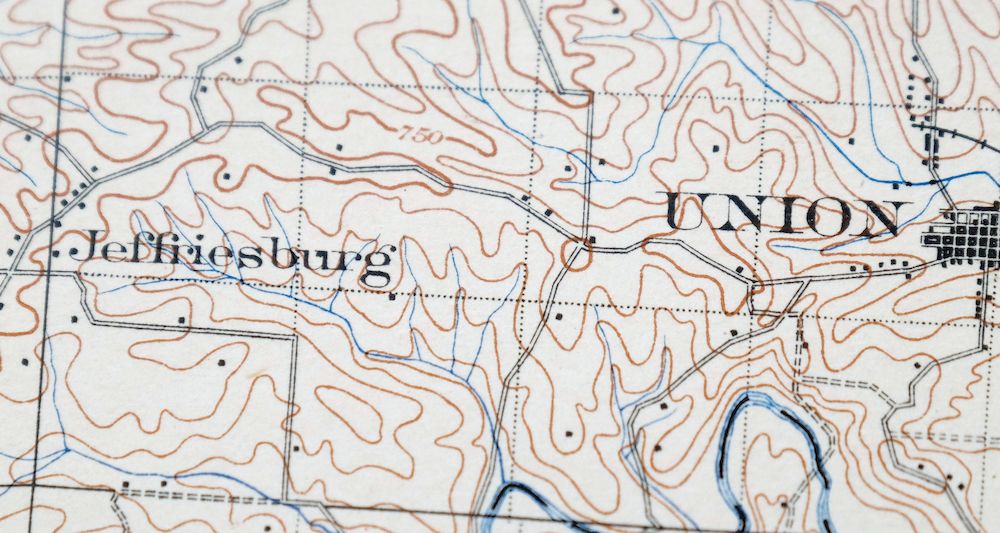
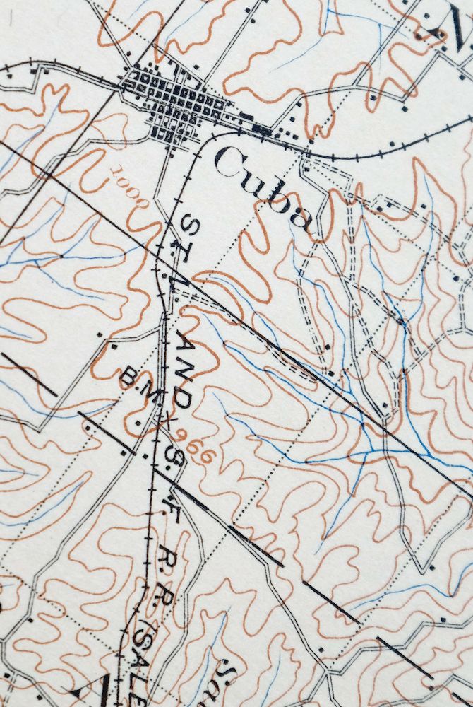
The Sullivan 30-minute map shows cities and towns, roads, railroads, rivers, creeks, elevation contour lines, public land survey lines, county, state, and other administrative boundaries as they existed at the time of the survey in 1899.
A VALUABLE HISTORICAL RECORD
Maps from the USGS 30-minute series have been out of print for many years. They have never been common and original prints are increasingly difficult to find. For areas where the 30-minute map was produced, it is usually the first large-scale survey done by the USGS for that area. These are a valuable historical record, as they contain many placenames and features that have been dropped from more recent series’ and editions.
Nearby maps
-
Potosi Missouri Mark Twain NF Caledonia USGS Topo Map 1906
$55 Add to cart -
Ironton Missouri Mark Twain NF Pilot Knob USGS Topo Map 1968
$37 Add to cart -

Cahokia Illinois St. Louis Dupo USGS Topographic Map 1975
$50 Add to cart -
Renault Illinois Ste. Genevieve Red Bud USGS Topo Map 1915
$45 Add to cart -
Florissant Missouri Hazelwood Ferguson USGS Topo Map 1982
$38 Add to cart -

Granite City Illinois St. Louis Jennings USGS Topo Map 1982
$48 Add to cart -

Hardin Illinois Fieldon Batchtown USGS Topo Map 1964 Vintage
$42 Add to cart -
Alton Illinois Godfrey East Alton USGS Topographic Map 1986
$37 Add to cart -

Chester Missouri Perryville Saint Mary USGS Topo Map 1964
$44 Add to cart -
Bethalto Illinois Alton Wood River USGS Topographic Map 1977
$43 Add to cart -

Pearl Illinois Kampsville Eldred USGS Topo Map 1956 Vintage
$40 Add to cart -
Carlyle Illinois Beckemeyer Huey USGS Topographic Map 1910
$40 Add to cart -
Pleasant Mound Illinois Tamalco USGS Topographic Map 1977
$28 Add to cart -

Quincy Illinois Hannibal Payson USGS Topo Map 1962 Vintage
$43 Add to cart -
Raymond Illinois Farmersville Waggoner USGS Topo Map 1925
$46 Add to cart -

Jonesboro Illinois Cape Girardeau Anna USGS Topo Map 1963
$42 Add to cart -
Patoka Illinois Vernon Shobonier USGS Topo Map 1977 Vintage
$32 Add to cart -

Cairo Illinois Mounds Barlow USGS Topo Map 1964 Vintage
$41 Add to cart -
Springfield East Illinois Sherman USGS Topo Map 1973 Vintage
$32 Add to cart -
Colchester Illinois Plymouth Tennessee USGS Topo Map 1913
$25 Add to cart -

Effingham Illinois Altamont Watson USGS Topographic Map 1964
$50 Add to cart -
La Harpe Illinois Stronghurst Raritan USGS Topo Map 1918
$49 Add to cart -

New Haven Illinois Ridgway Herald USGS Topo Map 1920 Antique
$24 Add to cart -
New Haven Illinois Ridgway Herald USGS Topo Map 1920 Antique
$38 Add to cart
