MAP DETAILS | |
|---|---|
| TITLE | Hartville |
| STATE | Wyoming |
| LOCATION | Vicinity of Wheatland, 75 miles north of Cheyenne, WY |
| SERIES | 30-minute |
| SURVEYED | 1895 Field Survey |
| GEOGRAPHER | Henry Gannett |
| ENGRAVED | 1897 |
| EDITION | 1901 |
| PRINTED | 1922 |
| PRINT NOTES | Thick paper stock |
| SCALE | 1:125000 |
| CONTOUR INTERVAL | 50 feet |
| SHEET DIMENSIONS | 16 1/2 x 20 inches |
| MAP DIMENSIONS | 13 x 17 1/2 inches |
| COVERAGE AREA | 26 x 35 miles |
| MAP NOTES | A fascinating historical snapshot surveyed before the modern highway system, showing historic overland routes, rail lines, and placenames like Lakeview, Uva, and Cassa. |
| SHEET CONDITION For maps of this vintage, effort is made to note all visible flaws, no matter how minor. | |
| OVERALL CONDITION | Good |
| SHEET NOTES | moderately handled, has foldlines, some age discoloration along foldlines |
| MAP AREA | minor wear, no markings |
| COLLARS | minor wear or tears, no markings, minor blemishes, light crease in upper left collar corner |
| MAP COVERAGE Quadrangle extent overlaid on current basemap. | |
| BACKSIDE LEGEND | |
 A map summary is printed on the back side of the Hartville sheet similar to the one shown in the picture. It outlines the history, purpose, and status of the USGS mapping program at the time of the printing in 1922. It also provides instructions on how to read contour lines and a description of how they are used to depict the terrain. At the bottom of the page is a legend showing all of the symbols used to represent the cultural, relief, and water features found on the map. | |
| PLACENAMES Depending on map series and survey date, all of the features listed below may not be shown on this map. This list contains features that currently exist or historically existed within the area covered by the map. The list can be used as a reference to determine if this map covers your area of interest. Placenames are listed alphabetically next to each feature type. | |
| CITIES AND TOWNS (CURRENT) | Cassa, Chugcreek, Fort Laramie, Guernsey, Hartville, Lakeview North, Sunrise, Wheatland, and Y-O Ranch |
| COUNTIES COVERED | Goshen and Platte |
| FEDERAL LAND UNITS | Fort Laramie National Historic Site, Glendo Reservoir, and Guernsey Reservoir |
| RIVERS AND STREAMS | Boxelder Creek, Broom Creek, Chugwater Creek, Cottonwood Creek, Deer Creek, Fish Creek, Horseshoe Creek, Laramie River, Little Cottonwood Creek, Little Deer Creek, Middle Bear Creek, Molly Fork, Muskrat Creek, North Bear Creek, North Laramie River, North Platte River, Patten Creek, Sixmile Creek, South Bear Creek, Spring Creek, and Wheatland Creek |
| WATER BODIES | Festo Lake, Glendo Reservoir, Guernsey Reservoir, Hooley Reservoir, Jones Lake, Long Gulch Reservoir, Lowica Reservoir, Reservoir Number 3, and Twiford Reservoir |
| Locations: Bard Ranch, Anderson Ranch, Antelope School, Bass Ranch, Baxter Ranch, Blevin Ranch, Boner Ranch, Brownrigg Ranch, Clair Milton Ranch, Cold Spring Campground, Crane, Kimble Ranch, Lauk-stein Ruins, Don Cundall Ranch, Emma Ranch, Ferguson Ranch, Floyd Damrow Ranch, Fred Damrow Ranch, Frederick Ranch, Graves Ranch, Greenhope Mine, Haushar Ranch, Hazelwood Ranch, Herman Ranch, Hoy Ranch, J Brown Ranch, Johnson Ranch, K Brown Ranch, McNutt Ranch, Meyers Ranch, Milton Ranch, Moody Community Club, Muthart Place, Newell Ranch, Old 4 J Ranch, Old Doty Ranch Site, Old Guernsey Ranch, Ollie Damrow Ranch, Osborn Ranch, Patten Creek School, Paul Cundall Ranch, Pepper Ranch, Phifer Ranch, Pugsley Ranch, Red Cloud Picnic Ground, Ross Ranch, Russel Ranch, Smith Ranch, Sommers Ranch, Spotted Tail Picnic Ground, Stokes Siding, Sudbury Ranch, Vandra Ranch, Wells Ranch, Wendover Bend Ranch, and West Ranch. Mountain Ranges: Haystack Range, Moore Spring Hills, and Twin Hills. Mountains, Peaks, and Summits: Baldy, Baldy Mountain, Casebier Hill, Chicago Mine Hill, Doty Hill, Eagles Nest, Garnet Hill, Horseshoe Butte, Mummy Mountain, Pine Hill, Porter Rock, Powell Mountain, Round Top, and Stroda Point. Valleys and Canyons: 4 J Canyon, Ayers Draw, Big Sand Draw, Black Canyon, Bohnstead Draw, Britain Draw, Buckshot Draw, Cottonwood Draw, County Line Draw, Deadhorse Canyon, Deadmans Gulch, Divinie Draw, Eagles Nest Canyon, Fish Canyon, Grant Agnew Draw, Hartville Canyon, Little Cottonwood Draw, Long Canyon, Ragan Draw, Sam Draw, Sand Draw, Sawmill Canyon, South Fork Sand Draw, Sparks Canyon, Stroda Draw, Warm Springs Canyon, Webb Canyon, Wendover Canyon, and Whalen Canyon. Parks: Fort Laramie National Historic Site, Register Cliff Monument, and State Park. Drainages: Broom Creek, Chugwater Creek, Cottonwood Creek, Laramie River, Deer Creek, Deercorn Spring Creek, Fish Creek, Horseshoe Creek, Little Cottonwood Creek, Little Deer Creek, Middle Bear Creek, Molly Fork, North Bear Creek, North Laramie River, Patten Creek, Pine Ridge Creek, Rock Creek, Sixmile Creek, South Bear Creek, Spring Creek, and Wheatland Creek. Mines: Chicago Mine, Copper Bottom Mine, Good Fortune Mine, Guernsey Stone Quarry, Ingleside Quarries, Pete Kiewit and Sons Mine, Sunrise Mine, and Torrington Number One Mine. Hospitals: Irvine Home Trust, Meadowlark Maison Hospital, Platte County Memorial Hospital, and Platte County Memorial Nursing Home. Lakes and Ponds: Festo Lake and Jones Lake. Buildings: Antelope Grange Hall. Dams: Damrow Dam, Detention Case Bier 1 Dam, Detention Pine Ridge 1 Dam, Glendo Dam, Glendo Dike Number 1 Dam, Glendo Dike Number 2 Dam, Glendo Dike Number 3 Dam, Grayrocks Dam, Guernsey Dam, Guernsey Fish Pond Dam, Long Gulch Dam, Mbpp Raw Water Storage Dam, McComb Dam, N Laramie Land Company Number 3 Dam, Roath Dam, Sandercock Dam, Sandercock Number 3 Dam, Twiford Dam, Walsh Dam, and Whalen Diversion Dam. Bluffs: Brimmer Point and Register Cliff. Gaps: Antelope Gap, Hell Gap, McCann Pass, McGinnis Pass, Rocky Pass, and Seward Pass. Canals: Bright And Southerland Ditch, City Ditch, Laramie River Ditch Number 1, Highline Ditch, Number 2 Canal, and Uva Ditch. Bends: Bulls Bend. Bays: Davis Bay and Newell Bay. Basins: Crescent Basin and Goshen Hole. Airports: Camp Guernsey Airport and Phifer Airfield. Schools: Cottonwood School, Libbey School, Fort Laramie Middle School, Guernsey-Sunrise High School, Guernsey-Sunrise Junior High School, Guernsey-Sunrise School, Moore Spring School, Sibylee School, Timber Canyon Ranch School, West School, Wheatland High School, and Wheatland Junior High School. Reservoirs and Tanks: Damrow Reservoir, Detention Reservoir Case Bier 1, Detention Reservoir Pine Ridge 1, Glendo Reservoir, Grayrocks Reservoir, Gross Reservoir, Guernsey Fish Pond, Guernsey Reservoir, Hooley Reservoir, Long Gulch Reservoir, Lowica Reservoir, Mbpp Raw Water Storage Reservoir, McComb Reservoir, N Laramie Land Company Number 3 Reservoir, Reservoir Number 3, Roath Reservoir, Sandercock Number 3 Reservoir, Sandercock Reservoir, Twiford Reservoir, and Walsh Reservoir. Flats: Bettelyoun Flats, Gyp Flat, and Harmony Heights. Tunnels: Burlington Northern Tunnel Number 1, Burlington Northern Tunnel Number 2, and Burlinton Northern Tunnel Number 3. Towers: KYCN-AM (Wheatland) and KYCN-FM (Wheatland). Springs: Box Springs, Broom Creek Spring, Cold Spring, Cottonwood Falls Spring, Eagles Nest Spring, Moore Spring, Patten Creek Spring, Twin Springs, Warm Springs, and Woodworth Spring. Slopes: Emigrant Hill and Sunrise Hill. | |
| SHIPPING AND RETURNS | |
 This map sheet will be carefully rolled in a sturdy tube and shipped via the US Postal Service. If you find that the sheet you receive is not as described in the listing, you may ship it back to us for a refund of the purchase price. | |
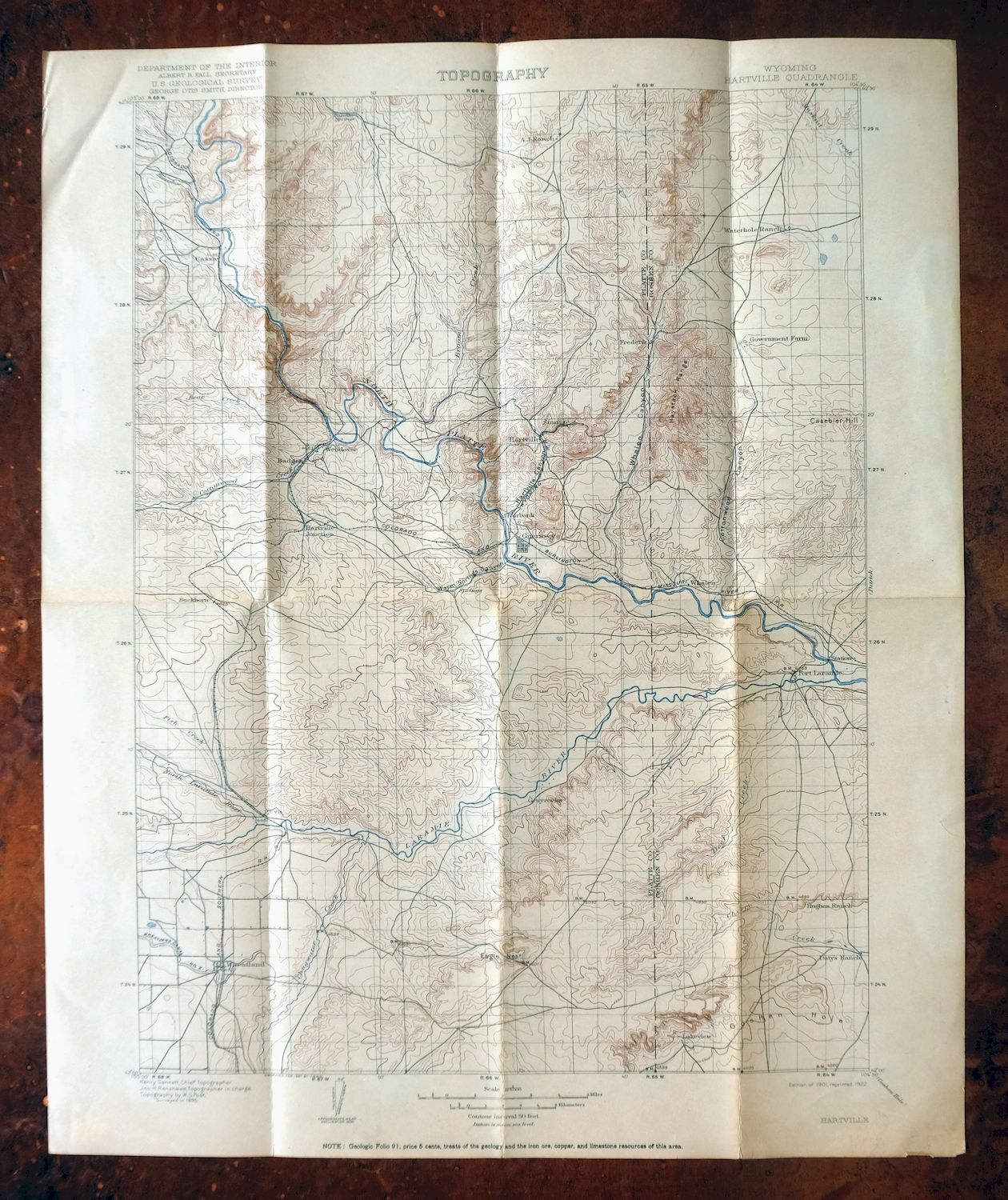
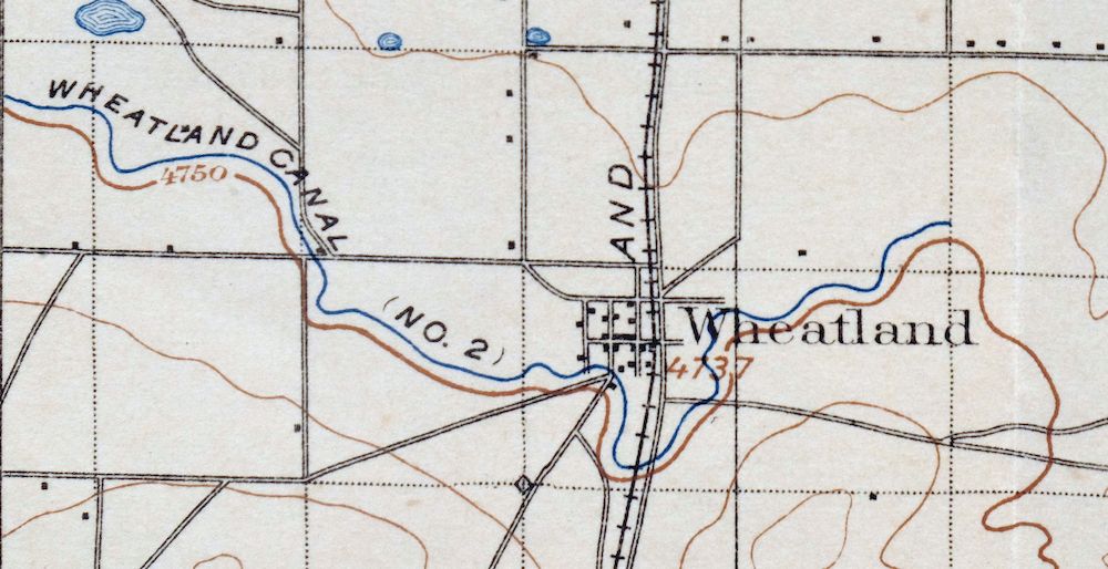
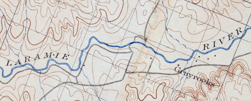
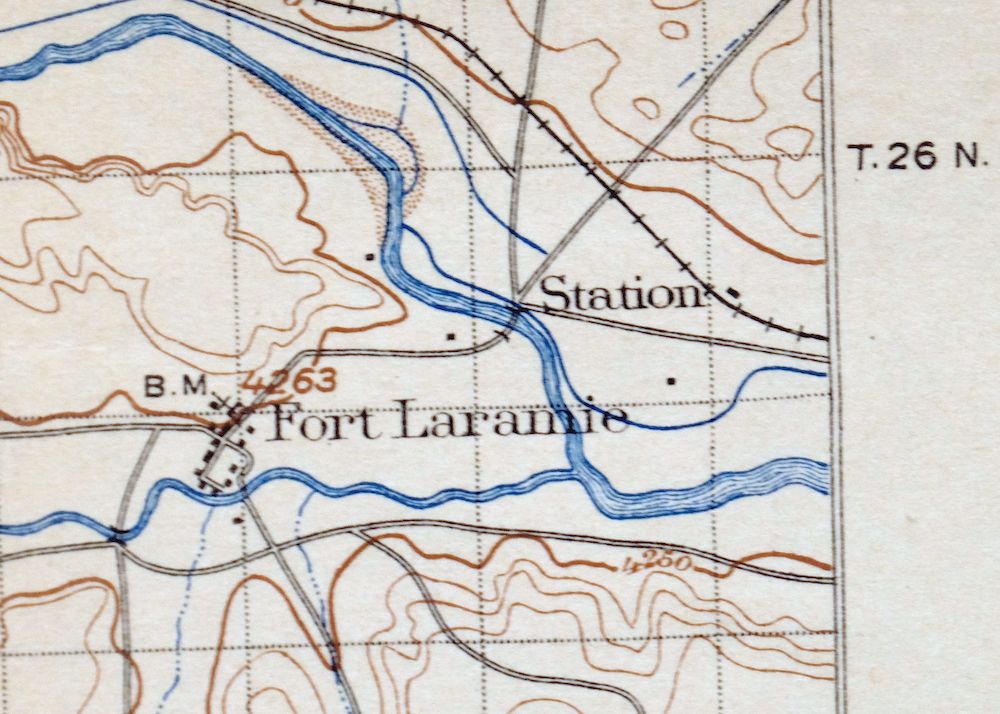
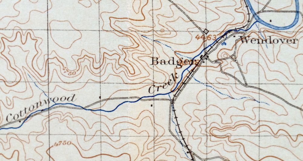
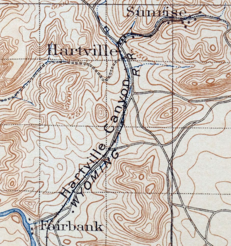
Hartville Wyoming Wheatland Guernsey USGS Topo Map 1922
$46
This USGS 30-minute topographic sheet is a 1901 edition, printed in 1922, and survives in good condition on thick stock with foldlines and some age discoloration along them. The quad area sits in southeastern Wyoming north of Cheyenne, taking in Wheatland and Guernsey along with the community of Hartville that gives the sheet its name, and includes portions of Guernsey and Glendo reservoirs. Surveyed in 1895 under geographer Henry Gannett and engraved in 1897, it records the overland routes, rail lines, and older placenames like Lakeview, Uva, and Cassa that predate the modern highway system. The reverse carries printed reference material on reading the map’s contours and symbols.
In stock
This antique sheet is a 1901 edition of the Hartville Wyoming USGS topographic map. It is an authentic 104-year-old 1922 United States Geological Survey print in good condition.
HOW THIS MAP CAN BE USED
In addition to making a fascinating conversation piece, this sheet would look great in a frame or on display, make a unique and prized gift for anyone interested in this area, be perfect as a reference for genealogy studies or general historical research, or fill that missing piece in your collection.
FEATURES SHOWN ON THE MAP
The Hartville 30-minute map shows cities and towns, roads, railroads, rivers, creeks, elevation contour lines, public land survey lines, county, state, and other administrative boundaries as they existed at the time of the survey in 1895.
A VALUABLE HISTORICAL RECORD
Maps from the USGS 30-minute series have been out of print for many years. They have never been common and original prints are increasingly difficult to find. For areas where the 30-minute map was produced, it is usually the first large-scale survey done by the USGS for that area. These are a valuable historical record, as they contain many placenames and features that have been dropped from more recent series’ and editions.
Nearby maps
-

Goshen Hole Wyoming Lyman Henry USGS Topographic Map 1916
$67 Add to cart -

Eaton Colorado Fort Collins Ault USGS Topographic Map 1957
$25 Add to cart -
Kings Canyon Colorado North Sand Hills USGS Topo Map 1969
$34 Add to cart -

Estes Park Colorado USGS 7.5-Min Topo Map 1961 Vintage
$31 Add to cart -
Trail Ridge Colorado USGS 7.5-Min Topo Map 1962 Vintage
$25 Add to cart -

Pearl Colorado USGS 15-Min Topographic Map 1969 Vintage
$43 Add to cart -
Lyons Colorado USGS 7.5-Min Topographic Map 1961 Vintage
$34 Add to cart -

Eastlake Colorado Westminster Thornton USGS Topo Map 1944
$44 Add to cart -
Eastlake Colorado Westminster Thornton USGS Topo Map 1967
$39 Add to cart -

Lafayette Colorado Westminster Thornton USGS Topo Map 1967
$38 Add to cart -
Eldorado Springs Colorado Arvada Boulder USGS Topo Map 1961
$37 Add to cart -
Hot Sulphur Springs Colorado Parshall USGS Topo Map 1963
$39 Add to cart -
Nederland Colorado Eldora Rollinsville USGS Topo Map 1964
$35 Add to cart -
Pilot Knob Colorado Routt NF USGS Topo Map 1963 Vintage
$37 Add to cart -

Box Elder School Colorado Denver Aurora USGS Topo Map 1942
$38 Add to cart -
Central City Colorado Black Hawk USGS Topo Map 1964 Vintage
$32 Add to cart -
Fitzsimons Colorado Denver Aurora USGS Topo Map 1948 Vintage
$36 Add to cart -
Coal Creek Colorado Aurora USGS Topographic Map 1942 Antique
$45 Add to cart -

Fort Logan Colorado Denver Bow Mar USGS Topographic Map 1941
$38 Add to cart -
Georgetown Colorado Silver Plume USGS Topo Map 1962 Vintage
$33 Add to cart -

Mount Powell Colorado Gore Range USGS Topo Map 1940 Antique
$32 Add to cart -
Highland Ranch Colorado Denver Southglenn USGS Topo Map 1949
$42 Add to cart -
Georgetown Colorado Idaho Springs USGS Topo Map 1980 Vintage
$42 Add to cart -

Daton Peak Colorado Routt NF Hayden USGS Topo Map 1965
$28 Add to cart
