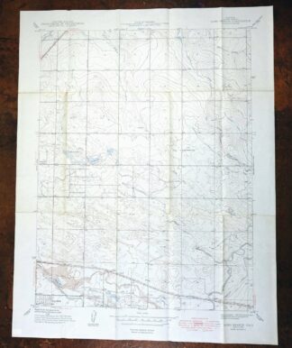
MAP DETAILS | |
|---|---|
| TITLE | Long Branch |
| STATE | Colorado |
| LOCATION | Vicinity of Denver |
| SERIES | 7.5-minute |
| SURVEYED | 1938 Field Survey |
| EDITION | 1948 |
| PRINTED | 1948 |
| PRINT NOTES | Thick paper stock |
| SCALE | 1:24000 |
| CONTOUR INTERVAL | 10 feet |
| SHEET DIMENSIONS | 21 x 27 inches |
| MAP DIMENSIONS | 17 1/2 x 22 3/4 inches |
| COVERAGE AREA | 7 x 9 miles |
| MAP NOTES | A historical snapshot of the area from present-day 96th Avenue south to Sand Creek Park and from Havana Street eastward to Green Valley Ranch, including the area that would become the Rocky Mountain Arsenal, depicting the landscape before suburban develop |
| SHEET CONDITION For maps of this vintage, effort is made to note all visible flaws, no matter how minor. | |
| OVERALL CONDITION | Fair |
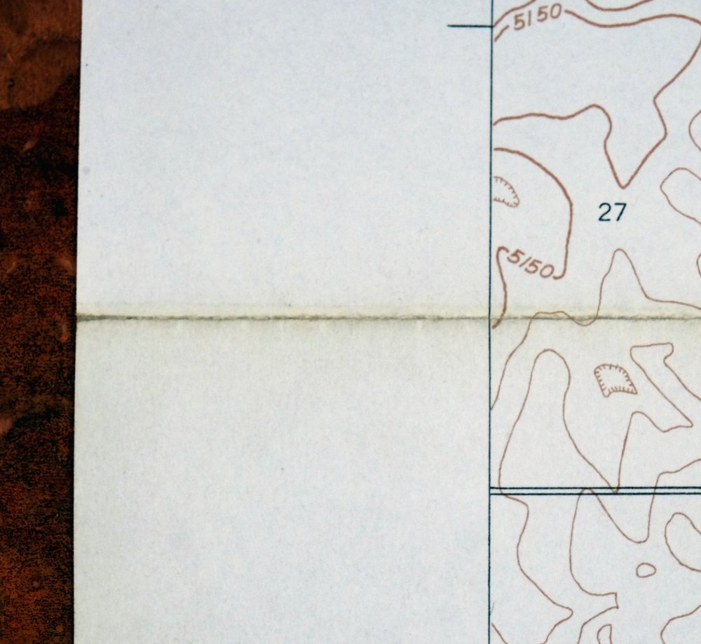
| SHEET NOTES | lightly handled, has foldlines, age discoloration along some foldlines |
| MAP AREA | minor wear, no markings |
| COLLARS | no wear or tears, no markings |
 | |
| MAP COVERAGE Quadrangle extent overlaid on current basemap. | |
| BACKSIDE LEGEND | |
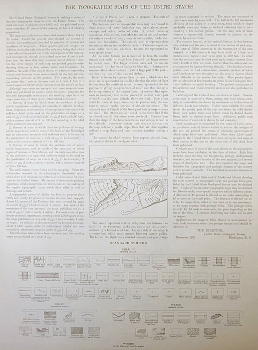 A map summary is printed on the back side of the Long Branch sheet similar to the one shown in the picture. It outlines the history, purpose, and status of the USGS mapping program at the time of the printing in 1948. It also provides instructions on how to read contour lines and a description of how they are used to depict the terrain. At the bottom of the page is a legend showing all of the symbols used to represent the cultural, relief, and water features found on the map. | |
| PLACENAMES Depending on map series and survey date, all of the features listed below may not be shown on this map. This list contains features that currently exist or historically existed within the area covered by the map. The list can be used as a reference to determine if this map covers your area of interest. Placenames are listed alphabetically next to each feature type. | |
| NOTABLE PLACES | Rocky Mountain Arsenal, Aurora, and Green Valley Ranch |
| CITIES AND TOWNS (CURRENT) | Commerce City and Denver |
| COUNTIES COVERED | Adams and Denver |
| FEDERAL LAND UNITS | Fitzsimons Army Medical Center (Closed), Rocky Mountain Arsenal (Closed), and Rocky Mountain Arsenal National Wildlife Refuge |
| RIVERS AND STREAMS | Coal Creek, First Creek, Sand Creek, Second Creek, and Toll Gate Creek |
| WATER BODIES | Lake Mary, Landora Lake, and Reservoir D |
| Locations: Magee and Roydale. Parks: Moorhead Memorial Park. Drainages: Toll Gate Creek. Lakes and Ponds: Bluff Lake. Dams: Cheyenne Lake Dam, Derby Dam, Ladora Lake Dam, Lower Derby Lake Dam, Reservoir C Dam, Reservoir D Dam, Reservoir E Dam, Reservoir F Dam, and Upper Derby Lake Dam. Canals: East Branch Highline Canal, Highline Lateral, Lone Tree Ditch, and Sand Creek Lateral. Basins: Basin F. Schools: Miller School, Park Lane School, and Sable School. Reservoirs and Tanks: Derby Lake, Lake Mary, Landora Lake, Reservoir C, Reservoir D, Reservoir E, Reservoir F, and Upper Derby Lake. | |
| SHIPPING AND RETURNS | |
 This map sheet will be carefully rolled in a sturdy tube and shipped via the US Postal Service. If you find that the sheet you receive is not as described in the listing, you may ship it back to us for a refund of the purchase price. | |
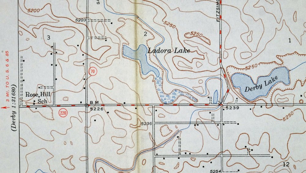
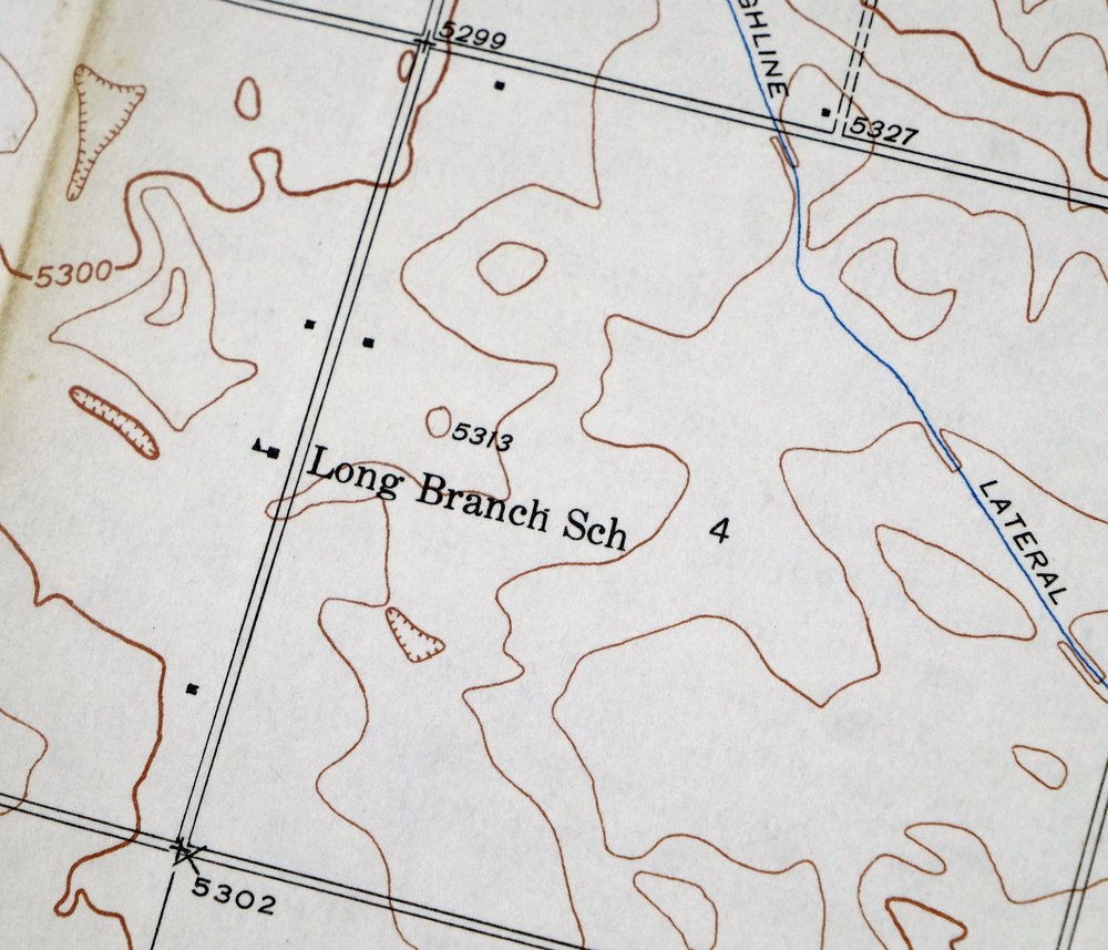
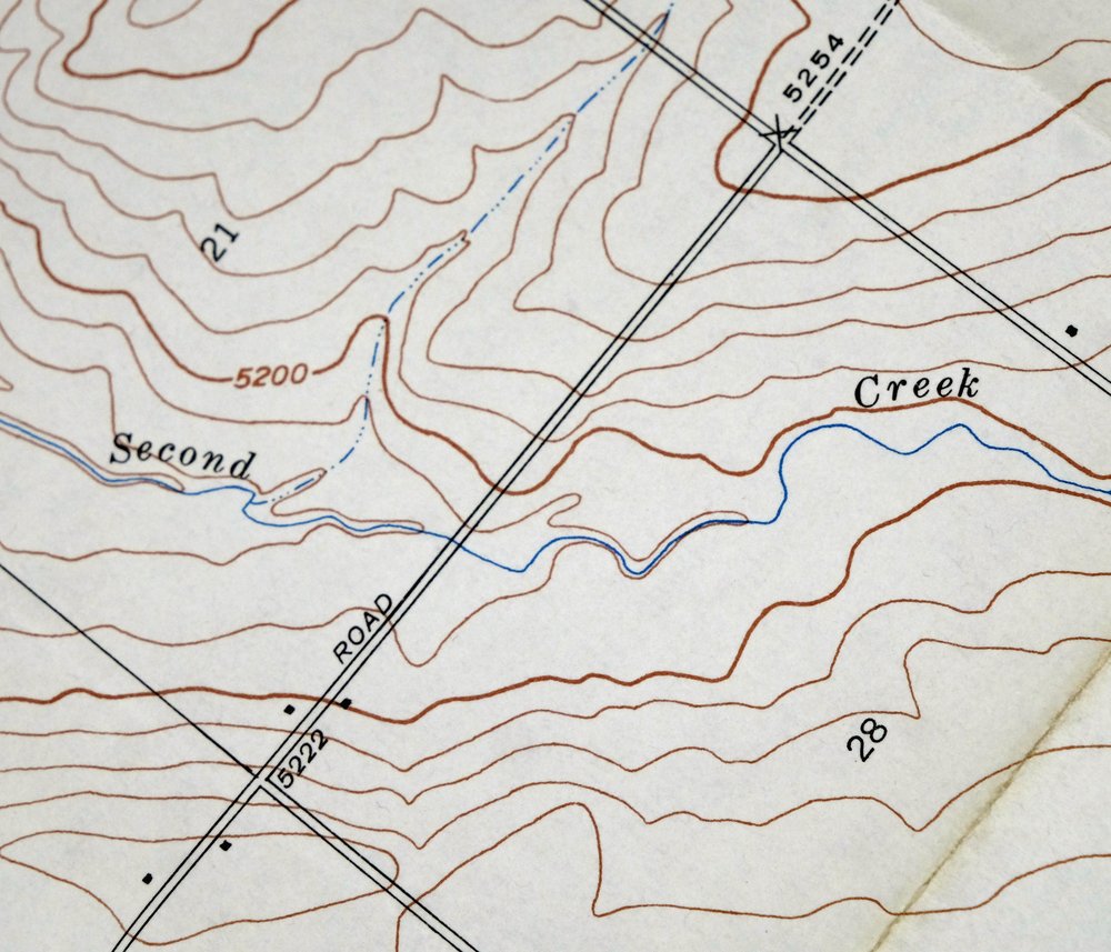
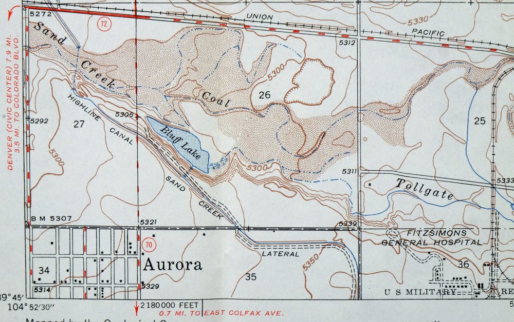
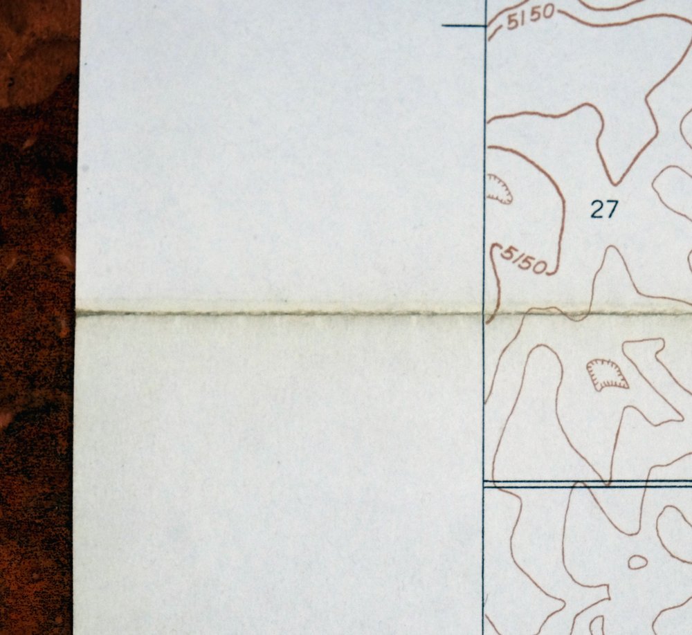
Long Branch Colorado Denver Aurora USGS Topographic Map 1948
$36
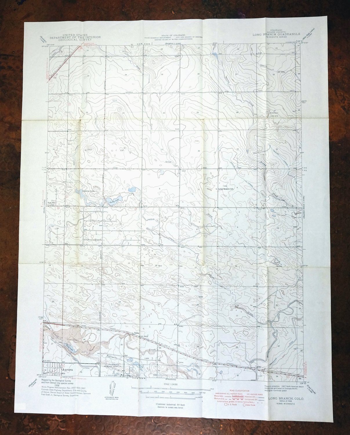
A historical snapshot of the area from present-day 96th Avenue south to Sand Creek Park and from Havana Street eastward to Green Valley Ranch, including the area that would become the Rocky Mountain Arsenal, depicting the landscape before suburban develop This is the Long Branch quadrangle, a 7.5-minute USGS topographic map printed in 1948, the first and only year of this edition, drawn from a 1938 field survey and printed on thick paper stock. It covers a stretch of land northeast of central Denver, reaching into Adams County and taking in parts of Aurora and Commerce City, with the ground that later became the Rocky Mountain Arsenal National Wildlife Refuge falling within the quad.
In stock
This vintage sheet is a 1948 edition of the Long Branch Colorado USGS topographic map. It is an original 78-year-old United States Geological Survey print in fair condition.
HOW THIS MAP CAN BE USED
In addition to making a fascinating conversation piece, this sheet would make a unique and prized gift for anyone interested in this area, be perfect as a reference for genealogy studies or general historical research, or fill that missing piece in your collection.
FEATURES SHOWN ON THE MAP
The Long Branch 7.5-minute map shows cities and towns, roads, paths, railroads, rivers, creeks, elevation contour lines, public land survey lines, county, state, and other administrative boundaries as they existed at the time of the survey in 1938. All known structures (houses, businesses, churches, schools, barns, cabins, etc) are also shown.
A VALUABLE HISTORICAL RECORD
This map is from the 7.5-minute series, the most detailed series that is widely available from the USGS. The 1948 Long Branch map is a valuable historical record for the area. It contains some placenames and features that have been dropped from more recent maps.
Nearby maps
-

Box Elder School Colorado Denver Aurora USGS Topo Map 1942
$38 Add to cart -
Fitzsimons Colorado Denver Aurora USGS Topo Map 1948 Vintage
$36 Add to cart -
Coal Creek Colorado Aurora USGS Topographic Map 1942 Antique
$45 Add to cart -

Eastlake Colorado Westminster Thornton USGS Topo Map 1944
$44 Add to cart -
Eastlake Colorado Westminster Thornton USGS Topo Map 1967
$39 Add to cart -

Fort Logan Colorado Denver Bow Mar USGS Topographic Map 1941
$38 Add to cart -

Lafayette Colorado Westminster Thornton USGS Topo Map 1967
$38 Add to cart -
Lafayette Colorado Westminster Thornton USGS Topo Map 1944
$48 Add to cart -
Highland Ranch Colorado Denver Southglenn USGS Topo Map 1949
$42 Add to cart -
Eldorado Springs Colorado Arvada Boulder USGS Topo Map 1961
$37 Add to cart -
Kassler Colorado Roxborough Park Louviers USGS Topo Map 1956
$48 Add to cart -
Platte Canyon Colorado South Platte USGS Topo Map 1955
$44 Add to cart -
1955 Tungsten Colorado USGS Topo Map: Barker Reservoir
$45 Add to cart -
Lyons Colorado USGS 7.5-Min Topographic Map 1961 Vintage
$34 Add to cart -
Central City Colorado Black Hawk USGS Topo Map 1964 Vintage
$32 Add to cart -
Nederland Colorado Eldora Rollinsville USGS Topo Map 1964
$35 Add to cart -
Bailey Colorado Will-O-The-Wisp Wandcrest USGS Topo Map 1973
$40 Add to cart -
Georgetown Colorado Idaho Springs USGS Topo Map 1980 Vintage
$42 Add to cart -
Shawnee Colorado Singleton USGS Topographic Map 1972 Vintage
$39 Add to cart -
Georgetown Colorado Silver Plume USGS Topo Map 1962 Vintage
$33 Add to cart -
Montezuma Colorado Keystone USGS 15-Min Topographic Map 1926
$65 Add to cart -
1972 Montezuma Colorado USGS Topo Map: Keystone
$48 Add to cart -

Estes Park Colorado USGS 7.5-Min Topo Map 1961 Vintage
$31 Add to cart -

Keystone Colorado USGS 7.5-Min Topographic Map 1963 Vintage
$35 Add to cart