MAP DETAILS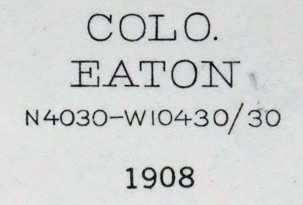 | |
|---|---|
| TITLE | Eaton |
| STATE | Colorado, Wyoming |
| LOCATION | Vicinity of Fort Collins |
| SERIES | 30-minute |
| SURVEYED | 1908 Field Survey |
| GEOGRAPHER | R.B. Marshall |
| EDITION | 1908 |
| PRINTED | 1957 |
| SCALE | 1:125000 |
| CONTOUR INTERVAL | 20 feet |
| SHEET DIMENSIONS | 16 x 20 inches (approximate) |
| MAP DIMENSIONS | 13 1/4 x 17 1/2 inches |
| COVERAGE AREA | 26 x 35 miles |
| SHEET CONDITION For maps of this vintage, effort is made to note all visible flaws, no matter how minor. | |
| OVERALL CONDITION | Excellent |
| SHEET NOTES | very lightly handled, never folded |
| MAP AREA | flawless map area |
| COLLARS | no markings, no blemishes, minor edge wear on exteme bottom collar, no edge tears, inventory stamp on lower collar |
| MAP COVERAGE Quadrangle extent overlaid on current basemap. | |
| PLACENAMES Depending on map series and survey date, all of the features listed below may not be shown on this map. This list contains features that currently exist or historically existed within the area covered by the map. The list can be used as a reference to determine if this map covers your area of interest. Placenames are listed alphabetically next to each feature type. | |
| CITIES AND TOWNS (CURRENT) | Ault, Carr, Eaton, Fort Collins, Galeton, Nunn, Pierce, Severance, Timnath, Wellington, and Windsor |
| COUNTIES COVERED | Laramie, Larimer, and Weld |
| FEDERAL LAND UNITS | Pawnee National Grassland |
| RIVERS AND STREAMS | Boxelder Creek, Cache La Poudre River, Coal Creek, Geary Creek, Little Owl Creek, Little Simpson Creek, Lone Tree Creek, North Fork Geary Creek, Owl Creek, Robinson Creek, Simpson Creek, Spottlewood Creek, Spring Creek, West Fork Willow Creek, Wildhorse Creek, and Willow Creek |
| WATER BODIES | Allison Reservoir, Angel Lake, Antelope Reservoir, Baker Lake, Baldridge Lake, Black Hollow Reservoir, Boyd Number 2 Reservoir, Clark Lake, Coal Bank Watershed CB-1 Reservoir, Cobb Lake, Cole Reservoir, Crom Lake, Deadman Lake, Dover Reservoir, Drake Lake, Eagle Rock Reservoir, Eichheim Reservoir, Faber Reservoir, Franklin Lake, Giffon Number 1 Reservoir, Giffon Number 2 Reservoir, Indian Creek Reservoir, James Lake, King Lake, Lake Canal Reservoir Number 1, Lee Lake, Lillie Reservoir, Long Lake, Mahood Reservoir, Mason Reservoir, Mc Grew Reservoir, Morris Reservoir, North Gray Reservoir, Owl Creek Reservoir, Roulard Lake, Rowe Brothers Reservoir, Schneider Lake, Smith Reservoir, South Gray Reservoir, Swanson Lake, Thomas Lake Reservoir, Timnath Reservoir, Windsor Reservoir, Woods Lake, Wykert Number 4 Reservoir, Wykert Reservoir Number 1, and Wykert Reservoir Number 2 |
| Colorado Locations: Allenbaw Windmill, Antelope Windmill, Badger Windmill, Atwell Windmill, Barton Camp, Baxter Camp, Beacon Camp, Black Hollow, Big Tank Windmill, Bly Windmill, Brass Cap Windmill, Buffalo Windmill, Bulger Windmill, Caliche Windmill, Canyon Windmill, Carroll Windmill, Central Plains Experiment Range Headquarters, Cheever Windmill, Collins Windmill, Davis Windmill, Drain Windmill, Eagle Rock Ranch, Eagle Windmill, East Farr Water Well, Eastman Windmill, Erickson Windmill, Erix Windmill, Fourteen Windmill, Glasspool Windmill, Gunn Windmill, Halter Windmill, Happy Hollow Windmill, Heinz Windmill, High Five Windmill, Joker Windmill, Kluver, Lamm Windmill, Lone Tree Windmill, McCormick Windmill, McNamara Junior Windmill, Meadow Springs Ranch, Meads Windmill, North Owl Windmill, Owl Camp, Owl Camp Windmill, Pap Windmill, Pawnee National Grasslands Research Center, Peterson Windmill, Ponnequin Camp, Prange Windmill, Railroad Windmill, Raven Windmill, Rodenbaugh Windmill, Rush Windmill, Saver Water Well, Schnoor Windmill, Shaklee Windmill, Stephens Windmill, Tuber, Verbich Windmill, Vivian Windmill, Weld County Gravel Pit, West Cross Windmill, West Farr Windmill, Woods, Worely Windmill, and Wrangler Windmill. Mountains, Peaks, and Summits: Simpson Mesa, Squaw Rock, and Wildhorse Tit. Valleys and Canyons: Black Hollow. Drainages: Block Hollow Creek, Coal Creek, Coalbank Creek, Cow Creek, Eastman Creek, Graves Creek, Indian Creek, Little Owl Creek, Little Simpson Creek, Lone Tree Creek, North Fork Geary Creek, Owl Creek, Robinson Creek, The Slough, Spottlewood Creek, Spotwood Creek, Spring Creek, West Fork Willow Creek, and Wildhorse Creek. Mines: Indian Springs Mine, King Solomon Mine, and Woodhams Quarry. Buildings: Prairie View Community Building. Dams: Angel Lake Dam, Black Hollow Dam, Floodwater Retention B-3 Dam, Floodwater Retention B-4 Dam, Clarks Lake Dam, Coal Bank Watershed CB-1 Dam, Cobb Lake Dam, Cozzens Dam, Dover Dam, Eaton-Law Dam, Giffon Number 1 Dam, Giffon Number 2 Dam, Gray Number 3 Dam, Grothe Dam, Indian Creek Dam, John Keller Dam, John Law Dam, Kitchell Dam, Lake Canal Number 1 Dam, Loup Lake Dam, McGrew Dam, Mountain Supply Number 18 Dam, North Gray Dam, Owl Creek Dam, Shaw Dam, South Gray Dam, Thompson Dam, Timnath Dam, Windsor Dam, Wood Dam, Wykert Number 1 Dam, Wykert Number 2 Dam, and Wykert Number 4 Dam. Bluffs: Chalk Bluffs. Canals: Boxelder Ditch, Burger-Gault Lateral, Cache la Poudre Reservoir Inlet, Cactus Hill Lateral, Collins Lateral, Cowan Lateral, Eaton Ditch, Good Lateral, John Law Ditch, Lake Canal, Lakeside Lateral, Larimer and Weld Canal, Lone Tree Ditch, Mead Lateral, Petit Lateral, Pierce Lateral, Roulard Lateral, Timnath Reservoir Outlet, Town Lateral, Windsor Ditch, and Windsor Reservoir Outlet. Basins: Eastman Basin. Airports: Bellmore Farms Airport, Barnetts Field, Burnham Field, Crop Air Incorporated Airport, Mile Hi Airport, Owl Canyon Gliderport, and William T Browder Heliport. Swamps: Packard Reservoir. Schools: Boxelder School, Prairie View School, and Wyatt School. Reservoirs and Tanks: Allison Reservoir, Angel Lake, Antelope Reservoir, Baker Lake, Black Hollow Reservoir, Baldridge Lake, Boyd Number 2 Reservoir, Floodwater Retention B-3 Reservoir, Clark Lake, Clark Reservoir, Clarks Lake, Coal Bank Watershed CB-1 Reservoir, Cobb Lake, Cole Reservoir, Cozzens Lake, Crom Lake, Deadman Lake, Decker - Pierce Reservoir, Dover Reservoir, Drake Lake, Eagle Rock Reservoir, Eaton-Law Reservoir, Eichheim Reservoir, Franklin Lake, Giffon Number 1 Reservoir, Giffon Number 2 Reservoir, Gray Reservoir Number 3, Gress Reservoir, Grothe Reservoir, Gunn Reservoir Number Three, Hinkley Lake, Indian Creek Reservoir, James Lake, John Keller Reservoir, John Law Reservoir, King Lake, Kitchel Lake, Lake Canal Reservoir Number 1, Law Reservoir, Lee Lake, Lillie Reservoir, Loop Lake, Loup Lake, Mahood Reservoir, Mason Reservoir, McGrew Reservoir, Morris Reservoir, Mountain Supply Reservoir Number 18, North Gray Reservoir, Owl Creek Reservoir, Retention Reservoir B-4, Roulard Lake, Rowe Brothers Reservoir, Saxton Lake, Schneider Lake, Shaw Reservoir, Smith Reservoir, South Gray Reservoir, Swanson Lake, Thomas Lake Reservoir, Thompson Lake, Thompson Reservoir, Timnath Reservoir, Windsor Reservoir, Woods Lake, Wykert Number 4 Reservoir, Wykert Reservoir Number 1, and Wykert Reservoir Number 2. Towers: KIMN-FM (Fort Collins), KSQI-FM (Greeley), KUAD-FM (Windsor), and KUNC-FM (Greeley). Oilfields: Black Hollow Oil Field, New Windsor Oil Field, and Pierce Oil Field. Wells: East Simpson Well, Jackpot Water Well, Milligon Well, Monument Water Well, Slab Water Well, and West Simpson Well. Springs: Antelope Spring, Boyd Springs, and Rattlesnake Springs. | |
| Wyoming | |
| Wyoming None | |
| SHIPPING AND RETURNS | |
 This map sheet will be carefully rolled in a sturdy tube and shipped via the US Postal Service. If you find that the sheet you receive is not as described in the listing, you may ship it back to us for a refund of the purchase price. | |
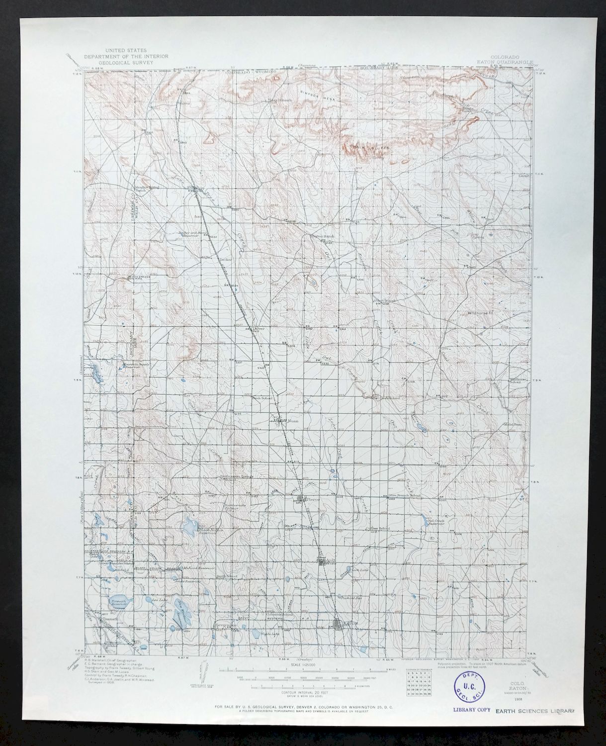
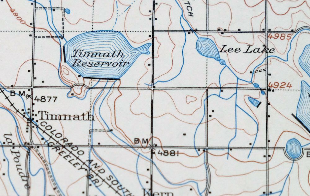
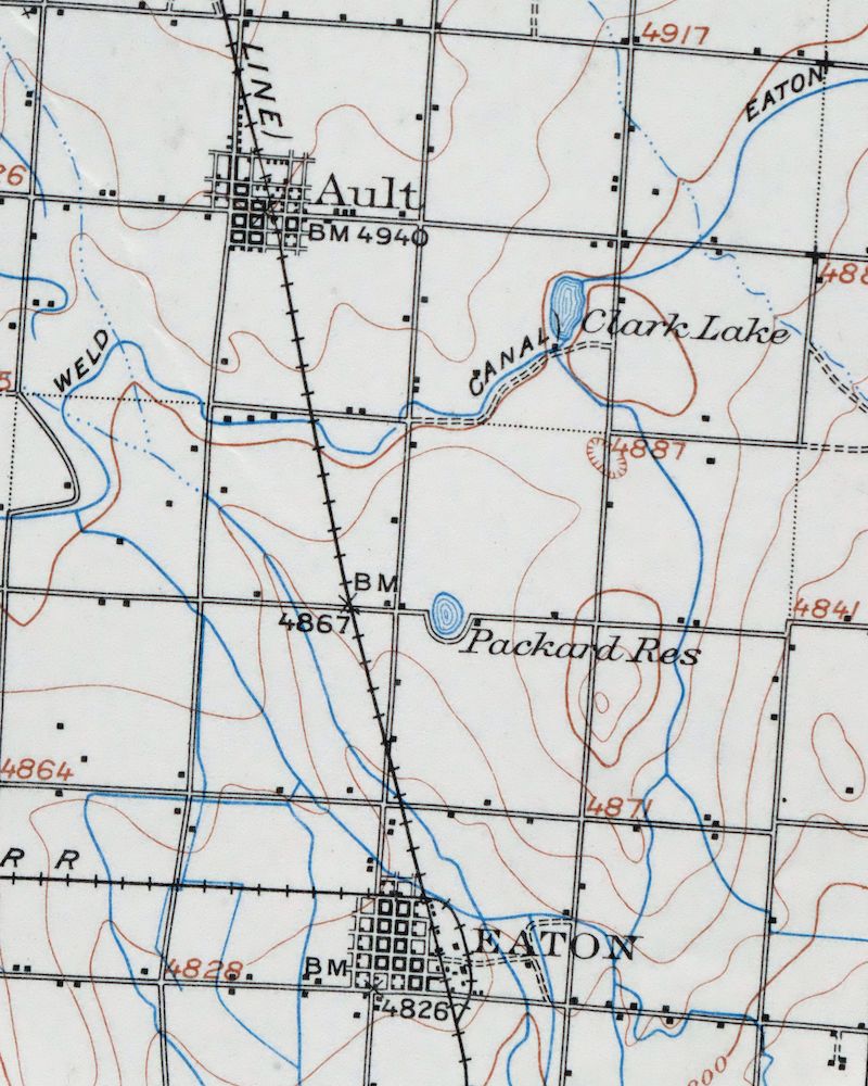
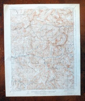
Eaton Colorado Fort Collins Ault USGS Topographic Map 1957
$25
First published in 1908, this Eaton sheet was printed in 1957 and is in excellent condition, very lightly handled and never folded. Drawn at 1:125,000 on the 30-minute series, it takes in northern Colorado around Fort Collins and Windsor, with Wellington, Eaton, Ault, Pierce, and Severance within the quad boundaries, and reaches north across the state line into Wyoming’s Laramie County. The eastern portion touches part of the Pawnee National Grassland, and the sheet carries R.B. Marshall’s name as geographer alongside the 1908 field survey behind this early quadrangle.
In stock
This vintage sheet is a 1908 edition of the Eaton Colorado USGS topographic map. It is an original 69-year-old 1957 United States Geological Survey print in excellent condition.
HOW THIS MAP CAN BE USED
In addition to making a fascinating conversation piece, this sheet would look great in a frame or on display, make a unique and prized gift for anyone interested in this area, be perfect as a reference for genealogy studies or general historical research, or fill that missing piece in your collection. Maps of this vintage are printed on durable stock and are well-suited for outdoor activities and recreation of all kinds, including hiking, backpacking, hunting, rafting and kayaking, backcountry skiing, geocaching, general exploration, treasure hunting, etc.
FEATURES SHOWN ON THE MAP
The Eaton 30-minute map shows cities and towns, roads, railroads, utilities and energy infrastructure, rivers, creeks, elevation contour lines, public land survey lines, county, state, and other administrative boundaries as they existed at the time of the survey in 1908.
A VALUABLE HISTORICAL RECORD
Maps from the USGS 30-minute series have been out of print for many years. They have never been common and original prints are increasingly difficult to find. For areas where the 30-minute map was produced, it is usually the first large-scale survey done by the USGS for that area. These are a valuable historical record, as they contain many placenames and features that have been dropped from more recent series’ and editions.
Nearby maps
-

Goshen Hole Wyoming Lyman Henry USGS Topographic Map 1916
$67 Add to cart -

Hartville Wyoming Wheatland Guernsey USGS Topo Map 1922
$46 Add to cart -

Estes Park Colorado USGS 7.5-Min Topo Map 1961 Vintage
$31 Add to cart -
Lyons Colorado USGS 7.5-Min Topographic Map 1961 Vintage
$34 Add to cart -
Trail Ridge Colorado USGS 7.5-Min Topo Map 1962 Vintage
$25 Add to cart -

Eastlake Colorado Westminster Thornton USGS Topo Map 1944
$44 Add to cart -
Eastlake Colorado Westminster Thornton USGS Topo Map 1967
$39 Add to cart -

Lafayette Colorado Westminster Thornton USGS Topo Map 1967
$38 Add to cart -
Eldorado Springs Colorado Arvada Boulder USGS Topo Map 1961
$37 Add to cart -

Box Elder School Colorado Denver Aurora USGS Topo Map 1942
$38 Add to cart -
Nederland Colorado Eldora Rollinsville USGS Topo Map 1964
$35 Add to cart -
Kings Canyon Colorado North Sand Hills USGS Topo Map 1969
$34 Add to cart -
Fitzsimons Colorado Denver Aurora USGS Topo Map 1948 Vintage
$36 Add to cart -
Coal Creek Colorado Aurora USGS Topographic Map 1942 Antique
$45 Add to cart -

Fort Logan Colorado Denver Bow Mar USGS Topographic Map 1941
$38 Add to cart -
Central City Colorado Black Hawk USGS Topo Map 1964 Vintage
$32 Add to cart -
Highland Ranch Colorado Denver Southglenn USGS Topo Map 1949
$42 Add to cart -
Hot Sulphur Springs Colorado Parshall USGS Topo Map 1963
$39 Add to cart -
Georgetown Colorado Silver Plume USGS Topo Map 1962 Vintage
$33 Add to cart -
Georgetown Colorado Idaho Springs USGS Topo Map 1980 Vintage
$42 Add to cart -
Kassler Colorado Roxborough Park Louviers USGS Topo Map 1956
$48 Add to cart -
Platte Canyon Colorado South Platte USGS Topo Map 1955
$44 Add to cart -
Bailey Colorado Will-O-The-Wisp Wandcrest USGS Topo Map 1973
$40 Add to cart -
Montezuma Colorado Keystone USGS 15-Min Topographic Map 1926
$65 Add to cart
