MAP DETAILS | |
|---|---|
| TITLE | Homestead |
| STATE | Florida |
| LOCATION | 28 miles southwest of Miami |
| SERIES | 7.5-minute |
| EDITION | 1988 |
| PRINTED | 1988 |
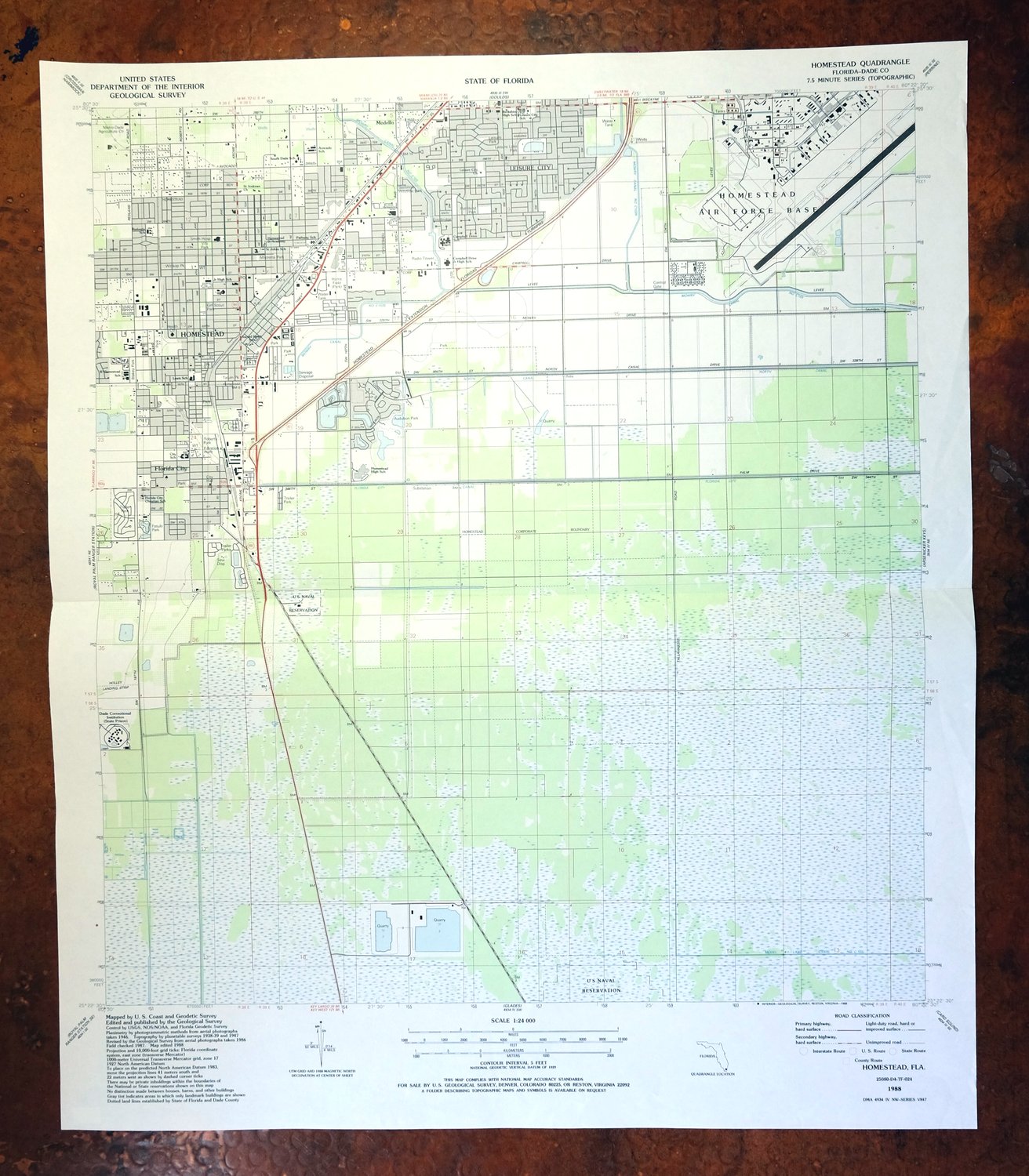
| PRINT NOTES | Thick paper stock, includes woodland tint (green to indicate vegetated areas). A reddish tint is used to indicate urban areas where only landmark buildings are shown. |
| SCALE | 1:24000 |
| SHEET DIMENSIONS | 22 7/8 x 26 7/8 inches |
| MAP DIMENSIONS | 20 5/8 x 22 3/4 inches |
| COVERAGE AREA | 8 x 9 miles |
| SHEET CONDITION For maps of this vintage, effort is made to note all visible flaws, no matter how minor. | |
| OVERALL CONDITION | Very Good |
| SHEET NOTES | lightly handled, midsheet horizontal foldline (in half), title notation pencilled on backside of sheet |
| MAP AREA | no markings, no blemishes |
| COLLARS | no wear or tears, no markings, no blemishes |
| MAP COVERAGE Quadrangle extent overlaid on current basemap. | |
| PLACENAMES Depending on map series and survey date, all of the features listed below may not be shown on this map. This list contains features that currently exist or historically existed within the area covered by the map. The list can be used as a reference to determine if this map covers your area of interest. Placenames are listed alphabetically next to each feature type. | |
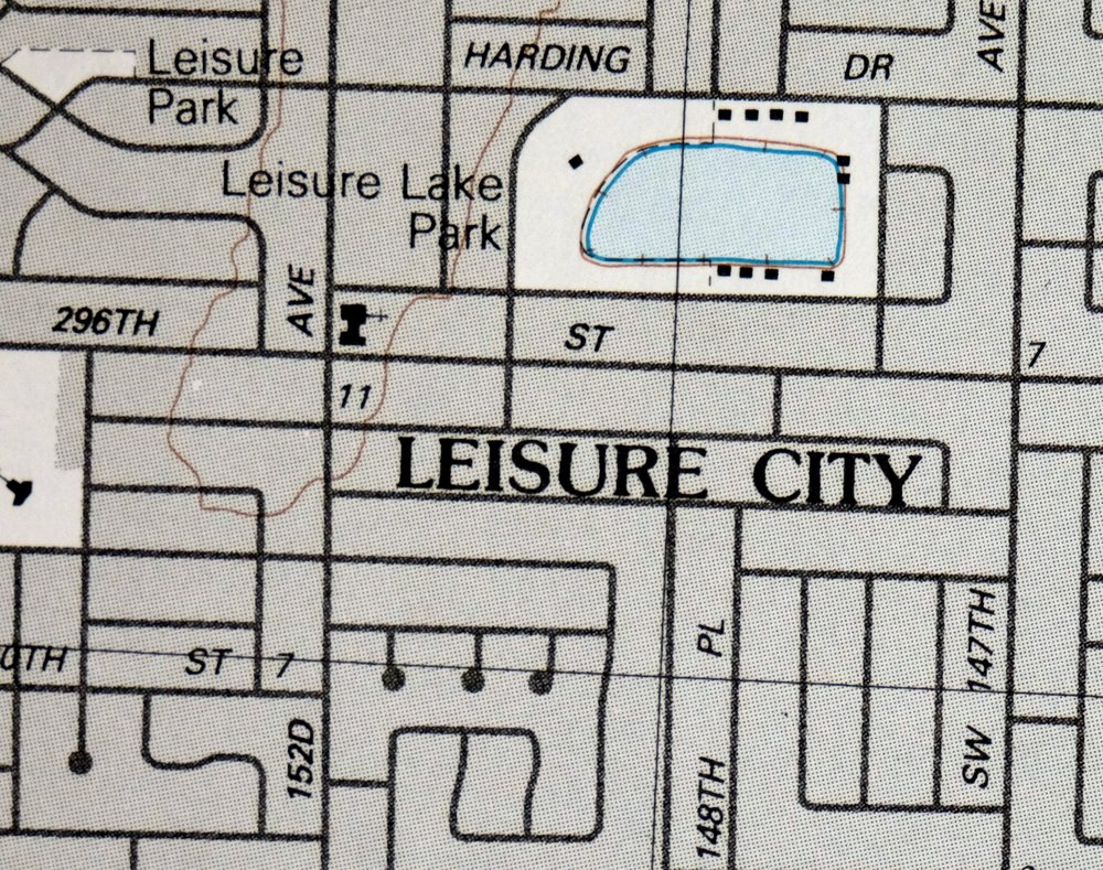
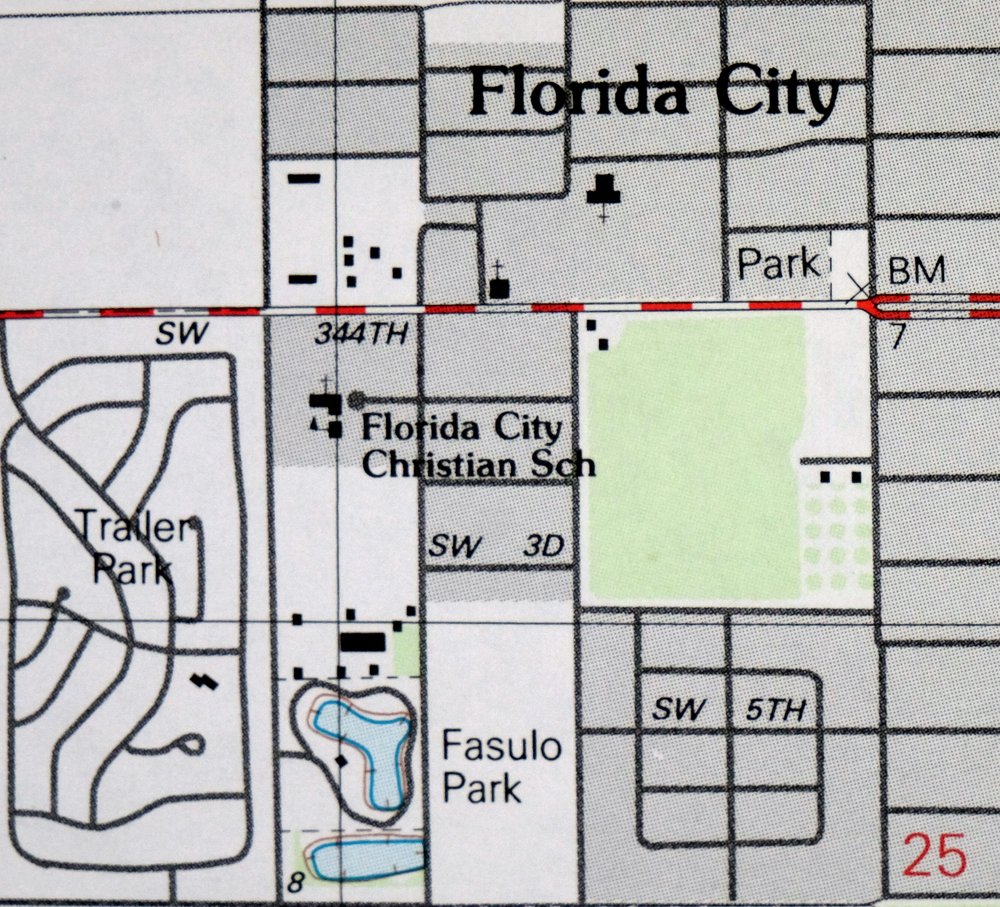
| NOTABLE PLACES | Leisure City and Florida City |
| CITIES AND TOWNS (CURRENT) | Homestead and Homestead Base |
| COUNTIES COVERED | Miami-Dade |
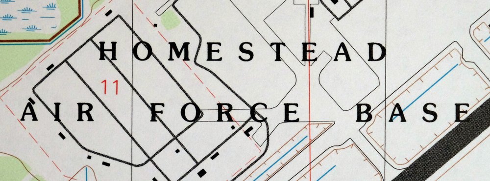
| FEDERAL LAND UNITS | Homestead Air Force Base (Closed) and Homestead Naval Security Group Activity |
| WATER BODIES | The Everglades |
| Populated Place: Florida City, Homestead, Leisure City, Aquarius Mobile Home Park, Four Seasons Mobile Home Park, Gateway Estates, Gateway West, Goldcoaster Mobile Home Park, Homestead Trailer Park, The Board Walk Mobile Home Park, and Boardwalk Mobile Home Park. Locations: Campbell One Plaza, Cutler Ridge Mall, Dade Correctional Institution, Fountain Plaza, Homestead Plaza, Palm Drive Shopping Plaza, State Farmers Market, Coral Castle, Florida Camper Site, Homestead-Miami Speedway, Homestead Motorsports Complex, Homestead Town Square, Prime Outlets at Florida City, Southern Comfort Recreational Vehicle Park, and Grand Cypress Resort Golf Course. Administrative Boundaries: City of Florida City and City of Homestead. Parks: Audubon Park, Blakey Park, Community Center, Fasulo Park, Girl Scout Park, Harris Field, Leisure Lake Park, Leisure Park, Mini Park, Mistretta Park, Modello Wayside Park, Municipal Park, Musselwhite Park, Palmland Park, Pioneer Park, Roberts Park, Robey George Park, Seminole Wayside Park, Soccer Park, Tatum Park, Vita Park, Washington Park, and Wittkop Park. Churches: B'nai Israel Synagogue, Bible Baptist Church of the Redlands, Church of Christ, Church of God, Covenant Baptist Church, First Assembly of God, First Church of God-Anderson, First Pentecostal Church, First Presbyterian Church of Homestead, First United Methodist Church, Grace Baptist Church, Leisure City Church, Modello Baptist Church, New Hope Assembly of God, Old Curer Presbyterian Church, Open Bible Gospel Tabernacle, Princeton Church of the Nazarene, Sacred Heart, Saint Andrew Church, Saint John Episcopal Church, Saint Johns Church, Saint Paul Church, Selah Tabernacle, Silver Palm United Methodist Church, South Dade Alliance Church, South Dade Church, The Church of Jesus Christ of Latter Day Saints, Trinity United Methodist Church, and Wat Buddharangsi Buddhist Temple. Post Office: Florida City Post Office and Homestead Post Office. Hospitals: Homestead Hospital, Smith Hospital, and South Florida Evaluation and Treatment Center. Buildings: Dade Correctional Institution, Homestead-Florida City Health Center, Homestead-Florida City Neighborhood Service Center, Metropolitan Dade Agriculture Center, Aim High Learning Center, Arc Project Thrive Number 4 Day Care Center, Berkshire Infant Care, Brookwood Gardens Convalescent Center, Countryside Early Learning Center, Dottie's Little Red Skool House, Eighth Street Day Care Center, Everglades Visitors Center, Florida City Police Department, Gonzalez Day Care Center, Homestead Chamber of Commerce, Homestead Family YMCA Day Care Center, Homestead Library, Homestead Police Department, Hudson Early Childhood Education Center, Kids R Us Day Care Center, Leisure City Elementary-YMCA Prime Time, Love the Little Children Day Care Center, Lucy Street Clinic, Martin Luther King Health Center, Miami - Dade County Homestead Fire Rescue Station 16, Miami - Dade County Modello Fire Station 6, Pioneer Museum, Rcma Centro Village Day Care Center, Rcma South Dade Day Care Center, Small Fry Day Care Center, Smith Homestead Hospital Day Care Center, YMCA Harris Field, YMCA Tatum Park, Young America Day Care Center, YWCA Florida City, Florida City Community Center, Homestead Air Reserve Base Fire Department, Miami - Dade College Police Department - Homestead Campus, Miami - Dade County East Homestead Fire Rescue Station 65, Miami - Dade County Village of Homestead Fire Rescue Station 66, and South Florida Evaluation and Treatment Center. Canals: Florida City Canal, Model Land Canal, and North Canal. Airports: Homestead Air Reserve Base. Census: Homestead Base Census Designated Place and Leisure City Census Designated Place. Schools: Avocado Elementary School, Berkshire High School, Berkshire Infant Care Center, Berkshire School, Bertha Abess Childrens Center, Campbell Drive Junior High School, Campbell Drive K - 8 Center, Campbell Drive Middle School, Cooper Educational Center, Dots Tots School, First United Methodist Day School, Florida Christian School, Florida City Christian School, Florida City Elementary School, Happy Day School, Homestead Junior Academy, Homestead Middle School, Homestead Senior High School, Kingswood Montessori School, Leisure City Elementary School, Lewis School, Little Sunbeams Child Care Center, N K Cooper Special Education Center, Redland Christian Academy, Redondo Elementary School, Sacred Heart School, Saint Johns School, Selah Christian Academy, South Dade School, West Homestead K - 8 Center, Aspira Charter School South, Balere Language Academy, Butterfly Cooperative Preschool, Campbell Drive Elementary Head Start, Colonial Christian School, Corporate Academy South, First Assembly Christian Academy, First Presbyterian Church School, First United Methodist Christian School, Florida City Head Start, Homestead Air Force Vocational School, Irving and Beatrice Peskoe K - 8 Center, Keys Gate Charter School, Laura C Saunders Elementary School, Le Jardin Head Start Number 2, Le Jardin Head Start Number 3, Le Jardin Head Start Number 4, Le Jardin Head Start Number 5, Leisure City Head Start, Leisure City K - 8 Center, Lincoln-Marti School 15th Campus, Lincoln Marti Schools, Miami Dade Community College, Neva King Cooper Educational Center, Primary Learning Center I, Rosa Parks Community School, Rosa Parks Community School-Florida City, Saint John's Episcopal School, South Dade Technical College, and The Homestead Nursery School. Military: Homestead Air Reserve Base. | |
| SHIPPING AND RETURNS | |
 This map sheet will be carefully rolled in a sturdy tube and shipped via the US Postal Service. If you find that the sheet you receive is not as described in the listing, you may ship it back to us for a refund of the purchase price. | |
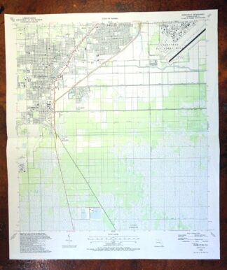
Homestead Florida Leisure City USGS Topo Map 1988 Vintage
$25
Printed in its first year of publication, 1988, this USGS 7.5-minute topographic sheet is in very good condition, lightly handled with a single horizontal foldline across the middle and a title notation pencilled on the reverse. It covers the Homestead area of Miami-Dade County, about 28 miles southwest of Miami, with Homestead, Florida City, and Leisure City all falling within the quad boundaries. The 1988 date captures this stretch of far southern Florida just a few years before Hurricane Andrew struck the region, and the map is printed on thick stock that holds up well.
In stock
This vintage sheet is a 1988 edition of the Homestead Florida USGS topographic map. It is an original 38-year-old United States Geological Survey print in very good condition.
HOW THIS MAP CAN BE USED
In addition to making a fascinating conversation piece, this sheet would look great in a frame or on display, make a unique and prized gift for anyone interested in this area, be perfect as a reference for genealogy studies or general historical research, or fill that missing piece in your collection. Maps of this vintage are printed on durable stock and are well-suited for outdoor activities and recreation of all kinds, including hiking, backpacking, hunting, rafting and kayaking, backcountry skiing, geocaching, general exploration, treasure hunting, etc.
FEATURES SHOWN ON THE MAP
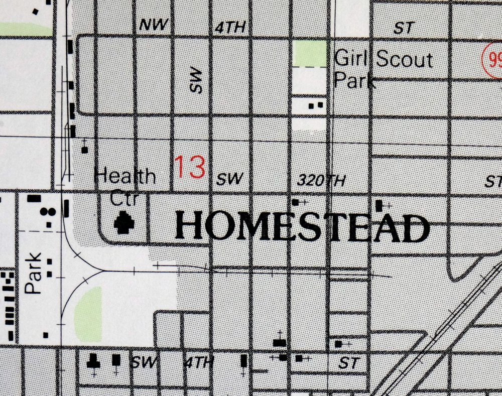
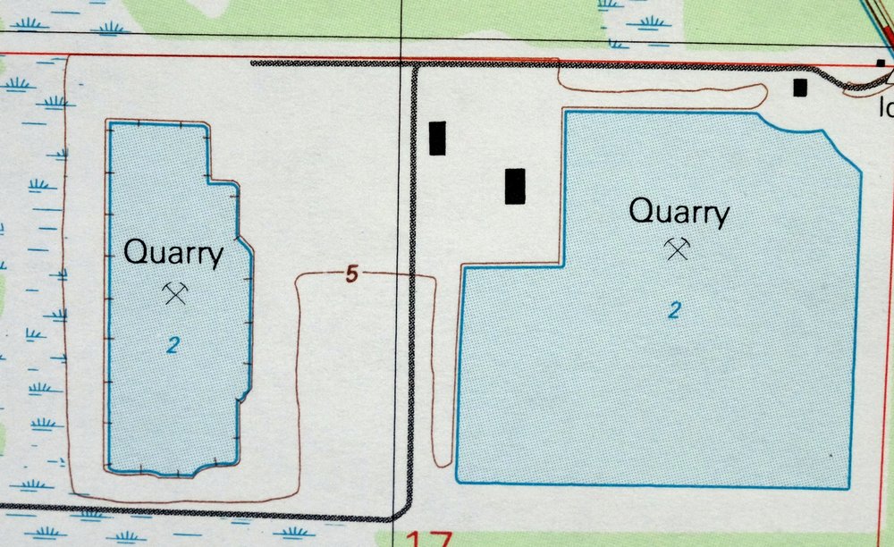
The Homestead 7.5-minute map shows cities and towns, roads, paths, railroads, utilities and energy infrastructure, rivers, creeks, elevation contour lines, public land survey lines, county, state, and other administrative boundaries as they existed at the time of the survey. A reddish tint is used on this sheet to indicate urban areas where only landmark buildings are depicted. Outside of those areas, all known structures (houses, businesses, churches, schools, barns, cabins, etc) are shown.
A VALUABLE HISTORICAL RECORD
This map is from the 7.5-minute series, the most detailed series that is widely available from the USGS. The 1988 Homestead map is a valuable historical record for the area. It contains some placenames and features that have been dropped from more recent maps.
Nearby maps
-
Plantation Key Florida Islamorada USGS Topo Map 1973 Vintage
$38 Add to cart -

North Miami Florida Pembroke Pines USGS Topographic Map 1988
$32 Add to cart -
Rood Florida Jupiter Tequesta USGS Topographic Map 1983
$37 Add to cart -

Apopka Florida South Apopka Zellwood USGS Topo Map 1972
$40 Add to cart -

Daytona Beach NW Florida Tiger Bay USGS Topographic Map 1964
$39 Add to cart -
Panama City Beach Florida Woodlawn USGS Topographic Map 1984
$38 Add to cart -

Greer South Carolina Simpsonville Duncan USGS Topo Map 1974
$32 Add to cart -
Inman South Carolina Boiling Springs USGS Topo Map 1964
$45 Add to cart -
Tigerville South Carolina Tryon USGS Topographic Map 1973
$20 Add to cart -
Vanceboro North Carolina Ernul USGS Topo Map 1968 Vintage
$45 Add to cart -
East Cleveland Tennessee Climer USGS Topographic Map 1966
$34 Add to cart -
East Chattanooga Tennessee Cannondale USGS Topo Map 1959
$38 Add to cart -
1970 East Chattanooga Tennessee USGS Topo Map: Cannondale
$50 Add to cart -
South Cleveland Tennessee Hopewell USGS Topographic Map 1966
$38 Add to cart -
Baton Rouge Louisiana Shenandoah Gardere USGS Topo Map 1967
$37 Add to cart -
Rocky Mount North Carolina Wilson Red Oak USGS Topo Map 1965
$48 Add to cart -
Shooks Gap Tennessee Knoxville Seymour USGS Topo Map 1955
$38 Add to cart -
Bearden Tennessee Knoxville Alcoa USGS Topo Map 1968 Vintage
$58 Add to cart -
1979 USGS Topo Map: Bearden, Cedar Bluff, Tennessee
$55 Add to cart -

John Sevier Tennessee Knoxville Mascot USGS Topo Map 1955
$38 Add to cart -
John Sevier Tennessee Knoxville Mascot USGS Topo Map 1978
$37 Add to cart -
1968 John Sevier Tennessee USGS Topo Map: Knoxville
$54 Add to cart -

Fountain City Tennessee Knoxville Halls USGS Topo Map 1955
$39 Add to cart -
1968 USGS Topo Map: Fountain City, Knoxville, Tennessee
$54 Add to cart