MAP DETAILS | |
|---|---|
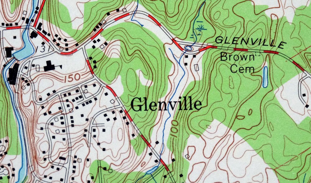
| TITLE | Glenville |
| STATE | Connecticut, New York |
| LOCATION | Vicinity of White Plains, 29 miles northeast of New York |
| SERIES | 7.5-minute |
| SURVEYED | 1949 through 1951 Aerial and Field Survey |
| EDITION | 1960 |
| REVISIONS | 1960 |
| PRINTED | 1966 |
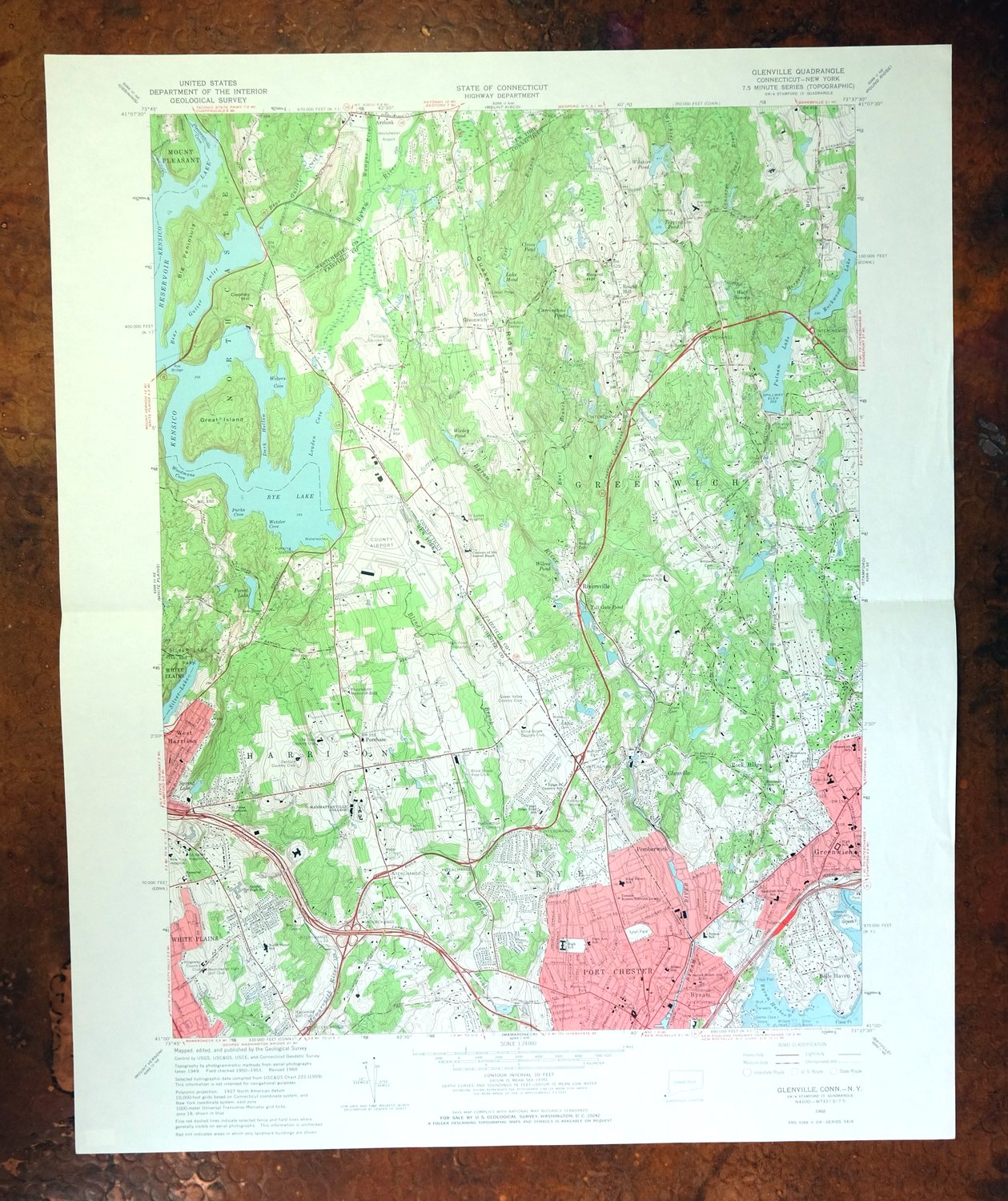
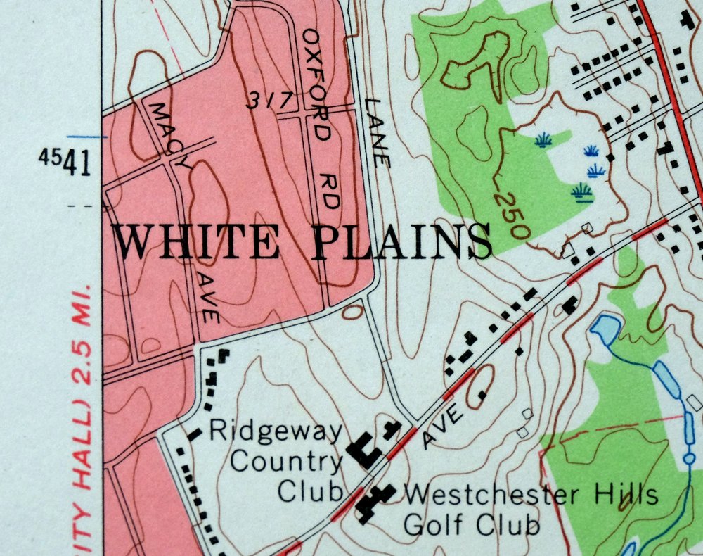
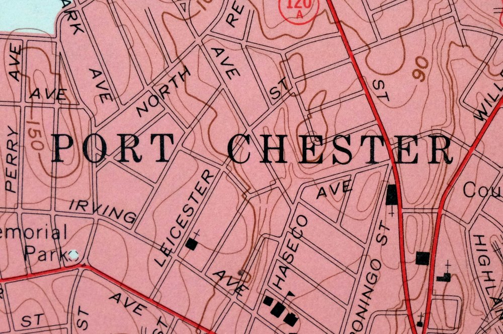
| PRINT NOTES | Thick paper stock, includes woodland tint (green to indicate vegetated areas). A reddish tint is used to indicate urban areas where only landmark buildings are shown. |
| SCALE | 1:24000 |
| CONTOUR INTERVAL | 10 feet |
| SHEET DIMENSIONS | 22 x 27 inches |
| MAP DIMENSIONS | 17 1/8 x 22 3/4 inches |
| COVERAGE AREA | 7 x 9 miles |
| MAP NOTES | A 1971 photo revision indicates considerable extension of roads and urban areas. |
| SHEET CONDITION For maps of this vintage, effort is made to note all visible flaws, no matter how minor. | |
| OVERALL CONDITION | Very Good |
| SHEET NOTES | lightly handled, midsheet horizontal foldline (in half), title notation pencilled on backside of sheet |
| MAP AREA | no markings, no blemishes |
| COLLARS | no wear or tears, no markings, no blemishes |
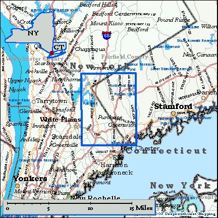
| MAP COVERAGE Quadrangle extent overlaid on current basemap. | |
| PLACENAMES Depending on map series and survey date, all of the features listed below may not be shown on this map. This list contains features that currently exist or historically existed within the area covered by the map. The list can be used as a reference to determine if this map covers your area of interest. Placenames are listed alphabetically next to each feature type. | |
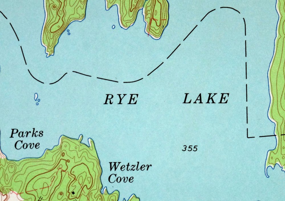
| NOTABLE PLACES | Port Chester, Rye Lake, White Plains, and Putnam Lake |
| CITIES AND TOWNS (CURRENT) | Armonk, East White Plains, Greenwich, Harrison, Purchase, Rye Brook, Thornwood, and Valhalla |
| COUNTIES COVERED | Fairfield and Westchester |
| RIVERS AND STREAMS | Bear Gutter Creek, Blind Brook, Byram River, Converse Pond Brook, East Branch Byram River, Horseneck Brook, Mamaroneck River, and Wampus River |
| WATER BODIES | Kensico Reservoir |
| Connecticut Locations: Belle Haven Club, Bruce Memorial Golf Club, Fairview Country Club, Field Club of Greenwich, Grass, Greenwich Avenue Center Shopping Center, Rosemary Hall, Round Hill, Round Hill Country Club, Stanwich Club, Stop and Shop Shopping Center, Tamarack Country Club, and Thru-Way Shopping Center. Mountains, Peaks, and Summits: Round Hill. Parks: Byram Park, Greenwich Avenue Historic District, Greenwich Common, Greenwich Municipal Center Historic District, Havemeyer Fields, Pemberwick Park, Roger Sherman Baldwin Park, Western Greenwich Civic Center Park, and Wild Flower Sanctuary. Drainages: Converse Pond Brook, East Branch Converse Pond Brook, Horseneck Brook, and Wilshire Pond Brook. Islands: Farwells Island, Game Cock Island, Shore Island, Otter Rocks, Rich Island, and Wilson Head. Capes: Field Point. Churches: Convent of the Sacred Heart, North Greenwich Congregational Church, Round Hill Community Church, Sacred Heart Church, Saint Barnabas Church, Saint Mary Parish Church, and Saint Rochs Church. Hospitals: Greenwich Hospital, Saint Lukes Hospital, and Witherell Hospital. Lakes and Ponds: Closes Pond, Lake Mead, Toll Gate Pond, and Wooley Pond. Buildings: Audubon Center of Greenwich, Greenwich Arts Council, Greenwich Hospital Library, Greenwich Library, and Greenwich Town Hall. Dams: American Can Company Dam, American Felt Dam, F W Perry Pond Dam, Spahn Pond Dam, Indian Spring Pond Dam, Pemberwick Dam, Putnam Reservoir Dam, Rockwood Lake Dam, Topping Pond Dam, West Fork Pond Dam, Wilshire Pond Dam, and Wooley Pond Dam. Crossings: Interchange 2, Interchange 28, Interchange 29, Interchange 3, and Interchange 31. Bays: Byram Harbor. Swamps: Wolf Swamp. Schools: Brunswick School, Glenville School, Greenwich High School, Haithcock School, Hamilton Avenue School, New Lebanon School, Parkway School, Sacred Heart School, Western Middle School, and Whitby School. Ridges: Quaker Ridge. Reservoirs and Tanks: Byram River Reservoir, Carringtons Pond, F W Perry Pond, Spahn Pond, Indian Spring Pond, Mill Pond, North Lake, Putnam Lake, Rockwood Lake, Topping Pond, West Fork Pond, Wilcox Pond, and Wilshire Pond. | |
| New York Locations: Blind Brook Country Club, Century Country Club, Green Valley Country Club, Maplemoor Golf Club, Old Oaks Country Club, Ridgeway Country Club, and Westchester Hills Golf Club. Administrative Boundaries: Town of Harrison and Town of Rye. Mountains, Peaks, and Summits: Cooney Hill. Parks: Lyon Park, Memorial Park, and Silver Lake Park. Drainages: Bear Gutter Creek, East Branch Byram River, Wampus River, and Wilshire Pond Brook. Islands: Great Island. Capes: Big Peninsula. Churches: Memorial Church, Resurrection Convent, Saint Johns Novitiate, and Temple Kneses Tifereth Israel. Hospitals: High Point Hospital and Saint Agnes Hospital. Lakes and Ponds: Kensico Lake, Rye Lake, and Silver Lake. Buildings: Harkness Home and Pforzheimer Memorial Bridge. Crossings: Interchange 21, Interchange 22, Interchange 23, Interchange 24, Interchange 25, Interchange 26, and Interchange 27. Channels: Dark Hollow. Bridges: Rye Bridge. Bays: Gutter Inlet, Louden Cove, Parks Cove, Pleasantville Cove, Webers Cove, Wetzler Cove, and Woodmans Cove. Airports: Old Orchard Road Heliport, Safe Flight Instrument Corporation Heliport, and Westchester County Airport. Schools: Edison School, King Street School, Lake Street School, Manhattanville College, North Street School, Park Avenue School, Ridge Street Country School, and Upper Ridge Road School. Reservoirs and Tanks: Forest Lake and Spring Lake. | |
| SHIPPING AND RETURNS | |
 This map sheet will be carefully rolled in a sturdy tube and shipped via the US Postal Service. If you find that the sheet you receive is not as described in the listing, you may ship it back to us for a refund of the purchase price. | |
1966 USGS Topo Map: Glenville, Connecticut/New York
$48
A 1971 photo revision indicates considerable extension of roads and urban areas. This is a USGS 7.5-minute topographic map of the Glenville quadrangle, first published as a 1960 edition and printed in 1966 at a scale of 1:24,000 with 10-foot contours and a green woodland tint. Straddling the Connecticut–New York line near White Plains, the quad area covers Port Chester, Rye Lake, and Harrison, along with Greenwich, Purchase, Rye Brook, and Armonk.
In stock
This vintage sheet is a 1960 edition of the Glenville Connecticut USGS topographic map. It is an original 60-year-old 1966 United States Geological Survey print in very good condition.
HOW THIS MAP CAN BE USED
In addition to making a fascinating conversation piece, this sheet would look great in a frame or on display, make a unique and prized gift for anyone interested in this area, be perfect as a reference for genealogy studies or general historical research, or fill that missing piece in your collection. Maps of this vintage are printed on durable stock and are well-suited for outdoor activities and recreation of all kinds, including hiking, backpacking, hunting, rafting and kayaking, backcountry skiing, geocaching, general exploration, treasure hunting, etc.
FEATURES SHOWN ON THE MAP
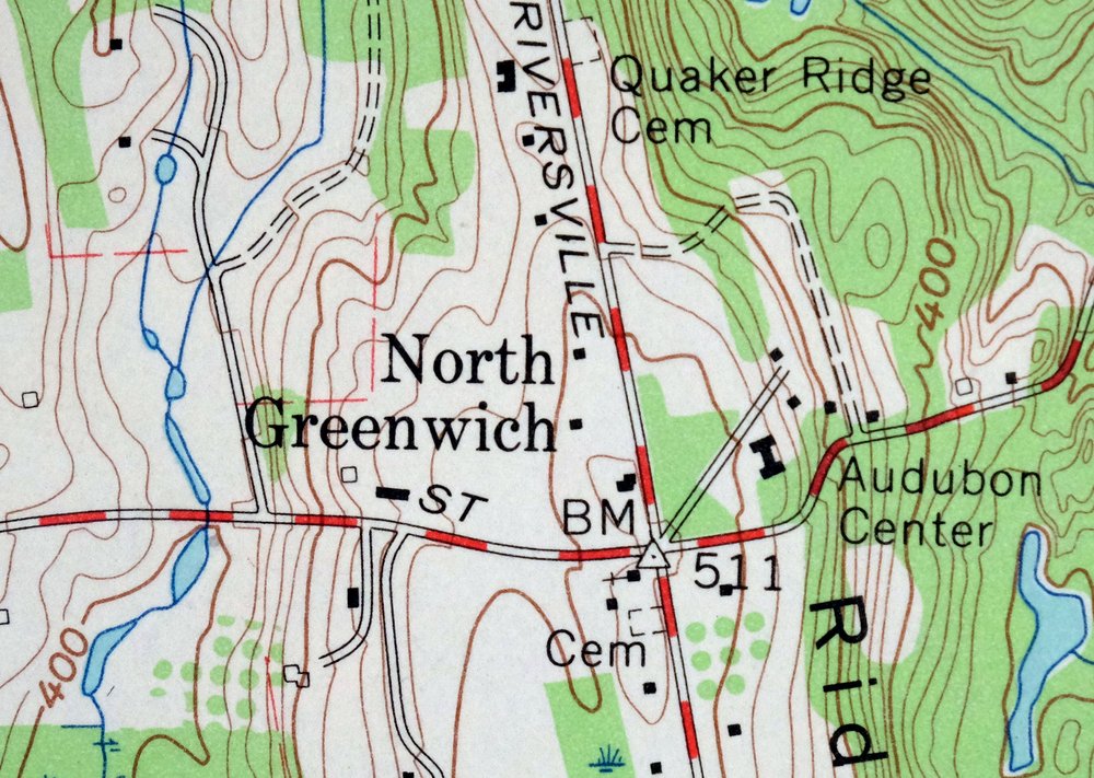
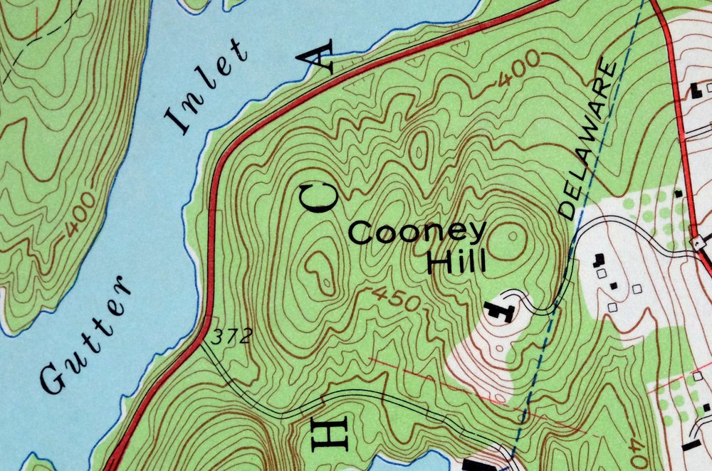
The Glenville 7.5-minute map shows cities and towns, roads, paths, railroads, utilities and energy infrastructure, rivers, creeks, elevation contour lines, public land survey lines, county, state, and other administrative boundaries as they existed at the time of the survey in 1949 through 1951. A reddish tint is used on this sheet to indicate urban areas where only landmark buildings are depicted. Outside of those areas, all known structures (houses, businesses, churches, schools, barns, cabins, etc) are shown.
A VALUABLE HISTORICAL RECORD
This map is from the 7.5-minute series, the most detailed series that is widely available from the USGS. The 1960 Glenville map is a valuable historical record for the area. It contains some placenames and features that have been dropped from more recent maps.
Nearby maps
-
Norwalk South Connecticut Stamford Darien USGS Topo Map 1963
$40 Add to cart -
Park Ridge New Jersey New City Ridgewood USGS Topo Map 1963
$45 Add to cart -
Westport Connecticut Fairfield USGS Topographic Map 1973
$42 Add to cart -
Harlem New York New York Yonkers USGS Topo Map 1913 Antique
$250 Add to cart -
West Point New York Newburgh Peekskill USGS Topo Map 1912
$105 Add to cart -

Danbury Connecticut Trumbull Bethel USGS Topo Map 1899
$70 Add to cart -
Schunemunk New York Newburgh Kiryas Joel USGS Topo Map 1915
$65 Add to cart -

Goshen New York Middletown Warwick USGS Topographic Map 1913
$55 Add to cart -
Plainfield New Jersey Edison Somerset USGS Topo Map 1965
$42 Add to cart -
Litchfield Connecticut Waterbury Oakville USGS Topo Map 1910
$100 Add to cart -

Riverhead New York Manorville Calverton USGS Topo Map 1915
$180 Add to cart -
New Brunswick New Jersey Spotswood Edison USGS Topo Map 1965
$32 Add to cart -
1960 Dingmans Ferry NJ/PA USGS Army COE Topo Map
$48 Add to cart -

Milford Pennsylvania Lackawaxen Pond Eddy USGS Topo Map 1915
$58 Add to cart -
Sag Harbor New York Hampton Bays USGS Topo Map 1913 Antique
$145 Add to cart -

Moodus Connecticut Lake Pocotopaug USGS Topographic Map 1946
$32 Add to cart -
Hawley Pennsylvania Tafton USGS 15-Min Topo Map 1964 Vintage
$44 Add to cart -

Trenton New Jersey Philadelphia Levittown USGS Topo Map 1907
$150 Add to cart -

Damascus Pennsylvania Honesdale USGS Topo Map 1964 Vintage
$35 Add to cart -
Uncasville Connecticut Ledyard Norwich USGS Topo Map 1984
$34 Add to cart -
Whiting New Jersey Barnegat Toms River USGS Topo Map 1907
$115 Add to cart -

Burlington Pennsylvania Trenton USGS Topographic Map 1958
$49 Add to cart -

Holyoke Massachusetts Springfield USGS Topo Map 1897 Antique
$85 Add to cart -
Honesdale Pennsylvania Carbondale Waymart USGS Topo Map 1945
$49 Add to cart