MAP DETAILS | |
|---|---|
| TITLE | Martin |
| STATE | Tennessee |
| LOCATION | 48 miles north of Jackson |
| SERIES | 7.5-minute |
| SURVEYED | 1949 and 1950 Aerial and Field Survey |
| EDITION | 1950 |
| REVISIONS | Photo revision in 1981 is shown in purple. |
| PRINTED | 1981 |
| PRINT NOTES | Thick paper stock, includes woodland tint (green to indicate vegetated areas) |
| SCALE | 1:24000 |
| CONTOUR INTERVAL | 10 feet |
| SHEET DIMENSIONS | 22 x 27 inches (approximate) |
| MAP DIMENSIONS | 18 3/8 x 22 3/4 inches |
| COVERAGE AREA | 7 x 9 miles |
| SHEET CONDITION For maps of this vintage, effort is made to note all visible flaws, no matter how minor. | |
| OVERALL CONDITION | Very Good |
| SHEET NOTES | lightly handled, never folded |
| MAP AREA | flawless map area |
| COLLARS | very minor wear or tears, no markings, no blemishes, library stamps in bottom right collar |
| MAP COVERAGE Quadrangle extent overlaid on current basemap. | |
| PLACENAMES Depending on map series and survey date, all of the features listed below may not be shown on this map. This list contains features that currently exist or historically existed within the area covered by the map. The list can be used as a reference to determine if this map covers your area of interest. Placenames are listed alphabetically next to each feature type. | |
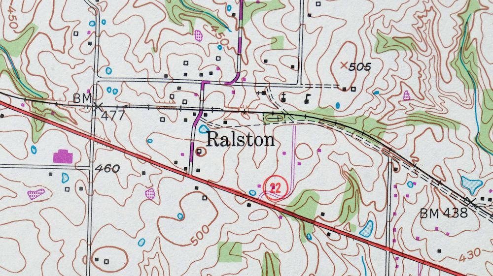
| NOTABLE PLACES | Ralston |
| CITIES AND TOWNS (CURRENT) | Dresden and Martin |
| COUNTIES COVERED | Weakley |
| RIVERS AND STREAMS | Brassfield Branch, Camp Ground Creek, Cane Creek, Chestnut Branch, Jones Creek, Little Cypress Creek, Mud Creek, and Vowell Branch |
| WATER BODIES | Mud Creek Watershed Lake Fifteen, Mud Creek Watershed Lake Five, Mud Creek Watershed Lake Number Seventeen, and W F Baker Lake |
| Locations: Martin Industrial Park. Parks: Harmon Field, Pacer Stadium, Rotary Field, and Virginia Weldon Park. Drainages: Brassfield Branch and Chestnut Branch. Churches: Adams Chapel, Bethany Church, Bible Union Church, Central Baptist Church, Eastside Baptist Church, Freemans Chapel, Martin Church of Christ, Miles Chapel Christian Methodist Episcopal Church, New Salem Church, Oak Grove Church, Oak Hill Church, Old Salem Church, Pleasant Hill Church, Public Wells Church, Shady Grove Church, and Travis Chapel. Hospitals: Northwest Tennessee Mental Health Center and Volunteer General Hospital. Buildings: Andy Holt Humanities Building, Atrium Residence Hall, Austin Peay Residence Hall, Cooper Hall, Brehm Hall, Browning Hall, Buford Ellington Residence Hall, C E Weldon Library, Cecil M and Boyce Gooch Hall, Frank Clement Residence Hall, G-H Residence Hall, Hall-Moody Administration Building, Jim McCord Residence Hall, Martin City Hall, Paul Meek Library, and University Center. Dams: Mud Creek Watershed Dam Fifteen, Mud Creek Watershed Dam Five, Mud Creek Watershed Dam Number Seventeen, Randolph Dam, and W F Baker Lake Dam. Schools: Martin Elementary School, Martin Junior High School, Martin Primary School, University of Tennessee, Vincent Grove School, and Westview High School. Reservoirs and Tanks: Mud Creek Watershed Lake Fifteen, Mud Creek Watershed Lake Five, Mud Creek Watershed Lake Number Seventeen, Randolph Lake, and W F Baker Lake. Towers: WCMT-AM (Martin), WCMT-FM (Martin), and WUTM-FM (Martin). | |
| SHIPPING AND RETURNS | |
 This map sheet will be carefully rolled in a sturdy tube and shipped via the US Postal Service. If you find that the sheet you receive is not as described in the listing, you may ship it back to us for a refund of the purchase price. | |
1981 Martin Tennessee USGS Topo Map: Ralston (1950 Edition)
$44
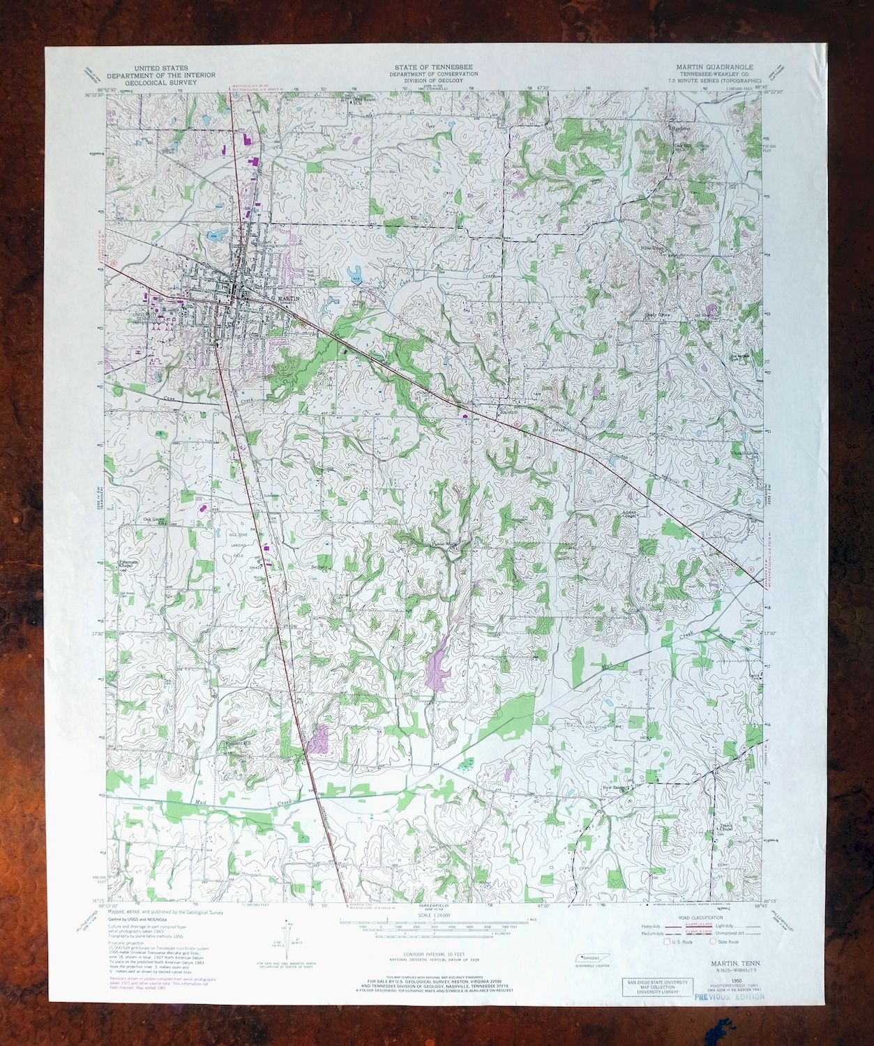
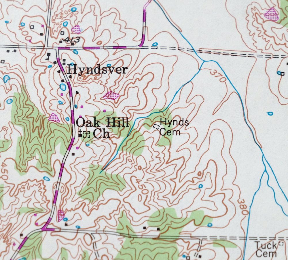
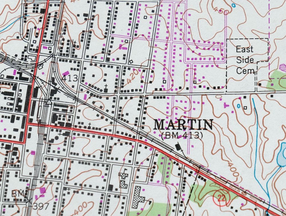
This 7.5-minute topographic sheet covers the Martin quadrangle in northwestern Tennessee, based on a 1950 edition revised in 1981 and printed that same year. It takes in the city of Martin in Weakley County, with the town of Dresden and the community of Ralston falling within the quad area, at a scale of 1:24,000 with 10-foot contours. Martin grew up around the University of Tennessee at Martin, and the sheet is clean and flat with a flawless map area, never folded and ready to frame.
In stock
This vintage sheet is a 1950 edition of the Martin Tennessee USGS topographic map revised in 1981 using aerial photography. It is an original 45-year-old 1981 United States Geological Survey print in very good condition.
HOW THIS MAP CAN BE USED
In addition to making a fascinating conversation piece, this sheet would look great in a frame or on display, make a unique and prized gift for anyone interested in this area, be perfect as a reference for genealogy studies or general historical research, or fill that missing piece in your collection. Maps of this vintage are printed on durable stock and are well-suited for outdoor activities and recreation of all kinds, including hiking, backpacking, hunting, rafting and kayaking, backcountry skiing, geocaching, general exploration, treasure hunting, etc.
FEATURES SHOWN ON THE MAP
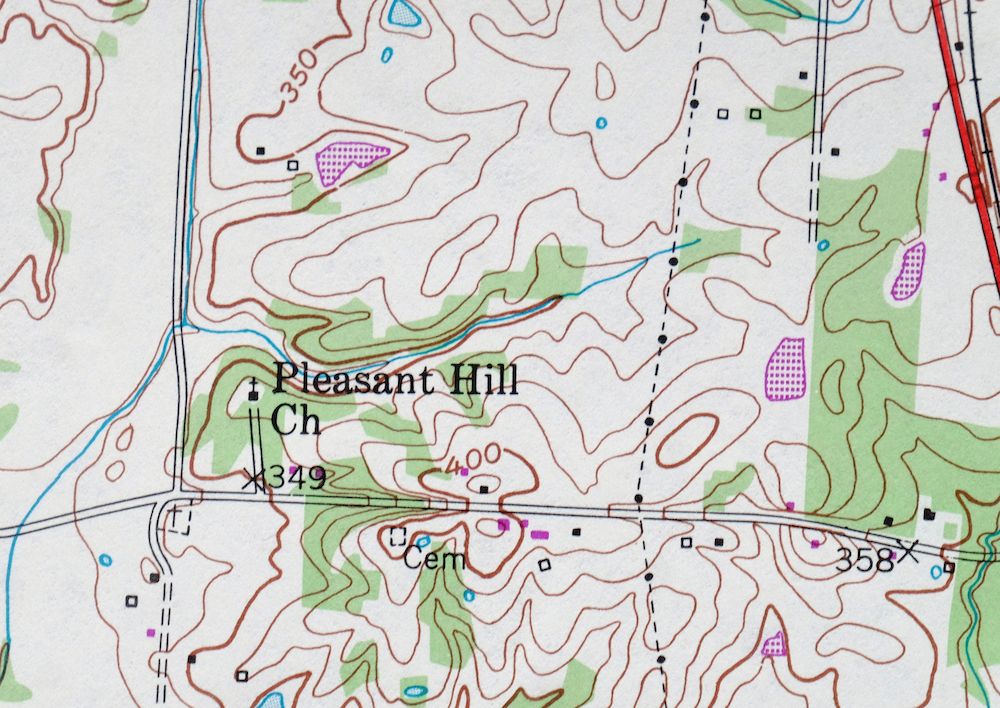
The Martin 7.5-minute map shows cities and towns, roads, paths, railroads, utilities and energy infrastructure, rivers, creeks, elevation contour lines, public land survey lines, county, state, and other administrative boundaries as they existed at the time of the survey in 1949 and 1950. All known structures (houses, businesses, churches, schools, barns, cabins, etc) are also shown.
A VALUABLE HISTORICAL RECORD
This map is from the 7.5-minute series, the most detailed series that is widely available from the USGS. The 1950 Martin map is a valuable historical record for the area. It contains some placenames and features that have been dropped from more recent maps.
The map was photorevised in 1981. Any features that changed or were added between the original edition year of 1950 and the photorevision year of 1981 are overlayed in purple. The purple overlay provides an excellent view of the fast-growing and changing areas within the quad boundary.
Nearby maps
-
Jackson North Tennessee Oakfield USGS Topographic Map 1980
$46 Add to cart -

Cairo Illinois Mounds Barlow USGS Topo Map 1964 Vintage
$41 Add to cart -
Jonesboro Illinois Cape Girardeau Anna USGS Topo Map 1963
$42 Add to cart -

Millington Tennessee Memphis USGS Topo Map 1994 Contemporary
$40 Add to cart -

Ellendale Tennessee Memphis Cordova USGS Topo Map 1967
$42 Add to cart -
Northeast Memphis Tennessee Egypt Memphis USGS Topo Map 1967
$43 Add to cart -
Northwest Memphis Tennessee Frayser USGS Topo Map 1967
$37 Add to cart -
Southeast Memphis Tennessee Memphis USGS Topo Map 1967
$43 Add to cart -
Southwest Memphis Tennessee Memphis USGS Topo Map 1974
$39 Add to cart -

Nashville West Tennessee Whitebridge USGS Topo Map 1971
$42 Add to cart -
New Haven Illinois Ridgway Herald USGS Topo Map 1920 Antique
$43 Add to cart -

Goodlettsville Tennessee Lakewood USGS Topographic Map 1953
$41 Add to cart -
1971 USGS Topo Map: Goodlettsville, Old Hickory, Tennessee
$46 Add to cart -
Nashville East Tennessee Lakewood USGS Topo Map 1959 Vintage
$40 Add to cart -
1971 Nashville East Tennessee USGS Topo Map: Lakewood
$44 Add to cart -
Antioch Tennessee Brentwood USGS Topographic Map 1971
$43 Add to cart -

Chester Missouri Perryville Saint Mary USGS Topo Map 1964
$44 Add to cart -

Farmington Tennessee Chapel Hill USGS Topo Map 1968 Vintage
$36 Add to cart -
Walterhill Tennessee Murfreesboro Smyrna USGS Topo Map 1984
$27 Add to cart -
Ironton Missouri Mark Twain NF Pilot Knob USGS Topo Map 1968
$30 Add to cart -
Renault Illinois Ste. Genevieve Red Bud USGS Topo Map 1915
$52 Add to cart -
1963 USGS Topo Map: Renault, Bloomsdale, Illinois/Missouri
$46 Add to cart -
Potosi Missouri Mark Twain NF Caledonia USGS Topo Map 1906
$72 Add to cart -
Marks Mississippi Jonestown Lula USGS Topo Map 1935 Antique
$32 Add to cart
