MAP DETAILS | |
|---|---|
| TITLE | Romney |
| STATE | West Virginia, Maryland, Virginia |
| LOCATION | Vicinity of Keyser |
| SERIES | 30-minute |
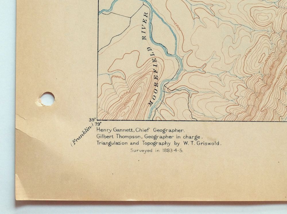
| SURVEYED | 1883 through 1885 Field Survey |
| GEOGRAPHER | Henry Gannett |
| EDITION | 1891 |
| PRINTED | 1909 |
| PRINT NOTES | Thick paper stock |
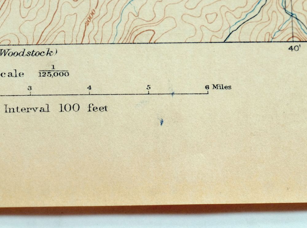
| SCALE | 1:125000 |
| CONTOUR INTERVAL | 100 feet |
| SHEET DIMENSIONS | 16 1/2 x 20 inches |
| MAP DIMENSIONS | 13 1/2 x 17 1/2 inches |
| COVERAGE AREA | 27 x 35 miles |
| SOURCE | From an uncommonly well-preserved collection |
| MAP NOTES | A fascinating historical snapshot surveyed before the modern highway system, showing historic overland travel routes, rail lines, and early placenames. |
| SHEET CONDITION For maps of this vintage, effort is made to note all visible flaws, no matter how minor. | |
| OVERALL CONDITION | Excellent |
| SHEET NOTES | very lightly handled, never folded, smooth and flat |
| MAP AREA | flawless map area |
| COLLARS | no wear or tears, no markings, hole punches along left collar, small blemish in bottom collar, very minor storage crease in lower left collar corner |
  | |
| MAP COVERAGE Quadrangle extent overlaid on current basemap. | |
| BACKSIDE LEGEND | |
 A map summary is printed on the back side of the Romney sheet similar to the one shown in the picture. It outlines the history, purpose, and status of the USGS mapping program at the time of the printing in 1909. It also provides instructions on how to read contour lines and a description of how they are used to depict the terrain. At the bottom of the page is a legend showing all of the symbols used to represent the cultural, relief, and water features found on the map. | |
| PLACENAMES Depending on map series and survey date, all of the features listed below may not be shown on this map. This list contains features that currently exist or historically existed within the area covered by the map. The list can be used as a reference to determine if this map covers your area of interest. Placenames are listed alphabetically next to each feature type. | |
| CITIES AND TOWNS (CURRENT) | Augusta, Baker, Delray, Fort Ashby, Keyser, Moorefield, Old Fields, Romney, Slanesville, Springfield, and Wardensville |
| COUNTIES COVERED | Allegany, Frederick, Grant, Hampshire, Hardy, Mineral, and Shenandoah |
| FEDERAL LAND UNITS | George Washington National Forest |
| RIVERS AND STREAMS | Abernathy Run, Allen Run, Anderson Run, Ashcabin Run, Baker Run, Bears Hell Run, Bearwallow Creek, Beaver Run, Big Run, Broad Run, Brushy Run, Buffalo Creek, Cabin Run, Cacapon River, Camp Branch, Camp Run, Capon Springs Run, Cave Run, Clints Run, Cold Spring Run, Core Run, Cove Run, Crooked Run, Deep Run, Devil Hole Run, Dillons Run, Dry Run, Dug Hill Run, Dumpling Run, Edwards Run, Elliber Run, Falling Run, Fort Run, Fox Run, Gibbons Run, Grassy Lick Run, Green Spring Run, Halfmoon Run, Harness Run, Hawk Run, Hazel Run, Hiett Run, Hollenbeck Run, Hopkins Lick Run, Horselick Run, Horseshoe Creek, Hutton Run, Johns Run, Johnson Run, Kellar Run, Lick Run, Limestone Run, Little Cacapon River, Long Meadow Run, Lost River, Maple Run, McDowell Run, Meadow Run, Mikes Run, Mill Creek, Mill Run, Moores Run, Mud Run, Mudlick Run, Myers Run, New Creek, North Branch Potomac River, North River, Ochre Run, Paddy Run, Painter Run, Pargut Run, Parr Spring Run, Parrill Run, Patterson Creek, Pine Draft Run, Pursley Run, Rinehart Run, Sauerkraut Run, Sawmill Run, Shawan Run, Shell Run, Slate Rock Run, South Branch Potomac River, South Fork Little Cacapon River, South Fork South Branch Potomac River, Sperry Run, Staggs Run, Stony Run, Stump Run, Sugar Run, Sulphur Spring Run, Sycamore Run, Tear Coat Creek, Three Churches Run, Three Springs Run, Titus Run, Trout Run, Turkeyfoot Run, Turnmill Run, Waites Run, Walnut Bottom Run, Waterlick Run, Wergman Run, Whipps Run, and Wild Meadow Run |
| WATER BODIES | Keyser Reservoir |
| West Virginia Populated Place: Markwood, Meadow, Milleson, Arkansas, Augusta, Baker, Barnes Mill, Baughman Settlement, Bean Settlement, Blues Beach, Burlington, Capon Lake, Champwood, Creekvale, Cunningham, Davis Ford, Delray, Donaldson, Forge Hill, Fort Run, Frenchburg, Gerstell, Grace, Headsville, Higginsville, Hoy, Inkerman, Intermont, Johnson, Junction, Keyser, Kirby, Levels, Limestone, Loom, McCauley, McNeill, Mechanicsburg, Millbrook, Millesons Mill, Moorefield, Needmore, North River Mills, Old Fields, Pancake, Pleasantdale, Points, Purgitsville, Rada, Raven Rocks, Reeses Mill, Ridgedale, Ridgeville, Rio, Ritters, Rock Oak, Romney, Ruckman, Russelldale, Sector, Sedan, Shanks, Slanesville, Springfield, Sycamore, Tannery, Taylor, Three Churches, Vance, Wapocomo, Wardensville, Wickham, and Yellow Spring. Locations: Bens Knob Lookout Tower, Slaty Lick Knob Lookout Tower, Mill Creek Country Club Golf Course, Camp Hemlock, Camp Minco, Camp Pinnacle, Capon Furnace, Flats, Hanging Rock, and Twin Mountain. Administrative Boundaries: Hampshire County, Hardy County, Mineral County, Capon District, City of Keyser, City of Romney, District 1, District 2, Gore District, Mill Creek District, Moorefield District, Old Fields District, Romney District, Sherman District, Springfield District, Town of Moorefield, and Town of Wardensville. Mountains, Peaks, and Summits: Fort Hill, Baker Mountain, Bald Knob, Bens Knob, Buck Mountain, Cherry Hill, Coburn Knob, Cooper Mountain, Dillons Mountain, Fairview Mountain, Ford Hill, Green Knob, Halfmoon Mountain, High Knob, Horseshoe Mountain, Lawn Knob, Little Cacapon Mountain, Little Mountain, Long Knob, Martins Hill, Merritt Knob, Mollys Hill, Nathaniel Mountain, North River Mountain, Phils Knob, Piney Hill, Piney Mountain, Powder Spring Knob, River Mountain, Rock Hill, Short Mountain, Slate Lick Knob, Stony Mountain, Sugarloaf Knob, Taylor Knob, Thrasher Knob, Three Square Knob, Timber Mountain, Valley Mountain, and Wacousta Hill. Valleys and Canyons: Bell Hollow, Birch Hollow, Brushy Hollow, Chimney Hollow, Clifford Hollow, Dover Hollow, Dutch Hollow, Ellis Hollow, Gerstell Hollow, Graybill Hollow, Greenwood Hollow, Gunbarrel Hollow, Henderson Hollow, Hoffman Hollow, Jemima Hollow, Landacre Hollow, Mine Hollow, Parker Hollow, Parks Hollow, Short Hollow, Springfield Valley, Stuart Hollow, Sugarcamp Hollow, Sulphur Spring Hollow, Swisher Hollow, Taylor Hollow, The Trough, Thorny Bottom, Tom Williams Hollow, Toombs Hollow, Trinton Hollow, Waxter Hollow, Williams Hollow, and Wood Hollow. Parks: Moorefield Historic District, Shanks Roadside Park, Springfield Wildlife Management Area, Fort Mill Ridge Wildlife Management Area, South Branch Wildlife Management Area, Nathaniel Mountain Wildlife Management Area, Short Mountain Wildlife Management Area, and Warden Lake Wildlife Management Area. Trails: Brushy Hollow Trail and Squirrel Gap Trail. Drainages: Abernathy Run, Allen Run, Anderson Run, Baker Run, Bears Hell Run, Bearwallow Creek, Beaver Run, Big Run, Broad Run, Brushy Run, Buffalo Creek, Buffalo Run, Buskirk Run, Cabin Run, Camp Branch, Camp Run, Capon Springs Run, Cave Run, Clints Run, Core Run, Cove Run, Crooked Run, Deep Run, Devil Hole Run, Dowden Run, Dry Run, Dug Hill Run, Dumpling Run, Elkhorn Run, Elliber Run, Elmlick Run, Falling Run, Fort Run, Fox Run, Gibbons Run, Grassy Lick Run, Graveyard Run, Halfmoon Run, Harness Run, Hawk Run, Hazel Run, Hiett Run, Hollenbeck Run, Hopkins Lick Run, Horn Camp Run, Horselick Run, Horseshoe Run, Hutton Run, Johns Run, Johnson Run, Kellar Run, Lick Run, Liller Run, Limestone Run, Little Devil Hole Run, Long Lick Run, Long Meadow Run, Long Run, Lost River, Maple Run, Mayhew Run, McDowell Run, Meadow Run, Mikes Run, Mill Creek, Mill Run, Moores Run, Mud Run, Mudlick Run, New Creek, North Fork Little Cacapon River, Ochre Run, Pargut Run, Parker Hollow, Parrill Run, Pine Draft Run, Pond Run, Pot Lick Run, Pursley Run, Rinehart Run, Sauerkraut Run, Sawmill Run, Shawan Run, Sine Run, Skaggs Run, Slate Rock Run, South Fork Little Cacapon River, South Fork South Branch Potomac River, Sperry Run, Spring Run, Staggs Run, Stony Run, Stump Run, Sugar Run, Sugarcamp Run, Sulphur Spring Run, Swartz Run, Sycamore Run, Tear Coat Creek, Three Churches Run, Three Springs Run, Thunderhill Run, Titus Run, Trout Run, Turkeyfoot Run, Turnmill Run, Waites Run, Walnut Bottom Run, Waterlick Run, Wergman Run, Whipps Run, Wild Meadow Run, and Willow Run. Capes: McKees Rocks. Churches: Branch Mountain Methodist Church, Calvary United Methodist Church, Capon Chapel Church of the Brethren, Central United Methodist Church, Church of Christ, Church of God, Church of the Assumption, Emmanuel Episcopal Church, First Baptist Church, First United Methodist Church, Grace United Methodist Church, Keyser Church of the Brethren, Keyser Presbyterian Church, Mount Bethel Presbyterian Church, Mount Zion Baptist Church, North River Mills United Methodist Church, Old Fields Church, Romney Christian Church, Romney Church of the Nazarene, Slanesville Presbyterian Church, Tannery Presbyterian Church, Trinity Lutheran Church, Zion Lutheran Church, Asbury Church, Baker Church, Beaver Run Church, Bethel Church, Cabin Run Church, Cave Valley Presbyterian Church, Crest Hill Church, Dennison Church, Dry Run Church, Ebenezer Church, Eusebia Church, Evergreen Church, Fairview Church, Fort Run Church, Harness Run Church, Harpers Chapel, Hebron Church, Holiness Church, Hotts Chapel, Kelley Chapel, Kirby Bethel Baptist Church, Little Cacapon Church, Lone Star Church, Markwood Church, Marvin Chapel, Mead Church, Mineral Church, Mount Moriah Church, Mount Olive Church, Mount Olive United Methodist Church, Mount Zion Church, Mountaindale Church, Old Pine Church, Otterdin Church, Patterson Creek Church, Pine Grove Church, Saint Lukes Church, Salem Church, Sperry Run Church, Spring Gap Church, Tear Coat Church, Trinity Church, Union Church, Willow Dale Chapel, and Zoar Church. Post Office: Augusta Post Office, Baker Post Office, Burlington Post Office, Delray Post Office, Keyser Post Office, Kirby Post Office, Moorefield Post Office, Old Fields Post Office, Points Post Office, Purgitsville Post Office, Rio Post Office, Romney Post Office, Shanks Post Office, Slanesville Post Office, Springfield Post Office, Three Churches Post Office, Wardensville Post Office, and Yellow Spring Post Office. Hospitals: Hampshire Memorial Hospital. Buildings: Hampshire County Courthouse, Hardy County Courthouse, Hardy County Public Library, Keyser-Mineral County Public Library, Literary Hall, Augusta Volunteer Fire Company, Augusta Volunteer Rescue Squad Company 13, Burlington Public Library, Burlington Volunteer Fire Department Company 44, Capon Valley Volunteer Fire Department, East Hardy Public Library, Fountain Volunteer Fire Department, Fraley Ambulance Service, Hampshire Convention and Visitors Bureau, Hampshire County Sheriff's Office, Hardy County Emergency Ambulance, Hardy County Sheriff's Office, J M Chick Buckbee Juvenile Detention Center, Keyser Emergency Medical Services 1, Keyser Police Department, Keyser Volunteer Fire Department Station 1, Keyser Volunteer Fire Department Station 2, Lamberts Ambulance Service 1, Levels Volunteer Fire Company, Mathias - Baker Volunteer Emergency Squad - Baker, Mathias Baker Volunteer Emergency Squad 42, Mineral County Bailiffs Office, Mineral County Courthouse, Mineral County Sheriff's Office, Moorefield Police Department, Moorefield Volunteer Fire Department, North River Valley Volunteer Fire Company, Potomac Highlands Regional Jail, Potomac State College of West Virginia University Police, Romney Police Department, Romney Volunteer Fire Department, Romney Volunteer Rescue Squad Company 11, Slanesville Volunteer Ambulance Service, Slanesville Volunteer Fire Company, South Branch Cinema 6, Springfield Area Rescue Squad, Springfield Valley Volunteer Fire Department, Valley Medical Transport, Wardensville Police Department, Wardensville Volunteer Rescue Squad, West Virginia Division of Forestry Hardy County Field Office, West Virginia Division of Forestry Mineral County Field Office, West Virginia Division of Forestry Romney Field Office, West Virginia State Police Troop 2 - Keyser Detachment, West Virginia State Police Troop 2 - Romney Detachment, and Wilson Community Hall. Dams: Boone Farms Lake Dam, Elkhorn Lake Dam, Ferndale Farms Recreation Lake Dam, New Creek Structure Number One Dam, Old Keyser Dam, Patterson Creek Structure 15 Dam, Patterson Creek Structure 20 Dam, Patterson Creek Structure 22 Dam, Patterson Creek Structure 24 Dam, Patterson Creek Structure 25 Dam, Patterson Creek Structure 26 Dam, Patterson Creek Structure 27 Dam, Patterson Creek Structure 36 Dam, Patterson Creek Structure 37 Dam, Patterson Creek Structure 38 Dam, Patterson Creek Structure 44 Dam, Patterson Creek Structure 45 Dam, Patterson Creek Structure 46 Dam, Patterson Creek Structure 47 Dam, Patterson Creek Structure 48 Dam, Patterson Creek Structure 52 Dam, Patterson Creek Structure Number 28 Dam, and Warden Lake Dam. Crossings: Blue Ford. Bluffs: Hanging Rock. Gaps: Blue Sea Gap, Falling Springs Gap, O'Neil Gap, Reynolds Gap, Squirrel Gap, Staacks Gap, Wise Gap, and Yellow Spring Gap. Bridges: Clifford Hollow Bridge, Headsville Bridge, Jerry Staggs Memorial Bridge, John Blue Bridge, Kenneth Seldon Bridge, Keyser McCoole Bridge, Long Lick Run Bridge, Lost River Number 1 Bridge, Lost River Number 3 Bridge, Millesons Mill Bridge, New Buzzard Ford Bridge, Parsons Ford Bridge, Romney Bridge, Rudy Memorial Bridge, Sauerkraut Run Bridge, SSGT J E Kelly Memorial Bridge, and Wendell Dell Hester Memorial Bridge. Basins: Cave Valley and Wilson Cove. Airports: Eastview Airport, Gerstell Farms Airport, and Lost Mountain Airport. Census: Fort Ashby Census Designated Place, Burlington Census Designated Place, and Springfield Census Designated Place. Schools: Augusta Elementary School, Burlington Primary School, Hampshire County Career Training Center, Hampshire High School, Moorefield Elementary School, Moorefield High School, Romney Elementary School, Romney Middle School, Saint Francis School, Slanesville Elementary School, Springfield - Green Spring Elementary School, West Virginia School for the Blind, East Hardy Early Middle School, East Hardy High School, John J Cornwell Elementary School, Keyser Primary / Middle School, Maranatha Christian Academy, Mineral County Alternative School, Mineral County Technical Center, Moorefield Middle School, Burlington Center, JM Chick Buckbee Juvenile Center, Keyser Headstart, Moorefield Intermediate School, Potomac Center, Slanesville Christian School, Fountain Primary School, Potomac State College of West Virginia University, and Reymann Memorial Farms West Virginia University. Ridges: Abrams Ridge, Anderson Ridge, Bears Hell, Big Ridge, Bird Ridge, Brushy Ridge, Buck Ridge, Cherry Ridge, Chestnut Oak Ridge, Chestnut Ridge, Devils Backbone, Devils Garden Ridge, Dunmore Ridge, Flat Ridge, Hanging Rock Ridge, High Top Ridge, Hunting Ridge, Island Ridge, Lockinger Ridge, Middle Ridge, Mill Creek Mountain, Mouser Ridge, Noland Ridge, Patterson Creek Mountain, Pearl Ridge, Pine Ridge, Potato Row, Queens Ridge, River Ridge, Rocky Ridge, Sandy Ridge, Sawmill Ridge, South Branch Mountain, Thorny Bottom Ridge, Timber Ridge, Town Hill, Warden Ridge, and Wildcat Ridge. Reservoirs and Tanks: Ferndale Farms Recreation Lake, Keyser Reservoir, Moores Run Lake Number One, and Warden Lake. Military: Fort Fuller and Fort Pearsall. Towers: Nathaniel Mountain Lookout Tower, WJGF-FM (Romney), WJJB-FM (Romney), WKLP-AM (Keyser), and WQZK-FM (Keyser). Pillars: High Rocks. Springs: Anderson Farm Spring, Arie Vankan Spring, Baker Mine Spring, Bane Brothers Spring, Beall Spring, Big Spring, Bitner Spring, Boiling Spring, Camp Pinnacle Spring, Capon Lake Farm Spring, Cave Gap Spring, Clifford Parker Spring, Cold Spring, Craig Spring, Everett Fruit Farm Spring, Fox Farm Spring, Gap Run Spring, Hampshire County Spring, Harding Spring, Harry Veeders Spring, High Farm Spring, High Spring, Huffman Spring, Landecker Farm Spring, Leatherman Farm Spring, Leslie This Spring, Lower State Farm Spring, Luna Roomsburg Spring, Manorland Post Motel Spring, McNeil Spring, Meadow Spring, Miller Spring, National Forest Spring, Newbrough Spring, Paul Keister Spring, Paul Williams Spring, Peewee Spring, Raven Rock Spring, Raymond Hawse Spring, Reed Farm Spring, Richard Farm Spring, Romney Spring, Springfield Spring, Steacy Conrad Spring, Trout Run Fault Spring, Upper State Farm Spring, Wardensville Spring, Webster Spring, Welton Spring, Willowvale Farm Spring, Winfred Tharp Spring, Yellow Spring, Elliber Spring, and Sand Spring. Cemetery: Bethel Cemetery, Heare Cemetery, Hotts Chapel Cemetery, Indian Mound Cemetery, Mount Bethel Cemetery, Mountaindale Cemetery, Old Bethel Church Cemetery, Old Pine Cemetery, Arnold Cemetery, Baker Cemetery, Bane Cemetery, Bever Run Cemetery, Biser Cemetery, Burlington Cemetery, Canon Cemetery, Carr Cemetery, Cundiff Cemetery, Delawder Cemetery, Eusebia Church Cemetery, Gerstell Family Cemetery, Green Cemetery, Greenwall Cemetery, Headsville Methodist Episcopal Church Cemetery, Hull - Utta Cemetery, John Liller Cemetery, Leatherman Cemetery, Ludwick Cemetery, Michaels Cemetery, Miller McCarty Cemetery, Mineral Baptist Cemetery, Mount Zion Cemetery, Old Fields Church Cemetery, Peerce Cemetery, Poor Farm Cemetery, Potomac Memorial Gardens, Rawlings Cemetery, Rees Memorial Cemetery, Reeves Cemetery, Roderick Cemetery, Schoemaker Cemetery, Sloan Cemetery, Staggs Cemetery, Stone Chapel Cemetery, Sulter Cemetery, Thrush Cemetery, Umstot Cemetery, Urice and Kerns Cemetery, Whip Cemetery, Augusta Cemetery, Bethel Baptist Church Cemetery, Bethel Methodist Church Cemetery, Branch Mountain Cemetery, Branch Mountain United Methodist Church Cemetery, Broad Run Graveyard, Central United Methodist Church Cemetery, Church of Christ Memorial Park, Church of the Brethren Cemetery, Ebenezer Cemetery, Grassy Lick Cemetery, Hebron Lutheran Church Cemetery, Little Cacapon Primitive Baptist Church Cemetery, Lutheran Ebenezer Cemetery, Mill Run Cemetery, Mount Pisgah Benevolence Cemetery, Pine Grove Cemetery, Quaker Cemetery, Saint Luke Presbyterian Church Cemetery, Springfield Hill Cemetery, Tear Coat Cemetery, Alum - Bank Cemetery, Baldwin Cemetery, Cabin Run Cemetery, Clagett Cemetery, Elijah High Cemetery, Green Hill Cemetery, Green Lane Cemetery, Green Mound Cemetery, Meadow View Cemetery, Oak Hill Cemetery, Olivet Cemetery, Queens Point Cemetery, Saint James Cemetery, Saint Marys Cemetery, and Wilson Cemetery. | |
| Maryland Populated Place: Black Oak, Dawson, and McCoole. Mountain Ranges: South Mountain. Mountains, Peaks, and Summits: Pond Hill. Valleys and Canyons: Culvert Hollow, Deep Hollow, and Toms Hollow. Drainages: Dry Run. Capes: Queens Point. Churches: Dawson United Methodist Church. Buildings: McCoole Fire and Rescue Department. Bridges: Twenty-First Bridge. Census: Dawson Census Designated Place and McCoole Census Designated Place. Schools: Bruce Middle School. Cemetery: Dayton Cemetery. | |
| Virginia Locations: Paul Gerhart Shelter. Mountain Ranges: Great North Mountain. Mountains, Peaks, and Summits: Bonnet Hill and Paddy Mountain. Drainages: Rocky Run. Buildings: Company 5 Fort Valley Volunteer Fire and Rescue - Substation. Bluffs: Three High Heads. Bays: Vances Cove. Springs: Fowlers Spring. | |
| SHIPPING AND RETURNS | |
 This map sheet will be carefully rolled in a sturdy tube and shipped via the US Postal Service. If you find that the sheet you receive is not as described in the listing, you may ship it back to us for a refund of the purchase price. | |
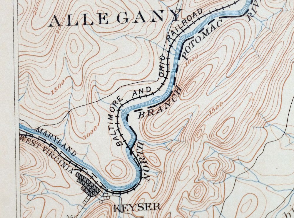
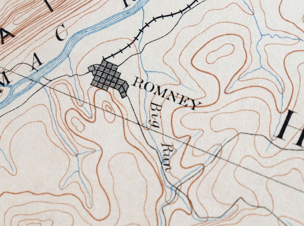
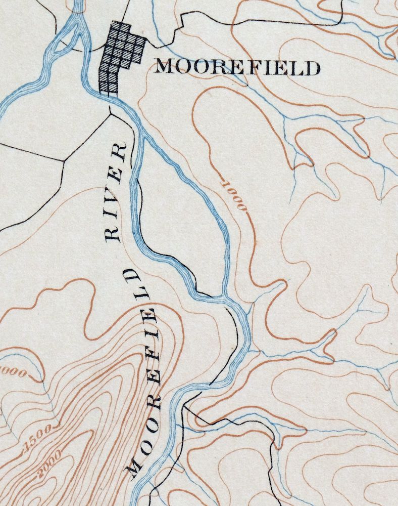
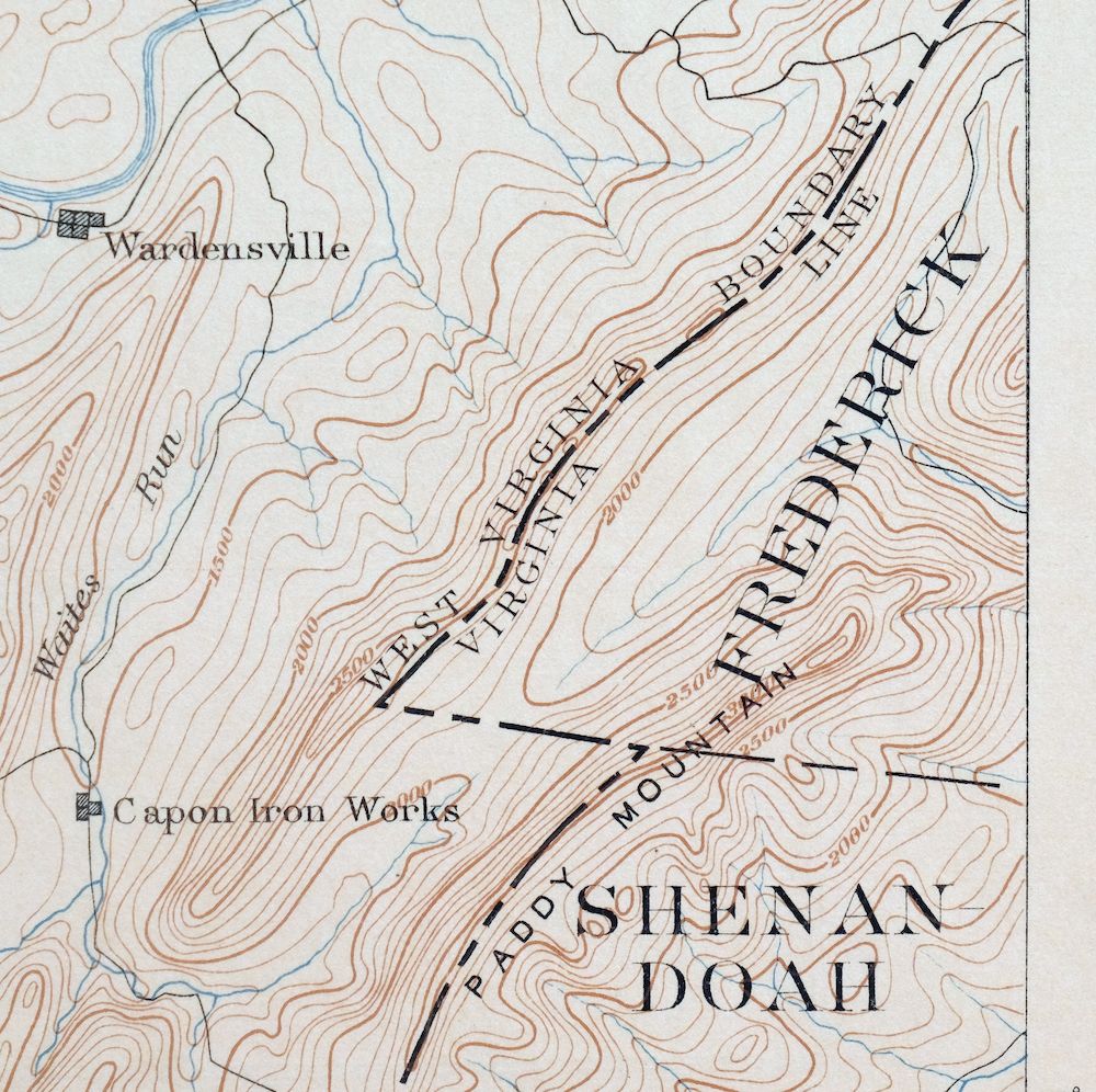
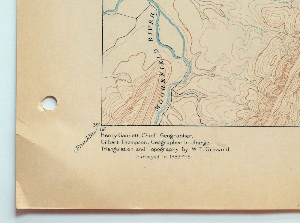

Romney West Virginia Keyser Delray USGS Topographic Map 1909
$115
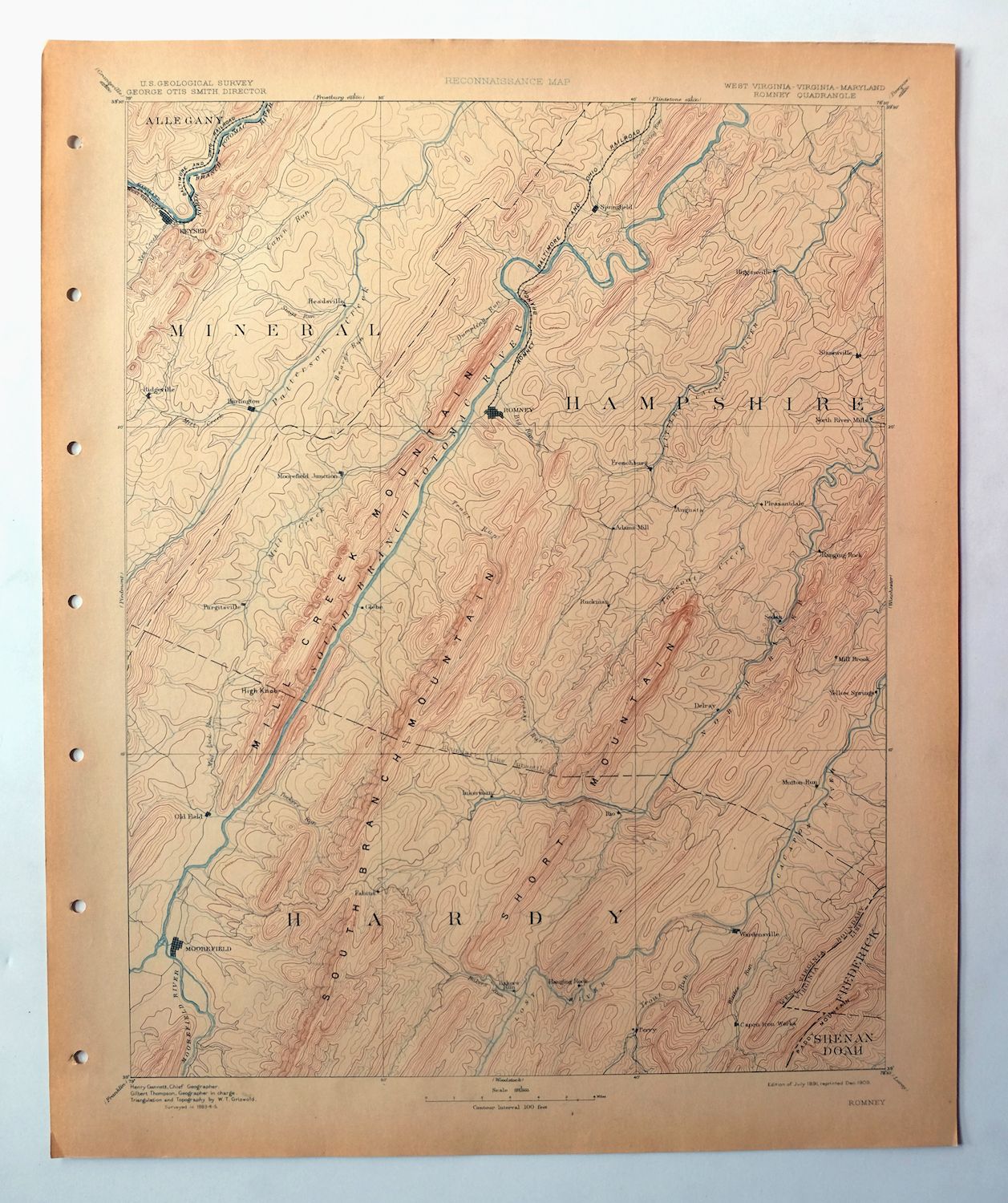
This USGS Reconnaissance Topo Map is a 30-minute sheet of the Romney quadrangle, first published in 1891 and printed in 1909, an antique sheet in excellent condition that was never folded and remains smooth and flat on thick stock. Drawn from an 1883 through 1885 field survey under geographer Henry Gannett, it takes in a stretch of the West Virginia–Maryland–Virginia border country, with the quad area including Romney, Moorefield, Keyser, and Fort Ashby along with part of the George Washington National Forest. Surveyed before the modern highway system, it records the overland travel routes, rail lines, and early placenames of the era, and this one comes from an uncommonly well-preserved collection. The reverse carries printed reference material from the 1909 USGS mapping program.
In stock
This antique sheet is an 1891 edition of the Romney West Virginia USGS topographic map. It is an authentic 117-year-old 1909 United States Geological Survey print in excellent condition.
HOW THIS MAP CAN BE USED
In addition to making a fascinating conversation piece, this sheet would look great in a frame or on display, make a unique and prized gift for anyone interested in this area, be perfect as a reference for genealogy studies or general historical research, or fill that missing piece in your collection.
FEATURES SHOWN ON THE MAP
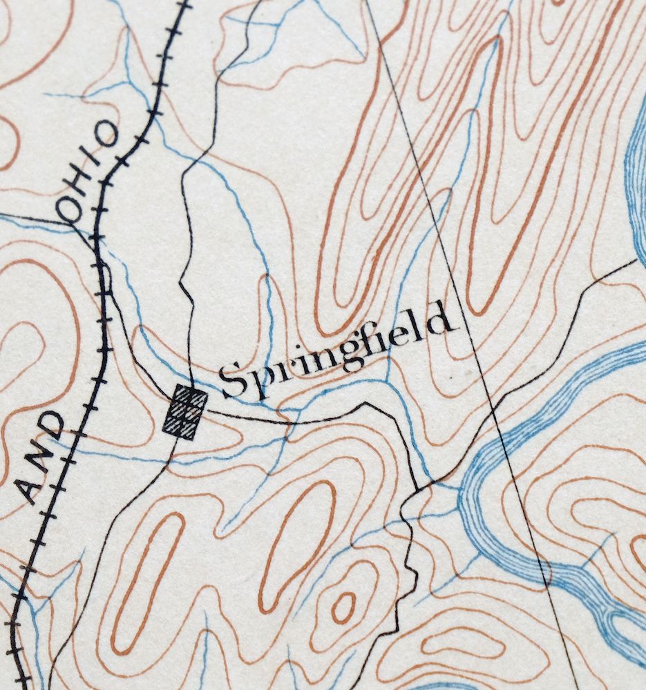
The Romney 30-minute map shows cities and towns, roads, railroads, rivers, creeks, elevation contour lines, public land survey lines, county, state, and other administrative boundaries as they existed at the time of the survey in 1883 through 1885.
A VALUABLE HISTORICAL RECORD
Maps from the USGS 30-minute series have been out of print for many years. They have never been common and original prints are increasingly difficult to find. For areas where the 30-minute map was produced, it is usually the first large-scale survey done by the USGS for that area. These are a valuable historical record, as they contain many placenames and features that have been dropped from more recent series’ and editions.
Nearby maps
-

Winchester Virginia Middletown Inwood USGS Topo Map 1916
$100 Add to cart -

Luray Virginia Front Royal Stanley USGS Topographic Map 1910
$115 Add to cart -

Franklin West Virginia Petersburg Onego USGS Topo Map 1914
$49 Add to cart -
Staunton Virginia Stuarts Draft USGS Topographic Map 1913
$120 Add to cart -

Mount Vernon Virginia Washington Accokeek USGS Topo Map 1912
$250 Add to cart -

Patapsco Maryland Baltimore Jessup USGS Topographic Map 1908
$195 Add to cart -

Palmyra Virginia Lake Monticello Dillwyn USGS Topo Map 1907
$75 Add to cart -
Patuxent Maryland Washington Bowie USGS 30-Min Topo Map 1907
$65 Add to cart -

Sutton West Virginia Glenville Elk River USGS Topo Map 1907
$110 Add to cart -

Natural Bridge Virginia Covington Selma USGS Topo Map 1911
$62 Add to cart -

Nicholas West Virginia Summersville Cowen USGS Topo Map 1912
$54 Add to cart -

Tolchester Maryland Dundalk Essex USGS Topo Map 1908 Antique
$145 Add to cart -

Hyndman Pennsylvania Buffalo Mills USGS 15-Min Topo Map 1967
$40 Add to cart -

Clearville Pennsylvania USGS 15-Min Topo Map 1945 Vintage
$42 Add to cart -

Needmore Pennsylvania Crystal Spring USGS Topo Map 1947
$44 Add to cart -

Bedford Pennsylvania Schellsburg USGS Topo Map 1958 Vintage
$42 Add to cart -

Chambersburg Pennsylvania Guilford USGS Topographic Map 1964
$40 Add to cart -

Brownsville Pennsylvania Monessen Donora USGS Topo Map 1954
$38 Add to cart -

Newville Pennsylvania Shippensburg USGS 15-Min Topo Map 1959
$40 Add to cart -

Carlisle Pennsylvania Schlusser USGS Topographic Map 1964
$45 Add to cart -

Freeport Pennsylvania Plum New Kensington USGS Topo Map 1956
$36 Add to cart -

Loysville Pennsylvania Landisburg USGS Topo Map 1966 Vintage
$42 Add to cart -

Carnegie Pennsylvania Pittsburgh Dormont USGS Topo Map 1954
$48 Add to cart -
New Kensington Pennsylvania Plum USGS Topographic Map 1956
$44 Add to cart
