MAP DETAILS | |
|---|---|
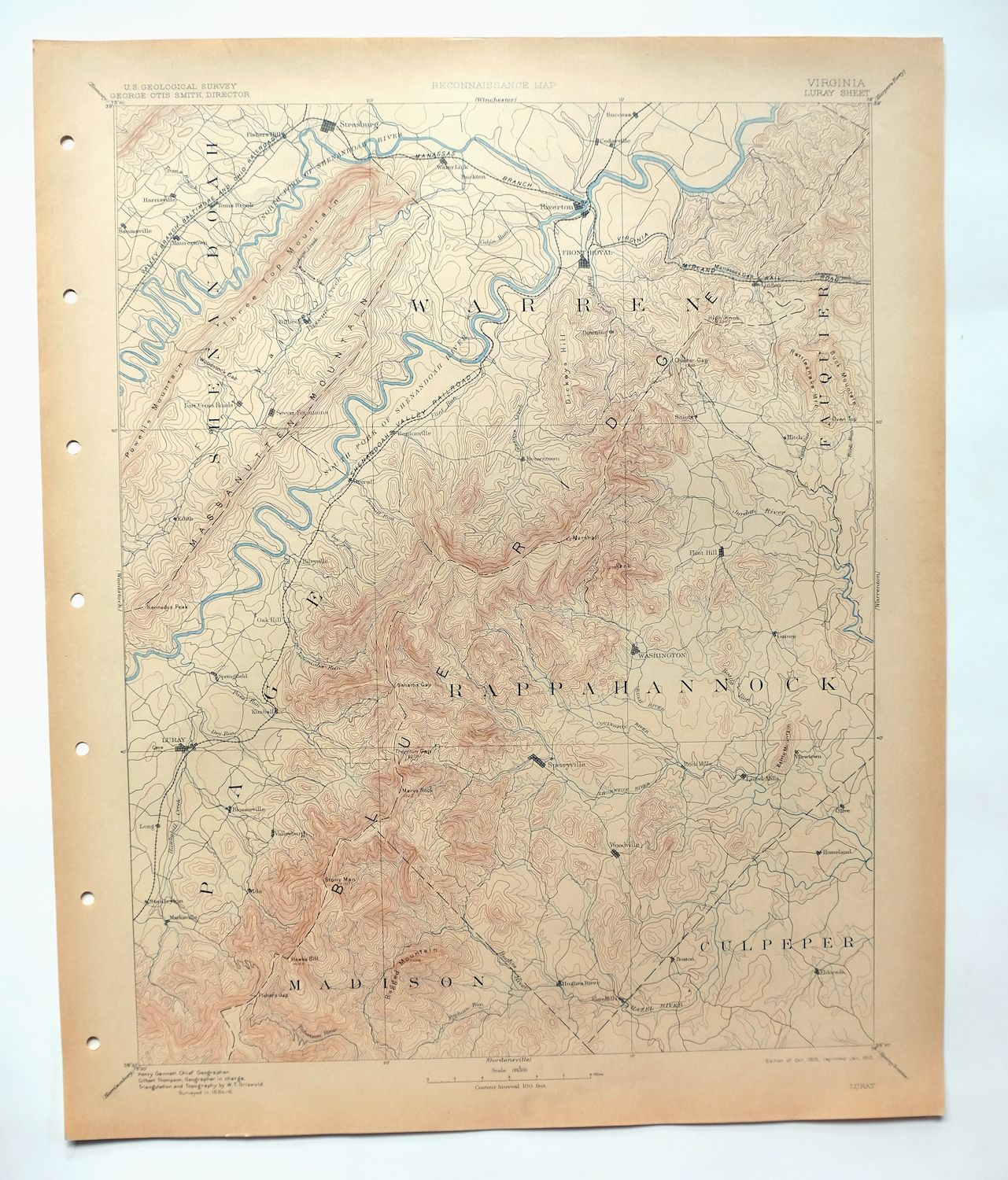
| TITLE | Luray |
| STATE | Virginia |
| LOCATION | Shenandoah National Park, vicinity of Front Royal |
| SERIES | 30-minute |
| SURVEYED | 1884 and 1886 Field Survey |
| GEOGRAPHER | Henry Gannett |
| EDITION | 1905 |
| PRINTED | 1910 |
| PRINT NOTES | Thick paper stock |
| SCALE | 1:125000 |
| CONTOUR INTERVAL | 100 feet |
| SHEET DIMENSIONS | 16 1/2 x 20 inches |
| MAP DIMENSIONS | 13 5/8 x 17 1/2 inches |
| COVERAGE AREA | 27 x 35 miles |
| SOURCE | From an uncommonly well-preserved collection |
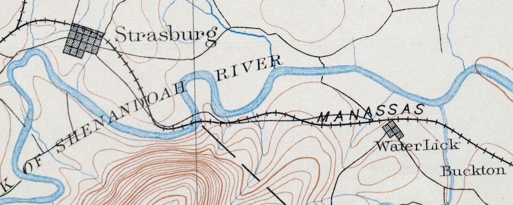
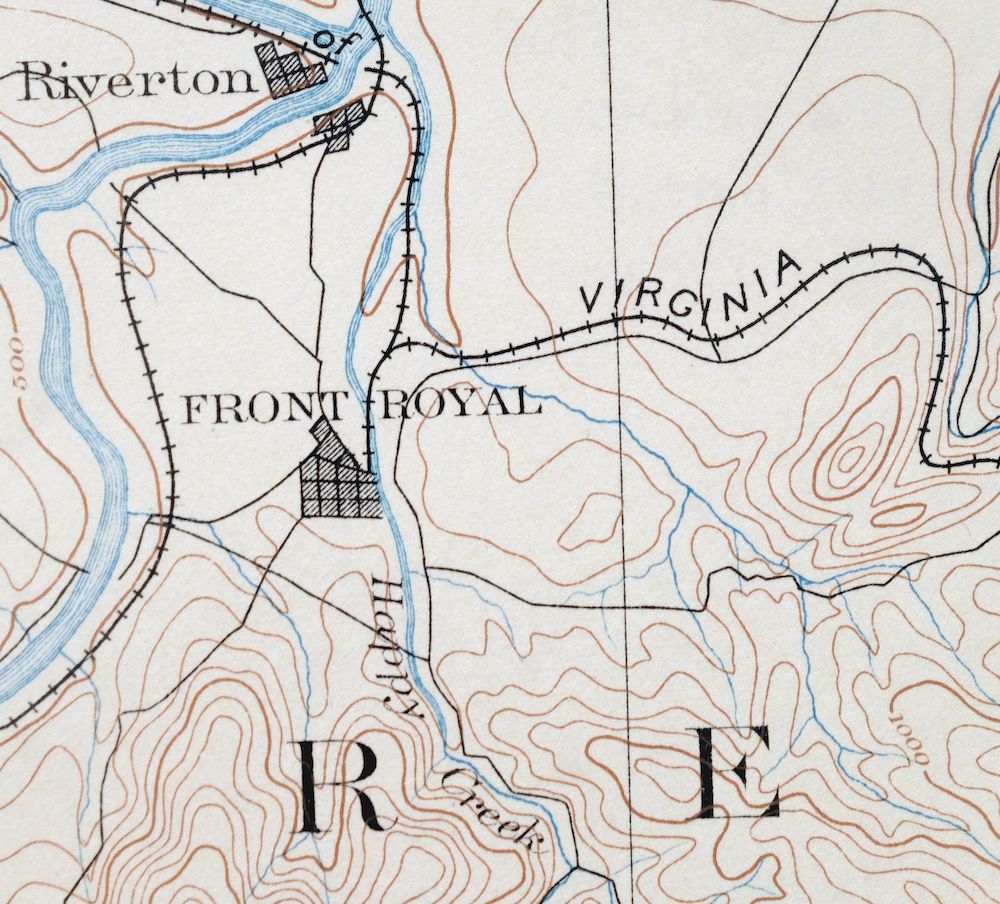
| MAP NOTES | A fascinating historical snapshot surveyed before the modern highway system, showing historic travel routes, rail lines, river crossings, and placenames. |
| SHEET CONDITION For maps of this vintage, effort is made to note all visible flaws, no matter how minor. | |
| OVERALL CONDITION | Excellent |
| SHEET NOTES | very lightly handled, never folded, smooth and flat, lightly age-toned paper |
| MAP AREA | flawless map area |
| COLLARS | no wear or tears, no markings, hole punches along left collar |
| MAP COVERAGE Quadrangle extent overlaid on current basemap. | |
| BACKSIDE LEGEND | |
 A map summary is printed on the back side of the Luray sheet similar to the one shown in the picture. It outlines the history, purpose, and status of the USGS mapping program at the time of the printing in 1910. It also provides instructions on how to read contour lines and a description of how they are used to depict the terrain. At the bottom of the page is a legend showing all of the symbols used to represent the cultural, relief, and water features found on the map. | |
| PLACENAMES Depending on map series and survey date, all of the features listed below may not be shown on this map. This list contains features that currently exist or historically existed within the area covered by the map. The list can be used as a reference to determine if this map covers your area of interest. Placenames are listed alphabetically next to each feature type. | |
| CITIES AND TOWNS (CURRENT) | Bentonville, Flint Hill, Front Royal, Luray, Nethers, Rileyville, Riverton, Sperryville, Stanley, Strasburg, Toms Brook, Washington, and Woodstock |
| COUNTIES COVERED | Clarke, Culpeper, Fauquier, Madison, Page, Rappahannock, Shenandoah, and Warren |
| FEDERAL LAND UNITS | George Washington National Forest, Shenandoah National Park, and Shenandoah Wilderness |
| RIVERS AND STREAMS | Balds Run, Borden Marsh Run, Brokenback Run, Cabin Run, Cedar Creek, Crooked Run, Dry Run, East Hawksbill Creek, Flint Run, Goose Creek, Happy Creek, Hawksbill Creek, Hazel River, Hickman Run, Hittles Mill Stream, Howellsville Branch, Hughes River, Indian Run, Jeremys Run, Jordan River, Jordan Run, Kilbys Creek, Little Hawksbill Creek, Little Passage Creek, Mill Creek, Mill Run, Mine Run, Molly Booth Run, Muddy Run, Naked Creek, North Fork Shenandoah River, North Fork Thornton River, Overall Run, Pass Run, Passage Creek, Peters Mill Run, Piney River, Rappahannock River, Robinson River, Rocky Branch, Rose River, Rush River, Shenandoah River, Shotwell Run, Smith Creek, South Fork Shenandoah River, Thornton River, Toms Brook, Town Run, Tumbling Run, West Branch Naked Creek, West Branch Thumb Run, White Walnut Run, and Willow Brook |
| WATER BODIES | Barr Pond, Caynor Lake, Digulin Pond, Lake Arrowhead, Lake Front Royal, Lake John, Lake Mosby, Liverman Pond, Sawyer Pond, Spring Lake, Strasburg Reservoir, and Sweeney Lake |
| Locations: Ashton Farm, Ben Venue, Bentonville Landing, Bonnie Glen, Bowling Green Country Club, Browntown Valley Overlook, East Luray Shopping Center, Elizabeth Furnace, Elkwallow Shelter, Buck Hollow Overlook, Buck Mountain Farm, Burkes Tree Farm, Buzzard Rock Overlook, Byrds Nest Number 1, Byrds Nest Number 2 Shelter, Byrds Nest Number 3, Byrds Nest Number 4, Camp Lupton, Camp Skymont, Camp Wamava, Constitution Oak Plaza Shopping Center, Corbin Cabin, Crescent Rock Overlook, Crosby Stadium, Curl Farm, Deerpoint Campground, Dickey Ridge Visitor Center, Fairhaven, Fishers Hill, Flint Run Farms, Folly Farm, Forest Grove, Fort Valley Overlook, Fosters Landing, Franklin Cliffs Overlook, Front Royal Country Club, Front Royal-Warren County Amphitheater, Front Royal-Warren County Industrial Park, Gateway Plaza Shopping Center, Gently Farm, Gimlet Ridge Overlook, Glenn Manor Tree Farm, Glenway Farm, Goods Landing, Gooney Creek Tree Farm, Gooney Manor Overlook, Gooney Run Overlook, Grassland Farm, Gravel Springs Shelter, Greenfield, Happy Creek Farm, Happy Creek Industrial Park, Hazel Mountain Overlook, Hemlock Springs Overlook, High Cliff Come Camp, High Knob, Hitch, Hogwallow Flat Overlook, Homeport, Hughes River, Indian Run Overlook, Indian Run Shelter, Jamesway Shopping Center, Jenkins Gap Overlook, Jeremys Run Overlook, Jewell Hollow Overlook, Karo Landing, Linden Business Center, Little Crease Shelter, Long Meadow, Longs Store, Manassas Gap Shelter, Mangens Farm, Massanutten Archery Club, Montvue Farms, Morgans Ford Farm, Mosby Shelter, Mount Marshall Overlook, Mountain View Farm, Newbus Cross Roads, Old Rag Shelter, Old Rag View Overlook, Oxbow Farm, Panorama, Pass Mountain Overlook, Pass Mountain Shelter, Piedmont Picnic Area, Pinnacle Overlook, Pinnacle Picnic Grounds, Poor House Farm, Powells Fort Camp, Range View Cabin, Range View Overlook, River Hill, Rock Hill Farm, Round Mountain Farm, Royal Plaza Shopping Center, Seak Ford Landing, Shannon Hill, Shaver Hollow Shelter, Shenandoah Research and Resource Management Center, Shenandoah Valley Golf Club, Shenandoah Valley Overlook, Signal Farm Retreat Center, Signal Knob Overlook, Silver Spring Farm, Skyline Evergreen Farm, Skyline Ranch Resort, Spitler Knoll Overlook, Springdale, Stony Man Overlook, Sundown, Sycamore Spring Farm, Tanners Ridge Overlook, The Cove, Thornton Hollow Overlook, Thornton River Camp, Thorofare Mountain Overlook, Timber Hollow Overlook, Triple M Farm, Tunnel Parking Overlook, Vaughan Archery Range, Virginia Fish Cultural Station, Wakeman Mill, White Oak Ranger Station, White Oaks Farm, Willow Brook Farm, Windcrest Farm, Woodcliff, and Yellow Rose Shelter. Areas: Warren County Environmental Study Area. Administrative Boundaries: Catalpa Magisterial District, Fork Magisterial District, Hampton Magisterial District, Happy Creek Magisterial District, Jackson Magisterial District, North River Magisterial District, Piedmont Magisterial District, Salem Magisterial District, Shenandoah Magisterial District, South River Magisterial District, Stonewall-Hawthorne Magisterial District, and Wakefield Magisterial District. Mountains, Peaks, and Summits: Aaron Mountain, Acorn Hill, Adam Yowell Mountain, Allens Mountain, Bailey Mountain, Bald Mountain, Battle Mountain, Bessie Bell Mountain, Bettys Rock, Big Mulky Mountain, Big Tom, Blackrock, Breedlove Knob, Broadus Mountain, Browns Mountain, Dulaney Mountain, Edge Hill, Brush Mountain, Buck Mountain, Bushytop, Butler Mountain, Buzzard Rock, Buzzard Rocks, Carson Mountain, Castleton Mountain, Catlett Mountain, Cave Hill, Chancellor Mountain, Chapman Mountain, Compton Peak, Corbin Mountain, Crescent Rock, Davis Mountain, Dickey Hill, Fielding Mountain, Fishers Hill, Fodder House Mountain, Fodder Stack Mountain, Fogg Mountain, Fork Mountain, Ginger Hill, Googe Mountain, Graves Mountain, Green Hill, Green Mountain, Grindstone Mountain, Guard Hill, Hardscrabble Mountain, Hawksbill, Hazel Mountain, Hershberger Hill, Hickerson Mountain, High Knob, High Peak, Hitt Mountain, Hoak Hill, Hogback Mountain, Hot Mountain, Hupp Hill, Jefferson Mountain, Jenkins Mountain, Jobbers Mountain, Kennedy Peak, Keyser Mountain, Kibler Hill, Kibler Knob, Knob Mountain, Little Battle Mountain, Little Crease Mountain, Little Hogback Mountain, Little Jenkins Mountain, Little Mason Mountain, Little Mulky Mountain, Little Stony Man, Long Mountain, Mount Marshall, Marys Rock, Mason Mountain, Massies Mountain, Meetinghouse Mountain, Menefee Mountain, Meneka Peak, Millers Head, Nakedtop, Neighbor Mountain, North Marshall, Oak Hill, Old Rag Mountain, Opechee Peak, Oventop, Oventop Mountain, Parish Mountain, Pass Mountain, The Peak, Pignut Mountain, Pine Hill, Pine Mountain, Piney Hill, Pinnacle Peak, Poes Mountain, Pollock Knob, Poortown Mountain, Pumpkin Hill, Rattlesnake Mountain, Ravensden Rock, Red Oak Mountain, Redmans Mountain, Richardson Knob, Robertson Mountain, Rosser Mountain, Round Hill, Round Mountain, Schoolhouse Mountain, Scott Mountain, Short Mountain, Signal Knob, Slaughter Mountain, South Marshall, Spitler Hill, Stage Hill, Stony Man, Stony Mountain, Sugarloaf, Tanbark Flat, Thorofare Mountain, Three Sisters, Three Top Mountain, Turkey Mountain, Varner Hill, Venus Hill, Walden Mountain, Wildcat Knob, Wind Hill, and Wolf Mountain. Valleys and Canyons: Bear Hollow, Beech Spring Hollow, Bell Hollow, Berry Hollow, Big Devils Stairs, Big Fill Hollow, Britton Hollow, Broad Hollow, Brown Hollow, Dulaney Hollow, Buck Hollow, Buracker Hollow, Compton Hollow, Corbin Hollow, Dark Hollow, Dismal Hollow, Dripping Springs Hollow, Fort Valley, Fox Hollow, Frazier Hollow, Gibson Hollow, Gray Hollow, Green Hollow, Harmony Hollow, Heiskell Hollow, Hickerson Hollow, Jenkins Hollow, Jewell Hollow, Jordan Hollow, Kemp Hollow, Kettle Canyon, Keyser Hollow, Kite Hollow, Little Devils Stairs, Mink Hollow, Molden Hollow, Nicholson Hollow, Oregon Hollow, Page Valley, Posey Hollow, Rowles Hollow, Sandbank Hollow, Shaver Hollow, Shenks Hollow, Shootz Hollow, Snake Hollow, Spring Hollow, Stillhouse Hollow, Thompson Hollow, Thornton Hollow, Timber Hollow, Toney Hollow, Trumbo Hollow, Tutwiler Hollow, Valley of Retreat, Weakley Hollow, Whiteoak Canyon, Wildcat Hollow, and Woodward Hollow. Woods: Harmony Hollow Orchard. Parks: Big Meadows Wayside, Ed Stump Playground, Elizabeth Furnace Recreational Area, Chimney Field Park, Happy Creek Park, Hazard Mill Recreation Area, Lions Park, Little Fort Recreation Area, Shenandoah National Park, Sperryville Historic District, Strasburg Historic District, Washington Historic District, and Woodstock Recreational Area. Trails: Appalachian National Scenic Trail, Bear Wallow Trail, Beahms Gap Trail, Beecher Ridge Trail, Belle Meade Linden Trail, Big Devils Stairs Trail, Bluff Trail, Broad Hollow Trail, Camp Ridge Trail, Catlett Mountain Trail, Cedar Run Trail, Corbin Cabin Trail, Corbin Mountain Trail, Crescent Rock Trail, Crusher Ridge Trail, Dickey Hill Trail, Gimlet Ridge Trail, Gravel Springs Trail, Hannah Run Trail, Hazel River Trail, Hogcamp Trail, Hollow Trail, Hot Short Mountain Trail, Indian Run Trail, Jeremys Run Trail, Keyser Path, Knob Mountain Trail, Leading Ridge Trail, Limberlost Trail, Little Devils Stairs Trail, Little Passage Trail, Massanutten Mountain Trail, Meadow Spring Trail, Neighbor Trail, Nicholson Hollow Trail, Overall Run Trail, Pass Mountain Trail, Passage Creek For Trail, Pine Hill Gap Trail, Piney Branch Trail, Piney Ridge Trail, Pinnacle Ridge Trail, Pole Link Bridge Trail, Powell Mountain Trail, Rattlesnake Trail, Ridge Trail, Robertson Mountain Trail, Rose River Trail, Saddle Trail, Sams Ridge Trail, Shawl Gap Trail, Signal Knob Trail, Stony Mountain Trail, The Peak Trail, Timber Hollow Trail, Turn Bridge Trail, Upper Dark Hollow Trail, Veach Gap Trail, White Oak Canyon Trail, and White Rocks Trail. Drainages: Aarons Branch, Apperson Creek, Battle Run, Bearwallow Creek, Beaver Run, Beaverdam Creek, Big Branch, Big Spring Branch, Blackwater Creek, Bolton Branch, Borden Marsh Run, Broad Run, Brokenback Run, East Fork Dry Run, East Hawksbill Creek, Buck Run, Butterwood Branch, Cabin Run, Cannons Run, Cedar Creek, Cedar Run, Cedar Spring Run, Chub Run, Covington River, Crooked Run, Devils Run, Dry Run, Fiery Run, Flint Run, Foot of the Mountain Run, Fowlers Run, Gooney Run, Greasy Run, Hannah Run, Happy Creek, Hawkins Run, Hawksbill Creek, Hickman Run, Hittles Mill Stream, Hogcamp Branch, Hollow Run, Howellsville Branch, Hughes River, Indian Run, Jeremys Run, Jordan River, Jordan Run, Keyser Run, Kilbys Creek, Lands Run, Leach Run, Little Hawksbill Creek, Little Passage Creek, Manassas Run, Mill Run, Mine Run, Molly Booth Run, Molly Camel Run, Moody Creek, Moore Run, Negro Run, Nelson Run, North Fork Dry Run, North Fork Shenandoah River, North Fork Thornton River, Overall Run, Pass Run, Passage Creek, Peters Mill Run, Phils Arm Run, Piney River, Popham Run, Pughs Run, Punches Run, Racer Run, Ragged Run, Ritenour Run, Rock Spring Branch, Rocky Branch, Rocky Run, Rosson Hollow Run, Rush River, Sams Run, Sheep Run, Sloan Creek, Smith Creek, Snapps Run, South Fork Dry Run, South Fork Shenandoah River, South Fork Tumbling Run, Sprucepine Branch, Stokes Branch, Stoney Run, Thornton River, Toms Brook, Town Run, Tumbling Run, Walnut Branch, Waterfall Branch, West Run, White Walnut Run, Willow Brook, and Wilson Branch. Capes: The Point and Sandy Hook. Churches: Alum Springs Church, Amissville Church, Antioch Church, Asbury Church, Battle Run Church, Beahms Chapel, Beth Eden Church, Bible Church, Beech Spring Church, Bennett Chapel, Bethel Assembly of God Church, Bethel Baptist Church, Bethel Church, Bethel Temple Church of God, Bethlehem Church, Beulah Church, Big Spring Church, Black Oak Church, Browntown Baptist Church, Browntown Church, Emmanuel Church, Buckton Presbyterian Church, Calvary Episcopal Church, Christ Episcopal Church, Church of Christ, Church of the Nazarene, Community Faith Baptist Church, Community Tabernacle Assembly of God Church, Cool Spring Church, Crest Hill Baptist Church, Dry Run Church, Esbie Baptist Church, Faith Fellowship Church, First Assembly of God Church, First Baptist Church, First Baptist Church of Washington, Five Forks Regular Baptist Church, Fletcher Chapel, Flint Hill Baptist Church, Flint Hill Methodist Church, Forest Grove Church, Fort Valley Church, Front Royal Baptist Temple, Front Royal Bible Church, Front Royal Church of the Brethren, Front Royal Presbyterian Church, Front Royal United Methodist Church, Full Gospel Church, Good Hope Church, Good Shepherd Lutheran Church, Gourdvine Church, Grace Church, Grace Fellowship Church, Green Valley Baptist Church, Happy Creek Primitive Baptist Church, Happy Creek United Methodist Church, Hawksbill Church, Hazel River Assembly Church, Heritage Baptist Church, Highway Tabernacle, Hope Hill Baptist Church, House of Jacob Church, Howellsville Methodist Church, John Wesley United Methodist Church, Joppa Church, Kingdom Hall Church, Kingdom Hall of Jehovahs Witnesses, Limeton Community United Methodist Church, Luray Christian Church, Luray United Methodist Church, Macedonia Baptist Church, Main Street Baptist Church, Marlow Heights Baptist Church, Massanova Church, Maurertown Brethren Church, Morning Star Church, Mount Calvary Church, Mount Carmel Baptist Church, Mount Carmel Church, Mount Carmel Regular Baptist Church, Mount Hebron Church, Mount Lebanon Church, Mount Moriah Church, Mount Nebo Church, Mount Paran Church, Mount Vernon Baptist Church, Mount Zion Church, Mountain View Church, Nazareth Church, New Covenant Church, New Salem Church, Oak Hill Church, Oakley Church, Old School Baptist Church, Old School Church, Piedmont Church, Promise Land Baptist Church, Reynolds Church, Rivermont Church, Rivermont United Methodist Church, Riverton United Methodist Church, Rockland Community Church, Rocky Branch Church, Round Hill Church, Saint David Church, Saint Davids Church, Saint Georges Church, Saint Johns Church, Saint Johns Free Baptist Church, Saint Johns Roman Catholic Church, Saint Marks Lutheran Church, Saint Matthews Church, Saint Pauls Church, Saint Pauls Lutheran Church, Saumsville Christian Church, Second Guildfield Baptist Church, Shiloh Baptist Church, Slate Mills Baptist Church, South River Primitive Baptist Church, Springfield Church, Strasburg Christian Church, Strasburg Methodist Church, Strasburg Presbyterian Church, The Church of Jesus Christ of Latter Day Saints, The Church of Waterlick, The Pine Hills Community Church, Thornton Gap Church, Thorntons Gap Regular Baptist Church, Trinity Church, Trinity Episcopal Church, Valley Pike Church, Valley Road Baptist Church, Vaughn Summit Church, Washington Baptist Church, White Chapel, Williams Chapel, Willis Chapel, Woodland Church, Woodville Baptist Church, and Zion Church. Hospitals: Memorial Hospital, Rappahannock Medical Clinic, and Warren Memorial Hospital. Buildings: Bel Air, Front Royal Town Hall, Liberty Hall, Melton Memorial Gymnasium, Page County Courthouse, Rappahannock County Library, Riverside, Rock Spring Cabin, Rose Hill, Samuels Public Library, Shenandoah River Lodge, The Mint House, Wapping, Warren County Courthouse, and Warren Rifles Confederate Museum. Waterfalls: Dark Hollow Falls, Goods Falls, Greasy Falls, Lewis Spring Falls, and Rose River Falls. Dams: Apple Mountain Lake Dam, Apple Mountain Upper Lake Dam, Barr Dam, Burnshire Dam, Chapman Dam, Cloud Dam, Compton Dam, Cooley Dam, Deer Dam, Digulian Dam, Dry Run Number 101 Dam, Dry Run Number 102 Dam, Lake Front Royal Dam, Lake John Dam, Liverman Dam, Loch Linden Dam, Luray Dam, Margolis Dam, Monumental Mills Dam, Mosby Dam, Pickett Dam, Potomac-Edison Dam, Sawyer Dam, Seven Fountains Dam, Smiley Dam, Spring Lake Dam, Strasburg Dam, Sullivans Dam, Sweeney Dam, Warren Dam, and Whippoorwill Dam. Crossings: Black Rock Ford, Bowmans Ford, Buckton Ford, Burners Ford, Cattle Ford, Interchange 13, Interchange 291, Interchange 6, McCoys Ford, Morgan Ford, Rock Ford, and Tapps Ford. Bluffs: Franklin Cliffs, Halfmile Cliff, and Rattlesnake Point. Gaps: Beahms Gap, Boyer Gap, Duncan Gap, Elkwallow Gap, Chester Gap, Compton Gap, Fishers Gap, Golladays Gap, Gravel Springs Gap, Habron Gap, Hawksbill Gap, Hughes River Gap, Jacks Notch, Jenkins Gap, Lands Run Gap, Low Gap, Lucas Gap, Manassas Gap, Milam Gap, Milford Gap, Mine Gap, Mudhole Gap, Pine Hill Gap, Red Spring Gap, Shawl Gap, Thornton Gap, Thorofare Gap, Thoroughfare Gap, Turkeypen Gap, Veach Gap, Walters Gap, and Woodstock Gap. Bridges: Bixler Bridge, Burnshire Bridge, Indian Hollow Bridge, James H Fletcher Bridge, Morgans Ford Bridge, and Wilson J Burke Senior Memorial Bridge. Bends: Burners Bottom, Horseshoe Bend, and Seven Bends. Bays: Blue Hole. Basins: The Cove and Little Fort Valley. Airports: Aspen Hill Airstrip, Front Royal-Warren County Airport, River Bend Landing Strip, Shackelford Airport, and Thornton River Airport. Swamps: Bearwallow. Schools: Christendom College, County High School, Fort Valley School, Jeffries Intermediate School, Keyser School, Luray Elementary School, Luray High School, Morrison School, Mosby Academy, Northern Virginia 4-H Educational Center, Otterburn School, Randolph Macon Military Academy, Rappahannock County High School, Rappahannock Elementary School, Rhodes School, Salem School, Springfield School, Strasburg Elementary School, Strasburg High School, Warren County Junior High School, West Luray Elementary School, and Woodstock High School. Ridges: Beecher Ridge, Elder Ridge, Buck Ridge, Cox Ridge, Dickey Ridge, Doll Ridge, Gimlet Ridge, Gravel Ridge, Indian Grave Ridge, Leading Ridge, Long Arm, Mathews Arm, Pickerel Ridge, Piney Ridge, Pinnacle Ridge, Rhodes Ridge, Rittenour Ridge, Skinner Ridge, Tanners Ridge, Timber Ridge, Turkey Ridge, and Wright Ridge. Reservoirs and Tanks: Apple Mountain Lake, Apple Mountain Upper Lake, Barr Pond, Chapman Reservoir, Cooley Lake, Deer Lake, Digulin Pond, Lake Arrowhead, Lake Culpeper, Lake Front Royal, Lake John, Lake Mosby, Lake Wilson, Lake of the Clouds, Liverman Pond, Loch Linden Lake, Luray Reservoir, Margolis Pond, Morning Star Lake, Mosby Lake, Pickett Lake, Sawyer Pond, Seven Fountains Lake, Spring Lake, Strasburg Reservoir, Sullivan Lake, Sweeney Lake, Warren Reservoir, Whippoorwill Pond, and Woodstock Reservoir. Rapids: Kings Eddy. Flats: Big Meadows, Chimney Field, and Hogwallow Flat. Towers: Singing Tower, WFTR-AM (Front Royal), WFTR-FM (Front Royal), WINC-FM (Winchester), WLCC-FM (Luray), WRAA-AM (Luray), WYFT-FM (Luray), and Woodstock Lookout Tower. Pillars: The Pinnacle and White Rocks. Springs: Borum Spring, Chalybeate Spring, Davids Spring, Furnace Spring, Hawksbill Spring, Lewis Spring, and Rock Spring. | |
| SHIPPING AND RETURNS | |
 This map sheet will be carefully rolled in a sturdy tube and shipped via the US Postal Service. If you find that the sheet you receive is not as described in the listing, you may ship it back to us for a refund of the purchase price. | |
Luray Virginia Front Royal Stanley USGS Topographic Map 1910
$115
This 30-minute USGS topographic sheet is a 1905 edition printed in 1910, in excellent condition on thick stock and, having never been folded, smooth and flat with only light age-toning. Drawn from an 1884 and 1886 field survey by geographer Henry Gannett, it takes in a broad stretch of the northern Shenandoah Valley, including Front Royal, Strasburg, Luray, and Woodstock, along with portions of Shenandoah National Park and George Washington National Forest. Surveyed before the modern highway system, it records the historic travel routes, rail lines, and river crossings of the era, and comes from an uncommonly well-preserved collection. The reverse carries printed reference material explaining the mapping program and contour lines. Its age-toned paper aside, the map area is flawless, and this antique sheet has survived 116 years in unusually clean shape.
In stock
This antique sheet is a 1905 edition of the Luray Virginia USGS topographic map. It is an authentic 116-year-old 1910 United States Geological Survey print in excellent condition.
HOW THIS MAP CAN BE USED
In addition to making a fascinating conversation piece, this sheet would look great in a frame or on display, make a unique and prized gift for anyone interested in this area, be perfect as a reference for genealogy studies or general historical research, or fill that missing piece in your collection.
FEATURES SHOWN ON THE MAP
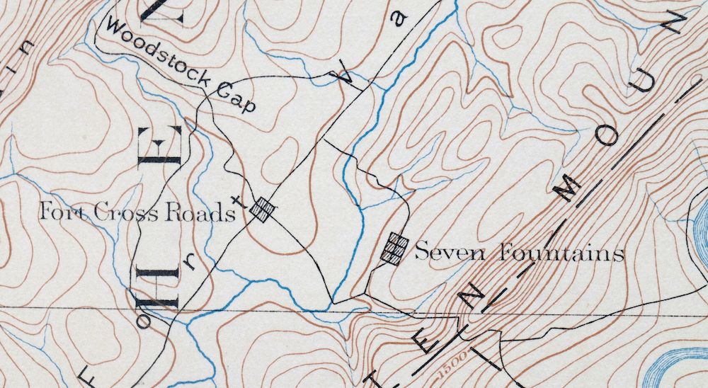
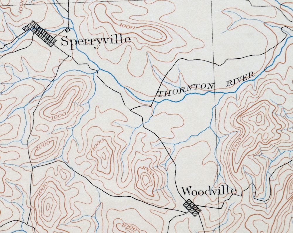
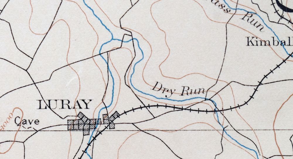
The Luray 30-minute map shows cities and towns, roads, railroads, rivers, creeks, elevation contour lines, public land survey lines, county, state, and other administrative boundaries as they existed at the time of the survey in 1884 and 1886.
A VALUABLE HISTORICAL RECORD
Maps from the USGS 30-minute series have been out of print for many years. They have never been common and original prints are increasingly difficult to find. For areas where the 30-minute map was produced, it is usually the first large-scale survey done by the USGS for that area. These are a valuable historical record, as they contain many placenames and features that have been dropped from more recent series’ and editions.
Nearby maps
-

Winchester Virginia Middletown Inwood USGS Topo Map 1916
$82 Add to cart -

Romney West Virginia Keyser Delray USGS Topographic Map 1909
$80 Add to cart -

Mount Vernon Virginia Washington Accokeek USGS Topo Map 1912
$200 Add to cart -

Franklin West Virginia Petersburg Onego USGS Topo Map 1914
$49 Add to cart -
Staunton Virginia Stuarts Draft USGS Topographic Map 1913
$90 Add to cart -

Palmyra Virginia Lake Monticello Dillwyn USGS Topo Map 1907
$75 Add to cart -
Patuxent Maryland Washington Bowie USGS 30-Min Topo Map 1907
$65 Add to cart -

Patapsco Maryland Baltimore Jessup USGS Topographic Map 1908
$96 Add to cart -
Farmville Virginia Blackstone Rice USGS Topographic Map 1914
$55 Add to cart -

Natural Bridge Virginia Covington Selma USGS Topo Map 1911
$62 Add to cart -
Amelia Virginia Richmond Bon Air USGS Topo Map 1904 Antique
$74 Add to cart -
Appomattox Virginia Brookneal Toga USGS Topographic Map 1912
$55 Add to cart -

Tolchester Maryland Dundalk Essex USGS Topo Map 1908 Antique
$145 Add to cart -

Sutton West Virginia Glenville Elk River USGS Topo Map 1907
$75 Add to cart -

Needmore Pennsylvania Crystal Spring USGS Topo Map 1947
$44 Add to cart -

Clearville Pennsylvania USGS 15-Min Topo Map 1945 Vintage
$42 Add to cart -

Hyndman Pennsylvania Buffalo Mills USGS 15-Min Topo Map 1967
$40 Add to cart -

Chambersburg Pennsylvania Guilford USGS Topographic Map 1964
$40 Add to cart -

Bedford Pennsylvania Schellsburg USGS Topo Map 1958 Vintage
$42 Add to cart -

Newville Pennsylvania Shippensburg USGS 15-Min Topo Map 1959
$40 Add to cart -

Carlisle Pennsylvania Schlusser USGS Topographic Map 1964
$45 Add to cart -

Loysville Pennsylvania Landisburg USGS Topo Map 1966 Vintage
$42 Add to cart -

Brownsville Pennsylvania Monessen Donora USGS Topo Map 1954
$38 Add to cart -

Quarryville Pennsylvania Oxford USGS Topographic Map 1944
$53 Add to cart
