MAP DETAILS | |
|---|---|
| TITLE | Palmyra |
| STATE | Virginia |
| LOCATION | Vicinity of Lake Monticello, 45 miles west of Richmond |
| SERIES | 30-minute |
| SURVEYED | 1888 and 1889 Field Survey |
| GEOGRAPHER | Henry Gannett |
| EDITION | 1897 |
| PRINTED | 1907 |
| PRINT NOTES | Thick paper stock |
| SCALE | 1:125000 |
| CONTOUR INTERVAL | 50 feet |
| SHEET DIMENSIONS | 16 1/2 x 20 inches |
| MAP DIMENSIONS | 13 7/8 x 17 1/2 inches |
| COVERAGE AREA | 27 x 35 miles |
| SOURCE | From an uncommonly well-preserved collection |
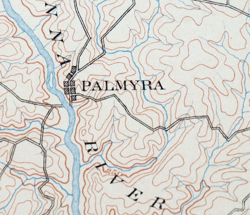
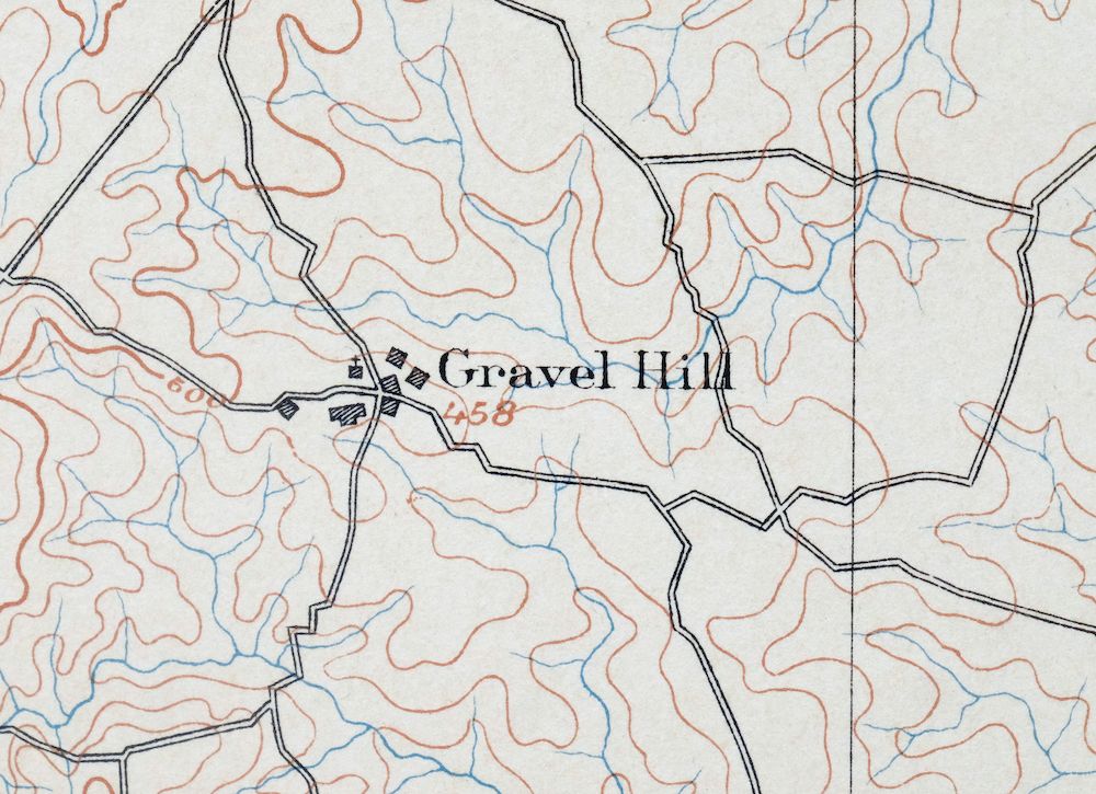
| MAP NOTES | A fascinating historical snapshot surveyed before the modern highway system, showing historic overland travel routes, rail lines, river crossings, and many placenames. |
| SHEET CONDITION For maps of this vintage, effort is made to note all visible flaws, no matter how minor. | |
| OVERALL CONDITION | Excellent |
| SHEET NOTES | very lightly handled, never folded, smooth and flat, lightly age-toned paper |
| MAP AREA | flawless map area |
| COLLARS | no wear or tears, no markings, no blemishes, hole punches along left collar |
| MAP COVERAGE Quadrangle extent overlaid on current basemap. | |
| BACKSIDE LEGEND | |
 A map summary is printed on the back side of the Palmyra sheet similar to the one shown in the picture. It outlines the history, purpose, and status of the USGS mapping program at the time of the printing in 1907. It also provides instructions on how to read contour lines and a description of how they are used to depict the terrain. At the bottom of the page is a legend showing all of the symbols used to represent the cultural, relief, and water features found on the map. | |
| PLACENAMES Depending on map series and survey date, all of the features listed below may not be shown on this map. This list contains features that currently exist or historically existed within the area covered by the map. The list can be used as a reference to determine if this map covers your area of interest. Placenames are listed alphabetically next to each feature type. | |
| CITIES AND TOWNS (CURRENT) | Arvonia, Cartersville, Columbia, Dillwyn, Elk Hill, Fork Union, Lake Monticello, New Canton, Palmyra, and Scottsville |
| COUNTIES COVERED | Albemarle, Buckingham, Cumberland, Fluvanna, Goochland, Louisa, and Powhatan |
| RIVERS AND STREAMS | Able Creek, Adams Creek, Ballinger Creek, Bear Creek, Bear Garden Creek, Big Cattail Creek, Bigger Creek, Bob Branch, Bold Branch, Bonbrook Creek, Boston Branch, Boston Creek, Bremo Creek, Briery Creek, Bryant Creek, Buck And Game Creek, Buck Branch, Buck Island Creek, Buffalo Creek, Burke Creek, Byrd Creek, Camp Creek, Carroll Creek, Carys Creek, Cat Branch, Cedar Branch, Central Branch, Cobbs Creek, Cole Creek, Colle Branch, Cottonpatch Branch, Crooked Creek, Davis Creek, Deep Creek, Deep Run, Dry Creek, East Fork Kent Branch, Flat Creek, Fork Creek, Fosters Creek, Georgia Branch, Gold Mine Branch, Green Creek, Halfway Creek, Hardware River, Harris Creek, Hatcher Creek, Henderson Creek, Holman Creek, Hooper Rock Creek, Horn Quater Creek, Horsepen Branch, Horsepen Creek, Houchins Creek, Hunts Creek, Indian Branch, Jacobs Creek, James River, Johnson Creek, Joshua Creek, Judy Creek, Jumping Branch, Lee Jones Creek, Lick Branch, Limestone Creek, Little Bear Creek, Little Buffalo Creek, Little Creek, Little Georgia Creek, Little Raccoon Creek, Little Rock Creek, Little Whittle Creek, Long Island Creek, Maple Swamp Creek, Martins Creek, Massey Creek, Maxey Mill Creek, Middle Fork Cunningham Creek, Middle Fork East Fork Kent Branch, Moore Creek, Muddy Creek, Oliver Creek, Peyton Creek, Poggio Branch, Punch Creek, Quarry Creek, Raccoon Creek, Randolph Creek, Ransome Creek, Reedy Creek, Reynolds Creek, Rivanna River, Rock Creek, Rock Point Creek, Rocky Creek, Rosney Creek, Roundabout Creek, Sharps Creek, Slate River, Snowquarter Creek, South Anna River, South Branch Fork Creek, South Creek, South Fork Cunningham Creek, Stegers Creek, Stigger Creek, Stouts Creek, Tarred Rat Creek, Three Square Creek, Tongue Quarter Creek, Tower Branch, Troublesome Creek, Turpin Creek, White Hall Creek, Williams Creek, and Woodson Creek |
| WATER BODIES | Arrowhead Lake, Bass Pond, Bear Creek Lake, Bevins Pond, Bonneys Pond, Bowles Pond, Brickhead Pond, Bullhead Pond, Cosner Lake, Dillwyn Lake, Fleming Lake, Fluvanna Ruritan Lake, Hideaway Lake, Lake Monticello, Lake Tahoe, Lake View, Lloyd Pond, Olympic Lake, Picketts Creek Reservoir, Powhatan Lakes, Queensmeer Lake, Sports Lake, Sunfish Pond, Trice Lake, and Winston Lake |
| Locations: Ash Lawn, Blenheim Estate, Boyd Tavern, Brookhill, Duncans Store, Butlers Store, Camp Swannanoa, Center Hill Community Center, Central Plains, Diana Mills, Gravel Hill, Grays Siding, Hensons Store, Island, James River Farms, Jefferson Mill, Johnson Station, Johnson Store, Jordans Store, Morven, Muddy Creek Mills, Pine Tree, Shepherds Store, Shores, Simeon Winery, State Prison Camp Number 12, Three Chopt Community Center, Well Water, and Yanceys Store. Administrative Boundaries: Columbia Magisterial District, Cunningham Magisterial District, Fork Union Magisterial District, Gold Hill Number 7 Magisterial District, Palmyra Magisterial District, Patrick Henry Magisterial District, and Slate River Number 6 Magisterial District. Mountains, Peaks, and Summits: Buffards Mountain, Buzzard Rock, Carters Mountain, Little Mountain Hill, Mountain Hill, Patterson Mountain, and Tower Hill. Parks: Bear Creek Lake State Park, Bear Creek State Park, Buckingham Female Collegiate Institute Historic District, Carys Creek Wayside, Fluvanna County Courthouse Historic District, Hardware River State Wildlife Management Are, and Scottsville Historic District. Trails: James River Batteau Festival Trail. Drainages: Able Creek, Adams Creek, Ballinger Creek, Bear Creek, Bear Garden Creek, Beaverdam Creek, Big Cattail Creek, Bigger Creek, Bob Branch, Bold Branch, Bonbrook Creek, Boston Branch, Boston Creek, Bremo Creek, Briery Creek, East Branch Horsepen Creek, East Fork Kent Branch, Buck And Game Creek, Buck Branch, Buck Island Creek, Buffalo Creek, Burke Creek, Byrd Creek, Carroll Creek, Carys Creek, Cat Branch, Cedar Branch, Cobbs Creek, Cocke Creek, Cole Creek, Cottonpatch Branch, Crooked Creek, Cunningham Creek, Davis Creek, Deep Run, Dry Creek, Flat Creek, Fosters Creek, Georgia Branch, Gold Mine Branch, Green Creek, Halfway Creek, Hardware River, Harris Creek, Hatcher Creek, Henderson Creek, Holman Creek, Hooper Rock Creek, Horn Quater Creek, Horsepen Branch, Horsepen Creek, Houchins Creek, Hunters Branch, Hunts Creek, Jacobs Creek, Johnson Creek, Joshua Creek, Judy Creek, Jumping Branch, Kent Branch, Lee Jones Creek, Lick Branch, Limestone Creek, Little Bear Creek, Little Buffalo Creek, Little Byrd Creek, Little Cattail Creek, Little Creek, Little George Creek, Little Georgia Creek, Little Raccoon Creek, Little Rock Creek, Little White Creek, Little Whittle Creek, Long Island Creek, Maple Swamp Creek, Martins Creek, Massey Creek, Maxey Mill Creek, Mechunk Creek, Middle Fork Cunningham Creek, Middle Fork East Fork Kent Branch, Mill Creek, Moore Creek, Muddy Creek, North Creek, North Fork Cunningham Creek, Oliver Creek, Peters Creek, Peyton Creek, Phils Creek, Punch Creek, Quarry Creek, Raccoon Creek, Randolph Creek, Ransome Creek, Rattlesnake Run, Reedy Creek, Reynolds Creek, Rivanna River, Rock Creek, Rock Point Creek, Rockfish Creek, Rocky Creek, Rosney Creek, Roundabout Creek, Sallee Creek, Sharps Creek, Shepherd Creek, Slate River, Snowquarter Creek, South Creek, South Fork Cunningham Creek, Stegers Creek, Stigger Creek, Stouts Creek, Tarred Rat Creek, Totier Creek, Tower Branch, Turkey Run, Turpin Creek, Venable Creek, West Fork Kent Branch, White Oak Branch, Williams Creek, Willis River, Winston Creek, and Woodson Creek. Islands: Big Island, Boatwrights Island, Bolling Island, Broken Island, Elk Island, Cleveland Island, Gregory Island, Pettit Island, Seven Islands, and Spicers Island. Capes: East Point and Point of Fork. Churches: Antioch Baptist Church, Antioch Church, Arbon Church, Arvon Church, Beaverdam Church, Bells Grove Church, Berea Chapel, Bethany Church, Bethel Church, Bethlehem Church, Beulah Church, Brown Chapel, Ebenezer Church, Effort Church, Elk Hill Church, Burning Bush Church, Bybee Road Church, Byrd Chapel, Byrd Grove Church, Cedar Church, Chestnut Grove Church, Cloverdale Baptist Church, Corinth Church, Cornerstone Church, County Church, County Line Church, Cunningham United Methodist Church, Evergreen Church, Fluvanna Church, Forest Grove Church, Fork Union Church, Fork of Willis Church, Fosters Creek Church, Fox Memorial Church, Galilee Church, Gold Mine Church, Goshen Church, Grace Memorial Episcopal Church, Gravel Hill Church, Haden Chapel, Hanes Chapel, Hatcher Baptist Church, Highway Mission Church, Holy Church, Independent Holiness Church, Jenkins Church, Jones Chapel, Liberty Church, Little Fork Church, Little Rock Church, Little Zion Church, Lyle Church, Macedonia Church, Middle Oak Church, Mispah Church, Mount Calvary Church, Mount Eagle Church, Mount Gilead Church, Mount Horeb Church, Mount Moriah Church, Mount Olive Church, Mount Pero Church, Mount Tabor Church, Mount Zion Church, Mourning Valley Church, Muddy Creek Church, New Fork Church, New Hope Church, Oak Grove Church, Oakwood Church, Palmyra United Methodist Church, Perkins Church, Petersville Church, Pleasant Grove Church, Pleasant View Church, Providence Church, Ridgeway Church, Rising Mount Zion Church, Rising Zion Church, Rocky Mount Church, Rose Hill Church, Saint James Church, Saint Johns Episcopal Church, Salem Church, Scottsville Baptist Church, Scottsville Methodist Church, Scottsville Presbyterian Church, Seay Chapel, Second Union Church, Sharon Church, Shiloh Church, Slate Hill Church, Spreading Oak Church, Spring Hill Church, Springfield Church, Thessalonian Church, Thomas Chapel, Union Branch Church, Union Church, Wake Forest Church, Waldrop Church, Wesley Chapel, Wesleyan Church, West Bottom Baptist Church, Zion Church, Zion Grove Church, and Zion Traveler Church. Forests: Cumberland State Forest. Buildings: Bremo Mansion, Bremo Power Station, Cliffside, Colle, Little Byrd Creek Community House, Lower Bremo Mansion, Scottsville Company 7 Fire Station, Scottsville Library, Scottsville Museum, Scottsville Town Hall, and Verdant Lawn. Dams: Anderson Dam, Andersons Dam, Arrowhead Lake Dam, Barrett Dam, Bear Creek Dam, Bevins Pond Dam, Benelli Dam, Bonbrook Lake Dam, Bonneys Dam, Bowles Dam, Brickhead Dam, Byrd Mill Dam, Cosner Dam, Fleming Dam, Flippen Dam, Fluvanna Ruritan Dam, Kennedys Dam, Knorr Dam, L B Atkins Dam, Lake Monticello Dam, Leon Hanson Dam, Linton Dam, Lloyd Dam, Lower Powhatan Dam, Martin Dam, Mayo-Alexander and Hadens Dam, McIver Dam, Michie Dam, Mink Creek Dam, Monticello Settling Pond Dam, New Ash Dam, Nixons Dam, Noname Number 14529 Dam, Oak Hill Lake Dam, Obrien Dam, Olympic Dam, Picketts Creek Dam, Queensmeer Dam, Redford Dam, Robertson Dam, Sanderson Dam, Solite Corporation Dam, Sports Dam, State Prison Camp Number 12 Dam, Strickler and Benzingers Dam, Sutherland Dam, T Potts Dam Number One, T Potts Dam Number Three, T Potts Dam Number Two, Thomas Dam, Trice Dam, Turner Dam, Volchers Dam, Willis River Number 5e Dam, Willis River Number Seven Dam, Williss Dam, Windsor Park Lake Dam, Winston Lake Dam, and Wyllies Dam. Crossings: Interchange 129, Interchange 136, Interchange 143, and Interchange 148. Bridges: Cosby Bridge, Griffin Bridge, John H Cocke Memorial Bridge, Pembroke Petit Bridge, and R Ellis Hannum Bridge. Bends: Hells Bend, Horseshoe Bend, and Muleshoe Bend. Bays: Adams Cove, Harrison Cove, Jackson Cove, Jefferson Cove, Madison Cove, Monroe Cove, Polk Cove, Taylor Cove, Tyler Cove, Van Buren Cove, and Washington Cove. Airports: Byrd Creek Airport, Fork Union Military Academy Airport, Snow Hill Airport, and Stokes Airport. Schools: Abrams High School, Ellis School, Buckingham Junior High School, Central School, Columbia School, Cunningham District School, Dillwyn Elementary School, Dillwyn Primary School, Ferncliff School, Fluvanna County High School, Fluvanna Middle School, Fork Union Military Academy, Gold Hill Elementary School, Palmyra School, Second Union School, Tandem School, and Woodson High School. Ridges: The Ridge. Reservoirs and Tanks: Arrowhead Lake, Bass Pond, Bear Creek Lake, Bevins Pond, Bonneys Pond, Bowles Pond, Brickhead Pond, Bullhead Pond, Byrd Millpond, Cosner Lake, Dillwyn Lake, Fleming Lake, Flippen Lake, Flippen Millpond, Fluvanna Ruritan Lake, Hideaway Lake, Kennedys Pond, Lake Monticello, Lake Tahoe, Lake View, Leon Hanson Pond, Linton Lake, Lloyd Pond, Lower Powhatan Lake, McIver Lake, Mink Creek, Monticello Pond, New Ash Pond, Oak Hill Lake, Obrien Pond, Olympic Lake, Picketts Creek Reservoir, Powhatan Lakes, Queensmeer Lake, Redford Lake, Redford Pond, Sports Lake, Sutherland Pond, Trice Lake, and Winston Lake. Towers: WHTJ-TV (Charlottesville), WUVA-FM (Charlottesville), and WVIR-TV (Charlottesville). | |
| SHIPPING AND RETURNS | |
 This map sheet will be carefully rolled in a sturdy tube and shipped via the US Postal Service. If you find that the sheet you receive is not as described in the listing, you may ship it back to us for a refund of the purchase price. | |
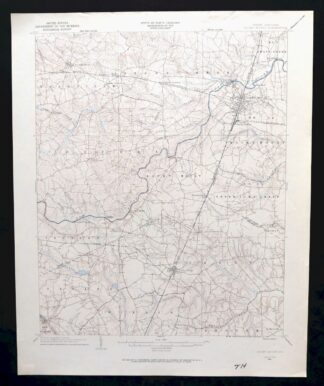
Palmyra Virginia Lake Monticello Dillwyn USGS Topo Map 1907
$75
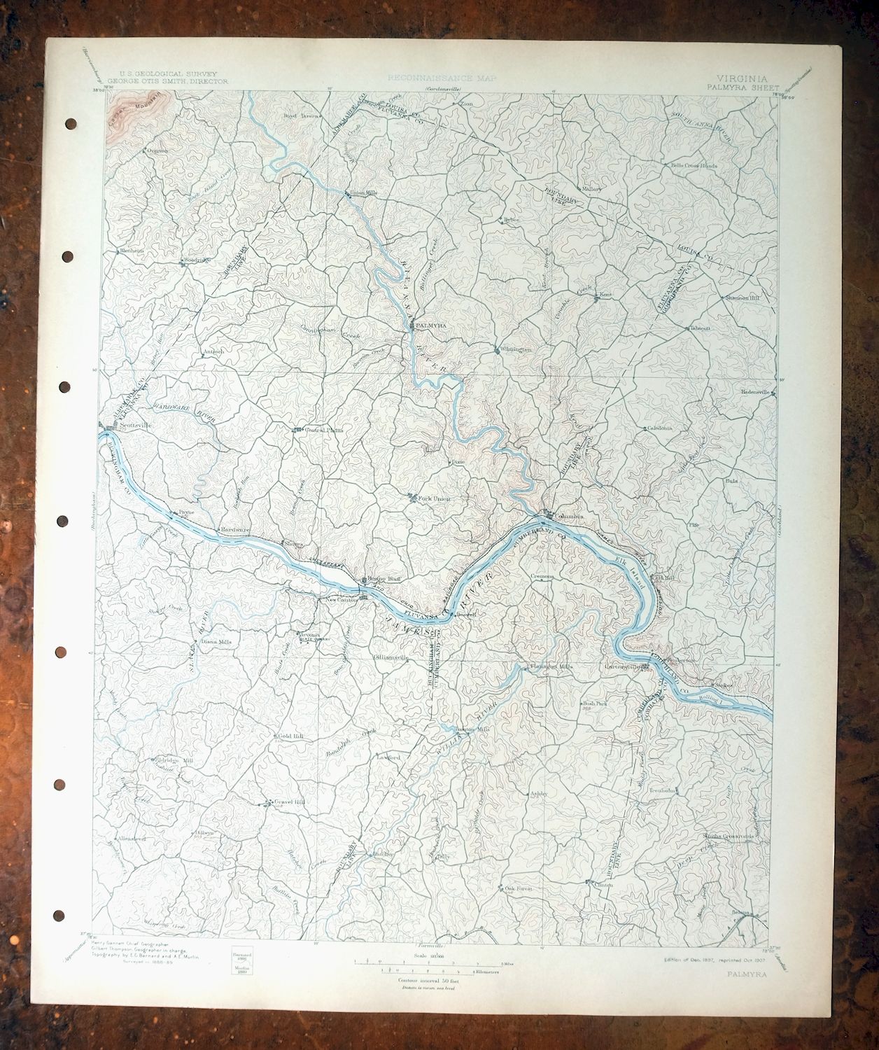
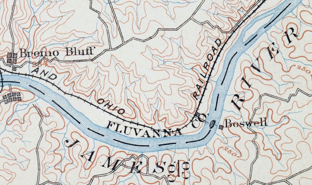
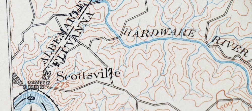
This USGS reconnaissance topographic sheet is a 1897 edition printed in 1907, an antique on thick stock that survives in excellent condition – never folded, smooth and flat, with a flawless map area and light age-toning to the paper. Drawn at a 30-minute scale from an 1888 and 1889 field survey under geographer Henry Gannett, it takes in a stretch of central Virginia west of Richmond, with the quad area including Palmyra, Scottsville, Columbia, Fork Union, and the ground now occupied by Lake Monticello across seven counties. Surveyed before the modern highway system, it records the overland travel routes, rail lines, river crossings, and placenames of the era, and the reverse carries printed reference material from the 1907 mapping program. It comes from an uncommonly well-preserved collection, and hole punches run along the left collar.
In stock
This antique sheet is an 1897 edition of the Palmyra Virginia USGS topographic map. It is an authentic 119-year-old 1907 United States Geological Survey print in excellent condition.
HOW THIS MAP CAN BE USED
In addition to making a fascinating conversation piece, this sheet would look great in a frame or on display, make a unique and prized gift for anyone interested in this area, be perfect as a reference for genealogy studies or general historical research, or fill that missing piece in your collection.
FEATURES SHOWN ON THE MAP
The Palmyra 30-minute map shows cities and towns, roads, railroads, rivers, creeks, elevation contour lines, public land survey lines, county, state, and other administrative boundaries as they existed at the time of the survey in 1888 and 1889.
A VALUABLE HISTORICAL RECORD
Maps from the USGS 30-minute series have been out of print for many years. They have never been common and original prints are increasingly difficult to find. For areas where the 30-minute map was produced, it is usually the first large-scale survey done by the USGS for that area. These are a valuable historical record, as they contain many placenames and features that have been dropped from more recent series’ and editions.
Nearby maps
-
Farmville Virginia Blackstone Rice USGS Topographic Map 1914
$55 Add to cart -
Amelia Virginia Richmond Bon Air USGS Topo Map 1904 Antique
$74 Add to cart -
Appomattox Virginia Brookneal Toga USGS Topographic Map 1912
$55 Add to cart -
Staunton Virginia Stuarts Draft USGS Topographic Map 1913
$90 Add to cart -

Luray Virginia Front Royal Stanley USGS Topographic Map 1910
$115 Add to cart -

Natural Bridge Virginia Covington Selma USGS Topo Map 1911
$62 Add to cart -

Mount Vernon Virginia Washington Accokeek USGS Topo Map 1912
$200 Add to cart -

Franklin West Virginia Petersburg Onego USGS Topo Map 1914
$49 Add to cart -

Winchester Virginia Middletown Inwood USGS Topo Map 1916
$82 Add to cart -
Patuxent Maryland Washington Bowie USGS 30-Min Topo Map 1907
$65 Add to cart -

Romney West Virginia Keyser Delray USGS Topographic Map 1909
$80 Add to cart -

Patapsco Maryland Baltimore Jessup USGS Topographic Map 1908
$96 Add to cart -

Jarratt Virginia Stony Creek Yale USGS Topographic Map 1951
$38 Add to cart -
White Plains Virginia Triplet Ebony USGS Topo Map 1944
$39 Add to cart -
Rocky Mount North Carolina Wilson Red Oak USGS Topo Map 1965
$48 Add to cart -

Nicholas West Virginia Summersville Cowen USGS Topo Map 1912
$54 Add to cart -

Needmore Pennsylvania Crystal Spring USGS Topo Map 1947
$44 Add to cart -

Clearville Pennsylvania USGS 15-Min Topo Map 1945 Vintage
$42 Add to cart -

Hyndman Pennsylvania Buffalo Mills USGS 15-Min Topo Map 1967
$40 Add to cart -

Tolchester Maryland Dundalk Essex USGS Topo Map 1908 Antique
$145 Add to cart -

Chambersburg Pennsylvania Guilford USGS Topographic Map 1964
$40 Add to cart -

Sutton West Virginia Glenville Elk River USGS Topo Map 1907
$75 Add to cart -

Raleigh West Virginia Beckley Oak Hill USGS Topo Map 1901
$135 Add to cart -

Bedford Pennsylvania Schellsburg USGS Topo Map 1958 Vintage
$42 Add to cart
