MAP DETAILS | |
|---|---|
| TITLE | Winchester |
| STATE | Virginia, West Virginia |
| LOCATION | 70 miles west of Washington |
| SERIES | 30-minute |
| SURVEYED | 1883 through 1885 Field Survey |
| GEOGRAPHER | Henry Gannett |
| EDITION | 1894 |
| REVISIONS | 1891 |
| PRINTED | 1916 |
| SCALE | 1:125000 |
| CONTOUR INTERVAL | 100 feet |
| SHEET DIMENSIONS | 16 1/2 x 20 inches |
| MAP DIMENSIONS | 13 1/2 x 17 1/2 inches |
| COVERAGE AREA | 27 x 35 miles |
| SOURCE | From an uncommonly well-preserved collection |
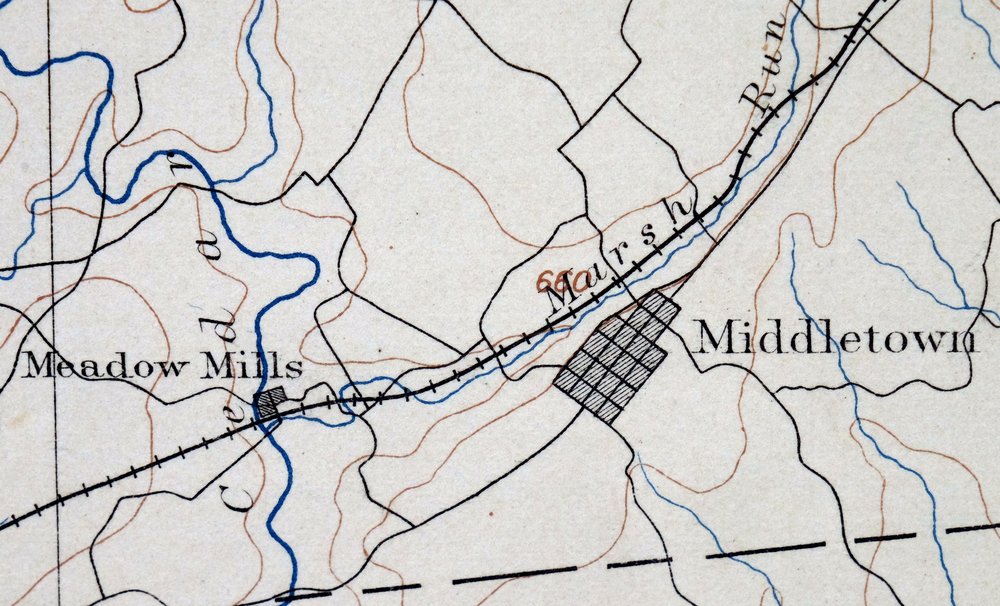
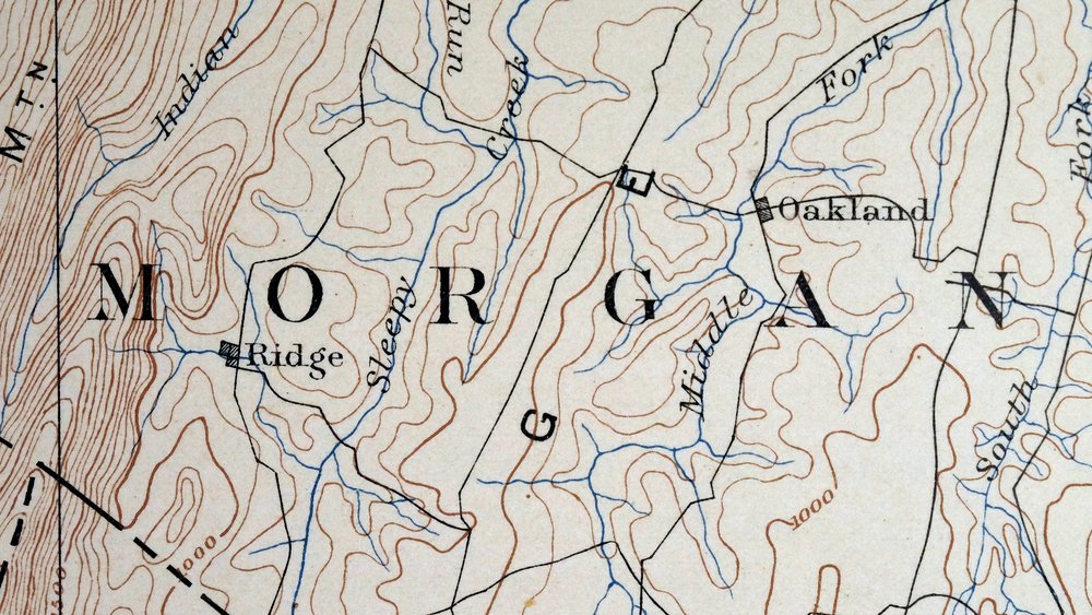
| MAP NOTES | A fascinating historical snapshot of the area from the Cacapon River southeast to the Shenandoah River, surveyed before the modern highway system, showing historic travel routes, rail lines, and placenames. |
| SHEET CONDITION For maps of this vintage, effort is made to note all visible flaws, no matter how minor. | |
| OVERALL CONDITION | Excellent |
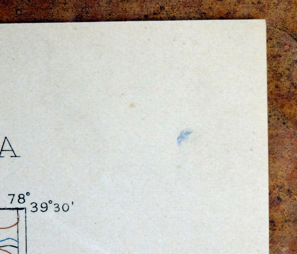
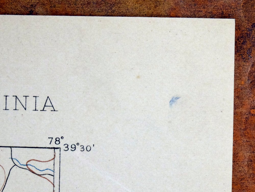
| SHEET NOTES | very lightly handled, never folded, smooth and flat |
| MAP AREA | flawless map area |
| COLLARS | no wear or tears, no markings, very minor blemishes, hole punches along left collar |
  | |
| MAP COVERAGE Quadrangle extent overlaid on current basemap. | |
| BACKSIDE LEGEND | |
 A map summary is printed on the back side of the Winchester sheet similar to the one shown in the picture. It outlines the history, purpose, and status of the USGS mapping program at the time of the printing in 1916. It also provides instructions on how to read contour lines and a description of how they are used to depict the terrain. At the bottom of the page is a legend showing all of the symbols used to represent the cultural, relief, and water features found on the map. | |
| PLACENAMES Depending on map series and survey date, all of the features listed below may not be shown on this map. This list contains features that currently exist or historically existed within the area covered by the map. The list can be used as a reference to determine if this map covers your area of interest. Placenames are listed alphabetically next to each feature type. | |
| CITIES AND TOWNS (CURRENT) | Berryville, Boyce, Brucetown, Capon Bridge, Forks of Cacapon, Gore, Inwood, Lebanon Church, Middletown, Shanghai, Stephens City, Strasburg, and Winchester |
| COUNTIES COVERED | Berkeley, Clarke, Frederick, Hampshire, Jefferson, Morgan, Shenandoah, Warren, and Winchester |
| FEDERAL LAND UNITS | George Washington National Forest |
| RIVERS AND STREAMS | Abrams Creek, Albin Run, Ash Hollow Run, Babbs Run, Back Creek, Bear Garden Run, Bear Run, Bloomery Run, Borden Marsh Run, Bowers Run, Brush Creek, Bucher Run, Buffalo Lick Run, Buffalo Marsh Run, Cacapon River, Capon Springs Run, Castle Run, Catlett Run, Cattail Run, Cedar Creek, Chapel Run, Clearbrook Run, Cold Spring Run, Cold Stream, Coyle Run, Critton Run, Crockett Run, Crooked Run, Dillons Run, Dry Marsh Run, Dry Run, Duck Run, Dug Hill Run, Duncan Run, Edwards Run, Eishelman Run, Elk Branch, Evans Run, Fall Run, Falling Run, Falling Spring Run, Fawcett Run, Froman Run, Furnace Run, Gap Run, Goose Creek, Gough Run, Gravel Springs Run, Green Spring Run, Hands Run, Hawk Run, Hiett Run, Himmelwright Run, Hockmans Run, Hoge Run, Hogue Creek, Indian Run, Isaac Run, Isaacs Creek, Ivy Run, Keckley Run, Laurel Run, Lick Run, Little Brush Creek, Little Cacapon River, Little Isaacs Creek, Loman Branch, Meadow Brook, Merchant Run, Middle Creek, Middle Fork Sleepy Creek, Middle Marsh Brook, Mill Branch, Mill Creek, Miller Run, Mine Spring Run, Molly Booth Run, Mulberry Run, North River, Old Man Run, Opequon Creek, Paddy Run, Page Brook, Parish Run, Pifer Run, Poplar Run, Preffitt Run, Redbud Run, Richards Run, Roaring Run, Sawmill Run, Shell Run, Shenandoah River, Slate Run, Sleepy Creek, South Fork Sleepy Creek, Specks Run, Spout Run, Stephens Run, Stony Creek, Stribling Run, Sulphur Spring Run, Sylvan Run, Tavenner Run, Three Run, Torytown Run, Town Run, Tub Run, Tumbling Run, Turkey Run, Tuscarora Creek, Watson Run, Westbrook Run, White Pine Branch, Willow Brook, Wolf Spring Run, Wolfe Marsh Run, Wrights Run, and Zanes Run |
| WATER BODIES | Cove Lake, Crystal Lake, Fresh Water Pond, High View Manor Lake, Izaak Walton Pond, Lake Leckszas, Lake Saint Clair, Lakeside Lake, Lehmans Pond, Peacefull Valley Lake, Seven Vistas Lake, and Silver Lake |
| Virginia Populated Place: Blue Ridge Downs, Canterburg, Cather Estates, Chambersville, Chapel Estates, Collinsville, Dearmont Chase, Greenway Estates, Gun Barrel Lane Estates, Hinckle, Indian Hollow, Keeneland, Keystone Estates, McQuire, Mount Hope, Mount Pleasant, Poplar Ridge, Rock Enon, Rock Hall, Stephenson, Tulip, Waterloo Heights, Apple View Estates, Arcadia Mobile Home Park, Ash Hollow Estates, Blue Ridge Mobile Home Park, Braddock Hills Estates, Brentwood Terrace, Brookneil, Bufflick Heights, Cabaniss, Chestnut Grove Estates, College Park, Country Club Estates, Country Club Heights, Country Park, Day - Mar Village, De Haveland Estates, Devland Estates, Echo Village, Fairway Estates, Fairway Heights, Fairway Meadows, Finger Lake Estates, Gordondale, Green Acres, Grouse Hollow Estates, Heritage Hills, Hogue Creek Estates, Hunters Valley, Indian Lake, Jackson Woods, Lakewood Acres, Layside Estates, Lincoln Estates, Miller Heights, Mosswood Hills, Mountain Falls Park, Mountain View Acres, Nordic Village, North Frederick Terrace, North Mountain Estates, Northwood Hills, Ole Orchard Estates, Paxton Hills, Payne Mobile Home Park, Peach Orchard Inn Farms, Plainfield Heights, Ravenwood Estates, Rolling Fields, Rolling Hills, Rosenberger, Senseny Heights, Shenandoah Mobile Home Park, Sherwood Forest, Sir John Addition, Southview, Southwood Hills, Spring Meadows Trailer Park, Spring Valley, Stonebrook Farms, Stonewall Orchard, The Knolls, Timber Ridge, Valley Acres, Wamplers Trailer Park, Wellington Acres, Westwood, Wildwood Hills, Woodchuck Heights, Zeiger, Lake Frederick, Albin, Armel, Ashby, Bartonsville, Bethel, Boyce, Briggs, Brucetown, Bunker Hill, Burning Knolls, Burnt Factory, Cedar Creek Battlefield, Cedar Grove, Cedar Hill, Clary, Claytonville, Clear Brook, Cross Junction, De Haven, Frederick Heights, Freyco, Gainesboro, Gore, Gravel Springs, Green Spring, Greenway Court, Greenwood Heights, Grimes, Hayfield, High View Manor, Hill Crest, Jordan Springs, Kernstown, Klines Mill, Lebanon Church, Leetown, Lost Corner, Marlboro, Meadow Mills, Middletown, Milldale, Millwood, Mount Williams, Mountain Falls, Nain, Nieswanders Fort, Nineveh, Opequon, Oranda, Parkins Mills, Pyletown, Reliance, Rest, Ridings Mill, Rock Enon Springs, Round Hill, Saratoga, Shawnee Land, Shenandoah Hills, Shockeysville, Siler, Stephens City, Stephens Fort, Sunnyside, Swimley, Vaucluse, Wadesville, Waterloo, Welltown, Wheatfield, Whitacre, White Hall, White Post, Wilde Acres, Winchester, and Zepp. Locations: Annefield Estate, Apple Blossom Center Shopping Center, Apple Blossom Corners Shopping Center, Apple Blossom Mall Shopping Center, Apple Valley Square Shopping Center, Blue and Gray Mall Shopping Center, Burke Center Shopping Center, Chapel Green Estate, Chapel Hill Estate, Clay Hill Estate, Delco Plaza of Winchester Shopping Center, Derflingers Farm, Do-Nothing Farm, Farnley Estate, Featherbed Lane Plaza Shopping Center, Featherbed Lane Shopping Center, Federal Hill Estate, Gaywood Estate, Glenvin Estate, Golden Acres, Goshen Estate, Greenville Estate, Guilford Estate, Hampton Estate, Helmsley Estate, Huntingdon, Jonesville Estate, Lakeville Estate, Long Branch Estate, Longwood Estate, Lucky Hit Estate, Milldale Farms, Millwood Crossing Shopping Center, Morgan Mill, Mountain View Estate, New Market Estate, North End Estate, Northpark Shopping Center, Northside Station Shopping Center, Oakley Estate, Old Town Mall Shopping Center, Pagebrook Estate, Pharmhouse Shopping Center, Pineville Plaza Shopping Center, Poplar Hill Estate, Prospect Farms, Providence Estate, Rosemont Estate, Rosney Estate, Soldiers Retreat Estate, Southpark Shopping Center, Springdale Mill Complex, Stonewall Farm, Summerville Estate, Sunnybrook, Sunnyside Plaza Shopping Center, The Briars, The Cottage Estate, The Meadow Estate, The Vineyard Estate, Tuleyries Estate, Valley View Farm, Ward Plaza Shopping Center, Westbrook Estate, Winchester Mall Shopping Center, Windmore, Airport Industrial Park, Candy Hill Camp, Cedar Creek Battlefield, Clayhill Farm, Cove Lake Camp, Fort Collier Industrial Estates, Lake Holiday Country Club, Molden Picnic Shelter, Peaceful Valley Lake Camp, Stonewall Industrial Park, High Hill Farm, Marker-Miller Orchards, Marsh Thoroughbred Farm, Millwood Farm Equestrian Center, Oak Hill Silk Farm, Rinker Orchards, Rock Harbor Golf Course, Sandstone Farms, White Post Dairy, Camp Buckhorn, Camp Rock Enon, Camp Sheemar, Camp Win-Wah, Capon Road, Carper's Valley Golf Club, Carter Hall, Double Tollgate, Hopewell Meetinghouse, Millwood Country Club, Reynolds Store, Star Tannery, State Prison Camp Number 7, Stone Bridge, Sugar Hill, Winchester Camp, and Winchester Country Club. Areas: Crag Rocks. Administrative Boundaries: City of Winchester, Back Creek District, Gainesboro District, Opequon District, Red Bud District, Russell District, Shawnee District, Stonewall District, Town of Boyce, Town of Middletown, Town of Stephens City, White Post District, and Frederick County. Mountain Ranges: Great North Mountain and Little North Mountain. Mountains, Peaks, and Summits: Sunset Hill, Bowers Hill, Acorn Hill, Babbs Mountain, Beans Hill, Chine Spring Knob, Eagle Rock, Funkhouser Knob, Grave Hill, High Point, Johnnies Knob, Little Mountain, North Mountain, Old Knob, Pinnacle, Pinnacle Rock, Point of Rocks, Ridings Hill, Round Hill, Shockeys Knob, Short Mountain, The Blue Ball, Thomas Mountain, and White Horse Rock. Valleys and Canyons: Clearboard Hollow, Big Hollow, Carpers Valley, Deep Hollow, Dick Hollow, Frog Hollow, Grove Hollow, Huffman Hollow, Indian Hollow, Polebridge Hollow, Poplar Hollow, Poplartree Hollow, Purtlebaugh Hollow, Rocky Hollow, Sink Pond Hollow, Smith Hollow, Stonebridge Hollow, Warm Springs Hollow, Woodpile Hollow, and Yellow Spring Hollow. Woods: Slonaker Orchard. Parks: Clarke County Recreation Area, White Post Historic District, White Post Village Park, Winchester Historic District, Cedar Creek and Belle Grove National Historical Park, Clearbrook Park, Frederick Heights Neighborhood Park, Gainesboro Neighborhood Park, Harry W Aikens Field, Kernstown Battlefield, Lowry Tennis Courts, North Mountain Neighborhood Park, Reynolds Store Neighborhood Park, Round Hill Neighborhood Park, Cedar Creek Wayside, Izaak Walton Park, and Winchester Recreation Park. Drainages: Abrams Creek, Albin Run, Ash Hollow Run, Babbs Run, Bakers Run, Bear Garden Run, Bear Run, Breakneck Run, Brush Creek, Bucher Run, Buffalo Lick Run, Buffalo Marsh Run, Catlett Run, Cattail Run, Clearbrook Run, Cold Spring Run, Coyle Run, Crockett Run, Dry Marsh Run, Dry Run, Duck Run, Eishelman Run, Fall Run, Fawcett Run, Froman Run, Furnace Run, Gap Run, Gough Run, Gravel Springs Run, Green Spring Run, Hands Run, Hiatt Run, Hockmans Run, Hoge Run, Hogue Creek, Hot Run, Indian Run, Isaac Run, Isaacs Creek, Johnson Run, Keckley Run, Laurel Run, Lick Run, Little Brush Creek, Little Isaacs Creek, Little Mountain Run, Meadow Brook, Middle Marsh Brook, Miller Run, Mine Spring Run, Mulberry Run, Nixon Run, Paddy Run, Page Brook, Parish Run, Pifer Run, Poplar Run, Preffitt Run, Redbud Run, Reed Creek, Richards Run, Roseville Run, Shell Run, Slate Run, Spout Run, Stephens Run, Stickley Run, Stribling Run, Sulphur Spring Run, Swamp Run, Sylvan Run, Tavenner Run, Town Run, Turkey Run, Venus Branch, Watson Run, Westbrook Run, White Pine Branch, White Run, Wolf Spring Run, Wolfe Marsh Run, Wrights Branch, Wrights Run, Yeiders Run, and Zanes Run. Islands: Hardin Island, Robinson Crusoe Island, and Treasure Island. Churches: Boyce Baptist Church, Boyce Methodist Church, Cunningham Parish Chapel, Ebenezer Primitive Baptist Church, Emmanuel Chapel Episcopal Church, Greenway Southern Baptist Church, Liberty Baptist Church, Mead Memorial Church, Millwood Church, Millwood United Methodist Church, Mount Olive Baptist Church, Ninevah Presbyterian Church, Reliance United Methodist Church, Shenandoah Farms Baptist Church, Shiloh Baptist Church, Stephens City Mennonite Church, Trinity Lutheran Church, White Post Methodist Church, Zion Baptist Church, Bethel Evangelical Lutheran Church, Brucetown United Methodist Church, Calvary Church of the Brethren, Clearbrook Presbyterian Church, College Park Church of Christ, Emmanuel Independent Baptist Church, Fellowship Bible Church, Gainesboro United Methodist Church, Goodson Chapel Recital Hall, Hayfield Assembly of God Church, Hebron Baptist Church, House of Jacob, Kernstown United Methodist Church, Mount Pleasant United Methodist Church, New Hope Alliance Church, Rest United Methodist Church, Rosedale Baptist Church, Round Hill Presbyterian Church, Round Hill United Methodist Church, Saint Pauls on the Hill Episcopal Church, Second Opequon Presbyterian Church, Shockeysville United Methodist Church, Southside Church of Christ, Sunnyside Presbyterian Church, The Church of Jesus Christ of Latter Day Saints, Welltown United Methodist Church, White Hall United Methodist Church, Winchester Church of the Brethren, Bethel Church, Burnt Church, Carpers Valley Church, Cedar Cliff Church, Cedar Creek Church, Chestnut Grove Church, Crums Church, Ebenezer Church, Emmanuel Church, Epworth Chapel, Fairview Church, Files Chapel, Fremont Church, Friendship Church, Galilee Church, Grace Church, Greenwood Church, Guilfield Church, Hites Chapel, Holy Trinity Mission Seminary, Home Mission Tabernacle, Howard Chapel, Lamps Memorial Church, Laurel Hill Church, Little Chapel, Little Mountain Church, Macedonia Church, Middletown Church, Mount Carmel Church, Mount Hebron Church, Mount Hope Church, Mount Olive Church, Mount Salem Church, Mount Sinai Church, Mountain View Church, Old Bethel Church, Old Chapel, Old Opequon Church, Old Salem Church, Old Stone Church, Old Zion Church, Pine Grove United Methodist Church, Pleasant Valley Church, Redbud Church, Redland Church, Refuge Church, Relief Church, Ridings Chapel, Sacred Heart Monastery, Saint James Church, Saint Johns Church, Saint Pauls Church, Saint Stephens Church, Salem Church, Shiloh Church, Siler Temple, Stines Chapel, Stones Chapel, Timber Ridge Church, Walnut Springs Church, Wesley Chapel, Wesley Church, and Woodbine Church. Post Office: Boyce Post Office, Brucetown Post Office, Clear Brook Post Office, Cross Junction Post Office, Downtown Winchester Post Office, Gore Post Office, Hayfield Post Office, Middletown Post Office, Millwood Post Office, Round Hill Post Office, Star Tannery Post Office, Stephens City Post Office, Whitacre Post Office, White Post Post Office, Stephenson Post Office, and Winchester Post Office. Hospitals: Winchester Medical Center. Lakes and Ponds: Bills Pond. Buildings: Erin, Harmony Hall, Middletown Town Hall, Mount Zion, Winchester Rehabilitation Center, Junior Library" "Alson H Smith, Aikens Athletic Center, Allen Dining Hall, Belle Grove Plantation, Boyce Volunteer Fire Company, Cedar Creek Battlefield Foundation Visitor Center, Cloverdale, Cooley Hall, Dorothy Ewing Studios of Dance, Evendale, Frederick County Fire and Rescue Department Station 11 - Stephens City Volunteer Fire and Rescue, Frederick County Fire and Rescue Department Station 12 - Middletown Volunteer Fire and Rescue, Frederick County Fire and Rescue Department Station 13 - Clear Brook Volunteer Fire and Rescue, Frederick County Fire and Rescue Department Station 14 - Gore Volunteer Fire and Rescue, Frederick County Fire and Rescue Department Station 15 - Round Hill Community Volunteer Fire, Frederick County Fire and Rescue Department Station 16 - Gainesboro Volunteer Fire and Rescue, Frederick County Fire and Rescue Department Station 18 - Greenwood Volunteer Fire and Rescue, Frederick County Fire and Rescue Department Station 19 - North Mountain Volunteer Fire and Rescue, Frederick County Fire and Rescue Department Station 20 - Reynolds Store Volunteer Fire and Rescue, Frederick County Fire and Rescue Department Station 21 - Millwood Volunteer Fire and Rescue, Frederick County Sheriffs Office, Funkhouser Hall, Glengary, Linden Building, Long Green Building, Long Meadows Building, Lupton - Bond House, Mary M Henkel Hall, Ohrstrom-Bryant Theatre, Racey Hall, Rose Hill, Ruebush Hall, Shenandoah Farms Volunteer Fire Department and Rescue Squad, Shenandoah Farms Volunteer Fire Department Company 6, Shenandoah University Television Center, Shingleton Hall, Star Tannery Volunteer Fire and Rescue Station 17, Star Tannery Volunteer Fire Department, University Inn, Walnut Grove Building, War Memorial Building, Cleridge, Dehaven Nursery, Frederick County Sheriff's Office, Lord Fairfax Community College Police Department, Northwestern Regional Adult Detention Center, Northwestern Regional Juvenile Detention Center, O'Sullivan Corporation Emergency Fire Response Team, Stephens City Police Department, Stonewall Jackson Museum, Valley Medical Transport, Virginia State Police Division 2 Area 13 Office, Webers Nursery, Winchester City Sheriff's Office, Winchester Fire and Rescue Department Station 1 Friendship Volunteer Fire Company, Winchester Fire and Rescue Department Station 2 Rouss Fire Company, Winchester Fire and Rescue Department Station 4 Shawnee Volunteer Fire Company, Winchester Fire and Rescue Department Station 5 South End Fire Company, Winchester Fire Chief, and Winchester Police Department. Waterfalls: Mountain Falls. Dams: Butler Dam, Cove Dam, Cove Number Two Dam, Crystal Dam, High View Manor Dam, Izaak Walton Park Pond Dam, Kelchners Dam, Lake Saint Clair Dam, Lakeside Lake Dam, Lehmans Dam, Meadowlake Dam, Seven Vistas Dam, Sheppard Dam, Silver Lake Dam, Stephens Park Dam, The Summit Dam, Unimin Fresh Water Dam, Unimin Tailings Dam, and Wheatlands Dam. Crossings: Dunlap Ford, Pooles Ford, Berryville Crossing, Clevengers Ford, Rocky Ford, Seivers Ford, Sulphur Spring Ford, Tanquarys Ford, Baileys Ford, Beelers Ford, and Minebank Ford. Bluffs: Dog Cliff and Lovers Leap. Gaps: Baldwin Gap, Catlett Gap, Clowser Gap, Cold Spring Gap, Dry Gap, Farmers Gap, Fawcett Gap, Hoop Petticoat Gap, Paddy Gap, Pontzer Gap, Reed Gap, Sawlog Gap, The Lock, Wingfield Gap, and Wisecarver Gap. Bends: The Loope. Basins: Bear Wallow. Bars: Swift Shoals. Airports: Jucapa Farms Airport, Al's Field, High View Farm Airport, Mulberry Run Airport, Smith Heliport, Timber Ridge Airpark, White Post Airport, Winchester Medical Center Heliport, and Winchester Regional Airport. Census: Brucetown Census Designated Place, Gore Census Designated Place, Lake Holiday Census Designated Place, and Shawneeland Census Designated Place. Schools: Apple Pie Ridge Elementary School, Bass - Hoover Elementary School, Boyce Elementary School, Daniel Morgan Middle School, Dowell J Howard Center, Emmanuel Christian Academy, Frederick Douglass Elementary School, Gore Elementary School, James Wood High School, James Wood Middle School, John Kerr Elementary School, Keystone Christian Academy, Kline Elementary School, Leary Educational Center, Lord Fairfax Community College, Middletown Elementary School, Robert E Aylor Middle School, Rosedale Christian Academy, Sacred Heart Academy, Seventh Day Adventist School, Shenandoah Valley Christian Academy, Virginia Avenue Charlotte Dehart Elementary School, Evendale Elementary School, Admiral Richard E Byrd Middle School, Douglas Community Learning Center, Frederick County Parent Resource Center, Indian Hollow Elementary School, Millbrook High School, Mountain View Christian Academy, Northwestern Regional Educational Program Smithfield Campus, Northwestern Regional Juvenile Detention Center School, Orchard View Elementary School, Redbud Run Elementary School, Robinson Educational Center, Sherando High School, Winchester Montessori School, Armel Elementary School, Bryarly School, Frederick County Middle School, Gainesboro Elementary School, Garland Quarles Elementary School, Highview School, John Handley High School, Kerr School, Monroe College, Powhatan School, Robinson Memorial Elementary School, Senseny Road Elementary School, Shenandoah University, Stonewall Elementary School, University of Virginia - Blandy Experimental Farm, and Wood High School. Ridges: Double Ridge, Apple Pie Ridge, Bear Ridge, Besor Ridge, Big Ridge, Bowling Green Ridge, Burnt Ridge, Capper Ridge, Cove Ridge, Devils Backbone, Dick Ridge, Fall Ridge, Flint Ridge, Fox Ridge, Gallows Ridge, Gibson Ridge, Hayfield Ridge, Hunting Ridge, Limestone Ridge, Little Timber Ridge, McIiwee Ridge, Mineral Ridge, Pangletown Ridge, Piney Ridge, Pinnacle Ridge, Poplar Ridge, Pumpkin Ridge, Railroad Ridge, Sand Ridge, Tarkiln Ridge, The Half Moon, Tunnel Ridge, Whisson Ridge, White Pine Ridge, and Winding Ridge. Reservoirs and Tanks: Lake Frederick, Beaver Lake, Cherokee Lake, Emerald Lake, Rainbow Lake, Swan Lake, Cove Lake, Fresh Water Pond, High View Manor Lake, Izaak Walton Pond, Lake Holiday, Lake Leckszas, Lake Saint Clair, Lake Serene, Lakeside Lake, Lehmans Pond, Meadow Lake, Peacefull Valley Lake, Seven Vistas Lake, Sheppard Pond, Silver Lake, Stephens Park Lake, and Tailings Pond. Military: Fort Milroy and Star Fort. Flats: White Oak Level. Towers: WXVA-AM (Winchester), WESI-FM (Strasburg), WFQX-FM (Front Royal), WINC-AM (Winchester), WTRM-FM (Winchester), WUSQ-AM (Winchester), and WUSQ-FM (Winchester). Springs: Vaucluse Spring, Branson Spring, Buck Lick Spring, Cold Spring, Horsepen Spring, Mine Spring, Old Town Spring, Pembroke Springs, Rouss Spring, Shawnee Spring, Washington Spring, and Whetzel Spring. Cemetery: Crums Cemetery, Fairview Cemetery, Friendship Cemetery, Laurel Hill Cemetery, Lebanon Church Cemetery, Little Chapel Cemetery, Macedonia Cemetery, Mount Carmel Cemetery, Old Bethel Cemetery, Old Chapel Cemetery, Old Salem Cemetery, Reliance Cemetery, Saint James Cemetery, Saint Stephens Cemetery, Stones Chapel Cemetery, Walnut Springs Christ Church Cemetery, Back Creek Quaker Cemetery, Beacon Baptist Church Cemetery, Bethel Cemetery, Brucetown Cemetery, Ebenezer Christian Church Cemetery, Greenwood Cemetery, Hopewell Meeting House Graveyard, Lamps Memorial Church Cemetery, Mount Olive United Methodist Church Cemetery, Old Stone Church Cemetery, Opequon Cemetery, Redbud Cemetery, Redland Cemetery, Saint Peters Lutheran Church Cemetery, Winchester National Cemetery, Centenary Reformed UCC Cemetery, General Daniel Morgan Veterans Cemetery, German Lutheran Church Cemetery, Stonewall Confederate Cemetery, Bethel Grange Cemetery, Gravel Springs Cemetery, Green Hill Cemetery, Hodgson Cemetery, Jabbers Hill Cemetery, Milburn Cemetery, Mount Hebron Cemetery, Orrick Cemetery, Quaker Cemetery, Sacred Heart Cemetery, Shenandoah Memorial Cemetery, Stickley Cemetery, Sunrise Cemetery, Upper Ridge Cemetery, Wisecarver Cemetery, Wood Family Cemetery, and Yeakley Cemetery. | |
| West Virginia Populated Place: Cacapehon, Arden, Bloomery, Bubbling Spring, Bunker Hill, Capon Bridge, Capon Springs, Cold Stream, Darkesville, Ganotown, Gerrardstown, Glengary, Good, Goose Nest, Greenwood, High View, Hooks Mills, Inwood, Jones Springs, Largent, Lehew, Morton Grove, Neals Run, Nollville, Oakland, Ridgeway, Shanghai, Tablers Station, Tarico Heights, Unger, Union Corner, and Woodrow. Locations: Edgewood Manor, North Mountain Lookout Tower, Capon Springs Resort Golf Course, Buffalo Gap Camp, Camp Green Briar, Camp Rim Rock, Camp Tall Timbers, Camp Tomahawk, Camp White Mountain, Camp White Rock, Forks of Cacapon, Hawk Campground, Locks-of-the-Mountain, Pine Ridge Camp, Ridge, and Ridge State Fish Hatchery. Administrative Boundaries: Bloomery District, Norborne District, Shenandoah District, Town of Capon Bridge, Valley District, and Berkeley County. Mountains, Peaks, and Summits: Bear Garden Mountain, Butchers Knob, Castle Mountain, Darbys Nose, Georges Peak, High Rock, Ice Mountain, Leith Mountain, Little Mountain, Pine Mountain, Raven Rocks, Roundtop, Schaffenaker Mountain, Slanes Knob, Sleepy Creek Mountain, Spring Gap Mountain, and Spring Mountain. Valleys and Canyons: Big Hollow, Frog Hollow, Horsebone Hollow, Johnson Hollow, Kale Hollow, Parks Valley, Riggs Hollow, Sandy Hollow, and Wolf Hollow. Parks: Bunker Hill Historic District, Darkesville Historic District, Edwards Run Wildlife Management Area, Mill Creek Historic District, and Ridge Road Historic District. Trails: Old Romney Grade. Drainages: Big Run, Bloomery Run, Bowers Run, Castle Run, Cold Stream, Coyle Run, Critton Run, Crooked Run, Dillons Run, Duncan Run, Edwards Run, Elk Branch, Falling Spring Run, Himmelwright Run, Indian Run, Ivy Run, Little Brush Creek, Loman Branch, Mill Branch, North River, Old Man Run, Roaring Run, Sawmill Run, Specks Run, Stony Creek, Sylvan Run, Torytown Run, Tub Run, and Turkey Run. Capes: Pee Wee Point. Churches: Arden United Methodist Church, Bloomery Presbyterian Church, Bunker Hill Presbyterian Church, Calvary United Brethren Church, First Baptist Church, Ganotown Methodist Church, Gerrardstown Presbyterian Church, Jones Springs Methodist Church, Bethel Church, Buck Hill Church, Capon Chapel, Central Church, Christian Church, Eubulus Church, Faith Tabernacle, Greenwood United Methodist Church, Island Hill Church, Morgan Chapel, Mount Carmel Church, Mount Olive Church, Mount Pleasant Church, Mount Tabor Church, Mount Union Church, Mountain Chapel, Mountain Side Tabernacle, Mountain View Church, Oakland United Methodist Church, Payne Chapel, Pleasant Grove Church, Saint Johns Church, Salem United Methodist Church, Sandy Ridge Church, Shiloh Church, Trinity Church, Tuscarora Presbyterian Church, Union Chapel United Methodist Church, and Woodrow Union Church. Post Office: Bloomery Post Office, Bunker Hill Post Office, Capon Bridge Post Office, Capon Springs Post Office, Gerrardstown Post Office, Glengary Post Office, High View Post Office, Inwood Post Office, Jones Springs Post Office, and Unger Post Office. Buildings: Morgan County Observatory, Back Creek Valley Volunteer Fire Department, Berkeley County Emergency Ambulance Authority 50, Berkeley County Emergency Ambulance Authority South Station Unit 98, Capon Bridge Police Department, Capon Bridge Rescue Squad, Capon Bridge Volunteer Fire Department, Capon Springs Volunteer Fire and Rescue Company, South Berkeley Volunteer Fire Department, South Morgan Volunteer Fire Department, and West Virginia Division of Forestry Berkeley County Field Office. Dams: Crooked Run Lake Dam and Indian Run Dam. Crossings: Shaulls Ford, Arnold Ford, and Carter Ford. Gaps: Boyds Gap, Dutton Gap, Mills Gap, and Spring Gap. Bridges: McCubbins Ford Bridge. Airports: River's Edge Farm Airport, Taylors Airport, and Michaels Farms Airport. Census: Inwood Census Designated Place. Schools: Capon Bridge Elementary School, Capon Bridge Middle School, Gerrardstown Elementary School, Inwood Primary School, Musselman Middle School, Mill Creek Intermediate School, Orchard View Intermediate School, Eastern Panhandle Christian Academy, Mountain Ridge Intermediate School, Back Creek Valley Elementary School, Bunker Hill Elementary School, Greenwood Elementary School, Musselman High School, and Valley View Elementary School. Ridges: Diamond Ridge, Middle Ridge, Bear Ridge, Buck Hill, Cacapon Mountain, L Ridge, Leading Ridge, North Mountain, Sandy Ridge, Third Hill Mountain, Timber Ridge, Warm Springs Ridge, and Wilson Ridge. Reservoirs and Tanks: Cacapon State Park Lake. Towers: WKMZ-FM (Martinsburg), WVEP-FM (Martinsburg), and WYVN-TV (Martinsburg). Pillars: Castle Rock. Springs: Bore Spring, Buffalo Gap Spring, Capon Springs, Cold Spring, Cold Stream Run Spring, Daisy Baker Spring, Hiett Spring, Ice Mountain Spring, Linnie Hiett Spring, Mountain Spring, Omps Farm Spring, Opequon Spring, Russel Spring, Boiling Springs, Boyer Farm Spring, Bubbling Spring, Buck Hill Spring, Burkhart Spring, Carter Spring, Charles Crim Spring, Cool Spring, Douglas Miller Farm Spring, Grey Spring, Griffith Spring, Gum Spring, Jones Spring, Kees Spring, Kitchen Spring, Lee Whitacore Farm Spring, LeFevre Spring, Lemons Spring, McDonald Spring, Neglar Spring, Overmale Springs, Peerless Orchard Farm Spring, Porter Farm Spring, Ridge Hatchery Spring, Shanghai Sulphur Well Spring, Silver Spring, and Springvale Farm Spring. Cemetery: Arden United Methodist Church Cemetery, Buck Hill Cemetery, Calvary Cemetery, Capon Chapel Cemetery, Central Chapel Cemetery, Darkesville Cemetery, Ganotown Cemetery, Gerrardstown Cemetery, Jones Springs Cemetery, Lutheran Cemetery, Morgan Chapel Cemetery, Mount Carmel Cemetery, Mount Pleasant Cemetery, Mountain Side Tabernacle Cemetery, Mountain View Cemetery, Paynes Chapel Cemetery, Salem United Methodist Church Cemetery, Shanghai Presbyterian Cemetery, Tuscarora Cemetery, Woodrow Church Cemetery, Roe Chapel Cemetery, Island Hill Cemetery, Jacob Snider Cemetery, McIntire Cemetery, Mount Union Church Cemetery, Old Bethel Church Cemetery, Prospect Hall-Edwards-Hunsicker Cemetery, Sandy Ridge Cemetery, Shiloh United Methodist Church Cemetery, Timber Ridge Christian Church Cemetery, Touhey Cemetery, Enon Cemetery, Greenwood Cemetery, Oakland Cemetery, Old Enon Primitive Baptist Church Cemetery, Pitzers Chapel Cemetery, Racey Cemetery, Salem Cemetery, Trinity Cemetery, and Union Chapel Cemetery. | |
| SHIPPING AND RETURNS | |
 This map sheet will be carefully rolled in a sturdy tube and shipped via the US Postal Service. If you find that the sheet you receive is not as described in the listing, you may ship it back to us for a refund of the purchase price. | |
Winchester Virginia Middletown Inwood USGS Topo Map 1916
$82
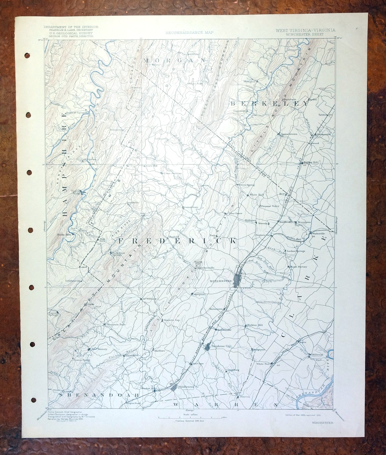
This USGS reconnaissance topographic sheet is a 1894 edition with 1891 revisions, printed in 1916, and survives in excellent condition—very lightly handled, never folded, smooth and flat, with a flawless map area. Spanning the Virginia–West Virginia line about 70 miles west of Washington, the quad takes in Winchester along with Strasburg, Berryville, Middletown, and Stephens City, the Cacapon and Shenandoah Rivers, and part of the George Washington National Forest. Surveyed under geographer Henry Gannett before the modern highway system, it captures the area’s historic travel routes, rail lines, and placenames of the era, and comes from an uncommonly well-preserved collection. The reverse carries printed reference material about the mapping program of the time.
In stock
This antique sheet is an 1894 edition of the Winchester Virginia USGS topographic map. It is an authentic 110-year-old 1916 United States Geological Survey print in excellent condition.
HOW THIS MAP CAN BE USED
In addition to making a fascinating conversation piece, this sheet would look great in a frame or on display, make a unique and prized gift for anyone interested in this area, be perfect as a reference for genealogy studies or general historical research, or fill that missing piece in your collection.
FEATURES SHOWN ON THE MAP
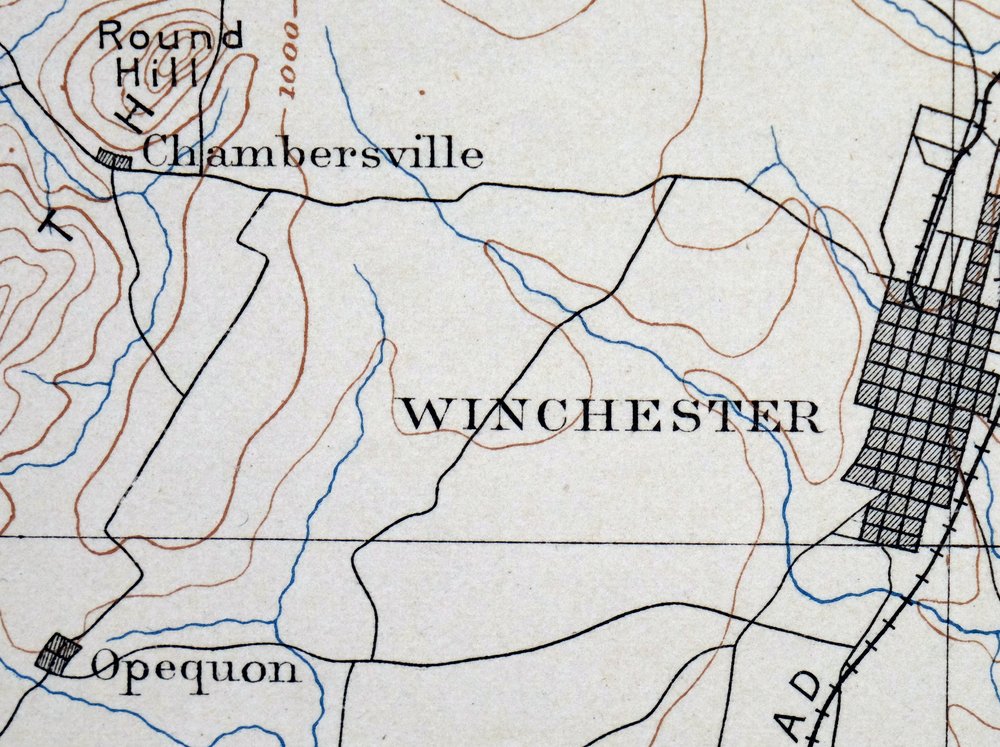
The Winchester 30-minute map shows cities and towns, roads, railroads, rivers, creeks, elevation contour lines, public land survey lines, county, state, and other administrative boundaries as they existed at the time of the survey in 1883 through 1885.
A VALUABLE HISTORICAL RECORD
Maps from the USGS 30-minute series have been out of print for many years. They have never been common and original prints are increasingly difficult to find. For areas where the 30-minute map was produced, it is usually the first large-scale survey done by the USGS for that area. These are a valuable historical record, as they contain many placenames and features that have been dropped from more recent series’ and editions.
Nearby maps
-

Romney West Virginia Keyser Delray USGS Topographic Map 1909
$80 Add to cart -

Luray Virginia Front Royal Stanley USGS Topographic Map 1910
$115 Add to cart -

Mount Vernon Virginia Washington Accokeek USGS Topo Map 1912
$200 Add to cart -

Franklin West Virginia Petersburg Onego USGS Topo Map 1914
$49 Add to cart -

Patapsco Maryland Baltimore Jessup USGS Topographic Map 1908
$96 Add to cart -
Staunton Virginia Stuarts Draft USGS Topographic Map 1913
$90 Add to cart -
Patuxent Maryland Washington Bowie USGS 30-Min Topo Map 1907
$65 Add to cart -

Palmyra Virginia Lake Monticello Dillwyn USGS Topo Map 1907
$75 Add to cart -

Tolchester Maryland Dundalk Essex USGS Topo Map 1908 Antique
$145 Add to cart -

Natural Bridge Virginia Covington Selma USGS Topo Map 1911
$62 Add to cart -
Dover Delaware Bombay Hook NWR Middletown USGS Topo Map 1906
$47 Add to cart -

Needmore Pennsylvania Crystal Spring USGS Topo Map 1947
$44 Add to cart -

Clearville Pennsylvania USGS 15-Min Topo Map 1945 Vintage
$42 Add to cart -

Hyndman Pennsylvania Buffalo Mills USGS 15-Min Topo Map 1967
$40 Add to cart -

Chambersburg Pennsylvania Guilford USGS Topographic Map 1964
$40 Add to cart -

Bedford Pennsylvania Schellsburg USGS Topo Map 1958 Vintage
$42 Add to cart -

Newville Pennsylvania Shippensburg USGS 15-Min Topo Map 1959
$40 Add to cart -

Carlisle Pennsylvania Schlusser USGS Topographic Map 1964
$45 Add to cart -

Loysville Pennsylvania Landisburg USGS Topo Map 1966 Vintage
$42 Add to cart -

Brownsville Pennsylvania Monessen Donora USGS Topo Map 1954
$38 Add to cart -

Philipsburg Pennsylvania Stormstown USGS Topo Map 1964
$34 Add to cart -
Bellefonte Pennsylvania Boalsburg USGS Topographic Map 1961
$44 Add to cart -

Hummelstown Pennsylvania Hershey Palmyra USGS Topo Map 1965
$37 Add to cart -

Lancaster Pennsylvania Columbia Lititz USGS Topo Map 1943
$58 Add to cart
