MAP DETAILS | |
|---|---|
| TITLE | Nicholas |
| STATE | West Virginia |
| LOCATION | Vicinity of Summersville |
| SERIES | 30-minute |
| SURVEYED | 1898 and 1899 Field Survey |
| GEOGRAPHER | H.M. Wilson |
| ENGRAVED | 1900 |
| EDITION | 1901 |
| PRINTED | 1912 |
| PRINT NOTES | Thick paper stock |
| SCALE | 1:125000 |
| CONTOUR INTERVAL | 100 feet |
| SHEET DIMENSIONS | 16 1/2 x 20 inches |
| MAP DIMENSIONS | 13 3/4 x 17 1/2 inches |
| COVERAGE AREA | 27 x 35 miles |
| SOURCE | From an uncommonly well-preserved collection |
| MAP NOTES | A fascinating historical snapshot surveyed before the modern highway system and before the creation of Summersville Lake on the Gauley River, showing historic travel routes, river crossings, and placenames. |
| SHEET CONDITION For maps of this vintage, effort is made to note all visible flaws, no matter how minor. | |
| OVERALL CONDITION | Excellent |
| SHEET NOTES | very lightly handled, never folded, smooth and flat |
| MAP AREA | flawless map area |
| COLLARS | no wear or tears, no markings, no blemishes, hole punches along left collar |
| MAP COVERAGE Quadrangle extent overlaid on current basemap. | |
| BACKSIDE LEGEND | |
 A map summary is printed on the back side of the Nicholas sheet similar to the one shown in the picture. It outlines the history, purpose, and status of the USGS mapping program at the time of the printing in 1912. It also provides instructions on how to read contour lines and a description of how they are used to depict the terrain. At the bottom of the page is a legend showing all of the symbols used to represent the cultural, relief, and water features found on the map. | |
| PLACENAMES Depending on map series and survey date, all of the features listed below may not be shown on this map. This list contains features that currently exist or historically existed within the area covered by the map. The list can be used as a reference to determine if this map covers your area of interest. Placenames are listed alphabetically next to each feature type. | |
| CITIES AND TOWNS (CURRENT) | Birch River, Camden-on-Gauley, Clearco, Clifftop, Cowen, Craigsville, Fenwick, Lookout, Mount Nebo, Nallen, Quinwood, Richwood, Summersville, Swandale, Tioga, and Zela |
| COUNTIES COVERED | Clay, Fayette, Greenbrier, Nicholas, and Webster |
| FEDERAL LAND UNITS | Gauley River National Recreation Area, Monongahela National Forest, New River Gorge National River, and Summersville Lake |
| RIVERS AND STREAMS | Adkins Lick Creek, Adkins Rockhouse Branch, Anglins Creek, Anthony Creek, Arbuckle Branch, Arrowwood Creek, Baber Branch, Barnet Run, Barrenshe Run, Bear Run, Bearpen Fork, Bee Run, Beech Run, Big Beaver Creek, Big Clear Creek, Big Ditch Run, Big Laurel Creek, Big Run, Birch River, Bishop Rockhouse Branch, Board Fork, Bowen Run, Brackens Creek, Bragg Run, Briery Creek, Brock Run, Brown Creek, Brushy Fork, Brushy Meadow Creek, Bryant Branch, Bryant Run, Buck Garden Creek, Buckeye Branch, Buckheart Run, Buffalo Creek, Burdette Creek, Butcher Branch, Cherry River, Cherry Run, Chestnut Camp Run, Chestnut Lick Run, Clear Fork, Cold Spring Branch, Collison Creek, Colt Branch, Contrary Creek, Coon Creek, Cranberry River, Cranes Nest Run, Crawford Branch, Crooked Run, Curtin Run, Cutlip Branch, Deer Creek, Dille Run, Dog Run, Dogwood Creek, Donahoe Fork, Dry Branch, Elevenmile Fork, Elijah Branch, Elm Creek, Enoch Branch, Ewings Branch, Fallrock Branch, Falls Run, Fern Creek, Floyd Creek, Franks Branch, Gauley River, Geho Run, Given Run, Glade Creek, Glade Run, Granny Run, Grassy Creek, Grassy Run, Groves Creek, Groves Spring Branch, Gulf Fork, Hannah Run, Harris Fork, Haynes Branch, Hedricks Creek, Hickory Fork, Hogcamp Run, Holcomb Creek, Holcomb Run, Hominy Creek, Horse Run, Hughey Branch, Hutchison Branch, Ike Fork, Improvement Branch, Jackeman Run, Jackson Run, Jane Branch, Jerry Fork, Jim Young Fork, Jims Branch, Jims Creek, Job Knob Branch, Joe Knob Branch, Joes Branch, Johnson Branch, Jones Run, Kates Creek, Keeney Creek, Kern Branch, Kuhn Branch, Laurel Branch, Laurel Creek, Laurel Fork, Leatherwood Creek, Left Fork Big Beaver Creek, Left Fork Poplar Creek, Lick Fork, Lick Run, Lilly Fork, Lincamp Branch, Line Laurel Creek, Little Barrenshe Run, Little Bee Run, Little Clear Creek, Little Creek, Little Dog Run, Little Fork, Little Glade Run, Little Laurel Creek, Little Laurel Run, Long Branch, Lost Run, Low Place Branch, Lower Cabin Run, Lower Laurel Run, Lower Mill Creek, Manning Branch, Maple Branch, McAvoy Run, McClung Branch, McMillion Creek, Meadow Creek, Meadow River, Middle Branch Hominy Creek, Mill Branch, Mill Creek, Mill Fork, Ming Run, Mouse Fork, Mud Fork, Murphy Branch, Neff Fork, Nettle Run, Nixon Branch, North Fork Cherry River, North Run, Old Field Branch, Packlets Creek, Panther Creek, Panther Lick Branch, Pearson Branch, Peaser Branch, Peters Creek, Pheasant Run, Pine Run, Piney Branch, Piney Creek, Poplar Creek, Powell Creek, Price Fork, Price Glade Run, Puddy Run, Rich Fork, Riley Branch, Road Fork, Roaring Creek, Robinson Fork, Rockcamp Branch, Rockcamp Run, Sam Creek, Sand Fork, Seng Camp Run, Short Creek, Slabcamp Run, Smokehouse Branch, South Fork Big Clear Creek, South Fork Cherry River, Spring Creek, Spring Run, Spruce Run, Staff Branch, Staton Branch, Stickler Run, Strange Creek, Strouds Creek, Sugar Branch, Sugarcamp Run, Sugargrove Creek, Surbaugh Creek, Taylor Creek, Taylor Run, Thrashhouse Run, Toms Branch, Toms Creek, Tucker Fork, Turkey Run, Twentymile Creek, Two Lick Branch, Two Lick Run, Upper Laurel Run, Walker Fork, Wallace Branch, Wallowhole Fork, Walnut Fork, Whitewater Branch, Williams River, and Wyatt Run |
| WATER BODIES | Summersville Lake and Water Supply Reservoir |
| Locations: Big Ditch Public Fishing Area, Big Rock Campground, Camp Splinter, Coal Siding, Cottle Knob Lookout Tower, Gauley Ranger Station, Harris Siding, Lowland, Old Carnifex Ferry Site, Pond Ridge Lookout Tower, Rich Knob Lookout Tower, Sugar Grove Lookout Tower, West Virginia State College 4-H Camp, and Woodbine Picnic Area. Administrative Boundaries: Beaver Magisterial District, Grant Magisterial District, Hamilton Magisterial District, Kentucky Magisterial District, New Haven Magisterial District, Summersville Magisterial District, and Wilderness Magisterial District. Mountains, Peaks, and Summits: Allen Knob, Beargarden Knob, Beech Knob, Laurel Creek Mountain, Laurel Knob, Little Beech Knob, Betty Bell Knob, Big Knob, Big Mountain, Brier Knob, Briery Knob, Buck Knob, Burnt Knob, Bush Place Knob, Chestnut Knob, Coggins Knob, Corren Knob, Cottle Knob, Dad Knob, Daubenspeck Knob, Emanuel Hill, Fork Mountain, Fowler Knob, Fury Knob, Grassy Knob, Job Knob, Joe Knob, Kerless Knob, Lonetree Mountain, Mann Knob, Mill Creek Mountain, Panther Mountain, Peaser Knob, Point Mountain, Pollock Knob, Potato Hole Knob, Rich Knob, Short Back Hill, Sugargrove Knob, Sumac Knob, Tanner Knob, Thorny Knob, Wallowhole Knob, Walnut Knob, Wildcat Knob, and White Buck Knob. Valleys and Canyons: Baughman Draft, Coal Hollow, Deep Hollow, Eller Hollow, The Gulf, Handle Factory Hollow, High Coal Hollow, Huggins Hollow, Jets Hollow, Josh Hollow, and Otter Hole. Parks: Carnifex Ferry Battlefield State Park, Gauley River National Recreation Area, Nicholas County Veterans Memorial Park, Summersville Lake Public Hunting and Fishing Area, and Young Monument. Trails: Adkin Rockhouse Trail, Carnifex Trail, Cranberry Ridge Trail, Harris Siding Trail, Hinkle Branch Trail, Perry Ridge Trail, and Way Back Trail. Drainages: Adkins Branch, Adkins Lick Creek, Adkins Rockhouse Branch, Little Run, Amos Run, Anglins Creek, Anthony Creek, Arbuckle Branch, Arrowwood Creek, Baber Branch, Back Creek, Back Fork, Barn Run, Barnet Run, Barrenshe Branch, Barrenshe Run, Battle Run, Bear Run, Bearpen Fork, Bee Run, Beech Fork, Beech Run, Kree Run, Laurel Branch, Laurel Creek, Laurel Fork, Laurel Lick Run, Laurel Run, Lincamp Branch, Line Laurel Creek, Linn Branch, Little Barrenshe Run, Little Beaver Creek, Little Bee Run, Left Fork Big Beaver Creek, Left Fork Poplar Creek, Libertybowl Branch, Lick Fork, Lick Run, Little Creek, Little Dog Run, Big Beaver Creek, Little Fork, Little Glade Creek, Little Glade Run, Little Laurel Creek, Little Laurel Run, Big Ditch Run, Big Laurel Creek, Big Run, Bills Branch, Bishop Rockhouse Branch, Board Fork, Bowen Run, Brackens Creek, Bragg Run, Briery Creek, Brock Run, Brown Creek, Bruffman Branch, Brushy Fence Fork, Brushy Fork, Brushy Meadow Creek, Bryant Branch, Bryant Run, Buck Branch, Buck Garden Creek, Buckeye Branch, Buckheart Run, Burdette Creek, Butcher Branch, Cabin Run, Cat Run, Cherry River, Cherry Run, Chestnut Camp Run, Chestnut Lick Run, Chuffy Run, Clear Fork, Coal Siding Run, Cobb Run, Cold Spring Branch, Collison Creek, Colt Branch, Conn Run, Coon Creek, Cow Run, Cranberry River, Cranes Nest Run, Crawford Branch, Crooked Run, Curtin Run, Cutlip Branch, Deal Fork, Deer Creek, Dennison Run, Desert Branch, Dille Run, Dog Run, Dogwood Creek, Donahoe Fork, Dorsey Branch, Dry Branch, Dryhouse Run, Duffy Branch, Elevenmile Fork, Elijah Branch, Elm Creek, Enoch Branch, Ewings Branch, Fallrock Branch, Falls Run, Flat Fork, Floyd Creek, Fockler Branch, Geho Run, Gibson Run, Given Run, Glade Creek, Glade Run, Golden Branch, Granny Run, Grassy Creek, Grassy Run, Groves Spring Branch, Gulf Fork, Hannah Run, Harris Fork, Harris Siding Run, Haynes Branch, Hedricks Creek, Hickory Fork, Hill Creek, Hinkle Branch, Hog Rock Branch, Hogcamp Run, Hogpen Run, Holcomb Creek, Holcomb Run, Hominy Creek, Horse Run, Hughey Branch, Hutchison Branch, Ike Fork, Improvement Branch, Jackeman Run, Jacks Run, Jackson Run, Jane Branch, Jerry Fork, Jim Young Fork, Jims Branch, Jims Creek, Job Knob Branch, Joe Knob Branch, Joes Branch, Johnson Branch, Jones Branch, Jones Run, Kate Run, Kates Creek, Keenan Branch, Kern Branch, Kettle Run, Low Place Branch, Lower Cabin Run, Lower Laurel Run, Long Branch, Lost Run, Lostlick Run, Lower Spruce Run, Lowry Branch, Manning Branch, Maple Branch, Maston Run, McAvoy Run, McClung Branch, McKee Creek, McMillion Creek, Meadow Creek, Meadow Fork, Meadow River, Middle Branch Hominy Creek, Middle Branch Laurel Creek, Mill Branch, Mill Creek, Mill Fork, Miller Creek, Ming Run, Morris Creek, Mouse Fork, Mud Fork, Muddlety Creek, Mudlick Run, Murphy Branch, Music Run, Neff Fork, Nettle Run, Nixon Branch, North Fork Big Clear Creek, North Fork Cherry River, North Prong Miller Creek, North Run, Norton Branch, O'Brien Fork, Odell Spring Branch, Old Field Branch, Oldhe Fork, Orchid Fork, Pack Fork, Packlets Creek, Paddy Run, Panther Creek, Panther Lick Branch, Pearson Branch, Peaser Branch, Persinger Creek, Pheasant Run, Phillips Run, Pine Run, Piney Branch, Piney Creek, Poplar Creek, Price Fork, Price Glade Run, Puddy Run, Rader Fork, Rader Run, Ramp Run, Rays Branch, Red Oak Branch, Rich Fork, Riley Branch, Road Fork, Road Run, Roaring Creek, Robinson Fork, Rockcamp Branch, Rockcamp Run, Rockhouse Run, Rupe Hinton Branch, Salmon Run, Sam Creek, Sand Fork, Seng Camp Run, Shant Branch, Silk Run, Simmons Branch, Skelt Run, Slabcamp Run, Slide Branch, Smokehouse Branch, South Fork Big Clear Creek, South Fork Cherry River, Spanish Oak Branch, Spencer Run, Spice Run, Spring Creek, Spring Run, Spruce Run, Staff Branch, Staton Branch, Stickler Run, Stony Branch, Strickland Run, Strouds Creek, Sugar Branch, Sugarcamp Run, Sugargrove Creek, Surbaugh Creek, Sycamore Run, Taylor Creek, Taylor Run, Tedrow Branch, Thrashhouse Run, Toms Branch, Toms Creek, Trap Run, Trent Branch, Trout Run, Tucker Fork, Tug Fork, Turkey Creek, Turkey Run, Two Lick Branch, Two Lick Run, Upper Laurel Run, Walker Fork, Wallowhole Fork, Walnut Fork, Williams Branch, Whetstone Creek, Whitewater Branch, Williams River, Wyatt Run, and Youngs Creek. Capes: Long Point. Churches: Advent Church, Alderson Church, Bennett Memorial Chapel, Bays Chapel, Beckley Chapel, LaFrank United Methodist Church, Liberty Church, Little Creek Union Church, Little Glade Church, Little Laurel Church, Little Union Church, Bethel Church, Beulah Church, Big Union Baptist Church, Birch River Baptist Church, Blacks Chapel, Brackens Creek Church, Bridge Church, Buckhorn Church, Calvary Baptist Church, Calvin Chapel, Calvin Church, Cemetery Hill Church, Chestnut Flat Church, Chestnut Grove Church, Church of God, Church of the Nazarene, Clifty Church, Craigsville Church of God, Craigsville Revival Center Pentecostal Church, Delphi United Methodist Church, Dixon Chapel, Dotson-Simson Church, Downtain Chapel, Emmanuel Baptist Church, Enoch Baptist Church, Enon Church, Eureka Church, First Baptist Church, First Baptist Church of Richwood, First Church of God, First United Methodist Church, Fowler Knob Church, Gilboa United Methodist Church, Gilgal Church, Glade Summit Church, Half Acre Bethel Church, Halo Church, Hickory Grove Church, Hilltop Church, Hinkle Chapel, Hinkle Mountain Church, Holy Family Catholic Church, Jordan Chapel, Keslers Memorial Church, Locust Grove Church, Macedonia Church, McFarlane Chapel, Memorial United Methodist Church, Miller Church, Minnie Bell Church, Mount Gilead Church, Mount Ovis Church, Mount Pleasant Church, Mount Union Church, Mount Vernon Church, Mount Zion Church, Mountain Church, Muddlety United Methodist Church, Namo Chapel, New Antioch Church, New Hope Church, New Prospect Church, New Testament Baptist Church, Nile Chapel, Olive Branch Church, Penile Church, Pierson Chapel, Pleasant Dale Church, Pleasant Hill United Methodist Church, Powell Mountain Church, Rader Chapel, Richmond Chapel, Richwood Christian Church, Richwood Presbyterian Church, Riverside Baptist Church, Rome Church, Saint Johns Church, Saint Martins Church, Saint Marys Church, Salem Church, Shady Grove Church, Snow Hill Church, Southern Baptist Fellowship Church, Spruce Grove Church, Sugargrove Church, Summersville Baptist Church, Summersville Church of God, Summersville Pentecostal Holiness Church, Summersville Presbyterian Church, Tioga United Methodist Church, Walnut Grove Chapel, Ward Road Church, Widen Baptist Church, Zions Rest Church, and Zoar Church. Hospitals: Richwood Area Medical Center and Summersville Memorial Hospital. Buildings: Elizabeth Stephenson Memorial Library, Nicholas County Courthouse, Old Stone House, Summersville Fire Station, and Summersville Municipal Building. Dams: Big Ditch Run Structure One Dam, Dillys Mill Boy Scout Camp Lake Dam, Gauley Eagle Slurry Pond Dam, Glade Run Lake Dam, Peerless Eagle Dam, Summersville Dam, and Widen-Taylor Fork Dam. Crossings: Rader Ford. Gaps: Bonetown Gap, Hughey Divide, Lynn Low Place, and Nicholas Gap. Canals: Long Glade Ditch. Bridges: Brocks Bridge. Bends: The Bend, The Loop, and Rucker Bend. Airports: Herold Airport, Richwood Municipal Airport, and Summersville Airport. Schools: Anderson School, Beaver School, Legg School, Leivasy Elementary School, Birch River Elementary School, Canvas Elementary School, Cherry River Elementary School, Craigsville Elementary School, Crichton Elementary-Junior High School, Divide Elementary School, Fleger Ridge School, Glade Creek School, Glade Elementary School, Greenbrier West High School, Hickman School, Midland Trail High School, Milltown School, Mount Nebo School, Mountain State Christian Academy, Muddlety Elementary School, Nettie Elementary School, New Hope School, New Life Christian Academy, Nicholas County Senior High School, Nicholas County Vocational-Technical Center, Nuttall Middle School, Oak Grove School, Richwood Junior High School, Richwood Senior High School, Summersville Elementary School, Summersville Junior High School, Webster County High School, and Zela Elementary School. Ridges: Barn Ridge, Bearhole Ridge, Beech Ridge, Kuhn Ridge, Little Clear Creek Mountain, Little Trap Ridge, Big Clear Creek Mountain, Blue Ridge, Browns Ridge, Brushy Ridge, Bryant Ridge, Clements Divide, Colt Ridge, Cranberry Ridge, Crooked Ridge, Davis Ridge, The Divide, The Divide, Duffy Ridge, Grassy Ridge, Hogpen Ridge, Horse Ridge, Huggins Ridge, Hurricane Ridge, Jims Ridge, Keester Ridge, Middle Mountain, Middle Ridge, Miller Ridge, Nunly Mountain, Old Field Mountain, Peaser Ridge, Perry Ridge, Pine Ridge, Pollock Mountain, Pond Ridge, Powell Mountain, Rockcamp Ridge, Rocky Ridge, Sam Ridge, Shawver Ridge, Shellcamp Ridge, Smokehouse Ridge, Strouds Knobs, Trace Ridge, and Wallowhole Ridge. Reservoirs and Tanks: Gauley Eagle Number Four Impoundment, Gauley Eagle Slurry Impoundment, Summersville Lake, Taylor Fork Refuse Disposal Lake, and Water Supply Reservoir. Rapids: Insignificant Rapids, Iron Ring Rapids, Lost Paddle Rapids, Pillow Rock Rapids, and Sweet Falls Rapids. Flats: Kuhn Glades, Cottle Glades, Hickory Flat, McClungs Meadows, and Shillings Flat. Tunnels: Carnifex Tunnel. Towers: Lone Star Lookout Tower, WCWV-FM (Summersville), WVAR Radio Tower (Sturgeon Bay), and WVAR-AM (Richwood). Pillars: Spy Rock. | |
| SHIPPING AND RETURNS | |
 This map sheet will be carefully rolled in a sturdy tube and shipped via the US Postal Service. If you find that the sheet you receive is not as described in the listing, you may ship it back to us for a refund of the purchase price. | |
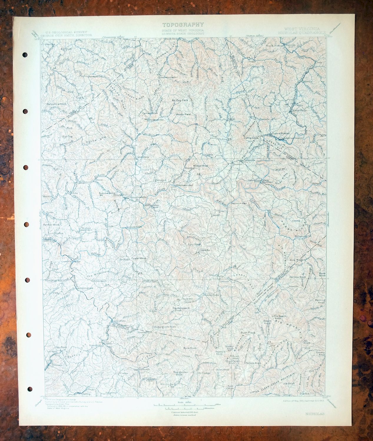
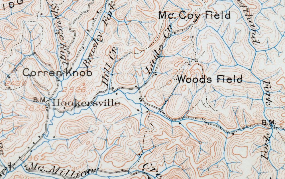
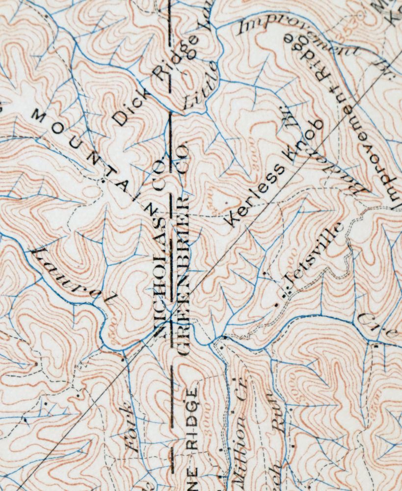
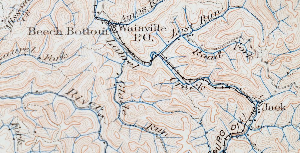
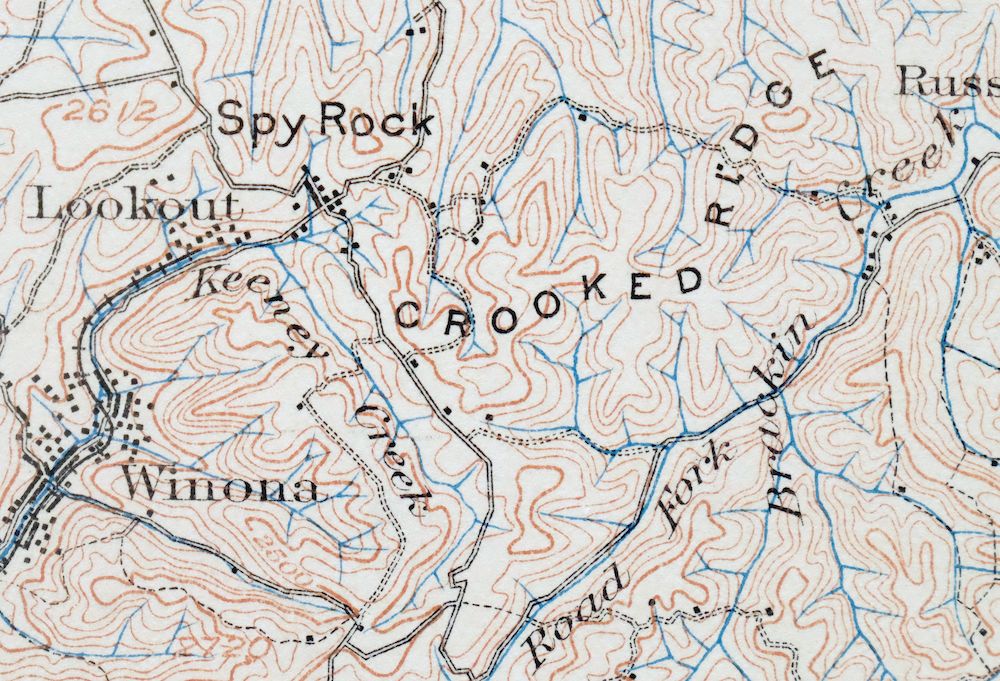
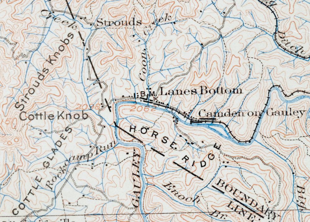
Nicholas West Virginia Summersville Cowen USGS Topo Map 1912
$54
This USGS 30-minute topographic sheet is a 1901 edition printed in 1912, and this 114-year-old antique sheet survives in excellent condition, never folded and kept smooth and flat on thick stock. The quad takes in a stretch of central West Virginia around Summersville, extending across Nicholas, Fayette, Greenbrier, Clay, and Webster counties and reaching towns such as Richwood, Craigsville, and Cowen, with part of the Monongahela National Forest within its bounds. Surveyed in the 1898 and 1899 field season and drawn before the modern highway system, it captures the Gauley River country as it was before Summersville Lake was created, showing historic travel routes, river crossings, and placenames of the era; the reverse carries printed reference material from the 1912 mapping program.
In stock
This antique sheet is a 1901 edition of the Nicholas West Virginia USGS topographic map. It is an authentic 114-year-old 1912 United States Geological Survey print in excellent condition.
HOW THIS MAP CAN BE USED
In addition to making a fascinating conversation piece, this sheet would look great in a frame or on display, make a unique and prized gift for anyone interested in this area, be perfect as a reference for genealogy studies or general historical research, or fill that missing piece in your collection.
FEATURES SHOWN ON THE MAP
The Nicholas 30-minute map shows cities and towns, roads, railroads, rivers, creeks, elevation contour lines, public land survey lines, county, state, and other administrative boundaries as they existed at the time of the survey in 1898 and 1899.
A VALUABLE HISTORICAL RECORD
Maps from the USGS 30-minute series have been out of print for many years. They have never been common and original prints are increasingly difficult to find. For areas where the 30-minute map was produced, it is usually the first large-scale survey done by the USGS for that area. These are a valuable historical record, as they contain many placenames and features that have been dropped from more recent series’ and editions.
Nearby maps
-

Sutton West Virginia Glenville Elk River USGS Topo Map 1907
$75 Add to cart -

Raleigh West Virginia Beckley Oak Hill USGS Topo Map 1901
$135 Add to cart -

Oceana West Virginia Logan Gilbert USGS Topographic Map 1912
$58 Add to cart -

Natural Bridge Virginia Covington Selma USGS Topo Map 1911
$62 Add to cart -
Staunton Virginia Stuarts Draft USGS Topographic Map 1913
$90 Add to cart -

Franklin West Virginia Petersburg Onego USGS Topo Map 1914
$49 Add to cart -

Warfield West Virginia Pikeville Harts USGS Topo Map 1911
$85 Add to cart -

Wytheville Virginia Marion Sparta USGS Topo Map 1907 Antique
$105 Add to cart -

Kenova Kentucky Louisa Grayson USGS Topo Map 1912 Antique
$54 Add to cart -

Romney West Virginia Keyser Delray USGS Topographic Map 1909
$80 Add to cart -
Appomattox Virginia Brookneal Toga USGS Topographic Map 1912
$55 Add to cart -

Whitesburg Kentucky Pikeville Cumberland USGS Topo Map 1910
$80 Add to cart -

Charleston West Virginia Cross Lanes Rand USGS Topo Map 1914
$68 Add to cart -

Peytona West Virginia Marmet Belle USGS Topographic Map 1911
$42 Add to cart -

Charleston West West Virginia Dunbar USGS Topo Map 1978
$22 Add to cart -

Pocatalico West Virginia Dunbar USGS Topographic Map 1977
$30 Add to cart -

Bald Knob West Virginia Mallory USGS Topo Map 1923 Antique
$50 Add to cart -

Saint Albans West Virginia Dunbar USGS Topographic Map 1909
$37 Add to cart -

Winfield West Virginia Bancroft Southside USGS Topo Map 1908
$37 Add to cart -

Ravenswood West Virginia New Haven Evans USGS Topo Map 1908
$40 Add to cart -

Saint Marys West Virginia Ellenboro Pike USGS Topo Map 1916
$47 Add to cart -

Marietta Ohio Wayne NF Devola USGS Topo Map 1912 Antique
$62 Add to cart -

Point Pleasant West Virginia Middleport USGS Topo Map 1908
$25 Add to cart -

Wayne West Virginia Dunlow Cove Gap USGS Topo Map 1909
$42 Add to cart
