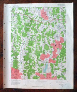
MAP DETAILS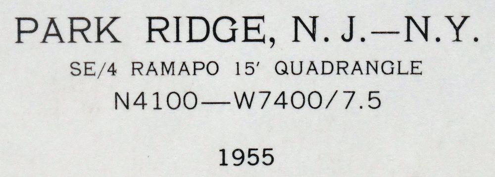 | |
|---|---|
| TITLE | Park Ridge |
| STATE | New Jersey, New York |
| SURVEYED | 1934 through 1944 Aerial and Field Survey |
| REVISIONS | Aerial revision in 1955. |
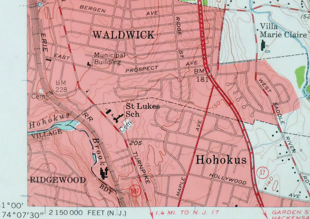
| PRINT NOTES | Thick paper stock, includes woodland tint (green to indicate vegetated areas). A reddish tint is used to indicate urban areas where only landmark buildings are shown. |
| SCALE | 1:24000 |
| CONTOUR INTERVAL | 10 feet |
| SHEET DIMENSIONS | 22 x 27 inches |
| MAP DIMENSIONS | 17 1/8 x 22 3/4 inches |
| COVERAGE AREA | 7 x 9 miles |
| SHEET CONDITION For maps of this vintage, effort is made to note all visible flaws, no matter how minor. | |
| SHEET NOTES | lightly handled, never folded |
| MAP AREA | flawless map area |
| COLLARS | no wear or tears, no markings, hole punches in left collar |
| MAP COVERAGE Quadrangle extent overlaid on current basemap. | |
| PLACENAMES Depending on map series and survey date, all of the features listed below may not be shown on this map. This list contains features that currently exist or historically existed within the area covered by the map. The list can be used as a reference to determine if this map covers your area of interest. Placenames are listed alphabetically next to each feature type. | |
| NOTABLE PLACES | Spring Valley, Hillsdale, Waldwick, and Woodcliff Lake |
| CITIES AND TOWNS (CURRENT) | Airmont, Allendale, Bardonia, Chestnut Ridge, Hillcrest, Ho-Ho-Kus, Kaser, Monsey, Montebello, Montvale, Nanuet, New City, Old Tappan, Park Ridge, Pearl River, Ramsey, Ridgewood, River Vale, Saddle River, Suffern, Tallman, Upper Saddle River, Viola, Washington Township, and Westwood |
| COUNTIES COVERED | Bergen and Rockland |
| RIVERS AND STREAMS | Allendale Brook, Bear Brook, Cherry Brook, Hackensack River, Holdrum Brook, Mill Brook, Muddy Brook, Nauraushaun Brook, Pascack Brook, Pine Brook, Pleasant Brook, Ramsey Brook, Saddle Brook, Saddle River, West Branch Saddle River, and Zabriskie Brook |
| WATER BODIES | Coles Pond, Lake Tappan, Laurel Lake, Mill Pond, Monsey Lake, Moores Pond, Penners Lake, Pine Lake, and Silver Lake |
| New Jersey Locations: Greenwood Country Club and Rivervale Country Club. Administrative Boundaries: Borough of Hillsdale, Borough of Montvale, Borough of Park Ridge, Township of River Vale, Borough of Saddle River, Borough of Upper Saddle River, and Borough of Woodcliff Lake. Valleys and Canyons: Saddle River Valley. Parks: Hillsdale Memorial Park. Drainages: Bear Brook, Cherry Brook, Hillsdale Brook, Holdrum Brook, Mill Brook, Muddy Brook, Pine Brook, Pleasant Brook, and West Branch Saddle River. Churches: Church of Saint Gabriel. Lakes and Ponds: Coles Pond. Dams: Woodcliff Lake Dam. Swamps: Bear Swamp. Schools: George W White School, Montvale Memorial School, Pascack Valley Regional High School, Saint John the Baptist School, Saint Lukes School, Wandell School, and Westside Elementary School. Reservoirs and Tanks: Anona Lake, Connoley Lake, Lake Tappan, Laurel Lake, Mill Pond, Moores Pond, Old Mill Pond, Penners Lake, Pine Lake, Silver Lake, Storm Pond, Western Reservoir, and Woodcliff Lake. | |
| New York Locations: Cedar Hollow Country Club and Masonic Camp. Mountains, Peaks, and Summits: Spook Rock. Drainages: Cherry Brook, Muddy Brook, and Pine Brook. Churches: Saint Seraphim Church and Saint Vincent De Paul Church. Hospitals: Pinehurst Nursing Home and Spring Valley General Hospital. Lakes and Ponds: Reed Pond. Buildings: Saint Agatha Home. Crossings: Interchange 14. Airports: Ramapo Heliport. Schools: Airmont School, Evans Park School, Green Meadow School, Lakeside School, Monsey School, Red Schoolhouse, Saint Anthonys School, Saint Josephs School, Saint Margarets School, Tallman School, and Yeshiva School. Reservoirs and Tanks: Island Lake and Monsey Lake. Towers: WLIR-AM (Spring Valley). | |
| SHIPPING AND RETURNS | |
 Ships carefully rolled in a sturdy 2" x 24" mailing tube. Shipping and return details are in our terms. | |
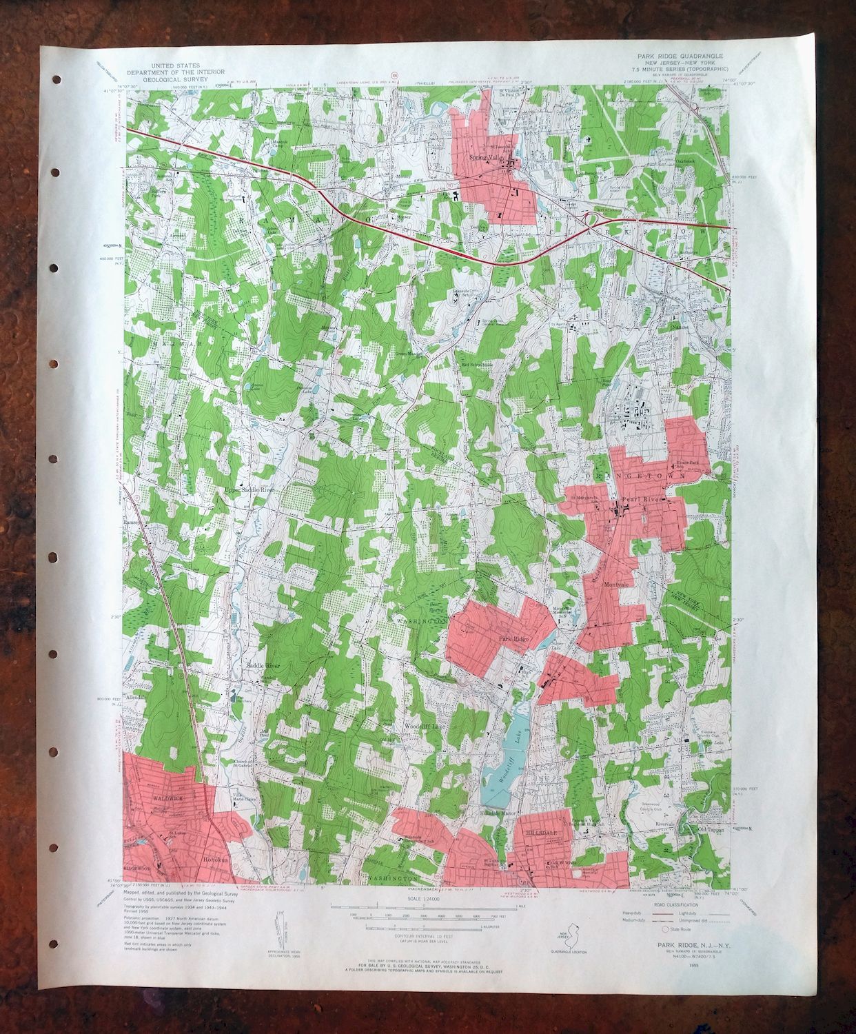
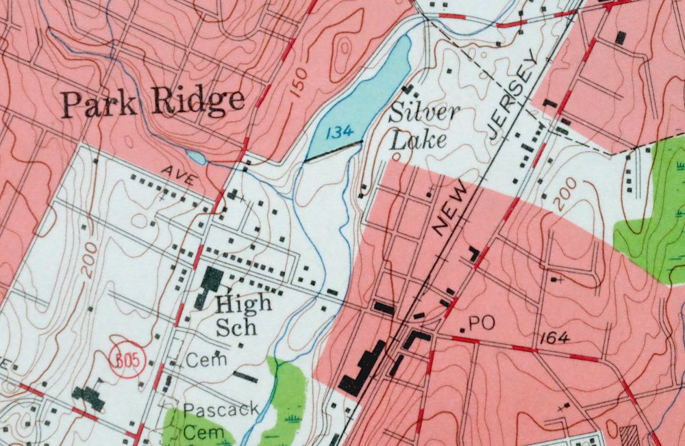
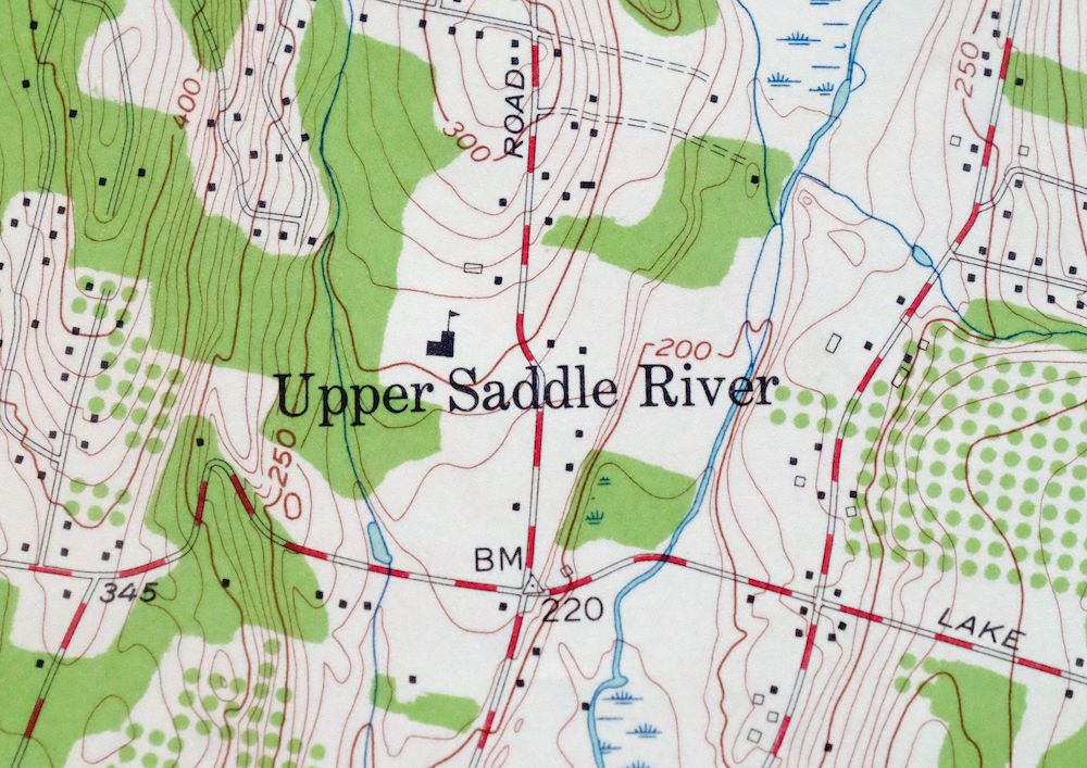
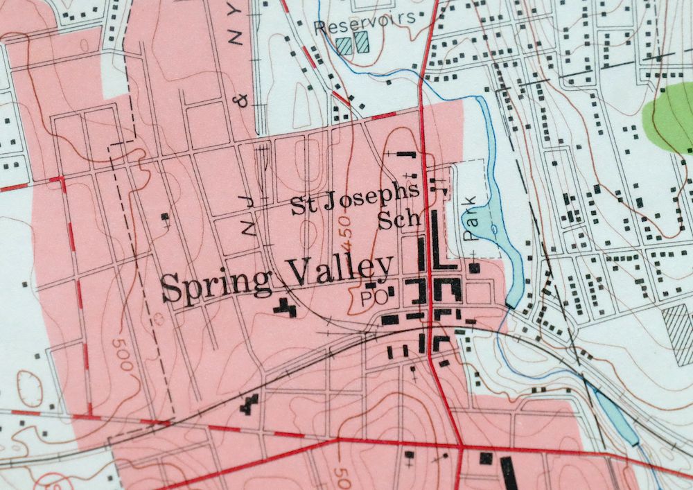
1955 USGS Topo Map: Park Ridge, New Jersey/New York
$44
- Vicinity of New City, 24 miles north of New York.
- 7.5-minute series, 1955 edition, printed in 1963.
- Very good condition, never folded.
In stock
This vintage sheet is a 1955 edition of the Park Ridge New Jersey USGS topographic map revised in 1955 using aerial photography. It is an original 63-year-old 1963 United States Geological Survey print in very good condition.
HOW THIS MAP CAN BE USED
In addition to making a fascinating conversation piece, this sheet would look great in a frame or on display, make a unique and prized gift for anyone interested in this area, be perfect as a reference for genealogy studies or general historical research, or fill that missing piece in your collection. Maps of this vintage are printed on durable stock and are well-suited for outdoor activities and recreation of all kinds, including hiking, backpacking, hunting, rafting and kayaking, backcountry skiing, geocaching, general exploration, treasure hunting, etc.
FEATURES SHOWN ON THE MAP
The Park Ridge 7.5-minute map shows cities and towns, roads, paths, railroads, utilities and energy infrastructure, rivers, creeks, elevation contour lines, public land survey lines, county, state, and other administrative boundaries as they existed at the time of the survey in 1934 through 1944. A reddish tint is used on this sheet to indicate urban areas where only landmark buildings are depicted. Outside of those areas, all known structures (houses, businesses, churches, schools, barns, cabins, etc) are shown.
A VALUABLE HISTORICAL RECORD
This map is from the 7.5-minute series, the most detailed series that is widely available from the USGS. The 1955 Park Ridge map is a valuable historical record for the area. It contains some placenames and features that have been dropped from more recent maps.
Nearby maps
-
1960 USGS Topo Map: Glenville, Connecticut/New York
$44 Add to cart -
1960 USGS Topo Map: Norwalk South, Noroton, Connecticut
$39 Add to cart -
Harlem, New York/New Jersey 1900 USGS Topo Map: Yonkers
$172 Add to cart -
Schunemunk, New York 1902 USGS Topo Map: New Windsor
$66 Add to cart -
West Point, Peekskill, New York 1901 USGS Topo Map
$77 Add to cart -

Goshen, Middletown, New York/New Jersey 1908 USGS Topo Map
$63 Add to cart -
1955 USGS Army COE Topo Map: Plainfield, New Jersey
$41 Add to cart -
1960 USGS Topo Map: Westport, Hemlock Reservoir, Connecticut
$35 Add to cart -

Danbury, Connecticut 1892 USGS Topo Map: Redding
$48 Add to cart -
Dingmans Ferry, NJ/PA 1954 USGS Army COE Topo Map
$38 Add to cart -
1954 USGS Topo Map: New Brunswick, Spotswood, New Jersey
$31 Add to cart -

1915 USGS Topo Map: Milford, Pennsylvania/New Jersey
$63 Add to cart -
Hawley, Pennsylvania 1935 USGS Topo Map (1964 Print)
$39 Add to cart -
1904 USGS Topo Map: Litchfield, Connecticut/New York
$87 Add to cart -

Trenton, New Jersey/Pennsylvania 1907 USGS Topo Map
$137 Add to cart -

Damascus, PA/NY 1920 USGS Topo Map (1964 Print)
$30 Add to cart -

1904 USGS Topo Map: Riverhead, Hampton Bays, New York
$152 Add to cart -

1904 USGS Topo Map: Burlington, PA/NJ (1958 Print)
$38 Add to cart -
Honesdale, Pennsylvania 1892 USGS Topo Map (1945 Print)
$37 Add to cart -
1946 USGS Topo Map: Olyphant, Dunmore, Pennsylvania
$36 Add to cart -
Whiting, New Jersey 1888 USGS Topo Map (1907 Print)
$79 Add to cart -
1894 USGS Topo Map: Quakertown, Hatfield, Pennsylvania
$107 Add to cart -
Germantown, Pennsylvania/New Jersey 1899 USGS Topo Map
$113 Add to cart -
Starrucca, PA/NY 1930 USGS Topo Map (1964 Print)
$33 Add to cart