MAP DETAILS | |
|---|---|
| TITLE | Ironton |
| STATE | Missouri |
| LOCATION | 15 miles southwest of Farmington |
| SERIES | 15-minute |
| EDITION | 1945 |
| PRINTED | 1968 |
| PRINT NOTES | Thick paper stock, includes woodland tint (green to indicate vegetated areas) |
| SCALE | 1:62500 |
| SHEET DIMENSIONS | 16 1/2 x 20 inches (approximate) |
| MAP DIMENSIONS | 13 7/8 x 17 1/2 inches |
| COVERAGE AREA | 14 x 17 miles |
| SHEET CONDITION For maps of this vintage, effort is made to note all visible flaws, no matter how minor. | |
| OVERALL CONDITION | Good |
| SHEET NOTES | moderately handled, never folded, crease in upper right sheet corner |
| MAP AREA | flawless map area |
| COLLARS | very minor wear or tears, no markings, minor blemishes, small inventory stamp in bottom collar |
| MAP COVERAGE Quadrangle extent overlaid on current basemap. | |
| PLACENAMES Depending on map series and survey date, all of the features listed below may not be shown on this map. This list contains features that currently exist or historically existed within the area covered by the map. The list can be used as a reference to determine if this map covers your area of interest. Placenames are listed alphabetically next to each feature type. | |
| CITIES AND TOWNS (CURRENT) | Arcadia, Belleview, Iron Mountain, Iron Mountain Lake, Ironton, Pilot Knob, and Roselle |
| COUNTIES COVERED | Iron, Madison, St. Francois, and Washington |
| FEDERAL LAND UNITS | Mark Twain National Forest |
| RIVERS AND STREAMS | Allen Branch, Belleview Creek, Big Creek, Carver Creek, Cedar Creek, Chambers Creek, Charles Creek, Claybaugh Creek, Doe Run Creek, East Fork Black River, Knob Creek, Little Creek, Little Taum Sauk Creek, Long Gravel Branch, Lost Creek, Lower Rock Creek, Marble Creek, Middlebrook Creek, Minor Creek, Mud Creek, Patterson Creek, Rock Creek, Saint Francis River, Saline Creek, Taum Sauk Creek, Townsen Creek, and West Branch Knob Creek |
| WATER BODIES | Hill View Lake, Iron Mountain Tailings Pond, Lake Avalon, and Shepherd Mountain Lake |
| Locations: Arcadia Valley Bible Camp, Arcadia Valley Golf Club, Blue Mountain Camp, Brown Row, Iron County Farm, Site of Fort Davidson, Tip Top, and Tip Top Picnic Area. Administrative Boundaries: Township of Iron, Township of Iron, and Township of Pendleton. Mountain Ranges: Saint Francois Mountains and Sainte Francois Mountains. Mountains, Peaks, and Summits: Crane Mountain, Anderson Mountain, Blankenship Mountain, Bald Knob, Bread Tray Mountain, Brown Mountain, Buck Mountain, Buford Mountain, Buzzards Roost, Cedar Hill, College Hill, Cord Wood Hill, Cuthbertson Mountain, Grassy Mountain, Hogan Mountain, Iron Mountain, Kelley Mountain, Ketcherside Mountain, Little Iron Mountain, Little Knob, Little Stono Mountain, McLard Hill, Middlebrook Hill, Oak Mountain, Pilot Knob, Pine Mountain, Reservoir Hill, Rocky Knob, Russell Mountain, Shepherd Mountain, Stono Mountain, Stony Point, Taum Sauk Mountain, Tims Mountain, Tribby Mountain, Turkey Foot Mountain, Vail Mountain, Van East Mountain, Victory Mountain, and Wolf Mountain. Valleys and Canyons: Barren Hollow, Devils Den Hollow, Froe Hollow, Ironton Hollow, Magee Hollow, South Spring Hollow, and Wallace Hollow. Parks: Elephant Rocks State Park. Trails: Taum Sauk Trail. Drainages: Belleview Creek, Buckner Branch, Chambers Creek, Charles Creek, Claybaugh Creek, East Branch Knob Creek, First Creek, Indian Creek, Knob Creek, Logan Creek, Long Gravel Branch, Middlebrook Creek, Minor Creek, Mud Creek, Palmer Creek, Rock Creek, Townsen Creek, West Branch Knob Creek, and White Creek. Mines: Ackhurst Iron Bank, Big Bogy Mountain Iron Bank, Bogy Ore Bend, Cartey and Mann Limestone Quarries, Cedar Hill Iron Mine, Cuthbertsons Iron Bank, Doe Run Lead Mines, Hastings Limestone Quarry, Hogan Mountain Iron Mines, Hollman Brothers Limestone Quarry, Leeds Hill Iron Bank, Phil Schneider Granite Quarries, Pilot Knob Granite Quarry, Russell Limestone Quarry, Sarah P Childers Marble Quarry, Schneider Companys Quarry, Sheahan Brothers Granite Quarry, and Syenite Granite Companys Quarry. Churches: Assembly of God Church, Mount Hope Church, Stono Union Church, Stouts Creek Church, Tabernacle Church, and Victory Church. Waterfalls: Mina Sauk Falls. Dams: Black Lower Lake Dam, Black Upper Lake Dam, Hematite Lake Dam, Iron Mountain Lake Dam, Iron Mountain Tailings Pond Dam, Lake 2 Dam, Lake Avalon Dam, Lake Killarney Dam, Lake Number 1 Dam, Scott Lake Dam, Shepard Mountain Dam, Snow Hollow Dam, Sylvan Lake Dam, and Wing Lake Dam. Gaps: Ketcherside Gap, Royal Gorge, and Wagon Wheel Gap. Airports: Dove Airstrip and Sky Ranch II Airport. Schools: Arcadia Valley School, Barren Hollow School, Belleview School, Cedar Bluff School, Cove School, Flatwoods School, Hogan School, Iron Mountain School, Red School, Stono School, Ursuline Academy, and White School. Reservoirs and Tanks: Hemitite Lake, Hill View Lake, Iron Mountain Lake, Iron Mountain Tailings Pond, Lake Avalon, Lake Killarney, Ozark Ore Company Lake, Pilot Knob Lake, Pilot Knob Pellet Company Lake Number 2, S G Powell Lake, Shepherd Mountain Lake, Snow Hollow Lake, and Wing Lake. Towers: KTJJ-FM (Farmington) and KYLS-FM (Ironton). Springs: Sunny Slope Spring. | |
| SHIPPING AND RETURNS | |
 This map sheet will be carefully rolled in a sturdy tube and shipped via the US Postal Service. If you find that the sheet you receive is not as described in the listing, you may ship it back to us for a refund of the purchase price. | |
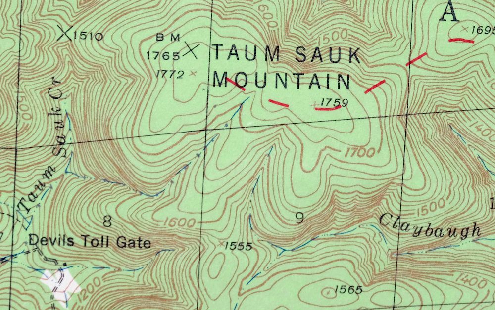
Ironton Missouri Mark Twain NF Pilot Knob USGS Topo Map 1968
$37
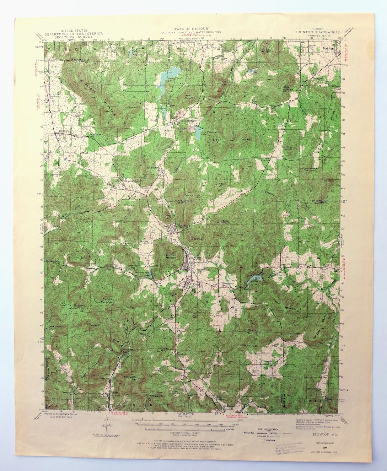
This USGS 15-minute topographic map of Ironton, Missouri is a 1945 edition printed in 1968, in good condition on thick stock with a flawless map area and a never-folded sheet, marked only by moderate handling and a crease in the upper right corner. Set about 15 miles southwest of Farmington, the quad takes in Ironton, Pilot Knob, Arcadia, and Iron Mountain Lake across Iron, Madison, St. Francois, and Washington counties, along with part of the Mark Twain National Forest. The place names here trace the old iron-mining country of southeastern Missouri, where Pilot Knob and Iron Mountain gave the region its name and its industry.
In stock
This vintage sheet is a 1945 edition of the Ironton Missouri USGS topographic map. It is an original 58-year-old 1968 United States Geological Survey print in good condition.
HOW THIS MAP CAN BE USED
In addition to making a fascinating conversation piece, this sheet would look great in a frame or on display, make a unique and prized gift for anyone interested in this area, be perfect as a reference for genealogy studies or general historical research, or fill that missing piece in your collection. Maps of this vintage are printed on durable stock and are well-suited for outdoor activities and recreation of all kinds, including hiking, backpacking, hunting, rafting and kayaking, backcountry skiing, geocaching, general exploration, treasure hunting, etc.
FEATURES SHOWN ON THE MAP
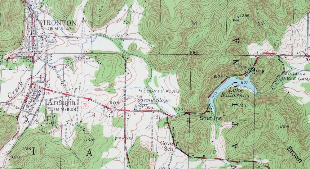
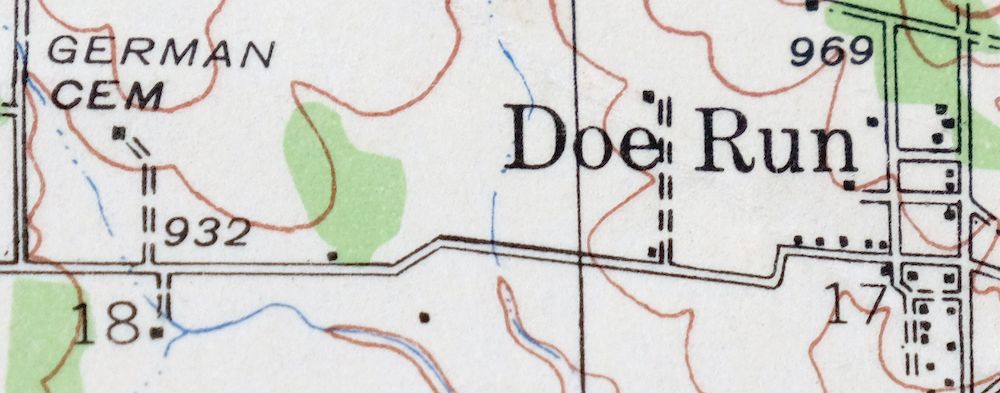
The Ironton 15-minute map shows cities and towns, roads, railroads, utilities and energy infrastructure, rivers, creeks, elevation contour lines, public land survey lines, county, state, and other administrative boundaries as they existed at the time of the survey. All known structures (houses, businesses, churches, schools, barns, cabins, etc) are also shown.
A VALUABLE HISTORICAL RECORD
Maps from the 15-minute series for the continental United States are no longer produced or printed by the USGS and original prints are becoming increasingly difficult to find. They are a valuable historical record for an area, as they contain many placenames and features that have been dropped from more recent maps.
Nearby maps
-
Potosi Missouri Mark Twain NF Caledonia USGS Topo Map 1906
$55 Add to cart -
Renault Illinois Ste. Genevieve Red Bud USGS Topo Map 1915
$45 Add to cart -

Chester Missouri Perryville Saint Mary USGS Topo Map 1964
$44 Add to cart -

Sullivan Missouri Mark Twain NF Union USGS Topo Map 1916
$42 Add to cart -

Cahokia Illinois St. Louis Dupo USGS Topographic Map 1975
$50 Add to cart -

Jonesboro Illinois Cape Girardeau Anna USGS Topo Map 1963
$42 Add to cart -

Granite City Illinois St. Louis Jennings USGS Topo Map 1982
$48 Add to cart -

Florissant Missouri Hazelwood Ferguson USGS Topo Map 1982
$38 Add to cart -

Cairo Illinois Mounds Barlow USGS Topo Map 1964 Vintage
$41 Add to cart -
Alton Illinois Godfrey East Alton USGS Topographic Map 1986
$37 Add to cart -
Bethalto Illinois Alton Wood River USGS Topographic Map 1977
$43 Add to cart -
Carlyle Illinois Beckemeyer Huey USGS Topographic Map 1910
$40 Add to cart -

Hardin Illinois Fieldon Batchtown USGS Topo Map 1964 Vintage
$42 Add to cart -
Pleasant Mound Illinois Tamalco USGS Topographic Map 1977
$28 Add to cart -
Patoka Illinois Vernon Shobonier USGS Topo Map 1977 Vintage
$32 Add to cart -

Pearl Illinois Kampsville Eldred USGS Topo Map 1956 Vintage
$40 Add to cart -
Raymond Illinois Farmersville Waggoner USGS Topo Map 1925
$46 Add to cart -

New Haven Illinois Ridgway Herald USGS Topo Map 1920 Antique
$24 Add to cart -
New Haven Illinois Ridgway Herald USGS Topo Map 1920 Antique
$38 Add to cart -

Effingham Illinois Altamont Watson USGS Topographic Map 1964
$50 Add to cart -

Quincy Illinois Hannibal Payson USGS Topo Map 1962 Vintage
$43 Add to cart -
Springfield East Illinois Sherman USGS Topo Map 1973 Vintage
$32 Add to cart -

Millington Tennessee Memphis USGS Topo Map 1994 Contemporary
$40 Add to cart -
Jackson North Tennessee Oakfield USGS Topographic Map 1980
$48 Add to cart