MAP DETAILS | |
|---|---|
| TITLE | Payson |
| STATE | Arizona |
| LOCATION | 60 miles northeast of Phoenix |
| SERIES | 15-minute |
| SURVEYED | 1935 and 1936 Field Survey |
| GEOGRAPHER | W.R. Chenoweth |
| EDITION | 1936 |
| PRINTED | 1965 |
| PRINT NOTES | Thick paper stock |
| SCALE | 1:62500 |
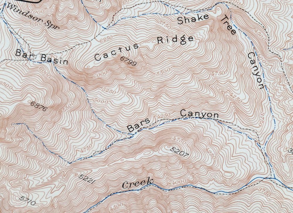
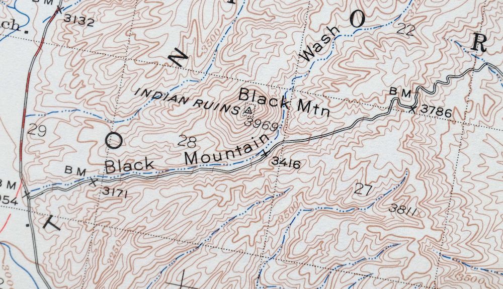
| CONTOUR INTERVAL | 50 feet |
| SHEET DIMENSIONS | 16 7/8 x 21 inches |
| MAP DIMENSIONS | 14 1/2 x 17 1/2 inches |
| COVERAGE AREA | 14 x 17 miles |
| SOURCE | From the vintage map collection of Art Christiansen, Tempe, Arizona |
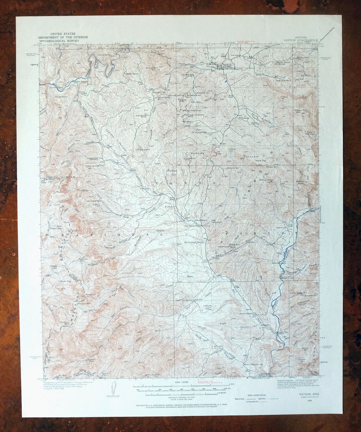
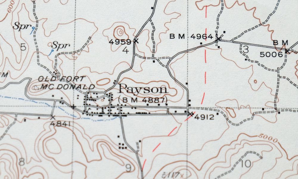
| MAP NOTES | A fascinating historical snapshot of the Payson area southward to present-day Jake's Corner, surveyed before the existence of the Beeline Highway, showing historic travel routes, placenames, and all houses known at the time. |
| SHEET CONDITION For maps of this vintage, effort is made to note all visible flaws, no matter how minor. | |
| OVERALL CONDITION | Excellent |
| SHEET NOTES | very lightly handled, never folded, smooth and flat |
| MAP AREA | flawless map area |
| COLLARS | no markings, no blemishes |
| MAP COVERAGE Quadrangle extent overlaid on current basemap. | |
| PLACENAMES Depending on map series and survey date, all of the features listed below may not be shown on this map. This list contains features that currently exist or historically existed within the area covered by the map. The list can be used as a reference to determine if this map covers your area of interest. Placenames are listed alphabetically next to each feature type. | |
| NOTABLE PLACES | Gisela, Mazatzal Mountains, and Tonto Basin |
| CITIES AND TOWNS (CURRENT) | Jakes Corner, Payson, and Sun Valley |
| COUNTIES COVERED | Gila, Maricopa, and Yavapai |
| FEDERAL LAND UNITS | Hellsgate Wilderness, Mazatzal Wilderness, and Tonto National Forest |
| RIVERS AND STREAMS | Alder Creek, Bear Creek, Black Mountain Wash, Boone Moore Wash, Callahan Creek, Center Creek, City Creek, Clover Wash, Deer Creek, Del Shay Creek, Delaware Wash, Dennis Creek, East Verde River, Gibson Creek, Gold Creek, Gun Creek, Hardt Creek, Hill Creek, House Creek, Houston Creek, Mineral Creek, Moore Wash, North Fork Deadman Creek, Pine Creek, Rock Creek, Rye Creek, Saint Johns Creek, Sand Wash, South Fork Deadman Creek, South Fork Deer Creek, Stewart Creek, Sycamore Creek, Sycamore Wash, Tonto Creek, Wet Bottom Creek, and Zulu Wash |
| Locations: Bar T Bar Ranch, Brown Ranch, Chilson Camp, City Creek Trailhead, Doll Baby Ranch, Doll Baby Trailhead, Fox Farm, H Bar Ranch, Hi Windmill, Mineral Creek Trail, N B Ranch, Payson Country Club, Payson Ranger Station, Red Hills Corral, Seventy Six Ranch, and Windsor Camp. Reserves: Payson Indian Reservation. Mountains, Peaks, and Summits: Barnhardt Mesa, Bishop Knoll, Bishop Nose, Black Mountain, Boyd Mountain, Cottonwood Mountain, Felton Mountain, Fisher Mesa, Gibson Peak, Gold Hill, Haycox Mountain, Marysville Hill, Mazatzal Peak, Monument Peak, Moore Mountain, North Peak, Oxbow Hill, Mount Peeley, Red Hills, Snowstorm Mountain, Sorghum Hill, Table Mountain, Table Top, and Yerba Senta Butte. Valleys and Canyons: Alkali Canyon, American Gulch, Arrastre Gulch, Barnhardt Canyon, Bars Canyon, Bee Canyon, The Box, Brady Canyon, Brushy Hollow, Cocomunga Canyon, Cottonwood Canyon, Eisenhauer Canyon, Flume Hollow, Green Valley, Haycox Canyon, Hells Hole, Hog Canyon, Jones Canyon, Limestone Canyon, Lousy Gulch, Maple Draw, Midget Draw, Neal Canyon, Oxbow Gulch, Pole Hollow Canyon, Rattlesnake Canyon, Round Valley, Shake Tree Canyon, Sorghum Canyon, Summit Canyon, Table Mountain Canyon, Thompson Draw, Willow Spring Canyon, and Wonder Gulch. Woods: Cypress Thicket. Parks: Payson Rodeo Grounds and Rumsey Park. Trails: Barnhardt Trail, Mazatzal Divide, Mazatzal Divide Trail, North Peak Trail, and Shake Tree Trail. Drainages: Alder Creek, Boone Moore Wash, Bear Creek, Black Mountain Wash, Callahan Creek, Center Creek, City Creek, Clover Wash, Deer Creek, Del Shay Creek, Delaware Wash, Dennis Creek, Gibson Creek, Hill Creek, House Creek, Houston Creek, Mineral Creek, Moore Wash, Pine Creek, Rock Creek, Rye Creek, Saint Johns Creek, Sand Wash, South Fork Deer Creek, Sycamore Wash, and Zulu Wash. Mines: Bishop Peak Tank, Callahan Mine, Collom Mine, Delaware Mine, Excursion Mine, Gold Hill Mine, Golden Wonder Mine, Harris Tank, House Mine, Little Green Mine, Little Maud Mine, Maggie Mine, Midget Mine, Neal Tank, Oxbow Mine, Pay Rock Mine, Rocky Ford Mine, Royal Flush Mine, Silver King Mine, Single Standard Mine, Thompson Mine, Waif Mine, and Zulu Mine. Hospitals: Payson Hospital. Buildings: Payson Fire Station. Gaps: Breakdown Saddle, The Narrows, and Sandy Saddle. Basins: Curry Basin, Hole in the Ground, Stewart Pocket, and Y Bar Basin. Airports: Lacy Airport. Schools: Julia Randall School, Payson High School, and Payson Junior High School. Ridges: Cactus Ridge, Shake Ridge, and Suicide Ridge. Reservoirs and Tanks: Alkali Tank, American Tank, Arrastre Tank, Barnhardt Mesa Tank, Barnhardt Tank, Bassett Tank, Beeline Tank, Big Tank, Bishop Knoll Tank, Bear Creek Tank, Black Mountain Tank, Browse Tank, Cal Tank, Callahan Tank, Cedar Knoll Tank, Coulee Tank, Elephant Head Tank, Fisher Tank, Gisela Tank, Gold Hill Tank, Goldfish Tank, Hale Tank, Hill Cabin Tank, Hill Tank, Jackson Tank, Joe Tank, Lousy Tank, Lower Barnhardt Tank, Mesa Tank, Munro Reservoir, North Tank, Orchard Tank, Oxbow Tank, Pasture Tank, Peace Tank, Rye Creek Tank, Saddle Tank, Saint Johns Tank, Shake Ridge Tank, Snowstorm Tank, South Fork Tank, South of Bar T Tank, Stewart Tank, Suicide Tank Number One, Suicide Tank Number Two, Table Top Tank, Three V Tank, Tom Tank, Trezise Tank, Willow Tank, Y Bar Tanks, Zula Tank Number Two, and Zulu Tank. Flats: The Park, Simonton Flat, and Weymouth Flat. Wells: Boone Moore Well, City Creek Well, Clover Well, Gold Creek Well, Hardt Creek Well, Harris Well, Headquarters Well, Hitching Rack Well, Hitching Rock Well, Indian Farm Well, and Rye Creek Well. Springs: Alkali Spring, Barnett Spring, Blue Spring, Boone Moore Spring, Booth Spring, Bear Spring, Bee Spring, Boyd Mountain Spring, Brody Seep, Brown Spring, Brushy Basin Spring, Calvin Spring, Castersen Seep, Chilson Spring, Dennis Spring, Eisenhauer Spring, Felton Spring, Fisher Spring, Garden Spring, Gibson Spring, Gilmore Spring, Gould Springs, Grape Spring, Grapevine Spring, Grimes Spring, Half Moon Spring, Hanging Rock Spring, Hidden Spring, Hog Canyon Spring, Hopi Spring, Horse Camp Seep, House Place Spring, Larsen Spring, Lincoln Spring, Malpais Spring, Mantkin Spring, Maple Spring, Martin Spring, Mineral Spring, Mud Spring, Neal Spring, Oak Spring, Peach Orchard Spring, Pig Spring, Pigeon Spring, Pole Hollow Spring, Red Mountain Spring, Sand Wash Spring, Sand Wash Spring Number Two, Sedge Spring, Surprise Spring, Sycamore Spring, Table Spring, Turkey Spring, Upper Hog Canyon Spring, Willow Spring, Windsor Spring, and Yellow Jacket Spring. | |
| SHIPPING AND RETURNS | |
 This map sheet will be carefully rolled in a sturdy tube and shipped via the US Postal Service. If you find that the sheet you receive is not as described in the listing, you may ship it back to us for a refund of the purchase price. | |
1965 Payson Arizona USGS Topo Map: Gisela (1936 Edition)
$50
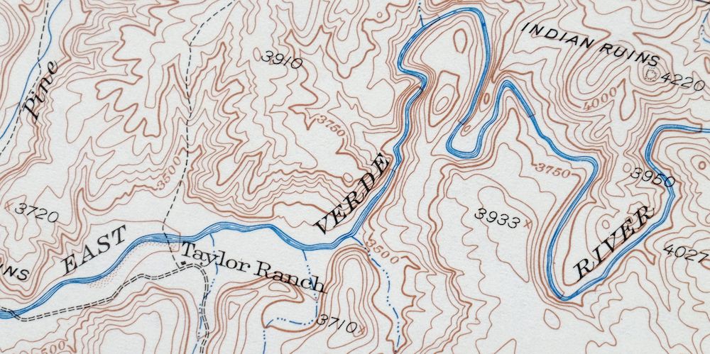
A fascinating historical snapshot of the Payson area southward to present-day Jake’s Corner, surveyed before the existence of the Beeline Highway, showing historic travel routes, placenames, and all houses known at the time. This 15-minute topographic sheet carries the 1936 edition of the Payson quad, surveyed in 1935 and 1936 and printed in 1965 on thick paper. It covers a 14-by-17-mile stretch of central Arizona about 60 miles northeast of Phoenix, taking in Payson, Gisela, and the community of Jakes Corner, with the Mazatzal Mountains and Tonto Basin, and portions of the Tonto National Forest.
In stock
This vintage sheet is a 1936 edition of the Payson Arizona USGS topographic map. It is an original 61-year-old 1965 United States Geological Survey print in excellent condition.
HOW THIS MAP CAN BE USED
In addition to making a fascinating conversation piece, this sheet would look great in a frame or on display, make a unique and prized gift for anyone interested in this area, be perfect as a reference for genealogy studies or general historical research, or fill that missing piece in your collection. Maps of this vintage are printed on durable stock and are well-suited for outdoor activities and recreation of all kinds, including hiking, backpacking, hunting, rafting and kayaking, backcountry skiing, geocaching, general exploration, treasure hunting, etc.
FEATURES SHOWN ON THE MAP
The Payson 15-minute map shows cities and towns, roads, railroads, utilities and energy infrastructure, rivers, creeks, elevation contour lines, public land survey lines, county, state, and other administrative boundaries as they existed at the time of the survey in 1935 and 1936. All known structures (houses, businesses, churches, schools, barns, cabins, etc) are also shown, with exceptions in some urban areas, where only landmark buildings may be shown.
A VALUABLE HISTORICAL RECORD
Maps from the 15-minute series for the continental United States are no longer produced or printed by the USGS and original prints are becoming increasingly difficult to find. They are a valuable historical record for an area, as they contain many placenames and features that have been dropped from more recent maps.
Nearby maps
-
Payson Arizona Sun Valley Gisela USGS Topo Map 1965 Vintage
$64 Add to cart -
Pine Arizona Payson Sun Valley USGS Topo Map 1940 Antique
$45 Add to cart -
Promontory Butte Arizona Coconino NF USGS Topo Map 1960
$46 Add to cart -
Woods Canyon Arizona Sitgreaves NF USGS 15-Min Topo Map 1963
$35 Add to cart -
Chediski Peak Arizona Cibecue USGS Topo Map 1963 Vintage
$32 Add to cart -

Camelback Arizona Tonto NF Phoenix USGS 15-Min Topo Map 1948
$55 Add to cart -

Superior Arizona Top-of-the-World USGS Topo Map 1957 Vintage
$45 Add to cart -

Desert Well Arizona Apache Junction Mesa USGS Topo Map 1906
$65 Add to cart -
Mingus Mountain Arizona Cottonwood USGS Topographic Map 1970
$51 Add to cart -
Cibecue Arizona Sitgreaves NF USGS Topo Map 1963 Vintage
$32 Add to cart -
Crown King Arizona Prescott NF USGS Topo Map 1955 Vintage
$46 Add to cart -

Crown King Arizona Prescott NF USGS Topo Map 1950 Vintage
$33 Add to cart -
Globe Arizona Miami Claypool USGS Topo Map 1955 Vintage
$54 Add to cart -
Globe Arizona Miami Claypool USGS Topo Map 1910 Antique
$85 Add to cart -

Mesa Arizona Phoenix Scottsdale USGS Topo Map 1960 Vintage
$75 Add to cart -

Mount Union Arizona Prescott NF Mayer USGS Topo Map 1949
$34 Add to cart -
Clay Springs Arizona Pinedale Aripine USGS Topo Map 1971
$34 Add to cart -
Mount Union Arizona Prescott NF Mayer USGS Topo Map 1964
$43 Add to cart -
Prescott Arizona Chino Valley Williamson USGS Topo Map 1948
$25 Add to cart -

Clarkdale Arizona Cottonwood Jerome USGS Topo Map 1948
$44 Add to cart -
1960 Phoenix Arizona USGS Topo Map: Tolleson
$50 Add to cart -
Turret Peak Arizona Camp Verde Pine USGS Topo Map 1933
$65 Add to cart -
1962 Turret Peak Arizona USGS Topo Map: Verde River
$54 Add to cart -
Roosevelt Arizona Four Peaks Tonto Basin USGS Topo Map 1956
$52 Add to cart
