MAP DETAILS | |
|---|---|
| TITLE | Clarkdale |
| STATE | Arizona |
| LOCATION | Vicinity of Cottonwood |
| SERIES | 15-minute |
| SURVEYED | 1944 Aerial and Field Survey |
| EDITION | 1948 |
| REVISIONS | 1947 |
| PRINTED | 1948 |
| PRINT NOTES | Thick paper stock |
| SCALE | 1:62500 |
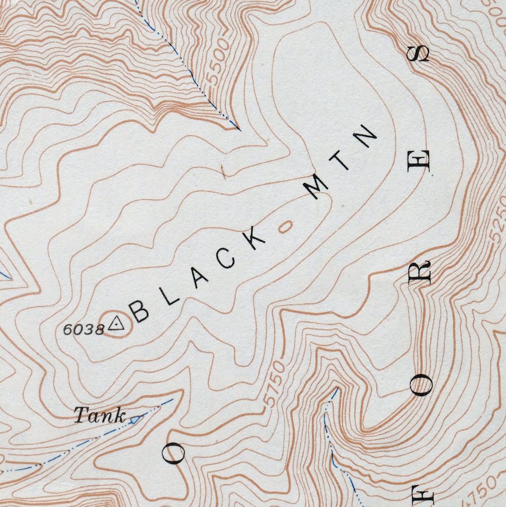
| CONTOUR INTERVAL | 50 feet |
| SHEET DIMENSIONS | 17 x 20 7/8 inches |
| MAP DIMENSIONS | 14 3/8 x 17 1/2 inches |
| COVERAGE AREA | 14 x 17 miles |
| SOURCE | From the vintage map collection of Art Christiansen, Tempe, Arizona |
| SHEET CONDITION For maps of this vintage, effort is made to note all visible flaws, no matter how minor. | |
| OVERALL CONDITION | Very Good |
| SHEET NOTES | moderately handled, never folded |
| MAP AREA | no wear, no markings, no blemishes |
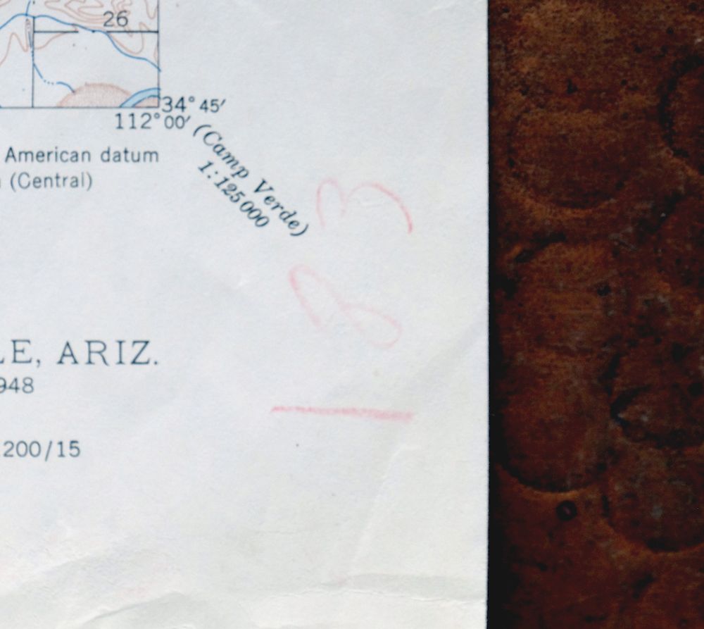
| COLLARS | no wear or tears, no blemishes, light colored pencil inventory notations in collar |
 | |
| MAP COVERAGE Quadrangle extent overlaid on current basemap. | |
| BACKSIDE LEGEND | |
 A map summary is printed on the back side of the Clarkdale sheet similar to the one shown in the picture. It outlines the history, purpose, and status of the USGS mapping program at the time of the printing in 1948. It also provides instructions on how to read contour lines and a description of how they are used to depict the terrain. At the bottom of the page is a legend showing all of the symbols used to represent the cultural, relief, and water features found on the map. | |
| PLACENAMES Depending on map series and survey date, all of the features listed below may not be shown on this map. This list contains features that currently exist or historically existed within the area covered by the map. The list can be used as a reference to determine if this map covers your area of interest. Placenames are listed alphabetically next to each feature type. | |
| CITIES AND TOWNS (CURRENT) | Clarkdale, Cottonwood, Cottonwood-Verde Village, Jerome, and Perkinsville |
| COUNTIES COVERED | Coconino and Yavapai |
| FEDERAL LAND UNITS | Coconino National Forest, Prescott National Forest, Red Rock-Secret Mountain Wilderness, Sycamore Canyon Wilderness, Tuzigoot National Monument, and Woodchute Wilderness |
| RIVERS AND STREAMS | Bitter Creek, Cedar Creek, Sycamore Creek, and Verde River |
| WATER BODIES | Pecks Lake |
| Locations: American Cement Corporation Substation, Daisy, Packard Ranch, Tapco Cliff Dwellings, Tapco Power Plant and Substation, Verde Valley Country Club, and Verde Valley Lookout. Mountain Ranges: Antelope Hills. Reserves: Camp Verde Indian Reservation. Mountains, Peaks, and Summits: Black Mountain, First View, Little Black Mesa, and Packard Mesa. Valleys and Canyons: CCC Canyon, Deception Gulch, Government Canyon, Horseshoe Canyon, Mescal Gulch, Munds Draw, Orchard Draw, Rafael Draw, Railroad Draw, S O B Canyon, Sycamore Canyon, and Wildcat Draw. Parks: Clarkdale Park, Dead Horse Ranch State Park, Jerome State Historic Park, Tuzigoot National Monument, and Woodchute Wilderness. Trails: Packard Trail Nmber Sixty Six, Sycamore Basin Trail, and Tuzigoot Trail. Drainages: Bitter Creek, Cedar Creek, and Sycamore Creek. Mines: A and A Shaft, Dundee Shaft, Haynes Shaft, Texas Shaft, and United Verde Mine. Buildings: Bear Railroad Station, Clarkdale Railroad Station, Jerome State Historical Mine Park Museum, Perkinsville Railroad Station, Phoenix Cement Plant, Sycamore Railroad Station, and Tapco Railroad Station. Dams: Red Point Tank Dam. Gaps: Bakers Pass. Basins: Mormon Pocket and Sycamore Basin. Swamps: Tavasel Marsh. Schools: Clarkdale Elementary School and Clarkdale Junior High School. Reservoirs and Tanks: Antelope Tank, Archibald Tank, Arrow Tank, Bakers Pass Tank, Bodkin Tank, Boggy Tank, Black Hills Tank, Black Mesa Number Two Tank, Black Mesa Tank Number One, Black Mesa Tank Number Two, Black Mountain Tank, Bull Tank, CCC Tank, Canyon Tank, China Dam Tank, Cliff Tank, Collins Tank, Contrary Tank, Coon Tank, Coyote Tank, Cross D Tank, Dam Tank, Deadman Tank, Dogie Tank, Dripping Spring Tank, Gale Tank, Halfway Tank, Harolds Tank, Henderson Tank, Henry Tank, Hieneken Tank, Honey Bee Tank, Horney Tank, Horse Camp Tanks, Horseshoe Tank, Howards Tank, Indian Tank, Jimmy Tank, Little Sand Tank, Lonesome Pocket Tank, Lost Arrow Head Tank, Mark Tank, McDaniel Tank, Mexican Tank, Mormon Pocket Tank, Munds Tank Number One, Munds Tank Number Two, Munds Trick Tank, Narrow Gauge Tank, Ocotillo Tank, Packard Trail Tank, Pass Tank, Pecks Lake, Pocket Tank, Quarry Tank, Rafael Tank, Railroad Draw Tank, Railroad Tank, Red Flat Tank, Red Point Tank, Road Canyon Tank, Road Tank, Rogers Tank, Sand Flat Tank, Sand Trap Tank, Shed Tank, Sheep Camp Tank, Smokey Tank, Straham Tank, Sycamore Basin Tank, Sycamore Pass Tank, Sycamore Tank, Telephone Draw Tank, Trestle Tank, Upper Mormon Pocket Tank, Vineyard Tank, Wells Tank, Williams Tank, Willows Tank, Witty Tom Tank, and Wood Trail Tank. Flats: Cow Flat, Duff Flat, Henderson Flat, Red Flat, and Sand Flat. Tunnels: Hopewell Tunnel and Josephine Tunnel. Towers: KCRJ-FM (Cottonwood) and KSMK-FM (Cottonwood). Wells: D K Well, Ott Well, and Red Point Well. Springs: Black Butte Spring, Black Seep, Dripping Spring, Elderberry Spring, Hogpen Spring, Mexican Seep, Parsons Spring, Sand Seeps, Section House Spring, Shea Spring, Slaughterhouse Spring, Summers Spring, Thatch Hut Spring Number One, and Thatch Hut Spring Number Two. | |
| SHIPPING AND RETURNS | |
 This map sheet will be carefully rolled in a sturdy tube and shipped via the US Postal Service. If you find that the sheet you receive is not as described in the listing, you may ship it back to us for a refund of the purchase price. | |
Clarkdale Arizona Cottonwood Jerome USGS Topo Map 1948
$44
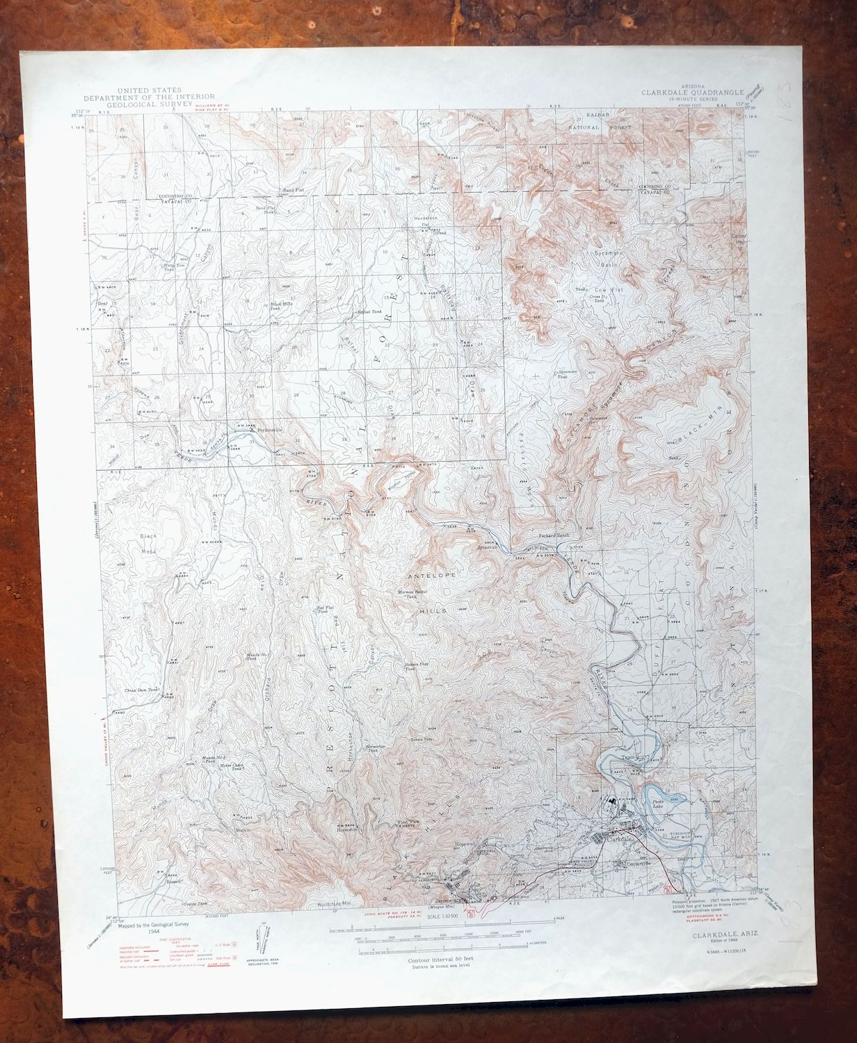
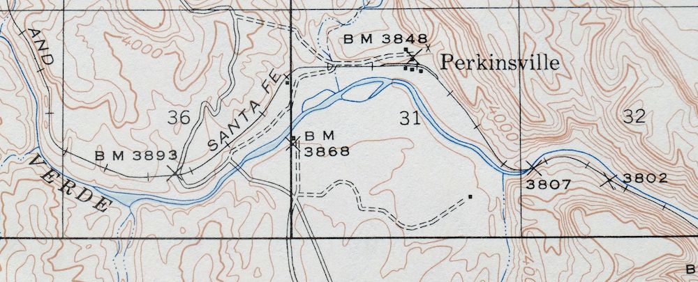
Printed in its year of first publication, this 1948 USGS 15-minute topographic sheet of the Clarkdale quad is in very good condition, moderately handled and never folded on thick stock. The quad takes in a stretch of Arizona’s Verde Valley, including Clarkdale, Cottonwood, and the old copper-mining town of Jerome, along with Perkinsville and portions of the Prescott and Coconino National Forests, the Sycamore Canyon and Woodchute Wilderness areas, and Tuzigoot National Monument. The map captures the region in the years when the Jerome mines were still working, and the reverse carries printed reference material on reading the map. This sheet comes from the vintage map collection of Art Christiansen of Tempe, Arizona, with light colored-pencil inventory notations in the collar.
In stock
This vintage sheet is a 1948 edition of the Clarkdale Arizona USGS topographic map. It is an original 78-year-old United States Geological Survey print in very good condition.
HOW THIS MAP CAN BE USED
In addition to making a fascinating conversation piece, this sheet would look great in a frame or on display, make a unique and prized gift for anyone interested in this area, be perfect as a reference for genealogy studies or general historical research, or fill that missing piece in your collection.
FEATURES SHOWN ON THE MAP
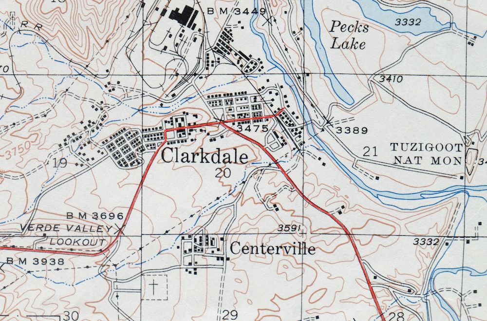
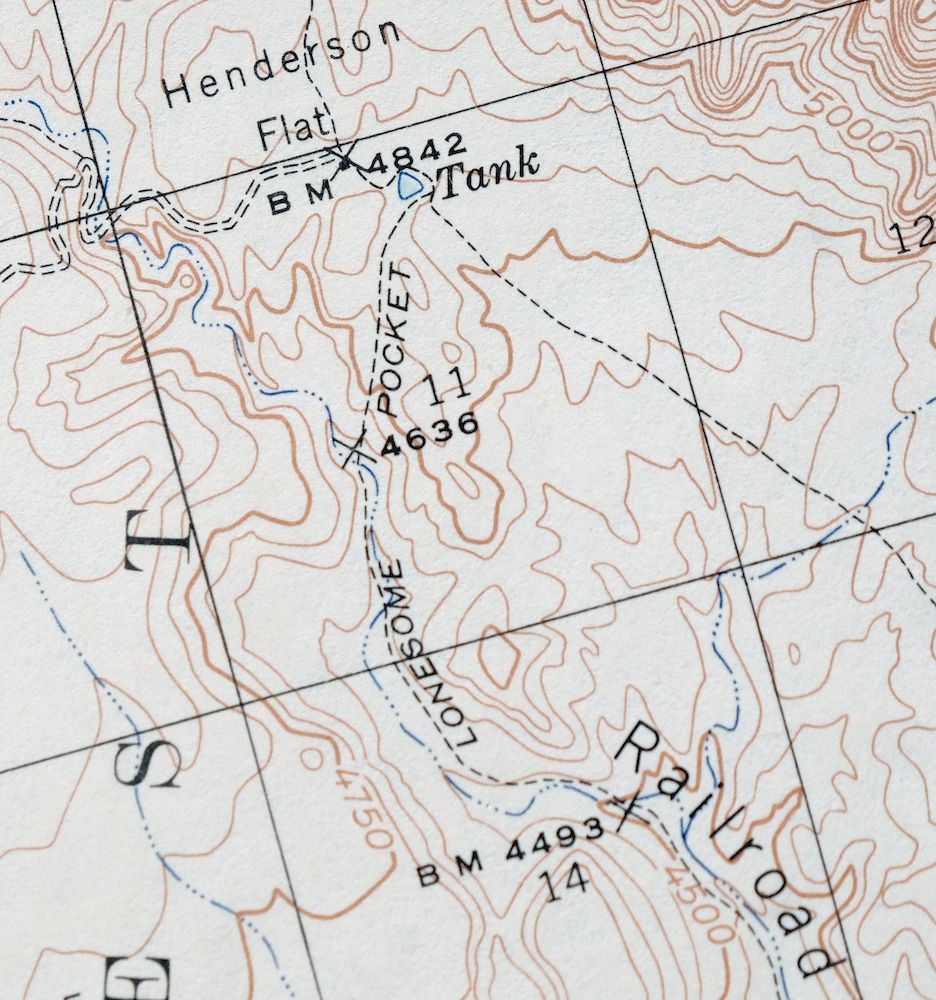
The Clarkdale 15-minute map shows cities and towns, roads, railroads, rivers, creeks, elevation contour lines, public land survey lines, county, state, and other administrative boundaries as they existed at the time of the survey in 1944. All known structures (houses, businesses, churches, schools, barns, cabins, etc) are also shown.
A VALUABLE HISTORICAL RECORD
Maps from the 15-minute series for the continental United States are no longer produced or printed by the USGS and original prints are becoming increasingly difficult to find. They are a valuable historical record for an area, as they contain many placenames and features that have been dropped from more recent maps.
Nearby maps
-

Bill Williams Mountain Arizona Williams USGS Topo Map 1983
$40 Add to cart -
Mingus Mountain Arizona Cottonwood USGS Topographic Map 1970
$51 Add to cart -
Ash Fork Arizona Kaibab NF Prescott NF USGS Topo Map 1978
$44 Add to cart -

Prescott Arizona Chino Valley Williamson USGS Topo Map 1966
$52 Add to cart -

Simmons Arizona Paulden Williamson USGS 15-Min Topo Map 1964
$42 Add to cart -
Picacho Butte Arizona Chino Valley USGS 15-Min Topo Map 1950
$24 Add to cart -

Mount Union Arizona Prescott NF Mayer USGS Topo Map 1949
$34 Add to cart -
Mount Union Arizona Prescott NF Mayer USGS Topo Map 1964
$43 Add to cart -
Camp Wood Arizona Prescott NF USGS Topographic Map 1949
$32 Add to cart -
Sheridan Mountain Arizona Sycamore Creek USGS Topo Map 1978
$35 Add to cart -
Valle Arizona Kaibab Quivero USGS Topo Map 1964 Vintage
$28 Add to cart -
Ebert Mountain Arizona Red Mountain USGS Topo Map 1969
$36 Add to cart -
Crown King Arizona Prescott NF USGS Topo Map 1955 Vintage
$46 Add to cart -
Pine Arizona Payson Sun Valley USGS Topo Map 1940 Antique
$45 Add to cart -
S P Mountain Arizona USGS 15-Min Topo Map 1975 Vintage
$34 Add to cart -
Promontory Butte Arizona Coconino NF USGS Topo Map 1960
$46 Add to cart -
Payson Arizona Sun Valley Gisela USGS Topo Map 1965 Vintage
$64 Add to cart -

Camp Verde Arizona Cottonwood Sedona USGS Topo Map 1965
$56 Add to cart -
Mountainaire Arizona Coconino NF USGS Topo Map 1964 Vintage
$36 Add to cart -

Congress Arizona Yarnell Wilhoit USGS Topo Map 1948 Vintage
$38 Add to cart -
Leupp Arizona USGS 15-Min Topographic Map 1959 Vintage
$44 Add to cart -
Woods Canyon Arizona Sitgreaves NF USGS 15-Min Topo Map 1963
$35 Add to cart -

Cave Creek Arizona Phoenix Mesa USGS Topo Map 1963 Vintage
$44 Add to cart -

Mcdowell Peak Arizona Scottsdale USGS Topo Map 1967 Vintage
$37 Add to cart
