MAP DETAILS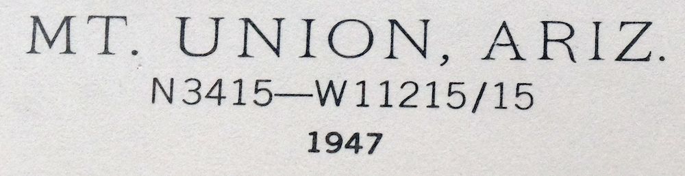 | |
|---|---|
| TITLE | Mount Union |
| STATE | Arizona |
| LOCATION | Vicinity of Mayer, 65 miles north of Phoenix |
| SERIES | 15-minute |
| SURVEYED | 1946 and 1947 Aerial and Field Survey |
| EDITION | 1947 |
| PRINTED | 1964 |
| PRINT NOTES | Thick paper stock, includes woodland tint (green to indicate vegetated areas) |
| SCALE | 1:62500 |
| CONTOUR INTERVAL | 50 feet |
| SHEET DIMENSIONS | 17 x 21 inches |
| MAP DIMENSIONS | 14 1/2 x 17 1/2 inches |
| COVERAGE AREA | 14 x 17 miles |
| SHEET CONDITION For maps of this vintage, effort is made to note all visible flaws, no matter how minor. | |
| OVERALL CONDITION | Excellent |
| SHEET NOTES | very lightly handled, never folded, smooth and flat |
| MAP AREA | flawless map area |
| COLLARS | no wear or tears, no markings, no blemishes, hole punches in left collar |
| MAP COVERAGE Quadrangle extent overlaid on current basemap. | |
| PLACENAMES Depending on map series and survey date, all of the features listed below may not be shown on this map. This list contains features that currently exist or historically existed within the area covered by the map. The list can be used as a reference to determine if this map covers your area of interest. Placenames are listed alphabetically next to each feature type. | |
| CITIES AND TOWNS (CURRENT) | Mayer |
| COUNTIES COVERED | Yavapai |
| FEDERAL LAND UNITS | Castle Creek Wilderness and Prescott National Forest |
| RIVERS AND STREAMS | Arrastra Creek, Ash Creek, Bannon Creek, Bear Creek, Big Bug Creek, Blind Indian Creek, Buzzard Roost Wash, Cedar Creek, Crazy Basin Creek, Granite Creek, Grapevine Creek, Groom Creek, Hackberry Creek, Hassayampa River, Indian Creek, Little Wolf Creek, Lynx Creek, Middleton Creek, Milk Creek, Mineral Creek, North Fork Blind Indian Creek, North Pine Creek, Pine Creek, Slate Creek, Towers Creek, Turkey Creek, Tuscumbia Creek, and Wolf Creek |
| WATER BODIES | Cedar Tank, Lower Goldwater Lake, and Upper Goldwater Lake |
| Locations: Camp Good News, Camp Maripai, Camp Wamatochick, Five Corners, Friendly Pines Camp, Goat Ranch, Groom Creek Forest Service Facility, Groom Creek Horse Camp, Groom Creek Work Center, Hackberry Mine Dump, Horse Camp Forest Service Facility, Kendall Camp, Old Dandrea Ranch, Olson Place, Orr Trap Corral, P Bar Camp, Palace Station, Phoenix YMCA Camp, Pine Summit Camp, Poland Junction Substation, Prescott Picnic Area, Sky Y Camp, Sparks Place, Storm Ranch, Walker Substation, White Spar Station, and Whitespar Station. Mountain Ranges: Bradshaw Mountains. Mountains, Peaks, and Summits: Bald Mountain, Battleship Butte, Bigelow Peak, Bean Peaks, Big Bug Mesa, Brady Butte, Mount Davis, Mount Elliott, Little Mesa, Lookout Mountain, Maverick Mountain, Moscow Peak, Pine Mountain, S A Hill, Smelter Hill, Spruce Mountain, Mount Tritle, Tuscumbia Mountain, Mount Union, and Yankee Doodle Peak. Valleys and Canyons: Box Canyon, Crooks Canyon, Daniels Gulch, Dosoris Canyon, Eugene Gulch, Knapp Gulch, Maidenhead Canyon, Muldoon Gulch, Mule Canyon, Peck Canyon, Pipeline Canyon, Pole Camp Canyon, Sawmill Gulch, Smith Ravine, Starlight Canyon, Taft Canyon, Ticonderoga Gulch, and Wild Flower Gulch. Parks: Church Assembly Campground, Indian Creek Campground, Lower Wolf Creek Campground, Mount Union Family Picnic Ground, Mount Union Recreational Area, Spruce Mountain Lookout Family Picnic Area, and Upper Wolf Creek Campground. Trails: Bradshaw Trail, E Cross L Trail Number Two Hundred Eighty One, Groom Creek Loop Number Three Hundred Seven, Groom Creek Loop Trail, Pine Creek Trail Number Two-hundred Eighty-nine, and Yankee Doodle Trail. Drainages: Arrastra Creek, Ash Creek, Bear Creek, Eugenie Stream, Grapevine Creek, Groom Creek, Indian Creek, Little Wolf Creek, Middleton Creek, North Fork Blind Indian Creek, North Pine Creek, Pine Creek, Slate Creek, Towers Creek, Tuscumbia Creek, and Wolf Creek. Mines: Accidental Mine, Alligator Mine, Amulet Mine Dump, Arizona Victory Mine, Bannie Mine, Bannie Mine Dump, Bodie Mine, Big Chief Mine, Buster Mine, Butternut Mine, Buzzard Mine, California Mine, Cash Mine, Combination Mine, Davis Dunkirk Mine, De Soto Mine, Elouise Mine, Eugene Mine, Gold King Mine, Golden Eagle Mine, Goldwater Mine, Harl Tank, Henrietta Mine, Jersey Lily Mine, King Benjamin Mine, Lookout Mine, Mark Twain Mine, Mastadon Mine, Midnite Test Mine, Mohawk Mine, Monte Cristo Mine, Mount Union Mine, Mudhole Mine, New Era Mine Dump, Oro Flame Mine, Orofino Mine, Peck Mine, Pine Mountain Mine, Red Rock Mine, Ruth Mine, Saint Theresa Mine, Scotty Spring Mine, Senator Mine, Sheldon Mine, Silver Spruce Mine, Snow Drift Mine, Snowdrift Mine, Starlight Mine, Sundance Mine, Swastika Mine, Tilly Starbuck Mine, Trails End Mine, Transcendent Mine, Tuscumbia Mine, Victor Mine, Yankee Boy Mine, and Yankee Girl Mine. Churches: Patterdell Pines Convent. Dams: Hassayampa Check Dam, Lower Goldwater Dam, and Upper Lake Goldwater Dam. Basins: Shady Dell. Ridges: Ash Creek Ridge, Eugene Ridge, Longfellow Ridge, and South Spruce Ridge. Reservoirs and Tanks: Ash Tank, Bannie Tank Number One, Bannie Tank Number Two, Battle Flat Trick Tank, Black Rock Tank, Boulder Dam Tank, Brady Butte Tank, Cedar Tank, Chaparral Tank, Coyote Tank, Crooked Leg Tank, De Soto Tank, Deer Trick Tank, Fence Tank, Hassayampa Lake, Johnson Flat Tank, Lower Goldwater Lake, Lower Skinner Tank, Lower Tank, Mineral Creek Dam Tank, Monument Section Thirty Two Tank, North Tank, Orr Trap Tank, S A Tank, SA Hill Trick Tank, Skinner Tank, Slick Rock Tank, Small Tank, Snake Track Tank, South Tank, South Trick Tank, Stump Tank, T D Tank, Upper Goldwater Lake, Upper Tank, Upper Yellow Jacket Tank, West Side Trick Tank, West Trick Tank, and Wolf Creek Tank. Flats: Battle Flat, Johnson Flat, and Pine Flat. Tunnels: Poland-Walker Tunnel. Wells: Hawkey Well, Shipley Well, and White Well. Springs: Apple Orchard Spring, Arrastra Spring, August Spring, Barrel Spring, Benjamin Spring, Blackjack Spring, Blancho Spring, Blower Spring, Bodie Spring, Bones Spring, Bootlegger Spring, Beck Spring, Berry Spring, Boundary Spring, Brushy Basin Spring, Bucket Spring, Butler Spring, Butternut Spring, Chalk Spring, Chaparral Spring, Cottonwood Spring, Coyote Spring, Crystal Spring, Culver Spring, Dandy Wire Spring, Davis Spring Number Two, Deer Lick Spring, Deer Spring, Dosoris Spring, E Cross L Spring, Eph Spring, Fall Spring, Gates Spring, Gold King Spring, Granite Spring, Grapevine Spring, Grapevine Springs, Hackberry Mine Spring, Hidden Smith Ravine Spring, Hidden Spring, Hidden Tunnel Spring, Horse Spring, Independent Spring, Juniper Spring, Longfellow Ridge Spring, Lookout Mountain Spring, Lower Mule Creek Spring, McNelty Spring, Midnite Spring, Mount Elliott Spring, Muldoon Spring, Nemo Spring, North Daniels Gulch Spring, North Fork Spring, Orejano Spring, Orr Spring, Payoff Spring, Pear Spring, Peck Spring, Pine Spring, Pipeline Spring, Poor Mans Spring, Postmaster Spring, Quail Spring, Rocky Spring, Ross Spring, Roy Spring, Sandrock Spring, Scotty Spring, Seaton Spring, Slate Spring, Smith Ravine Spring, Smith Spring, South Daniels Gulch Spring, Spence Spring, Taft Spring, Tin Trough Spring, The Troughs Spring, Turkey Spring, Upper Spring, Walnut Spring, Watson Spring, Willow Spring, Wire Spring, and Wood Spring. | |
| SHIPPING AND RETURNS | |
 This map sheet will be carefully rolled in a sturdy tube and shipped via the US Postal Service. If you find that the sheet you receive is not as described in the listing, you may ship it back to us for a refund of the purchase price. | |
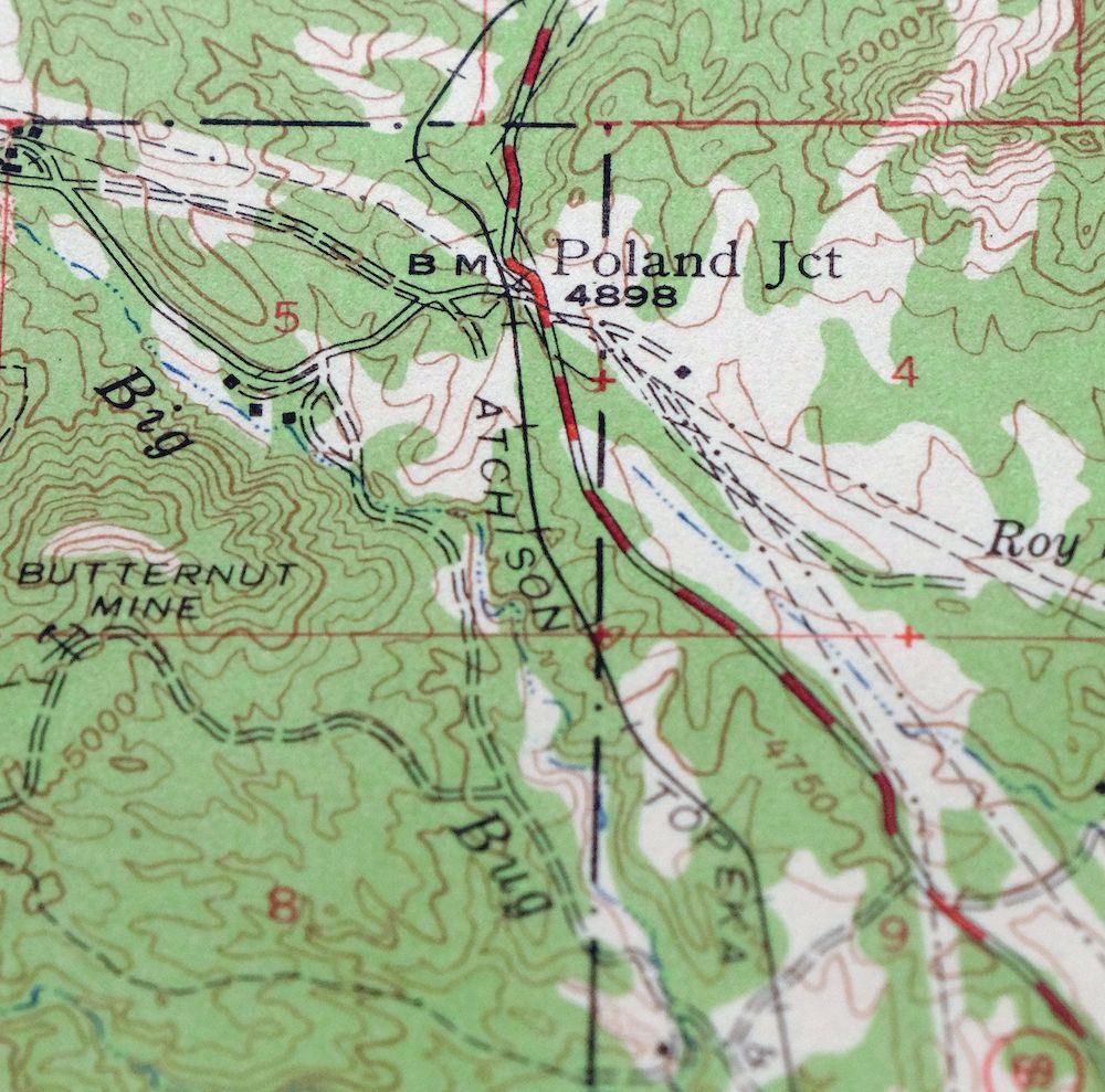
Mount Union Arizona Prescott NF Mayer USGS Topo Map 1964
$43
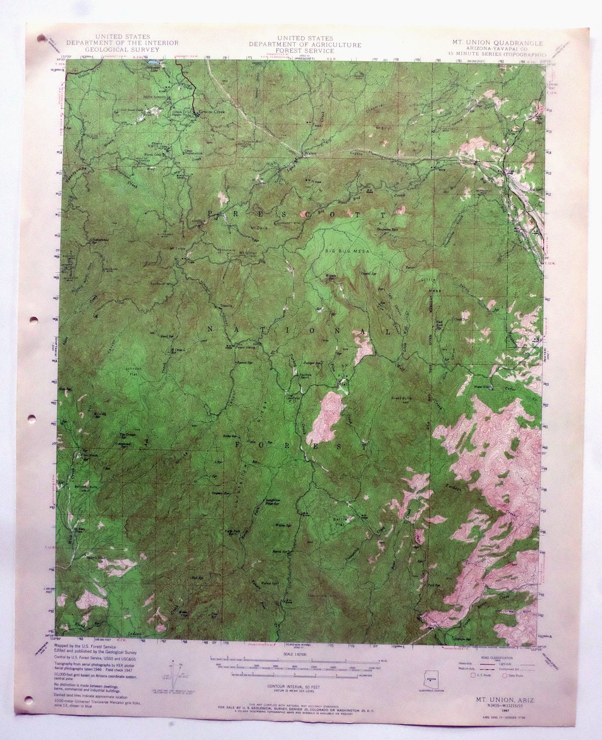
This USGS 15-minute topographic map is a 1947 edition printed in 1964, and the sheet is in excellent condition: never folded, smooth and flat, on thick stock with a flawless map area. Covering roughly 14 by 17 miles of the mountains of Yavapai County in central Arizona, the quad takes in the community of Mayer and portions of Prescott National Forest and the Castle Creek Wilderness, about 65 miles north of Phoenix. The 50-foot contours trace the rugged high country around Mount Union, one of the higher summits in the Bradshaw Mountains, and its never-folded condition means it lies flat for framing.
In stock
This vintage sheet is a 1947 edition of the Mount Union Arizona USGS topographic map. It is an original 62-year-old 1964 United States Geological Survey print in excellent condition.
HOW THIS MAP CAN BE USED
In addition to making a fascinating conversation piece, this sheet would look great in a frame or on display, make a unique and prized gift for anyone interested in this area, be perfect as a reference for genealogy studies or general historical research, or fill that missing piece in your collection. Maps of this vintage are printed on durable stock and are well-suited for outdoor activities and recreation of all kinds, including hiking, backpacking, hunting, rafting and kayaking, backcountry skiing, geocaching, general exploration, treasure hunting, etc.
FEATURES SHOWN ON THE MAP
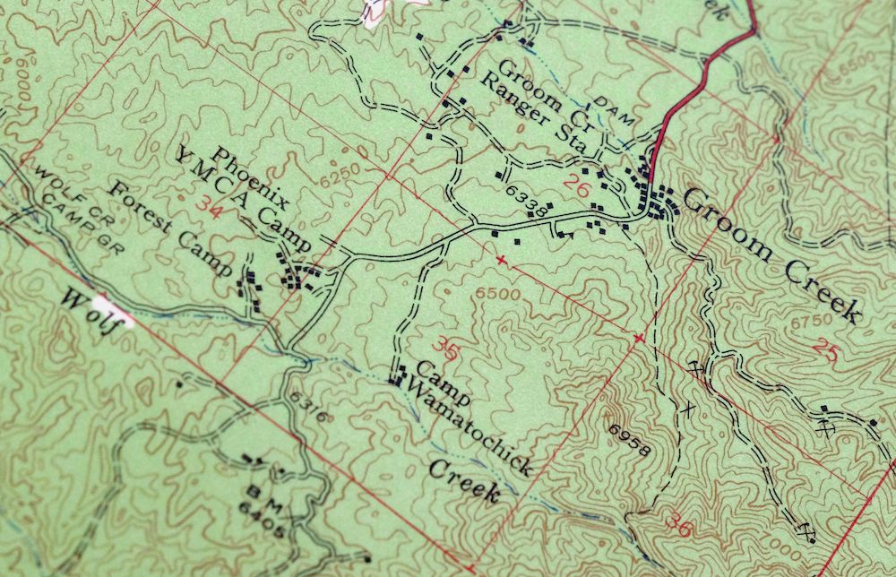
The Mount Union 15-minute map shows cities and towns, roads, railroads, utilities and energy infrastructure, rivers, creeks, elevation contour lines, public land survey lines, county, state, and other administrative boundaries as they existed at the time of the survey in 1946 and 1947. All known structures (houses, businesses, churches, schools, barns, cabins, etc) are also shown.
A VALUABLE HISTORICAL RECORD
Maps from the 15-minute series for the continental United States are no longer produced or printed by the USGS and original prints are becoming increasingly difficult to find. They are a valuable historical record for an area, as they contain many placenames and features that have been dropped from more recent maps.
Nearby maps
-

Mount Union Arizona Prescott NF Mayer USGS Topo Map 1949
$34 Add to cart -

Prescott Arizona Chino Valley Williamson USGS Topo Map 1966
$52 Add to cart -
Crown King Arizona Prescott NF USGS Topo Map 1955 Vintage
$46 Add to cart -
Mingus Mountain Arizona Cottonwood USGS Topographic Map 1970
$51 Add to cart -
Sheridan Mountain Arizona Sycamore Creek USGS Topo Map 1978
$35 Add to cart -

Clarkdale Arizona Cottonwood Jerome USGS Topo Map 1948
$44 Add to cart -

Simmons Arizona Paulden Williamson USGS 15-Min Topo Map 1964
$42 Add to cart -
Camp Wood Arizona Prescott NF USGS Topographic Map 1949
$32 Add to cart -
Ash Fork Arizona Kaibab NF Prescott NF USGS Topo Map 1978
$44 Add to cart -
Picacho Butte Arizona Chino Valley USGS 15-Min Topo Map 1950
$24 Add to cart -

Bill Williams Mountain Arizona Williams USGS Topo Map 1983
$40 Add to cart -
Pine Arizona Payson Sun Valley USGS Topo Map 1940 Antique
$45 Add to cart -

Camelback Arizona Tonto NF Phoenix USGS 15-Min Topo Map 1948
$55 Add to cart -
Payson Arizona Sun Valley Gisela USGS Topo Map 1965 Vintage
$64 Add to cart -

Gladden Arizona Aguila Valley USGS Topographic Map 1971
$30 Add to cart -

Congress Arizona Yarnell Wilhoit USGS Topo Map 1948 Vintage
$38 Add to cart -

Camp Verde Arizona Cottonwood Sedona USGS Topo Map 1965
$56 Add to cart -

Cave Creek Arizona Phoenix Mesa USGS Topo Map 1963 Vintage
$44 Add to cart -

Mcdowell Peak Arizona Scottsdale USGS Topo Map 1967 Vintage
$37 Add to cart -
Glendale Arizona Phoenix Peoria USGS Topo Map 1975 Vintage
$37 Add to cart -
Mountainaire Arizona Coconino NF USGS Topo Map 1964 Vintage
$36 Add to cart -
Fowler Arizona Phoenix Tolleson USGS Topo Map 1957 Vintage
$41 Add to cart -
Phoenix Arizona USGS 7.5-Min Topographic Map 1968 Vintage
$32 Add to cart -

Avondale Arizona Phoenix Goodyear USGS Topo Map 1965 Vintage
$55 Add to cart