MAP DETAILS | |
|---|---|
| TITLE | Crown King |
| STATE | Arizona |
| LOCATION | 50 miles north of Phoenix |
| SERIES | 15-minute |
| SURVEYED | 1946 and 1947 Aerial and Field Survey |
| GEOGRAPHER | Forest Service |
| EDITION | 1947 |
| PRINTED | 1955 |
| PRINT NOTES | Thick paper stock, includes woodland tint (green to indicate vegetated areas) |
| SCALE | 1:62500 |
| CONTOUR INTERVAL | 50 feet |
| SHEET DIMENSIONS | 17 x 21 inches |
| MAP DIMENSIONS | 14 1/2 x 17 1/2 inches |
| COVERAGE AREA | 14 x 17 miles |
| SOURCE | From the vintage map collection of Art Christiansen, Tempe, Arizona |
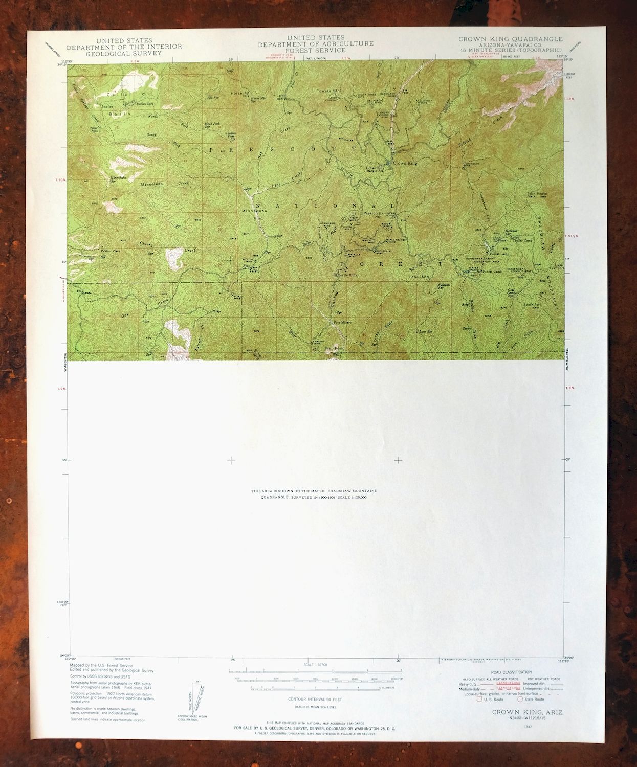
| MAP NOTES | The south half of this quadrangle is not surveyed. |
| SHEET CONDITION For maps of this vintage, effort is made to note all visible flaws, no matter how minor. | |
| OVERALL CONDITION | Excellent |
| SHEET NOTES | very lightly handled, never folded, smooth and flat |
| MAP AREA | flawless map area |
| COLLARS | no wear or tears, no markings, no blemishes |
| MAP COVERAGE Quadrangle extent overlaid on current basemap. | |
| PLACENAMES Depending on map series and survey date, all of the features listed below may not be shown on this map. This list contains features that currently exist or historically existed within the area covered by the map. The list can be used as a reference to determine if this map covers your area of interest. Placenames are listed alphabetically next to each feature type. | |
| COUNTIES COVERED | Yavapai |
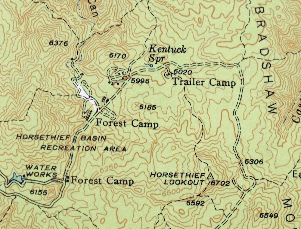
| FEDERAL LAND UNITS | Castle Creek Wilderness and Prescott National Forest |
| RIVERS AND STREAMS | Ash Creek, Banty Creek, Bear Creek, Bill Arp Creek, Black Butte Wash, Boulder Creek, Buckhorn Creek, Buzzard Roost Creek, Castle Creek, Cellar Springs Creek, Cherry Creek, Copper Creek, Cottonwood Creek, Cow Creek, Crazy Basin Creek, Dugan Wash, East Fork Castle Creek, French Creek, Humbug Creek, Indian Springs Creek, Jim Creek, Little Buckhorn Creek, Minnehaha Creek, North Fork Cellar Springs Creek, North Pine Creek, Oak Creek, Pine Creek, Poland Creek, Red Creek, Rock Creek, Ryland Creek, Sand Creek, Silver Creek, South Fork Cellar Springs Creek, Sycamore Creek, Tiger Creek, Towers Creek, Tule Creek, Tussock Spring Creek, Whipsaw Creek, and Willow Creek |
| Locations: Champie Ranch, Cottonwood Windmill, Crown King Ranger Station, Doss Windmill, Green Tank Windmill, Hells Hole Overlook, Horsethief Guard Station, Indian Springs Camp, Kentucks Cabin, Lower Oak Creek Windmill, ML Windmill, Milk Ranch, Miller Windmill, Shelley-Pearce Ranch, and Upper Oak Creek Windmill. Mountain Ranges: McAllister Range. Mountains, Peaks, and Summits: Bald Hill, Black Butte, Black Hill, Castle Rock, The Cements, Evans Butte, Gold Hill, Horse Mountain, Lane Mountain, Lehman Mountain, Malpais Hill, Poland Vista Point, Porphry Mountain, Rock Hill, Sheep Mountain, Silver Mountain, Thoma Butte, Thompson Butte, Towers Mountain, Twin Peaks, Wasson Peak, and Watson Peak. Valleys and Canyons: Box Canyon, Carpenter Gulch, Charcoal Gulch, Horsethief Canyon, Joes Gulch, Jones Gulch, Lorena Gulch, Marceds Gulch, Pipeline Canyon, Rockwall Gulch, Swilling Gulch, Taylor Gulch, Walker Gulch, and Wheels Canyon. Parks: Castle Creek Wilderness, Hazlett Hollow Campground, Horsethief Basin Recreation Area, Kentuck Spring Campground, and Turney Gulch Campground. Trails: Algonquin Trail Two Hundred Twentyfive, Bull Run Trail, Cherry Creek Trail Two Hundred Fourteen, Horse Mountain Trail Number Two Hundred Twelve, Jim Creek Trail Number Two Hundred Thirty Five, Lane Mountain Trail, Tiptop Trail, Twin Peaks Trail, Wagoner Trail Number Two Hundred Thirteen, and Willow Spring Trail. Drainages: Ash Creek, Banty Creek, Black Butte Wash, Buckhorn Creek, Buzzard Roost Creek, Copper Creek, Copperopolis Creek, Dugan Wash, East Fork Castle Creek, Golden Aster Creek, Horsethief Creek, Indian Springs Creek, Jim Creek, Little Buckhorn Creek, North Fork Cellar Springs Creek, Pine Creek, Red Creek, Rock Creek, Ruby Wash, Ryland Creek, Sand Creek, Silver Creek, South Fork Cellar Springs Creek, Spring Creek, Tiger Creek, Tussock Spring Creek, Whipsaw Creek, and Willow Creek. Mines: Algonquin Mine, Boaz Mine, Buckhorn Mine, Button Mine, Camp Bird Mine, Coolidge Mine, Copperopolis Mine, Cougar Mine, Crescent Mine, Crown King Mine, Del Pasco Mine, Dugan Mine, Eagle Tail Mine, Fat Jack Mine, Gazelle Mine, Gladiator Mine, Glint Mine, Gold Spring Mine, Hardtimes Mine, Joker Mine, Juniper Mine, Lincoln Mine, Little Joe Mine, Lucky Mine, Lukes Hoist Mine, Lunan Mine, Mascot Mine, McKinzie Mine, New Jersey Mine, New Savoy Mine, Oro Belle Mine, Pacific Mine, Pero Bonito Mine, Philadelphia Mine, Rapid Transit Mine, Red Star Mine, Savoy Mine, Seventysix Mine, Silver Christmas Mine, Silver Dollar Mine, Springfield Mine, Standard Mine, Tiger Mine, Top Notch Mine, Tunnel Mine, Union Mine, War Eagle Mine, Whipsaw Mine, and Wild Flower Mine. Waterfalls: Minnehaha Waters. Dams: Horsethief Dam. Gaps: Baldy Trap, Hooper Saddle, Jakies Pass, and Wild Flower Saddle. Bends: The Box and Hells Hole. Basins: Cellar Basin, Copper Basin, and Horsethief Basin. Schools: Champie School and Crown King Elementary School. Ridges: Joes Ridge, Juniper Ridge, LF Ridge, and Lukes Hoist Divide. Reservoirs and Tanks: Barney Williams Dam Tank, Ash Creek Trough, Horsethief Lake, Joes Tank, Juniper Tank, LF Tank, Mormon Tank, Packer Tank, Slims Tank, and Windy Saddle Tank. Flats: Johnson Flat and Minnehaha Flat. Wells: Allen Mill Well, Camp Bird Well, and Oak Creek Well. Pillars: Castle Rock, The Doghouse, Eagle Rock, and The Rockhouse. Springs: Anderson Spring, Ash Spring, Bartol Spring, Bens Spring, Black Jack Spring, Boulder Dam Spring, Box Spring, Bradshaw Spring, Buckhorn Spring, Bull Run Spring, Burnt Ground Spring, Burnt Trough Spring, Burro Spring, Castle Rock Spring, Cedar Spring, Cellar Springs, Charles Spring, Cherry Spring, Cherry Trap Spring, Coal Camp Spring, Colorado Spring, Copper Basin Spring, Copper Creek Spring, Corral Spring, Cottonwood Spring, Dannys Lower Spring, Double Trough Spring, Ensign Spring, Escondido Spring, Gladiator Spring, Goodwin Spring, Grapevine Spring, Hackberry Spring, Harry Knight Spring, Hesnnann Spring, Horse Mountain Spring, Horse Spring, House Water Spring, Indian Springs, Iron Spring, Jakies Pass Spring, Jerky Dam Spring, Jim Creek Spring, John Spring, Johnson Flat Spring, Juniper Spring, Kane Spring, Kentuch Spring, Lane Spring, Lion Spring, Little Joker Spring, Lizzie Lee Mine Spring, Log Cabin Spring, Logan Mine Spring, Lucky Spring, Minnehaha Spring, Misery Spring, Mountain Springs, Mulberry Spring, Oak Creek Spring, Patterson Spring, Pay Dirt Spring, Perkins Tunnel Spring, Peter Spring, Pine Spring, Purebred Spring, Rabbit Spring, Rainbow Spring, Ralphs Spring, Red Clay Spring, Ridges Spring, Rock Creek Spring, Rock Spring, Rockwall Spring, Rush Spring, Shurtlett Spring, Silver Dollar Spring, Steamboat Spring, Sullivan Spring, TB Spring, Tetterman Spring, Tule Spring, Tussock Spring, Upper Dead Cow Spring, Upper Peck Spring, Walker Creek Spring, Waterhole Spring, Whipsaw Spring, Whiskey Spring, Wild Pigeon Spring, Willow Spring, Y Spring, and Yellow Jacket Spring. | |
| SHIPPING AND RETURNS | |
 This map sheet will be carefully rolled in a sturdy tube and shipped via the US Postal Service. If you find that the sheet you receive is not as described in the listing, you may ship it back to us for a refund of the purchase price. | |
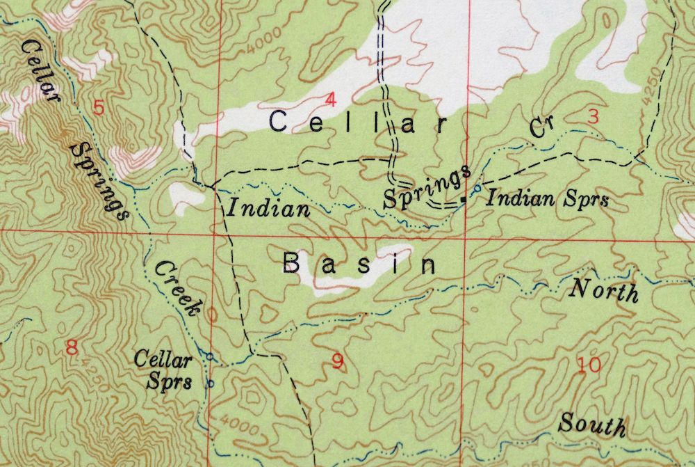
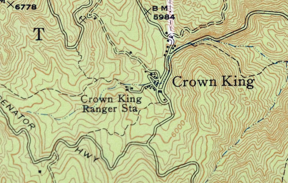

Crown King Arizona Prescott NF USGS Topo Map 1955 Vintage
$46
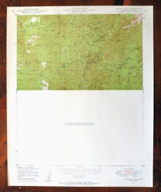
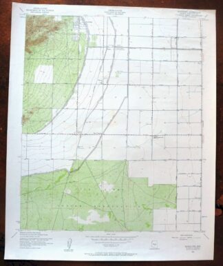
This USGS 15-minute topographic map is a 1947 edition printed in 1955, on thick stock and in excellent condition: never folded, smooth and flat, with a flawless map area and a clean collar showing no wear or markings. Covering a stretch of Yavapai County in the Bradshaw Mountains about 50 miles north of Phoenix, the quad takes in part of Prescott National Forest and the Castle Creek Wilderness, with the old mining settlement of Crown King in its high country. The Bradshaws were one of Arizona’s early gold and silver districts, and this sheet maps that rugged terrain at a 50-foot contour interval; note that the south half of the quadrangle was left unsurveyed. From the vintage map collection of Art Christiansen of Tempe, Arizona.
In stock
This vintage sheet is a 1947 edition of the Crown King Arizona USGS topographic map. It is an original 71-year-old 1955 United States Geological Survey print in excellent condition.
HOW THIS MAP CAN BE USED
In addition to making a fascinating conversation piece, this sheet would look great in a frame or on display, make a unique and prized gift for anyone interested in this area, be perfect as a reference for genealogy studies or general historical research, or fill that missing piece in your collection. Maps of this vintage are printed on durable stock and are well-suited for outdoor activities and recreation of all kinds, including hiking, backpacking, hunting, rafting and kayaking, backcountry skiing, geocaching, general exploration, treasure hunting, etc.
FEATURES SHOWN ON THE MAP
The Crown King 15-minute map shows cities and towns, roads, railroads, utilities and energy infrastructure, rivers, creeks, elevation contour lines, public land survey lines, county, state, and other administrative boundaries as they existed at the time of the survey in 1946 and 1947. All known structures (houses, businesses, churches, schools, barns, cabins, etc) are also shown.
A VALUABLE HISTORICAL RECORD
Maps from the 15-minute series for the continental United States are no longer produced or printed by the USGS and original prints are becoming increasingly difficult to find. They are a valuable historical record for an area, as they contain many placenames and features that have been dropped from more recent maps.
Nearby maps
-

Mount Union Arizona Prescott NF Mayer USGS Topo Map 1949
$34 Add to cart -
Mount Union Arizona Prescott NF Mayer USGS Topo Map 1964
$43 Add to cart -

Prescott Arizona Chino Valley Williamson USGS Topo Map 1966
$52 Add to cart -
Mingus Mountain Arizona Cottonwood USGS Topographic Map 1970
$51 Add to cart -
Sheridan Mountain Arizona Sycamore Creek USGS Topo Map 1978
$35 Add to cart -

Camelback Arizona Tonto NF Phoenix USGS 15-Min Topo Map 1948
$55 Add to cart -

Avondale Arizona Phoenix Goodyear USGS Topo Map 1965 Vintage
$55 Add to cart -

Clarkdale Arizona Cottonwood Jerome USGS Topo Map 1948
$44 Add to cart -

Simmons Arizona Paulden Williamson USGS 15-Min Topo Map 1964
$42 Add to cart -
Buckeye Arizona Palo Verde USGS 15-Min Topo Map 1963 Vintage
$65 Add to cart -
Payson Arizona Sun Valley Gisela USGS Topo Map 1965 Vintage
$64 Add to cart -
Camp Wood Arizona Prescott NF USGS Topographic Map 1949
$32 Add to cart -
Pine Arizona Payson Sun Valley USGS Topo Map 1940 Antique
$45 Add to cart -

Gladden Arizona Aguila Valley USGS Topographic Map 1971
$30 Add to cart -

Desert Well Arizona Apache Junction Mesa USGS Topo Map 1906
$65 Add to cart -

Congress Arizona Yarnell Wilhoit USGS Topo Map 1948 Vintage
$38 Add to cart -
Glendale Arizona Phoenix Peoria USGS Topo Map 1975 Vintage
$37 Add to cart -

Cave Creek Arizona Phoenix Mesa USGS Topo Map 1963 Vintage
$44 Add to cart -

Mcdowell Peak Arizona Scottsdale USGS Topo Map 1967 Vintage
$37 Add to cart -
Fowler Arizona Phoenix Tolleson USGS Topo Map 1957 Vintage
$41 Add to cart -
Phoenix Arizona USGS 7.5-Min Topographic Map 1968 Vintage
$32 Add to cart -

Camp Verde Arizona Cottonwood Sedona USGS Topo Map 1965
$56 Add to cart -

Mesa Arizona Gilbert Salt River USGS Topo Map 1965 Vintage
$95 Add to cart -
Guadalupe Arizona Phoenix Mesa USGS Topo Map 1957 Vintage
$49 Add to cart