MAP DETAILS | |
|---|---|
| TITLE | Prudence Island |
| STATE | Rhode Island |
| LOCATION | Vicinity of Newport, 19 miles south of Providence |
| SERIES | 7.5-minute |
| SURVEYED | 1939 and 1955 Aerial and Field Survey |
| EDITION | 1955 |
| REVISIONS | Photo revision in 1970 is shown in purple. |
| PRINTED | 1973 |
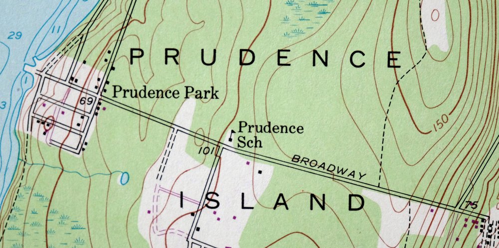
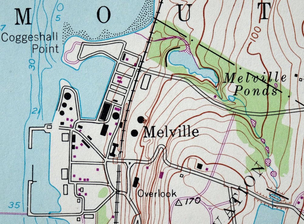
| PRINT NOTES | Thick paper stock, includes woodland tint (green to indicate vegetated areas). A reddish tint is used to indicate urban areas where only landmark buildings are shown. |
| SCALE | 1:24000 |
| CONTOUR INTERVAL | 10 feet |
| SHEET DIMENSIONS | 22 x 27 inches |
| MAP DIMENSIONS | 17 x 22 3/4 inches |
| COVERAGE AREA | 6 x 9 miles |
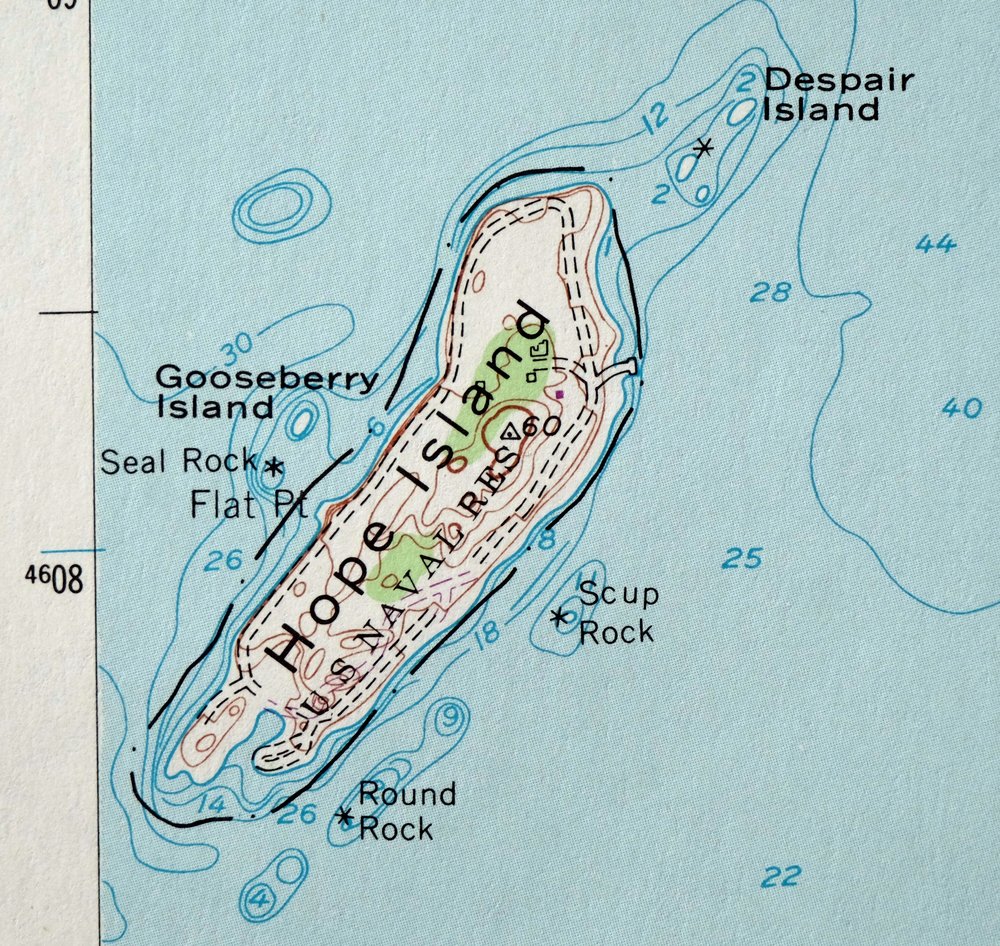
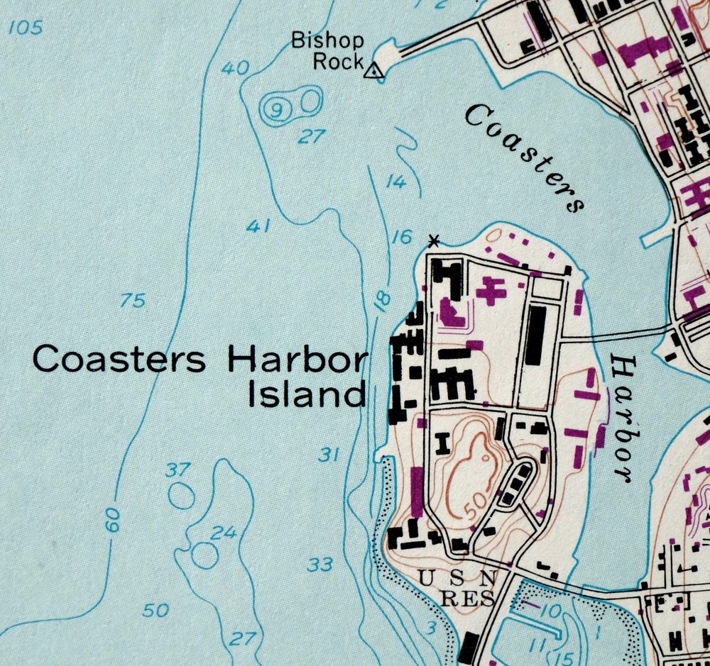
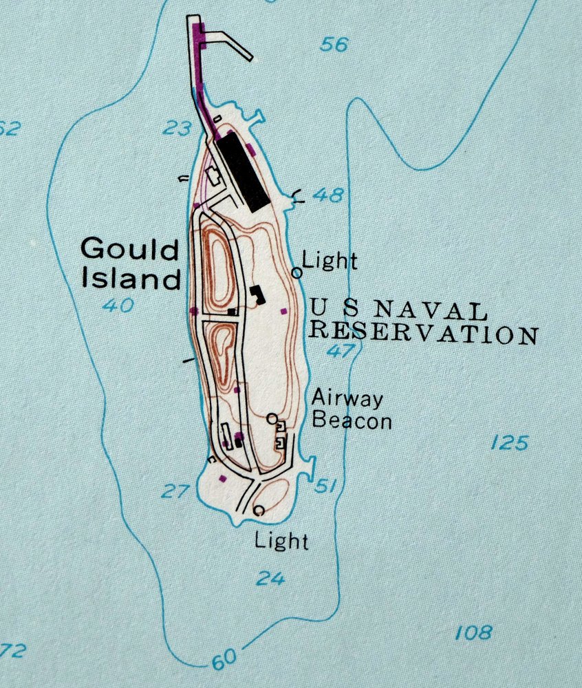
| MAP NOTES | Includes bathymetric depth contours. |
| SHEET CONDITION For maps of this vintage, effort is made to note all visible flaws, no matter how minor. | |
| OVERALL CONDITION | Very Good |
| SHEET NOTES | lightly handled, never folded |
| MAP AREA | flawless map area |
| COLLARS | no markings, no blemishes, no edge tears, minor edgewear |
| MAP COVERAGE Quadrangle extent overlaid on current basemap. | |
| PLACENAMES Depending on map series and survey date, all of the features listed below may not be shown on this map. This list contains features that currently exist or historically existed within the area covered by the map. The list can be used as a reference to determine if this map covers your area of interest. Placenames are listed alphabetically next to each feature type. | |
| NOTABLE PLACES | Newport, Middletown, Portsmouth, and East Passage |
| CITIES AND TOWNS (CURRENT) | Melville and Newport East |
| FEDERAL LAND UNITS | Newport Naval Educational and Training Center |
| RIVERS AND STREAMS | Bailey Brook, Barker Brook, and Great Creek |
| WATER BODIES | Crows Swamp, Green End Pond, Jamestown Reservoir, Lawton Valley Reservoir, Melville Ponds, and Sisson Pond |
| Populated Place: Paradise Mobile Home Park, Conanicut Park, Homestead, Lawtons, Melville, Middletown, Portsmouth, Prudence Park, South Portsmouth, and Whitehall. Locations: Ames Plaza Shopping Center, Aquidneck Shopping Centre, Browns Lane Plaza Shopping Center, East Passage Yachting Center, Eastgate Shopping Center, Green End Fort, Green Valley Golf Course, Jamestown Golf Course, Mall at Newport, Melville Ponds Campground, Middletown Plaza Shopping Center, Newport Butterfly Farm, Newport Vineyards and Winery, One Mile Corner, Prudence Island Lighthouse, Ted Hood Marine Complex, United States Navay Pier 2, United States Navy Pier 1, Wanumetonomy Golf Club, Escobar Highland Farm, and Sweet Berry Farm. Administrative Boundaries: Town of Jamestown, Town of Middletown, and Town of Portsmouth. Mountains, Peaks, and Summits: Honeyman Hill, Almy Hill, Beacon Hill, Bliss Hill, Butts Hill, Freebody Hill, Lehigh Hill, Miantonomi Hill, Quaker Hill, Slate Hill, Turkey Hill, Twomile Corner, and Windmill Hill. Valleys and Canyons: Lawton Valley. Parks: Bay Island Park, Bay Island Park South Prudence Island, Butterfly Zoo, Cottrell Field, Green Animals Topiary Garden, Marsh Meadows Wildlife Preserve, Memorial Park, Memorial to Black Soldiers, Paradise Valley Park, Windmill Hill Historic District, and Fort Butts. Drainages: Bailey Brook, Barker Brook, Bloody Brook, and Mill Creek. Islands: Coasters Harbor Island, Despair Island, Dyer Island, Gooseberry Island, Gould Island, Hope Island, Prudence Island, and Rhode Island. Capes: Arnold Point, Bryer Point, Carr Point, Coddington Point, Coggeshall Point, Conanicut Point, Flat Point, Sandy Point, South Point, and Taylor Point. Churches: Calvary United Methodist Church, Church of Christ, Hillside Baptist Church, Holy Cross Church, Kingdom Hall of Jehovahs Witnesses, Middletown Baptist Church, Portsmouth Evangelical Friends Meetinghouse, Saint Marys Church, Saint Michaels Episcopal Church, Saint Peters Lutheran Church, Temple Shalom, The Church of Jesus Christ of Latter Day Saints, and Union Church. Post Office: Middletown Post Office, NETC Station Post Office, and Prudence Island Post Office. Hospitals: Naval Health Clinic New England. Lakes and Ponds: Lawton Valley Reservoir, Melville Ponds, Saint Marys Pond, and Sisson Pond. Buildings: Birds Nest, Middletown Historical Society Building, Middletown Public Library, Middletown Town Hall, Mount Hope Maritime Terminal, Naval Hospital Medical Library, Naval War College Museum, Newport County Chamber of Commerce, Newport Memorial Tower, Portsmouth Abbey School Library, Portsmouth Historical Society Building, Portsmouth Town Hall, Rhode Island State Police Portsmouth Barracks, Temple Shalom Judaica Library, United State Naval War College Library, Whitehall Museum, Bright Ideas Child Care Center, Growing Children of Rhode Island Day Care Center, Jamestown Police Department, Little Friends Day Care Center, Luce Hall, Middletown Fire Department, Middletown Police Department, Naval Station Newport Fire Department, Portsmouth Barracks, Portsmouth Fire Department, Portsmouth Police Department, and Prudence Island Volunteer Fire Department. Dams: Jamestown Reservoir Dam, Lawton Valley Reservoir Dam, Saint Marys Pond Dam, and Sisson Pond Dam. Channels: East Passage. Bridges: Newport Toll Bridge. Bays: Bullock Cove, Coasters Harbor, Coddington Cove, Cranston Cove, Narragansett Bay, Potter Cove, and Weaver Cove. Bars: Greene Ledge. Airports: Newport State Airport. Swamps: Tank Swamp, Crows Swamp, Hessians Hole, Round Swamp, and Schoolhouse Swamp. Census: Melville Census Designated Place and Newport East Census Designated Place. Schools: Berkeley School, Coggeshall School, Doctor M H Sullivan School, Forest Avenue Elementary School, George H Triplett School, Howland School, Hutchinson School, John F Kennedy Elementary School, Joseph H Gaudet Middle School, Melville Elementary School, Middletown High School, Newport County Catholic Regional School, Old Schoolhouse, Oliphant School, Paradise School, Portsmouth Abbey School, Portsmouth High School, Portsmouth Middle School, Prescott Middle School, Priory School, Sheffield School, The Pennefield School, United States Naval War College, Witherbee School, Beginnings the Childrens School, Countryside Childrens Center, Forest Avenue School, James L Maher School, John F Kennedy School, Portsmouth Nursery School, Saint Philomena School, Shining Star Preschool, and Prudence School. Reservoirs and Tanks: Jamestown Reservoir. Military: Naval Station Newport. Towers: WADK-AM (Newport) and WJHD-FM (Portsmouth). Pillars: The Sisters, Bishop Rock, Fiske Rock, Fowler Rocks, Gull Rocks, Halfway Rock, Paradise Rocks, Round Rock, Scup Rock, and Seal Rock. Cemetery: Middletown Four Corners Cemetery, Portsmouth Friends' Churchyard Cemetery, Saint Columbas Cemetery, Artemas Fish Lot Cemetery, Benjamin Chase Lot Cemetery, Borden Slocum Lot Cemetery, Captain Clarke Cornell Lot Cemetery, Captain George Lawton Lot Cemetery, Captain Job Lawton Lot Cemetery, Chase and Cory Lot Cemetery, Colonel William Hall Lot Cemetery, Corey Lot Cemetery, David Albro Lot Cemetery, Edward Almy Lot Cemetery, Governor Caleb Carr Cemetery, Job Sherman Lot Cemetery, John Mitchell Lot Cemetery, Joseph Fish Lot Cemetery, Joshua Anthony Lot Cemetery, Nichols - Hassard Ground Cemetery, Paine Cemetery, Portsmouth Cemetery, Priory Cemetery, Prudence Island Cemetery, Saint Mark's Catholic Cemetery, Saint Mary's Episcopal Churchyard Cemetery, Seth Anthony Lot Cemetery, Sisson - Carr Lot Cemetery, Town Farm Lot Cemetery, Trinity Cemetery, and Union Cemetery. | |
| SHIPPING AND RETURNS | |
 This map sheet will be carefully rolled in a sturdy tube and shipped via the US Postal Service. If you find that the sheet you receive is not as described in the listing, you may ship it back to us for a refund of the purchase price. | |
1973 USGS Topo Map: Prudence Island, Newport, Rhode Island
$46
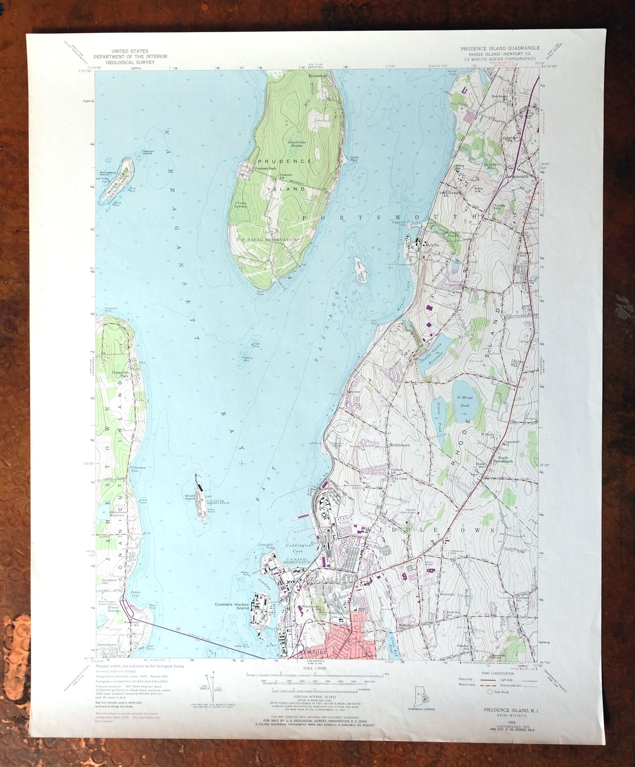
Includes bathymetric depth contours. This 7.5-minute USGS topographic sheet, a 1955 edition printed in 1973 with revisions through 1970, maps Prudence Island and the surrounding waters of Narragansett Bay at a scale of 1:24,000. The quad area covers much of Prudence Island itself along with the shores of Portsmouth and Middletown, the Melville area, and the Newport East section, roughly 19 miles south of Providence.
In stock
This vintage sheet is a 1955 edition of the Prudence Island Rhode Island USGS topographic map revised in 1970 using aerial photography. It is an original 53-year-old 1973 United States Geological Survey print in very good condition.
HOW THIS MAP CAN BE USED
In addition to making a fascinating conversation piece, this sheet would look great in a frame or on display, make a unique and prized gift for anyone interested in this area, be perfect as a reference for genealogy studies or general historical research, or fill that missing piece in your collection. Maps of this vintage are printed on durable stock and are well-suited for outdoor activities and recreation of all kinds, including hiking, backpacking, hunting, rafting and kayaking, backcountry skiing, geocaching, general exploration, treasure hunting, etc.
FEATURES SHOWN ON THE MAP
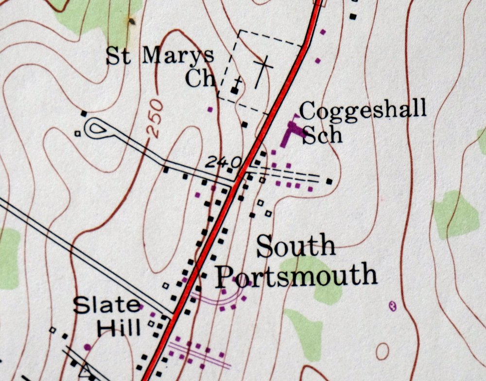
The Prudence Island 7.5-minute map shows cities and towns, roads, paths, railroads, utilities and energy infrastructure, rivers, creeks, elevation contour lines, public land survey lines, county, state, and other administrative boundaries as they existed at the time of the survey in 1939 and 1955. A reddish tint is used on this sheet to indicate urban areas where only landmark buildings are depicted. Outside of those areas, all known structures (houses, businesses, churches, schools, barns, cabins, etc) are shown.
A VALUABLE HISTORICAL RECORD
This map is from the 7.5-minute series, the most detailed series that is widely available from the USGS. The 1955 Prudence Island map is a valuable historical record for the area. It contains some placenames and features that have been dropped from more recent maps.
The map was photorevised in 1970. Any features that changed or were added between the original edition year of 1955 and the photorevision year of 1970 are overlayed in purple. The purple overlay provides an excellent view of the fast-growing and changing areas within the quad boundary.
Nearby maps
-
1957 Pawtucket Rhode Island/Massachusetts USGS Topo Map
$16 Add to cart -
1961 Mansfield Massachusetts USGS Topo Map: Sharon
$13 Add to cart -

Blackstone Massachusetts Milford Hopedale USGS Topo Map 1944
$22 Add to cart -
Uncasville Connecticut Ledyard Norwich USGS Topo Map 1984
$34 Add to cart -
Norwood Massachusetts Boston Dover USGS Topographic Map 1960
$18 Add to cart -

Quinsigamond Massachusetts Milford USGS Topographic Map 1910
$125 Add to cart -

Moodus Connecticut Lake Pocotopaug USGS Topographic Map 1946
$32 Add to cart -
Provincetown Massachusetts USGS Topographic Map 1978 Vintage
$45 Add to cart -

Riverhead New York Manorville Calverton USGS Topo Map 1915
$180 Add to cart -

Holyoke Massachusetts Springfield USGS Topo Map 1897 Antique
$80 Add to cart -
Litchfield Connecticut Waterbury Oakville USGS Topo Map 1910
$80 Add to cart -
Westport Connecticut Fairfield USGS Topographic Map 1973
$36 Add to cart -

Danbury Connecticut Trumbull Bethel USGS Topo Map 1899
$48 Add to cart -
Norwalk South Connecticut Stamford Darien USGS Topo Map 1963
$40 Add to cart -
Alton New Hampshire Farmington Strafford USGS Topo Map 1977
$12 Add to cart -
1966 USGS Topo Map: Glenville, Connecticut/New York
$48 Add to cart -

Taconic Vermont Pittsfield Adams USGS Topographic Map 1912
$75 Add to cart -
West Point New York Newburgh Peekskill USGS Topo Map 1912
$80 Add to cart -

Troy New York Albany Watervliet USGS Topo Map 1907 Antique
$94 Add to cart -
Harlem New York New York Yonkers USGS Topo Map 1913 Antique
$250 Add to cart -
Schunemunk New York Newburgh Kiryas Joel USGS Topo Map 1915
$69 Add to cart -
Park Ridge New Jersey New City Ridgewood USGS Topo Map 1963
$45 Add to cart -

Goshen New York Middletown Warwick USGS Topographic Map 1913
$65 Add to cart -
Amsterdam New York Rotterdam Hagaman USGS Topo Map 1912
$58 Add to cart