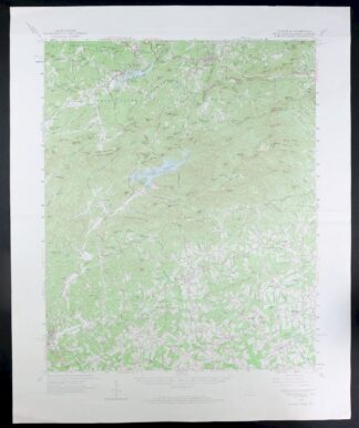
MAP DETAILS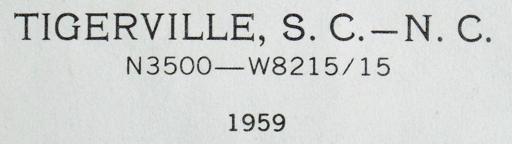 | |
|---|---|
| TITLE | Tigerville |
| STATE | South Carolina, North Carolina |
| LOCATION | Vicinity of Flat Rock |
| SERIES | 15-minute |
| SURVEYED | 1955 through 1959 Aerial and Field Survey |
| EDITION | 1959 |
| PRINTED | 1973 |
| PRINT NOTES | Includes woodland tint (green to indicate vegetated areas) |
| SCALE | 1:62500 |
| CONTOUR INTERVAL | 40 feet |
| SHEET DIMENSIONS | 17 x 21 inches (approximate) |
| MAP DIMENSIONS | 14 1/4 x 17 1/2 inches |
| COVERAGE AREA | 14 x 17 miles |
| SHEET CONDITION For maps of this vintage, effort is made to note all visible flaws, no matter how minor. | |
| OVERALL CONDITION | Good |
| SHEET NOTES | moderately handled, midsheet horizontal foldline (in half), two horizontal midline folds |
| MAP AREA | no wear, no markings, no blemishes |
| COLLARS | no markings, no blemishes, handling wear within collars, no edge tears |
| MAP COVERAGE Quadrangle extent overlaid on current basemap. | |
| PLACENAMES Depending on map series and survey date, all of the features listed below may not be shown on this map. This list contains features that currently exist or historically existed within the area covered by the map. The list can be used as a reference to determine if this map covers your area of interest. Placenames are listed alphabetically next to each feature type. | |
| CITIES AND TOWNS (CURRENT) | Flat Rock, Saluda, Slater, Slater-Marietta, Tryon, and Tuxedo |
| COUNTIES COVERED | Greenville, Henderson, and Polk |
| RIVERS AND STREAMS | Bear Creek, Beaverdam Creek, Belue Creek, Big Fall Creek, Big Falls Creek, Bobs Creek, Brice Creek, Brushy Creek, Bull Creek, Cabin Creek, Calahan Branch, Camp Creek, Campbell Creek, Capps Branch, Cherry Branch, Colt Creek, Cove Creek, Davis Creek, Devils Fork Creek, Enoree River, Foyster Creek, Freeman Creek, Gap Creek, Green Creek, Green River, Greer Creek, Guest Creek, Jamison Mill Creek, Joe Creek, Long Branch, Meadow Fork, Middle Tyger River, Mill Creek, Murray Creek, Mush Creek, Noe Creek, North Enoree River, North Pacolet River, North Saluda River, Phillips Creek, Posey Creek, Rock Creek, Short Branch, South Pacolet River, South Tyger River, Talley Creek, Terry Creek, Thompson Branch, Vernon Creek, and Vira Branch |
| WATER BODIES | Awanita Lake, Batson Pond, Berrys Millpond, Bryant Pond, Dysart Lake, Glenns Lake, Lake Chinquapin, Lake Hosea, Lake Mollirene, Lake Summit, North Saluda Reservoir, Valley Lake, Water Shed Five Reservoir, and Watershed Lake Number 4c |
| South Carolina Locations: Camp Old Indian, Camp White Pine, O'Neal Detention Center, Paradise Camp, Riverside Speedway, and Travelers Rest Correctional Center. Mountains, Peaks, and Summits: Alec Mountain, Allen Knob, Bryant Mountain, Calahan Mountain, Big Top, Cedar Mountain, High Spur Knob, Hightower Mountain, Hogback Mountain, Hoghead Mountain, Chestnut Mountain, Corbin Mountain, Evans Mountain, Frank Mountain, Fuller Mountain, Glassy Mountain, Hyde Mountain, Little Mountain, Little Piney Mountain, McCarrol Mountain, Mill Knob, Old Indian Mountain, Panther Mountain, Pax Mountain, Phillips Mountain, Pine Mountain, Plumley Mountain, Posey Mountain, Pruett Mountain, Rich Mountain, Rocky Mountain, Squirrel Mountain, Stanton Mountain, Tillet Mountain, Vance Mountain, and Walnut Mountain. Parks: Pleasant Ridge State Park. Drainages: Barton Creek, Beaverdam Creek, Brushy Creek, Calahan Branch, Campbell Creek, Big Falls Creek, Brice Creek, Bull Creek, Fall Creek, Foyster Creek, Guest Creek, Johnson Creek, Little Falls Creek, McKinney Creek, Meadow Fork, Mill Creek, Mush Creek, Noe Creek, Posey Creek, Short Branch, Sprigg Creek, Talley Creek, Terry Creek, Thompson Branch, and Wildcat Creek. Churches: Barton Chapel, Beaverdam Church, Behtany CHurch, Belvue Church, Bethany Church, Blue Ridge Church, Camp Creek Church, Bible Church, Cherry Hill Church, High Church, Highland Church, Church of God, Cool Springs Church, Cox Chapel, Cross Plains Church, Ebenezer Church, Fews Chapel, Glassy Mountain Church, Golden Grove Church, Gum Springs Church, Lima Church, Locust Hill Church, Lookup Chapel, Meadow Fork Church, Mount Ararat Church, Mount Grove Church, Mount Pleasant Church, Mountain Hill Church, Mountain View Church, Mush Creek Church, New Liberty Church, New Salem Church, North Fork Church, North Greenville Church, Pleasant Hill Church, Pleasant View Church, Rock Springs Church, Saint Pauls Church, Terry Creek Church, Truth Tabernacle, Tyger Church, Walnut Grove Church, and Welcome Home Church. Buildings: Spring Lake Lodge. Waterfalls: Big Falls. Dams: Anthony Lake Dam Number One D-2885, Anthony Lake Dam Number Two D-2884, Awanita Lake Dam D-2215, Beckydon Lake Dam, Belk Simpson Lake Dam D-2864, Bryant Pond Dam D-2891, C Fink Pond Dam D-2217, Bradburn Pond Dam D-1171, Casteel Pond Number One Dam D-2835, Casteel Pond Number Three Dam D-2836, Howie Pond Dam D-1129, Chinquapin Lake Dam, Douglas Ranch Pond Dam D-2838, Dysart Lake Dam D-2851, Forty Niner Lake Dam D-2852, Hayes Pond Dam D-2867, J Stooksburry Pond Dam D-1121, J Williams Pond Dam D-1173, L A Hendricks Pond Dam, L Cooper Pond Dam D-2882, Lake Caldwell Dam D-3297, Lake Mollirene Dam D-1174, McCarter Lake Dam D-1179, N Morgan Pond Dam D-1172, Rice Pond Dam D-1373, Ridgill Lake Dam, Rudolf Pond Dam D-2849, S Huffman Pond Dam D-2834, South Carolina Noname 23003 Dam, South Carolina Noname 23012 D-2883 Dam, South Tyger River WCD Dam 2c D-2865, South Tyger River WCD Dam 4c D-2915, Stevens Lake Dam D-2837, and Woods Pond Dam D-2866. Bluffs: Glassy Rock. Gaps: Panther Gap, Trammel Gap, and Vaughns Gap. Bridges: Campbell Covered Bridge. Airports: King Field, O Neal Field, and Wilbanks Airport. Schools: Blue Ridge School, Mountain View Elementary School, North Greenville Junior College, Skyland School, Slater-Marietta Elementary School, and Tigerville Elementary School. Ridges: Bailey Ridge, Brushy Ridge, Hooker Ridge, Chestnut Ridge, Coon Top Ridge, and Rocky Spur. Reservoirs and Tanks: Awanita Lake, Beckydon Lake, Berrys Millpond, Bryant Pond, Hugey Pond, Chinquapin Lake, Dysart Lake, Edwards Lake, Glenns Lake, L A Hendricks Pond, Lake Caldwell, Lake Chinquapin, Lake Francis, Lake Mollirene, Lazy Water Lake, North Saluda Reservoir, Poplar Lake, Ridgill Pond, Sudduth Pond, Valley Lake, Water Shed Five Reservoir, and Watershed Lake Number 4c. Towers: WSPA-FM (Spartanburg) and WSPA-TV (Spartanburg). Pillars: Round Rock. | |
| North Carolina Locations: Camp Arrowhead, Camp Green Cove, Camp Windy Wood, Elks Club Camp, and Kings Mountain Camp. Administrative Boundaries: Township of Green River and Township of Saluda. Mountains, Peaks, and Summits: Buck Mountain, Alec Mountain, Ann Mountain, Big Top, Big Warrior Mountain, Blakes Peak, Butler Mountain, Cedar Mountain, Corbin Mountain, Evans Mountain, Frank Mountain, Hammond Mountain, Hetherly Height, Humes Mountain, Little Mountain, Little Warrior Mountain, Long Mountain, Mackerel Mountain, McAlpine Mountain, McCarrol Mountain, Melrose Mountain, Mine Mountain, Panther Mountain, Piney Mountain, Potato Hill, Rice Knob, Round Mountain, Rush Mountain, Smoke Mountain, Vance Mountain, and Ward Mountain. Drainages: Bear Creek, Bell Creek, Big Fall Creek, Bobs Creek, Cabin Creek, Cold Branch, Colt Creek, Davis Creek, Falling Creek, Fork Creek, Freeman Creek, Joe Creek, Joels Creek, Jones Creek, Laurel Branch, Little Fall Creek, Rock Creek, Shop Creek, Spring Branch, Terry Creek, Vernon Creek, and Vira Branch. Churches: Bobs Creek Church, Double Springs Church, Crossroads Church, Fork Creek Church, Friendship Church, Grace Church, Green River Church, Mountain Valley Church, Mountain View Church, Piney Grove Church, Warrior Mountain Church, Zion Hill Church, and Zirconia Church. Waterfalls: Pearsons Falls. Dams: John T Coates Dam, Lake Hosea Dam, Lake Shelia Dam, Lake Summit Dam, Melrose Mountain Dam Number One, Melrose Mountain Dam Number Two, and Orchard Lake Dam. Bluffs: Cedar Cliff. Gaps: Howard Gap, Panther Gap, and Trammel Gap. Schools: Saluda Elementary and Saluda Junior High School. Ridges: Dughill Ridge and Huckleberry Ridge. Reservoirs and Tanks: Bullseye Orchard Lake, Hosea Lake, Lake Hosea, Lake Shelia, Lake Summit, Melrose Lake, Melrose Mountain Lake Number One, Melrose Mountain Lake Number Two, and Warrior Mountain Lake. | |
| SHIPPING AND RETURNS | |
 This map sheet will be carefully rolled in a sturdy tube and shipped via the US Postal Service. If you find that the sheet you receive is not as described in the listing, you may ship it back to us for a refund of the purchase price. | |
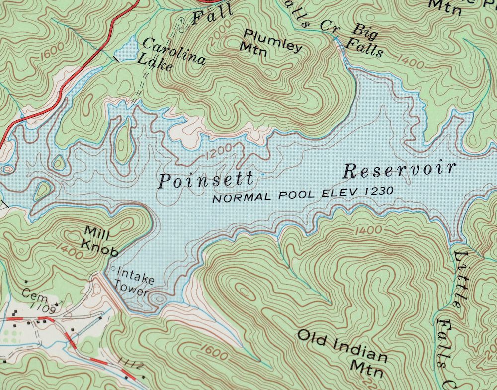
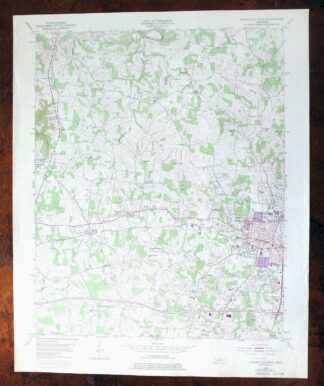
Tigerville South Carolina Tryon USGS Topographic Map 1973
$20
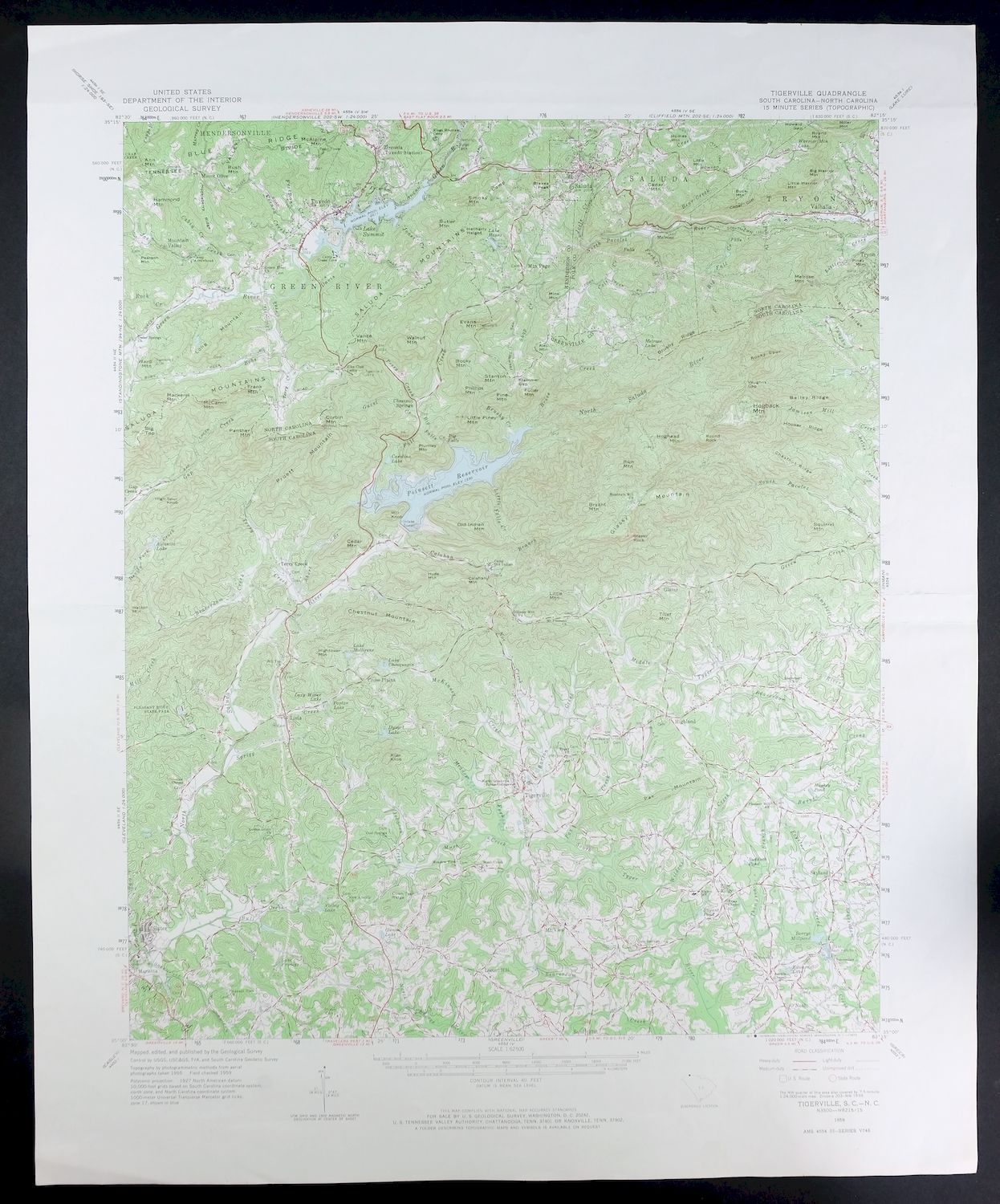
This USGS 15-minute topographic sheet is a 1959 edition, printed in 1973, and is in good condition with clean map detail and midsheet foldlines from handling. The quad straddles the South Carolina-North Carolina line, taking in the country around Flat Rock and Saluda to the north and Slater-Marietta and Tuxedo to the south, with parts of Greenville, Henderson, and Polk counties. Mapped from a 1955 through 1959 aerial and field survey, the 40-foot contours trace the rugged terrain along the Blue Ridge escarpment where the Carolinas meet, ground that anyone with ties to the Flat Rock or Saluda area would recognize.
In stock
This vintage sheet is a 1959 edition of the Tigerville South Carolina USGS topographic map. It is an original 53-year-old 1973 United States Geological Survey print in good condition.
HOW THIS MAP CAN BE USED
In addition to making a fascinating conversation piece, this sheet would look great in a frame or on display, make a unique and prized gift for anyone interested in this area, be perfect as a reference for genealogy studies or general historical research, or fill that missing piece in your collection. Maps of this vintage are printed on durable stock and are well-suited for outdoor activities and recreation of all kinds, including hiking, backpacking, hunting, rafting and kayaking, backcountry skiing, geocaching, general exploration, treasure hunting, etc.
FEATURES SHOWN ON THE MAP
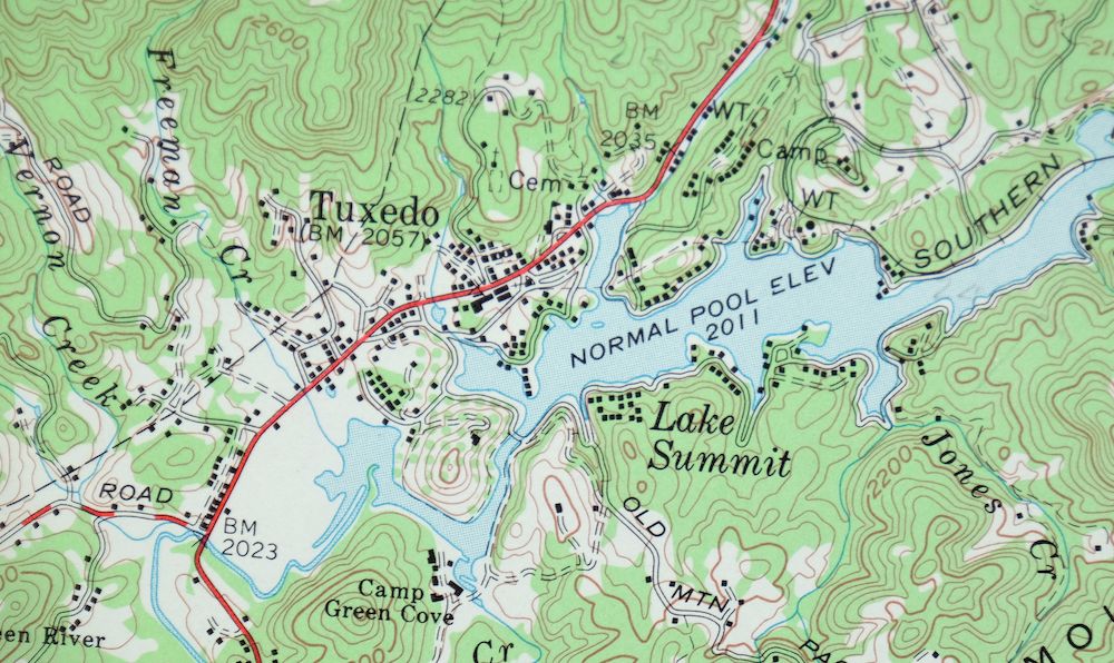
The Tigerville 15-minute map shows cities and towns, roads, railroads, utilities and energy infrastructure, rivers, creeks, elevation contour lines, public land survey lines, county, state, and other administrative boundaries as they existed at the time of the survey in 1955 through 1959. All known structures (houses, businesses, churches, schools, barns, cabins, etc) are also shown.
A VALUABLE HISTORICAL RECORD
Maps from the 15-minute series for the continental United States are no longer produced or printed by the USGS and original prints are becoming increasingly difficult to find. They are a valuable historical record for an area, as they contain many placenames and features that have been dropped from more recent maps.
Nearby maps
-
Inman South Carolina Boiling Springs USGS Topo Map 1964
$45 Add to cart -

Greer South Carolina Simpsonville Duncan USGS Topo Map 1974
$32 Add to cart -
Shooks Gap Tennessee Knoxville Seymour USGS Topo Map 1955
$38 Add to cart -

John Sevier Tennessee Knoxville Mascot USGS Topo Map 1955
$38 Add to cart -

Fountain City Tennessee Knoxville Halls USGS Topo Map 1955
$39 Add to cart -
Bearden Tennessee Knoxville Alcoa USGS Topo Map 1968 Vintage
$58 Add to cart -

Wytheville Virginia Marion Sparta USGS Topo Map 1907 Antique
$105 Add to cart -
East Cleveland Tennessee Climer USGS Topographic Map 1966
$34 Add to cart -
South Cleveland Tennessee Hopewell USGS Topographic Map 1966
$38 Add to cart -

Whitesburg Kentucky Pikeville Cumberland USGS Topo Map 1910
$80 Add to cart -
East Chattanooga Tennessee Cannondale USGS Topo Map 1959
$38 Add to cart -
Manchester Kentucky Booneville McKee USGS Topo Map 1917
$51 Add to cart -

Warfield West Virginia Pikeville Harts USGS Topo Map 1911
$85 Add to cart -

Oceana West Virginia Logan Gilbert USGS Topographic Map 1912
$58 Add to cart -

Salyersville Kentucky West Liberty Zag USGS Topo Map 1918
$47 Add to cart -

Raleigh West Virginia Beckley Oak Hill USGS Topo Map 1901
$135 Add to cart -
Cookeville West Tennessee Westgate Baxter USGS Topo Map 1975
$42 Add to cart -

Bald Knob West Virginia Mallory USGS Topo Map 1923 Antique
$50 Add to cart -

Wayne West Virginia Dunlow Cove Gap USGS Topo Map 1909
$42 Add to cart -

Peytona West Virginia Marmet Belle USGS Topographic Map 1911
$42 Add to cart -

Kenova Kentucky Louisa Grayson USGS Topo Map 1912 Antique
$54 Add to cart -

Charleston West West Virginia Dunbar USGS Topo Map 1978
$22 Add to cart -

Saint Albans West Virginia Dunbar USGS Topographic Map 1909
$37 Add to cart -

Charleston West Virginia Cross Lanes Rand USGS Topo Map 1914
$68 Add to cart