MAP DETAILS | |
|---|---|
| TITLE | Oceana |
| STATE | West Virginia, Kentucky, Virginia |
| LOCATION | 40 miles south of Charleston |
| SERIES | 30-minute |
| SURVEYED | 1895 through 1896 Field Survey |
| GEOGRAPHER | H.M. Wilson |
| ENGRAVED | 1898 |
| EDITION | 1898 |
| PRINTED | 1912 |
| PRINT NOTES | Thick paper stock |
| SCALE | 1:125000 |
| CONTOUR INTERVAL | 100 feet |
| SHEET DIMENSIONS | 16 1/2 x 20 inches |
| MAP DIMENSIONS | 13 7/8 x 17 1/2 inches |
| COVERAGE AREA | 27 x 35 miles |
| SOURCE | From an uncommonly well-preserved collection |
| MAP NOTES | A fascinating historical snapshot surveyed before the modern highway system and before R.D. Bailey Lake, and before large-scale strip mining, showing historic travel routes, river crossings, rail lines, and placenames. |
| SHEET CONDITION For maps of this vintage, effort is made to note all visible flaws, no matter how minor. | |
| OVERALL CONDITION | Excellent |
| SHEET NOTES | very lightly handled, never folded, smooth and flat, lightly age-toned paper |
| MAP AREA | flawless map area |
| COLLARS | no wear or tears, no markings, hole punches along left collar |
| MAP COVERAGE Quadrangle extent overlaid on current basemap. | |
| BACKSIDE LEGEND | |
 A map summary is printed on the back side of the Oceana sheet similar to the one shown in the picture. It outlines the history, purpose, and status of the USGS mapping program at the time of the printing in 1912. It also provides instructions on how to read contour lines and a description of how they are used to depict the terrain. At the bottom of the page is a legend showing all of the symbols used to represent the cultural, relief, and water features found on the map. | |
| PLACENAMES Depending on map series and survey date, all of the features listed below may not be shown on this map. This list contains features that currently exist or historically existed within the area covered by the map. The list can be used as a reference to determine if this map covers your area of interest. Placenames are listed alphabetically next to each feature type. | |
| CITIES AND TOWNS (CURRENT) | Amherstdale, Amherstdale-Robinette, Bald Knob, Gilbert, Gilbert Creek, Hutchinson, Jeffrey, Justice, Kopperston, Logan, Mallory, Man, Mitchell Heights, Mount Gay-Shamrock, Oceana, Peach Creek, Pineville, Robinette, Switzer, West Logan, Wharncliffe, and Whitesville |
| COUNTIES COVERED | Boone, Buchanan, Logan, McDowell, Mingo, Pike, Raleigh, and Wyoming |
| FEDERAL LAND UNITS | R. D. Bailey Lake |
| RIVERS AND STREAMS | Abe Burgess Fork, Acord Branch, Adams Fork, Adkins Fork, Alum Creek, Bailey Branch, Baldwin Branch, Baldwin Fork, Bandy Branch, Bans Branch, Bear Branch, Bearhole Fork, Bearwallow Branch, Beaver Pond Branch, Bee Branch, Bee Fork, Beech Branch, Beech Creek, Beech Fork, Belcher Branch, Ben Creek, Bend Branch, Bias Branch, Big Branch, Big Coal River, Big Creek, Big Cub Creek, Big Jarrells Creek, Big Springs Branch, Bills Branch, Birch Fork, Boardtree Run, Brickle Branch, Brier Creek, Browning Fork, Brushy Fork, Buck Fork, Buffalo Creek, Bull Creek, Burnt Camp Branch, Butch Fork, Cabin Branch, Camp Branch, Canebrake Branch, Casey Creek, Cedar Creek, Chestnut Camp Branch, Clear Fork, Cloverlick Branch, Coal Branch, Conley Branch, Coon Branch, Coon Fork, Cow Creek, Crane Fork, Crooked Creek, Dave Branch, David Branch, Davy Branch, Defeat Branch, Dennison Fork, Dingess Branch, Dingess Run, Dolliver Branch, Doublecamp Branch, Drews Creek, Dry Branch, Elk Creek, Elk Run, Elklick Branch, Ellis Creek, Fallrock Branch, Farley Branch, Fort Branch, Fourpole Creek, Garland Fork, Georges Creek, Gilbert Creek, Glen Fork, Grapevine Branch, Green Branch, Greenbrier Creek, Groundhog Branch, Gulf Branch, Guyandotte River, Harrys Branch, Hazy Creek, Hensley Creek, Hewett Creek, Hickory Gap Branch, Hollow Log Branch, Hopkins Fork, Horse Creek, Horsepen Creek, Hound Fork, House Fork, Huff Creek, Hurricane Branch, Indian Creek, Island Creek, Isom Branch, Jacob Cook Branch, James Branch, James Creek, Jarrell Branch, Jarrells Creek, Jasper Workman Branch, Kezee Fork, King Shoal Branch, Lacey Branch, Lake Branch, Lambert Branch, Lanes Branch, Laurel Branch, Laurel Fork, Leatherwood Creek, Left Fork Beech Creek, Left Fork Ben Creek, Left Fork Bias Branch, Left Fork Davy Branch, Left Fork Rich Creek, Left Fork Skin Fork, Left Fork Spring Fork, Lefthand Fork Bearhole Fork, Lefthand Left Fork Ben Creek, Lick Branch, Little Branch, Little Cub Creek, Little Huff Creek, Little Jarrells Creek, Little White Oak Branch, Lizard Creek, Logan Fork, Long Branch, Longlick Branch, Longpole Creek, Lost Branch, Low Gap Branch, Lower Pete Branch, Lynn Branch, Madison Branch, Marsh Fork, Mash Branch, Matts Creek, McDonald Mill Creek, Meadow Branch, Middle Fork Buffalo Creek, Middle Fork Island Creek, Mikes Fork, Mill Creek, Missouri Fork, Moccasin Creek, Mohawk Branch, Moore Branch, Moore Fork, Mossy Branch, Muzzle Creek, Nancy Fork, Neds Branch, Nelson Branch, North Branch, Old House Branch, Oldhouse Branch, Pad Fork, Panther Fork, Paynter Branch, Peach Creek, Perry Branch, Perry Fork, Pickering Branch, Pigeon Creek, Pigeonroost Branch, Pinnacle Creek, Pit Branch, Pointlick Fork, Pond Fork, Powell Branch, Ralph Branch, Reedy Branch, Rich Branch, Rich Creek, Riddle Branch, Right Fork Browning Fork, Right Fork Buffalo Creek, Right Fork Gilbert Creek, Right Fork Sandlick Creek, Right Fork Seng Camp Creek, Right Fork Turkey Creek, Right Hand Fork Elk Creek, Righthand Fork Pad Fork, Righthand Fork Skin Fork, Roach Branch, Robinette Branch, Rockcastle Creek, Rockhouse Branch, Rockhouse Creek, Rockhouse Fork, Rocklick Branch, Rocky Branch, Rose Branch, Rum Creek, Sandlick Branch, Sandlick Creek, Schoolhouse Branch, Seng Camp Creek, Seng Fork, Simmons Fork, Sinker Fork, Sixmile Creek, Skillet Creek, Skin Fork, Skin Poplar Branch, Slab Fork, Slickrock Branch, Smith Branch, Snap Creek, Spring Fork, Spruce Fork, Spruce Laurel Fork, Spruce Lick Fork, Steele Branch, Straight Fork, Sturgeon Branch, Sugar Run, Suke Creek, Sweet Fork, Sycamore Branch, Sycamore Creek, Sycamore Fork, Sylvia Branch, Tickle Britches Fork, Tom Bailey Branch, Toms Branch, Toney Fork, Trace Branch, Trace Fork, Tug Fork, Turkey Creek, Turkeywallow Branch, Twin Branch, Wallace Fork, Walls Branch, West Fork Pond Fork, White Oak Branch, White Oak Fork, Whites Branch, Wildcat Creek, Wolfpen Branch, and Workman Branch |
| WATER BODIES | Horse Creek Lake, Kopperston Number Four Slurry Pond, R D Bailey Lake, and R. D. Bailey Lake |
| West Virginia Locations: Bandmill Junction, Lambert Knob Lookout Tower, Blair Mountan Lookout Tower, Burning Rock Lookout Tower, Campus, Mountain Mart Village Shopping Center, Mountain View, Piney Knob Lookout Tower, Triadelphia Country Club, Wharncliffe Station, and Wolf Pen. Areas: Jarrolds Field. Administrative Boundaries: District 2 Magisterial District and Stafford Magisterial District. Mountains, Peaks, and Summits: Bald Knob, Ben Creek Mountain, Kopperston Mountain, Blair Mountain, Brushy Point, Buffalo Mountain, Burning Rock, Cherry Pond Mountain, Cook Mountain, Coon Knob, Glen Alum Mountain, Godby Knob, Horsepen Mountain, Huff Mountain, Kelly Mountain, Panther Knob, Pilot Knob, Piney Knob, Rattlesnake Knob, and Spring Mountain. Valleys and Canyons: Bandmill Hollow, Argus Hollow, Barn Hollow, Bean Hollow, Bear Hollow, Bee Hollow, Kuhn Hollow, Laurel Hollow, Little Dark Hollow, Big Dark Hollow, Big Hollow, Bingo Hollow, Broad Hollow, Buckeye Hollow, Bull Hollow, Canebrake Hollow, Chestnut Log Hollow, Coal Hollow, Coon Hollow, Cow Hollow, Daniel Hollow, Duck Brown Hollow, Ducky Ferrell Hollow, Elbow Hollow, Elsie Hollow, Ely Hollow, Ethel Hollow, Fallrock Hollow, Fitzwater Hollow, He Hollow, Henry Hollow, Indian Grave Hollow, Indian Hollow, Long Hollow, Morgan Hollow, Newsome Hollow, North Hollow, Oil Well Hollow, Old House Hollow, Poplar Log Hollow, Proctor Hollow, Rocky Poplar Hollow, Ruffner Hollow, Sheep Hollow, Shop Hollow, Splashdam Hollow, Steer Hollow, Still Hollow, Stratton Hollow, Switchback Hollow, Toler Hollow, Trent Hollow, Walnut Hollow, and White Oak Hollow. Parks: Laurel Park, Horse Creek Public Fishing Area, and Walhonde Roadside Park. Drainages: Abe Burgess Fork, Acord Branch, Adams Fork, Adkins Fork, Little Marsh Fork, Aleshire Branch, Bandy Branch, Bans Branch, Alum Creek, Avis Fork, Axe Branch, Bailey Branch, Baisden Fork, Baldwin Branch, Baldwin Fork, Balls Branch, Barker Fork, Bear Branch, Bear Fork, Bear Spring Branch, Bearhole Fork, Beartree Branch, Bearwallow Branch, Beaver Pond Branch, Bee Branch, Bee Fork, Beech Branch, Beech Creek, Beech Fork, Belcher Branch, Ben Creek, Bend Branch, King Shoal Branch, Knife Branch, Lacey Branch, Lake Branch, Lambert Branch, Lanes Branch, Laurel Branch, Laurel Fork, Laurel Lick Branch, Lawson Branch, Leatherwood Creek, Lee Fork, Left Fork, Left Fork Acord Branch, Left Fork Alum Creek, Left Fork Beech Creek, Left Fork Ben Creek, Left Fork Bias Branch, Left Fork Gilbert Creek, Left Fork Rich Creek, Left Fork Rockcastle Creek, Left Fork Skin Fork, Left Fork Spring Fork, Left Fork Sycamore Fork, Left Hand Fork Harrys Branch, Lefthand Fork, Lefthand Fork Bearhole Fork, Lefthand Left Fork Ben Creek, Lick Branch, Lick Fork, Little Branch, Little Cub Creek, Big Abe Fork, Little Huff Creek, Little Swamp Fork, Little Ugly Branch, Little White Oak Branch, Lizard Creek, Bias Branch, Big Branch, Big Cub Creek, Big Fork, Big Lick Branch, Big Springs Branch, Big Swamp Fork, Bills Branch, Birch Fork, Bird Branch, Boardtree Run, Bonner Branch, Bradley Fork, Brickle Branch, Brier Creek, Browning Fork, Browns Branch, Brushy Fork, Buck Branch, Buck Fork, Buffalo Creek, Bull Creek, Bum Fork, Burgess Branch, Burnt Cabin Branch, Burnt Camp Branch, Butch Fork, Cabin Branch, Calvin Branch, Camp Branch, Canebrake Branch, Car Branch, Cartwright Branch, Casey Creek, Castle Branch, Cedar Creek, Chestnut Camp Branch, Chestnut Flats Branch, Christian Branch, Clay Branch, Clear Fork, Cloverlick Branch, Coal Branch, Conley Branch, Coon Branch, Coon Fork, Cow Creek, Craddock Fork, Crane Fork, Crooked Creek, Cub Branch, Cub Trace Branch, Curry Branch, Curry Fork, Dave Branch, David Branch, Davy Branch, Deadman Branch, Deep Ford Branch, Defeat Branch, Dennison Fork, Dent Fork, Dick Branch, Dicks Branch, Dingess Branch, Dingess Fork, Dingess Run, Dog Fork, Dolliver Branch, Donaldson Branch, Doublecamp Branch, Dry Branch, Elk Creek, Elk Run, Elk Trace Branch, Elkins Branch, Elklick Branch, Ellis Branch, Ellis Creek, Fallrock Branch, Farley Branch, Field Branch, Fort Branch, Fourpole Creek, Freeze Fork, Gap Branch, Garden Gap Branch, Garland Fork, Georges Creek, Gilbert Creek, Glen Fork, Gore Fork, Grapevine Branch, Green Branch, Groundhog Branch, Gulf Branch, Hainer Branch, Hanna Branch, Harless Fork, Harrys Branch, Hazy Creek, Henry Branch, Hewett Creek, Hickory Branch, Hickory Gap Branch, Hollow Log Branch, Honey Run, Horse Creek, Horsepen Creek, Hound Fork, House Fork, Huff Creek, Hurricane Branch, Ikes Fork, Indian Creek, Island Creek, Isom Branch, Jacks Branch, Jacky Fork, Jacob Cook Branch, James Branch, James Creek, Jarrell Branch, Jarrells Creek, Jasper Workman Branch, Jerry Fork, Jigly Branch, Jims Branch, Joe Branch, John O Branch, Jordan Fork, Jud Branch, Kanawha Branch, Kezee Fork, Low Gap Branch, Lower Dempsey Branch, Lower Lick Branch, Long Branch, Long Fork, Longlick Branch, Lost Branch, Lower Pete Branch, Lower Road Branch, Lynn Branch, Madison Branch, Mare Branch, Marsh Fork, Mash Branch, Matts Creek, McDonald Fork, McDonald Mill Creek, Meadow Branch, Meadow Fork, Meetinghouse Branch, Meredith Branch, Middle Fork Buffalo Creek, Middle Fork Island Creek, Mikes Fork, Mile Branch, Mill Branch, Mill Creek, Miller Branch, Missouri Fork, Moccasin Creek, Mohawk Branch, Moore Branch, Moore Fork, Morgan Fork, Mossy Branch, Muddy Bridge Branch, Mudlick Branch, Mudlick Fork, Mullens Branch, Muzzle Creek, Nancy Fork, Napier Fork, Neds Branch, Nelson Branch, North Branch, North Fork Buffalo Creek, North Mudlick Branch, North Spring Branch, Oak Branch, Obes Branch, Old House Branch, Oldhouse Branch, Olinger Fork, Orchard Branch, Pad Fork, Panther Fork, Paynter Branch, Peach Creek, Perry Branch, Perry Fork, Perrys Branch, Peters Branch, Pickering Branch, Pigeon Creek, Pigeonroost Branch, Pigtail Branch, Pine Branch, Pine Fork, Pinnacle Creek, Pit Branch, Pointlick Fork, Pound Mill Branch, Pounding Mill Branch, Powell Branch, Price Branch, Raccoon Branch, Ralph Branch, Reedy Branch, Rich Branch, Rich Creek, Riddle Branch, Riffe Branch, Riggins Branch, Right Fork Browning Fork, Right Fork Buffalo Creek, Right Fork Gilbert Creek, Right Fork Island Creek, Right Fork Muzzle Creek, Right Fork Sandlick Creek, Right Fork Seng Camp Creek, Right Fork Turkey Creek, Right Fork White Oak Branch, Right Hand Fork Elk Creek, Right Hand Fork Rum Creek, Righthand Fork, Righthand Fork Pad Fork, Righthand Fork Skin Fork, Roach Branch, Road Branch, Road Fork, Robinette Branch, Rock Branch, Rockcamp Branch, Rockcastle Creek, Rockhouse Branch, Rockhouse Creek, Rockhouse Fork, Rocklick Branch, Rocky Branch, Rollins Branch, Rose Branch, Rough Branch, Rum Creek, Salt River, Sams Branch, Sand Lick, Sandford Branch, Sandlick Branch, Sandlick Creek, Schoolhouse Branch, Schoolhouse Fork, Seng Camp Creek, Seng Creek, Shannon Mill Creek, Sharkey Branch, Shop Branch, Shumate Creek, Simmons Fork, Sims Fork, Sinker Fork, Sixmile Creek, Skillet Creek, Skin Fork, Skin Poplar Branch, Slab Fork, Slickrock Branch, Smith Branch, Snap Creek, South Mudlick Branch, Sow Branch, Spence Fork, Spice Creek, Spratt Branch, Spring Branch, Spring Fork, Spruce Laurel Fork, Spruce Lick Fork, Stable Branch, Stafford Branch, Stafford Trace, Stanley Fork, Star Fork, Steele Branch, Stink Run, Stollings Branch, Stonecoal Branch, Straight Fork, Sturgeon Branch, Sugar Branch, Sugar Run, Sugarcamp Branch, Sugarcamp Fork, Sugartree Branch, Suke Creek, Swag Fork, Sweet Fork, Sycamore Branch, Sycamore Creek, Sycamore Fork, Sylvia Branch, Tan Trough Branch, Taylor Branch, Thompson Branch, Tickle Britches Fork, Tom Bailey Branch, Toms Branch, Toney Fork, Trace Branch, Trace Fork, Trap Branch, Trough Fork, Turkey Creek, Turkeypen Branch, Turkeywallow Branch, Upper Dempsey Branch, Upper Lick Branch, Upper Pete Branch, Upper Road Branch, Upper Sturgeon Branch, Varney Branch, Wallace Fork, Walls Branch, West Fork Pond Fork, Wheatley Branch, White Oak Branch, White Oak Fork, Whites Branch, Whites Trace Branch, Wildcat Creek, Williamson Branch, Winding Shoals Branch, Wolf Pen Branch, Wolfpen Branch, and Workman Branch. Islands: Hatfield Island. Capes: Joe Point. Churches: Apostolic Faith Church, Aracoma Baptist Church, Ball Chapel, Barker Fork Church, Bethel Chapel, Kingwood Church, Kopperston Church, Lacoma Baptist Church, Lake Church, Little Huff Creek Church, Big Cub Church, Bnai El Synagogue, Brenton Church, Brewster Chapel, Bright Prospect Church, Bright Star Church, Browning Fork Church, Campus Church of God, Church of Christ, Church of God, Church of the Nazarene, Clear Fork Valley Church, Community Church, Coon Fork Church, Cooper Church, Crany Baptist Church, Curtis Church, Cyclone Church, Davy Branch Church, Ebenezer Baptist Church, Elizabeth Church, Emanuel Church, Faith Independent Baptist Church, First Baptist Church, First Christian Church, First Church of God, First Presbyterian Church, Free Methodist Church, Galilee Church, Garrett Chapel, Garrett Fork Church, Guyandotte Baptist Church, Holy Cross Catholic Church, Holy Trinity Episcopal Church, Keyrock Church, McConnell Tabernacle, Meadow Fork Church, Mill Creek Church, Monahill Church, Mount Mission Church, Mount Olive Church, Mount Zion Church, New Zion Church, Nighbert Memorial United Methodist Church, Our Lady of Mount Carmel Roman Catholic Church, Pilgrim Rest Church, Pineville Baptist Church, Poplar Grove Church, Reedy Church, Riverview Church, Russell Church, Sandlick Church, Shields Memorial Church, Shumate Chapel, Sixmile Creek Church, Spencer United Methodist Church, Spruce Laurel Church, Stevens Chapel, Sunbeam Chapel, Taplin Church, The Church of the Timber, Toler Church, Turkey Creek Church, Turkey Ridge Church, Van United Methodist Church, Varney Branch Church, Victory Church, West Logan Baptist Church, Wharncliffe Church, Wharton Church, Wheatley Branch Church, Wolf Pen Church, and Yolyn Church. Hospitals: Guyan Valley Hospital, Logan General Hospital, and Man Appalachian Regional Hospital. Buildings: Logan County Courthouse, Logan County Jail, and Wyoming County Courthouse. Dams: Big Lick Branch Dams Dam, Coal Mountain Number 9b Mine Refuse Disposal Dam, Horse Creek Dam Number One, Johns Branch Number One Dam, Johns Branch Number Two Dam, Low Gap Branch Two Impoundment Dam, Lower Road Branch Lynco Number Two Dam, Mill Branch Coal Refuse Dam, Neds Branch Refuse Bank Dam, Peach Creek Dam, Pinnacle Creek Refuse Bank Dam, R D Bailey Lake Dam, R.D. Bailey Dam, Refuse Dam and Impoundment Number One, Rockhouse Branch Refuse Bank Dam, Skin Poplar Branch Refuse Dump Dam, Stirrat Number 15 Waste Embankment Dam, Titanic Hollow Dam, Twin Branch Dam Number One, and Twin Branch Dam Number Two. Gaps: Adkins Gap, Barker Gap, Elkins Gap, Hazy Gap, Indian Gap, Lower Gap, Twisted Gun Gap, Upper Gap, and Walnut Gap. Bridges: Jeep Bridge. Airports: Kee Field, McDonald Field, and Swope Farm Airport. Schools: Amherstdale Elementary School, Aracoma Grade School, Baileysville Elementary School, Baileysville High School, Barker School, Ben Creek School, Lake Elementary School, Lane School, Laurel City School, Buffalo School, Christian Elementary School, Cline School, Coal Mountain School, Crooked Creek School, Douglas School, Earling Elementary School, Glen Fork Elementary School, Guyan Valley School, Hardy Union School, Huff Creek School, Logan Central Grade School, Logan Central Junior High School, Logan High School, Logan Junior High School Number 1, Longpole School, Mallory Elementary School, Man High School, Man Junior High School, Manila School, Marsh Fork High School, Marsh Pork Junior High School, Mill Creek School, Mooney School, Oceana High School, Omar Elementary School, Pettus Elementary School, Pineville High School, Ramage Elementary School, Reedy Creek School, Reedy School, Road Branch School, Sharples High School, South Man Elementary School, Spruce School, Stollings Elementary School, Van Elementary School, Van Junior-Senior High School, Wharton Elementary School, Wharton Junior High School, and Whitesville Elementary-Junior High School. Ridges: Jarrells Ridge, Mill Ridge, and Turkey Ridge. Reservoirs and Tanks: Kopperston Number Four Slurry Pond, Kopperston Number Three Impoundment Number One, Kopperston Number Three Impoundment Number Two, Horse Creek Lake, Hyer Lake, Keppler Mine Impoundment, Low Gap Branch Number Two Impoundment, Lower Big Branch Refuse Impoundment, Lynco Number Two Lake, Number 50 Earthfill Impoundment, Peach Creek Impoundment, Pond Fork Impoundment, R. D. Bailey Lake, Ridge View Twin Lakes, Robinhood Impoundment, Rum Creek Impoundment, Skin Poplar Branch Impoundment, Slagle Impoundment, Stirrat Number 15 Impoundment, and Wharton Number Two Mine Slurry Pond. Flats: Chestnut Flats and Jarrells Flats. Towers: Mingo Lookout Tower, Spring Mountain Lookout Tower, WLOG-AM (Logan), WVOW-AM (Logan), WVOW-FM (Logan), and WWYO-AM (Pineville). Springs: Kimbrell Water Works Spring and Triadelphia Water-Taplin Spring. | |
| Kentucky Valleys and Canyons: Monk Hollow. Drainages: Staggerweed Branch and Tunnel Branch. | |
| Virginia Drainages: Big Branch, Greenbrier Creek, and Long Branch. | |
| SHIPPING AND RETURNS | |
 This map sheet will be carefully rolled in a sturdy tube and shipped via the US Postal Service. If you find that the sheet you receive is not as described in the listing, you may ship it back to us for a refund of the purchase price. | |
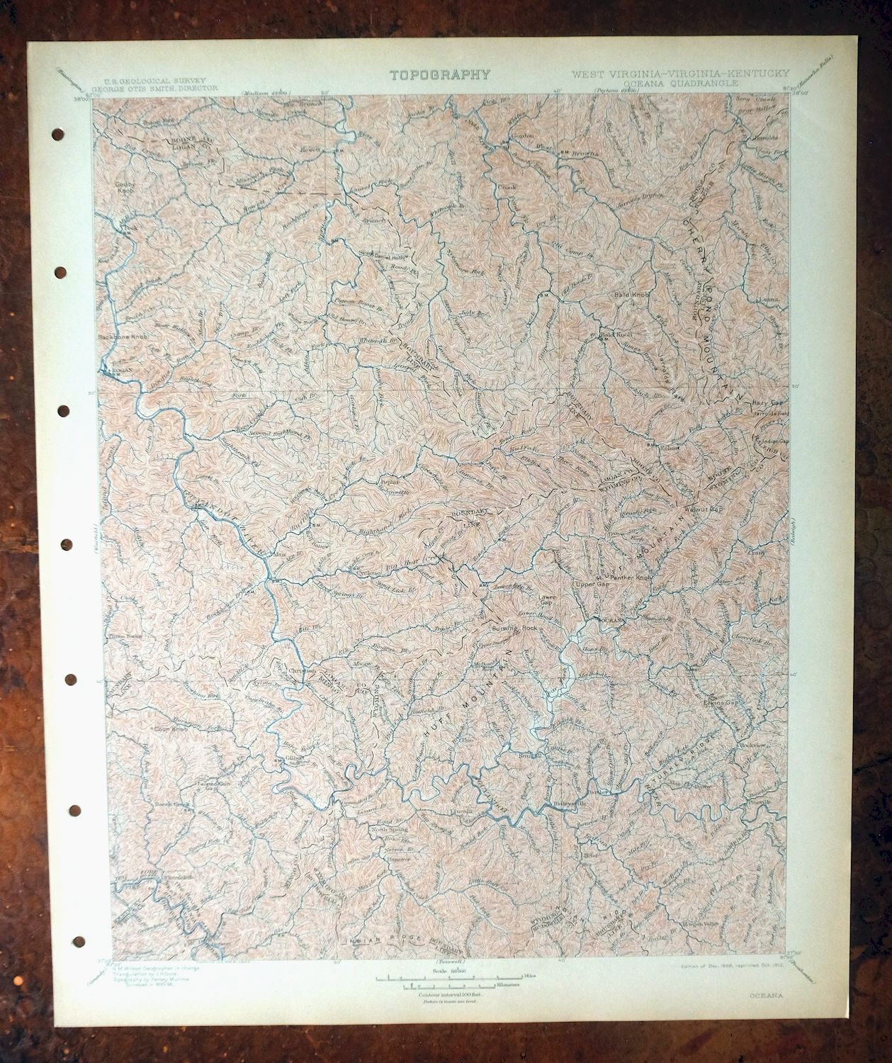
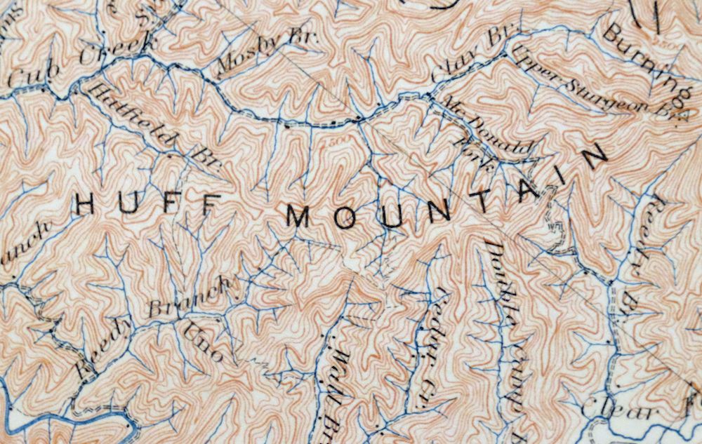
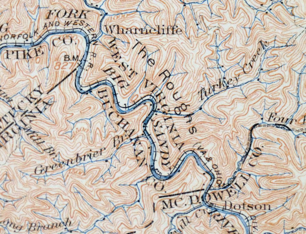
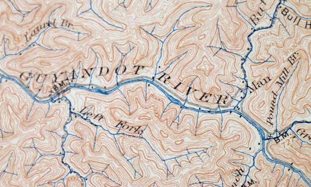
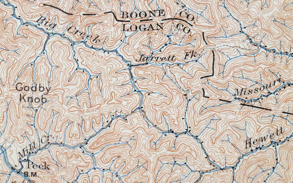
Oceana West Virginia Logan Gilbert USGS Topographic Map 1912
$58
This is a 1898 edition of the Oceana quadrangle, printed in 1912 and graded in excellent condition after very light handling; the sheet was never folded and remains smooth and flat on thick stock, with only light age-toning to the paper. The 30-minute quad takes in a stretch of southern West Virginia coal country where the boundaries reach into Kentucky and Virginia, including Logan, Oceana, and the towns along the Guyandotte and Tug Fork valleys, with counties from Boone and Logan to McDowell and Pike. Surveyed in 1895 and 1896 under geographer H.M. Wilson, this sheet predates the modern highway system and R.D. Bailey Lake, recording the historic travel routes, river crossings, rail lines, and placenames of the region before large-scale strip mining reshaped it. The reverse carries printed reference material about the mapping program and how to read the contours, and the sheet comes from an uncommonly well-preserved collection.
In stock
This antique sheet is an 1898 edition of the Oceana West Virginia USGS topographic map. It is an authentic 114-year-old 1912 United States Geological Survey print in excellent condition.
HOW THIS MAP CAN BE USED
In addition to making a fascinating conversation piece, this sheet would look great in a frame or on display, make a unique and prized gift for anyone interested in this area, be perfect as a reference for genealogy studies or general historical research, or fill that missing piece in your collection.
FEATURES SHOWN ON THE MAP
The Oceana 30-minute map shows cities and towns, roads, railroads, rivers, creeks, elevation contour lines, public land survey lines, county, state, and other administrative boundaries as they existed at the time of the survey in 1895 through 1896.
A VALUABLE HISTORICAL RECORD
Maps from the USGS 30-minute series have been out of print for many years. They have never been common and original prints are increasingly difficult to find. For areas where the 30-minute map was produced, it is usually the first large-scale survey done by the USGS for that area. These are a valuable historical record, as they contain many placenames and features that have been dropped from more recent series’ and editions.
Nearby maps
-

Raleigh West Virginia Beckley Oak Hill USGS Topo Map 1901
$135 Add to cart -

Warfield West Virginia Pikeville Harts USGS Topo Map 1911
$85 Add to cart -

Nicholas West Virginia Summersville Cowen USGS Topo Map 1912
$54 Add to cart -

Kenova Kentucky Louisa Grayson USGS Topo Map 1912 Antique
$54 Add to cart -

Whitesburg Kentucky Pikeville Cumberland USGS Topo Map 1910
$80 Add to cart -

Wytheville Virginia Marion Sparta USGS Topo Map 1907 Antique
$105 Add to cart -

Salyersville Kentucky West Liberty Zag USGS Topo Map 1918
$47 Add to cart -

Sutton West Virginia Glenville Elk River USGS Topo Map 1907
$75 Add to cart -

Natural Bridge Virginia Covington Selma USGS Topo Map 1911
$62 Add to cart -
Manchester Kentucky Booneville McKee USGS Topo Map 1917
$51 Add to cart -

Bald Knob West Virginia Mallory USGS Topo Map 1923 Antique
$50 Add to cart -

Peytona West Virginia Marmet Belle USGS Topographic Map 1911
$42 Add to cart -

Charleston West West Virginia Dunbar USGS Topo Map 1978
$22 Add to cart -

Wayne West Virginia Dunlow Cove Gap USGS Topo Map 1909
$42 Add to cart -

Charleston West Virginia Cross Lanes Rand USGS Topo Map 1914
$68 Add to cart -

Saint Albans West Virginia Dunbar USGS Topographic Map 1909
$37 Add to cart -

Pocatalico West Virginia Dunbar USGS Topographic Map 1977
$30 Add to cart -

Winfield West Virginia Bancroft Southside USGS Topo Map 1908
$37 Add to cart -

Ravenswood West Virginia New Haven Evans USGS Topo Map 1908
$40 Add to cart -

Point Pleasant West Virginia Middleport USGS Topo Map 1908
$25 Add to cart -

Garrison Kentucky Portsmouth York USGS Topo Map 1918 Antique
$32 Add to cart -

Pomeroy Ohio Middleport Mason USGS Topo Map 1907 Antique
$37 Add to cart -

Parkersburg Ohio Marietta Vienna USGS Topo Map 1912 Antique
$63 Add to cart -

Marietta Ohio Wayne NF Devola USGS Topo Map 1912 Antique
$62 Add to cart
