MAP DETAILS | |
|---|---|
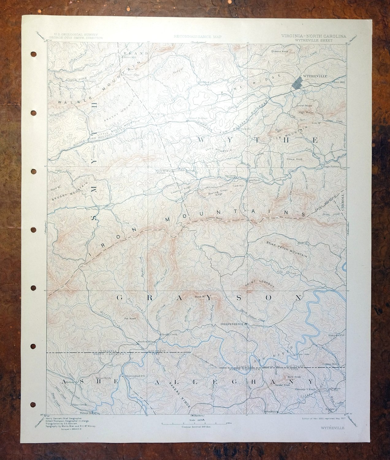
| TITLE | Wytheville |
| STATE | Virginia, North Carolina |
| LOCATION | 70 miles northwest of Winston-Salem, NC |
| SERIES | 30-minute |
| SURVEYED | 1883 through 1888 Field Survey |
| GEOGRAPHER | Henry Gannett |
| EDITION | 1892 |
| PRINTED | 1907 |
| PRINT NOTES | Thick paper stock |
| SCALE | 1:125000 |
| CONTOUR INTERVAL | 100 feet |
| SHEET DIMENSIONS | 16 1/2 x 20 inches |
| MAP DIMENSIONS | 14 x 17 1/2 inches |
| COVERAGE AREA | 28 x 35 miles |
| SOURCE | From an uncommonly well-preserved collection |
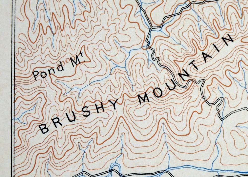
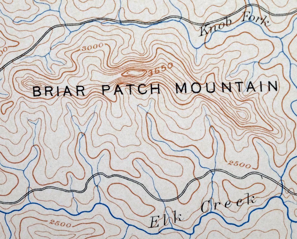
| MAP NOTES | A fascinating historical snapshot of the area from Nebo to Sparta, surveyed before the modern highway system, showing historic travel routes, rail lines, and placenames. |
| SHEET CONDITION For maps of this vintage, effort is made to note all visible flaws, no matter how minor. | |
| OVERALL CONDITION | Excellent |
| SHEET NOTES | very lightly handled, never folded |
| MAP AREA | flawless map area |
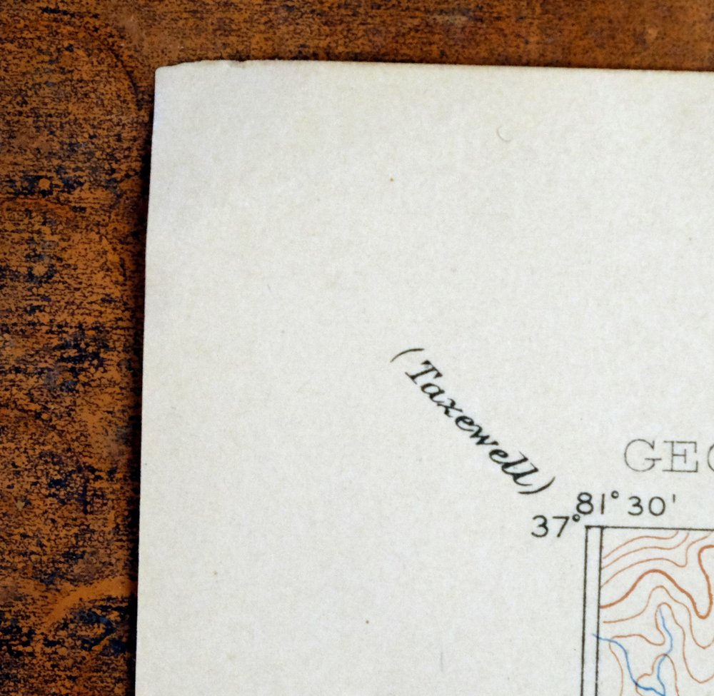
| COLLARS | no wear or tears, no markings, no blemishes, hole punches along left collar, slight bend at extreme upper left collar corner |
 | |
| MAP COVERAGE Quadrangle extent overlaid on current basemap. | |
| BACKSIDE LEGEND | |
 A map summary is printed on the back side of the Wytheville sheet similar to the one shown in the picture. It outlines the history, purpose, and status of the USGS mapping program at the time of the printing in 1907. It also provides instructions on how to read contour lines and a description of how they are used to depict the terrain. At the bottom of the page is a legend showing all of the symbols used to represent the cultural, relief, and water features found on the map. | |
| PLACENAMES Depending on map series and survey date, all of the features listed below may not be shown on this map. This list contains features that currently exist or historically existed within the area covered by the map. The list can be used as a reference to determine if this map covers your area of interest. Placenames are listed alphabetically next to each feature type. | |
| CITIES AND TOWNS (CURRENT) | Atkins, Cripple Creek, Crockett, Fort Chiswell, Independence, Kent, Marion, Mouth of Wilson, Rural Retreat, Sparta, Sugar Grove, Trout Dale, Troutdale, and Wytheville |
| COUNTIES COVERED | Alleghany, Ashe, Bland, Carroll, Grayson, Smyth, Tazewell, and Wythe |
| FEDERAL LAND UNITS | Jefferson National Forest, Little Dry Run Wilderness, Little Wilson Creek Wilderness, and Mount Rogers National Recreation Area |
| RIVERS AND STREAMS | Baker Branch, Bear Branch, Bear Creek, Beaverdam Creek, Big Branch, Big Spring Branch, Big Wilson Creek, Bishop Branch, Bledsoe Creek, Blue Spring Creek, Bournes Branch, Bridle Creek, Brier Run, Brush Creek, Bull Run, Bullins Branch, Carico Branch, Chaney Branch, Clems Branch, Cold Run, Comers Creek, Comers Rock Branch, Cook Branch, Coon Branch, Cove Branch, Cove Creek, Crab Creek, Crab Fork, Cressy Creek, Crigger Creek, Cripple Creek, Dean Branch, Dickey Creek, Dry Branch, Dry Creek, Dry Run, Dulton Branch, Dungeon Branch, Eagle Bottom Creek, East Dry Run Fork, East Fork Nicks Creek, Elk Creek, Fall Branch, Falls Branch, Farmers Branch, Flag Pond Branch, Fox Creek, Francis Mill Creek, Georges Branch, Glade Creek, Granny Branch, Grassy Creek, Grippy Branch, Guffey Creek, Gullion Fork, Harmon Branch, Helton Creek, Henley Creek, Houndshell Branch, Hungry Mother Creek, Hurricane Creek, Hutson Branch, Hutton Branch, Jerd Branch, Jerry Creek, Johns Creek, Jones Branch, Jones Creek, Jumping Creek, Killinger Creek, Kings Branch, Kinser Creek, Knob Fork, Laurel Branch, Laurel Creek, Laurel Run, Lee Branch, Lick Branch, Lick Creek, Little Beartown Branch, Little Brush Creek, Little Dry Run, Little Fox Creek, Little Helton Creek, Little Peach Bottom Creek, Little Pine Creek, Little Piney Creek, Little River, Little Rock Creek, Little Sprouts Creek, Little Wilson Creek, Long Branch, Lynn Camp Creek, Marchant Creek, McDonald Branch, Middle Branch Elk Creek, Middle Fork Holston River, Middle Fox Creek, Mill Branch, Mill Creek, Moccasin Creek, Monkey Run, Muddy Branch, Mudlick Branch, Mullins Branch, Muskrat Branch, New River, Nicks Creek, North Branch Elk Creek, North Fork Holston River, North Fork New River, Old Field Creek, Opossum Creek, Page Branch, Panther Creek, Peggies Branch, Penn Branch, Pierce Branch, Pine Run, Piney Creek, Pool Spring Branch, Possum Creek, Potato Creek, Powder Mill Branch, Powdermill Creek, Prathers Creek, Punch And Judy Creek, Quebec Branch, Raccoon Branch, Redman Branch, Reed Creek, Ripshin Creek, Roaring Branch, Rock Creek, Roger Branch, Saddle Creek, Scott Branch, Shippy Branch, Shoal Creek, Shop Branch, Shupe Creek, Silas Creek, Slate Spring Branch, Slemp Creek, Snavely Branch, Solomon Branch, South Branch Elk Creek, South Fork Holston River, South Fork New River, South Fork Reed Creek, Staley Creek, Stevens Creek, Stone Creek, Stony Fork, Stuffle Run, Sugar Branch, Sugar Run, Tate Run, Thorn Branch, Thorn Creek, Trout Branch, Turkey Fork, Vaught Branch, Venrick Run, Vile Creek, Wallen Creek, Wilburn Branch, Wilson Creek, Wolfpen Branch, Yellow Branch, and Young Branch |
| WATER BODIES | Hampton Lake and Rural Retreat Lake |
| Virginia Populated Place: Shady Grove, Atkins, Attoway, Barton Crossroad, Baywood, Beaver, Bennington Mill, Blacklick, Blessing, Bridle Creek, Carsonville, Cedar Springs, Cline, Clito Mill, Collier, Comers Rock, Copenhavers, Cripple Creek, Crockett, Crowgeys, Eagle Furnace, Elk Creek, Fairview, Fairwood, Fallville, Favonia, Flat Ridge, Fox, Furnace Hill, Grant, Groseclose, Groseclose Store, Grubb, Henley, Hildreths House, Huddle, Independence, Kegleys, Kent, Kindrick, Lower Elk Creek, Mill Creek, Mount Carmel, Mouth of Wilson, Murpheyville, Musser, Nebo, Noble Furnace, Oak Hill, Peach Bottom, Petunia, Providence, Riverside, Roberts Mill, Rowe Crossroads, Rugby, Rural Retreat, Shiloh, Shupe, Simmerman, Slabtown, Speedwell, Spring Valley, Staley Crossroads, Stinson, Stones Mill, Stringtown, Sugar Grove, Summit, Sutherland, Trout Dale, Turkey Fork, Volney, West Piney, Willard, Wilson, and Wytheville. Locations: Tilson Mill, Grubb Dairy Farm, Rolling Acres Dairy, Camp, Camp High Rock, Catrons Mill, Cox Chapel, Dark Horse Hollow Campground, Evansham Shopping Center, Glade Mountain Shelter, Government Siding, Hacklers Store, Haven, Haw Orchard, Hurricane Campground, Hussy Mountain Horse Camp, Marion Plaza Shopping Center, Marion State Fish Hatchery, Mount Rogers National Recreation Area Office, Mount Rogers Work Center, Old Mount Airy, Raccoon Branch Campground, Raccoon Branch Shelter, Raven Cliff Campground, Raven Cliff Furnace, Raven Cliff Horse Camp, Rectors Store, Sinclair Preston Landscape for the Future, Stroupes Store, Summit, Teas, Wytheville Golf Club, and Wytheville National Fish Hatchery Number 1. Administrative Boundaries: Atkins District, Black Lick District, East Wytheville District, Elk Creek District, Providence District, Rye Valley District, Speedwell District, Town of Independence, Town of Rural Retreat, Town of Troutdale, Town of Wytheville, West Wytheville District, Wilson Creek District, Grayson County, and Wythe County. Mountain Ranges: Little Brushy Mountain. Reserves: Little Wilson Creek Wilderness, Raccoon Branch Wilderness, and Little Dry Run Wilderness. Mountains, Peaks, and Summits: Bald Hill, Bald Rock, Big Turkey Knob, Blackburn Knob, Bowling Green Mountain, Brierpatch Mountain, Browns Peak, Brushy Butt, Bryants Knob, Buchanan Mountain, Buck Mountain, Buzzard Hill, Buzzard Rock, Carter Mountain, Cave Hill, Chestnut Knob, Chestnut Mountain, Chimney Rocks, Comers Rock, Couchs Knob, Devils Den, Dickey Knob, Ewing Mountain, First Peak, Fox Knob, Fries Knob, Fry Hill, Glade Mountain, Gleaves Knob, Goat Knob, Grassy Knob, Groundhog Hill, Harvel Knob, Henley Mountain, High Knob, High Point, High Rock, High Rocks, Horne Knob, Horse Heaven, Huckleberry Knob, Hussy Mountain, Jones Knob, Kindrick Mountain, Lick Mountain, Lina Rocks, Little Brushy Mountain, Little Horse Heaven, Little Huckleberry Knob, Little Mountain, Little Turkey Knob, Locust Mountain, Lundy Knob, McKenney Hill, Mill Mountain, Panther Knob, Penitentiary Hill, Perkins Knob, Point Lookout Mountain, Poor Knob, Porter Mountain, Privett Knob, Queens Knob, Roaring Hill, Ross Knob, Round Mountain, Russell Knob, Sand Mountain, Second Peak, Sells Knob, Shoal Hill, Sindion Point, Snake Den Mountain, Steer Knob, Stevens Knob, Stone Mountain, Straight Mountain, Striped Rock, Stuart Mountain, Swecker Mountain, The Pilot, The Pinnacle, Third Peak, Tims Knob, Turkey Knob, Upper Sharp Knob, White Rock Mountain, Willie Knob, and Wolf Hill. Valleys and Canyons: Andrews Hollow, Ann Grubb Hollow, Arney Hollow, Ashland Hollow, Bell Hollow, Bridgeman Hollow, Broad Hollow, Brown Hollow, Channel Rock Hollow, Claybank Hollow, Crawfish Valley, Crockett Cove, Crow Hollow, Currin Valley, Dark Hollow, Davis Hollow, Davis Valley, Deckard Hollow, Dutton Hollow, Fairwood Valley, Goodpasture Hollow, Hazelnut Hollow, Heldreth Hollow, Henley Hollow, Hollow Rock Hollow, Huff Hollow, Jackson Hollow, Jones Hollow, Kingdom Hollow, Kirk Hollow, Laurel Hollow, Lindamood Hollow, Logan Hollow, Long Hollow, Newman Hollow, Old Road Hollow, Overbay Hollow, Phillips Hollow, Pickle Hollow, Roberts Cove, Rocky Hollow, Russell Hollow, Rye Cove, Rye Valley, Scott Hollow, Shop Hollow, Shupe Hollow, Six Valley, Slabtown Hollow, Spruce Pine Hollow, Sugar Camp Hollow, Sugarcamp Hollow, Tickle Pink Hollow, Waddle Hollow, Whetstone Hollow, Willow Branch Hollow, and Wolf Rock Hollow. Parks: Comers Rock Recreation Area, Dark Hollow Picnic Area, Grayson Highlands State Park, and Mount Rogers National Recreation Area. Trails: Bearpen Trail, Bobby's Trail, Bournes Branch Trail, Cliff Branch Trail, Comers Creek Trail, Crigger Creek Trail, Divide Trail, First Peak Trail, Hickory Ridge Trail, Horse Heaven Trail, Hurricane Creek Trail, Little Dry Run Trail, Miles Gap Trail, Mountain Trail, Mullins Branch Trail, Perkins Knob Trail, Rocky Hollow Trail, Scales Trail, Switchback Trail, Third Peak Trail, Virginia Highland Trail, and Yellow Branch Trail. Drainages: Notch Creek, Band Branch, Bear Branch, Bear Creek, Beaverdam Creek, Big Branch, Big Spring Branch, Big Wilson Creek, Bishop Branch, Blue Spring Creek, Boags Branch, Bournes Branch, Bowen Branch, Bridle Creek, Brier Run, Brush Creek, Bull Run, Bullins Branch, Carico Branch, Chaney Branch, Clems Branch, Cold Run, Comers Creek, Comers Rock Branch, Cook Branch, Coon Branch, Cove Branch, Cox Branch, Cressy Creek, Crigger Creek, Crow Branch, Dickey Creek, Dry Branch, Dry Creek, Dry Run, Dulton Branch, East Dry Run Fork, East Fork Nicks Creek, Elk Creek, Fall Branch, Falls Branch, Farmers Branch, Flag Pond Branch, Fox Creek, Francis Mill Creek, Georges Branch, Glade Branch, Goose Creek, Granny Branch, Gray Branch, Grippy Branch, Guffey Creek, Gullion Fork, Harmon Branch, Harvel Creek, Heninger Branch, Henley Creek, Hines Branch, Houndshell Branch, Huddle Branch, Hurricane Creek, Hutson Branch, Hutton Branch, Jerry Creek, Johns Creek, Jones Branch, Jones Creek, Jumping Creek, Killinger Creek, Kings Branch, Kinser Creek, Knob Fork, Laurel Branch, Laurel Creek, Laurel Run, Lee Branch, Lick Branch, Lick Creek, Little Brush Creek, Little Dry Run, Little Fox Creek, Little Peach Bottom Creek, Little Rock Creek, Little Wilson Creek, Lynn Camp Creek, Marchant Creek, McDonald Branch, Middle Branch Elk Creek, Middle Creek, Middle Fox Creek, Mill Branch, Mill Creek, Monkey Run, Moore Creek, Muddy Branch, Mudlick Branch, Mullins Branch, Muskrat Branch, Nettle Branch, Nicks Creek, North Branch Elk Creek, Opossum Creek, Page Branch, Panther Creek, Parks Creek, Peach Bottom Creek, Peggies Branch, Penn Branch, Phillippi Branch, Pierce Branch, Pine Run, Pool Spring Branch, Possum Creek, Powdermill Creek, Quarter Branch, Quebec Branch, Raccoon Branch, Ripshin Creek, Roaring Branch, Rock Creek, Roger Branch, Saddle Creek, Saint Lukes Fork, Sally Run, Scott Branch, Shanty Branch, Shoal Creek, Shop Branch, Shupe Creek, Slabtown Branch, Slate Spring Branch, Slemp Creek, Snavely Branch, Snider Branch, Solomon Branch, South Branch Elk Creek, South Fork, Stone Creek, Stony Fork, Stuffle Run, Sugar Branch, Sugar Run, Sugarcamp Branch, Tate Run, Thorn Branch, Thorn Creek, Trout Branch, Turkey Fork, Vaughn Branch, Vaught Branch, Venrick Run, Wallen Creek, Ward Branch, Weiss Branch, West Dry Run Fork, White Rock Creek, Wilburn Branch, Wildcat Branch, Wilson Creek, Wolfpen Branch, Yellow Branch, and Young Branch. Mines: Cardinal Quarries and Rural Retreat Quarry. Churches: Saint Mathews Church, Asbury Church, Atkins Church, Bald Rock Church, Bear Creek Church, Berea Church, Bethany Church, Bethel African Methodist Episcopal Church, Bethel Church, Bethlehem Baptist Church, Bibleway Baptist Church, Blacklick Church, Blue Spring Church, Brush Creek Church, Brush Creek Mission, Burton Chapel, Calvary Church, Carmi Church, Cedar Bluff Church, Cedar Hill Church, Centenary Church, Center View Church, Central Church, Chestnut Hill Church, Chestnut Ridge Church, Church of Christ, Church of God, Cold Springs Church, Comers Creek Church, Corinth Church, Cox Chapel, Crockett Chapel, Cross Road Church, Davis Memorial Church, Ebenezer Church, Elizabeth Church, Evergreen Church, Ezelle Church, Fairview Church, Fairview United Methodist Church, Faith Church, Falling Water Church, Fellowship Church, First Assembly of God Church, First Christian Church, First Church of God, Flat Rock Church, Flemming Church, Forest Church, Fox Union Baptist Church, Franklin Street United Methodist Church, Friendship Church, Fulton Church, Furnace Hill Lutheran Church, Galilee Church, Glenwood Church, Gold Hill Church, Goodwill Church, Grace Church, Green Mountain Church, Groseclose Chapel, Grubbs Chapel, High Point Church, Hines Branch Church, Holy Advent Church, Holy Trinity Lutheran Church, Honey Grove Church, Jackson Presbyterian Chapel, Jerusalem Church, Kimberlin Church, Kings Grove Church, Laurel Hill Church, Lebanon Church, Liberty Church, Liberty Hill Church, Lick Mountain Church, Little Wilson Church, Longview Church, Marvin Church, Memorial Church, Morning Star Church of God, Mount Carmel Church, Mount Carmel United Methodist Church, Mount Ephraim Church, Mount Mitchell Church, Mount Olive Church, Mount Pleasant Church, Mount Zion Church, Mountain View Church, New Bethel Church, New Hope Church, Nicks Creek Church, Oak Grove Church, Pilgrims Rest Church, Pine Branch Church, Pine Mountain Church, Pleasant Branch Church, Pleasant Grove Church, Pleasant Hill Church, Potato Creek Church, Providence Church, Pugh Mountain Church, Razor Ridge Church, Redman Church, Riddles Memorial Church, River Hill Church, Rock Creek Church, Rockbridge Church, Rosenbaum Church, Saddle Creek Church, Saint Johns Church, Saint Johns Episcopal Church, Saint Marys Catholic Church, Saint Paul United Methodist Church, Saint Pauls Church, Saint Peters Church, Salem Church, Sharon Church, Speedwell Methodist Church, Springfield Church, Stones Chapel, Suminit Church, Summerfield Church, Union Church, Volney Church, West End United Methodist Church, Wharfhill Church, Wolf Knob Church, Wytheville Baptist Church, Wytheville Pentecostal Holiness Church, Wytheville Presbyterian Church, Wytheville Seventh Day Adventist Church, Young Chapel, Youngs Chapel, and Zion Church. Post Office: Atkins Post Office, Crockett Post Office, Elk Creek Post Office, Independence Post Office, Mouth of Wilson Post Office, Rural Retreat Post Office, Speedwell Post Office, Sugar Grove Post Office, Troutdale Post Office, and Wytheville Post Office. Hospitals: Smyth County Community Hospital and Wythe County Community Hospital. Lakes and Ponds: Cress Lake. Buildings: Atkins Volunteer Fire Department, Baywood Search and Rescue Squad, Elk Creek Rescue Squad, Elk Creek Volunteer Fire Department, Grayson County Sheriff's Department, Independence Volunteer Fire Department, Independence Volunteer Rescue Squad, Rugby Fire and Rescue Department, Rural Retreat Volunteer Fire Department, Speedwell Volunteer Fire Department, Sugar Grove Life Saving Crew, Sugar Grove Volunteer Fire Department, Troutdale Community Volunteer Fire Department, Wythe County Rescue Squad, Wytheville Community College Police Department, Wytheville Fire Department, Independence Police Department, Nebo Volunteer Fire Department Station 2, River North Correctional Center, Rural Retreat Police Department, Smyth County Ambulance Service, Wythe County Sheriff's Office, Wytheville Police Department, Edgemont Center, Grayson County Courthouse, Wythe County Courthouse, Wythe County Jail, Wytheville City Hall, Wytheville Ranger Station, and Wytheville Work Center. Waterfalls: The Falls. Dams: Fields Dam, Hale Dam, Hungry Mother Dam, Laurel Creek Dam, Roberts Dam, Rural Retreat Dam, and Stuart Dam. Crossings: Anderson Ford, Billings Ford, Cox Ford, Doughton Ford, Ham Ford, Penitentiary Ford, Spurlin Ford, and Todd Ford. Bluffs: Eagle Cliff, Raven Cliff, and White Rock Cliff. Gaps: Blue Spring Gap, Dickey Gap, Dry Run Gap, Flat Ridge Gap, Houndshell Gap, Longs Gap, Low Gap, Mikes Gap, Redding Gap, Scott Gap, and Tilson Gap. Bridges: R A Droughton Memorial Bridge, Reverend J W Rader Memorial Bridge, and William Andrew Scott Memorial Bridge. Bays: Collins Cove. Basins: Kinder Valley and The Devils Hopper. Airports: Mountain Empire Airport and Wythe County Community Hospital Heliport. Census: Atkins Census Designated Place, Sugar Grove Census Designated Place, and Baywood Census Designated Place. Schools: Independence Elementary School, Rural Retreat Middle School, Speedwell Elementary School, Wythe County Technology Center, Echo Valley Christian School, Granite Christian Academy, Grayson County Career and Technical Center, Oak Hill Academy, Atkins Elementary School, Baywood Elementary School, Bridle Creek Elementary School, Elk Creek Elementary School, George Wythe High School, Grayson County High School, Independence Middle School, Marion Primary School, Providence Elementary School, Rural Retreat Elementary School, Rural Retreat High School, Scott Memorial Middle School, Spiller Elementary School, Sugar Grove Combined School, Virginia-North Carolina School, Wytheville Community College, and Wytheville Primary School. Ridges: Pine Ridge, Bald Rock Ridge, Bearpen Ridge, Big Ridge, Big Spring Ridge, Bobbys Ridge, Brushy Mountain, Brushy Ridge, Brushy Spur, Canadays Ridge, Cave Ridge, Chestnut Ridge, Cinnamon Ridge, Dickey Ridge, Flat Ridge, Goodpasture Ridge, Grape Ridge, Green Ridge, Hickory Ridge, Leading Ridge, Long Ridge, Long Spur, Mikes Ridge, Mink Ridge, Nettle Ridge, Newlands Ridge, Perkins Ridge, Quillen Ridge, Razor Ridge, Russell Ridge, Sheep Ridge, Snake Den Ridge, and York Ridge. Reservoirs and Tanks: Fields Reservoir, Hale Lake, Hampton Lake, and Rural Retreat Lake. Flats: Chestnut Flat, Hemp Patch, Matney Flat, and Pine Glade. Towers: Walker Mountain Lookout Tower, WCRR-AM (Rural Retreat), WCRR-FM (Rural Retreat), WOLD-AM (Marion), WOLD-FM (Marion), WYVE-AM (Wytheville), and WYVE Radio Tower (Galax). Pillars: Hightree Rock. Springs: Big Spring, Blue Spring, Cedar Spring, and Wyrick Spring. Cemetery: Old Parks Cemetery, Adams Cemetery, Anderson Cemetery, Atkins Cemetery, Blevins Cemetery, Bolt Cemetery, Brooks Cemetery, Buchanan Cemetery, Burton Chapel Cemetery, Calhoun Cemetery, Campbell Cemetery, Carmi Cemetery, Carrico Cemetery, Cole Cemetery, Comer Cemetery, Cooper Cemetery, Corinth Cemetery, Cornett Cemetery, Cox Cemetery, Coxs Chapel Cemetery, Cregger Cemetery, Cress Cemetery, Dainel Cemetery, Davis Cemetery, Earhart Cemetery, East End Cemetery, Ebenezer Cemetery, Fairwood Cemetery, Floglesong Cemetery, Fox Union Cemetery, Gold Hill Cemetery, Goodman Cemetery, Goodpasture Cemetery, Grubb Cemetery, Harmon Cemetery, Harrington Cemetery, Haw Orchard Cemetery, Hays Cemetery, Hoffman Cemetery, Holdaway Cemetery, Hubble Cemetery, Hutton Cemetery, James Cemetery, Jerusalem Cemetery, Jones Cemetery, Keesling Cemetery, Kimberling Cemetery, Kirk Cemetery, Liberty Hill Cemetery, Little Wilson Cemetery, Long Cemetery, Marchant Cemetery, McGhee Cemetery, Morgan Cemetery, Mountain View Cemetery, Murpheyville Cemetery, Nelson Cemetery, Oak Grove Cemetery, Oakwood Memorial Gardens, Overbay Cemetery, Parks Cemetery, Perkins Cemetery, Phipps Cemetery, Pierce Cemetery, Pine Branch Cemetery, Pleasant Branch Cemetery, Porter Cemetery, Potato Creek Cemetery, Providence Cemetery, Pugh Cemetery, Reedy Cemetery, Ridgelawn Cemetery, Roberts Cemetery, Rose Lawn Cemetery, Ross Cemetery, Saddle Creek Cemetery, Saint Johns Cemetery, Scott Cemetery, Shuler Cemetery, Slemp Cemetery, Snavely Cemetery, Speedwell Methodist Cemetery, Sprinkle Cemetery, Steffey Cemetery, Steffy Cemetery, Sullivan Cemetery, Sunset Memorial Gardens Cemetery, Tilson Cemetery, Trout Dale Cemetery, Warrick Cemetery, Wassum Cemetery, Watson Cemetery, West End Cemetery, Woods Cemetery, Young Cemetery, and Zion Cemetery. | |
| North Carolina Populated Place: Chestnut Grove, Kings Creek, Mount Zion, Vox, Amelia, Blevins Crossroads, Chestnut Hill, Crumpler, Edwards Crossroads, Grassy Creek, Helton, Hooker, New Haven, Piney Creek, Sessex, Sparta, Stratford, Sturgills, Topia, Twin Oaks, and Weavers Ford. Locations: New River Canoe and Campground, New River Country Club, and Rivercamp USA. Administrative Boundaries: Town of Sparta, Township of Gap Civil, Township of Grassy Creek, Township of Helton, and Township of Piney Creek. Mountains, Peaks, and Summits: Lilah Hill, Rocky Knob, Bald Knob, Doughton Mountain, Helton Knob, and Turkey Knob. Drainages: Jewel Creek, Kings Creek, Brush Creek, Crab Creek, Elk Creek, Glade Creek, Grassy Creek, Helton Creek, Jerd Branch, Jones Branch, Little Helton Creek, Little Pine Creek, Little River, Long Branch, Millpond Branch, Moccasin Creek, North Fork New River, Old Field Creek, Piney Creek, Potato Creek, Rock Creek, Shippy Branch, South Fork New River, and Vile Creek. Islands: Mountain Island. Churches: New Haven Church of the Brethren, Piney Creek Primitive Baptist Church, Piney Creek United Methodist Church, Bakers Ridge Mission, Chestnut Grove Church, Chestnut Hill Church, Elk Creek Primitive Baptist Church, Glade Creek Church, Greenwood Church, Healing Springs Church, Helton Church, Landmark Church, Liberty Church, Little Helton Church, Little Piney Church, Mount Carmel Union Baptist Church, Mount Zion Methodist Church, New Home Free Will Baptist Church, New River Church, New River Missionary Baptist Church, Osborne Memorial Missionary Baptist Church, Pleasant Home Church, Pleasant Home Union Baptist Church, Pleasant Valley Church, Shiloh United Methodist Church, Silas Creek Church, South Fork Union Baptist Church, Trinity Church, Walnut Branch Church, White Plains Union Baptist Church, and Zion Primitive Baptist Church. Post Office: Crumpler Post Office, Grassy Creek Post Office, Piney Creek Post Office, and Sparta Post Office. Hospitals: Alleghany Memorial Hospital. Buildings: Alleghany County Courthouse, Alleghany County Emergency Medical Services, Alleghany County Rescue Squad, Alleghany County Sheriff's Office, Helton Ambulance Service, Piney Creek Volunteer Fire Department, Sparta Alleghany Volunteer Fire Department, and Sparta Police Department. Crossings: Kings Creek Ford. Airports: Maxwell Airport. Schools: Alleghany High School, Healing Springs School, Helton School, Piney Creek High School, and Virginia-North Carolina School. Ridges: Bakers Ridge. Flats: Jacks Bottom. Cemetery: Elk Creek Cemetery, Mount Zion Cemetery, New Haven Cemetery, Piney Creek Cemetery, Pleasant Home Cemetery, Shiloh Cemetery, South Fork Cemetery, Sparta Cemetery, Zion Cemetery, Greenwood Cemetery, New River Cemetery, and Rocky Ridge Cemetery. | |
| SHIPPING AND RETURNS | |
 This map sheet will be carefully rolled in a sturdy tube and shipped via the US Postal Service. If you find that the sheet you receive is not as described in the listing, you may ship it back to us for a refund of the purchase price. | |
Wytheville Virginia Marion Sparta USGS Topo Map 1907 Antique
$105
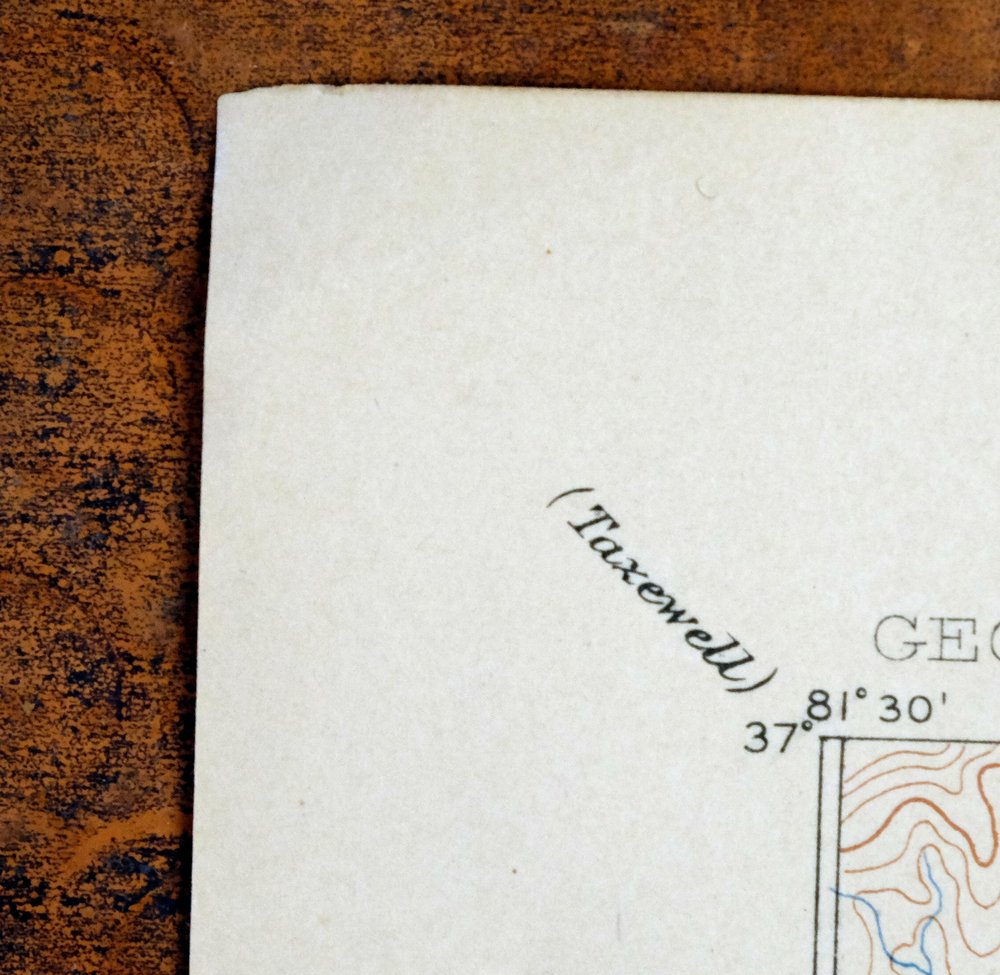
This USGS Reconnaissance Topo Map is a 1892 edition printed in 1907, an antique sheet on thick stock in excellent condition, very lightly handled and never folded. Spanning the Virginia–North Carolina line, the quad takes in Wytheville, Marion, and Rural Retreat in Virginia along with Sparta and Mouth of Wilson to the south, and includes portions of Jefferson National Forest. Surveyed between 1883 and 1888 under geographer Henry Gannett, it records the area from Nebo to Sparta before the modern highway system, showing the historic travel routes, rail lines, and placenames of that era. The reverse carries printed reference material, and the sheet comes from an uncommonly well-preserved collection.
In stock
This antique sheet is an 1892 edition of the Wytheville Virginia USGS topographic map. It is an authentic 119-year-old 1907 United States Geological Survey print in excellent condition.
HOW THIS MAP CAN BE USED
In addition to making a fascinating conversation piece, this sheet would look great in a frame or on display, make a unique and prized gift for anyone interested in this area, be perfect as a reference for genealogy studies or general historical research, or fill that missing piece in your collection.
FEATURES SHOWN ON THE MAP
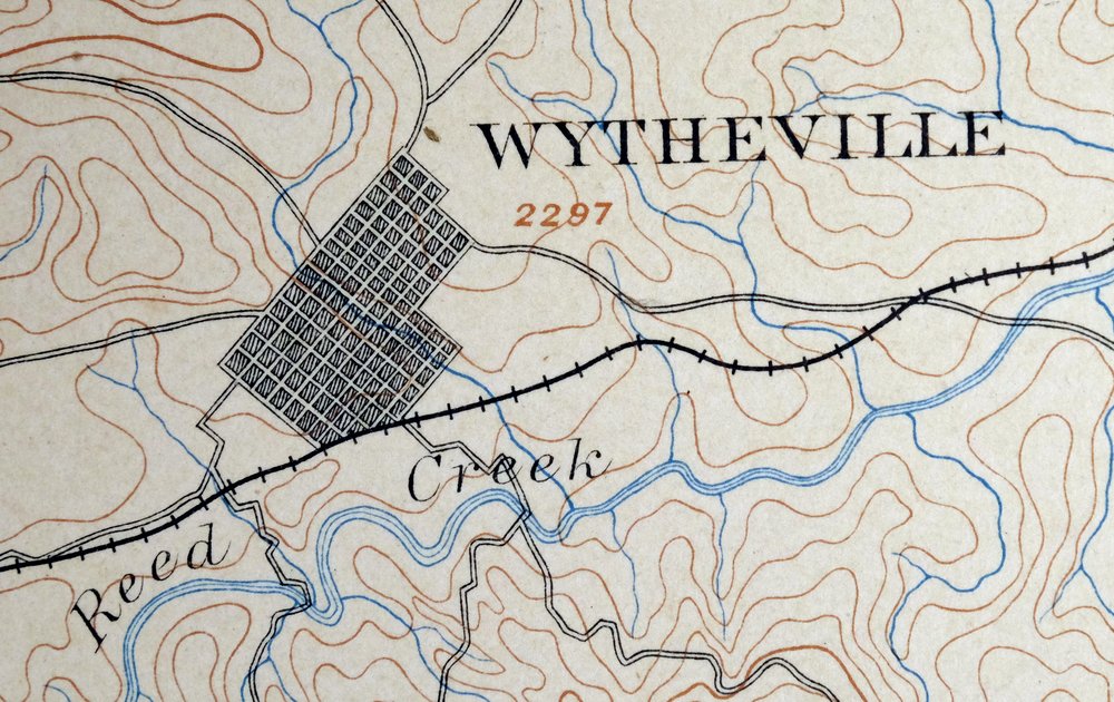
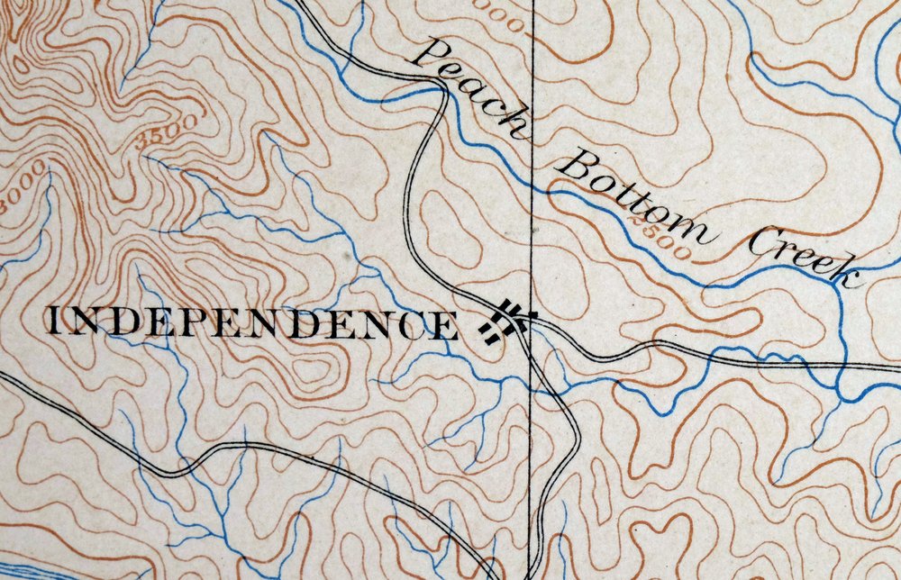
The Wytheville 30-minute map shows cities and towns, roads, railroads, rivers, creeks, elevation contour lines, public land survey lines, county, state, and other administrative boundaries as they existed at the time of the survey in 1883 through 1888.
A VALUABLE HISTORICAL RECORD
Maps from the USGS 30-minute series have been out of print for many years. They have never been common and original prints are increasingly difficult to find. For areas where the 30-minute map was produced, it is usually the first large-scale survey done by the USGS for that area. These are a valuable historical record, as they contain many placenames and features that have been dropped from more recent series’ and editions.
Nearby maps
-

Raleigh West Virginia Beckley Oak Hill USGS Topo Map 1901
$95 Add to cart -

Oceana West Virginia Logan Gilbert USGS Topographic Map 1912
$58 Add to cart -

Warfield West Virginia Pikeville Harts USGS Topo Map 1911
$105 Add to cart -

Whitesburg Kentucky Pikeville Cumberland USGS Topo Map 1910
$115 Add to cart -

Nicholas West Virginia Summersville Cowen USGS Topo Map 1912
$54 Add to cart -

Natural Bridge Virginia Covington Selma USGS Topo Map 1911
$62 Add to cart -

Salyersville Kentucky West Liberty Zag USGS Topo Map 1918
$47 Add to cart -

Kenova Kentucky Louisa Grayson USGS Topo Map 1912 Antique
$54 Add to cart -

Bald Knob West Virginia Mallory USGS Topo Map 1923 Antique
$50 Add to cart -

Peytona West Virginia Marmet Belle USGS Topographic Map 1911
$42 Add to cart -

Charleston West West Virginia Dunbar USGS Topo Map 1978
$22 Add to cart -

Wayne West Virginia Dunlow Cove Gap USGS Topo Map 1909
$42 Add to cart -

Charleston West Virginia Cross Lanes Rand USGS Topo Map 1914
$75 Add to cart -

Saint Albans West Virginia Dunbar USGS Topographic Map 1909
$37 Add to cart -

Pocatalico West Virginia Dunbar USGS Topographic Map 1977
$30 Add to cart -
Inman South Carolina Boiling Springs USGS Topo Map 1964
$45 Add to cart -
Tigerville South Carolina Tryon USGS Topographic Map 1973
$20 Add to cart -

Winfield West Virginia Bancroft Southside USGS Topo Map 1908
$37 Add to cart -

Greer South Carolina Simpsonville Duncan USGS Topo Map 1974
$32 Add to cart -

Sutton West Virginia Glenville Elk River USGS Topo Map 1907
$110 Add to cart -
Appomattox Virginia Brookneal Toga USGS Topographic Map 1912
$55 Add to cart -
Manchester Kentucky Booneville McKee USGS Topo Map 1917
$51 Add to cart -

John Sevier Tennessee Knoxville Mascot USGS Topo Map 1955
$38 Add to cart -

Ravenswood West Virginia New Haven Evans USGS Topo Map 1908
$40 Add to cart
