MAP DETAILS | |
|---|---|
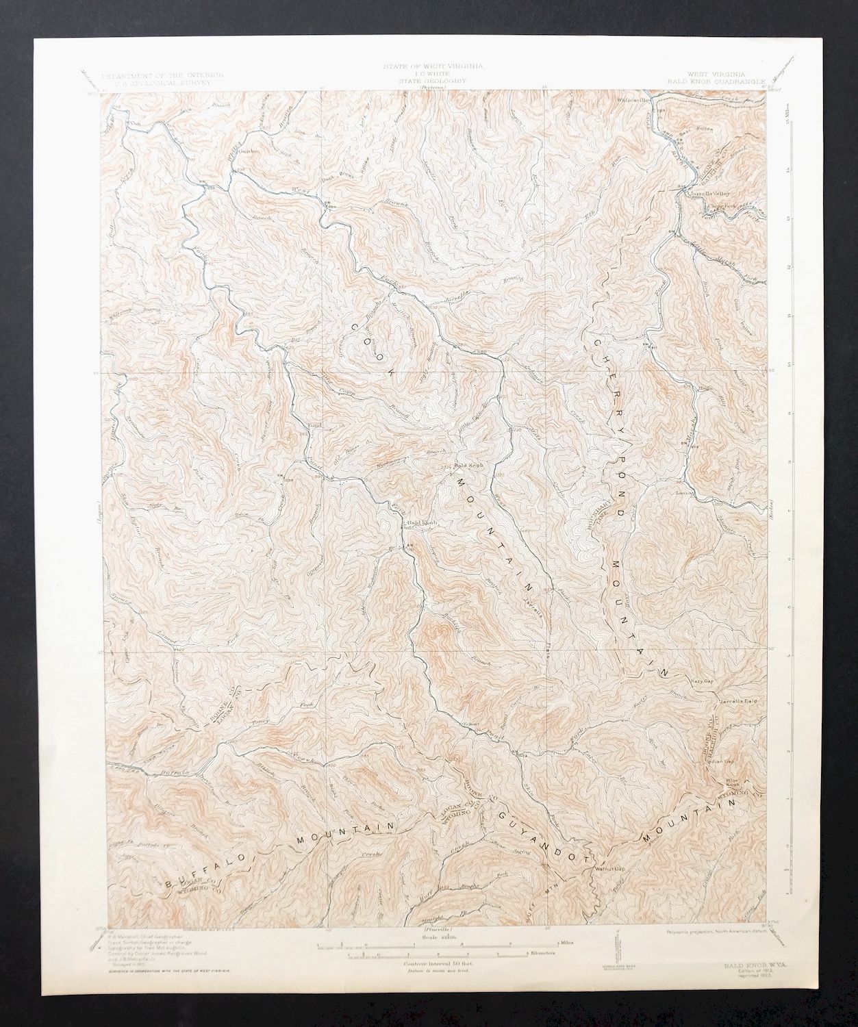
| TITLE | Bald Knob |
| STATE | West Virginia |
| LOCATION | Vicinity of Amherstdale-Robinette, 35 miles south of Charleston |
| SERIES | 15-minute |
| SURVEYED | 1910 Field Survey |
| GEOGRAPHER | R.B. Marshall |
| ENGRAVED | 1912 |
| EDITION | 1912 |
| PRINTED | 1923 |
| PRINT NOTES | Thick paper stock |
| SCALE | 1:62500 |
| CONTOUR INTERVAL | 50 feet |
| SHEET DIMENSIONS | 16 1/2 x 20 inches (approximate) |
| MAP DIMENSIONS | 13 7/8 x 17 1/2 inches |
| COVERAGE AREA | 14 x 17 miles |
| MAP NOTES | Historical snapshot of the pre-mining landscape in the early 1900s. |
| SHEET CONDITION For maps of this vintage, effort is made to note all visible flaws, no matter how minor. | |
| OVERALL CONDITION | Very Good |
| SHEET NOTES | very lightly handled, never folded, lightly age-toned sheet |
| MAP AREA | flawless map area |
| COLLARS | no markings, no blemishes, two minor bottom edge tears carefully stabilized with clear archival tape on backside of sheet |
| MAP COVERAGE Quadrangle extent overlaid on current basemap. | |
| BACKSIDE LEGEND | |
 A map summary is printed on the back side of the Bald Knob sheet similar to the one shown in the picture. It outlines the history, purpose, and status of the USGS mapping program at the time of the printing in 1923. It also provides instructions on how to read contour lines and a description of how they are used to depict the terrain. At the bottom of the page is a legend showing all of the symbols used to represent the cultural, relief, and water features found on the map. | |
| PLACENAMES Depending on map series and survey date, all of the features listed below may not be shown on this map. This list contains features that currently exist or historically existed within the area covered by the map. The list can be used as a reference to determine if this map covers your area of interest. Placenames are listed alphabetically next to each feature type. | |
| CITIES AND TOWNS (CURRENT) | Amherstdale-Robinette, Bald Knob, Mallory, and Whitesville |
| COUNTIES COVERED | Boone, Logan, Raleigh, and Wyoming |
| RIVERS AND STREAMS | Bandy Branch, Beaver Pond Branch, Beech Branch, Big Branch, Big Coal River, Big Jarrells Creek, Birch Fork, Brushy Fork, Buffalo Creek, Burnt Camp Branch, Casey Creek, Clear Fork, Coal Branch, Cow Creek, Crane Fork, Dennison Fork, Dingess Branch, Drews Creek, Dry Branch, Elk Run, Elklick Branch, Ellis Creek, Farley Branch, Grapevine Branch, Hazy Creek, Hopkins Fork, Huff Creek, James Branch, James Creek, Jarrell Branch, Jarrells Creek, Jasper Workman Branch, Lacey Branch, Lick Branch, Little Jarrells Creek, Logan Fork, Low Gap Branch, Marsh Fork, Matts Creek, Middle Fork Buffalo Creek, Old House Branch, Pond Fork, Right Fork Buffalo Creek, Roach Branch, Rockhouse Creek, Rocklick Branch, Seng Fork, Skin Fork, Skin Poplar Branch, Slickrock Branch, Spruce Fork, Spruce Laurel Fork, Spruce Lick Fork, Straight Fork, Sycamore Creek, Sycamore Fork, Toms Branch, Toney Fork, Trace Branch, West Fork Pond Fork, White Oak Branch, Whites Branch, and Workman Branch |
| WATER BODIES | Kopperston Number Four Slurry Pond |
| Areas: Jarrolds Field. Administrative Boundaries: District 2 Magisterial District. Mountains, Peaks, and Summits: Bald Knob, Kopperston Mountain, Buffalo Mountain, Cherry Pond Mountain, Cook Mountain, Pilot Knob, and Spring Mountain. Valleys and Canyons: Bean Hollow, Bear Hollow, Kuhn Hollow, Coon Hollow, Duck Brown Hollow, Ducky Ferrell Hollow, Elsie Hollow, Indian Hollow, and Still Hollow. Parks: Walhonde Roadside Park. Drainages: Little Marsh Fork, Bandy Branch, Bear Spring Branch, Beartree Branch, Beaver Pond Branch, Laurel Lick Branch, Birch Fork, Lacey Branch, Laurel Branch, Lee Fork, Left Fork Sycamore Fork, Lick Branch, Little Ugly Branch, Big Abe Fork, Bradley Fork, Browns Branch, Brushy Fork, Bull Creek, Burnt Camp Branch, Camp Branch, Casey Creek, Clear Fork, Coal Branch, Cow Creek, Davy Branch, Dennison Fork, Dingess Branch, Dry Branch, Elk Run, Elklick Branch, Ellis Creek, Farley Branch, Grapevine Branch, Hazy Creek, Jacks Branch, James Branch, James Creek, Jarrell Branch, Jarrells Creek, Jasper Workman Branch, Jigly Branch, Jordan Fork, Low Gap Branch, Marsh Fork, Matts Creek, Meredith Branch, Middle Fork Buffalo Creek, Mudlick Branch, North Fork Buffalo Creek, Old House Branch, Rich Branch, Right Fork White Oak Branch, Roach Branch, Road Fork, Rockhouse Creek, Rocklick Branch, Seng Creek, Shumate Creek, Skin Fork, Skin Poplar Branch, Slickrock Branch, Spring Branch, Spruce Lick Fork, Stink Run, Sycamore Creek, Sycamore Fork, Toms Branch, Toney Fork, Trace Fork, Upper Lick Branch, Upper Road Branch, West Fork Pond Fork, Workman Branch, and Whites Branch. Churches: Kingwood Church, Bright Prospect Church, Curtis Church, Elizabeth Church, New Zion Church, Shumate Chapel, Van United Methodist Church, and Wharton Church. Dams: Low Gap Branch Two Impoundment Dam, Rockhouse Branch Refuse Bank Dam, and Skin Poplar Branch Refuse Dump Dam. Gaps: Hazy Gap, Indian Gap, and Walnut Gap. Schools: Marsh Fork High School, Marsh Pork Junior High School, Mooney School, Pettus Elementary School, Van Elementary School, Van Junior-Senior High School, Wharton Elementary School, Wharton Junior High School, and Whitesville Elementary-Junior High School. Ridges: Jarrells Ridge. Reservoirs and Tanks: Low Gap Branch Number Two Impoundment, Lower Big Branch Refuse Impoundment, Pond Fork Impoundment, Robinhood Impoundment, Skin Poplar Branch Impoundment, and Wharton Number Two Mine Slurry Pond. Flats: Jarrells Flats. Towers: Spring Mountain Lookout Tower. Springs: Kimbrell Water Works Spring. | |
| SHIPPING AND RETURNS | |
 This map sheet will be carefully rolled in a sturdy tube and shipped via the US Postal Service. If you find that the sheet you receive is not as described in the listing, you may ship it back to us for a refund of the purchase price. | |
Bald Knob West Virginia Mallory USGS Topo Map 1923 Antique
$50
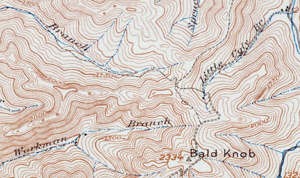
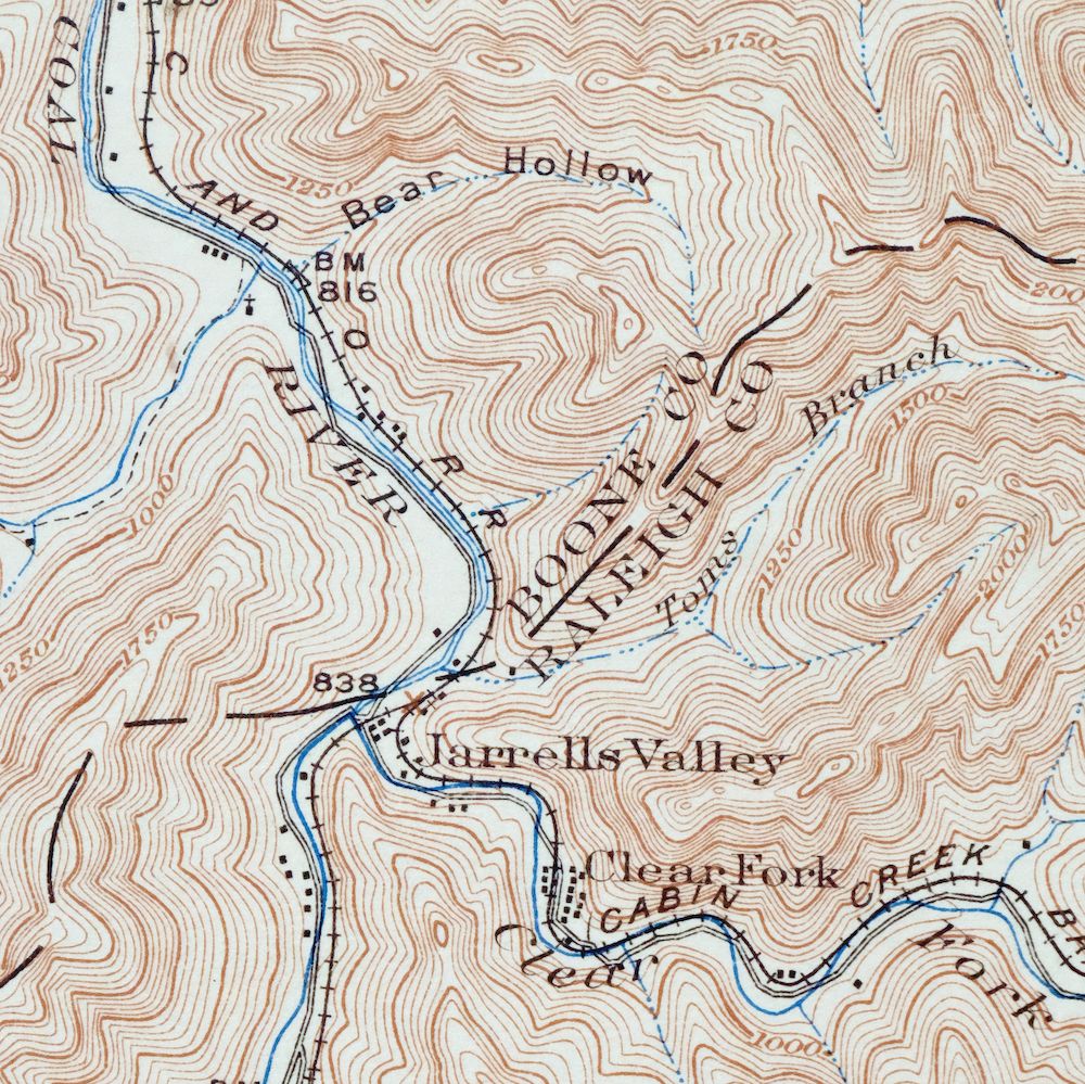
This USGS 15-minute topographic sheet is a 1912 edition, printed in 1923, and survives in very good condition – never folded, lightly age-toned, on thick stock, with two minor bottom edge tears carefully stabilized on the backside with archival tape. Drawn from a 1910 field survey and engraved in 1912 under geographer R.B. Marshall, it takes in a stretch of southern West Virginia across Boone, Logan, Raleigh, and Wyoming counties, including Amherstdale-Robinette, Mallory, Whitesville, and the community of Bald Knob that gives the quad its name. The 50-foot contours record the steep ridge-and-hollow country of this coalfield region as it stood in the early 1900s, before much of the mining that would reshape it, and the reverse carries printed reference material from the 1923 mapping program.
In stock
This antique sheet is a 1912 edition of the Bald Knob West Virginia USGS topographic map. It is an authentic 103-year-old 1923 United States Geological Survey print in very good condition.
HOW THIS MAP CAN BE USED
In addition to making a fascinating conversation piece, this sheet would look great in a frame or on display, make a unique and prized gift for anyone interested in this area, be perfect as a reference for genealogy studies or general historical research, or fill that missing piece in your collection.
FEATURES SHOWN ON THE MAP
The Bald Knob 15-minute map shows cities and towns, roads, railroads, rivers, creeks, elevation contour lines, public land survey lines, county, state, and other administrative boundaries as they existed at the time of the survey in 1910. All known structures (houses, businesses, churches, schools, barns, cabins, etc) are also shown, with exceptions in some urban areas, where only landmark buildings may be shown.
A VALUABLE HISTORICAL RECORD
Maps from the 15-minute series for the continental United States are no longer produced or printed by the USGS and original prints are becoming increasingly difficult to find. They are a valuable historical record for an area, as they contain many placenames and features that have been dropped from more recent maps.
Nearby maps
-

Peytona West Virginia Marmet Belle USGS Topographic Map 1911
$42 Add to cart -

Charleston West Virginia Cross Lanes Rand USGS Topo Map 1914
$75 Add to cart -

Saint Albans West Virginia Dunbar USGS Topographic Map 1909
$37 Add to cart -

Wayne West Virginia Dunlow Cove Gap USGS Topo Map 1909
$42 Add to cart -

Winfield West Virginia Bancroft Southside USGS Topo Map 1908
$37 Add to cart -

Oceana West Virginia Logan Gilbert USGS Topographic Map 1912
$58 Add to cart -

Raleigh West Virginia Beckley Oak Hill USGS Topo Map 1901
$95 Add to cart -

Charleston West West Virginia Dunbar USGS Topo Map 1978
$22 Add to cart -

Warfield West Virginia Pikeville Harts USGS Topo Map 1911
$105 Add to cart -

Pocatalico West Virginia Dunbar USGS Topographic Map 1977
$30 Add to cart -

Nicholas West Virginia Summersville Cowen USGS Topo Map 1912
$54 Add to cart -

Kenova Kentucky Louisa Grayson USGS Topo Map 1912 Antique
$54 Add to cart -

Ravenswood West Virginia New Haven Evans USGS Topo Map 1908
$40 Add to cart -

Point Pleasant West Virginia Middleport USGS Topo Map 1908
$25 Add to cart -

Whitesburg Kentucky Pikeville Cumberland USGS Topo Map 1910
$115 Add to cart -

Sutton West Virginia Glenville Elk River USGS Topo Map 1907
$110 Add to cart -

Wytheville Virginia Marion Sparta USGS Topo Map 1907 Antique
$105 Add to cart -

Salyersville Kentucky West Liberty Zag USGS Topo Map 1918
$47 Add to cart -

Pomeroy Ohio Middleport Mason USGS Topo Map 1907 Antique
$37 Add to cart -

Garrison Kentucky Portsmouth York USGS Topo Map 1918 Antique
$32 Add to cart -

Natural Bridge Virginia Covington Selma USGS Topo Map 1911
$62 Add to cart -

Parkersburg Ohio Marietta Vienna USGS Topo Map 1912 Antique
$63 Add to cart -

Marietta Ohio Wayne NF Devola USGS Topo Map 1912 Antique
$62 Add to cart -

Saint Marys West Virginia Ellenboro Pike USGS Topo Map 1916
$47 Add to cart
