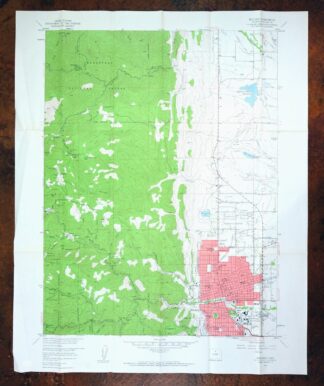
MAP DETAILS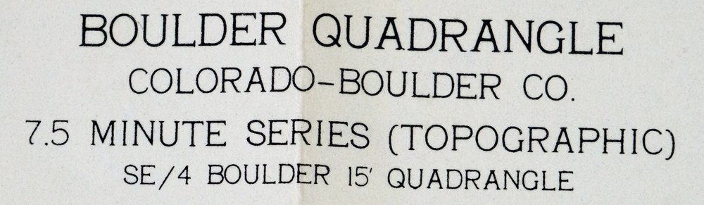 | |
|---|---|
| TITLE | Boulder |
| STATE | Colorado |
| SURVEYED | 1953 and 1957 Aerial and Field Survey |
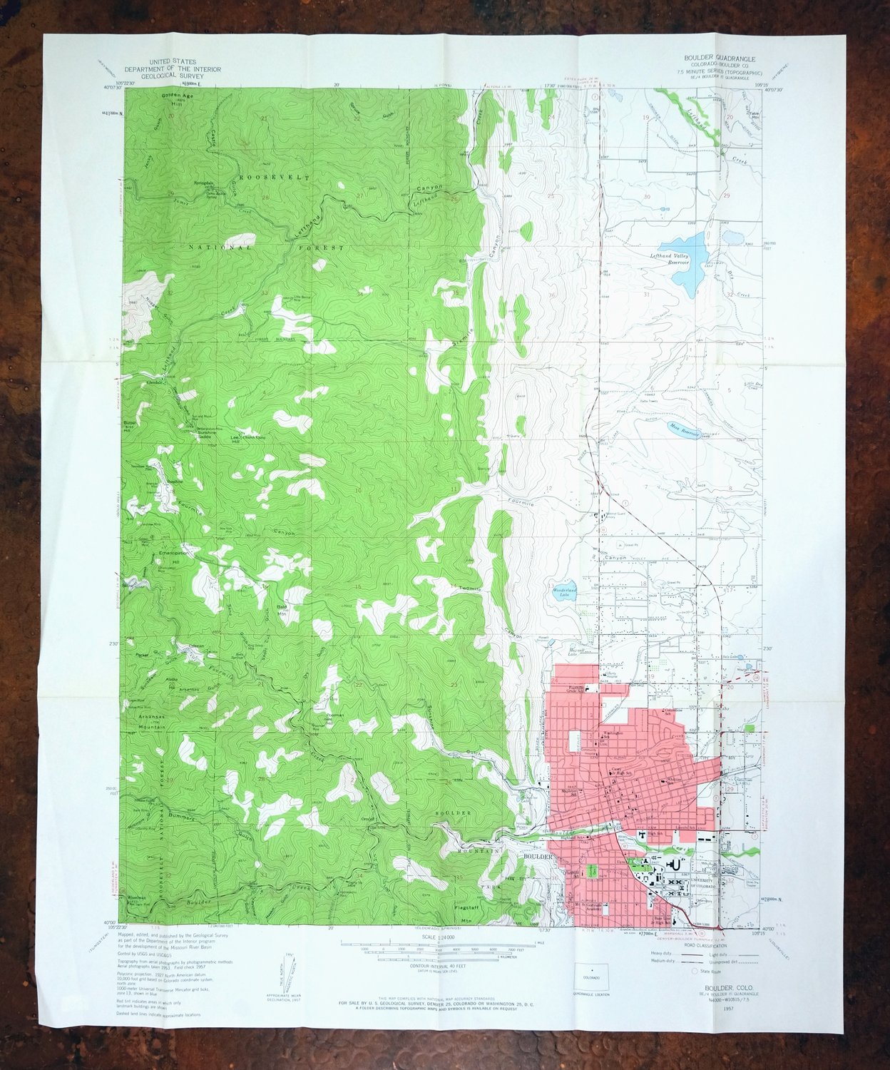
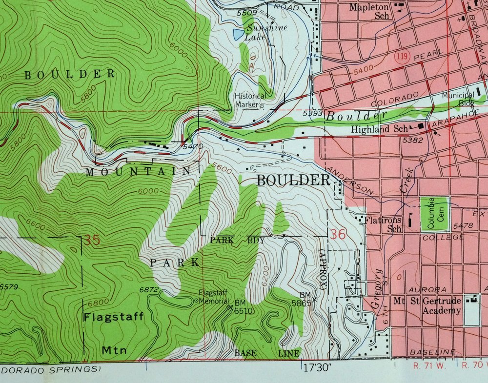
| PRINT NOTES | Thick paper stock, includes woodland tint (green to indicate vegetated areas). A reddish tint is used to indicate urban areas where only landmark buildings are shown. |
| SCALE | 1:24000 |
| CONTOUR INTERVAL | 40 feet |
| SHEET DIMENSIONS | 22 x 27 inches |
| MAP DIMENSIONS | 17 1/2 x 22 3/4 inches |
| COVERAGE AREA | 7 x 9 miles |
| SHEET CONDITION For maps of this vintage, effort is made to note all visible flaws, no matter how minor. | |
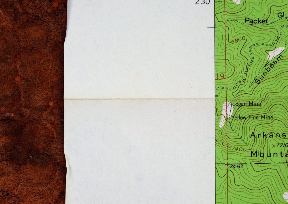
| SHEET NOTES | lightly handled, has foldlines |
| MAP AREA | no markings, minor wear along some foldlines |
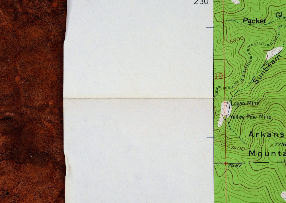
| COLLARS | no markings, no blemishes, no edge tears, creases in left collar |
 | |
| MAP COVERAGE Quadrangle extent overlaid on current basemap. | |
| PLACENAMES Depending on map series and survey date, all of the features listed below may not be shown on this map. This list contains features that currently exist or historically existed within the area covered by the map. The list can be used as a reference to determine if this map covers your area of interest. Placenames are listed alphabetically next to each feature type. | |
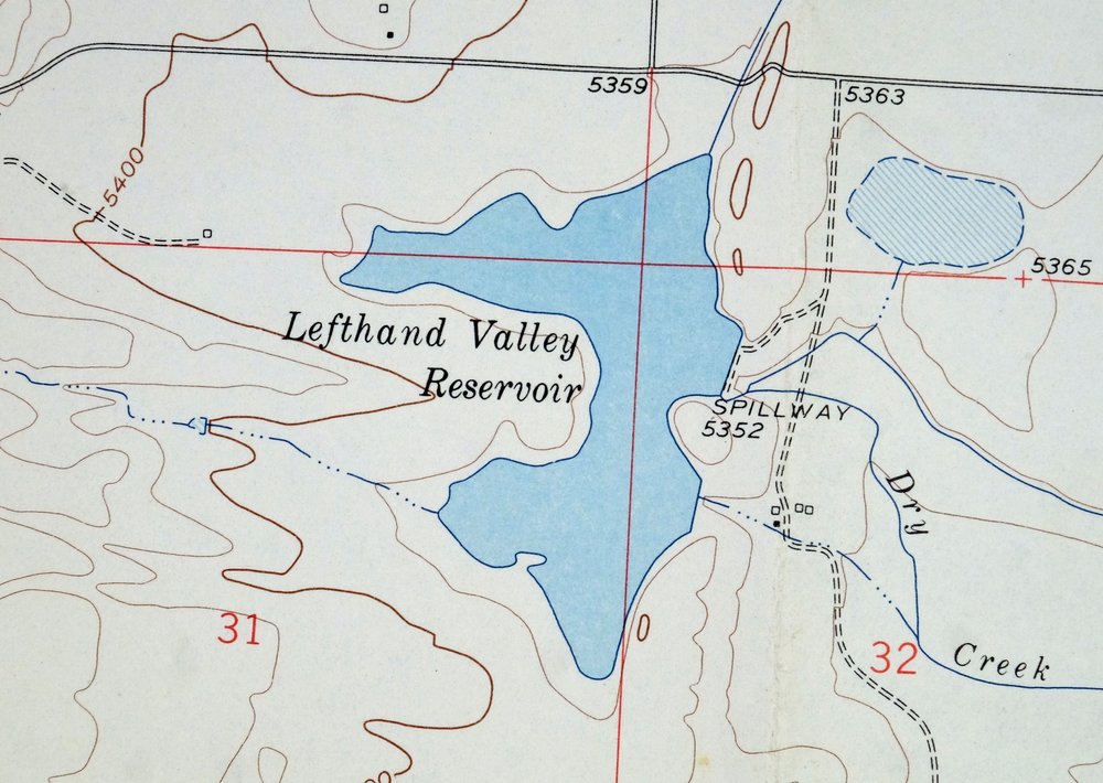
| NOTABLE PLACES | Glendale, Salina, and Lefthand Valley Reservoir |
| CITIES AND TOWNS (CURRENT) | Boulder and Jamestown |
| COUNTIES COVERED | Boulder |
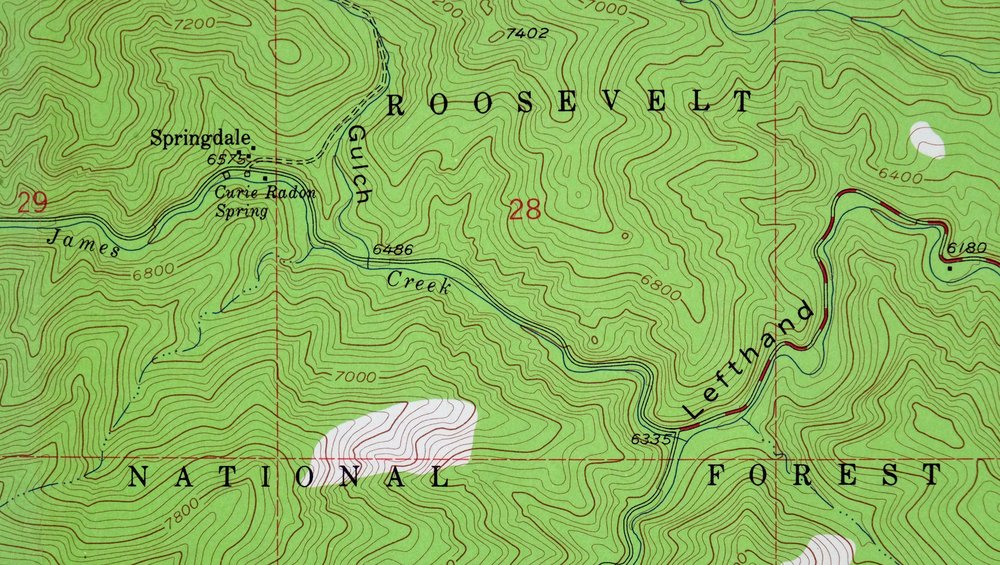
| FEDERAL LAND UNITS | Roosevelt National Forest |
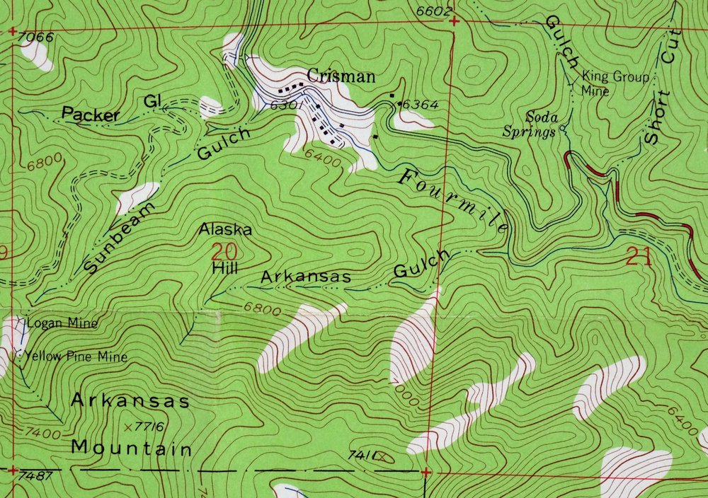
| RIVERS AND STREAMS | Boulder Creek, Dry Creek, Fourmile Creek, Gold Run, Left Hand Creek, Little Dry Creek, and Little James Creek |
| WATER BODIES | Joder Reservoir, Left Hand Valley Reservoir, Loukonen Brothers Reservoir, Margaret Spurgeon Reservoir Number 1, and Mesa Reservoir |
| Populated Place: Ara, Boulder, Crisman, El Vado, Glendale, Lazy Acres, Orodell, Pine Brook Hill, Salina, Seven Hills, Silver Spruce, Springdale, Sunshine, Tall Timber, and Wheelman. Locations: Boulder District Ranger Office, Boulder Filtration Plant, Folsom Stadium, Arapahoe Village Shopping Center, Boulder Retail Center, Broadway Shoppes, Community Plaza Shopping Center, Crossroads Mall, Marshalls Boulder Plaza, North Broadway Shopping Center, Palmer Gardens Shopping Center, Sunrise Center, The Village Shopping Center, Villa Shopping Center, Willow Springs II Shopping Center, Mary Rippon Theatre, and Prentup Field. Administrative Boundaries: Boulder County and City of Boulder. Mountains, Peaks, and Summits: Alaska Hill, Arkansas Mountain, Bald Mountain, Butzel Hill, Emancipation Hill, Flagstaff Mountain, Golden Age Hill, Lee Hill, Poorman Hill, and Mount Sanitas. Valleys and Canyons: Arkansas Gulch, Bummers Gulch, Calhoun Gulch, Castle Gulch, Dry Gulch, Fourmile Canyon, Glendale Gulch, Hawkin Gulch, Jenks Gulch, Keystone Gulch, Left Hand Canyon, Lost Gulch, Millionaire Gulch, Nugget Gulch, Packer Gulch, Sand Gulch, Short Cut Gulch, Sixmile Canyon, Slaughterhouse Gulch, Spruce Gulch, Sunbeam Gulch, Sunshine Canyon, Sweet Home Gulch, and Twomile Canyon. Parks: Bald Mountain Scenic Area, Beach Park, Betasso Preserve, Buckingham Park, Carpenter Park, Catalpa Park, Central Park, Flagstaff Memorial, Melody Park, North Boulder Park, Pine View Park, Pow Wow Park, Smith Park, and Dalton Trumbo Fountain Court. Drainages: Fourmile Creek, Gold Run, Goose Creek, Gregory Creek, James Creek, and Little James Creek. Mines: Poorman Mine, Red Signe Mine, American Mine, Arapahoe Pit, Archer Mine, Badger Mine, Barron Mine, Belmont Mine, Beryl Lode Claim Mine, Beryl Number One Claim, Beryl Number Two Claim, Black Jack Mine, Blue Ribbon Mine, Boulder Pit Number 485, Brannan Pit Number 14, Buckskin Joe Number One Mine, Buena Vista Mine Number One, Buena Vista Mine Number Three, Buena Vista Mine Number Two, Carfield Mine, Cleveland Mine, Cobalt Mine, Colorado Miracle Mine, Copeland Mine, Copper King Nickel Mine, Crete Mine, Degge Clark Mine, Delaware Group Mine, Doolittle Mine, Dorothy Mine, Earl Mine, East Boston Mine, Elkhorn Prospect, Ella C Mine, Emancipation Mine, Essco Mine, Five Brothers Mine, Fox Hills Outcrop, G and S Mine, Genghis Khan Mine, Gilard Mine, Gladiator Mine, Gold Coin Mine, Gold Hill Beryl Claims, Good Hope Mine, Grace Mine, Grand Central Mine, Grand Union Mine, Grand View Mine, Gunbarrel Mine, Heil Brothers Quarry, Hidden Treasure Mine, Highline Prospect, Home Sweet Home Mine, India Mine, Interocean Mine, Iron King Tunnel Mine, J O Lode Mine, Jake Witter Mine, Jenkins Pit, Katie Mine, King Wilhelm Mine, Lady Bug Mine, Leo the Lion Lode Number One Mine, Lily Mine, Little Bonnie Mine, Little Julie Mine, Logan Mine, Lost Dutchman Mine, Lucky Two Mine, Marshall Clay Pit, McKnight Placer Mine, Missing Link Mine, Mojave Mine, More Mine, Morning Glory Mine, Nancy Group Mine, New Girl Prospect, New York Union Mine, Nil Desperandum Mine, Ohio Tungsten Mine, Oklahoma Mine, Osceola Mine, Pilot Mine, Plain View Mine, Plough Boy Mine, Princess Eulalia Mine, Railroad Boy Group of Mines, Red Elephant Mine, Red Gold Mine, Richard Mine, Rip Van Dam Mine, Roosevelt Lease Mine, Saint James Mine, Saint Louis Mine, Sentinel Mine, Spicer Pit, Standard Mine, Sun and Moon Mine, Sussex Mine, Sylvanite Tunnel Mine, Tennessee Mine, Three Mine, Tillie Botzel Mine, Tri State Quarry, Tungsten Mine, Turnpike Mine, Twin Brothers Mine, United Mines, Victor Mine, Viola Beatty Claim, Viola Beatty Claim Mine, Washburn Mine, Washington Irving Mine, White Crow Mine, White Eagle Mine, Yellow Jacket Mine, and Yellow Pine Mine. Churches: Boulder Seventh Day Adventist, First Baptist Church, First Church of Christ Scientist, First Congregational Church, Sacred Heart of Jesus Catholic Church, Saint Johns Episcopal Church, Trinity Lutheran Church, Bethel United Methodist Church, Boulder First Church of the Nazarene, First Christian Church, First Methodist Episcopal Church, Unity Church, and High Way Community Church. Post Office: Boulder Post Office. Hospitals: Boulder Community Hospital Mapleton Center, Boulder Community Hospital, Boulder Community Hospital Surgery Center, and Boulder Medical Center. Lakes and Ponds: Maxwell Lake. Buildings: Boulder Municipal Building, Boulder Public Library, Boulder Public Library Carnegie Branch of Local History, Sacred Heart of Jesus Parish Center, West Boulder Senior Center, Aden Hall, Andrews Hall, Armory Building, Arnett Hall, Athens Court, Baker Hall, Balch Fieldhouse, Benson Earth Sciences Building, Boulder County Courthouse, Boulder County Justice Center, Boulder County Sheriff's Office Civil Division, Boulder Fire / Rescue Department Headquarters, Boulder Fire Rescue Department Station 1, Boulder Fire Rescue Department Station 2, Boulder Fire Rescue Department Station 3, Boulder Fire Rescue Department Station 5, Boulder Mountain Fire Protection District Station 1, Boulder Mountain Fire Protection District Station 2, Boulder Mountain Fire Protection District Station 3, Boulder Police Department, Boulder Rural Fire Department Station 2, Brackett Hall, Buckingham Hall, Carlson Gymnasium, Cheyenne Arapaho Hall, City of Boulder Public Safety Center, Clare Small Arts and Sciences Building, Cockerell Hall, Continuing Education Building, Cooperative Institute for Research in Environmental Sciences Building, Coors Events/Conference Center, Cristol Chemistry and Biochemistry Building, Crosman Hall, Dal Ward Athletic Center, Denison Arts and Sciences Building, Discovery Learning Center, Duane Physics and Astrophysics Building, Eaton Humanities Building, Economics Building, Education Building, Ekeley Sciences Building, Engineering Center, Environmental Design Building, Environmental Health and Safety Center, Euclid Avenue AutoPark, Federal Bureau of Investigation, Federal Bureau of Investigation Boulder Resident Office, Fiske Planetarium and Science Center, Fleming Law Building, Four Mile Fire Department, Four Mile Fire Department Station 1, Gates Woodruff Womens Studies Cottage, Guggenheim Geography Building, Hale Science Building, Hallett Hall, Health Physics Laboratory, Hellems Arts and Sciences Building, Imig Music Building, Integrated Teaching and Learning Laboratory, Ketchum Arts and Sciences Building, Kittredge West Hall, Koenig Alumni Center, Laboratory for Atmospheric and Space Physics, Leeds School of Business, Lefthand Fire Protection District Station 3, Libby Hall, Macky Auditorium, Mathematics Building, McKenna Languages Building, Miriam R Hart Regional Radiation Therapy Center, Muenzinger Psychology Building, Museum Collections - Bruce Curtis Building, Museum of Natural History - Henderson Building, National Guard Armory, Norlin Library, Old Main Building, People's Clinic, Poorman Volunteer Fire Department, Ramaley Biology Building, Reed Hall, Regent Drive AutoPark, Research Laboratory Number 6 - Marine Street Science Center, Roosevelt National Forest - Boulder Ranger Station, Sewall Hall, Sibell Wolle Fine Arts Building, Smith Hall, Sommers-Bausch Observatory, Language, and Hearing Sciences Building Speech, Student Recreation Center, Sugar Loaf Fire Protection District Station 2, Sunshine Fire Protection District Station 1, Sunshine Fire Protection District Station 2, University Memorial Center, University of Colorado Police Department, University Theatre, Wardenburg Health Center, Willard Administrative Center - North Wing, Willard Hall - South Wing, Wolf Law Building, Woodbury Arts and Sciences Building, Boulder County Regional Fire Training Center, and Lefthand Fire Protection District Station 4. Dams: Joder Dam, Lefthand Valley Dam, Loukonen Brothers Dam, Margaret Spurgeon Number 1 Dam, and Mesa Park Dam. Gaps: Sunshine Saddle. Canals: Anderson Extension Ditch, Crocker Ditch, Farmers Ditch, Haldi Ditch, and Silver Lake Ditch. Airports: Boulder Community Hospital Heliport. Census: Crisman Census Designated Place, Glendale Census Designated Place, Lazy Acres Census Designated Place, Pine Brook Hill Census Designated Place, Seven Hills Census Designated Place, Sunshine Census Designated Place, and Tall Timber Census Designated Place. Schools: Base Line Middle School, Casey Middle School, Centennial Middle School, Columbine Elementary School, Flatirons Elementary School, Foothill Elementary School, Highland School, Mapleton Elementary School, Naropa University - Arapahoe Campus, New Vista High School, University Hill School, University of Colorado Boulder, Washington Bilingual Elementary School, Whittier International Elementary School, Sacred Heart of Jesus School, Boulder High School, Boulder Junior Academy, Homeopathy School of Colorado, Jarrow Montessori School, Mount Zion Lutheran School, September School, Shining Mountain Waldorf School, Shining Mountains Waldorf Elementary / Middle School, Tara Institute of the Performing Arts, and Watershed School. Reservoirs and Tanks: Joder Reservoir, Left Hand Valley Reservoir, Loukonen Brothers Reservoir, Margaret Spurgeon Reservoir Number 1, Maxwell Reservoir, Mesa Reservoir, Sale Lake, Sunshine Lake, Varsity Lake, and Wonderland Lake. Towers: KBOL-AM (Boulder) and KSSP-FM (Boulder). Springs: Curie Spring, Soda Springs, and Ute Spring. Cemetery: Columbia Cemetery, Mountain View Cemetery, and Sunshine Cemetery. | |
| SHIPPING AND RETURNS | |
| This map sheet ships via the US Postal Service. Choose your preferred packaging at eBay checkout: rolled in a sturdy tube, or folded in a padded mailer. If you find that the sheet you receive is not as described in the listing, you may ship it back to us for a refund of the purchase price. | |
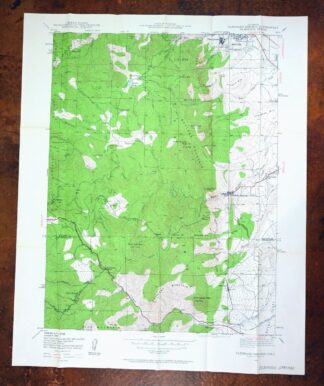
Boulder, Glendale, Colorado 1957 USGS Topo Map
$38
- 28 miles northwest of Denver.
- 7.5-minute series, 1957 edition, printed in 1961.
- Good condition.
In stock
This vintage sheet is a 1957 edition of the Boulder Colorado USGS topographic map. It is an original 65-year-old 1961 United States Geological Survey print in good condition.
HOW THIS MAP CAN BE USED
In addition to making a fascinating conversation piece, this sheet would look great in a frame or on display, make a unique and prized gift for anyone interested in this area, be perfect as a reference for genealogy studies or general historical research, or fill that missing piece in your collection. Maps of this vintage are printed on durable stock and are well-suited for outdoor activities and recreation of all kinds, including hiking, backpacking, hunting, rafting and kayaking, backcountry skiing, geocaching, general exploration, treasure hunting, etc.
FEATURES SHOWN ON THE MAP
The Boulder 7.5-minute map shows cities and towns, roads, paths, railroads, utilities and energy infrastructure, rivers, creeks, elevation contour lines, public land survey lines, county, state, and other administrative boundaries as they existed at the time of the survey in 1953 and 1957. A reddish tint is used on this sheet to indicate urban areas where only landmark buildings are depicted. Outside of those areas, all known structures (houses, businesses, churches, schools, barns, cabins, etc) are shown.
A VALUABLE HISTORICAL RECORD
This map is from the 7.5-minute series, the most detailed series that is widely available from the USGS. The 1957 Boulder map is a valuable historical record for the area. It contains some placenames and features that have been dropped from more recent maps.
Nearby maps
-
Eldorado Springs Colorado Arvada Boulder USGS Topo Map 1961
$37 Add to cart -
Lyons Colorado USGS 7.5-Min Topographic Map 1961 Vintage
$34 Add to cart -
1942 USGS Topo Map: Tungsten, Barker Reservoir, Colorado
$39 Add to cart -

Lafayette Colorado Westminster Thornton USGS Topo Map 1967
$38 Add to cart -
Nederland Colorado Eldora Rollinsville USGS Topo Map 1964
$35 Add to cart -
Lafayette, Colorado 1944 USGS Topo Map: Broomfield
$39 Add to cart -
Lafayette, Broomfield, Colorado 1956 USGS Topo Map
$30 Add to cart -

Eastlake, Colorado 1944 USGS Topo Map: Thornton
$52 Add to cart -
Eastlake Colorado Westminster Thornton USGS Topo Map 1967
$39 Add to cart -
Central City Colorado Black Hawk USGS Topo Map 1964 Vintage
$32 Add to cart -
Mchenrys Peak, Colorado 1957 USGS Topo Map
$33 Add to cart -

Fort Logan Colorado Denver Bow Mar USGS Topographic Map 1941
$38 Add to cart -
Fort Logan, Denver, Colorado 1965 USGS Topo Map (Lakewood)
$36 Add to cart -

Estes Park Colorado USGS 7.5-Min Topo Map 1961 Vintage
$31 Add to cart -
Long Branch Colorado Denver Aurora USGS Topographic Map 1948
$36 Add to cart -
Georgetown Colorado Silver Plume USGS Topo Map 1962 Vintage
$33 Add to cart -
Trail Ridge Colorado USGS 7.5-Min Topo Map 1962 Vintage
$25 Add to cart -
Georgetown, Colorado 1957 USGS Topo Map (1980 Print)
$41 Add to cart -
Fitzsimons Colorado Denver Aurora USGS Topo Map 1948 Vintage
$36 Add to cart -

Box Elder School Colorado Denver Aurora USGS Topo Map 1942
$38 Add to cart -
Highland Ranch, Colorado 1949 USGS Topo Map: Lone Tree
$34 Add to cart -
1942 USGS Topo Map: Coal Creek, Aurora, Colorado
$42 Add to cart -
1926 USGS Topo Map: Montezuma, Keystone, Colorado
$58 Add to cart -
Montezuma, Keystone, Colorado 1958 USGS Topo Map
$46 Add to cart