MAP DETAILS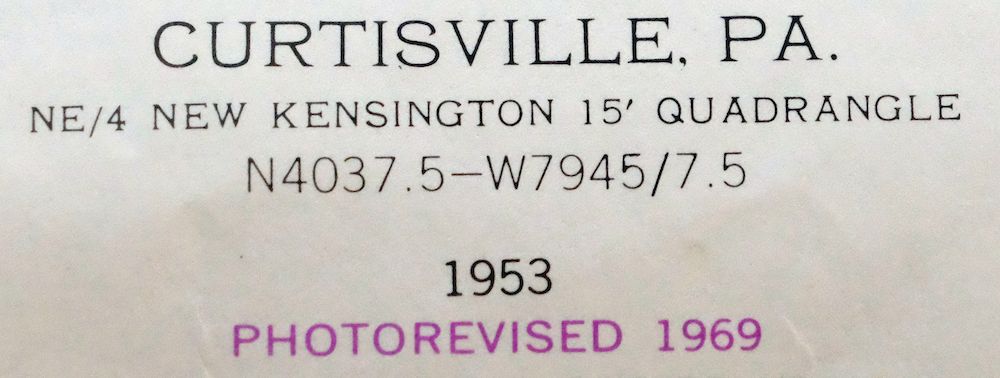 | |
|---|---|
| TITLE | Curtisville |
| STATE | Pennsylvania |
| LOCATION | 20 miles northeast of Pittsburgh |
| SERIES | 7.5-minute |
| SURVEYED | 1925 and 1953 Aerial and Field Survey |
| EDITION | 1953 |
| REVISIONS | Photo revision in 1969 is shown in purple. |
| PRINTED | 1970 |
| PRINT NOTES | Thick paper stock, includes woodland tint (green to indicate vegetated areas) |
| SCALE | 1:24000 |
| CONTOUR INTERVAL | 20 feet |
| SHEET DIMENSIONS | 22 x 27 inches |
| MAP DIMENSIONS | 17 1/4 x 22 3/4 inches |
| COVERAGE AREA | 7 x 9 miles |
| SHEET CONDITION For maps of this vintage, effort is made to note all visible flaws, no matter how minor. | |
| OVERALL CONDITION | Very Good |
| SHEET NOTES | lightly handled, never folded |
| MAP AREA | flawless map area |
| COLLARS | no markings, no blemishes, no edge tears, minor handling wear along bottom collar |
| MAP COVERAGE Quadrangle extent overlaid on current basemap. | |
| PLACENAMES Depending on map series and survey date, all of the features listed below may not be shown on this map. This list contains features that currently exist or historically existed within the area covered by the map. The list can be used as a reference to determine if this map covers your area of interest. Placenames are listed alphabetically next to each feature type. | |
| CITIES AND TOWNS (CURRENT) | Blanchard, Culmerville, Curtisville, Lernerville, Millerstown, Sarversville, and Saxonburg |
| COUNTIES COVERED | Allegheny and Butler |
| RIVERS AND STREAMS | Bailey Run, Bull Creek, Davis Run, Glade Run, Lardintown Run, Little Buffalo Creek, Little Bull Creek, McDowell Run, Rocky Run, and Thorn Creek |
| WATER BODIES | Greisinger Pond |
| Locations: Saxon Golf Course and Woods. Administrative Boundaries: Township of Clinton, Township of Jefferson, Borough of Saxonburg, and Township of West Deer. Valleys and Canyons: Cherry Valley. Drainages: Davis Run, Lardintown Run, McDowell Run, and Rocky Run. Churches: Bull Creek Church, Clinton Church, Pleasant Unity Church, Saint Paul Church, Saint Victors Church, and Westminster Church. Dams: Greisinger Dam. Airports: Cooper Airport, Culmerville Airport, and Saxon Airport. Schools: Carnegie Institute of Technology, Buffalo Township Elementary School, Clinton Elementary School, and Knoch Junior Senior High School. Reservoirs and Tanks: Greisinger Pond. | |
| SHIPPING AND RETURNS | |
 This map sheet will be carefully rolled in a sturdy tube and shipped via the US Postal Service. If you find that the sheet you receive is not as described in the listing, you may ship it back to us for a refund of the purchase price. | |
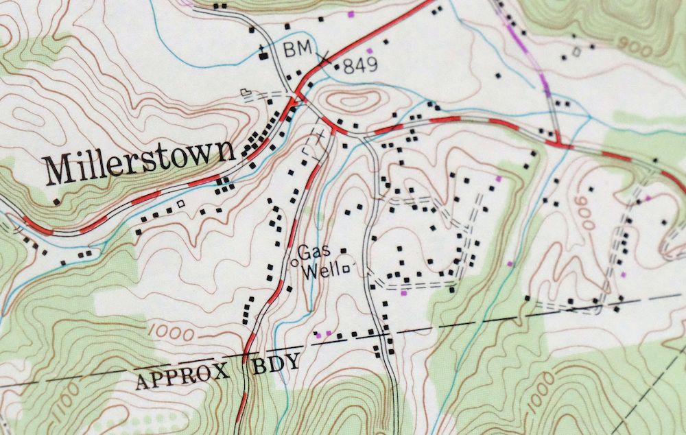
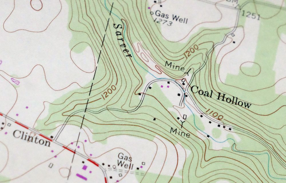
1970 USGS Topo Map: Curtisville, Saxonburg, Pennsylvania
$23
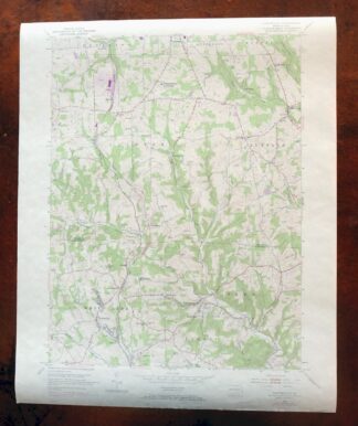
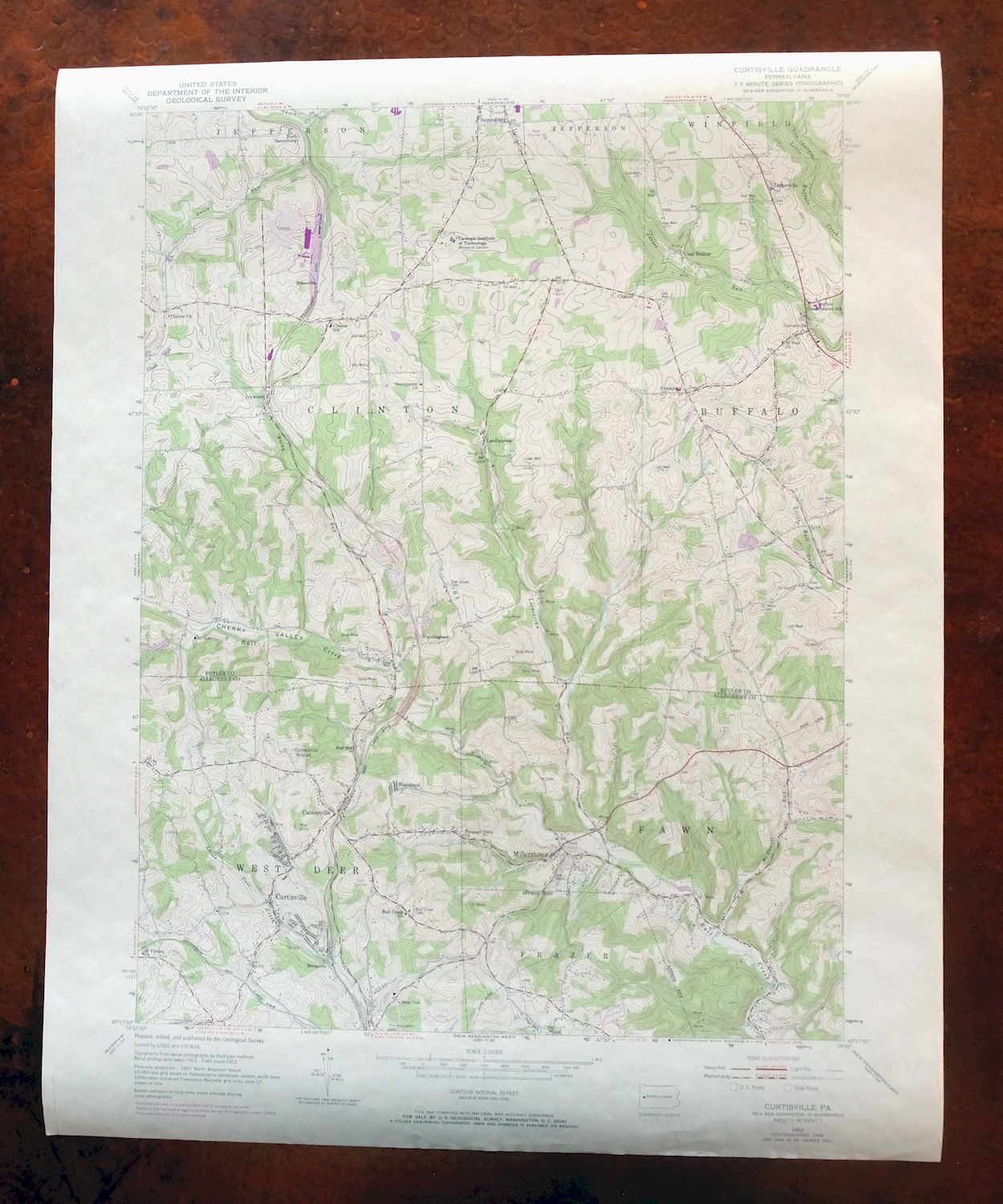
This 7.5-minute topographic sheet maps the Curtisville area of western Pennsylvania, about 20 miles northeast of Pittsburgh. It is a 1953 edition revised in 1969 and printed in 1970, drawn at 1:24,000 with 20-foot contours. The quad straddles Allegheny and Butler counties, taking in Curtisville and Saxonburg along with Sarversville, Millerstown, Lernerville, and Culmerville. The green woodland tint and 20-foot contours trace the rolling terrain of this old coal and oil country. Never folded, on thick stock with a flawless map area.
In stock
This vintage sheet is a 1953 edition of the Curtisville Pennsylvania USGS topographic map revised in 1969 using aerial photography. It is an original 56-year-old 1970 United States Geological Survey print in very good condition.
HOW THIS MAP CAN BE USED
In addition to making a fascinating conversation piece, this sheet would look great in a frame or on display, make a unique and prized gift for anyone interested in this area, be perfect as a reference for genealogy studies or general historical research, or fill that missing piece in your collection. Maps of this vintage are printed on durable stock and are well-suited for outdoor activities and recreation of all kinds, including hiking, backpacking, hunting, rafting and kayaking, backcountry skiing, geocaching, general exploration, treasure hunting, etc.
FEATURES SHOWN ON THE MAP
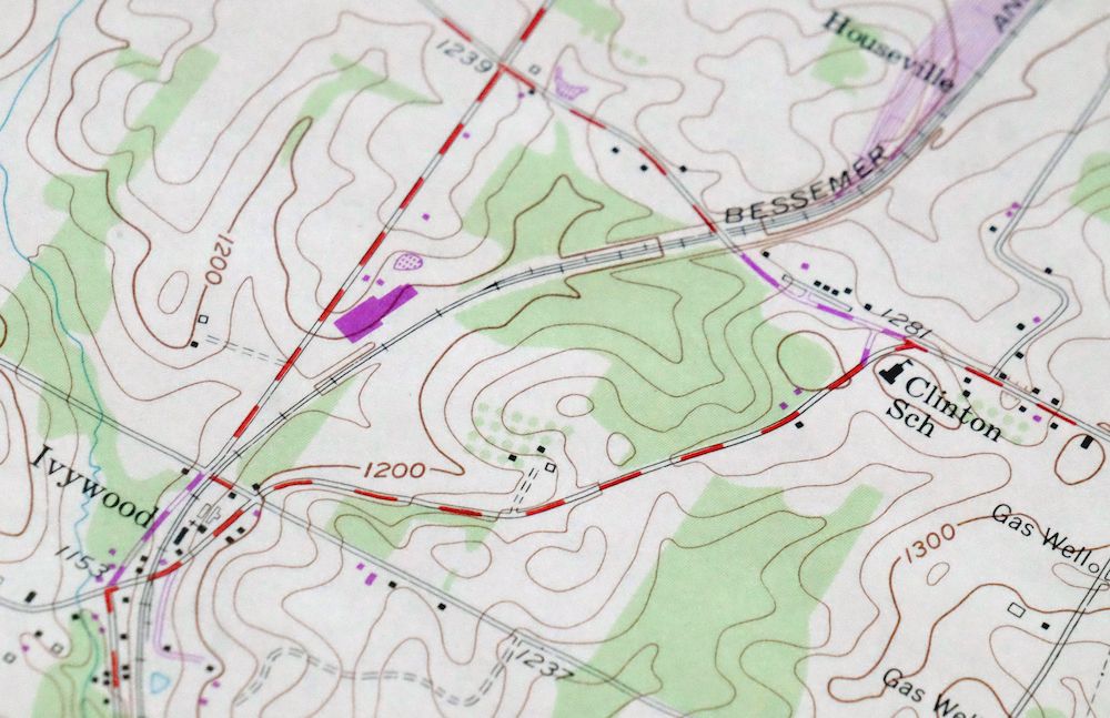
The Curtisville 7.5-minute map shows cities and towns, roads, paths, railroads, utilities and energy infrastructure, rivers, creeks, elevation contour lines, public land survey lines, county, state, and other administrative boundaries as they existed at the time of the survey in 1925 and 1953. All known structures (houses, businesses, churches, schools, barns, cabins, etc) are also shown.
A VALUABLE HISTORICAL RECORD
This map is from the 7.5-minute series, the most detailed series that is widely available from the USGS. The 1953 Curtisville map is a valuable historical record for the area. It contains some placenames and features that have been dropped from more recent maps.
The map was photorevised in 1969. Any features that changed or were added between the original edition year of 1953 and the photorevision year of 1969 are overlayed in purple. The purple overlay provides an excellent view of the fast-growing and changing areas within the quad boundary.
Nearby maps
-
Slippery Rock Pennsylvania West Liberty USGS Topo Map 1964
$42 Add to cart -
New Kensington Pennsylvania Plum USGS Topographic Map 1956
$44 Add to cart -

Freeport Pennsylvania Plum New Kensington USGS Topo Map 1956
$36 Add to cart -

Carnegie Pennsylvania Pittsburgh Dormont USGS Topo Map 1954
$50 Add to cart -
Beaver Pennsylvania Aliquippa Carnot-Moon USGS Topo Map 1958
$44 Add to cart -

New Castle North Pennsylvania Oakwood USGS Topo Map 1960
$34 Add to cart -
Burgettstown Pennsylvania Midway USGS Topographic Map 1958
$47 Add to cart -

Brownsville Pennsylvania Monessen Donora USGS Topo Map 1954
$38 Add to cart -
Campbell Ohio Youngstown Boardman USGS Topo Map 1971 Vintage
$37 Add to cart -
Franklin Pennsylvania Sugarcreek Polk USGS Topo Map 1962
$36 Add to cart -
1957 USGS Topo Map: Punxsutawney, Rossiter, Pennsylvania
$32 Add to cart -
Townville Pennsylvania Cooperstown USGS 15-Min Topo Map 1964
$40 Add to cart -
Bedford Pennsylvania Schellsburg USGS Topo Map 1958 Vintage
$42 Add to cart -

Union City Pennsylvania Waterford Elgin USGS Topo Map 1961
$44 Add to cart -
Corry Pennsylvania Spartansburg Elgin USGS Topo Map 1958
$41 Add to cart -
Cambridge Springs Pennsylvania Edinboro USGS Topo Map 1964
$38 Add to cart -
Hyndman Pennsylvania Buffalo Mills USGS 15-Min Topo Map 1967
$40 Add to cart -

Philipsburg Pennsylvania Stormstown USGS Topo Map 1964
$34 Add to cart -
Mount Jewett Pennsylvania Wilcox USGS Topographic Map 1965
$40 Add to cart -
Clearville Pennsylvania USGS 15-Min Topo Map 1945 Vintage
$42 Add to cart -
Conneaut Ohio Hatch Corners USGS Topo Map 1971 Vintage
$44 Add to cart -
Kinzua Pennsylvania Westline USGS Topo Map 1967 Vintage
$42 Add to cart -

Crosby Pennsylvania Norwich Rich Valley USGS Topo Map 1957
$35 Add to cart -

North East Pennsylvania Wattsburg USGS Topo Map 1962 Vintage
$44 Add to cart