MAP DETAILS | |
|---|---|
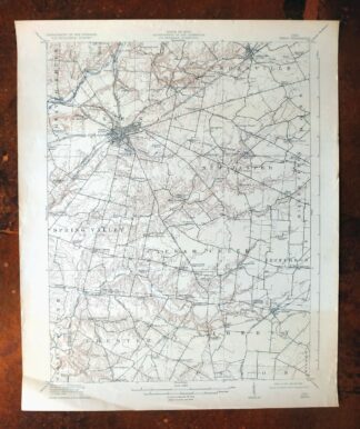
| TITLE | Garrison |
| STATE | Kentucky, Ohio |
| LOCATION | Vicinity of Portsmouth |
| SERIES | 15-minute |
| SURVEYED | 1915 Field Survey |
| GEOGRAPHER | R.B. Marshall |
| ENGRAVED | 1917 |
| EDITION | 1918 |
| PRINTED | 1918 |
| PRINT NOTES | Thick paper stock, includes woodland tint (green to indicate vegetated areas) |
| SCALE | 1:62500 |
| CONTOUR INTERVAL | 20 feet |
| SHEET DIMENSIONS | 16 1/2 x 20 inches |
| MAP DIMENSIONS | 13 5/8 x 17 1/2 inches |
| COVERAGE AREA | 13 x 17 miles |
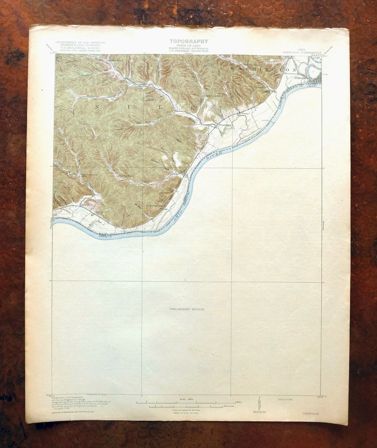
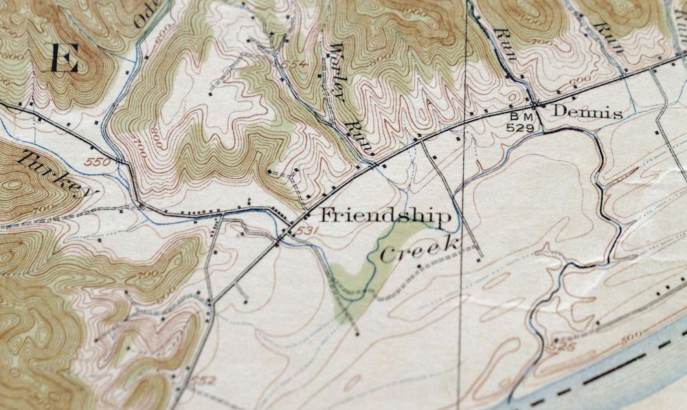
| MAP NOTES | The Kentucky side (including Garrison) is not surveyed on this sheet. The sheet does feature the Shawnee Forest, Friendship, and Alexandria in Ohio, as well as the Ohio River. |
| SHEET CONDITION For maps of this vintage, effort is made to note all visible flaws, no matter how minor. | |
| OVERALL CONDITION | Very Good |
| SHEET NOTES | lightly handled, never folded, attractively age-toned sheet |
| MAP AREA | no wear, no markings |
| COLLARS | no markings, no blemishes, minor wear along top collar edge |
 | |
| MAP COVERAGE Quadrangle extent overlaid on current basemap. | |
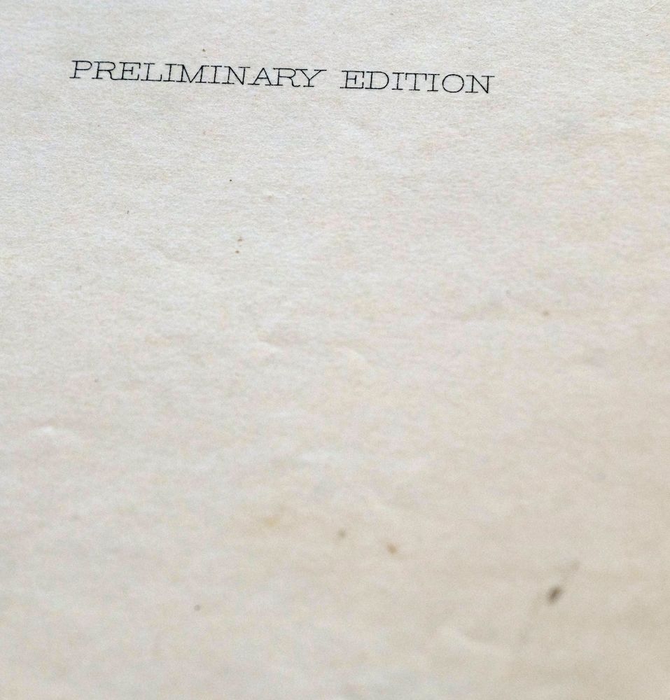
| BACKSIDE LEGEND | |
 A map summary is printed on the back side of the Garrison sheet similar to the one shown in the picture. It outlines the history, purpose, and status of the USGS mapping program at the time of the printing in 1918. It also provides instructions on how to read contour lines and a description of how they are used to depict the terrain. At the bottom of the page is a legend showing all of the symbols used to represent the cultural, relief, and water features found on the map. | |
| PLACENAMES Depending on map series and survey date, all of the features listed below may not be shown on this map. This list contains features that currently exist or historically existed within the area covered by the map. The list can be used as a reference to determine if this map covers your area of interest. Placenames are listed alphabetically next to each feature type. | |
| CITIES AND TOWNS (CURRENT) | Firebrick, Garrison, Portsmouth, Saint Paul, West Portsmouth, and York |
| COUNTIES COVERED | Carter, Greenup, Lewis, and Scioto |
| RIVERS AND STREAMS | Bald Knob Run, Bear Branch, Beechy Creek, Bevins Creek, Big Lick Branch, Bill Chain Branch, Briery Branch, Briery Fork, Brouse Run, Brush Fork, Brushy Creek, Buck Creek, Buck Lick, Buckner Branch, Buzzard Roost Fork, Careys Run, Clarks Branch, Cub Run, Dry Fork, Dry Run, East Fork Pond Run, East Fork Upper Twin Creek, Fitch Branch, Gabe Run, Garden Branch, Horner Fork, Hubbard Branch, Hygean Run, Iller Branch, Indian Run, Kinniconick Creek, Lampblack Run, Leatherwood Branch, Left Fork Rock Creek, Little Bill Chain Branch, Little Leatherwood Branch, Little Oak Creek, Lost Creek, Lousy Run, Lowder Fork, Lower Twin Branch, Lower White Oak Creek, Mackletree Tree, Madden Fork, McAtee Run, McDowell Creek, McGlone Fork, McKinney Branch, Middle Fork Pond Run, Mill Branch, Millstone Branch, Montgomery Creek, Moore Run, Mud Lick, Mudlick Branch, Odell Creek, Ohio River, Old Kinniconick Bed, Old Lade Run, Old Pond Run, Old Trace Branch, Orchid Branch, Plummer Fork, Pond Lick Run, Pond Run, Rabbit Run, Raccoon Fork, Right Fork Rock Creek, River Fork, Rock Blind Branch, Rock Creek, Rock Lick, Rock Run, Sand Branch, Scaffold Lick, Schultz Creek, Schultz Fork, Scioto River, Shanty Branch, Slab Run, Spencer Run, Spy Run, State Road Fork, Stockholm Creek, Stony Run, Sugarcamp Creek, Three Prong Branch, Trace Creek, Turkey Creek, Upper Twin Branch, Upper Twin Creek, Vance Creek, Vaughters Run, Wes Run, White Oak Creek, Willis Branch, Wingo Creek, Wolf Creek, and Worley Run |
| WATER BODIES | McBride Lake, Pond Lick Lake, Roosevelt Lake, and Turkey Creek Lake |
| Kentucky Mountains, Peaks, and Summits: Lost Hill, Negro Hill, and Round Top. Valleys and Canyons: Alum Hollow, Anderson Hollow, Bee Hollow, Bark Hollow, Barn Hollow, Bear Hollow, Beechy Hollow, Big Hollow, Big Kellen Hollow, Big Stave Hollow, Birch Hollow, Black John Hollow, Blane Hollow, Board Tree Hollow, Bradley Hollow, Brown Hollow, Bruce Hollow, Brushart Hollow, Buris Hollow, Burnt House Hollow, Chain Hollow, Cherry Tree Hollow, Chimney Hollow, Holbrook Hollow, Horse Hollow, House Hollow, Hurricane Hollow, Clay Hollow, Cow Hollow, Dog Hollow, Dry Hollow, First Hollow, Frank Hollow, Gate Hollow, Gillem Hollow, Graveyard Hollow, Greenbrier Hollow, Grizzle Hollow, Gum Hollow, Gunnel Hollow, Hackworth Hollow, Hale Hollow, Hammerhill Hollow, Hickory Hollow, John Howard Hollow, John Will Hollow, Johnson Hollow, Jones Hollow, Knott Hollow, Kotcamp Hollow, Laney Hollow, Leitch Hollow, Lettingham Hollow, Little Kellen Hollow, Little Stave Hollow, Maynard Hollow, Mill Hollow, Miller Hollow, Monk Hollow, Moore Hollow, Negro Hollow, Newberry Hollow, Old House Hollow, Opossum Hollow, Orchard Hollow, Peach Orchard Hollow, Peters Cave Hollow, Pheasant Lick Hollow, Pigeon Roost Hollow, Polly Hollow, Powder Mill Hollow, Progue Hollow, Puncheon Hollow, River Hollow, Rockhouse Hollow, Rocky Branch, Roy Hollow, Royster Hollow, Rube Hollow, Ruckel Hollow, Schoolhouse Hollow, Second Hollow, Sexton Hollow, Sherman Hollow, Shop Hollow, Shupe Hollow, Slate Hollow, Smoothrock Hollow, Soapstone Hollow, Spruce Hollow, Stable Hollow, Stamper Hollow, Star Hollow, Stockholm Hollow, Stone Coal Hollow, Sugarcamp Hollow, Surrey Hollow, Tar Camp Hollow, Third Hollow, Thompson Hollow, Turkeypen Hollow, Two Lick Hollow, Underwood Hollow, Walnut Grove Hollow, Watson Hollow, and Whistling Jim Hollow. Drainages: Anderson Branch, Annis Branch, Bear Branch, Bevins Creek, Big Lick Branch, Bill Chain Branch, Briery Branch, Briery Fork, Bridge Branch, Buck Lick, Brushy Branch, Buckner Branch, Buzzard Roost Fork, Horner Fork, Hubbard Branch, Iller Branch, Clark Branch, Clarks Branch, Clay Branch, Cloverleaf Branch, Drumm Branch, Dry Fork, Fisher Fork, Fitch Branch, Flatwoods Branch, Garden Branch, Ham Branch, Indian Run, Jameson Fork, John A Lewis Branch, Kinniconick Creek, Leatherbelly Branch, Left Fork Beechy Creek, Left Fork Rock Creek, Lick Branch, Little Bill Chain Branch, Little Iller Branch, Low Gap Branch, Lowder Fork, Lower Twin Branch, Madden Fork, McDowell Creek, McGlone Fork, McKinney Branch, Mill Branch, Millstone Branch, Montgomery Creek, Mud Lick, Mudlick Branch, Old Kinniconick Bed, Old Trace Branch, Orchid Branch, Pugh Branch, Raccoon Fork, Red Fox Branch, Right Fork Rock Creek, River Fork, Rock Blind Branch, Rock Creek, Rock Run, Scaffold Lick, Schultz Fork, Scotts Branch, Shanty Branch, Shingle Branch, Spring Branch, Spy Run, State Road Fork, Stockholm Creek, Sugarcamp Creek, Town Branch, Trace Creek, Upper Twin Branch, Vance Creek, Willis Branch, and Wolf Creek. Churches: Bevins Chapel, Carr Church, Kentucky Heights Church, Morris Hill Church, Rock Hill Chapel, and White Oak Chapel. Bridges: Carl Perkins Memorial Bridge. Schools: Armstrong School, Horn School, Hampshire School, Kenton-Furnace School, Leatherwood School, Logan School, Loper School, Red Brush School, Ruggles School, South Portsmouth School, Spy Run School, Tannery School, Thompson School, Upper Three Prong School, and Zion Hill School. Ridges: Zion Ridge. | |
| Ohio Locations: Elliots Landing, Givens Landing, Infirmary Landing, Manuel Moores Landing, McAtee Landing, McCormack Landing, Morrisons Landing, Shawnee State Park Marina, Walker Landing, and Wyckoffs Landing. Mountains, Peaks, and Summits: Picnic Point. Valleys and Canyons: Bellamy Hollow, Bland Hollow, Blue Clay Hollow, Bond Hollow, Bradford Hollow, Broad Hollow, Brown Hollow, Conklin Hollow, Evans Hollow, Cotton Eye Hollow, Crane Hollow, Cutlipp Hollow, Dead Man Hollow, Dodds Hollow, Groundhog Hollow, Hobey Hollow, Hog Thief Hollow, Hogpen Hollow, Hoosier Hollow, Linetree Hollow, Long Hollow, Lower Shaw Hollow, Massey Hollow, Middle Hollow, Mudlick Hollow, Opossum Hollow, Pheasant Hollow, Poplar Hollow, Poplar Tree Hollow, Quitoff Hollow, Rock Lick Hollow, Rocky Hollow, Sawmill Hollow, Shady Hollow, Sheep House Hollow, Sheep Lot Hollow, Slate Hollow, Springer Hollow, Swanigen Hollow, Tarkiln Hollow, Upper Shaw Hollow, Walker Hollow, Webb Hollow, Williamson Hollow, and Zorns Hollow. Parks: Earl Thomas Conley Riverside Park, Riverfront Park, Second Street Historic District, Shawnee State Forest, Shawnee State Park, and Sixth Street Historic District. Drainages: Bald Knob Run, Barbara Run, Bellamy Run, Boland Run, Bronze Run, Brouse Run, Brush Fork, Brushy Fork, Buck Lick, Careys Run, Dry Run, East Fork Pond Run, East Fork Upper Twin Creek, Gabe Run, Grass Lick Run, Harber Fork Turkey Creek, Hygean Run, Jake Run, Lampblack Run, Lousy Run, Lower Lick, Mackletree Tree, McAtee Run, McBride Run, Middle Fork Pond Run, Moore Run, Mundy Run, Nace Run, Odell Creek, Old Lade Run, Old Pond Run, Plummer Fork, Pond Lick Run, Pond Run, Rabbit Run, Rock Lick, Scioto River, Slab Run, Spellacy Run, Spencer Run, Stony Run, Sulphur Lick, Tucker Run, Turkey Creek, Upper Lick, Upper Twin Creek, Vaughters Run, Wes Run, Wolfden Run, and Worley Run. Churches: All Saints Episcopal Church, Bethel Church, Careys Run Church, First Presbyterian Church, Mackletree Mission, McKendree Church, Pond Run Church, Portsmouth Wesleyan Church, Saint Marys Catholic Church, Slab Run Church, Stony Run Church, Stony Run Tabernacle, and Turkey Creek Church. Buildings: Portsmouth Bar and Law Library, Scioto County Courthouse, and Scioto County Home. Dams: Roosevelt Lake Dam and Turkey Creek Lake Dam. Bayous and Sloughs: Stable Gut. Airports: Shawnee Airport and Shawnee State Lodge Heliport. Schools: Friendship Elementary School, Saint Marys School, and Scudder Center School. Reservoirs and Tanks: McBride Lake, Pond Lick Lake, Roosevelt Lake, and Turkey Creek Lake. Towers: Pond Run Lookout Tower. | |
| SHIPPING AND RETURNS | |
 This map sheet will be carefully rolled in a sturdy tube and shipped via the US Postal Service. If you find that the sheet you receive is not as described in the listing, you may ship it back to us for a refund of the purchase price. | |
Garrison Kentucky Portsmouth York USGS Topo Map 1918 Antique
$32
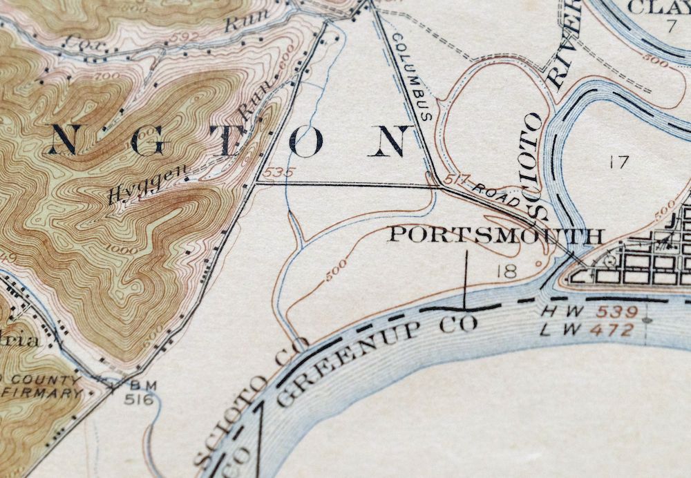
A first-year 1918 print from the USGS 15-minute series, this antique sheet has been lightly handled, never folded, and is attractively age-toned, graded very good on thick stock. Set in the vicinity of Portsmouth along the Ohio River, the sheet shows the Ohio side of the quad—including Portsmouth, Friendship, and Alexandria—while the Kentucky side around Garrison is left unsurveyed. Engraved in 1917 under geographer R.B. Marshall, the sheet captures the river towns of southern Ohio as they stood at the close of the First World War, with the Ohio River tracing the state line.
In stock
This antique sheet is a 1918 edition of the Garrison Kentucky USGS topographic map. It is an authentic 108-year-old United States Geological Survey print in very good condition.
HOW THIS MAP CAN BE USED
In addition to making a fascinating conversation piece, this sheet would look great in a frame or on display, make a unique and prized gift for anyone interested in this area, be perfect as a reference for genealogy studies or general historical research, or fill that missing piece in your collection.
FEATURES SHOWN ON THE MAP
The Garrison 15-minute map shows cities and towns, roads, railroads, rivers, creeks, elevation contour lines, public land survey lines, county, state, and other administrative boundaries as they existed at the time of the survey in 1915. All known structures (houses, businesses, churches, schools, barns, cabins, etc) are also shown, with exceptions in some urban areas, where only landmark buildings may be shown.
A VALUABLE HISTORICAL RECORD
Maps from the 15-minute series for the continental United States are no longer produced or printed by the USGS and original prints are becoming increasingly difficult to find. They are a valuable historical record for an area, as they contain many placenames and features that have been dropped from more recent maps.
Nearby maps
-
Seaman Ohio West Union West Union USGS Topo Map 1918 Antique
$62 Add to cart -

Wayne West Virginia Dunlow Cove Gap USGS Topo Map 1909
$42 Add to cart -

Point Pleasant West Virginia Middleport USGS Topo Map 1908
$25 Add to cart -
Sabina Ohio Leesburg New Vienna USGS Topo Map 1917 Antique
$42 Add to cart -

Pomeroy Ohio Middleport Mason USGS Topo Map 1907 Antique
$37 Add to cart -

Winfield West Virginia Bancroft Southside USGS Topo Map 1908
$37 Add to cart -

Kenova Kentucky Louisa Grayson USGS Topo Map 1912 Antique
$54 Add to cart -

Salyersville Kentucky West Liberty Zag USGS Topo Map 1918
$47 Add to cart -

Era Ohio South Bloomfield Williamsport USGS Topo Map 1913
$40 Add to cart -

Ravenswood West Virginia New Haven Evans USGS Topo Map 1908
$40 Add to cart -

Saint Albans West Virginia Dunbar USGS Topographic Map 1909
$37 Add to cart -
Mount Sterling Ohio Washington Midway USGS Topo Map 1925
$42 Add to cart -

Octa Ohio Sabina Jamestown USGS 15-Min Topo Map 1916 Antique
$46 Add to cart -

Warfield West Virginia Pikeville Harts USGS Topo Map 1911
$85 Add to cart -

Pocatalico West Virginia Dunbar USGS Topographic Map 1977
$30 Add to cart -
Xenia Ohio Cedarville Jamestown USGS Topographic Map 1934
$43 Add to cart -

Charleston West West Virginia Dunbar USGS Topo Map 1978
$22 Add to cart -

Charleston West Virginia Cross Lanes Rand USGS Topo Map 1914
$68 Add to cart -

Peytona West Virginia Marmet Belle USGS Topographic Map 1911
$42 Add to cart -

South Charleston Ohio Springfield Catawba USGS Topo Map 1927
$50 Add to cart -

Parkersburg Ohio Marietta Vienna USGS Topo Map 1912 Antique
$63 Add to cart -

Oceana West Virginia Logan Gilbert USGS Topographic Map 1912
$58 Add to cart -

Bald Knob West Virginia Mallory USGS Topo Map 1923 Antique
$50 Add to cart -

Whitesburg Kentucky Pikeville Cumberland USGS Topo Map 1910
$80 Add to cart
