MAP DETAILS | |
|---|---|
| TITLE | Point Pleasant |
| STATE | West Virginia, Ohio |
| LOCATION | 30 miles south of Athens, OH |
| SERIES | 15-minute |
| SURVEYED | 1905 and 1906 Field Survey |
| GEOGRAPHER | H.M. Wilson |
| ENGRAVED | 1908 |
| EDITION | 1908 |
| PRINTED | 1908 |
| PRINT NOTES | Thick paper stock |
| SCALE | 1:62500 |
| CONTOUR INTERVAL | 20 feet |
| SHEET DIMENSIONS | 16 1/2 x 20 inches |
| MAP DIMENSIONS | 13 5/8 x 17 1/2 inches |
| COVERAGE AREA | 13 x 17 miles |
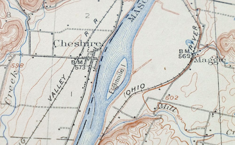
| MAP NOTES | Surveyed before the modern highway system, showing historic travel routes and rail lines. |
| SHEET CONDITION For maps of this vintage, effort is made to note all visible flaws, no matter how minor. | |
| OVERALL CONDITION | Fair |
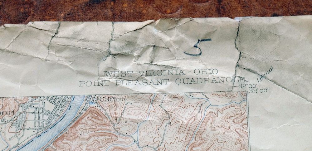
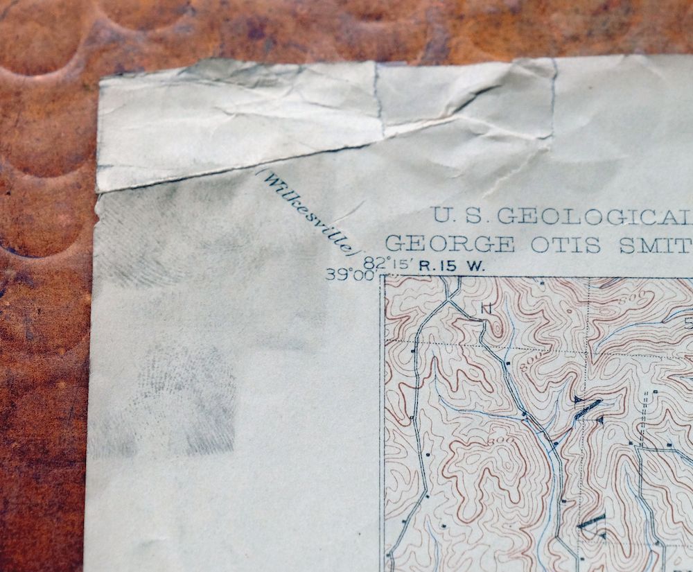
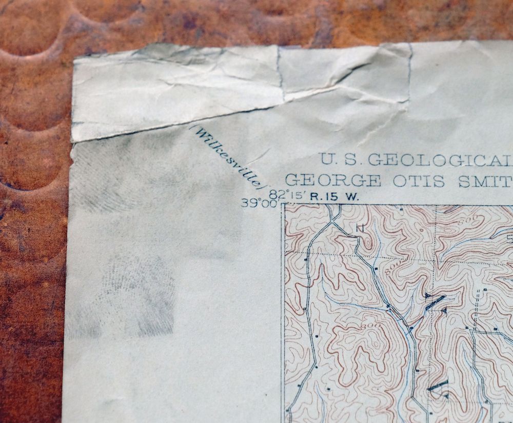
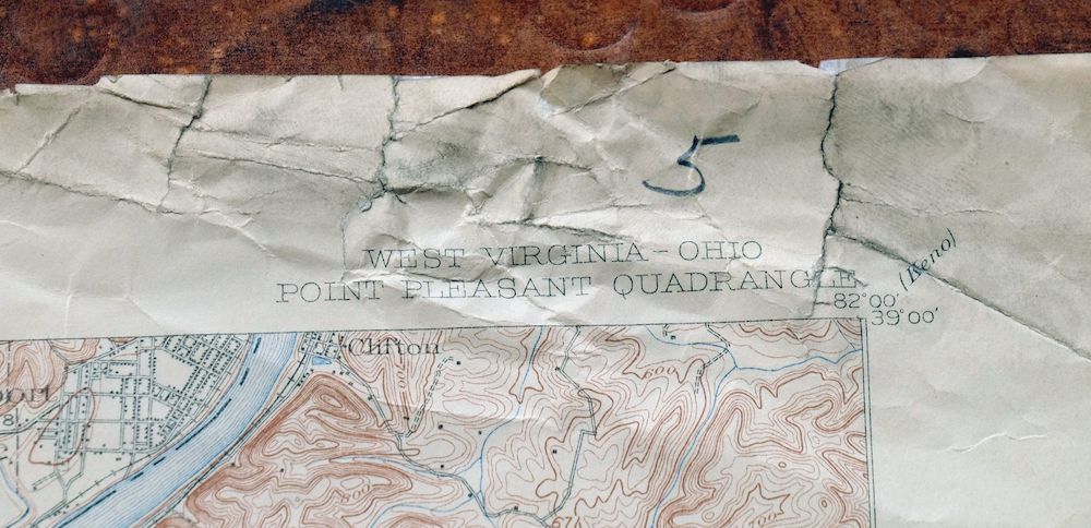
| SHEET NOTES | never folded, considerable handling and storage wear and some discoloration along top of sheet |
| MAP AREA | no markings, no blemishes |
| COLLARS | top collar tears carefully stabilized with archival tape on backside of sheet, pencilled notation in upper right collar corner, small inventory stamp in bottom right collar |
  | |
| MAP COVERAGE Quadrangle extent overlaid on current basemap. | |
| BACKSIDE LEGEND | |
 A map summary is printed on the back side of the Point Pleasant sheet similar to the one shown in the picture. It outlines the history, purpose, and status of the USGS mapping program at the time of the printing in 1908. It also provides instructions on how to read contour lines and a description of how they are used to depict the terrain. At the bottom of the page is a legend showing all of the symbols used to represent the cultural, relief, and water features found on the map. | |
| PLACENAMES Depending on map series and survey date, all of the features listed below may not be shown on this map. This list contains features that currently exist or historically existed within the area covered by the map. The list can be used as a reference to determine if this map covers your area of interest. Placenames are listed alphabetically next to each feature type. | |
| CITIES AND TOWNS (CURRENT) | Addison, Brighton, Cheshire, Gallipolis, Henderson, Middleport, and Point Pleasant |
| COUNTIES COVERED | Gallia, Mason, and Meigs |
| FEDERAL LAND UNITS | Wayne National Forest |
| RIVERS AND STREAMS | Bell Lick Run, Blosser Creek, Campaign Creek, Chickamauga Creek, Clark Run, Crooked Creek, Fallentimber Branch, Fivemile Creek, George Creek, Hysell Run, Ice Creek, Kanawha River, Kings Branch, Kyger Creek, Leading Creek, Little Campaign Creek, Little Chickamauga Creek, Little Fivemile Creek, Little Kyger Creek, Little White Oak Creek, Long Branch, Long Run, Lower Fivemile Creek, Lower Ninemile Creek, Middle Fork Crab Creek, Middle Ninemile Creek, Mill Run, Ohio River, Oldtown Creek, Paint Creek, Plants Run, Potter Creek, Rayburn Creek, Robinson Run, Rockcastle Creek, Rocky Run, Salt Creek, Sand Fork Crab Creek, Storys Run, Tenmile Creek, Threemile Creek, Trace Fork, Turkey Run, Twomile Creek, Upper Fivemile Creek, Upper Ninemile Creek, White Oak Creek, and Wolfpen Branch |
| WATER BODIES | Gavin Fly Ash Impoundment |
| West Virginia Locations: Clements State Tree Nursery, Hidden Valley Country Club, and Machir Landing. Administrative Boundaries: Lewis Magisterial District, Robinson Magisterial District, and Waggener Magisterial District. Parks: Clifton F McClintic State Wildlife Station, Harmon Park, and Tu-Endie-Wei State Park. Drainages: Arbuckle Creek, Little Fivemile Creek, Crooked Creek, Eightmile Creek, Fallentimber Branch, Ferry Creek, Fivemile Creek, Ice Creek, Kanawha River, Lower Fivemile Creek, Lower Ninemile Creek, Middle Ninemile Creek, Mile Creek, Mill Run, Oldtown Creek, Potter Creek, Rayburn Creek, Robinson Run, Rockcastle Creek, Salt Creek, Tenmile Creek, Threemile Creek, Trace Fork, Turkey Run, Twomile Creek, Upper Fivemile Creek, Upper Ninemile Creek, Willow Branch, and Wolfpen Branch. Islands: Eightmile Island and Gallipolis Island. Churches: Krebs Chapel, Brighton Methodist Episcopal Church, College Hill Church, Concord Church, Ecard Church, Eddy Chapel, Gillispie Chapel, Gospel Tabernacle, Hickory Chapel, Jordan Church, Mission Ridge Church, Morning Star Church, Peniel Church, Salem Church, Spilman Church, Trinity Church, Vaught Memorial Church, and Westminster Church. Hospitals: Lakin State Hospital and Pleasant Valley Hospital. Lakes and Ponds: Blue Goose Pond. Buildings: Mason County Courthouse. Dams: McClintic Wildlife Pond Number 18 Dam and McClintic Wildlife Pond Number Three Dam. Channels: The Sound. Bridges: Shadle Bridge. Airports: Mason County Airport and Pleasant Valley Hospital Heliport. Schools: Beale School, Central Elementary School, Central School, Eightmile School, Franklin D Roosevelt School, Hazel Valley School, Ordnance School, Point Pleasant High School, Point Pleasant Junior High School, West Columbia Elementary School, and West Virginia University Experimental Station. Ridges: Mission Ridge and Redmond Ridge. Reservoirs and Tanks: Pond Number Nine. Towers: WTGR-AM (Point Pleasant) and WZYI-FM (Point Pleasant). Springs: Larry Sullivan Spring, Leslie Rayburn Spring, Blain Spring, Bush Spring, Byrd Blain Spring, Clarence Casto Spring, Dale Neibert Spring, Dawley Spring, Drew Hatfield Spring, Duff Spring, Harold Edwards Spring, Henderson Spring, Howard Yeager Spring, John Oshell Spring, Keener Spring, Logan Burdette Spring, Massick Spring, McCoy Spring, McCulloch Spring, Minnie Spears Spring, Ray Crank Spring, Smith Spring, Stanley Spring, Stone Spring, Virgil Adkins Spring, Williams Spring, and Williamson Spring. | |
| Ohio Locations: Baileys Landing, Berrys Landing, Cliffside Golf Club, Farmers Landing, Festers Landing, Hallidays Landing, Hobson Yards, Little Kyger Grange, Long Landing, Lowe Middleport Landing, Silver Bridge Plaza Shopping Center, Silver Creek Landing, and Walkers Landing. Administrative Boundaries: Township of Cheshire, Township of Addison, and Township of Gallipolis. Mountains, Peaks, and Summits: Fortification Hill and Prospect Hill. Valleys and Canyons: Honey Hollow, Oil Hollow, and Sand Hollow. Parks: Bobin Park, Elizabeth L Evans Waterfowl and Bird Sanctuary, Gallia County Fairgrounds, Gallia County Junior Fairgrounds, Gallipolis City Park, Gallipolis Public Square and Garden Lots Historic District, Haskins Memorial Park, Memorial Field, and Texas Road Wildlife Area. Drainages: Chickamauga Creek, Bell Lick Run, Blosser Creek, Bryans Run, Campaign Creek, Clark Run, Evans Run, Flatfork Run, George Creek, Jessie Creek, Kyger Creek, Leading Creek, Lime Kiln Creek, Little Campaign Creek, Little Chickamauga Creek, Little Kyger Creek, Little White Oak Creek, Long Run, Mill Creek, Molasses Run, Paint Creek, Rocky Run, Silver Run, Stingy Run, Storys Run, Thomas Fork, and Turkey Run. Churches: Ash Street Freewill Baptist Church, Campaign Church, Christ United Methodist Church, Church of Christ, Church of the Nazarene, Eno Church, Enterprise Church, Fair Haven Methodist Church, Faith Chapel Open Bible Church, Final Hour Church, First Baptist Church, First Church of God, First Presbyterian Church, French City Church, Grace Church, Heath United Methodist Church, John Gee African Methodist Episcopal Chapel, Kyger Church, Kyger United Methodist Church, Little Kyger Church, Mina Chapel, New Life Lutheran Church, Paint Creek Baptist Church, Poplar Ridge Church, Prospect Church, Saint Peters Episcopal Church, Third Kyger Church, Tried Stone Baptist Church, and Wesley Chapel. Hospitals: Holzer Medical Center. Buildings: Davis Hall, Doctor Samuel L Bossard Memorial Library, French Art Colony Regional Multi-Arts Center, Gallia County Childrens Home, Gallia County Courthouse, Gallia County Infirmary, Gallipolis City Hall, Gatewood, James A Gavin Power Plant, Kyger Creek Power Plant, Morris and Dorothy Haskins Ariel Theatre, Ohio Valley Visitors Center, Our House Museum, and Riverby. Dams: Carter and Evans Lake Dam, Gavin Bottom Ash Pond Dam, and Gavin Fly Ash Dam. Channels: The Sound. Airports: Gallia-Meigs Regional Airport, Holzer Heliport, and Jaymar Heliport. Schools: Cheshire-Kyger Elementary School, Addaville Elementary School, Gallia Academy High School, Gallipolis State Institute, Kanauga School, Kyger Creek High School, Meigs Elementary School, Middleport Elementary School, Ohio Valley Christian School, and Washington Elementary School. Ridges: Kriner Ridge and Poplar Ridge. Reservoirs and Tanks: Carter and Evans Lake, Gavin Bottom Ash Pond, and Gavin Fly Ash Impoundment. Towers: WGTR-FM (Gallipolis), WJEH Radio Tower, and WJEH-AM (Gallipolis). | |
| SHIPPING AND RETURNS | |
 This map sheet will be carefully rolled in a sturdy tube and shipped via the US Postal Service. If you find that the sheet you receive is not as described in the listing, you may ship it back to us for a refund of the purchase price. | |
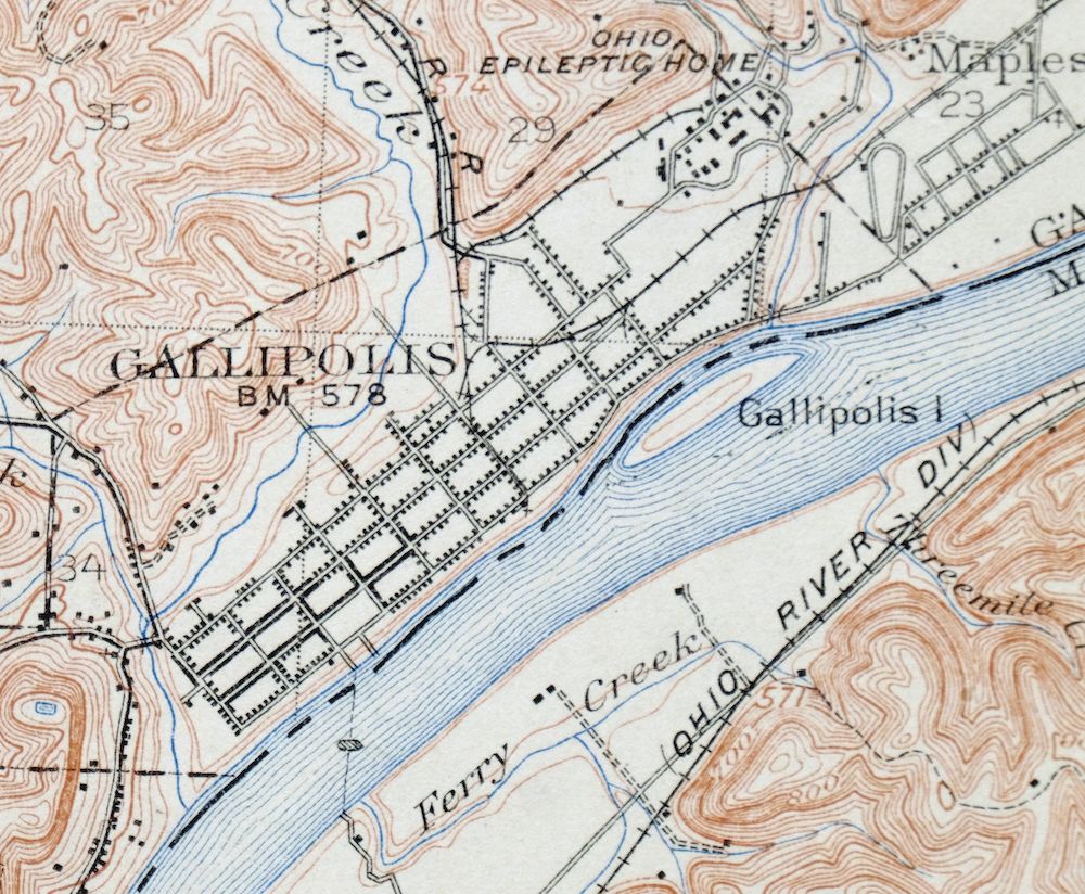
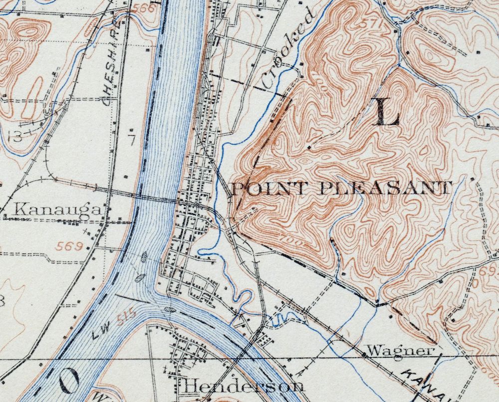
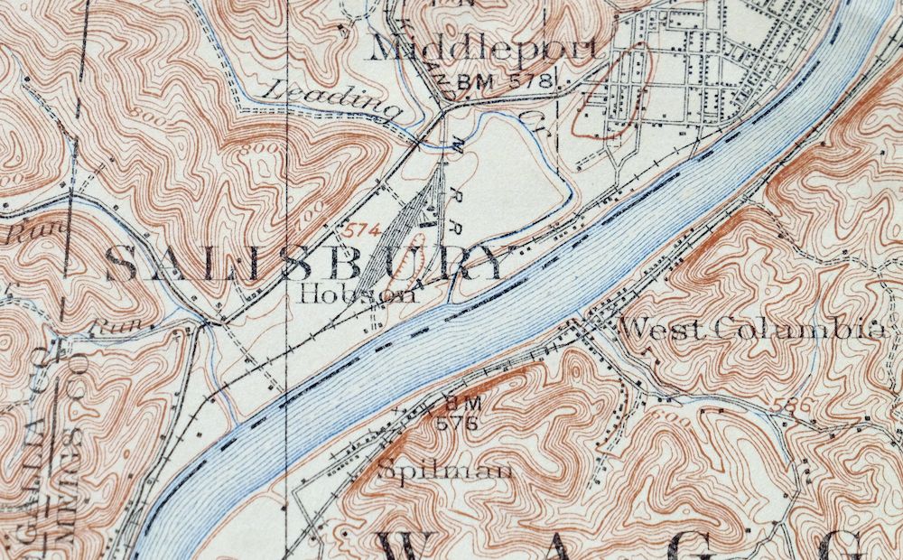
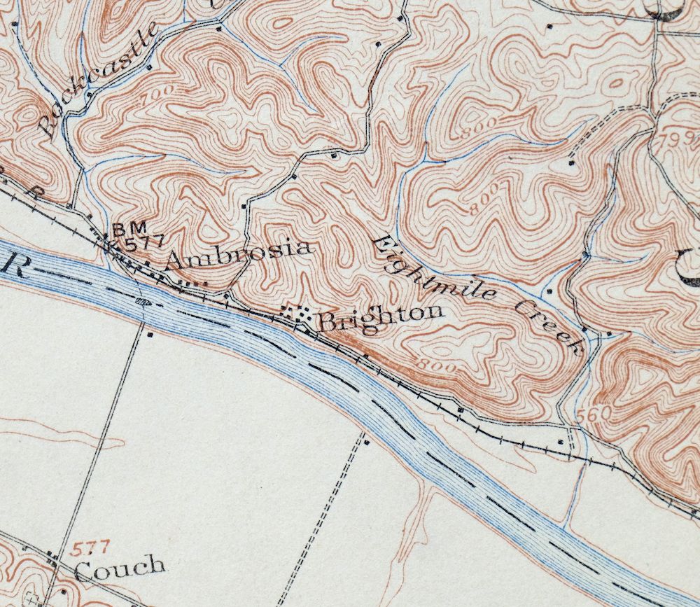
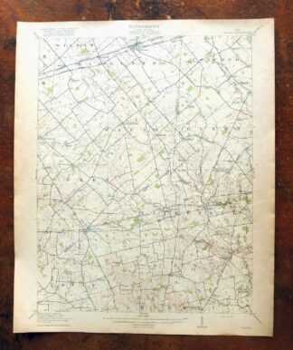
Point Pleasant West Virginia Middleport USGS Topo Map 1908
$25
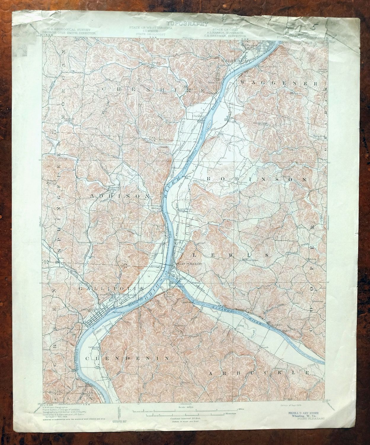
Printed in its year of first publication, 1908, this antique USGS 15-minute topographic sheet is in fair condition, never folded but with considerable handling and storage wear and some discoloration along the top of the sheet; the top collar tears have been carefully stabilized with archival tape on the reverse, and it is printed on thick stock. The quad straddles the West Virginia–Ohio line along the Ohio River, taking in Point Pleasant, Gallipolis, and Middleport along with the communities of Henderson, Cheshire, and Addison across Gallia, Mason, and Meigs counties, and reaches into part of the Wayne National Forest. Surveyed in 1905 and 1906 under geographer H.M. Wilson and engraved in 1908, it predates the modern highway system and records the historic travel routes and rail lines of that era.
In stock
This antique sheet is a 1908 edition of the Point Pleasant West Virginia USGS topographic map. It is an authentic 118-year-old United States Geological Survey print in fair condition.
HOW THIS MAP CAN BE USED
In addition to making a fascinating conversation piece, this sheet would make a unique and prized gift for anyone interested in this area, be perfect as a reference for genealogy studies or general historical research, or fill that missing piece in your collection.
FEATURES SHOWN ON THE MAP
The Point Pleasant 15-minute map shows cities and towns, roads, railroads, rivers, creeks, elevation contour lines, public land survey lines, county, state, and other administrative boundaries as they existed at the time of the survey in 1905 and 1906. All known structures (houses, businesses, churches, schools, barns, cabins, etc) are also shown, with exceptions in some urban areas, where only landmark buildings may be shown.
A VALUABLE HISTORICAL RECORD
Maps from the 15-minute series for the continental United States are no longer produced or printed by the USGS and original prints are becoming increasingly difficult to find. They are a valuable historical record for an area, as they contain many placenames and features that have been dropped from more recent maps.
Nearby maps
-

Ravenswood West Virginia New Haven Evans USGS Topo Map 1908
$40 Add to cart -

Pomeroy Ohio Middleport Mason USGS Topo Map 1907 Antique
$37 Add to cart -

Winfield West Virginia Bancroft Southside USGS Topo Map 1908
$37 Add to cart -

Saint Albans West Virginia Dunbar USGS Topographic Map 1909
$37 Add to cart -

Parkersburg Ohio Marietta Vienna USGS Topo Map 1912 Antique
$63 Add to cart -

Charleston West Virginia Cross Lanes Rand USGS Topo Map 1914
$68 Add to cart -

Marietta Ohio Wayne NF Devola USGS Topo Map 1912 Antique
$62 Add to cart -

Wayne West Virginia Dunlow Cove Gap USGS Topo Map 1909
$42 Add to cart -

Garrison Kentucky Portsmouth York USGS Topo Map 1918 Antique
$32 Add to cart -

Peytona West Virginia Marmet Belle USGS Topographic Map 1911
$42 Add to cart -

Saint Marys West Virginia Ellenboro Pike USGS Topo Map 1916
$47 Add to cart -

Pocatalico West Virginia Dunbar USGS Topographic Map 1977
$30 Add to cart -

Charleston West West Virginia Dunbar USGS Topo Map 1978
$22 Add to cart -

Kenova Kentucky Louisa Grayson USGS Topo Map 1912 Antique
$54 Add to cart -

Bald Knob West Virginia Mallory USGS Topo Map 1923 Antique
$50 Add to cart -

Era Ohio South Bloomfield Williamsport USGS Topo Map 1913
$40 Add to cart -

Sutton West Virginia Glenville Elk River USGS Topo Map 1907
$75 Add to cart -

Warfield West Virginia Pikeville Harts USGS Topo Map 1911
$85 Add to cart -

Oceana West Virginia Logan Gilbert USGS Topographic Map 1912
$58 Add to cart -
Seaman Ohio West Union West Union USGS Topo Map 1918 Antique
$62 Add to cart -
Mount Sterling Ohio Washington Midway USGS Topo Map 1925
$42 Add to cart -

Nicholas West Virginia Summersville Cowen USGS Topo Map 1912
$54 Add to cart -
Sabina Ohio Leesburg New Vienna USGS Topo Map 1917 Antique
$42 Add to cart -

Raleigh West Virginia Beckley Oak Hill USGS Topo Map 1901
$135 Add to cart
