MAP DETAILS | |
|---|---|
| TITLE | Ravenswood |
| STATE | West Virginia, Ohio |
| LOCATION | 30 miles southwest of Parkersburg |
| SERIES | 15-minute |
| SURVEYED | 1905 and 1906 Field Survey |
| GEOGRAPHER | H.M. Wilson |
| ENGRAVED | 1908 |
| EDITION | 1908 |
| PRINTED | 1908 |
| PRINT NOTES | Thick paper stock |
| SCALE | 1:62500 |
| CONTOUR INTERVAL | 20 feet |
| SHEET DIMENSIONS | 16 1/2 x 20 inches |
| MAP DIMENSIONS | 13 5/8 x 17 1/2 inches |
| COVERAGE AREA | 13 x 17 miles |
| MAP NOTES | Surveyed before the modern highway system, showing historic travel routes and rail lines. |
| SHEET CONDITION For maps of this vintage, effort is made to note all visible flaws, no matter how minor. | |
| OVERALL CONDITION | Very Good |
| SHEET NOTES | moderately handled, never folded, diagonal crease in lower right sheet corner |
| MAP AREA | no markings, no blemishes |
| COLLARS | minor wear or tears, minor blemishes, pencilled notation in upper right collar corner, edge tears stabilized with archival tape on backside of sheet, small inventory stamp in bottom right collar |
| MAP COVERAGE Quadrangle extent overlaid on current basemap. | |
| BACKSIDE LEGEND | |
 A map summary is printed on the back side of the Ravenswood sheet similar to the one shown in the picture. It outlines the history, purpose, and status of the USGS mapping program at the time of the printing in 1908. It also provides instructions on how to read contour lines and a description of how they are used to depict the terrain. At the bottom of the page is a legend showing all of the symbols used to represent the cultural, relief, and water features found on the map. | |
| PLACENAMES Depending on map series and survey date, all of the features listed below may not be shown on this map. This list contains features that currently exist or historically existed within the area covered by the map. The list can be used as a reference to determine if this map covers your area of interest. Placenames are listed alphabetically next to each feature type. | |
| CITIES AND TOWNS (CURRENT) | Cottageville, Evans, Hartford City, Leon, Letart Falls, New Haven, Racine, Ravenswood, and Syracuse |
| COUNTIES COVERED | Jackson, Mason, and Meigs |
| RIVERS AND STREAMS | Baker Branch, Bar Run, Barnett Fork, Bee Run, Big Horse Run, Bowman Run, Briar Run, Broad Run, Bug Run, Bull Run, Cabin Creek, Cedar Run, Claylick Run, Cooper Fork, Cow Run, Crooked Fork, Dry Run, Falls Run, Granny Run, Groundhog Creek, Horse Cave Run, Isaacs Run, Jennie Watts Run, Johns Run, Kanawha River, Kings Branch, Kissel Run, Lick Run, Little Broad Run, Little Horse Cave Run, Little Mill Creek, Little Sandy Creek, Loglick Run, Mikes Run, Mill Creek, Mill Run, Mud Run, Ohio River, Oldtown Creek, Parchment Creek, Plants Run, Pond Branch, Poplar Fork, Robinson Run, Roundknob Run, Sandy Creek, Savers Run, Seaman Run, Silver Creek, Silver Valley, Sliding Hill Creek, Spring Creek, Spring Run, Spruce Run, Sugar Run, Tanner Run, Tenmile Creek, Thirteenmile Creek, Trace Fork, Turkey Run, Twomile Creek, West Creek, Wolf Run, Wolfpen Branch, Wolfpen Run, Yeager Fork, and Yellowbush Creek |
| WATER BODIES | Bailey Lake, Hutchison Lake, Kera Lakes, Porter Pond, and Rollins Lake |
| West Virginia Locations: Graham Station, Maupin Landing, Ravenswood Plaza Shopping Center, and Ravenswood Works. Administrative Boundaries: Cologne Magisterial District, Copper Magisterial District, and Graham Magisterial District. Mountains, Peaks, and Summits: Roundknob. Valleys and Canyons: Lieu Hollow, Kay Hollow, and Stewarts Hollow. Parks: Keraland Recreation Area, Quillen Park, and Turkey Run Lake Public Fishing Area. Drainages: Little Mill Creek, Little Sandy Creek, Bar Run, Barnett Fork, Kings Branch, Left Fork Cow Run, Left Fork Mud Run, Lick Fork, Lick Run, Little Broad Run, Little Horse Cave Run, Big Horse Run, Brinker Run, Broad Run, Bug Run, Bull Run, Cedar Run, Claylick Run, Cooper Fork, Cow Run, Falls Run, Grass Run, Horse Cave Run, Huff Run, Isaacs Run, Johns Run, Loglick Run, Mill Creek, Mud Run, Parchment Creek, Plants Run, Pole Run, Pond Branch, Right Fork Cow Run, Right Fork Mud Run, Roundknob Run, Sandy Creek, Seaman Run, Silver Valley, Spring Creek, Spring Run, Stedman Run, Sugar Run, Tenmile Creek, Thirteenmile Creek, Tombleson Run, Toms Run, Turkey Run, Twomile Creek, and West Creek. Islands: Letart Island and Buffington Island. Churches: Antioch Church, Baden Baptist Church, Baden Church, Bethel Church, Board Church, Cedar Run Church, Church of Christ, Cottageville Church, Creston Church, Davies Grove Church, Fairview Church, Faith Bible Church, First Christian Church, Foster Chapel, General Assembly of the Lord Church, Grace Episcopal Church, Graham Church, Guiding Church, Harvey Chapel, Hopewell Church, Longview Church, Martin Chapel, Mount Hebron Church, Mount Moriah Church, Mount Olive Church, Mount Zion Church, North United Methodist Church, Oak Grove Church, Otterbein Church, Our Saviour Evangelical Lutheran Church, Pine Grove Church, Pleasant View Church, Praise Cathedral, Second Baptist Church, Shiloh Church, Tabor Church, Union Church, Vernon Church, White Church, Yauger Church, and Zion Church. Lakes and Ponds: Ritchies Pond. Dams: Hutchinson Farm Pond Dam, Racine Locks and Dam, Rollins Dam Number One, Rollins Lake Number Two Dam, Turkey Run Lake Dam, West Virginia Baptist Church Camp Dam, and Wv Baptist Church Camp Dam. Crossings: Ravenswood Ferry. Bars: Wolf Bar. Airports: Jackson County Airport and Ravenswood Seaplane Base. Schools: Bearwallow School, Broad Run School, Bug Run School, Cottageville Elementary School, Evans Elementary School, Henry J Kaiser Elementary School, Heritage Christian Academy, Hill School, Longview School, Mountain Flower School, New Haven Elementary School, Ravenswood High School, Ravenswood Middle School, Silver Valley School, Union School, and Wood School. Ridges: Lathem Ridge, Chestnut Ridge, Foster Ridge, Gunville Ridge, Kapp Ridge, Locust Grove Ridge, Plants Ridge, Pleasant View Ridge, Thomas Ridge, and Yauger Ridge. Reservoirs and Tanks: Little Horse Lake, Big Horse Lake, Hutchison Lake, Kera Lakes, Rollins Lake, and Turkey Foot Lake. Towers: WMOV-AM (Ravenswood). Springs: Leo Roush Spring, Lloyd Casto Spring, Carl McDale Spring, Cleon Cadle Spring, Clifford Vickers Spring, Dowell Spring, Elroy Kaylor Spring, Everett Keefer Spring, Gill Spring, Guy Midturn Spring, Harold Sayre Spring, Homer Peck Spring, Okey Roush Spring, Oscar Weigand Spring, Otis Randolph Spring, Rayford Roush Spring, Rollins Spring, and Runion Spring. | |
| Ohio Locations: Alexanders Landing, Crows Landing, Dows Landing, Dyes Landing, Halls Landing, James Hall Landing, McClintocks Landing, McKays Landing, Mill Landing, Painters Landing, Peyton Landing, Peytons Landing, Pickens Landing, Rouses Landing, Sanfords Landing, Sayres Landing, Widow Parr Landing, and Williamson Landing. Administrative Boundaries: Township of Letart and Township of Sutton. Mountains, Peaks, and Summits: Cedar Hill. Valleys and Canyons: Copperhead Hollow and Lathley Hollow. Drainages: Bowman Run, Cabin Creek, Carleton Creek, Cooks Run, Dry Run, Forked Run, German Fork, Granny Run, Groundhog Creek, Jennie Watts Run, Jessie Creek, Johns Run, Mikes Run, Mill Run, Oldtown Creek, Peytons Run, Savers Run, Silver Creek, Skidmore Run, Tanner Run, Toms Run, Tuppers Run, Wolf Run, and Yellowbush Creek. Churches: Bethany Church, Bethlehem Church, Condeville Methodist Church, Fairview Church, East Letart United Methodist Church, Great Bend Church, Letart Falls United Brethren in Christ Church, Letart Falls United Methodist Church, Morse Chapel, Oak Grove Church, and Plants Methodist Church. Lakes and Ponds: Bailey Lake. Dams: Porter Pond Dam and Steve Finlaw Lake Dam. Crossings: Ravenswood Ferry. Bends: Great Bend. Bays: Hughes Eddy. Bars: Sand Creek Bar and Weaver Bar. Schools: Letart Falls Elementary School, Racine Elementary School, Southern Elementary School, Southern Local High School, and Syracuse Elementary School. Reservoirs and Tanks: Porter Pond and Steve Finlaw Lake. Flats: Letart Falls Bottoms. | |
| SHIPPING AND RETURNS | |
 This map sheet will be carefully rolled in a sturdy tube and shipped via the US Postal Service. If you find that the sheet you receive is not as described in the listing, you may ship it back to us for a refund of the purchase price. | |
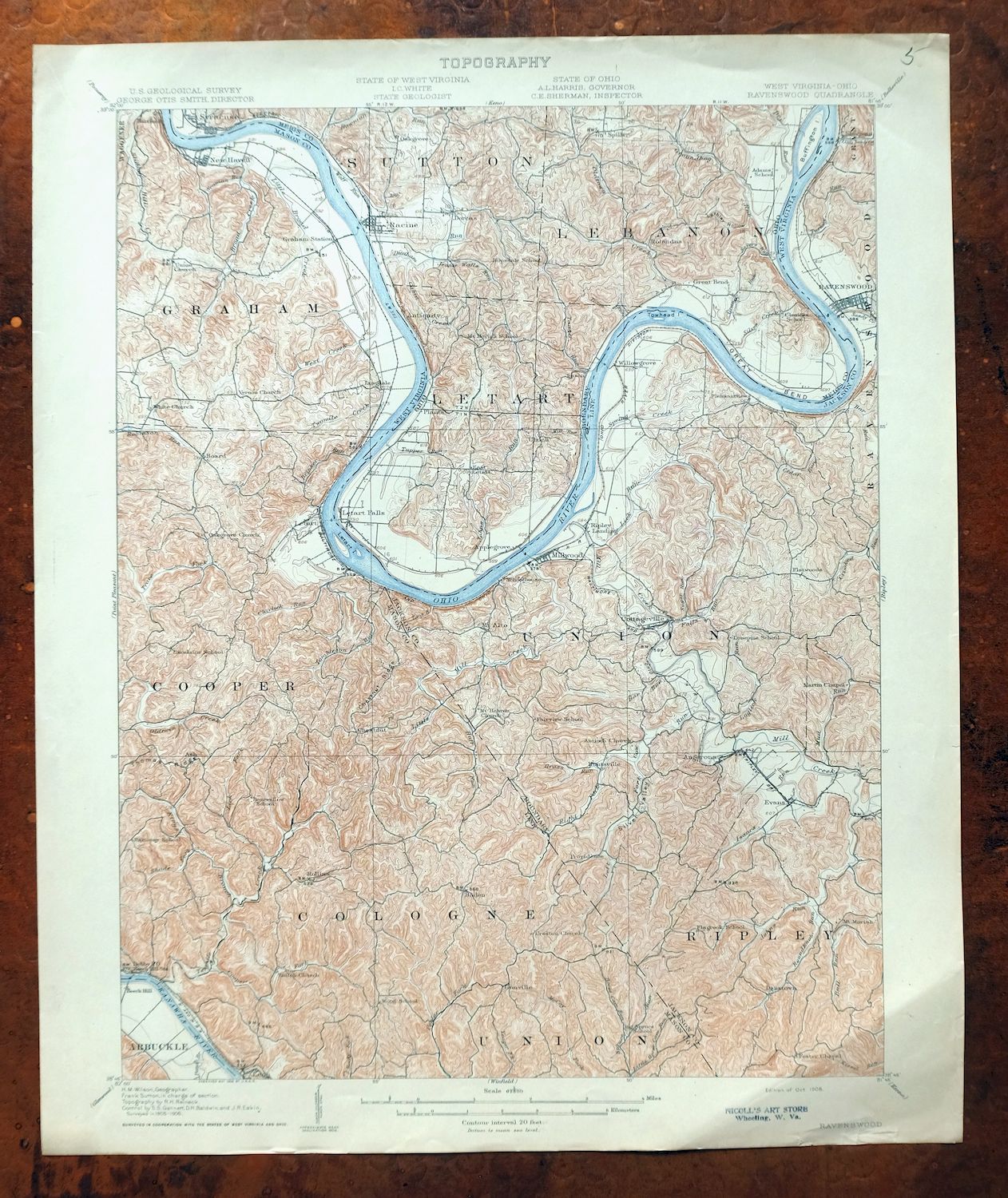
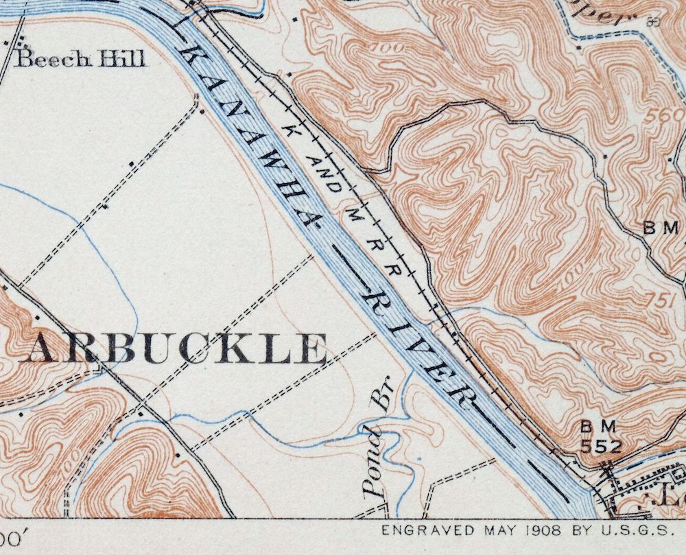
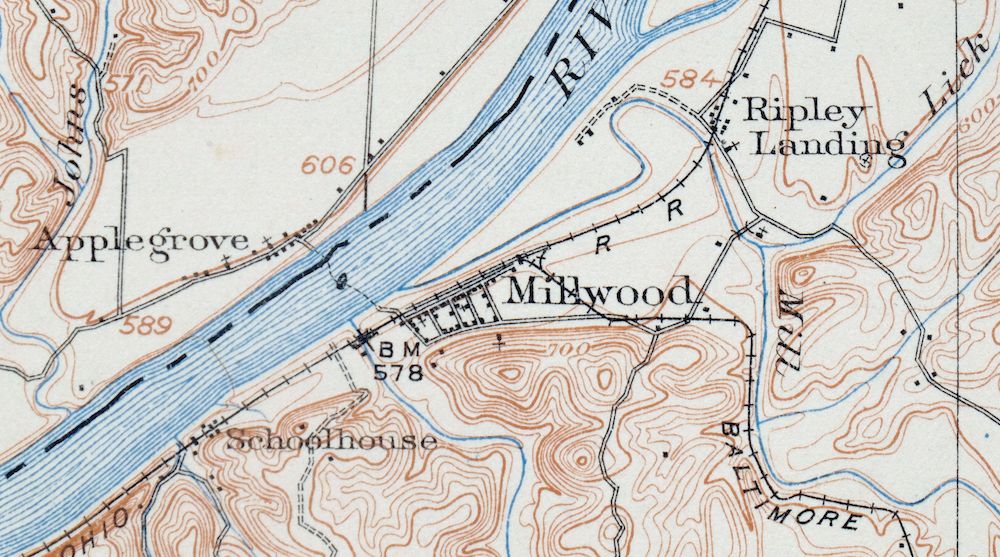
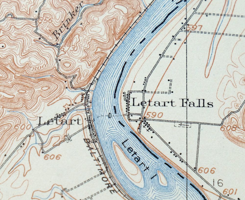
Ravenswood West Virginia New Haven Evans USGS Topo Map 1908
$40
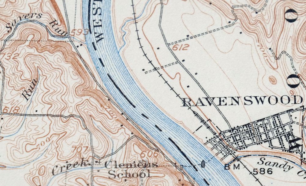
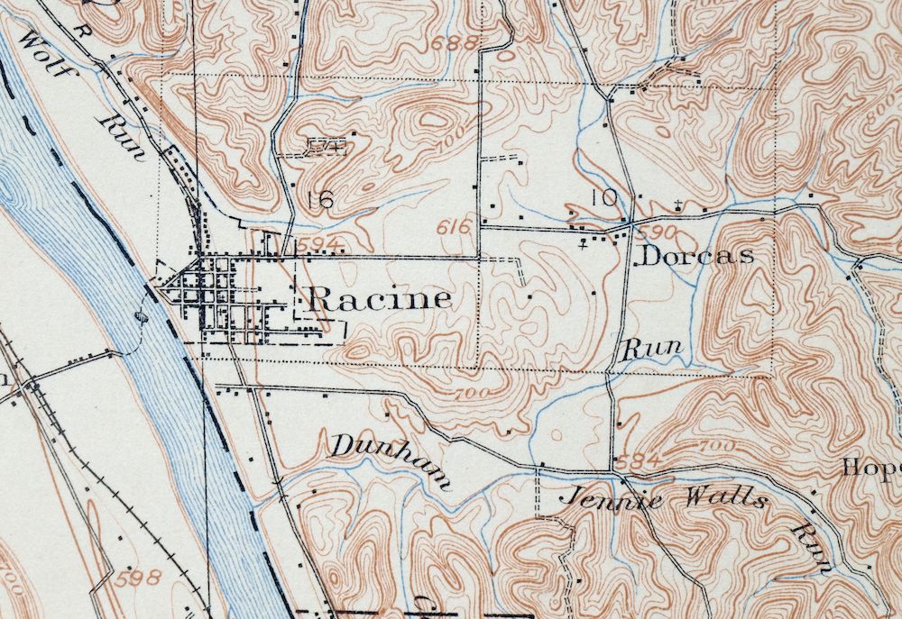
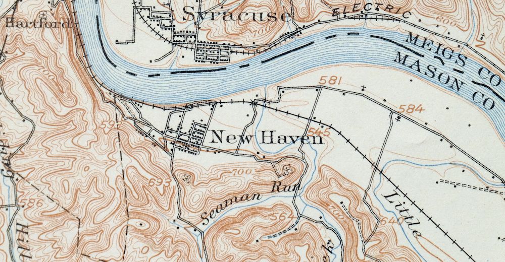
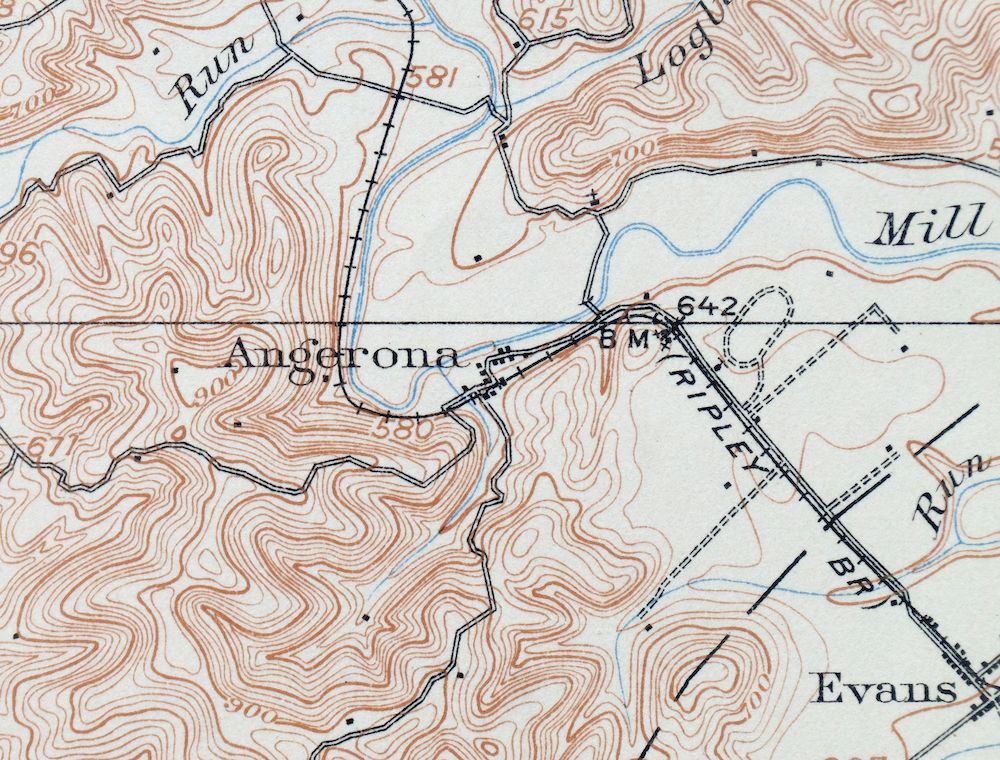
Printed in its year of first publication, 1908, this USGS 15-minute topographic sheet is in very good condition, never folded, on thick stock, with a diagonal crease in the lower right corner and edge tears stabilized with archival tape on the reverse. The quad straddles the West Virginia–Ohio line along the Ohio River, taking in Ravenswood and the surrounding parts of Jackson County plus New Haven, Hartford City, and Racine on the far bank, with smaller communities like Letart Falls and Cottageville within its boundaries. Surveyed in 1905 and 1906 by a party under geographer H.M. Wilson and engraved in 1908, the sheet predates the modern highway system and records the wagon roads and rail lines that carried travel through the river valley at the time, and the reverse carries printed reference material on reading the map. An antique sheet at 118 years old, it survives with no markings or blemishes in the mapped area.
In stock
This antique sheet is a 1908 edition of the Ravenswood West Virginia USGS topographic map. It is an authentic 118-year-old United States Geological Survey print in very good condition.
HOW THIS MAP CAN BE USED
In addition to making a fascinating conversation piece, this sheet would look great in a frame or on display, make a unique and prized gift for anyone interested in this area, be perfect as a reference for genealogy studies or general historical research, or fill that missing piece in your collection.
FEATURES SHOWN ON THE MAP
The Ravenswood 15-minute map shows cities and towns, roads, railroads, rivers, creeks, elevation contour lines, public land survey lines, county, state, and other administrative boundaries as they existed at the time of the survey in 1905 and 1906. All known structures (houses, businesses, churches, schools, barns, cabins, etc) are also shown, with exceptions in some urban areas, where only landmark buildings may be shown.
A VALUABLE HISTORICAL RECORD
Maps from the 15-minute series for the continental United States are no longer produced or printed by the USGS and original prints are becoming increasingly difficult to find. They are a valuable historical record for an area, as they contain many placenames and features that have been dropped from more recent maps.
Nearby maps
-

Point Pleasant West Virginia Middleport USGS Topo Map 1908
$25 Add to cart -

Winfield West Virginia Bancroft Southside USGS Topo Map 1908
$37 Add to cart -

Pomeroy Ohio Middleport Mason USGS Topo Map 1907 Antique
$37 Add to cart -

Saint Albans West Virginia Dunbar USGS Topographic Map 1909
$37 Add to cart -

Parkersburg Ohio Marietta Vienna USGS Topo Map 1912 Antique
$63 Add to cart -

Charleston West Virginia Cross Lanes Rand USGS Topo Map 1914
$68 Add to cart -

Marietta Ohio Wayne NF Devola USGS Topo Map 1912 Antique
$62 Add to cart -

Saint Marys West Virginia Ellenboro Pike USGS Topo Map 1916
$47 Add to cart -

Peytona West Virginia Marmet Belle USGS Topographic Map 1911
$42 Add to cart -

Wayne West Virginia Dunlow Cove Gap USGS Topo Map 1909
$42 Add to cart -

Pocatalico West Virginia Dunbar USGS Topographic Map 1977
$30 Add to cart -

Charleston West West Virginia Dunbar USGS Topo Map 1978
$22 Add to cart -

Sutton West Virginia Glenville Elk River USGS Topo Map 1907
$75 Add to cart -

Kenova Kentucky Louisa Grayson USGS Topo Map 1912 Antique
$54 Add to cart -

Garrison Kentucky Portsmouth York USGS Topo Map 1918 Antique
$32 Add to cart -

Bald Knob West Virginia Mallory USGS Topo Map 1923 Antique
$50 Add to cart -

Nicholas West Virginia Summersville Cowen USGS Topo Map 1912
$54 Add to cart -

Oceana West Virginia Logan Gilbert USGS Topographic Map 1912
$58 Add to cart -

Warfield West Virginia Pikeville Harts USGS Topo Map 1911
$85 Add to cart -

Raleigh West Virginia Beckley Oak Hill USGS Topo Map 1901
$135 Add to cart -

Era Ohio South Bloomfield Williamsport USGS Topo Map 1913
$40 Add to cart -
Seaman Ohio West Union West Union USGS Topo Map 1918 Antique
$62 Add to cart -
Mount Sterling Ohio Washington Midway USGS Topo Map 1925
$42 Add to cart -
Sabina Ohio Leesburg New Vienna USGS Topo Map 1917 Antique
$42 Add to cart
