MAP DETAILS | |
|---|---|
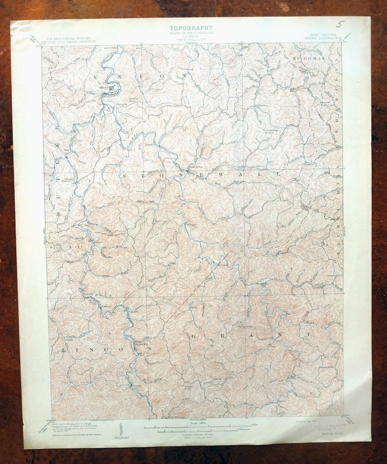
| TITLE | Wayne |
| STATE | West Virginia |
| LOCATION | 20 miles south of Huntington |
| SERIES | 15-minute |
| SURVEYED | 1907 Field Survey |
| GEOGRAPHER | Frank Sutton |
| ENGRAVED | 1909 |
| EDITION | 1909 |
| PRINTED | 1909 |
| PRINT NOTES | Thick paper stock |
| SCALE | 1:62500 |
| CONTOUR INTERVAL | 50 feet |
| SHEET DIMENSIONS | 16 1/2 x 20 inches |
| MAP DIMENSIONS | 13 3/4 x 17 1/2 inches |
| COVERAGE AREA | 14 x 17 miles |
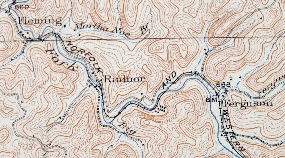
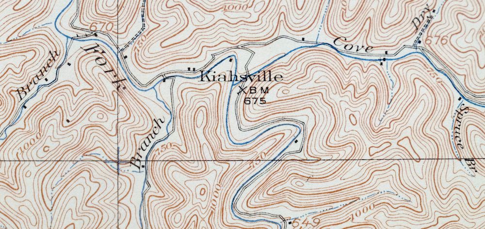
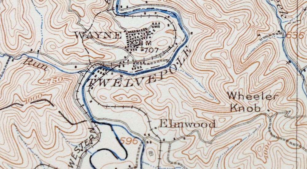
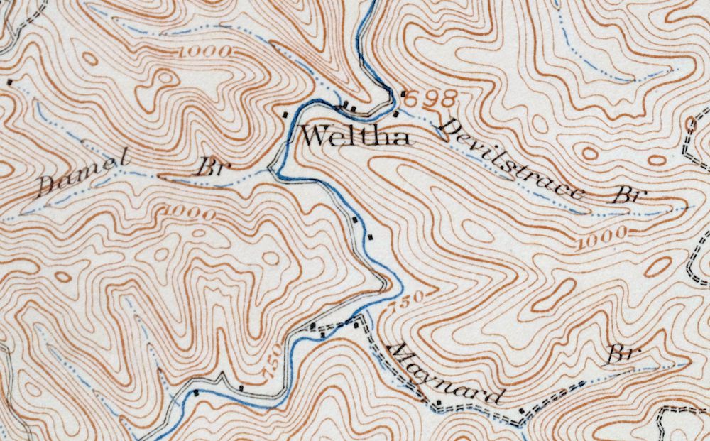
| MAP NOTES | Surveyed before the modern highway and interstate system and before the existence of East Lynn Lake, showing historic travel routes, rail lines, and placenames. |
| SHEET CONDITION For maps of this vintage, effort is made to note all visible flaws, no matter how minor. | |
| OVERALL CONDITION | Very Good |
| SHEET NOTES | lightly handled, never folded, attractively age-toned paper, light diagonal crease in lower right sheet corner |
| MAP AREA | no wear, no markings, no blemishes |
| COLLARS | very minor blemishes, pencilled notation in upper right collar corner, stabilized edge tear in upper left collar corner |
| MAP COVERAGE Quadrangle extent overlaid on current basemap. | |
| BACKSIDE LEGEND | |
 A map summary is printed on the back side of the Wayne sheet similar to the one shown in the picture. It outlines the history, purpose, and status of the USGS mapping program at the time of the printing in 1909. It also provides instructions on how to read contour lines and a description of how they are used to depict the terrain. At the bottom of the page is a legend showing all of the symbols used to represent the cultural, relief, and water features found on the map. | |
| PLACENAMES Depending on map series and survey date, all of the features listed below may not be shown on this map. This list contains features that currently exist or historically existed within the area covered by the map. The list can be used as a reference to determine if this map covers your area of interest. Placenames are listed alphabetically next to each feature type. | |
| CITIES AND TOWNS (CURRENT) | Dunlow, East Lynn, Kiahsville, and Wayne |
| COUNTIES COVERED | Cabell, Lincoln, and Wayne |
| FEDERAL LAND UNITS | East Lynn Lake |
| RIVERS AND STREAMS | Battern Fork, Beech Fork, Big Branch, Big Laurel Creek, Billy Branch, Booth Branch, Brush Creek, Camp Creek, Dalton Fork, Deephole Branch, Donathan Branch, East Fork Twelvepole Creek, Falls Branch, Flat Branch, Fourmile Creek, Fraley Fork, Garrett Creek, Grassy Branch, Greenbrier Creek, Harless Fork, Holly Branch, Indianlick Branch, Kentuck Fork, Kiah Creek, Laurel Creek, Left Fork Camp Creek, Left Fork Lynn Creek, Left Fork Millers Fork, Left Fork Parker Branch, Left Fork Rich Creek, Left Fork Wilson Creek, Lick Creek, Little Laurel Creek, Little Lynn Creek, Lost Creek, Lower Right Fork, Luster Fork, Lynn Creek, McClarity Branch, McComas Branch, Middle Fork Wilson Creek, Milam Creek, Mill Creek, Millers Fork, Missouri Branch, Niece Branch, Parker Branch, Patrick Creek, Pratt Branch, Raccoon Creek, Red River Fork, Right Fork Camp Creek, Right Fork Lick Creek, Right Fork Little Lynn Creek, Right Fork Lost Creek, Right Fork Lynn Creek, Right Fork Rich Creek, Rockhouse Fork, Rush Branch, Sandlick Branch, Stone Branch, Sycamore Branch, Tiger Fork, Trace Fork, Trough Fork, Twelvepole Creek, Twomile Creek, West Fork Twelvepole Creek, Wilson Creek, and Wolf Creek |
| WATER BODIES | East Lynn Lake |
| Locations: Hickory Gap. Administrative Boundaries: Stonewall Magisterial District. Mountains, Peaks, and Summits: Buck Knob, Buzzard Roost Knob, Hooker Knob, Mays Knob, McComas Mountain, Porter Knob, Saddle Knob, Squirrel Knob, Sweet Potato Knob, Turkeycamp Knob, Wheeler Knob, and Windy Oak Knob. Valleys and Canyons: Asbury Hollow, Boat Gunwale Hollow, Coal Hollow, Deadwood Hollow, Drenner Hollow, Horse Hollow, Lynn Hollow, Mill Hollow, Murder Hollow, and Rocky Hollow. Drainages: Little Lynn Creek, Little Milam Creek, Alum Fork, Alum Rock Branch, Amp Branch, Apple Orchard Branch, Benny Branch, Bartram Branch, Bates Branch, Battern Fork, Bearwallow Branch, Beechy Branch, Ben Haley Branch, Lambert Branch, Laurel Branch, Laurel Creek, Laurel Fork, Left Fork Camp Creek, Left Fork Lick Creek, Left Fork Lynn Creek, Left Fork Millers Fork, Left Fork Parker Branch, Left Fork Rich Creek, Left Fork Sycamore Branch, Left Fork Wilson Creek, Lick Branch, Lick Creek, Licklog Branch, Little Laurel Creek, Little Spring Branch, Big Branch, Big Laurel Creek, Billy Branch, Bluelick Branch, Bob Wetherall Branch, Booth Branch, Brush Creek, Buck Branch, Calf Branch, Camp Branch, Camp Creek, Carter Branch, Cedar Branch, Cove Creek, Crockett Fork, Dalton Fork, Damel Branch, Damel Fork, Davis Fork, Deephole Branch, Devilstrace Branch, Dick Branch, Donathan Branch, Doublelick Branch, Drift Branch, Dry Branch, East Fork Twelvepole Creek, Edds Branch, Elkins Branch, Falls Branch, Ferguson Branch, Flat Branch, Fort Branch, Fraley Fork, Frank Branch, Geiger Branch, Gilkerson Branch, Gilles Branch, Grassy Branch, Greenbrier Creek, Henry Smith Branch, Holly Branch, Honeytrace Fork, Humpy Branch, Hurricane Branch, Indianlick Branch, Jackson Branch, Joels Branch, Johnnys Branch, Jones Branch, Kiah Creek, Kilpeck Branch, Luster Fork, Lynn Creek, Lynn Fork, Martha Noe Branch, Mat Rice Branch, Matty Ferguson Branch, May Branch, Maynard Branch, McComas Branch, Meeks Branch, Middle Fork Wilson Creek, Milam Creek, Milt Adkins Fork, Mudlick Branch, Nestlow Branch, Newcomb Creek, Niece Branch, Onemile Creek, Parker Branch, Patrick Creek, Peach Orchard Branch, Perry Branch, Peter Cave Branch, Petercave Branch, Price Branch, Puncheoncamp Branch, Queen Branch, Queens Fork, Queenscamp Branch, Rich Creek, Right Fork Beech Fork, Right Fork Camp Creek, Right Fork Lick Creek, Right Fork Little Lynn Creek, Right Fork Lost Creek, Right Fork Lynn Creek, Right Fork Rich Creek, Rockhouse Branch, Rockhouse Fork, Sally Branch, Sam Noe Branch, Sandlick Branch, Sellards Branch, Shingle Branch, Spring Branch, Spruce Branch, Spruce Fork, Spry Branch, Stephens Fork, Stevens Branch, Stonecoal Branch, Sulphur Spring Branch, Sumate Fork, Sycamore Branch, Tiger Fork, Toms Creek, Trace Branch, Trace Fork, Trough Fork, Turkeycamp Branch, Twomile Creek, Walker Branch, Ward Branch, West Fork Twelvepole Creek, White Oak Creek, White Oak Fork, Wilson Creek, Wolf Creek, and Wolfpen Branch. Churches: Beech Fork Church, Beech Grove Church, Liberty Church, Bethel Church, Comfort Church, Cove Chapel, East Lynn Church, Echo Church, Fairmont Church, Greasy Ridge Church, Greenbrier Church, Haney Church, Hopewell Church, Kennedy Chapel, Lost Creek Church, Mary Magdalene Church, Mill Creek Church, Newcomb Creek Church, Patrick Creek Church, Perry Memorial Church, Queens Ridge Church, Spurlock Church, Toms Creek Church, Twelvepole Valley Church, Wolfpen Church, and Zion Church. Lakes and Ponds: Mam-Maw Lake. Dams: East Lynn Dam. Gaps: Bing Gap, Black Oak Gap, and Sand Gap. Schools: Beech Fork School, Big Branch School, Big Lynn School, Billy Branch School, Camp Creek School, Damron School, Dunlow Elementary School, East Lynn Elementary School, Garrett Creek School, Haney School, Joels Branch School, Kiah Creek School, Lower Laurel School, Lycans Ridge School, McComas School, Milam School, Parker School, Rich Creek School, Sycamore School, Twomile School, Upper Laurel School, Wayne Elementary School, Wayne High School, Wayne Middle School, and Wilson School. Ridges: Crackersneck Ridge, Ferguson Ridge, Fork Ridge, Lycans Ridge, Mathis Ridge, Napier Ridge, Queens Ridge, and Watts Ridge. Reservoirs and Tanks: East Lynn Lake. | |
| SHIPPING AND RETURNS | |
 This map sheet will be carefully rolled in a sturdy tube and shipped via the US Postal Service. If you find that the sheet you receive is not as described in the listing, you may ship it back to us for a refund of the purchase price. | |
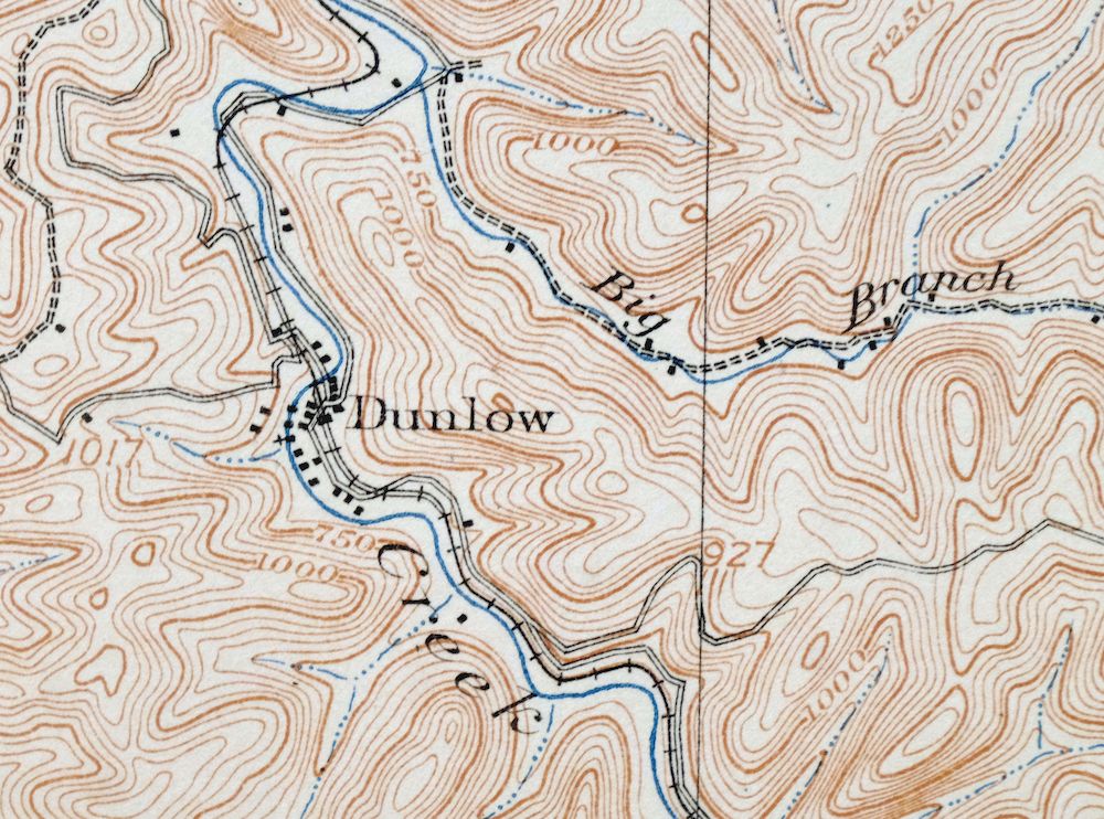
Wayne West Virginia Dunlow Cove Gap USGS Topo Map 1909
$42
Printed in 1909, its year of first publication, this antique 15-minute USGS topographic sheet is in very good condition, never folded and on thick stock with attractively age-toned paper. The quad sits in southwestern West Virginia about 20 miles south of Huntington, taking in the town of Wayne along with the communities of Kiahsville, East Lynn, and Dunlow across Wayne, Lincoln, and Cabell counties. Drawn from a 1907 field survey and engraved in 1909, well before the modern highway system and East Lynn Lake, it records the rail lines, wagon roads, and placenames of the county as they stood at the turn of the century. A light diagonal crease sits in the lower right corner, and the reverse carries printed reference material about reading the map.
In stock
This antique sheet is a 1909 edition of the Wayne West Virginia USGS topographic map. It is an authentic 117-year-old United States Geological Survey print in very good condition.
HOW THIS MAP CAN BE USED
In addition to making a fascinating conversation piece, this sheet would look great in a frame or on display, make a unique and prized gift for anyone interested in this area, be perfect as a reference for genealogy studies or general historical research, or fill that missing piece in your collection.
FEATURES SHOWN ON THE MAP
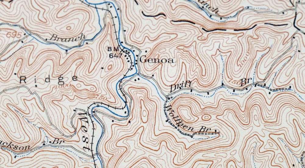
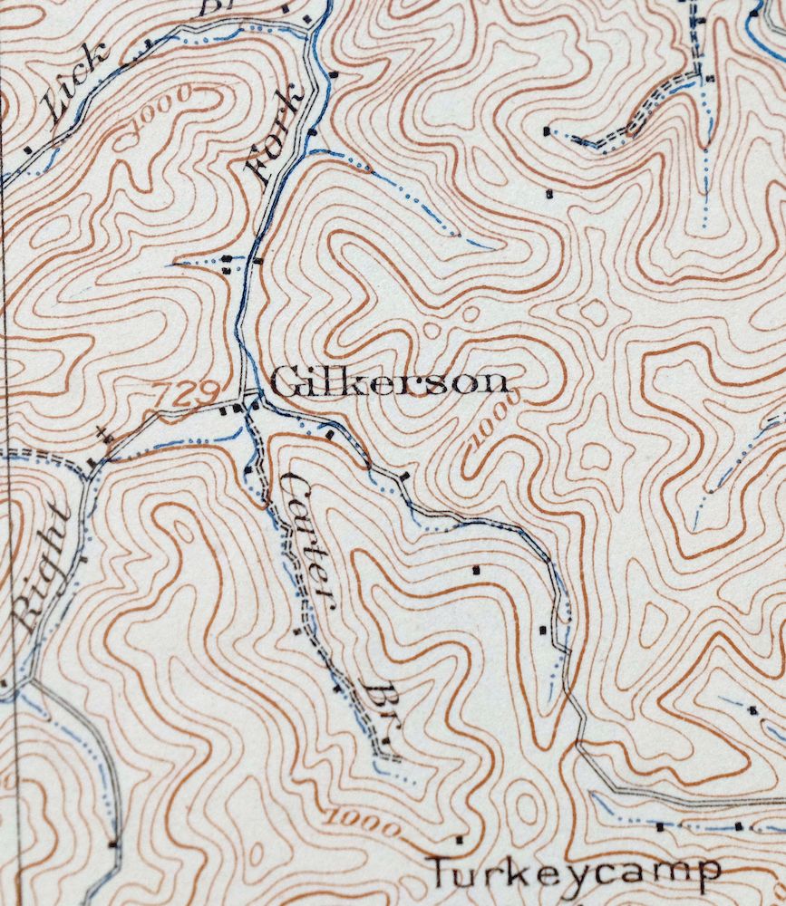
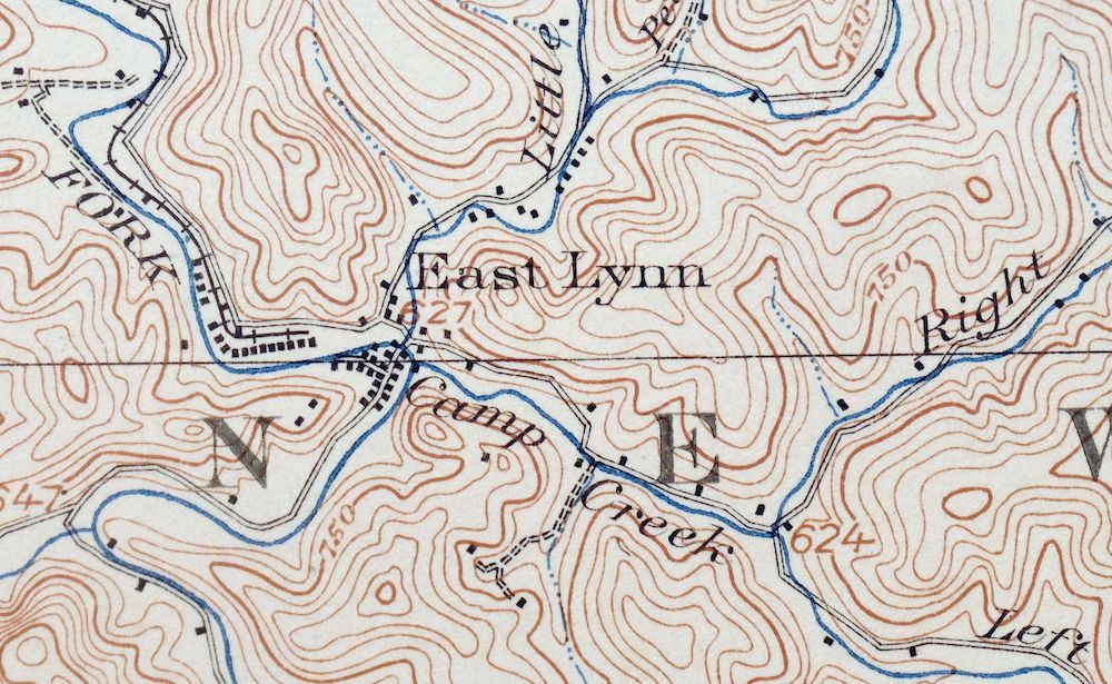
The Wayne 15-minute map shows cities and towns, roads, railroads, rivers, creeks, elevation contour lines, public land survey lines, county, state, and other administrative boundaries as they existed at the time of the survey in 1907. All known structures (houses, businesses, churches, schools, barns, cabins, etc) are also shown, with exceptions in some urban areas, where only landmark buildings may be shown.
A VALUABLE HISTORICAL RECORD
Maps from the 15-minute series for the continental United States are no longer produced or printed by the USGS and original prints are becoming increasingly difficult to find. They are a valuable historical record for an area, as they contain many placenames and features that have been dropped from more recent maps.
Nearby maps
-

Saint Albans West Virginia Dunbar USGS Topographic Map 1909
$37 Add to cart -

Peytona West Virginia Marmet Belle USGS Topographic Map 1911
$42 Add to cart -

Winfield West Virginia Bancroft Southside USGS Topo Map 1908
$37 Add to cart -

Charleston West Virginia Cross Lanes Rand USGS Topo Map 1914
$68 Add to cart -

Bald Knob West Virginia Mallory USGS Topo Map 1923 Antique
$50 Add to cart -

Garrison Kentucky Portsmouth York USGS Topo Map 1918 Antique
$32 Add to cart -

Point Pleasant West Virginia Middleport USGS Topo Map 1908
$25 Add to cart -

Ravenswood West Virginia New Haven Evans USGS Topo Map 1908
$40 Add to cart -

Kenova Kentucky Louisa Grayson USGS Topo Map 1912 Antique
$54 Add to cart -

Warfield West Virginia Pikeville Harts USGS Topo Map 1911
$85 Add to cart -

Charleston West West Virginia Dunbar USGS Topo Map 1978
$22 Add to cart -

Oceana West Virginia Logan Gilbert USGS Topographic Map 1912
$58 Add to cart -

Pocatalico West Virginia Dunbar USGS Topographic Map 1977
$30 Add to cart -

Salyersville Kentucky West Liberty Zag USGS Topo Map 1918
$47 Add to cart -

Whitesburg Kentucky Pikeville Cumberland USGS Topo Map 1910
$80 Add to cart -

Raleigh West Virginia Beckley Oak Hill USGS Topo Map 1901
$135 Add to cart -

Pomeroy Ohio Middleport Mason USGS Topo Map 1907 Antique
$37 Add to cart -
Seaman Ohio West Union West Union USGS Topo Map 1918 Antique
$62 Add to cart -

Nicholas West Virginia Summersville Cowen USGS Topo Map 1912
$54 Add to cart -

Parkersburg Ohio Marietta Vienna USGS Topo Map 1912 Antique
$63 Add to cart -
Manchester Kentucky Booneville McKee USGS Topo Map 1917
$51 Add to cart -

Sutton West Virginia Glenville Elk River USGS Topo Map 1907
$75 Add to cart -

Marietta Ohio Wayne NF Devola USGS Topo Map 1912 Antique
$62 Add to cart -
Sabina Ohio Leesburg New Vienna USGS Topo Map 1917 Antique
$42 Add to cart
