MAP DETAILS | |
|---|---|
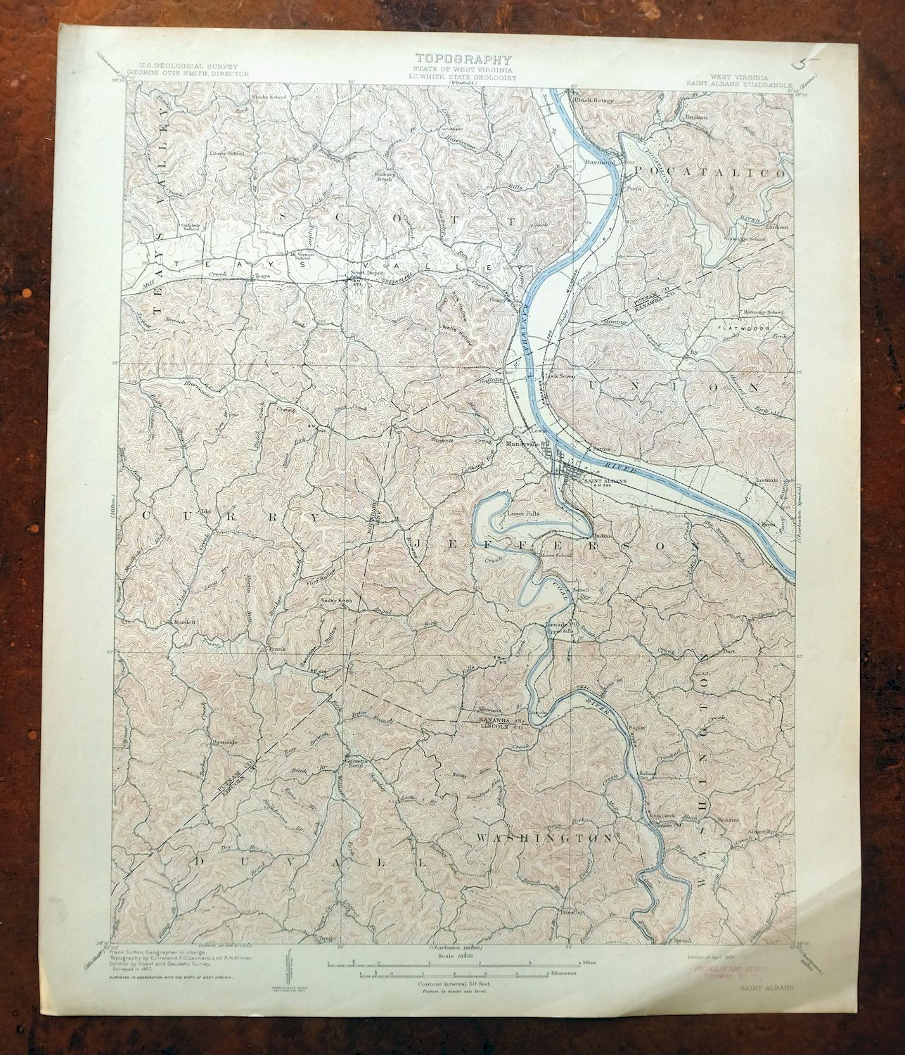
| TITLE | Saint Albans |
| STATE | West Virginia |
| LOCATION | 15 miles west of Charleston |
| SERIES | 15-minute |
| SURVEYED | 1907 Field Survey |
| GEOGRAPHER | Frank Sutton |
| ENGRAVED | 1909 |
| EDITION | 1909 |
| PRINTED | 1909 |
| PRINT NOTES | Thick paper stock |
| SCALE | 1:62500 |
| CONTOUR INTERVAL | 50 feet |
| SHEET DIMENSIONS | 16 1/2 x 20 inches |
| MAP DIMENSIONS | 13 3/4 x 17 1/2 inches |
| COVERAGE AREA | 14 x 17 miles |
| MAP NOTES | Surveyed before the modern highway and interstate system, showing historic travel routes, rail lines, and placenames. |
| SHEET CONDITION For maps of this vintage, effort is made to note all visible flaws, no matter how minor. | |
| OVERALL CONDITION | Very Good |
| SHEET NOTES | lightly handled, never folded, attractively age-toned paper, light diagonal crease in lower right sheet corner |
| MAP AREA | no markings, no blemishes |
| COLLARS | minor blemishes, pencilled notation in upper right collar corner, small inventory stamp in bottom right collar, no edge tears |
| MAP COVERAGE Quadrangle extent overlaid on current basemap. | |
| BACKSIDE LEGEND | |
 A map summary is printed on the back side of the Saint Albans sheet similar to the one shown in the picture. It outlines the history, purpose, and status of the USGS mapping program at the time of the printing in 1909. It also provides instructions on how to read contour lines and a description of how they are used to depict the terrain. At the bottom of the page is a legend showing all of the symbols used to represent the cultural, relief, and water features found on the map. | |
| PLACENAMES Depending on map series and survey date, all of the features listed below may not be shown on this map. This list contains features that currently exist or historically existed within the area covered by the map. The list can be used as a reference to determine if this map covers your area of interest. Placenames are listed alphabetically next to each feature type. | |
| CITIES AND TOWNS (CURRENT) | Alum Creek, Cross Lanes, Dunbar, Hurricane, Jefferson, Nitro, Poca, Saint Albans, Scott Depot, South Charleston, St. Albans, Teays Valley, and Tornado |
| COUNTIES COVERED | Kanawha, Lincoln, and Putnam |
| RIVERS AND STREAMS | Adkins Fork, Alum Creek, Angel Fork, Beech Branch, Big Coal River, Big Creek, Big Spring Fork, Blakes Creek, Bowman Fork, Bridge Creek, Browns Creek, Clay Bank Branch, Clymer Creek, Coal River, Cobb Creek, Cow Creek, Crooked Creek, Donley Fork, Dry Branch, Falls Creek, Finney Branch, Fuquay Creek, Grobes Branch, Harmon Branch, Hayzlett Fork, Heizer Creek, Hurricane Creek, Island Creek, Joes Branch, Joes Creek, Kanawha River, Kelly Creek, Kellys Creek, Laurel Fork, Lefthand Fork Turkey Creek, Lick Branch, Lick Creek, Little Brier Creek, Little Coal River, Little Hurricane Creek, Little Scary Creek, Little Smith Creek, Long Branch, Manila Creek, Mannens Branch, Martin Run, Molly Branch, Mudsuck Branch, Pocatalico River, Rider Creek, Road Fork, Rockhouse Branch, Rockstep Run, Rocky Fork, Rocky Run, Sams Fork, Scary Creek, Smith Creek, Sugar Branch, Tackett Branch, Tango Branch, Toms Branch, Tony Branch, Trace Branch, Trace Creek, Trace Fork, Turkey Creek, Two and Three Quarter Mile Creek, and Twomile Branch |
| WATER BODIES | Dickinson Lake, I-64 Lake, Lake Chaweva, Teays Valley Lakes, and Lake Washington |
| Locations: Liberty Square Shopping Center, Bradford Landing, Camp Happy Valley, Central Square Shopping Center, Gateway Shopping Center, Hub Industrial Park, Monsanto Sportsmen Club, Putnam Village Shopping Center, Rock Branch Industrial Park, Saint Albans Mall Shopping Center, Saint Albans Plaza Shopping Center, Scarlet Oaks Country Club, Sleepy Hollow Golf Course, and Teays Valley Industrial Park. Administrative Boundaries: District 3 Magisterial District, Teays Magisterial District, and Washington Magisterial District. Mountains, Peaks, and Summits: Coal Mountain, Hickory Knob, and Rocky Knob. Valleys and Canyons: Kirk Hollow, Coal Hollow, Flint Hollow, Raccoon Hollow, and Wells Hollow. Parks: Crawford Field, Hilbert Public Hunting Area, Hurricane City Park, Nitro City Park, Ridenour Memorial Park, Saint Albans City Park, and Shawnee Park. Trails: Midland Trail. Drainages: Adkins Fork, Little Scary Creek, Alum Creek, Angel Fork, Armour Creek, Bailey Branch, Beech Branch, Laurel Fork, Little Alum Creek, Lefthand Fork, Lefthand Fork Turkey Creek, Lick Branch, Lick Creek, Lick Run, Little Coal River, Little Smith Creek, Big Branch, Big Coal River, Big Spring Fork, Bills Creek, Blakes Creek, Boardtree Run, Bowman Fork, Bridge Creek, Browns Creek, Bryan Branch, Buck Branch, Buffs Branch, Cain Branch, Clay Bank Branch, Coal River, Coon Branch, Cow Creek, Crooked Creek, Donley Fork, Dry Branch, Ezekiel Branch, Falls Creek, Farley Creek, Fields Brook, Finney Branch, Fuquay Creek, Gallatin Branch, Grobes Branch, Hayzlett Fork, Heizer Creek, Howard Fork, Indian Creek, Island Creek, Joes Branch, Joes Creek, Kelly Creek, Kellys Creek, Long Branch, Mahone Branch, Manila Creek, Mannens Branch, Martin Branch, Martin Creek, Martin Run, Mill Creek, Molly Branch, Morrison Fork, Pocatalico River, Rider Creek, Road Fork, Rock Branch, Rockhouse Branch, Rockstep Run, Rocky Run, Sams Fork, Scary Creek, Smith Creek, Snag Creek, Sugar Branch, Tackett Branch, Tackett Creek, Tango Branch, Toms Branch, Toms Fork, Tony Branch, Trace Branch, Trace Creek, Turkey Creek, Two and Three Quarter Mile Creek, Twomile Branch, and Upton Creek. Churches: Abney Street Church of God, Apostolic Free Church of God, Browns Chapel, Browns Creek Church, Catholic Church of the Ascension, Church of Christ, Church of God, Community Chapel, Community Chapel Church, Cross Lanes United Methodist Church, Elizabeth Church, First Baptist Church of Nitro, First Baptist Church of Saint Albans, First Christian Church, First Methodist Episcopal Church, First Presbyterian Church of Saint Albans, Gateway Church of Christ, Good Hope Church, Good Shepherd Southern Baptist Church, Grace Baptist Temple, Grace Evangelical Lutheran Church, Green Valley Church of God, Highlawn First Church of God, Highlawn Presbyterian Church, Holy Trinity Catholic Church, Hopewell Church, Humphreys Memorial United Methodist Church, Joes Creek Church, Johnsotons Church, Judson Church, Lower Falls Baptist Church, Mount Moriah Church, Mount Olive Church, Mount Salem Church, Mount Tabor Church, Mount Vernon Church, Mount Zion Church, New Hope Church, Nitro Church of Christ, Nitro Church of God, Pentecostal Church of Christ, Peoples Baptist Church, Pine Grove Church, Pleasant Hill Church, Pleasant View Church, Poca Baptist Church, Providence Church, Putnam Christian Church, Saint Albans Church of the Nazarene, Saint Andrew United Methodist Church, Saint Francis of Assisi Roman Catholic Church, Saint Marks Episcopal Church, Saint Paul Baptist Church, Saint Pauls United Methodist Church, Saint Peters United Methodist Church, Saint Timothy in the Valley Episcopal Church, Spring Creek Church, Teays Valley Chapel, Toms Fork Church, Valley View Church, and Youngs Chapel. Hospitals: Putnam General Hospital and Women and Childrens Hospital. Buildings: Lock House Number 1, Callihan House, Chilton House, Colcord House, Fire Station Number 2, John Amos Power Plant, Nitro City Hall, Poca Branch Putnam County Library, Poca Town Hall, Ravenswood, Rosedale, Saint Albans City Hall, Saint Albans Library, The Beeches, William E Mohler House, and Zerkle House. Waterfalls: Lower Falls and Upper Falls. Dams: Lake Chaweva Dam, Lake Oakwood Dam, Blakes-Armour Creek Structure Number Seven Dam, Hurricane Water Supply Reservoir Dam, John Amos Fly Ash Retention Dam, Poffenbarger Dam Number One, Poffenbarger Dam Number Two, Ranch Lake Estate Dam, and Sleepy Hollow Golf Club Reservoir Dam. Crossings: Interchange 39, Interchange 44, Interchange 46, Interchange 47, and Interchange 50. Airports: State Police Heliport. Schools: Alum Creek School, Andrews Heights School, Anne Bailey Elementary School, Baker Elementary School, Belvil Elementary School, Ben Franklin Career Education Center, King Creek School, Lakewood Elementary School, Big Scary School, Black Lick School, Calvary Baptist Academy, Central School, Cross Lanes Elementary School, District High School, Dry Branch School, Dunbar Elementary School, Dunbar Junior High School, East Sattes School, Eastbrook Elementary School, Fairview School, George C Weimer Elementary School, Hansford School, Hayes Junior High School, Highland School, Highlawn School, Hill Valley School, Hudson School, Institute School, Island Creek School, McKinley Junior High School, Midway School, New Hope School, Nitro Elementary School, Nitro High School, Ordnance Park School, Pleasant Hill School, Pleasant View School, Poca High School, Poca Middle School, Poca School, Point Harmony School, Rider Creek School, Robinson School, Rock Branch School, Saint Albans Elementary School, Saint Albans High School, Saint Francis School, Scott Teays School, Shawnee Hills Rieg School, Shelton College, Spring Hollow School, State Police Academy, Sunnydale School, Tackett School, Webb School, West Dunbar School, West Sattes School, West Teays Elementary School, and West Virginia State College. Ridges: Dry Ridge. Reservoirs and Tanks: Amos Fly Ash Pond, Lake Ann Tormey, Lake Chaweva, Dickinson Lake, Hurricane Lake, I-64 Lake, Oakwood Lake, and Teays Valley Lakes. Towers: WCHS-AM (Charleston), WCHS-TV (Charleston), WKAZ-AM (Saint Albans), WKLC-FM (Saint Albans), WKRP-TV (Charleston), and WVAH-TV (Charleston). Springs: Leyton Fisher Spring, Bruce Hunt Spring, Cottle Spring, Ensell Mercer Spring, Ervan Coiner Junior Spring, Farley Spring, Hager Spring, Henson Spring, Hubert Beaver Spring, Jarrett Spring, Jones Spring, Lois Umberger Spring, Mercer Spring, Moore Spring, Mynes Spring, Neary Spring, Russell Mercer Spring, Shermans Place Spring, Stone Spring, Williams Spring, and Wyant Spring. | |
| SHIPPING AND RETURNS | |
 This map sheet will be carefully rolled in a sturdy tube and shipped via the US Postal Service. If you find that the sheet you receive is not as described in the listing, you may ship it back to us for a refund of the purchase price. | |
Saint Albans West Virginia Dunbar USGS Topographic Map 1909
$37
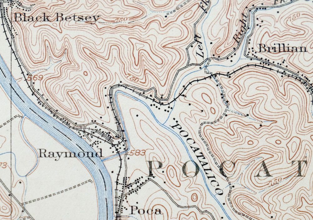
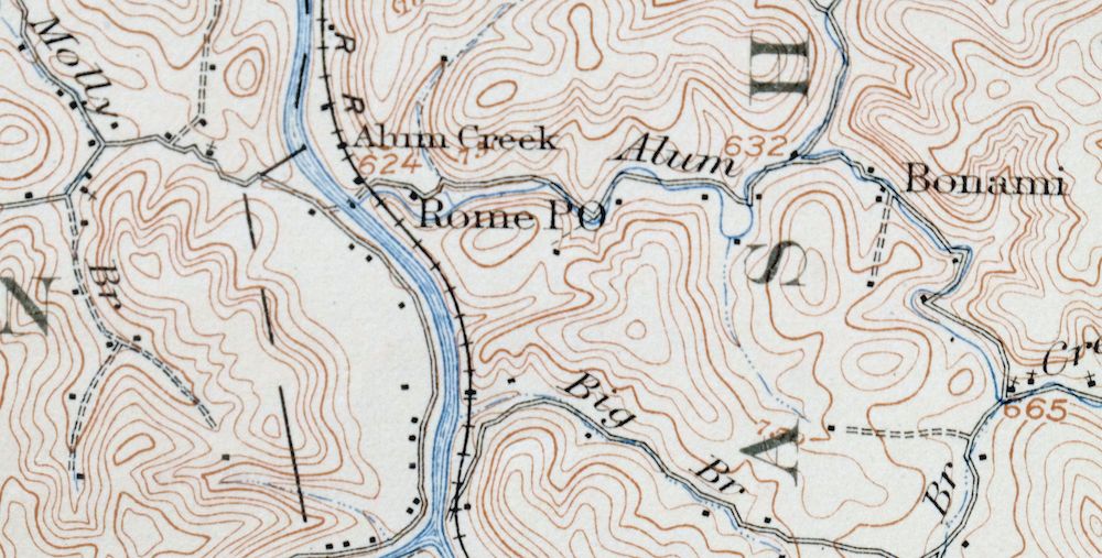
Printed in its year of first publication, 1909, this antique USGS topographic sheet is in very good condition, on thick stock, never folded with attractively age-toned paper and a light diagonal crease in the lower right corner. Engraved in 1909 under geographer Frank Sutton from a 1907 field survey, it takes in the country west of Charleston along the Kanawha River, with the quad area including St. Albans, South Charleston, Dunbar, Nitro, Teays Valley, and Scott Depot across Kanawha, Lincoln, and Putnam counties. Made before the modern highway and interstate system, it shows the historic travel routes, rail lines, and placenames of the valley as they stood over a century ago, and the reverse carries printed reference material on reading the map.
In stock
This antique sheet is a 1909 edition of the Saint Albans West Virginia USGS topographic map. It is an authentic 117-year-old United States Geological Survey print in very good condition.
HOW THIS MAP CAN BE USED
In addition to making a fascinating conversation piece, this sheet would look great in a frame or on display, make a unique and prized gift for anyone interested in this area, be perfect as a reference for genealogy studies or general historical research, or fill that missing piece in your collection.
FEATURES SHOWN ON THE MAP
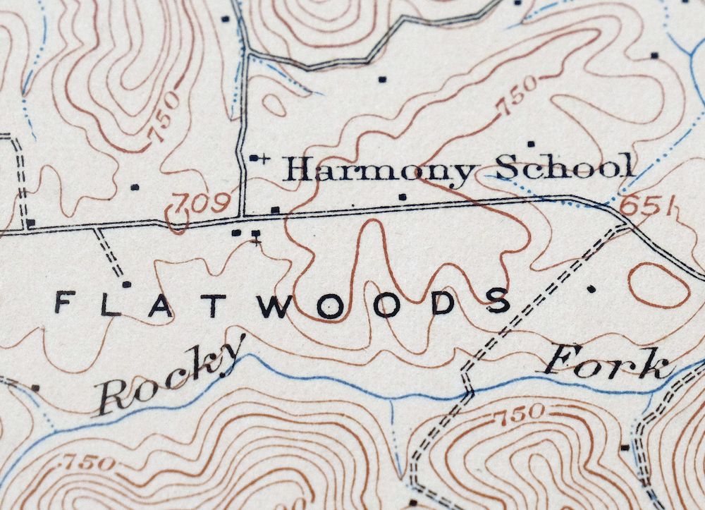
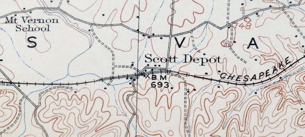
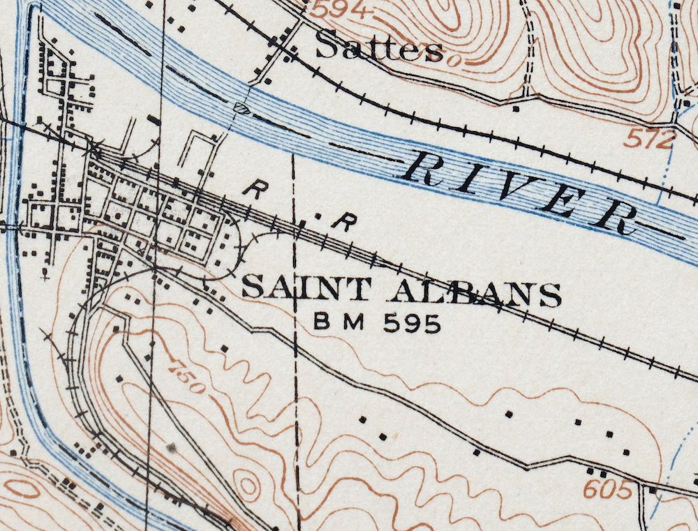
The Saint Albans 15-minute map shows cities and towns, roads, railroads, rivers, creeks, elevation contour lines, public land survey lines, county, state, and other administrative boundaries as they existed at the time of the survey in 1907. All known structures (houses, businesses, churches, schools, barns, cabins, etc) are also shown, with exceptions in some urban areas, where only landmark buildings may be shown.
A VALUABLE HISTORICAL RECORD
Maps from the 15-minute series for the continental United States are no longer produced or printed by the USGS and original prints are becoming increasingly difficult to find. They are a valuable historical record for an area, as they contain many placenames and features that have been dropped from more recent maps.
Nearby maps
-

Charleston West Virginia Cross Lanes Rand USGS Topo Map 1914
$68 Add to cart -

Winfield West Virginia Bancroft Southside USGS Topo Map 1908
$37 Add to cart -

Peytona West Virginia Marmet Belle USGS Topographic Map 1911
$42 Add to cart -

Wayne West Virginia Dunlow Cove Gap USGS Topo Map 1909
$42 Add to cart -

Ravenswood West Virginia New Haven Evans USGS Topo Map 1908
$40 Add to cart -

Point Pleasant West Virginia Middleport USGS Topo Map 1908
$25 Add to cart -

Bald Knob West Virginia Mallory USGS Topo Map 1923 Antique
$50 Add to cart -

Pomeroy Ohio Middleport Mason USGS Topo Map 1907 Antique
$37 Add to cart -

Charleston West West Virginia Dunbar USGS Topo Map 1978
$22 Add to cart -

Pocatalico West Virginia Dunbar USGS Topographic Map 1977
$30 Add to cart -

Oceana West Virginia Logan Gilbert USGS Topographic Map 1912
$58 Add to cart -

Warfield West Virginia Pikeville Harts USGS Topo Map 1911
$85 Add to cart -

Kenova Kentucky Louisa Grayson USGS Topo Map 1912 Antique
$54 Add to cart -

Raleigh West Virginia Beckley Oak Hill USGS Topo Map 1901
$135 Add to cart -

Nicholas West Virginia Summersville Cowen USGS Topo Map 1912
$54 Add to cart -

Sutton West Virginia Glenville Elk River USGS Topo Map 1907
$75 Add to cart -

Garrison Kentucky Portsmouth York USGS Topo Map 1918 Antique
$32 Add to cart -

Parkersburg Ohio Marietta Vienna USGS Topo Map 1912 Antique
$63 Add to cart -

Marietta Ohio Wayne NF Devola USGS Topo Map 1912 Antique
$62 Add to cart -

Saint Marys West Virginia Ellenboro Pike USGS Topo Map 1916
$47 Add to cart -

Salyersville Kentucky West Liberty Zag USGS Topo Map 1918
$47 Add to cart -

Whitesburg Kentucky Pikeville Cumberland USGS Topo Map 1910
$80 Add to cart -
Seaman Ohio West Union West Union USGS Topo Map 1918 Antique
$62 Add to cart -

Era Ohio South Bloomfield Williamsport USGS Topo Map 1913
$40 Add to cart
