MAP DETAILS | |
|---|---|
| TITLE | Oak Harbor |
| STATE | Washington |
| LOCATION | 51 miles north of Seattle |
| SERIES | 7.5-minute |
| SURVEYED | 1972 and 1973 Aerial and Field Survey |
| EDITION | 1973 |
| PRINTED | 1977 |
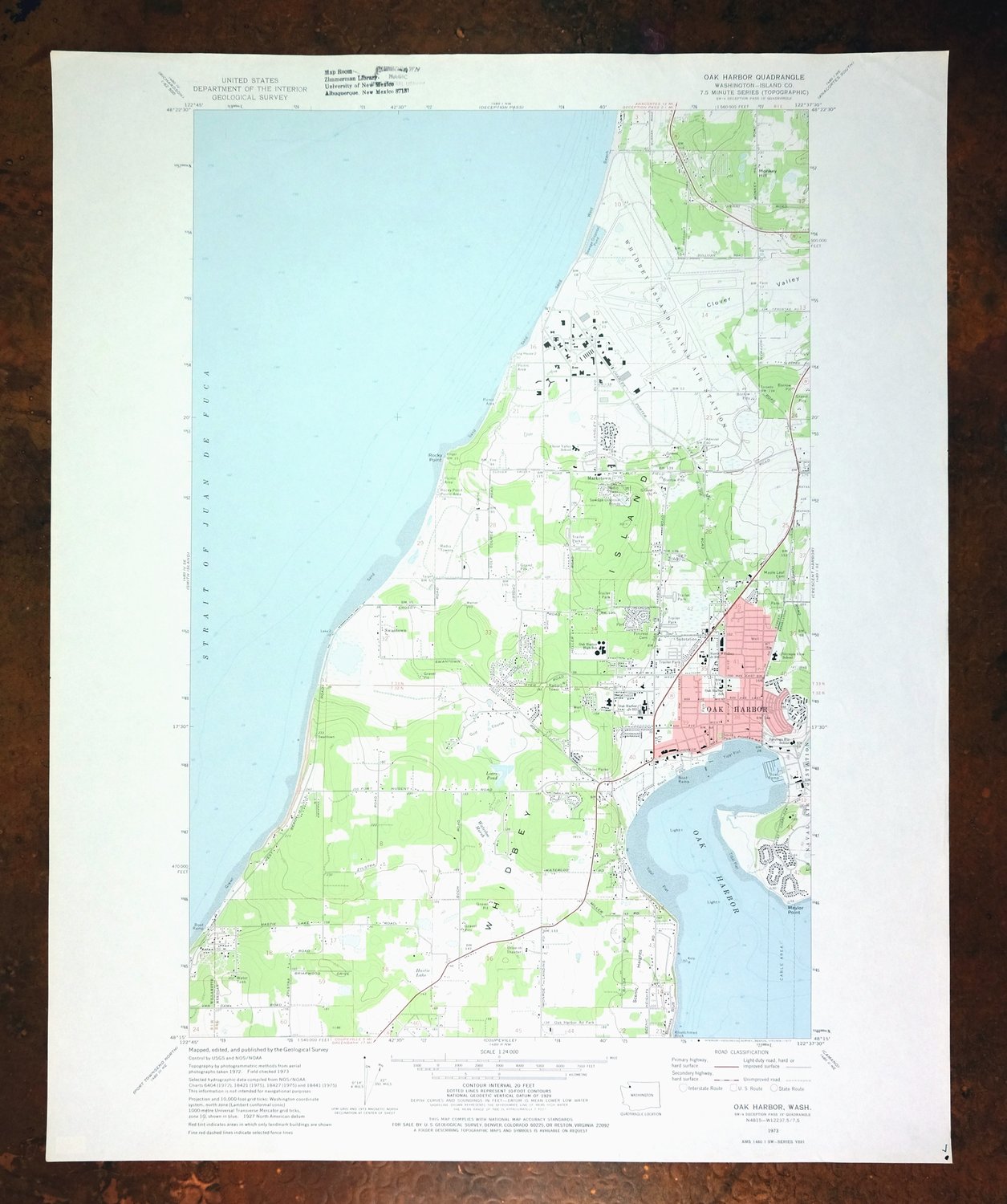
| PRINT NOTES | Includes woodland tint (green to indicate vegetated areas). A reddish tint is used to indicate urban areas where only landmark buildings are shown. |
| SCALE | 1:24000 |
| CONTOUR INTERVAL | 20 feet |
| SHEET DIMENSIONS | 22 x 27 inches (approximate) |
| MAP DIMENSIONS | 15 1/8 x 22 3/4 inches |
| COVERAGE AREA | 6 x 9 miles |
| SHEET CONDITION For maps of this vintage, effort is made to note all visible flaws, no matter how minor. | |
| OVERALL CONDITION | Excellent |
| SHEET NOTES | lightly handled, never folded |
| MAP AREA | no wear, no markings, no blemishes |
| COLLARS | very minor wear or tears, no blemishes, library stamp in top collar, very small inventory notation in extreme lower right collar corner |
| MAP COVERAGE Quadrangle extent overlaid on current basemap. | |
| PLACENAMES Depending on map series and survey date, all of the features listed below may not be shown on this map. This list contains features that currently exist or historically existed within the area covered by the map. The list can be used as a reference to determine if this map covers your area of interest. Placenames are listed alphabetically next to each feature type. | |
| CITIES AND TOWNS (CURRENT) | Ault Field and Oak Harbor |
| COUNTIES COVERED | Island |
| FEDERAL LAND UNITS | Ebey's Landing National Historical Reserve and Whidbey Island Naval Air Station |
| WATER BODIES | Loers Pond |
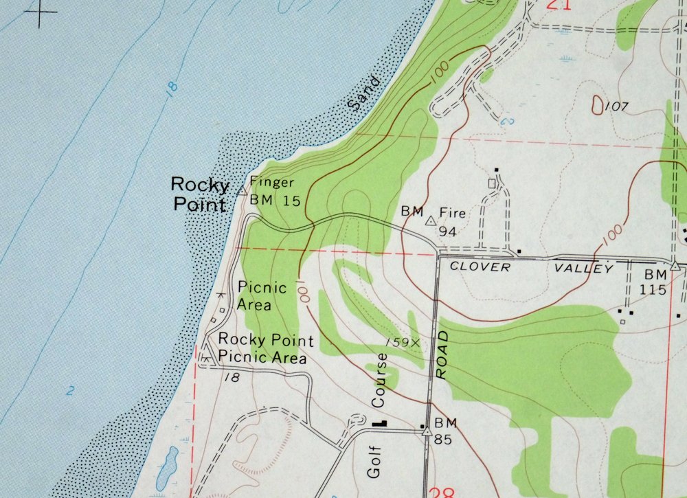
| Populated Place: Harborview Mobile Home Park, Oak Hollow Mobile Home Park, Parkwood Manor Mobile Home Park, Valley High Mobile Park, Wagon Wheel Mobile Home Park, Western Village Mobile Estates, Windmill Mobile Home Courts, Marketown, Oak Harbor, and Swantown. Locations: Gallery Golf Course, Oak Harbor Marina, Oak Harbor Park and Ride, Oak Harbor Sewage Treatment Plant, Staysail Recreational Vehicle Park, Whidbey Golf and Country Club, and Rocky Point Picnic Area. Administrative Boundaries: City of Oak Harbor and North Whidbey Island Division. Mountains, Peaks, and Summits: Monkey Hill and Scenic Heights. Parks: Joseph Whidbey State Park and Smith Park. Islands: Whidbey Island. Capes: Maylor Point and Rocky Point. Mines: Ault Field Road Sand Quarry. Churches: Bible Baptist Church, Church on the Rock, Family Bible Church, First Church of Christ Scientist, First Reformed Church, Grace Evangelical Church, Kingdom Hall of Jehovahs Witnesses, Lighthouse Christian Center, Living Word Fellowship Church, New Covenant Fellowship Church, Oak Harbor Assembly of God Church, Oak Harbor Christian Reformed Church, Oak Harbor Church of the Nazarene, Oak Harbor First United Methodist Church, Oak Harbor Lutheran Church, Oak Harbor Seventh Day Adventist Church, Oak Harbor Southern Baptist Church, Saint Augustine's Catholic Church, Saint Stephen's Anglican Church, The Church of Jesus Christ of Latter Day Saints, and Whidbey Presbyterian Church. Post Office: Oak Harbor Post Office and Whidbey Island Naval Air Post Office. Hospitals: Naval Hospital Oak Harbor. Buildings: Harbor Tower Village, Homeplace Special Care Center at Oak Harbor, Island County Fire District 2 North Whidbey Fire and Rescue Station 25 Heller Road, Island County Fire District 2 North Whidbey Fire and Rescue Station 26 Zylstra Road, Island County Fire District 2 North Whidbey Fire and Rescue Station 27 Monroe Landing Road, Naval Region Northwest Fire and Rescue Services, Oak Harbor City Hall, Oak Harbor Fire Department, Oak Harbor Fire Department Headquarters / Station 81, Oak Harbor Library, Oak Harbor Police Department, Regency on Whidbey, Summer Hill Assisted Living Community, Whidbey Island Manor, and YMCA. Dams: Loers Dam. Bays: Oak Harbor. Bars: Klootchman Rock. Airports: Whidbey Island Naval Air Station /Ault Field and AJ Eisenberg Airport. Swamps: Hastie Lake and Waterloo Marsh. Census: Whidbey Island Station Census Designated Place. Schools: Bible Baptist Church School, Brandman University at Whidbey Island, Childrens Academy, Der Kinderhuis Montessori, Midway School, Oak Harbor School District 201 Office, Skagit Valley College Whidbey Island Campus, Teddy Bear Child Care Center, Their Place Childrens Center, Whidbey Island Campus Hayes Hall, Whidbey Island Campus Oak Hall, Whidbey Island Campus Sprague Hall, Whidbey Island Campus Toddler Learning Center, Broadview Elementary School, Clover Valley Home Connection School, Hillcrest Elementary School, North Whidbey Middle School, Oak Harbor Christian School, Oak Harbor Elementary School, Oak Harbor High School, Oak Harbor Middle School, Olympic View Elementary School, Saratoga Heights School, and Whidbey Christian Elementary School. Reservoirs and Tanks: Loers Pond. Military: Naval Air Station Whidbey Island. Towers: KJTT-AM (Oak Harbor). Cemetery: Maple Leaf Cemetery. | |
| SHIPPING AND RETURNS | |
 This map sheet will be carefully rolled in a sturdy tube and shipped via the US Postal Service. If you find that the sheet you receive is not as described in the listing, you may ship it back to us for a refund of the purchase price. | |
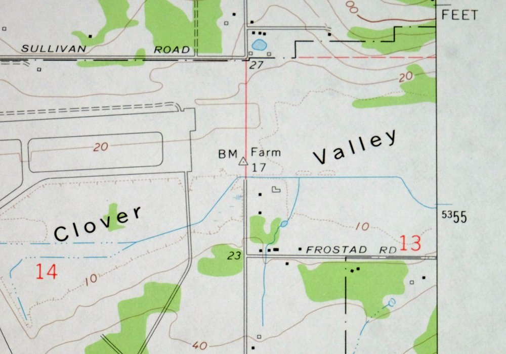
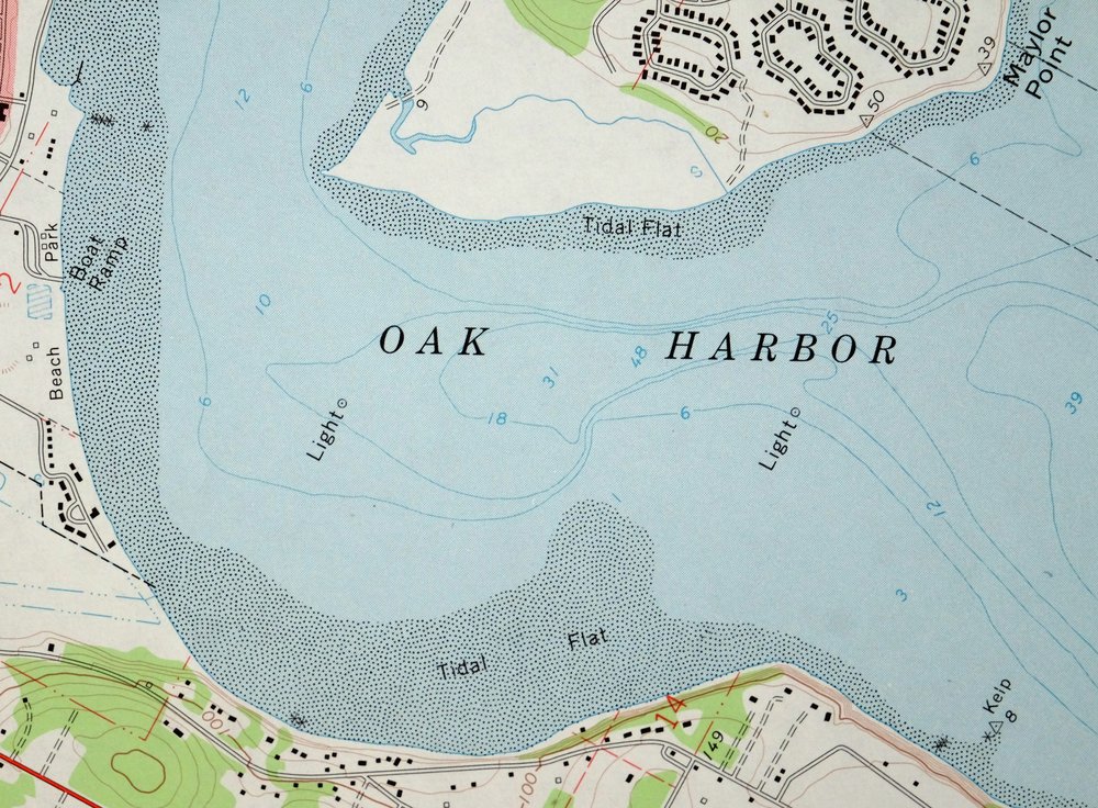
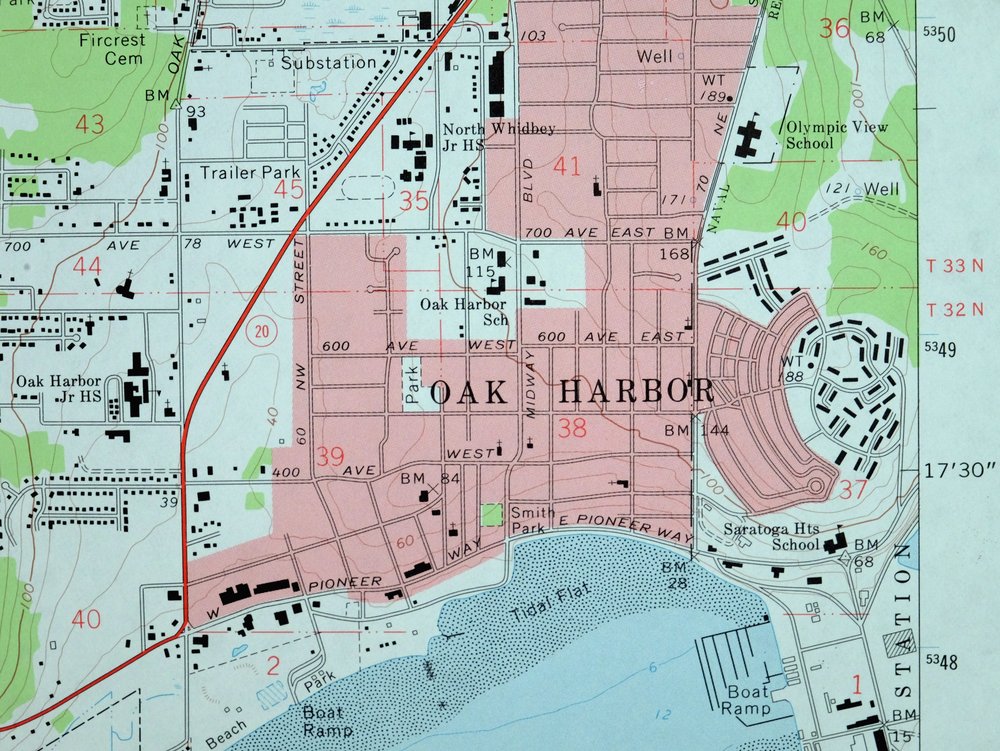
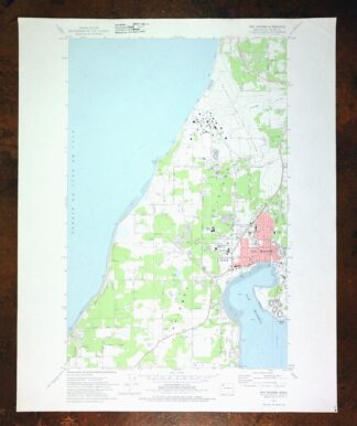
Oak Harbor Washington Ault Field USGS Topo Map 1977 Vintage
$46
This USGS 7.5-minute topographic map is a 1973 edition printed in 1977, and the sheet is in excellent condition, lightly handled and never folded. It takes in the northern part of Whidbey Island in Island County, including the city of Oak Harbor and Ault Field, with the surrounding waters of Puget Sound framing the shoreline about 51 miles north of Seattle. Ault Field is the naval air station on the island, and the map records the town and airfield as they stood in the early 1970s. A library stamp sits in the top collar and a small inventory notation in the lower right corner; because the sheet was never folded, it lies flat and would frame well.
In stock
This vintage sheet is a 1973 edition of the Oak Harbor Washington USGS topographic map. It is an original 49-year-old 1977 United States Geological Survey print in excellent condition.
HOW THIS MAP CAN BE USED
In addition to making a fascinating conversation piece, this sheet would look great in a frame or on display, make a unique and prized gift for anyone interested in this area, be perfect as a reference for genealogy studies or general historical research, or fill that missing piece in your collection. Maps of this vintage are printed on durable stock and are well-suited for outdoor activities and recreation of all kinds, including hiking, backpacking, hunting, rafting and kayaking, backcountry skiing, geocaching, general exploration, treasure hunting, etc.
FEATURES SHOWN ON THE MAP
The Oak Harbor 7.5-minute map shows cities and towns, roads, paths, railroads, utilities and energy infrastructure, rivers, creeks, elevation contour lines, public land survey lines, county, state, and other administrative boundaries as they existed at the time of the survey in 1972 and 1973. A reddish tint is used on this sheet to indicate urban areas where only landmark buildings are depicted. Outside of those areas, all known structures (houses, businesses, churches, schools, barns, cabins, etc) are shown.
A VALUABLE HISTORICAL RECORD
This map is from the 7.5-minute series, the most detailed series that is widely available from the USGS. The 1973 Oak Harbor map is a valuable historical record for the area. It contains some placenames and features that have been dropped from more recent maps.
Nearby maps
-

Lopez Pass Washington USGS 7.5-Min Topo Map 1977 Vintage
$45 Add to cart -
Wickersham Washington Lyman Acme USGS Topographic Map 1974
$43 Add to cart -

Lummi Bay Washington Ferndale Birch Bay USGS Topo Map 1974
$47 Add to cart -

Edmonds West Washington Shoreline Woodway USGS Topo Map 1976
$47 Add to cart -
Oso Washington Lake Cavanaugh USGS Topo Map 1977 Vintage
$40 Add to cart -
Edmonds East Washington Shoreline Brier USGS Topo Map 1976
$38 Add to cart -
Sumas Washington Bellingham Lynden USGS 15-Min Topo Map 1931
$59 Add to cart -
Mount Angeles Washington Olympic NF USGS Topo Map 1964
$32 Add to cart -
Port Crescent Washington Joyce USGS Topo Map 1941 Antique
$38 Add to cart -

Monroe Washington Duvall High Rock USGS Topographic Map 1976
$46 Add to cart -
Silverton Washington Darrington Verlot USGS Topo Map 1975
$36 Add to cart -
The Brothers Washington Eldon USGS Topo Map 1950 Vintage
$38 Add to cart -
Olalla Washington Vashon USGS 7.5-Min Topo Map 1975 Vintage
$30 Add to cart -
Mount Shuksan Washington USGS 15-Min Topo Map 1957 Vintage
$37 Add to cart -

Renton Washington Seattle Kent USGS Topo Map 1976 Vintage
$38 Add to cart -
Glacier Peak Washington Suiattle River USGS Topo Map 1946
$36 Add to cart -

Maple Valley Washington Covington USGS Topographic Map 1976
$43 Add to cart -
Pysht Washington USGS 15-Min Topographic Map 1942 Antique
$34 Add to cart -
Blanca Lake Washington USGS 7.5-Min Topo Map 1982 Vintage
$40 Add to cart -
Clallam Washington USGS 15-Min Topographic Map 1947 Vintage
$36 Add to cart -
Longbranch Washington USGS 7.5-Min Topo Map 1969 Vintage
$46 Add to cart -

Puyallup Washington Tacoma Waller USGS Topographic Map 1976
$46 Add to cart -

Sumner Washington South Hill Auburn USGS Topo Map 1976
$43 Add to cart -
Enumclaw Washington Buckley Upper Mill USGS Topo Map 1976
$45 Add to cart