MAP DETAILS | |
|---|---|
| TITLE | Glacier Peak |
| STATE | Washington |
| LOCATION | North Cascades National Park, 65 miles northeast of Seattle |
| SERIES | 30-minute |
| SURVEYED | 1897 through 1899 Field Survey |
| GEOGRAPHER | R.U. Goode |
| EDITION | 1901 |
| PRINTED | 1946 |
| PRINT NOTES | Thick paper stock. A reddish tint is used to indicate urban areas where only landmark buildings are shown. |
| SCALE | 1:125000 |
| CONTOUR INTERVAL | 100 feet |
| SHEET DIMENSIONS | 17 x 21 inches |
| MAP DIMENSIONS | 11 5/8 x 17 1/2 inches |
| COVERAGE AREA | 23 x 35 miles |
| SHEET CONDITION For maps of this vintage, effort is made to note all visible flaws, no matter how minor. | |
| OVERALL CONDITION | Good |
| SHEET NOTES | never folded |
| MAP AREA | no markings, no blemishes |
| COLLARS | no markings, minor blemishes, no edge tears, light handling in bottom collar, library stamp in collar |
| MAP COVERAGE Quadrangle extent overlaid on current basemap. | |
| PLACENAMES Depending on map series and survey date, all of the features listed below may not be shown on this map. This list contains features that currently exist or historically existed within the area covered by the map. The list can be used as a reference to determine if this map covers your area of interest. Placenames are listed alphabetically next to each feature type. | |
| COUNTIES COVERED | Chelan, Skagit, and Snohomish |
| FEDERAL LAND UNITS | Glacier Peak Wilderness, Henry M. Jackson Wilderness, Mount Baker National Forest, North Cascades National Park, Stephen Mather Wilderness, and Wenatchee National Forest |
| RIVERS AND STREAMS | All Creek, Amber Creek, Arrow Creek, Bachelor Creek, Baekos Creek, Barrett Creek, Basin Creek, Bath Creek, Bedal Creek, Bench Creek, Big Creek, Black Creek, Black Oak Creek, Bluebell Creek, Boston Creek, Boulder Creek, Bowser Creek, Brown Creek, Buck Creek, Cadet Creek, Camp Creek, Canyon Creek, Captain Creek, Cascade River, Chetwot Creek, Chikamin Creek, Chocolate Creek, Chocwich Creek, Circle Creek, Cleve Creek, Conn Creek, Conrad Creek, Cougar Creek, Crystal Creek, Dan Creek, Dead Duck Creek, Decline Creek, Dolly Creek, Dome Creek, Doubtful Creek, Downey Creek, Drop Creek, Dubor Creek, Dusty Creek, Dutch Creek, East Fork Milk Creek, Eldorado Creek, Elliott Creek, Falls Creek, Fern Creek, Fire Creek, Flat Creek, Foam Creek, Found Creek, Fourteenmile Creek, Gamma Creek, Gilbert Creek, Glacier Creek, Goat Creek, Goodman Creek, Grade Creek, Gravel Creek, Hard Creek, Harriet Creek, High Log Creek, Hilt Creek, Horse Creek, Illabot Creek, Indigo Creek, Irene Creek, Iron Creek, Jordan Creek, Jug Creek, Kennedy Creek, Kindy Creek, Lightning Creek, Lime Creek, Lost Creek, Marten Creek, Martin Creek, Meadow Creek, Merry Brook, Midas Creek, Middle Fork Cascade River, Milk Creek, Milt Creek, Miners Creek, Morning Star Creek, Mutchler Creek, North Fork Cascade River, North Fork Falls Creek, North Fork Sauk River, O'Brian Creek, Otter Creek, Owl Creek, Palmer Creek, Pearsall Creek, Peek-a-boo Creek, Pelton Creek, Perry Creek, Pincer Creek, Prairie Creek, Pugh Creek, Pumice Creek, Red Creek, Roush Creek, Ruby Creek, Salix Creek, Sauk River, Shake Creek, Sitkum Creek, Skagit River, Sloan Creek, Small Creek, Sonny Bay Creek, South Fork Cascade River, South Fork Falls Creek, South Fork Sauk River, South Fork Stillaguamish River, Spire Creek, Stehekin River, Straight Creek, Stujack Creek, Suiattle River, Sulphur Creek, Swamp Creek, Swift Creek, Tahlak Creek, Tenas Creek, Thunder Creek, Vee Creek, Vista Creek, Weeden Creek, West Fork Agnes Creek, West Fork Flat Creek, White Chuck River, White Creek, and White River |
| WATER BODIES | Airplane Lake, Bath Lakes, Boulder Lake, Box Mountain Lakes, Buller Lake, Canyon Lake, Caskey Lake, Chaval Lake, Crystal Lake, Doubtful Lake, Emerald Lake, Foss Lake, Hidden Lake, Honeycomb Glacier, Indigo Lake, Jug Lake, Le Conte Lake, Lime Lake, Lake Louise, Marten Lake, Meadow Lake, Lake Metam, Mica Lake, Middle Cascade Glacier, Milk Lakes, Monte Cristo Lake, Lake Number 1, Prairie Mountain Lakes, Rivord Lake, Ruby Lake, Slide Lake, Snowking Lake, South Cascade Glacier, Sulphur Mountain Lake, Trapper Lake, Twin Lakes, Upper Falls Lake, Upper Jordan Lake, and Yang Yang Lakes |
| Locations: Canyon Creek Shelter, Bedal Campground, Buck Creek Campground, Chocwich Campground, Crystal Creek Campground, Dearinger Campground, Dolly Vista Shelter, Downey Creek Campground, Downy Trailhead, East Side Buck Creek Campground, Elliott Creek Camp, Hidden Lake Lookout, Huckleberry Lookout, Kennedy Hot Spring, Kennedy Hot Springs, Mackinaw Shelter, Mill Camp, Mineral Park Campground, Mineral Park Guard Station, Miners Creek Shelter, North Fork Guard Station, Orient, Owl Creek Campground, Red Mountain Lookout, Sixmile Shelter, Sloan Creek Campground, South Fork Camp, Suiattle Guard Station, Suiattle Trailhead, Sulphur Creek Campground, Twin Peaks Camp, Tyee Pool Camp, White Chuck Campground, White Chuck Trailhead, White Deer Camp, and Whitewater Launch. Mountains, Peaks, and Summits: Arts Knoll, Barlow Point, Box Mountain, Bedal Peak, Black Mountain, Boston Peak, Mount Buckindy, Cascade Peak, Mount Chaval, Circle Peak, Mount Dickerman, Disappointment Peak, Dome Peak, Downey Mountain, Mount Forgotten, Mount Formidable, Fire Mountain, Gamma Peak, Glacier Peak, Green Mountain, Horseshoe Peak, Huckleberry Mountain, Hurricane Peak, Hurry-up Peak, Illabot Peaks, Indian Head Peak, Johannesburg Mountain, Kennedy Peak, Le Conte Mountain, Lewis Peak, Lime Mountain, Lizard Mountain, Magic Mountain, Meadow Mountain, Mount (not official) Misch, Mix-up Peak, Morning Star Peak, Old Guard Peak, Painted Mountain, Pelton Peak, Portal Peak, Prairie Mountain, Mount Pugh, Razorback Mountain, Saddle Point, Sahale Mountain, Mount Saul, Sentinel Peak, Sheep Mountain, Sinister Peak, Skullcap Peak, Sloan Peak, Snowking Mountain, Spider Mountain, Spring Mountain, Stillaguamish Peak, Sulphur Mountain, Tenpeak Mountain, Trapper Mountain, The Triplets, Twin Peaks, White Chuck Cinder Cone, White Chuck Mountain, White Mountain, and Zi iob Peak. Valleys and Canyons: Box Canyon and Penders Canyon. Parks: Boston Glacier Research Natural Area, Henry M Jackson Wilderness, and Mineral Park. Trails: Glacier Ridge Trail, Kennedy Ridge Trail, and Meadow Mountain Trail. Drainages: All Creek, Amber Creek, Arrow Creek, Bachelor Creek, Baekos Creek, Barrett Creek, Basin Creek, Bath Creek, Big Creek, Bluebell Creek, Brown Creek, Cadet Creek, Camp Creek, Canyon Creek, Bedal Creek, Bench Creek, Black Creek, Black Oak Creek, Boston Creek, Bowser Creek, Buck Creek, Captain Creek, Chetwot Creek, Chikamin Creek, Chocolate Creek, Chocwich Creek, Circle Creek, Cleve Creek, Conn Creek, Conrad Creek, Cougar Creek, Crystal Creek, Dead Duck Creek, Dolly Creek, Dome Creek, Doubtful Creek, Downey Creek, Drop Creek, Dubor Creek, Dusty Creek, Dutch Creek, East Fork Milk Creek, Eldorado Creek, Elliott Creek, Foam Creek, Falls Creek, Fern Creek, Fire Creek, Found Creek, Fourteenmile Creek, Gamma Creek, Garnet Creek, Gilbert Creek, Glacier Creek, Goat Creek, Goodman Creek, Grade Creek, Hard Creek, Harriet Creek, Hidden Lake Creek, High Log Creek, Horse Creek, Indigo Creek, Iron Creek, Jug Creek, Kennedy Creek, Kindy Creek, Lightning Creek, Lime Creek, Lost Creek, Marten Creek, Martin Creek, Meadow Creek, Merry Brook, Midas Creek, Middle Fork Cascade River, Milk Creek, Milt Creek, Miners Creek, Morning Star Creek, Mutchler Creek, North Fork Cascade River, North Fork Falls Creek, North Fork Sauk River, O'Brian Creek, O'Brien Creek, Otter Creek, Owl Creek, Palmer Creek, Pearsall Creek, Peek-a-boo Creek, Pelton Creek, Pincer Creek, Pugh Creek, Pumice Creek, Red Creek, Roush Creek, Ruby Creek, Salix Creek, Shake Creek, Sitkum Creek, Skalabats Creek, Skull Creek, Sloan Creek, Small Creek, Soldier Boy Creek, Sonny Bay Creek, South Fork Cascade River, South Fork Falls Creek, South Fork Sauk River, Spire Creek, Straight Creek, Stujack Creek, Sulphur Creek, Swamp Creek, Swift Creek, Tahlak Creek, Tenas Creek, Thunder Creek, Triad Creek, Vee Creek, Vista Creek, Weeden Creek, and White Chuck River. Capes: Sahale Arm. Mines: Diamond Mine. Forests: Darrington Ranger District and Wenatchee National Forest. Lakes and Ponds: Airplane Lake, Arrowhead Lake, Basin Lake, Bath Lake, Bath Lakes, Bear Lake, Bluff Lake, Box Mountain Lakes, Lake Byrne, Cadet Lake, Camp Lake, Beaver Lake, Bee Lake, Bench Lake, Boulder Lake, Buller Lake, Chaval Lake, Cliff Lake, Cougar Lake, Crater Lake, Crystal Lake, Cub Lake, Cyclone Lake, Diamond Lake, Doubtful Lake, Downey Lake, Emerald Lake, Enjar Lake, Fly Lake, Falls Lake, Foss Lake, Found Lake, Found Lakes, Goat Lake, Goodman Lake, Granite Lakes, Hamar Lake, Hardtack Lake, Hidden Lake, Horse Lake, Hyas Lake, Ida Lake, Illabot Lake, Image Lake, Indigo Lake, Itswoot Lake, Jordan Lakes, Jug Lake, Lake Kawkawak, Kid Pond, King Lake, Kool-Aid Lake, Lake Toketie, Le Conte Lake, Lime Lake, Long Gone Lake, Lookout Lake, Lost Lake, Lake Louise, Lower Granite Lake, Lower Jordan Lake, Lower Jug Lake, Marten Lake, Meadow Lake, Lake Metam, Mica Lake, Milk Lake, Milk Lakes, Monte Cristo Lake, Mule Lake, Myrtle Lake, Nels Lake, Neori Lake, Lake Number 1, Lake Number 1, Lake Number 2, Lake Number 2, Pear Lake, Peek-a-boo Lake, Pelton Lake, Pemmican Lake, Pilot Lake, Prairie Mountain Lakes, Reflection Pond, Rivord Lake, Round Lake, Ruby Lake, Skaro Lake, Slide Lake, Slim Lake, Snowking Lake, Sonny Boy Lakes, South Cascade Lake, South Lake, Spire Lake, Sulphur Mountain Lake, Sunup Lake, Target Lake, Thornton Lake, Lake Toketie, Trapper Lake, Lake Tupso, Twin Lakes, Upper Falls Lake, Upper Granite Lake, Upper Jordan Lake, Van Lake, Whale Lake, White Chuck Lakes, White Rock Lakes, Woods Lake, and Yang Yang Lakes. Waterfalls: Gibson Falls, North Fork Falls, and Teepee Falls. Bluffs: Grassy Point, North Guardian Rock, and Spire Point. Gaps: Barlow Pass, Bettys Pass, Cache Col, Bingley Gap, Cascade Pass, Fire Creek Pass, Headlee Pass, Johannesburg Col, Kaiwhat Pass, Rat Trap Pass, Red Pass, Ross Pass, Stujack Pass, Totem Pass, and White Pass. Basins: Buckeye Basin, Horseshoe Basin, and Thunder Basin. Ridges: Gamma Ridge, Glacier Ridge, Grassy Point, Kennedy Ridge, Lime Ridge, Miners Ridge, Ripsaw Ridge, and Vista Ridge. Flats: Green Mountain Pasture. Pillars: North Guardian Rock and South Guardian Rock. Springs: Gamma Hot Springs and Sulphur Hot Springs. | |
| SHIPPING AND RETURNS | |
 This map sheet will be carefully rolled in a sturdy tube and shipped via the US Postal Service. If you find that the sheet you receive is not as described in the listing, you may ship it back to us for a refund of the purchase price. | |
Glacier Peak Washington Suiattle River USGS Topo Map 1946
$36
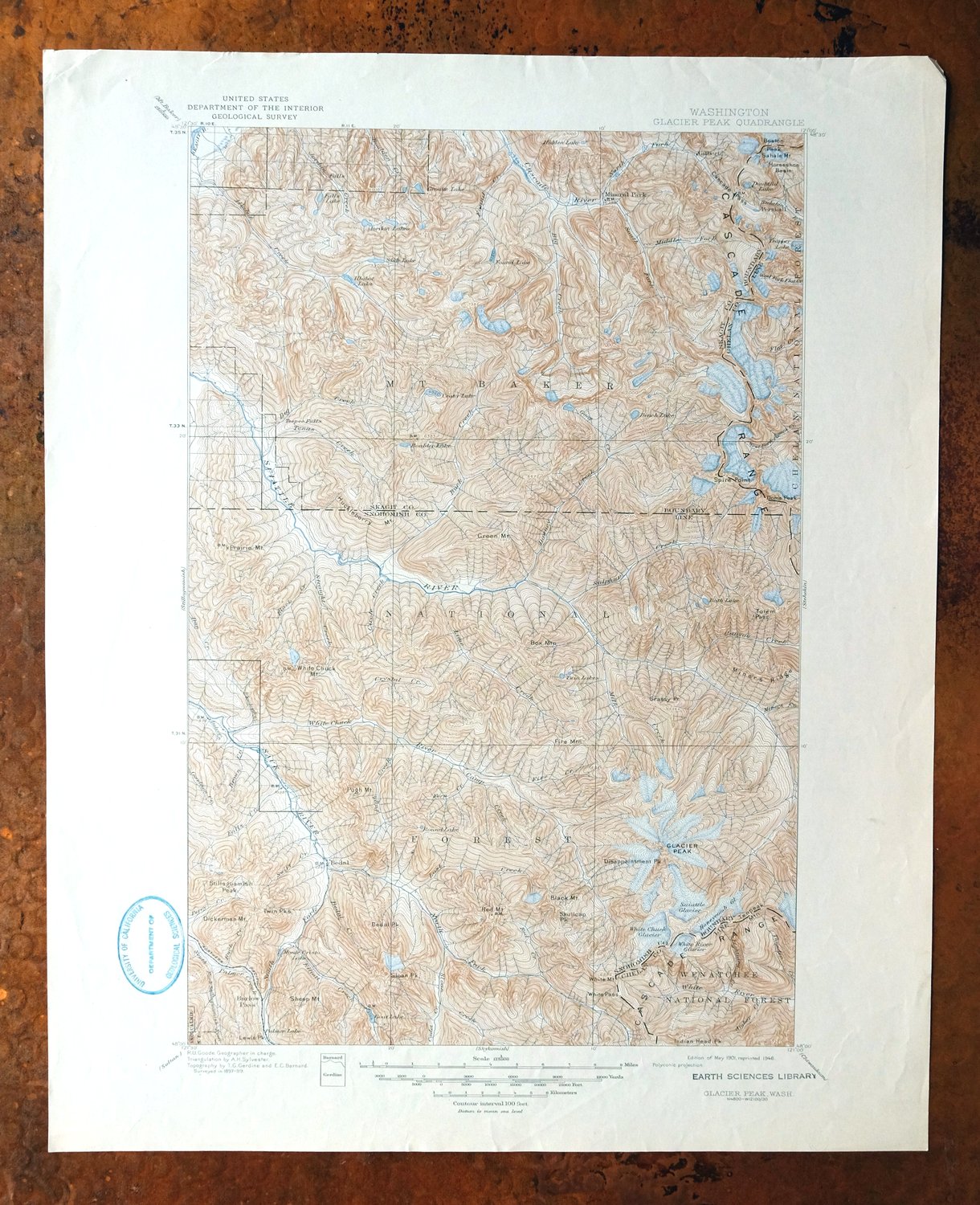
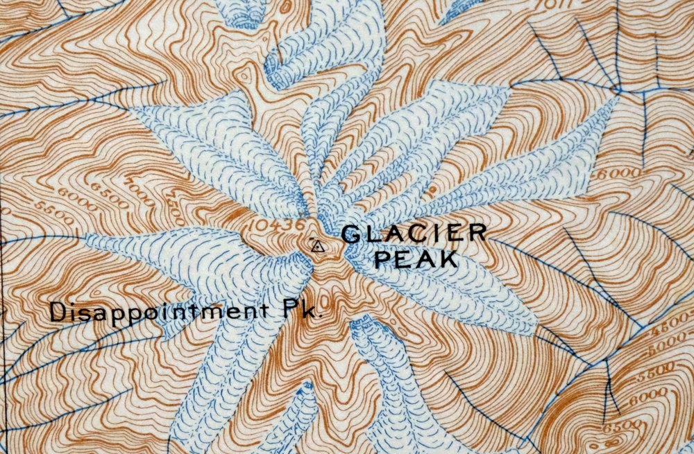
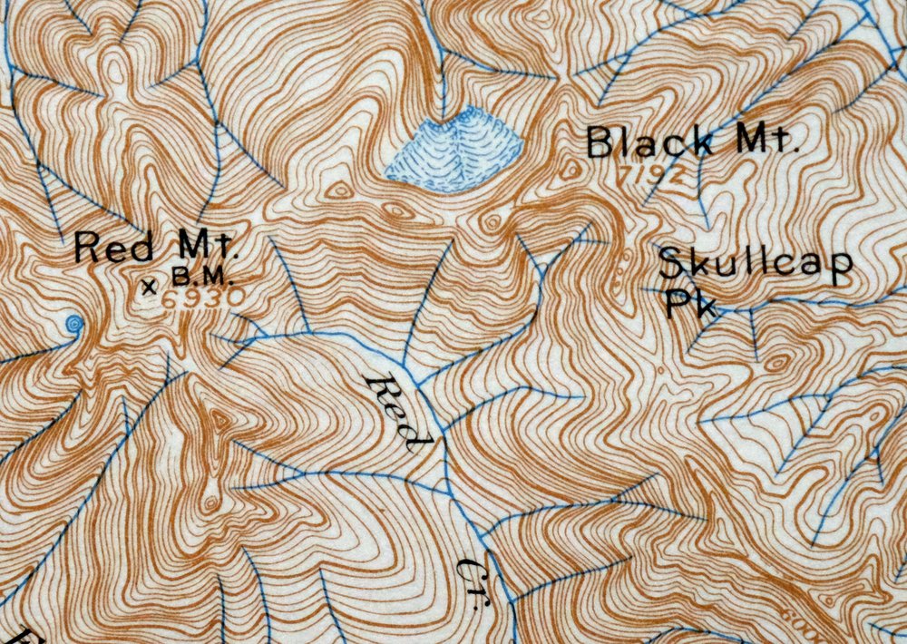
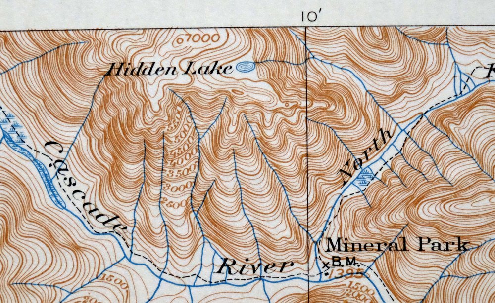
First published in 1901, this Glacier Peak sheet was printed in 1946 and is in good condition, never folded and on thick stock. The 30-minute quad takes in a rugged stretch of Washington’s North Cascades about 65 miles northeast of Seattle, with the Suiattle River winding through terrain that today falls within North Cascades National Park, the Stephen Mather and Henry M. Jackson Wilderness areas, and parts of the Mount Baker and Wenatchee National Forests. The 1901 base rests on an 1897 through 1899 field survey with R.U. Goode as geographer, a record of this high, glaciated country as it was mapped at the turn of the century. The collar carries a library stamp and light handling along the bottom, while the map area itself is clean, free of markings or blemishes.
In stock
This vintage sheet is a 1901 edition of the Glacier Peak Washington USGS topographic map. It is an original 80-year-old 1946 United States Geological Survey print in good condition.
HOW THIS MAP CAN BE USED
In addition to making a fascinating conversation piece, this sheet would look great in a frame or on display, make a unique and prized gift for anyone interested in this area, be perfect as a reference for genealogy studies or general historical research, or fill that missing piece in your collection.
FEATURES SHOWN ON THE MAP
The Glacier Peak 30-minute map shows cities and towns, roads, railroads, rivers, creeks, elevation contour lines, public land survey lines, county, state, and other administrative boundaries as they existed at the time of the survey in 1897 through 1899.
A VALUABLE HISTORICAL RECORD
Maps from the USGS 30-minute series have been out of print for many years. They have never been common and original prints are increasingly difficult to find. For areas where the 30-minute map was produced, it is usually the first large-scale survey done by the USGS for that area. These are a valuable historical record, as they contain many placenames and features that have been dropped from more recent series’ and editions.
Nearby maps
-
Chopaka Washington Okanogan NF USGS Topographic Map 1917
$42 Add to cart -
Colockum Pass Washington Wenatchee USGS 30-Min Topo Map 1922
$36 Add to cart -
Osoyoos Washington Okanogan NF Oroville USGS Topo Map 1937
$36 Add to cart -
Republic Washington Malo Danville USGS Topo Map 1944 Vintage
$38 Add to cart -
Chehalis Washington Lacey Tumwater USGS Topographic Map 1916
$75 Add to cart -
Silverton Washington Darrington Verlot USGS Topo Map 1975
$36 Add to cart -
Blanca Lake Washington USGS 7.5-Min Topo Map 1982 Vintage
$40 Add to cart -
Oso Washington Lake Cavanaugh USGS Topo Map 1977 Vintage
$40 Add to cart -

Lucerne Washington USGS 15-Min Topographic Map 1949 Vintage
$42 Add to cart -

Monroe Washington Duvall High Rock USGS Topographic Map 1976
$46 Add to cart -
Mount Shuksan Washington USGS 15-Min Topo Map 1957 Vintage
$37 Add to cart -
Wickersham Washington Lyman Acme USGS Topographic Map 1974
$43 Add to cart -
Edmonds East Washington Shoreline Brier USGS Topo Map 1976
$38 Add to cart -
Snoqualmie Pass Washington Hyak USGS Topographic Map 1965
$21 Add to cart -

Edmonds West Washington Shoreline Woodway USGS Topo Map 1976
$47 Add to cart -
Oak Harbor Washington Ault Field USGS Topo Map 1977 Vintage
$46 Add to cart -
Sumas Washington Bellingham Lynden USGS 15-Min Topo Map 1931
$59 Add to cart -

Maple Valley Washington Covington USGS Topographic Map 1976
$43 Add to cart -

Renton Washington Seattle Kent USGS Topo Map 1976 Vintage
$38 Add to cart -

Lopez Pass Washington USGS 7.5-Min Topo Map 1977 Vintage
$45 Add to cart -
Rock Island Washington South Wenatchee USGS Topo Map 1967
$41 Add to cart -

Lummi Bay Washington Ferndale Birch Bay USGS Topo Map 1974
$47 Add to cart -
Enumclaw Washington Buckley Upper Mill USGS Topo Map 1976
$45 Add to cart -
Olalla Washington Vashon USGS 7.5-Min Topo Map 1975 Vintage
$30 Add to cart