MAP DETAILS | |
|---|---|
| TITLE | Douglas |
| STATE | Arizona |
| LOCATION | 40 miles east of Sierra Vista |
| SERIES | 15-minute |
| SURVEYED | 1956 through 1958 Aerial and Field Survey |
| EDITION | 1958 |
| PRINTED | 1964 |
| PRINT NOTES | Thick paper stock, includes woodland tint (green to indicate vegetated areas). A reddish tint is used to indicate urban areas where only landmark buildings are shown. |
| SCALE | 1:62500 |
| CONTOUR INTERVAL | 40 feet |
| SHEET DIMENSIONS | 18 x 22 inches |
| MAP DIMENSIONS | 15 x 17 1/2 inches |
| COVERAGE AREA | 15 x 17 miles |
| MAP NOTES | Mexico is not surveyed on this sheet. |
| SHEET CONDITION For maps of this vintage, effort is made to note all visible flaws, no matter how minor. | |
| OVERALL CONDITION | Very Good |
| SHEET NOTES | lightly handled, never folded, small title notation on backside of sheet |
| MAP AREA | no wear, no markings, no blemishes |
| COLLARS | no markings, no blemishes, no edge tears, minor creases along collar edge |
| MAP COVERAGE Quadrangle extent overlaid on current basemap. | |
| PLACENAMES Depending on map series and survey date, all of the features listed below may not be shown on this map. This list contains features that currently exist or historically existed within the area covered by the map. The list can be used as a reference to determine if this map covers your area of interest. Placenames are listed alphabetically next to each feature type. | |
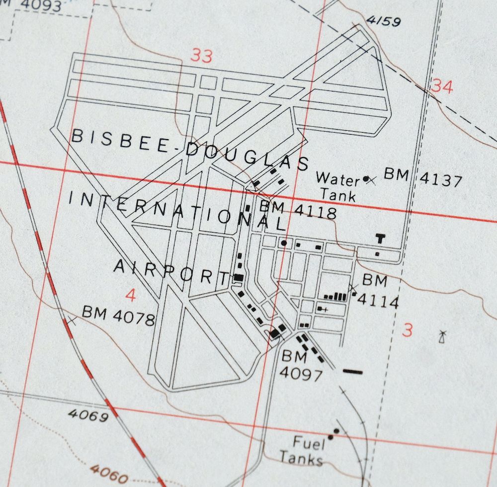
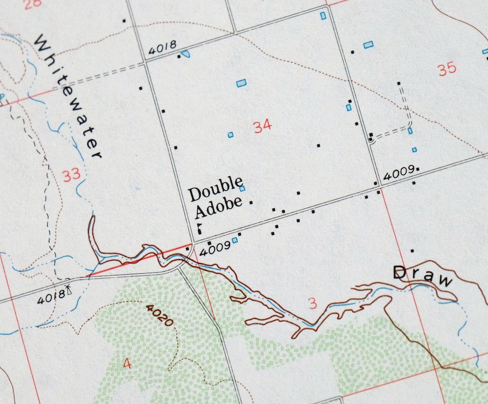
| NOTABLE PLACES | Double Adobe, Bisbee-Douglas Airport, and Sulphur Springs Valley |
| CITIES AND TOWNS (CURRENT) | Douglas, Paul Spur, and Pirtleville |
| COUNTIES COVERED | Cochise |
| Locations: Agua Prieta Substation, Cochise County Fairgrounds, Copper Queen Smelter, Douglas Golf Course, Douglas Substation, El Paso Natural Gas Company Compressor Station, Fairview Substation, Harris Ranch, Lazy KJ Ranch, Rancho San Jose, Stewart Ranch, Watson Ranch, and Wells Ranch. Valleys and Canyons: Mud Springs Draw. Parks: Fifteenth Street Park, Fifth Street Park, and Tenth Street Park. Trails: Geronimo Trail. Hospitals: Cochise County Hospital. Buildings: Douglas Municipal Pumping Plant and Mexican Consulate. Airports: Bisbee-Douglas International Airport, Cochise College Airport, Douglas Municipal Airport, Forrest Airport, Puerto Cielo, and Rancho San Jose Airstrip. Schools: A Avenue School, Apache Junior High School, Clawson School, Cochise County Junior College, Douglas High School, Fifteenth Street School, Joe Carlson School, Pirtleville School, Sarah Marley School, Stevenson School, and Twelfth Street Junior High School. Towers: KAPR-AM (Douglas), KDAP-AM (Douglas), KDAP-FM (Douglas), and KKRK-FM (Douglas). | |
| SHIPPING AND RETURNS | |
 This map sheet will be carefully rolled in a sturdy tube and shipped via the US Postal Service. If you find that the sheet you receive is not as described in the listing, you may ship it back to us for a refund of the purchase price. | |
1964 USGS Topo Map: Douglas, Double Adobe, Arizona
$47
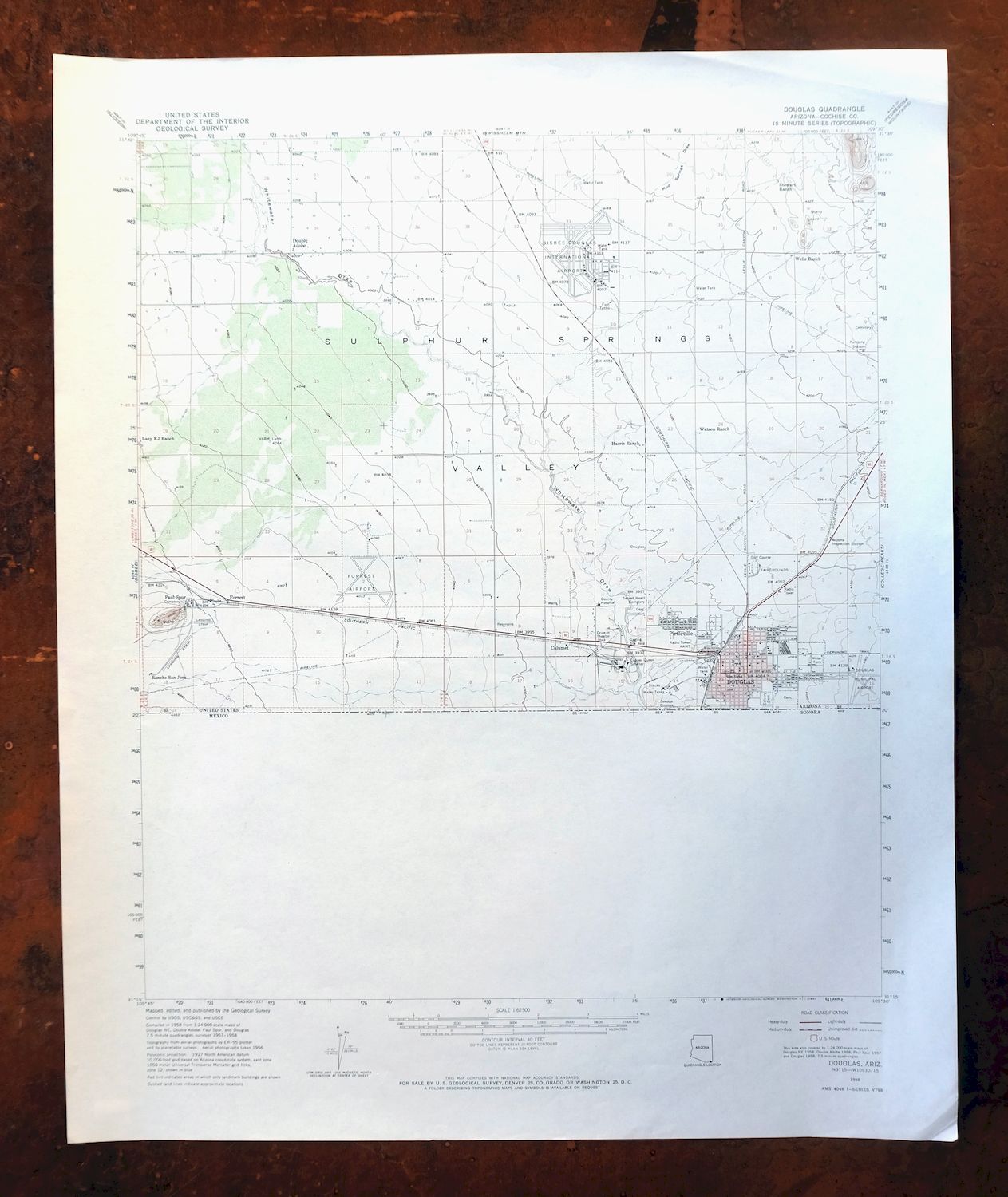
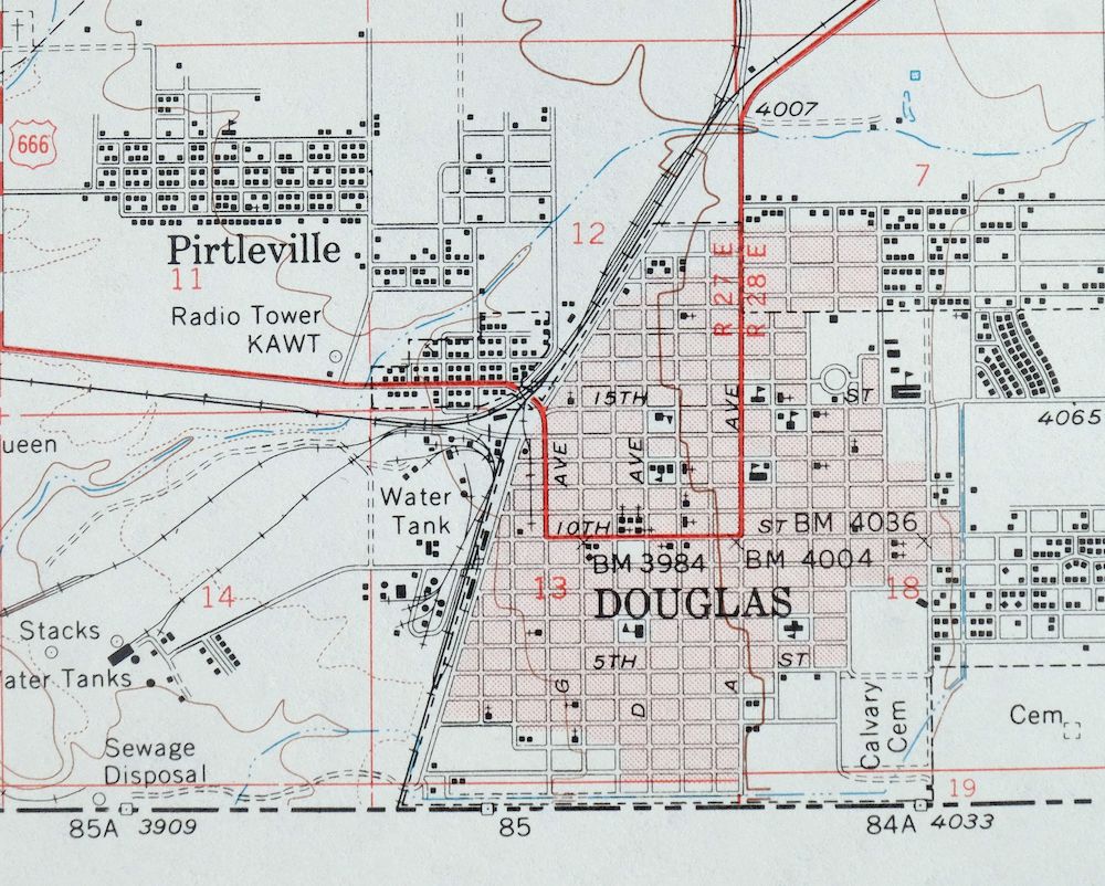
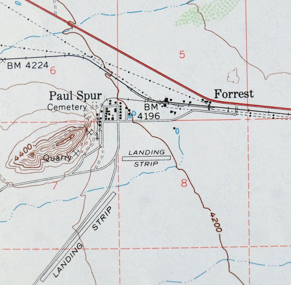
Mexico is not surveyed on this sheet. This 15-minute topographic sheet covers the Douglas quadrangle in southeastern Arizona’s Cochise County, drawn from a 1958 edition and printed in 1964 at a scale of 1:62,500 with 40-foot contours. The quad area takes in the city of Douglas along the international border, nearby Pirtleville and Paul Spur, the Bisbee-Douglas Airport, and the open floor of the Sulphur Springs Valley.
In stock
This vintage sheet is a 1958 edition of the Douglas Arizona USGS topographic map. It is an original 62-year-old 1964 United States Geological Survey print in very good condition.
HOW THIS MAP CAN BE USED
In addition to making a fascinating conversation piece, this sheet would look great in a frame or on display, make a unique and prized gift for anyone interested in this area, be perfect as a reference for genealogy studies or general historical research, or fill that missing piece in your collection. Maps of this vintage are printed on durable stock and are well-suited for outdoor activities and recreation of all kinds, including hiking, backpacking, hunting, rafting and kayaking, backcountry skiing, geocaching, general exploration, treasure hunting, etc.
FEATURES SHOWN ON THE MAP
The Douglas 15-minute map shows cities and towns, roads, railroads, utilities and energy infrastructure, rivers, creeks, elevation contour lines, public land survey lines, county, state, and other administrative boundaries as they existed at the time of the survey in 1956 through 1958. A reddish tint is used on this sheet to indicate urban areas where only landmark buildings are depicted. Outside of those areas, all known structures (houses, businesses, churches, schools, barns, cabins, etc) are shown.
A VALUABLE HISTORICAL RECORD
Maps from the 15-minute series for the continental United States are no longer produced or printed by the USGS and original prints are becoming increasingly difficult to find. They are a valuable historical record for an area, as they contain many placenames and features that have been dropped from more recent maps.
Nearby maps
-

Bisbee Arizona Naco Mule Mountains USGS 15-Min Topo Map 1959
$48 Add to cart -
College Peaks Arizona Douglas USGS Topo Map 1959 Vintage
$31 Add to cart -
Bisbee Arizona Naco Mule Mountains USGS Topographic Map 1910
$75 Add to cart -
1967 USGS Army COE Topo Map: Hereford, Arizona
$50 Add to cart -
Tombstone Arizona Sierra Vista USGS Topo Map 1959 Vintage
$65 Add to cart -
1963 USGS Topo Map: Squaretop Hills, Arizona (Vintage Print)
$48 Add to cart -
Chiricahua Peak Arizona Coronado NF USGS Topo Map 1962
$38 Add to cart -

Sunnyside Arizona Sierra Vista USGS Topo Map 1965 Vintage
$46 Add to cart -
Portal Arizona Rodeo USGS 15-Min Topo Map 1963 Vintage
$54 Add to cart -
Animas Peak New Mexico Coronado NF USGS 15-Min Topo Map 1932
$38 Add to cart -
1962 USGS Army COE Topo Map: Dos Cabezas, Arizona
$26 Add to cart -
Cochise Head Arizona USGS 15-Min Topo Map 1957 Vintage
$44 Add to cart -
Cochise Arizona Willcox USGS 15-Min Topo Map 1963 Vintage
$43 Add to cart -
Cochise Arizona Willcox USGS 15 Minute Topo Map 1943 Vintage
$48 Add to cart -
Benson Arizona Coronado NF St. David USGS Topo Map 1962
$38 Add to cart -
Lochiel Arizona USGS 15-Min Topographic Map 1965 Vintage
$47 Add to cart -

Elgin Arizona Patagonia Sonoita USGS Topo Map 1971 Vintage
$52 Add to cart -
Empire Mountains Arizona Vail Pantano USGS Topo Map 1961
$47 Add to cart -
Bisbee Arizona USGS 7.5-Min Topographic Map 1978 Vintage
$40 Add to cart -
Perilla Arizona Douglas USGS 30-Min Topo Map 1919 Antique
$46 Add to cart -
1948 Perilla Arizona/New Mexico USGS Topo Map
$54 Add to cart -
Pearce Arizona McNeal Gleeson USGS Topo Map 1948 Vintage
$55 Add to cart -
1964 USGS Army COE Topo Map: Tombstone, Arizona
$32 Add to cart -
Hereford Arizona Sierra Vista USGS Topo Map 1946 Vintage
$45 Add to cart