MAP DETAILS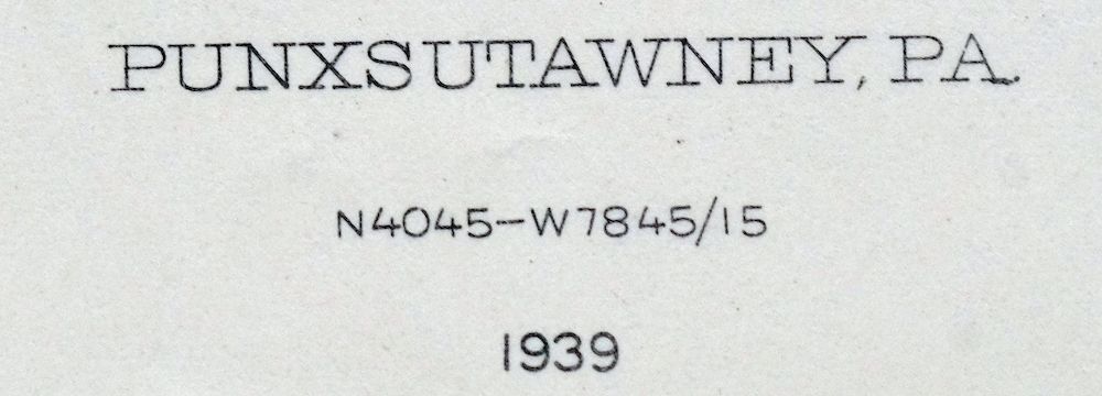 | |
|---|---|
| TITLE | Punxsutawney |
| STATE | Pennsylvania |
| LOCATION | 65 miles northeast of Pittsburgh |
| SERIES | 15-minute |
| SURVEYED | 1902 through 1904 Field Survey |
| GEOGRAPHER | A.C. Roberts |
| EDITION | 1939 |
| PRINTED | 1957 |
| PRINT NOTES | Thick paper stock |
| SCALE | 1:62500 |
| CONTOUR INTERVAL | 20 feet |
| SHEET DIMENSIONS | 16 1/2 x 20 inches (approximate) |
| MAP DIMENSIONS | 13 1/4 x 17 1/2 inches |
| COVERAGE AREA | 13 x 17 miles |
| SHEET CONDITION For maps of this vintage, effort is made to note all visible flaws, no matter how minor. | |
| OVERALL CONDITION | Excellent |
| SHEET NOTES | very lightly handled, never folded, smooth and flat |
| MAP AREA | flawless map area |
| COLLARS | no wear or tears, no blemishes |
| MAP COVERAGE Quadrangle extent overlaid on current basemap. | |
| PLACENAMES Depending on map series and survey date, all of the features listed below may not be shown on this map. This list contains features that currently exist or historically existed within the area covered by the map. The list can be used as a reference to determine if this map covers your area of interest. Placenames are listed alphabetically next to each feature type. | |
| CITIES AND TOWNS (CURRENT) | Arcadia, Big Run, Burnside, Glen Campbell, Punxsutawney, and Rossiter |
| COUNTIES COVERED | Clearfield, Indiana, and Jefferson |
| RIVERS AND STREAMS | Barrett Run, Bear Run, Beaver Run, Beech Run, Big Run, Boiling Spring Run, Brady Run, Brewer Run, Broadhead Run, Buck Run, Clover Run, Couch Run, Curry Run, Deer Run, Dixon Run, East Branch Mahoning Creek, East Run, Elk Run, Graffius Run, Horton Run, Jackson Run, Laurel Run, Little Mahoning Creek, Lost Run, Mahoning Creek, Martin Run, North Branch Straight Run, North Run, Painter Run, Patchin Run, Powell Run, Rairigh Run, Rock Run, Salsgiver Run, Sawmill Run, Shryock Run, South Branch Bear Run, Stony Run, Straight Run, Trout Run, Ugly Run, West Branch Susquehanna River, Whisky Run, and Windfall Run |
| WATER BODIES | Cloe Lake and Punxsutawney Reservoir |
| Locations: B and O Terminal, Chetremon Golf Course, Cush, Cush Creek Junction, Elk Run Junction, Junction Bear Run Branch Station, McGees Station, Mount Airie, Raytown, Ridge, Robertsville, Rossiter Station, Smithville, and Winslow. Administrative Boundaries: Township of Brady, Township of Canoe, Township of Bell, Township of Bell, Township of Banks, Borough of Big Run, Borough of Burnside, Township of East Mahoning, Township of Gaskill, Borough of Glen Campbell, Township of Grant, Township of Henderson, Township of McCalmont, Township of Montgomery, Township of North Mahoning, Borough of Punxsutawney, and Township of Young. Mountains, Peaks, and Summits: Doty Roundtop, Gobblers Knob, Gorman Summit, and Kinter Hill. Parks: Hemlock Lake County Park, State Game Lands Number 174, State Game Lands Number 195, and State Game Lands Number 262. Drainages: Boiling Spring Run, Brady Run, Canoe Creek, Beaver Run, Beech Run, Barrett Run, Bear Run, Big Run, Brewer Run, Broadhead Run, Clover Run, Cold Spring Run, Couch Run, Crooked Run, Cush Creek, Deer Run, East Branch Mahoning Creek, East Run, Elk Lick Run, Elk Run, Graffius Run, Hess Run, Horton Run, Jackson Run, Laurel Run, Leasure Run, Little Elk Run, Lost Run, Martin Run, North Branch Straight Run, North Run, Painter Run, Patchin Run, Pine Run, Powell Run, Rairigh Run, Rishell Run, Rock Run, Salsgiver Run, Sawmill Run, Shryock Run, Smith Run, South Branch Bear Run, Stony Run, Straight Run, Stump Creek, Trout Run, Ugly Run, West Branch Cush Creek, Whisky Run, and Windfall Run. Churches: Antioch Church, Calvary Church, Fairview Church, Hillsdale Church, Montgomery Church, Mount Pleasant Church, Otterbein Church, Pine Church, Pine Grove Church, Pinevale Church, Pleasant Grove Church, Saint Marks Church, Saint Michaels Church, Saints Peter And Paul Church, Steffy Chapel, Susquehanna Church, and Union Church. Buildings: Crawfordtown Delancey PO. Dams: Cloe Dam, Clover Dam, Rossiter Dam, and Straight Run Dam. Airports: Punxsutawney Municipal Airport. Schools: Canoe Grant School, Bell Township Elementary School, Big Run Elementary School, Couch School, Crawford School, Cush Creek School, Davis School, Fairview School, Gaston School, Henderson School, Henry School, Hoeh School, Lower Bucheit School, Pine Grove School, Pleasantville School, Punxsutawney Area Senior High School, Ruffener School, Schlimmer School, Snyder School, Thomas School, Wainwright School, and West End Elementary School. Reservoirs and Tanks: Cloe Lake, Punxsutawney Reservoir, and Straight Run Lake. Towers: Glen Campbell Fire Tower. | |
| SHIPPING AND RETURNS | |
 This map sheet will be carefully rolled in a sturdy tube and shipped via the US Postal Service. If you find that the sheet you receive is not as described in the listing, you may ship it back to us for a refund of the purchase price. | |
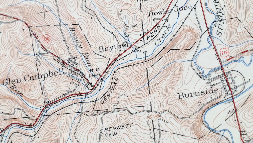
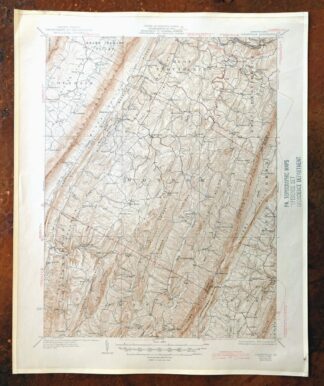
1957 USGS Topo Map: Punxsutawney, Rossiter, Pennsylvania
$32
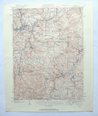
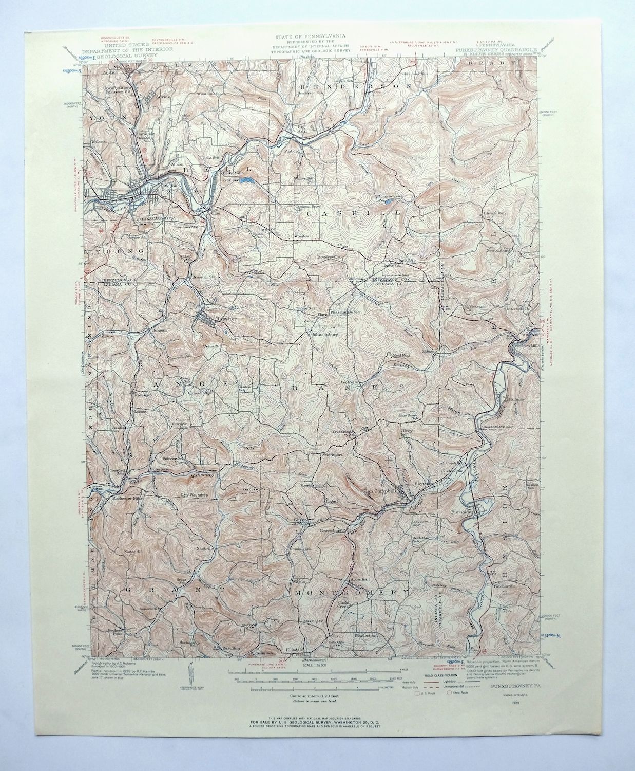
This 15-minute USGS topographic sheet covers the Punxsutawney area of west-central Pennsylvania, printed in 1957 from a 1939 edition at a scale of 1:62,500. The quad spans parts of Jefferson, Indiana, and Clearfield counties, taking in Punxsutawney itself along with Big Run, Rossiter, and smaller communities like Glen Campbell and Arcadia. The landscape here was shaped by bituminous coal mining, with towns like Rossiter built around the mines. The sheet is in excellent condition, never folded, smooth and flat on thick stock – ready for framing.
In stock
This vintage sheet is a 1939 edition of the Punxsutawney Pennsylvania USGS topographic map. It is an original 69-year-old 1957 United States Geological Survey print in excellent condition.
HOW THIS MAP CAN BE USED
In addition to making a fascinating conversation piece, this sheet would look great in a frame or on display, make a unique and prized gift for anyone interested in this area, be perfect as a reference for genealogy studies or general historical research, or fill that missing piece in your collection. Maps of this vintage are printed on durable stock and are well-suited for outdoor activities and recreation of all kinds, including hiking, backpacking, hunting, rafting and kayaking, backcountry skiing, geocaching, general exploration, treasure hunting, etc.
FEATURES SHOWN ON THE MAP
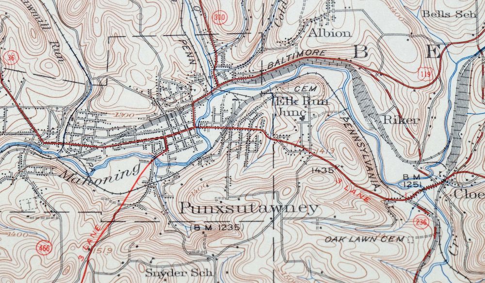
The Punxsutawney 15-minute map shows cities and towns, roads, railroads, utilities and energy infrastructure, rivers, creeks, elevation contour lines, public land survey lines, county, state, and other administrative boundaries as they existed at the time of the survey in 1902 through 1904. All known structures (houses, businesses, churches, schools, barns, cabins, etc) are also shown, with exceptions in some urban areas, where only landmark buildings may be shown.
A VALUABLE HISTORICAL RECORD
Maps from the 15-minute series for the continental United States are no longer produced or printed by the USGS and original prints are becoming increasingly difficult to find. They are a valuable historical record for an area, as they contain many placenames and features that have been dropped from more recent maps.
Nearby maps
-

Philipsburg Pennsylvania Stormstown USGS Topo Map 1964
$34 Add to cart -

Freeport Pennsylvania Plum New Kensington USGS Topo Map 1956
$36 Add to cart -

Driftwood Pennsylvania Sterling Run USGS Topo Map 1956
$39 Add to cart -
Bellefonte Pennsylvania Boalsburg USGS Topographic Map 1961
$44 Add to cart -
Mount Jewett Pennsylvania Wilcox USGS Topographic Map 1965
$40 Add to cart -
Bedford Pennsylvania Schellsburg USGS Topo Map 1958 Vintage
$42 Add to cart -
New Kensington Pennsylvania Plum USGS Topographic Map 1956
$44 Add to cart -

Crosby Pennsylvania Norwich Rich Valley USGS Topo Map 1957
$35 Add to cart -
Renovo West Pennsylvania Westport USGS Topographic Map 1965
$38 Add to cart -
Franklin Pennsylvania Sugarcreek Polk USGS Topo Map 1962
$36 Add to cart -

Centre Hall Pennsylvania Bellefonte Zion USGS Topo Map 1958
$28 Add to cart -
1970 USGS Topo Map: Curtisville, Saxonburg, Pennsylvania
$23 Add to cart -
Snow Shoe Pennsylvania Clarence USGS Topo Map 1963 Vintage
$30 Add to cart -
Snow Shoe NW Pennsylvania Sproul SF USGS Topo Map 1962
$32 Add to cart -
Snow Shoe SE Pennsylvania Orviston USGS Topographic Map 1962
$34 Add to cart -
Slippery Rock Pennsylvania West Liberty USGS Topo Map 1964
$42 Add to cart -
Kinzua Pennsylvania Westline USGS Topo Map 1967 Vintage
$42 Add to cart -
Hyndman Pennsylvania Buffalo Mills USGS 15-Min Topo Map 1967
$40 Add to cart -
Townville Pennsylvania Cooperstown USGS 15-Min Topo Map 1964
$40 Add to cart -

Conrad Pennsylvania Hammersley Wild Area USGS Topo Map 1958
$34 Add to cart -

Brownsville Pennsylvania Monessen Donora USGS Topo Map 1954
$38 Add to cart -
Smethport Pennsylvania Eldred USGS Topographic Map 1960
$43 Add to cart -
Clearville Pennsylvania USGS 15-Min Topo Map 1945 Vintage
$42 Add to cart -

Carnegie Pennsylvania Pittsburgh Dormont USGS Topo Map 1954
$48 Add to cart