MAP DETAILS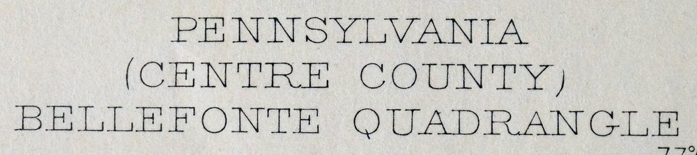 | |
|---|---|
| TITLE | Bellefonte |
| STATE | Pennsylvania |
| LOCATION | Vicinity of State College |
| SERIES | 15-minute |
| SURVEYED | 1908 Field Survey |
| GEOGRAPHER | R.B. Marshall |
| EDITION | 1908 |
| PRINTED | 1961 |
| PRINT NOTES | Thick paper stock |
| SCALE | 1:62500 |
| CONTOUR INTERVAL | 20 feet |
| SHEET DIMENSIONS | 17 x 21 inches |
| MAP DIMENSIONS | 13 1/4 x 17 1/2 inches |
| COVERAGE AREA | 13 x 17 miles |
| MAP NOTES | A fascinating historical snapshot of the Nittany Valley region, surveyed before the modern highway system, showing historic overland travel routes, rail lines, and structures. |
| SHEET CONDITION For maps of this vintage, effort is made to note all visible flaws, no matter how minor. | |
| OVERALL CONDITION | Very Good |
| SHEET NOTES | lightly handled, never folded |
| MAP AREA | no wear, no markings, no blemishes |
| COLLARS | no markings, no blemishes, no edge tears, edge protectors applied, library stamp in center right collar |
| MAP COVERAGE Quadrangle extent overlaid on current basemap. | |
| PLACENAMES Depending on map series and survey date, all of the features listed below may not be shown on this map. This list contains features that currently exist or historically existed within the area covered by the map. The list can be used as a reference to determine if this map covers your area of interest. Placenames are listed alphabetically next to each feature type. | |
| CITIES AND TOWNS (CURRENT) | Bellefonte, Boalsburg, Houserville, Julian, Lemont, Milesburg, Park Forest Village, Pine Grove Mills, Pleasant Gap, Ramblewood, State College, Stormstown, and Unionville |
| COUNTIES COVERED | Centre |
| RIVERS AND STREAMS | Antis Run, Bald Eagle Creek, Beaver Branch, Benner Run, Buffalo Run, Bush Hollow Run, Cedar Run, Dewitt Run, Dicks Run, Galbraith Gap Run, Halfmoon Creek, Holt Run, Laurel Run, Little Marsh Creek, Logan Branch, Moose Run, Mudlick Run, North Branch Wallace Run, Pine Run, Roaring Run, Slab Cabin Run, South Fork Beech Creek, Spring Creek, Stinktown Run, Wallace Run, and Whetstone Run |
| WATER BODIES | Rockview Reservoir |
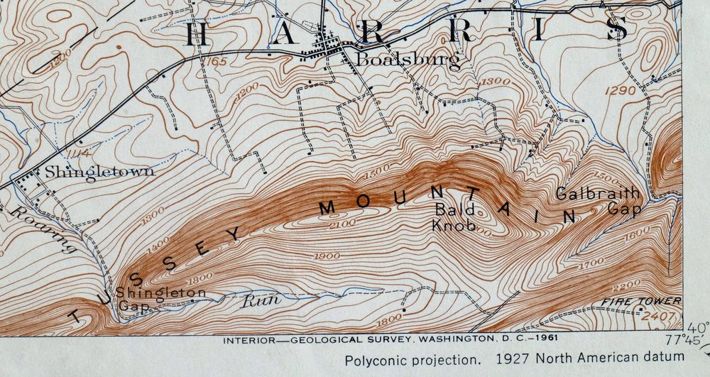
| Locations: Bald Eagle Lookout, Bald Eagle Mine Station, Bellefonte Station, Beaver Stadium, Centre Hills Country Club, Chemical Station, Fish Research Station, Ionosphere Research Station, Millbrook, Nittany Mall, Pennsylvania State University Golf Course, Pleasant Gap State Fish Hatchery, Rockview State Correctional Institution, Toftrees Golf Course, Tussey Mountain Ski Resort, University Park Plaza, and Westerly Parkway Plaza. Administrative Boundaries: Borough of Bellefonte, Township of Benner, Township of College, Township of Harris, Borough of Milesburg, Township of Patton, Commonwealth of Pennsylvania, Township of Spring, Borough of State College, Township of Union, and Borough of Unionville. Mountains, Peaks, and Summits: Bear Knob, Bald Knob, The Barrens, Bear Rocks, Ganderstep Knob, and Trcziyulny Mountain. Valleys and Canyons: Big Hollow, Brower Hollow, Brushy Hollow, Bush Hollow, Dry Hollow, Foxy Hollow, Holt Hollow, Nittany Valley, Penns Valley, and Steel Hollow. Parks: Holmes-Foster Park, State Game Lands Number 103, State Game Lands Number 176, State Game Lands Number 92, Sunset View Park, and Twenty-Eighth Division Memorial Shrine. Drainages: Birch Lick Run, Brower Hollow Run, Buffalo Run, Bush Hollow Run, Cedar Run, Dewitt Run, Dicks Run, Galbraith Gap Run, Holt Run, Laurel Run, Logan Branch, Moose Run, Mudlick Run, North Branch Wallace Run, Roaring Run, Rock Cabin Run, Slab Cabin Run, Spring Creek, Thompson Run, Wallace Run, and Whetstone Run. Churches: Advent Church, Buffalo Run Church, Bush Hollow Church, Dicks Run Church, Fairview Church, Forge Union Church, Grays Church, New Bush Hollow Church, and Shiloh Church. Dams: Rockview Reservoir Dam. Bluffs: Buck Point. Gaps: Galbraith Gap, Grindstone Gap, McBride Gap, and Shingletown Gap. Airports: Bellefonte Skypark, Dillen Airport, Eagle Field, Eagle Ridge Gliderport, Nittany Valley Aerodrome, Ridge Soaring Airport, State College Air Depot, and University Park Airport. Swamps: Thompsons Meadow. Schools: Bald Eagle High School, Belleview School, Bishop Street School, Boalsburg Elementary School, College Heights School, Corl Street School, Easterly Parkway School, Fairmount Avenue Elementary School, Houserville Elementary School, Intermediate High School, Knox School, Lemont Elementary School, Matternville School, Old Main, Panorama Village Elementary School, Park Forest Elementary School, Pennsylvania State University, Radio Park Elementary School, Saint Johns School, State College Area Junior High School, and Woodlawn Middle School. Ridges: Gatesburg Ridge. Reservoirs and Tanks: Rockview Reservoir. Towers: Little Flat Fire Tower, WBLF-AM (Bellefonte), WDFM-FM (State College), WGMR-FM (Tyrone), WMAJ-AM (State College), WQWK-FM (State College), WQWK-FM (University Park), WRSC-AM (State College), and WXLR-FM (State College). Springs: Axemann Spring, Benner Spring, Blue Spring, Forked Spring, Kelley Spring, Shutgart Spring, and Thompson Spring. | |
| SHIPPING AND RETURNS | |
 This map sheet will be carefully rolled in a sturdy tube and shipped via the US Postal Service. If you find that the sheet you receive is not as described in the listing, you may ship it back to us for a refund of the purchase price. | |
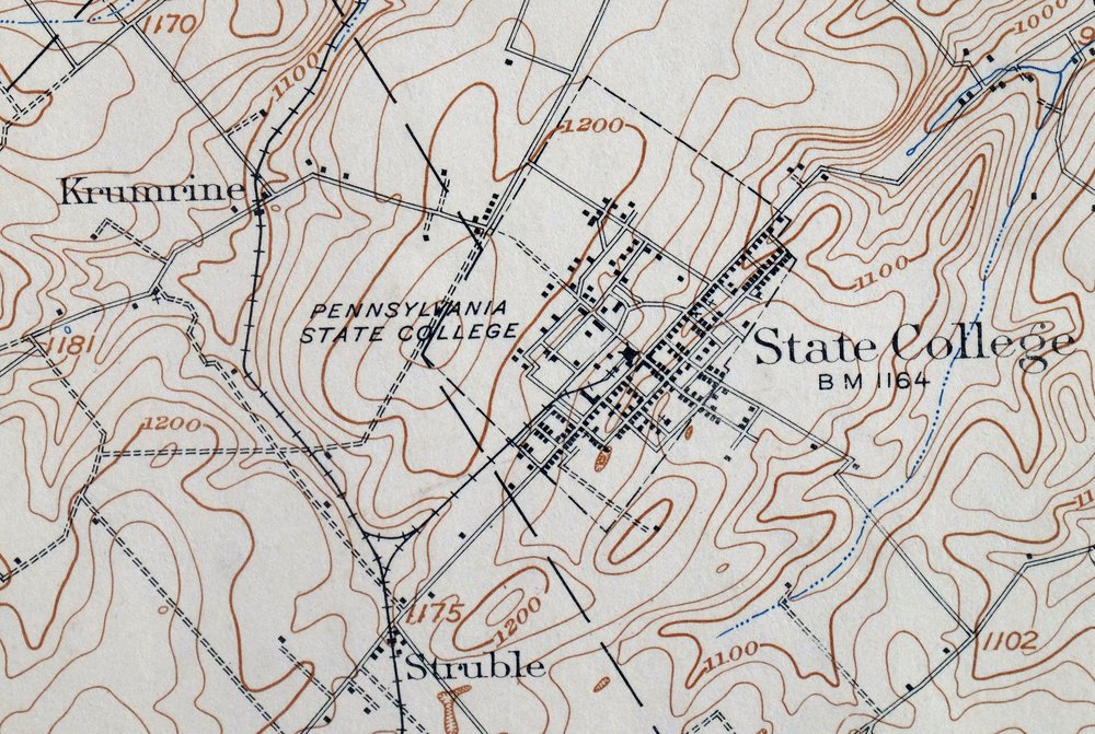
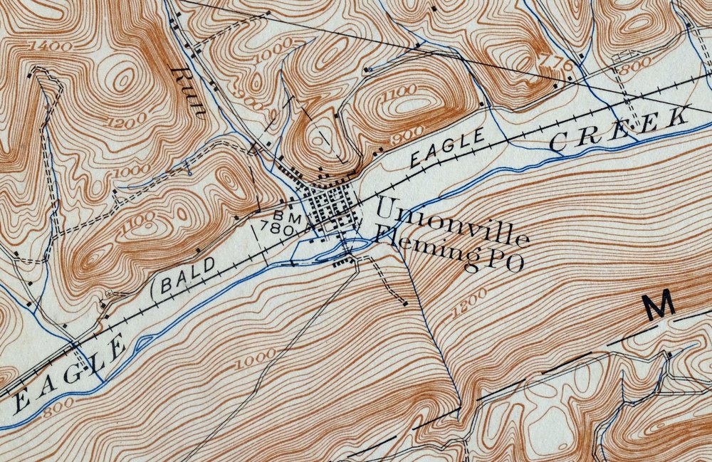
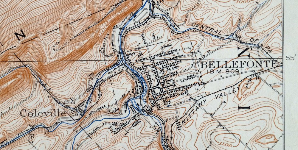
Bellefonte Pennsylvania Boalsburg USGS Topographic Map 1961
$44
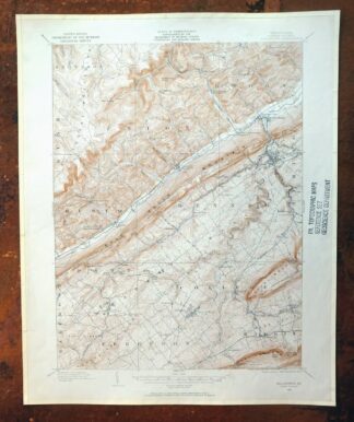
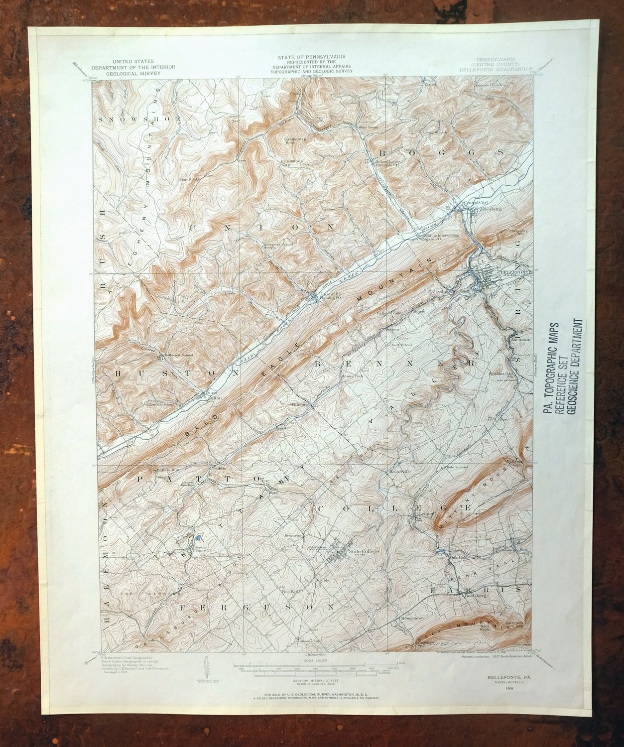
This USGS 15-minute topographic map is a 1908 edition, printed in 1961, and the sheet is in very good condition—lightly handled, never folded, on thick stock with edge protectors applied and a library stamp in the center right collar. Its coverage in Centre County, Pennsylvania takes in State College along with Bellefonte, Boalsburg, Lemont, Houserville, and Park Forest Village, with Unionville and Julian also within the quad boundaries. Based on a 1908 field survey under geographer R.B. Marshall, it shows the Nittany Valley region before the modern highway system, with the overland travel routes, rail lines, and structures of that era. Because it was never folded and sits on heavy stock, the sheet lies flat for framing.
In stock
This vintage sheet is a 1908 edition of the Bellefonte Pennsylvania USGS topographic map. It is an original 65-year-old 1961 United States Geological Survey print in very good condition.
HOW THIS MAP CAN BE USED
In addition to making a fascinating conversation piece, this sheet would look great in a frame or on display, make a unique and prized gift for anyone interested in this area, be perfect as a reference for genealogy studies or general historical research, or fill that missing piece in your collection. Maps of this vintage are printed on durable stock and are well-suited for outdoor activities and recreation of all kinds, including hiking, backpacking, hunting, rafting and kayaking, backcountry skiing, geocaching, general exploration, treasure hunting, etc.
FEATURES SHOWN ON THE MAP
The Bellefonte 15-minute map shows cities and towns, roads, railroads, utilities and energy infrastructure, rivers, creeks, elevation contour lines, public land survey lines, county, state, and other administrative boundaries as they existed at the time of the survey in 1908. All known structures (houses, businesses, churches, schools, barns, cabins, etc) are also shown, with exceptions in some urban areas, where only landmark buildings may be shown.
A VALUABLE HISTORICAL RECORD
Maps from the 15-minute series for the continental United States are no longer produced or printed by the USGS and original prints are becoming increasingly difficult to find. They are a valuable historical record for an area, as they contain many placenames and features that have been dropped from more recent maps.
Nearby maps
-

Philipsburg Pennsylvania Stormstown USGS Topo Map 1964
$34 Add to cart -

Centre Hall Pennsylvania Bellefonte Zion USGS Topo Map 1958
$28 Add to cart -
Renovo West Pennsylvania Westport USGS Topographic Map 1965
$38 Add to cart -

Driftwood Pennsylvania Sterling Run USGS Topo Map 1956
$39 Add to cart -

Loysville Pennsylvania Landisburg USGS Topo Map 1966 Vintage
$42 Add to cart -

Conrad Pennsylvania Hammersley Wild Area USGS Topo Map 1958
$34 Add to cart -

Crosby Pennsylvania Norwich Rich Valley USGS Topo Map 1957
$35 Add to cart -

Newville Pennsylvania Shippensburg USGS 15-Min Topo Map 1959
$40 Add to cart -
Warrensville Pennsylvania Barbours USGS Topographic Map 1962
$42 Add to cart -
Mount Jewett Pennsylvania Wilcox USGS Topographic Map 1965
$40 Add to cart -

Carlisle Pennsylvania Schlusser USGS Topographic Map 1964
$45 Add to cart -

Bedford Pennsylvania Schellsburg USGS Topo Map 1958 Vintage
$42 Add to cart -

Hughesville Pennsylvania Millville Iola USGS Topo Map 1962
$42 Add to cart -

Lykens Pennsylvania Valley View Reinerton USGS Topo Map 1964
$45 Add to cart -
Snow Shoe Pennsylvania Clarence USGS Topo Map 1963 Vintage
$30 Add to cart -
Snow Shoe SE Pennsylvania Orviston USGS Topographic Map 1962
$34 Add to cart -
Snow Shoe NW Pennsylvania Sproul SF USGS Topo Map 1962
$32 Add to cart -

Coudersport Pennsylvania Oswayo USGS Topographic Map 1966
$42 Add to cart -

Chambersburg Pennsylvania Guilford USGS Topographic Map 1964
$40 Add to cart -

Needmore Pennsylvania Crystal Spring USGS Topo Map 1947
$44 Add to cart -

Canton Pennsylvania Alba Ralston USGS Topo Map 1958 Vintage
$20 Add to cart -
Eagles Mere Pennsylvania Laporte USGS Topographic Map 1961
$36 Add to cart -

Elkland Pennsylvania Wellsboro Knoxville USGS Topo Map 1903
$52 Add to cart -
Smethport Pennsylvania Eldred USGS Topographic Map 1960
$43 Add to cart