MAP DETAILS | |
|---|---|
| TITLE | Appomattox |
| STATE | Virginia |
| LOCATION | 20 miles west of Farmville |
| SERIES | 30-minute |
| SURVEYED | 1889 and 1890 Field Survey |
| GEOGRAPHER | Henry Gannett |
| EDITION | 1892 |
| PRINTED | 1912 |
| PRINT NOTES | Thick paper stock |
| SCALE | 1:125000 |
| CONTOUR INTERVAL | 50 feet |
| SHEET DIMENSIONS | 16 3/8 x 20 inches |
| MAP DIMENSIONS | 13 7/8 x 17 1/2 inches |
| COVERAGE AREA | 27 x 35 miles |
| SOURCE | From an uncommonly well-preserved collection |
| MAP NOTES | Surveyed just 25 years after the Battle of Appomattox Court House. |
| SHEET CONDITION For maps of this vintage, effort is made to note all visible flaws, no matter how minor. | |
| OVERALL CONDITION | Excellent |
| SHEET NOTES | very lightly handled, never folded, smooth and flat |
| MAP AREA | flawless map area |
| COLLARS | no wear or tears, no markings, no blemishes, hole punches along left collar |
| MAP COVERAGE Quadrangle extent overlaid on current basemap. | |
| BACKSIDE LEGEND | |
 A map summary is printed on the back side of the Appomattox sheet similar to the one shown in the picture. It outlines the history, purpose, and status of the USGS mapping program at the time of the printing in 1912. It also provides instructions on how to read contour lines and a description of how they are used to depict the terrain. At the bottom of the page is a legend showing all of the symbols used to represent the cultural, relief, and water features found on the map. | |
| PLACENAMES Depending on map series and survey date, all of the features listed below may not be shown on this map. This list contains features that currently exist or historically existed within the area covered by the map. The list can be used as a reference to determine if this map covers your area of interest. Placenames are listed alphabetically next to each feature type. | |
| CITIES AND TOWNS (CURRENT) | Appomattox, Brookneal, Charlotte Court House, Concord, Cullen, Drakes Branch, Madisonville, Pamplin, Pamplin City, Phenix, Prospect, and Toga |
| COUNTIES COVERED | Amherst, Appomattox, Buckingham, Campbell, Charlotte, Halifax, and Prince Edward |
| FEDERAL LAND UNITS | Appomattox Court House National Historical Park |
| RIVERS AND STREAMS | Abbott Branch, Appomattox River, Archer Creek, Ash Camp Creek, Austin Creek, Bargers Branch, Bear Branch, Bear Creek, Beasley Creek, Beaverpond Branch, Bell Creek, Bent Creek, Bentleys Branch, Birds Branch, Bishop Creek, Blackfoot Creek, Bowler Creek, Brickyard Branch, Browns Branch, Buck Branch, Buck Creek, Bush Ford Branch, Butterwood Creek, Cabin Branch, Caldwells Creek, Camp Branch, Carey Creek, Caulk Branch, Cedar Creek, Cemetery Creek, Chandlers Branch, Childrey Creek, Coldwater Creek, Crane Creek, David Creek, Dividing Branch, Dog Creek, Ducker Creek, Dunnavant Creek, East Branch Wallace Branch, East Branch Wards Fork Creek, Entry Creek, Falling Creek, Falling River, Flintoy Creek, Forbes Creek, Grease Creek, Harris Creek, Hat Creek, Hickory Creek, Hills Creek, Hog Branch, Holts Branch, Horsepen Creek, Jacobs Creek, James River, Jamison Creek, Jenkins Creek, Jerrys Branch, Lacy Branch, Lawsons Creek, Left Hand Fork, Little Bear Creek, Little Cub Creek, Little Falling River, Little Louse Creek, Little Wreck Island Creek, Locket Creek, Long Branch, Long Creek, Madison Mill Branch, Maple Spring Branch, Marrowbone Creek, Martin Branch, Martins Creek, Middle Branch Wards Fork Creek, Mill Creek, Mill Run, Mingo Creek, Moores Branch, Morris Branch, Mountain Branch, Mud Creek, Mulberry Creek, Naked Creek, Natts Branch, North Branch Spring Creek, North Creek, North Fork Wolf Creek, North Holiday Creek, Phelps Branch, Pitman Creek, Plain Run Branch, Plum Branch, Plum Creek, Poorhouse Creek, Pulliam Branch, Purdums Branch, Ragby Branch, Rattlesnake Branch, Rattlesnake Creek, Reedy Creek, Right Hand Fork Big Cub Creek, Roanoke Creek, Roanoke River, Rough Creek, Sams Creek, Sanders Creek, Sandy Creek, Slate River, Snake Creek, South Branch Spring Creek, South Fork Appomattox River, South Fork Falling River, Spencer Branch, Spencer Creek, Spring Branch, Spring Creek, Stevens Run, Stillhouse Creek, Stonewall Creek, Suanee Creek, Tanyard Branch, Temple Branch, Terrys Creek, Tongue Quarter Creek, Turkey Branch, Turnip Creek, Twittys Creek, Walkers Ford Creek, Wallace Branch, Wards Fork Creek, Webb Mill Creek, West Branch Wards Fork Creek, White Marsh Branch, Willis River, Wolf Creek, and Wreck Island Creek |
| WATER BODIES | Bell Lake, Brookneal Reservoir, Buffalo Lake, Camp Hat Creek Lake, Concord Lake, Gala Lake, Grand View Lake, Holiday Lake, Industrial Waste Pond, Lake Gayle, Little Creek Lake, Paradise Lake, Phoebe Lake, Roanoke Creek Site 35-A Lake, Roanoke Creek Site 4a Lake, Roanoke Creek Site 5b Lake, Roanoke Creek Site 67 Lake, Roanoke Creek Site 68 Lake, Roanoke Creek Site 6a Lake, Spring Creek Lake, Stockton Lake, and Townwanda Lake |
| Locations: Camp Hat Creek, Camptown, Fairview Youth Camp, Falling River Country Club, Four H Club, Gravel Ridge, Greenfield Plantation, Maloney Siding, Mike, Morris Church, New Store, Old Well, Red Hill, Red House, Rolling Hill, Rose Bower, The Shoppes of Appomattox Shopping Center, Triangle Plaza Shopping Center, Virginia Polytechnic Institute Experimental Farm, Wards Fork Mill, and Wildway. Administrative Boundaries: Clover Hill Magisterial District, Madison Magisterial District, Midway Magisterial District, Roanoke Magisterial District, Southside Magisterial District, Stonewall Magisterial District, and Walton Magisterial District. Mountains, Peaks, and Summits: Baker Mountain, Bald Mountain, Gunner Mountain, Kyles Mountain, Lyle Mountain, Paradise Hill, Pilot Mountain, Piney Mountain, Red Oak Mountain, Turner Mountain, and Woods Mountain. Parks: Appomattox Buckingham State Forest, Appomattox Court House National Historical Park, Holiday Lake State Park, Holiday Lake State Recreation Area, and Patrick Henry National Memorial. Drainages: Abbott Branch, Austin Creek, Ash Camp Creek, Bargers Branch, Bear Branch, Bear Creek, Beasley Creek, Beaverpond Branch, Bell Creek, Bentleys Branch, Big Cub Creek, Birds Branch, Blackfoot Creek, Bowler Creek, Brickyard Branch, Browns Branch, Dunnavant Creek, East Branch Wards Fork Creek, Buck Branch, Buck Creek, Bull Branch, Bush Ford Branch, Butterwood Creek, Cabin Branch, Caldwells Creek, Camp Branch, Carey Creek, Caulk Branch, Cedar Creek, Cemetery Creek, Chandlers Branch, Coldwater Creek, Crane Creek, Crocked Branch, Dividing Branch, Dog Creek, Double Branch, Ducker Creek, Entry Creek, Falling River, Fishpond Creek, Flintoy Creek, Forbes Creek, Harris Creek, Hat Creek, Hickory Creek, Hills Creek, Hog Branch, Holiday Creek, Holts Branch, Horsepen Creek, Jacobs Creek, Jamison Creek, Jenkins Creek, Jerrys Branch, Jonnican Branch, Lawsons Creek, Left Hand Fork, Lions Creek, Little Bear Creek, Little Childrey Creek, Little Cub Creek, Little Falling River, Little Louse Creek, Little Wreck Island Creek, Long Branch, Long Creek, Louse Creek, Lucks Branch, Madison Mill Branch, Maple Spring Branch, Marrowbone Creek, Martin Branch, Martins Creek, Middle Branch Wards Fork Creek, Mill Creek, Mill Run, Mollys Creek, Moores Branch, Morris Branch, Mountain Branch, Mud Creek, Mulberry Creek, Naked Creek, Natts Branch, North Branch Spring Creek, North Creek, North Fork Wolf Creek, North Holiday Creek, Partridge Creek, Phelps Branch, Phoebe Branch, Pine Creek, Plain Run Branch, Plum Creek, Poorhouse Creek, Pulliam Branch, Purdums Branch, Ragby Branch, Rattler Branch, Rattlesnake Branch, Rattlesnake Creek, Reedy Creek, Right Hand Fork Big Cub Creek, Roaches Branch, Rocky Run, Rough Creek, Sams Creek, Sanders Creek, Sandy Creek, Snake Creek, South Branch Spring Creek, South Fork Appomattox River, South Fork Falling River, Spencer Branch, Spencer Creek, Spring Branch, Spring Creek, Steele Fork, Stillhouse Creek, Stonewall Creek, Suanee Creek, Suck Creek, Tanyard Branch, Temple Branch, Terrys Creek, Turkey Branch, Vaughans Creek, Walkers Ford Creek, Webb Mill Creek, West Branch Wards Fork Creek, Whipping Creek, White Marsh Branch, and Wolf Creek. Islands: Pettyjohn Island. Churches: Alabama Church, Appomattox Assembly of God Church, Appomattox Court House Presbyterian Church, Appomattox Pentecostal Holiness Church, Appomattox Seventh Day Adventist Church, Aspen Hill Church, Bible Baptist Church, Beautiful Zion Church, Bethany Church, Bethel Baptist Church, Bethel Church, Bethlehem Church, Bethpeor Church, Beulah Church, Earlys Chapel, Ebenezer Church, Buffalo Church, Calvary Church, Canaan Church, Central Church, Cetenary Church, Charlotte Court House United Methodist Church, Chestnut Grove Church, Concord Church, Douglas Church, Eureka Church, Evergreen United Methodist Church, Fairmount Church, Faith Mission Church, Falling River Church, First Baptist Church, First Liberty Church, Galilee Church, Hat Creek Church, Hebron Church, Herman Church, Hope Church, Jordan Church, Liberty Baptist Church, Liberty Chapel, Little Rock Church, Madisonville Church, Memorial United Methodist Church, Midway Church, Morning Star Church, Morrison Grove Church, Mount Airy Church, Mount Calvary Church, Mount Carmel Church, Mount Comfort Church, Mount Harmony Church, Mount Horan Church, Mount Lyle Church, Mount Nebo Church, Mount Obed Church, Mount Pleasant Church, Mount Shiloh Church, Mount Tirzah Church, Mount Zion Church, Nazareth Church, New Bethel Church, New Concord Church, New Eureka Church, New Hope Church, Oak View Church, Old Concord Church, Olive Branch Church, Peaceful Grove Church, Peaks Church, Phenix United Methodist Church, Pilot Mountain Church, Pine Ridge Church, Plain Church, Pleasant Grove Church, Promised Land Church, Prospect Methodist Church, Providence Church, Red Oak Church, Reedy Spring Church, Roanoke Church, Rocks Church, Saint Andrews Church, Saint Anns Church, Saint Douglas Church, Saint Elizabeth Church, Saint James Church, Saint Louis Church, Saint Lukes Church, Saint Michaels Church, Saint Pauls Church, Salem Church, Second Liberty Church, Spring Creek Church, Spring Hill Church, Springfield Church, Sulphur Spring Church, Trinity Church, Triumph Church, Union Church, Union Hill Church, Village Church, Walkers Church, West End Church, White Oak Grove Church, and Willow Grove Church. Forests: Lee Experimental Forest. Buildings: Appomattox County Courthouse, Appomattox County Jail, Appomattox Court House, Appomattox Town Hall, Charlotte County Courthouse, Clover Hill Tavern, Isbell House, Kelly House, McLean House, Meeks Store, Patrick Henry Museum, Peers House, and Sherwill Community Center. Dams: Bates Dam, Brisentines Dam, Brookneal Dam, East Fork Falling River Number 15 Dam, East Fork Falling River Number 21 Dam, East Fork Falling River Number Seven Dam, Buffalo Creek Number Eight Dam, Buffalo Creek Number Five Dam, Buffalo Creek Number Four Dam, Buffalo Creek Number Nine Dam, Buffalo Creek Number One Dam, Buffalo Creek Number Seven Dam, Buffalo Creek Number Six Dam, Buffalo Creek Number Three Dam, Buffalo Creek Number Two Dam, Camp Hat Creek Dam, Carter Dam, Fairview Youth Camp Dam, Holiday Dam, Industrial Waste Dam, Jones Dam, Lawsons Dam, Little Falling River Number Three Dam, Little Falling River Number Two Dam, Moody Dam, Orange Dam, Roanoke Creek Dam Number 43-A, Roanoke Creek Number 31b Dam, Roanoke Creek Number 35a Dam, Roanoke Creek Number 4a Dam, Roanoke Creek Number 54 Dam, Roanoke Creek Number 5b Dam, Roanoke Creek Number 67 Dam, Roanoke Creek Number 68 Dam, Roanoke Creek Number 6a Dam, Roanoke Creek Number 70a Dam, Wells Dam, Willis River Number 1a Dam, Willis River Number 1b Dam, and Willis River Number 6a Dam. Crossings: Beazley Ford and Cut Banks Ford. Bridges: Venables Bridge. Airports: Layne Farm Airstrip, Nashs Airport, Redhouse Airfield, Skovhus Airport, State Police Division Three Heliport, and Toga Airport. Schools: Appomattox Elementary School, Appomattox Middle School, Appomattox Primary School, Brookneal Elementary School, Carver Price School, Central Middle School, Concord School, Eureka Elementary School, Falling River School, Jeffress Memorial School, Phenix Elementary School, Randolph-Henry School, and Robert E Lee Academy. Reservoirs and Tanks: Bell Lake, Brisentine Pond, Brookneal Reservoir, Buffalo Lake, Camp Hat Creek Lake, Concord Lake, Gala Lake, Grand View Lake, Holiday Lake, Industrial Waste Pond, Jones Pond, Keysville Reservoir, Lake Gayle, Lawsons Pond, Little Creek Lake, Paradise Lake, Phoebe Lake, Roanoke Creek Site 31b Lake, Roanoke Creek Site 35-A Lake, Roanoke Creek Site 43a Lake, Roanoke Creek Site 4a Lake, Roanoke Creek Site 54 Lake, Roanoke Creek Site 5b Lake, Roanoke Creek Site 67 Lake, Roanoke Creek Site 68 Lake, Roanoke Creek Site 6a Lake, Roanoke Creek Site 70-A Lake, Spring Creek Lake, Stockton Lake, and Townwanda Lake. Towers: Phenix Lookout Tower, WODI-AM (Brookneal), WTTX-AM (Appomattox), and WTTX-FM (Appomattox). | |
| SHIPPING AND RETURNS | |
 This map sheet will be carefully rolled in a sturdy tube and shipped via the US Postal Service. If you find that the sheet you receive is not as described in the listing, you may ship it back to us for a refund of the purchase price. | |

Appomattox Virginia Brookneal Toga USGS Topographic Map 1912
$55
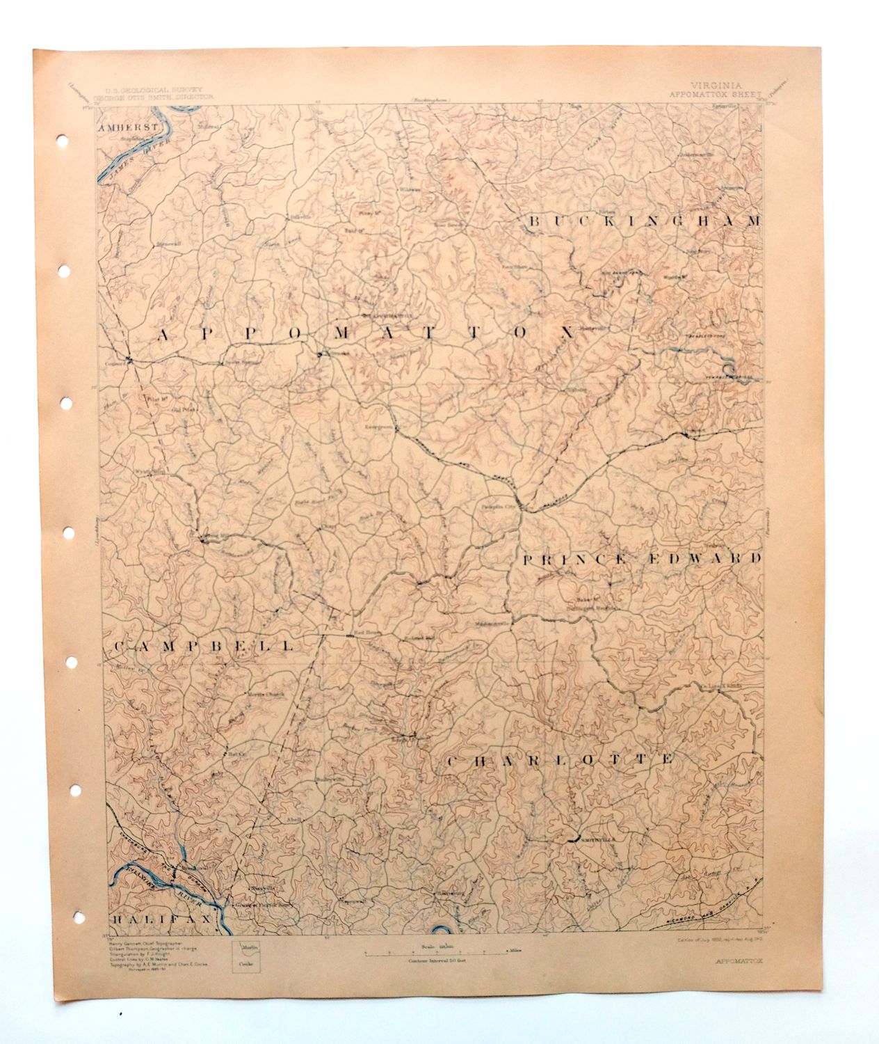
This USGS 30-minute topographic sheet is an 1892 edition printed in 1912, and at 114 years old it has been kept in excellent condition — very lightly handled, never folded, and printed on thick stock that has stayed smooth and flat. Based on an 1889 and 1890 field survey under geographer Henry Gannett, it takes in a stretch of central Virginia about 20 miles west of Farmville, with the quad area including Appomattox, Brookneal, Drakes Branch, and Charlotte Court House across parts of Amherst, Appomattox, and neighboring counties. The survey work behind it came just twenty-five years after the Battle of Appomattox Court House, mapping the countryside around a name known to anyone with an interest in the close of the Civil War. The reverse carries printed reference material on reading the map, and this sheet comes from an uncommonly well-preserved collection.
In stock
This antique sheet is an 1892 edition of the Appomattox Virginia USGS topographic map. It is an authentic 114-year-old 1912 United States Geological Survey print in excellent condition.
HOW THIS MAP CAN BE USED
In addition to making a fascinating conversation piece, this sheet would look great in a frame or on display, make a unique and prized gift for anyone interested in this area, be perfect as a reference for genealogy studies or general historical research, or fill that missing piece in your collection.
FEATURES SHOWN ON THE MAP
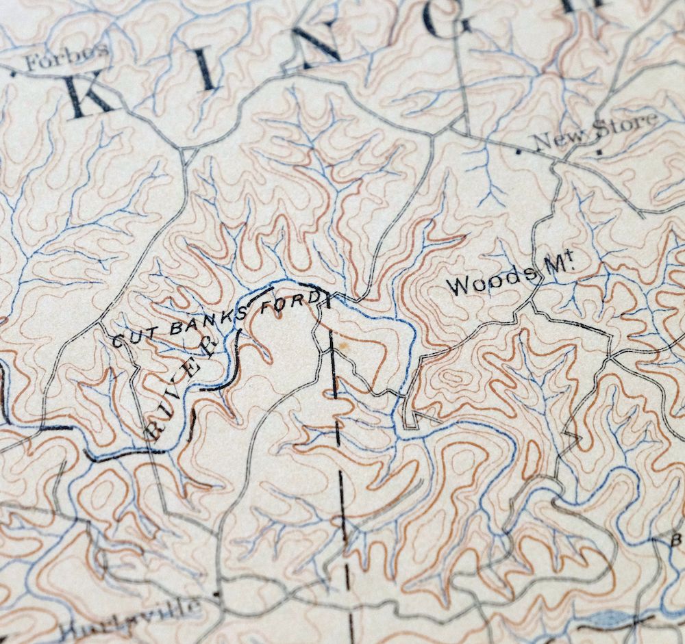
The Appomattox 30-minute map shows cities and towns, roads, railroads, rivers, creeks, elevation contour lines, public land survey lines, county, state, and other administrative boundaries as they existed at the time of the survey in 1889 and 1890.
A VALUABLE HISTORICAL RECORD
Maps from the USGS 30-minute series have been out of print for many years. They have never been common and original prints are increasingly difficult to find. For areas where the 30-minute map was produced, it is usually the first large-scale survey done by the USGS for that area. These are a valuable historical record, as they contain many placenames and features that have been dropped from more recent series’ and editions.
Nearby maps
-
Farmville Virginia Blackstone Rice USGS Topographic Map 1914
$55 Add to cart -

Palmyra Virginia Lake Monticello Dillwyn USGS Topo Map 1907
$75 Add to cart -
Amelia Virginia Richmond Bon Air USGS Topo Map 1904 Antique
$74 Add to cart -

Natural Bridge Virginia Covington Selma USGS Topo Map 1911
$62 Add to cart -
Staunton Virginia Stuarts Draft USGS Topographic Map 1913
$90 Add to cart -

Luray Virginia Front Royal Stanley USGS Topographic Map 1910
$115 Add to cart -

Franklin West Virginia Petersburg Onego USGS Topo Map 1914
$49 Add to cart -

Nicholas West Virginia Summersville Cowen USGS Topo Map 1912
$54 Add to cart -

Mount Vernon Virginia Washington Accokeek USGS Topo Map 1912
$200 Add to cart -
White Plains Virginia Triplet Ebony USGS Topo Map 1944
$39 Add to cart -

Jarratt Virginia Stony Creek Yale USGS Topographic Map 1951
$38 Add to cart -
Rocky Mount North Carolina Wilson Red Oak USGS Topo Map 1965
$48 Add to cart -

Romney West Virginia Keyser Delray USGS Topographic Map 1909
$80 Add to cart -

Winchester Virginia Middletown Inwood USGS Topo Map 1916
$82 Add to cart -

Raleigh West Virginia Beckley Oak Hill USGS Topo Map 1901
$135 Add to cart -

Wytheville Virginia Marion Sparta USGS Topo Map 1907 Antique
$105 Add to cart -
Patuxent Maryland Washington Bowie USGS 30-Min Topo Map 1907
$65 Add to cart -

Sutton West Virginia Glenville Elk River USGS Topo Map 1907
$75 Add to cart -
Vanceboro North Carolina Ernul USGS Topo Map 1968 Vintage
$45 Add to cart -

Bald Knob West Virginia Mallory USGS Topo Map 1923 Antique
$50 Add to cart -

Oceana West Virginia Logan Gilbert USGS Topographic Map 1912
$58 Add to cart -

Peytona West Virginia Marmet Belle USGS Topographic Map 1911
$42 Add to cart -

Charleston West Virginia Cross Lanes Rand USGS Topo Map 1914
$68 Add to cart -

Patapsco Maryland Baltimore Jessup USGS Topographic Map 1908
$96 Add to cart