MAP DETAILS | |
|---|---|
| TITLE | San Fernando |
| STATE | California |
| LOCATION | Vicinity of Los Angeles |
| SERIES | 7.5-minute |
| SURVEYED | 1924 through 1953 Aerial and Field Survey |
| EDITION | 1955 |
| PRINTED | 1955 |
| PRINT NOTES | Includes woodland tint (green to indicate vegetated areas) |
| SCALE | 1:25000 |
| SHEET DIMENSIONS | 22 x 26 1/4 inches |
| MAP DIMENSIONS | 18 1/8 x 21 7/8 inches |
| COVERAGE AREA | 7 x 9 miles |
| SHEET CONDITION For maps of this vintage, effort is made to note all visible flaws, no matter how minor. | |
| OVERALL CONDITION | Good |
| SHEET NOTES | moderately handled, has foldlines |
| MAP AREA | no wear, no markings, no blemishes |
| COLLARS | no wear or tears, no markings, no blemishes, bottom collar trimmed |
| MAP COVERAGE Quadrangle extent overlaid on current basemap. | |
| PLACENAMES Depending on map series and survey date, all of the features listed below may not be shown on this map. This list contains features that currently exist or historically existed within the area covered by the map. The list can be used as a reference to determine if this map covers your area of interest. Placenames are listed alphabetically next to each feature type. | |
| CITIES AND TOWNS (CURRENT) | Los Angeles, San Fernando, and Santa Clarita |
| COUNTIES COVERED | Los Angeles |
| FEDERAL LAND UNITS | Angeles National Forest |
| RIVERS AND STREAMS | Bull Creek, East Canyon Channel, Pacoima Wash, Placerita Creek, and Tujunga Wash |
| WATER BODIES | Hansen Flood Control Basin, Hansen Lake, Pacoima Reservoir, Redwing Lake, and Van Norman Lake |
| Locations: Balboa-Mission Shopping Center, Balboa-Mission Square Shopping Center, Bear Divide Station, Burns Ranch, El Cariso Golf Course, El Cariso Regional Park, Hansen Dam Golf Course, Knollwood Golf Course, LACD Fire Camp 9, La Rinda Shopping Center, Lopez Canyon Forest Station, Rancho Sombrero, San Fernando Ranger Station, San Fernando Valley Juvenile Hall, Sylmar Shopping Center, Sylmar Square Shopping Center, and Sylmar Towne Shopping Center. Areas: Achois Comihavit. Mountains, Peaks, and Summits: Kagel Mountain and Sugarloaf. Valleys and Canyons: Bartholomaus Canyon, Bull Canyon, Cougar Canyon, Grapevine Canyon, Hog Canyon, Indian Canyon, Limekiln Canyon, Loop Canyon, Lopez Canyon, Maple Canyon, May Canyon, Pacoima Canyon, Schoolhouse Canyon, Sombrero Canyon, West Fork Sombrero Canyon, and Wilson Canyon. Parks: Andreas Pico Adobe Park, Brand Park, Devonshire Arleta Park, Devonwood Park, Glenoaks Park, Gothic Rinaldi Park, Granada Hills Park, Griffith Ranch Historical Monument, Hubert H Humphrey Memorial Park, Kagel Canyon Park, Las Palmas Park, Layne Park, Pacoima Park, Paxton Park, Recreation Park, Roger Jessup Recreation Center, Stetson Ranch Park, Sylmar Park, and Veterans Memorial Park. Drainages: East Canyon Channel. Capes: Bisker and Contract Point. Churches: Mission San Fernando Rey de Espana. Hospitals: Highland Sanitarium, Holy Cross Medical Center, Olive View Hospital, Pacoima Memorial Hospital, San Fernando Hospital, and United States Veterans Hospital. Lakes and Ponds: Middle Lake. Buildings: Fire Station Number 75, Granada Hills Branch Los Angeles Public Library, Los Angeles City Fire Station, Pacoima Branch Los Angeles Public Library, San Fernando Branch County of Los Angeles Public Library, San Fernando City Hall, and Sylmar Branch Los Angeles Public Library. Dams: Channel Diversion Dike 6-039 Dam, Hansen Dam, Lopez Dam, Los Angeles Reservoir 6-050 Dam, Lower San Fernando 6-015 Dam, Lower Van Norman Bypass 6-048 Dam, Pacoima Dam, Schoolhouse Debris Dam, Upper San Fernando 6-028 Dam, Wilson Debris Dam, and Yarnell Debris Basin 6-046 Dam. Gaps: Bear Divide, May Canyon Saddle, and Wilson Canyon Saddle. Basins: Hansen Spreading Grounds, Lower Retention Basin, Pacoima Spreading Grounds, Schoolhouse Debris Basin, Wilson Debris Basin, and Yarnell Debris Basin. Airports: Barton Heliport, Holy Cross Medical Center Heliport, Lake View Medical Center Heliport, Merle Norman Cosmetics-Sylmar Heliport, and Whiteman Airport. Schools: Alemany High School, Broadous Elementary School, Danube Avenue Elementary School, De La Salle School, Dyer Elementary School, El Dorado Elementary School, Fenton Elementary School, First Lutheran School, Gridley Elementary School, Guardian Angel School, Haddon Elementary School, Harding Street Elementary School, Haskell Avenue School, Herrick Avenue Elementary School, Hubbard Elementary School, J F Kennedy High School, John F Kennedy High School, Knollwood Elementary School, Light and Life School, Maclay Middle School, Mary Immaculate School, Mayall Elementary School, Morningside Elementary School, O'Melveny Elementary School, Oak Hill School, Olive View School, Olive Vista Junior High School, Osceola Elementary School, Our Saviors School, Pacoima Elementary School, Porter Middle School, Saint Didacus School, San Fernando Elementary School, San Fernando Middle School, San Fernando Senior High School, San Jose Elementary School, Santa Rosa School, Seminary of Our Lady Queen of the Angels, Sharp Elementary School, Sylmar Elementary School, Sylmar High School, Telfair Elementary School, Tulsa Elementary School, Vaughn Elementary School, and Vintage Street Fundamental Magnet School. Reservoirs and Tanks: Hansen Flood Control Basin, Hansen Lake, Lower Van Norman Lake, Pacoima Reservoir, Upper Van Norman Lake, and Van Norman Bypass Reservoir. Towers: KCSN-FM (Northridge) and KMGX-FM (San Fernando). Wells: Mission Wells. Springs: Los Pinetos Spring. | |
| SHIPPING AND RETURNS | |
 This map sheet will be carefully rolled in a sturdy tube and shipped via the US Postal Service. If you find that the sheet you receive is not as described in the listing, you may ship it back to us for a refund of the purchase price. | |


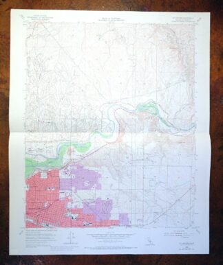
San Fernando California Angeles NF USGS Topographic Map 1955
$26
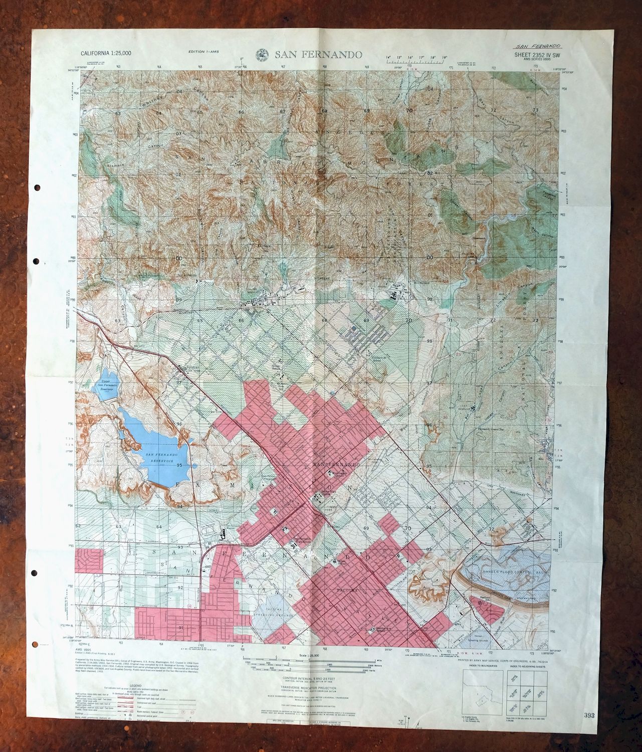
Printed in its year of first publication, 1955, this Army Map Service topographic sheet is in good condition, moderately handled with foldlines and a clean map area free of wear or markings. Covering a 7-by-9-mile stretch at the northern edge of the Los Angeles basin, the quad area takes in the city of San Fernando and reaches into part of the Angeles National Forest, with San Fernando Valley communities of Los Angeles falling within its boundaries. Drawn from aerial and field survey work carried out between 1924 and 1953, it captures the northern San Fernando Valley as it stood in the mid-1950s, when the postwar building boom was reshaping this corner of the county.
In stock
This vintage sheet is a 1955 edition of the San Fernando California AMS topographic map. It is an original 71-year-old Army Map Service print in good condition.
HOW THIS MAP CAN BE USED
In addition to making a fascinating conversation piece, this sheet would look great in a frame or on display, make a unique and prized gift for anyone interested in this area, be perfect as a reference for genealogy studies or general historical research, or fill that missing piece in your collection. Maps of this vintage are printed on durable stock and are well-suited for outdoor activities and recreation of all kinds, including hiking, backpacking, hunting, rafting and kayaking, backcountry skiing, geocaching, general exploration, treasure hunting, etc.
FEATURES SHOWN ON THE MAP
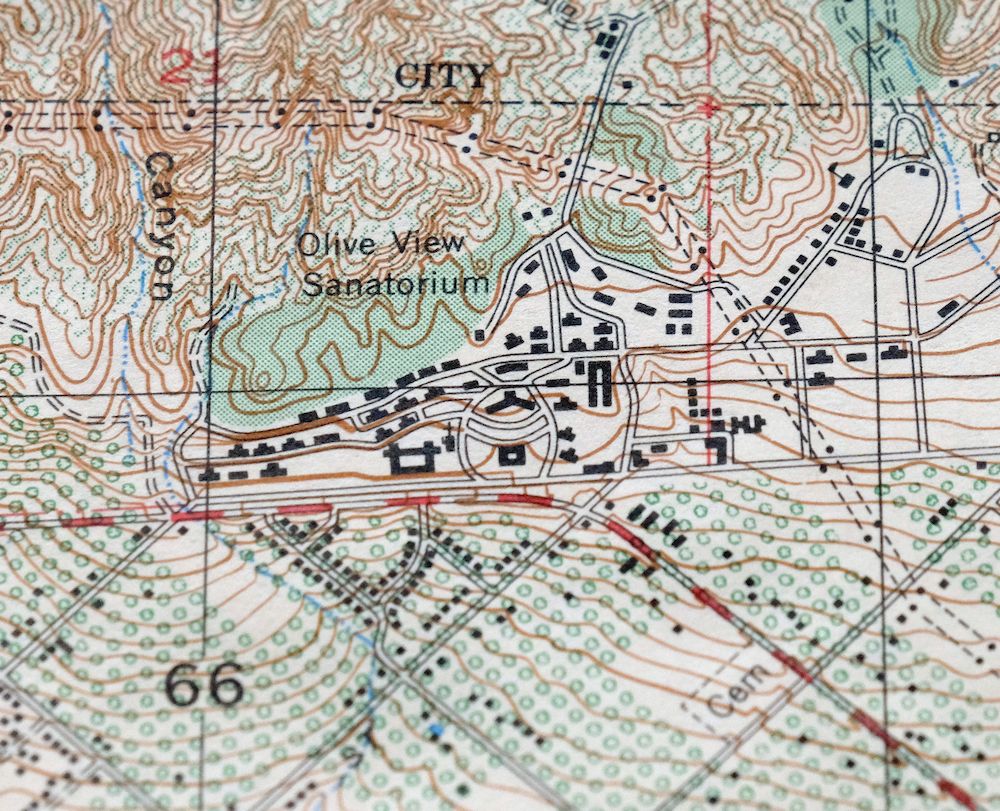
The San Fernando 7.5-minute map shows cities and towns, roads, paths, railroads, utilities and energy infrastructure, rivers, creeks, elevation contour lines, public land survey lines, county, state, and other administrative boundaries as they existed at the time of the survey in 1924 through 1953. A tint is used on this sheet to indicate urban areas where only landmark buildings are depicted. Outside of those areas, all known structures (houses, businesses, churches, schools, barns, cabins, etc) are shown.
A VALUABLE HISTORICAL RECORD
This map is from the 7.5-minute series, the most detailed series that is widely available from the AMS. The 1955 San Fernando map is a valuable historical record for the area. It contains some placenames and features that have been dropped from more recent maps.
Nearby maps
-
Santa Susana California Brandeis USGS Topographic Map 1970
$42 Add to cart -
Inglewood California Los Angeles Torrance USGS Topo Map 1965
$48 Add to cart -
Moorpark California Somis USGS 7.5-Min Topo Map 1978 Vintage
$42 Add to cart -
Newbury Park California Camarillo USGS Topographic Map 1972
$45 Add to cart -
Rock Creek California Angeles NF USGS Topo Map 1903 Antique
$52 Add to cart -
Santa Paula California Camarillo USGS Topo Map 1980 Vintage
$49 Add to cart -
Saticoy California El Rio Montalvo USGS Topographic Map 1968
$39 Add to cart -

Anaheim California Santa Ana Garden Grove USGS Topo Map 1956
$39 Add to cart -
San Antonio California Wrightwood USGS Topo Map 1903 Antique
$42 Add to cart -
Cucamonga California Ontario Chino USGS Topographic Map 1917
$46 Add to cart -
Orange Anaheim California Vintage USGS Topographic Map 1970
$36 Add to cart -
Shadow Mountains California El Mirage USGS Topo Map 1948
$28 Add to cart -

Santiago Creek California USGS 7.5-Min Topo Map 1945 Vintage
$23 Add to cart -

Santa Catalina East California Avalon USGS Topo Map 1950
$35 Add to cart -

Santa Catalina South California USGS Topo Map 1950 Vintage
$30 Add to cart -
Riverside East California Edgemont USGS Topographic Map 1955
$40 Add to cart -

Emerald Mountain California USGS 15-Min Topographic Map 1943
$37 Add to cart -
Fairfax School California Lamont USGS Topographic Map 1939
$44 Add to cart -
Gosford California Bakersfield USGS Topo Map 1941 Antique
$43 Add to cart -
Gosford California Bakersfield USGS Topo Map 1970 Vintage
$30 Add to cart -
Apple Valley California Bell Mountain USGS Topo Map 1968
$32 Add to cart -

Salisbury Potrero California USGS Topo Map 1944 Vintage
$25 Add to cart -
Stevens California Bakersfield Rosedale USGS Topo Map 1940
$38 Add to cart -
Oil Center California Bakersfield USGS Topo Map 1970 Vintage
$40 Add to cart
