MAP DETAILS | |
|---|---|
| TITLE | Riverside East |
| STATE | California |
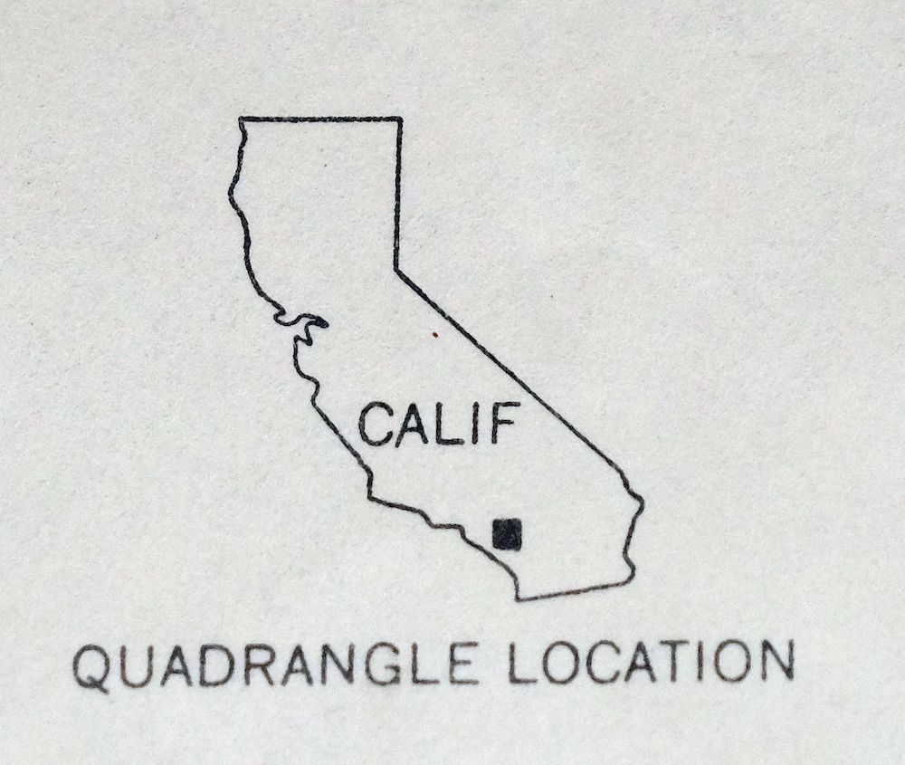
| LOCATION | 54 miles east of Los Angeles |
| SERIES | 7.5-minute |
| SURVEYED | 1939 through 1953 Aerial and Field Survey |
| EDITION | 1953 |
| PRINTED | 1955 |
| PRINT NOTES | Thick paper stock. A reddish tint is used to indicate urban areas where only landmark buildings are shown. |
| SCALE | 1:24000 |
| CONTOUR INTERVAL | 20 feet |
| SHEET DIMENSIONS | 22 x 27 inches |
| MAP DIMENSIONS | 18 7/8 x 22 3/4 inches |
| COVERAGE AREA | 7 x 9 miles |
| SHEET CONDITION For maps of this vintage, effort is made to note all visible flaws, no matter how minor. | |
| OVERALL CONDITION | Very Good |
| SHEET NOTES | lightly handled, never folded |
| MAP AREA | flawless map area |
| COLLARS | no markings, edge wrinkling on lower right collar, no edge tears |
| MAP COVERAGE Quadrangle extent overlaid on current basemap. | |
| PLACENAMES Depending on map series and survey date, all of the features listed below may not be shown on this map. This list contains features that currently exist or historically existed within the area covered by the map. The list can be used as a reference to determine if this map covers your area of interest. Placenames are listed alphabetically next to each feature type. | |
| CITIES AND TOWNS (CURRENT) | Edgemont, March AFB, Moreno Valley, Riverside, and Woodcrest |
| COUNTIES COVERED | Riverside |
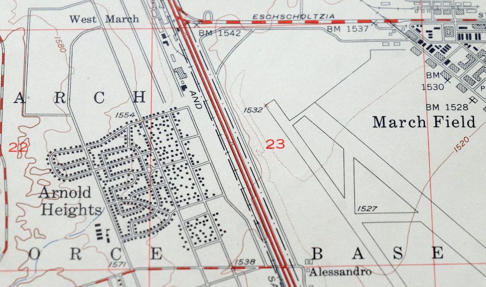
| FEDERAL LAND UNITS | March Air Force Base (Closed) |
| Locations: Box Springs, Box Springs Lookout, Canyon Crest Golf Course, Canyon Springs Plaza Shopping Center, City Hall Mall, Lawless Ranch, Lieutenant General Archie J Old Junior Golf Course, Moreno Valley Golf Course, Moreno Valley Mall at Towngate Shopping Center, Plaza del Sol Shopping Center, Riverside International Raceway, Town Gate Community Shopping Center, Town Square Shopping Center, University Center Shopping Center, University Shopping Center, University Village Shopping Center, Victoria Golf Course, and Woodcrest Plaza Shopping Center. Mountain Ranges: Box Springs Mountains. Mountains, Peaks, and Summits: North Hill, Sugarloaf Mountain, and Victoria Hill. Valleys and Canyons: Box Springs Canyon, Pigeon Pass Valley, and Sycamore Canyon. Parks: Andulka Park, Bergmont Park, Bobby Bonds Park and Sports Complex, Bordwell Park, Box Springs Mountain Regional Park, Castleview Park, Fairmount Park, Hidden Springs Community Park, Hunter Park, Islander Park, Lincoln Park, Moreno Valley Community Park, Mount Vernon Park, North Park, Orange Crest Number 2 Park, Patterson Park, Quail Run Park, Sycamore Canyon Park, Taft Park, Towngate Memorial Park, and Westbluff Park. Drainages: Spring Brook. Churches: All Souls Universalist Church, Amos Temple Christian Church, Apostolic Church, Born Again Church, Calvary Baptist Church, Centro Cristiano la Mission, Christ Church Universal Love, Church of Religious Science, Ebenezer Asemblea de Dios, Evangelical Free Church, First Church of Christ, First Congregational Church, Gethsemane Lutheran Church, Good News Missionary Baptist Church, Kansas Avenue Seventh Day Church, Living Word Baptist Church, March Air Force Base Chapel, Mount Zion Lighthouse Full Gospel Church, New Covenant Bible Church, Oasis Christian Fellowship Church, Our Lady of Guadalupe Shrine, Power House Church of God, Quinn African Methodist Episcopal Church, Reformed Baptist Church, Rehoboth Tabernacle, Riverside First Assembly of God Church, Riverside Spanish Advent Church, Saint James Church of God, Saint John Missionary Baptist Church, Salvation Army Church, Seventh Day Baptist Church, The Church of Jesus Christ of Latter Day Saints, Trinity Baptist Church, and Oil and Wine Christian Church Wheat. Buildings: Aberdeen-Inverness Residence Hall, Andrew Carnegie Library, Batchelor Hall, Boyce Hall, Boyden Laboratories, Central Branch Riverside City and County Public Library, Chapman Hall, Fawcett Laboratory, Hinderaker Hall, Lothian Residence Hall, March Field Museum, Masonic Temple, Olmsted Hall, Pierce Hall, Riverside Art Museum, Riverside County Courthouse, Riverside Municipal Auditorium and Soldiers Memorial Building, Rupert Costo Library of the American Indian, Spieth Hall, Sproul Hall, Tomas Rivera Library, Veitch Student Center, Watkins Hall, Watkins House, and Webber Hall. Dams: Alessandro 1003-003 Dam, Box Springs 1003-007 Dam, Henry J Mills 35-014 Dam, Prenda 1003-004 Dam, and Sycamore 1003-005 Dam. Gaps: Pigeon Pass. Canals: Gage Canal. Schools: Abraham Lincoln Continuation High School, Alcott Elementary School, Arnold Heights Elementary School, Benjamin Franklin Elementary School, Box Springs School, Canyon Springs High School, Castle View Elementary School, Continuation School, Edgemont Elementary School, Emerson Elementary School, Fremont Elementary School, Hidden Springs School, Highland Elementary School, Honey Hollow Elementary School, Hyatt Elementary School, John W North High School, Longfellow Elementary School, Moreno Valley High School, Our Lady of Guadalupe Academy, Polytechnic High School, Raceway School, Saint Francis School, Seneca Elementary School, Sheriffs Academy, Sunnymeadows Elementary School, University Heights Junior High School, University of California Experiment Station, University of California Riverside, Victoria Elementary School, Vista Heights School, William Howard Taft Elementary School, Woodcrest Christian High School, and Woodcrest Elementary School. Towers: KDUO-FM (Riverside), KGGI-FM (Riverside), KOLA-FM (San Bernardino), KUCR-FM (Riverside), KVCR-FM (San Bernardino), and KVCR-TV (San Bernardino). Springs: Cassina Springs and Hidden Springs. | |
| SHIPPING AND RETURNS | |
 This map sheet will be carefully rolled in a sturdy tube and shipped via the US Postal Service. If you find that the sheet you receive is not as described in the listing, you may ship it back to us for a refund of the purchase price. | |
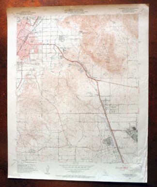
Riverside East California Edgemont USGS Topographic Map 1955
$40
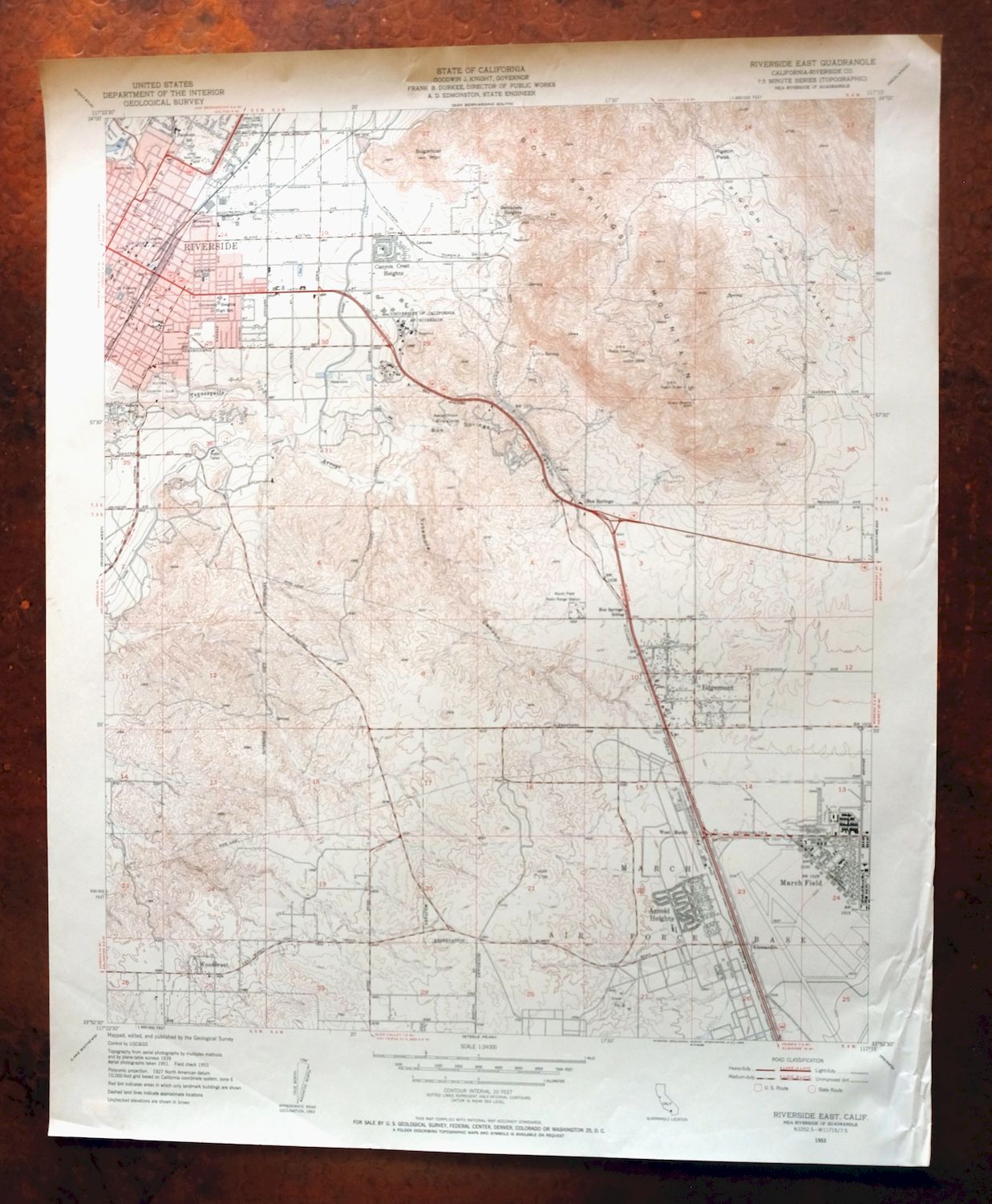
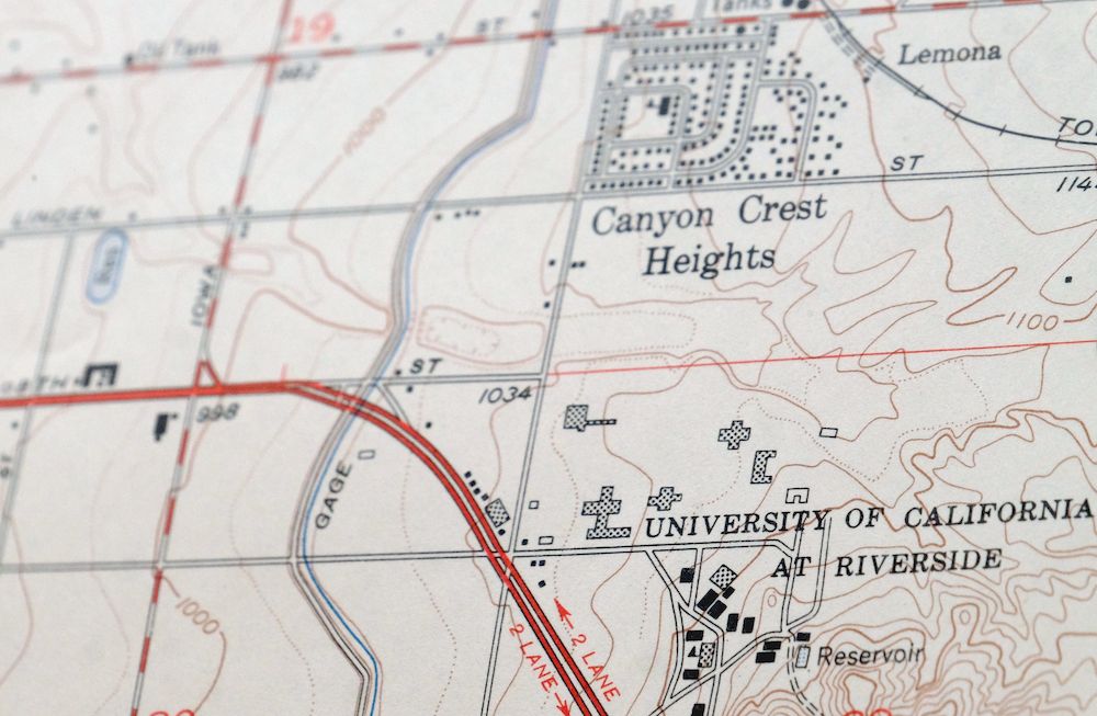
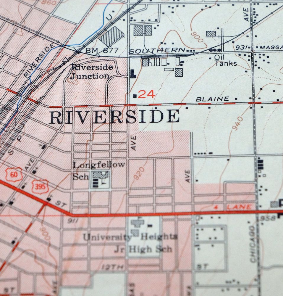
First published in 1953, this Riverside East sheet was printed in 1955 and is in very good condition, lightly handled and never folded on thick stock with a flawless map area. Part of the USGS 7.5-minute series at 1:24,000, it takes in the eastern side of Riverside along with Moreno Valley, Woodcrest, and Edgemont in Riverside County, about 54 miles east of Los Angeles. The map also includes March Air Force Base, an active installation through the 1953 era this edition depicts, drawn from an aerial and field survey conducted between 1939 and 1953.
In stock
This vintage sheet is a 1953 edition of the Riverside East California USGS topographic map. It is an original 71-year-old 1955 United States Geological Survey print in very good condition.
HOW THIS MAP CAN BE USED
In addition to making a fascinating conversation piece, this sheet would look great in a frame or on display, make a unique and prized gift for anyone interested in this area, be perfect as a reference for genealogy studies or general historical research, or fill that missing piece in your collection. Maps of this vintage are printed on durable stock and are well-suited for outdoor activities and recreation of all kinds, including hiking, backpacking, hunting, rafting and kayaking, backcountry skiing, geocaching, general exploration, treasure hunting, etc.
FEATURES SHOWN ON THE MAP
The Riverside East 7.5-minute map shows cities and towns, roads, paths, railroads, utilities and energy infrastructure, rivers, creeks, elevation contour lines, public land survey lines, county, state, and other administrative boundaries as they existed at the time of the survey in 1939 through 1953. A reddish tint is used on this sheet to indicate urban areas where only landmark buildings are depicted. Outside of those areas, all known structures (houses, businesses, churches, schools, barns, cabins, etc) are shown.
A VALUABLE HISTORICAL RECORD
This map is from the 7.5-minute series, the most detailed series that is widely available from the USGS. The 1953 Riverside East map is a valuable historical record for the area. It contains some placenames and features that have been dropped from more recent maps.
Nearby maps
-
Orange Anaheim California Vintage USGS Topographic Map 1970
$36 Add to cart -
Cucamonga California Ontario Chino USGS Topographic Map 1917
$46 Add to cart -
Hemet California Valle Vista Valle Vista USGS Topo Map 1943
$48 Add to cart -
San Antonio California Wrightwood USGS Topo Map 1903 Antique
$42 Add to cart -

Temecula California Fallbrook Rainbow USGS Topo Map 1978
$38 Add to cart -

Anaheim California Santa Ana Garden Grove USGS Topo Map 1956
$56 Add to cart -
Rock Creek California Angeles NF USGS Topo Map 1903 Antique
$52 Add to cart -
Apple Valley California Bell Mountain USGS Topo Map 1968
$32 Add to cart -
Shadow Mountains California El Mirage USGS Topo Map 1948
$28 Add to cart -
Inglewood California Los Angeles Torrance USGS Topo Map 1965
$48 Add to cart -

San Fernando California Angeles NF USGS Topographic Map 1955
$26 Add to cart -

Santa Catalina East California Avalon USGS Topo Map 1950
$35 Add to cart -

Santa Catalina South California USGS Topo Map 1950 Vintage
$30 Add to cart -
Santa Susana California Brandeis USGS Topographic Map 1970
$42 Add to cart -
Cottonwood Spring California USGS Topo Map 1973 Vintage
$39 Add to cart -
Newbury Park California Camarillo USGS Topographic Map 1972
$45 Add to cart -
Moorpark California Somis USGS 7.5-Min Topo Map 1978 Vintage
$42 Add to cart -

Potrero California Morena Village Tecate USGS Topo Map 1954
$27 Add to cart -
Santa Paula California Camarillo USGS Topo Map 1980 Vintage
$49 Add to cart -
Saticoy California El Rio Montalvo USGS Topographic Map 1968
$39 Add to cart -

Emerald Mountain California USGS 15-Min Topographic Map 1943
$37 Add to cart -
Fairfax School California Lamont USGS Topographic Map 1939
$44 Add to cart -

Santiago Creek California USGS 7.5-Min Topo Map 1945 Vintage
$23 Add to cart -
Gosford California Bakersfield USGS Topo Map 1941 Antique
$43 Add to cart