MAP DETAILS | |
|---|---|
| TITLE | San Antonio |
| STATE | California |
| LOCATION | Vicinity of Wrightwood, 40 miles northeast of Los Angeles |
| SERIES | 15-minute |
| SURVEYED | 1899 and 1900 Field Survey |
| GEOGRAPHER | R.U. Goode |
| ENGRAVED | 1903 |
| EDITION | 1903 |
| PRINTED | 1903 |
| PRINT NOTES | Thick paper stock |
| SCALE | 1:62500 |
| CONTOUR INTERVAL | 50 feet |
| SHEET DIMENSIONS | 17 x 21 inches (approximate) |
| MAP DIMENSIONS | 14 1/2 x 17 1/2 inches |
| COVERAGE AREA | 14 x 17 miles |
| SHEET CONDITION For maps of this vintage, effort is made to note all visible flaws, no matter how minor. | |
| OVERALL CONDITION | Very Good |
| SHEET NOTES | lightly handled, midsheet horizontal and vertical foldlines (1/4), age-toning along fold lines |
| MAP AREA | no markings, no blemishes |
| COLLARS | no blemishes, small inventory notation in upper right collar corner |
| MAP COVERAGE Quadrangle extent overlaid on current basemap. | |
| BACKSIDE LEGEND | |
 A map summary is printed on the back side of the San Antonio sheet similar to the one shown in the picture. It outlines the history, purpose, and status of the USGS mapping program at the time of the printing in 1903. It also provides instructions on how to read contour lines and a description of how they are used to depict the terrain. At the bottom of the page is a legend showing all of the symbols used to represent the cultural, relief, and water features found on the map. | |
| PLACENAMES Depending on map series and survey date, all of the features listed below may not be shown on this map. This list contains features that currently exist or historically existed within the area covered by the map. The list can be used as a reference to determine if this map covers your area of interest. Placenames are listed alphabetically next to each feature type. | |
| CITIES AND TOWNS (CURRENT) | Wrightwood |
| COUNTIES COVERED | Los Angeles and San Bernardino |
| FEDERAL LAND UNITS | Angeles National Forest, Cucamonga Wilderness, San Bernardino National Forest, San Gabriel Wilderness, and Sheep Mountain Wilderness |
| RIVERS AND STREAMS | Big Butch Wash, Cajon Wash, Fish Fork, Fremont Wash, Governor Edmund G Brown California Aqueduct, Iron Fork, Le Montaine Creek, Mescal Creek, Middle Fork Lytle Creek, North Fork Lytle Creek, North Fork San Gabriel River, and San Antonio Creek Channel |
| WATER BODIES | Jackson Lake and Twin Lakes |
| Locations: All Nations Camp, Appletree Campground, Arch Picnic Ground, Ball Target Shooting Area, Big Horn Campground, Big Pine Station, Big Pines Camp, Blue RIdge Electronic Site, Blue Ridge Camp, Blue Ridge Ski Lift, Buttemer Ranch, Cabin Flat Campground, Camp Ester, Camp Harmony Pines, Camp Hawthorne, Camp Hemohme, Camp Jubilee, Camp Junipero Serra, Camp Kassab, Camp Lupine, Camp Manzanita, Camp Maria Stella, Camp Marion, Camp McClellan, Camp McKiwanis, Camp Metaka, Camp San Antonio, Camp Teresita Pines, Camp Verdugo Pines, Centinela Valley Camp, Clyde Ranch, Coldwater Campground, Deer Ridge Camp, Fish Fork Camp, Glacier Camp, Glacier Picnic Area, Glacier Picnic Ground, Goss Ranch, Grassy Hollow Campground, Guffy Camp, Hagenbaugh Ranch, Holiday Hill Ski Lift, Horse Target Shooting Area, Iron Fork Camp, Jackson Flat Campground, Johnson Ranch, Kare Camp Campground, Kassab Camp, Lake Campground, Manker Campground, Mescal Campground, Mine Gulch Camp, Mormon Rocks Forest Service Station, Mount High East Ski Area, Mount High East Ski Lift, Mount High West Ski Area, Mount High West Ski Lift, Mount Oak Campground, Mount View Organizational Camp, Nielson Ranch, Nuss Ranch, Oak Spring Ranch, Pauite Campground, Peavine Campground, Phelan Village Shopping Center, Prairie Fork Guard Station, Prudhon Ranch, Sharpless Ranch, Smithsonian Observatory, Stone House Crossing Campground, Sunrise Ski Area, Table Mountain Campground, Twin Valley Camp, Weber Camp, Widman Ranch, Wilson Ranch, and Y M C A Camp. Mountains, Peaks, and Summits: Dawson Peak, Mount Harwood, Inspiration Point, Iron Mountain, Pine Mountain, Mount San Antonio, Table Mountain, Telegraph Peak, Thunder Mountain, and Wright Mountain. Valleys and Canyons: Acorn Canyon, Alder Gulch, Allison Gulch, Bear Gulch, Blind Canyon, Boneyard Canyon, Cedar Canyon, Clark Gulch, Coldwater Canyon, Dog Bone Canyon, Dry Gulch, Falls Gulch, Flume Canyon, Fossil Canyon, Government Canyon, Graham Canyon, Grassy Hollow, Heath Canyon, Horse Canyon, Jesus Canyon, Laurel Gulch, Manker Canyon, Mine Gulch, The Narrows, Puzzle Canyon, Ross Gulch, Sawmill Canyon, Sheep Canyon, Slover Canyon, Swarthout Valley, Vincent Gulch, and Wildhorse Canyon. Parks: Cucamonga Wilderness and Pioneer Historic Marker. Trails: Allison Trail, Baldy Trail, Dawson Peak Trail, Heaton Flat Trail, PL and P Trail, and Pacific Crest National Recreation Trail. Drainages: Big Butch Wash, Fish Fork, Iron Fork, Prairie Fork, and Sheep Creek. Mines: Allison Mine, Baldora Mine, Big Horn Mine, Eagle Mine, Gold Dollar Mine, Gold Ridge Mine, Native Son Mine, Stanley-Miller Mine, and Widco Mine. Lakes and Ponds: Jackson Lake. Waterfalls: San Antonio Falls. Gaps: Mount Baldy Notch. Basins: Miners Bowl and Stone Basin. Schools: Chaparral High School, Phelan Elementary School, Pinon Hills Elementary School, Pinon Mesa Middle School, Serrano High School, and Wrightwood Elementary School. Ridges: Big Horn Ridge, Blue Ridge, Devils Backbone, Gold Ridge, Pine Mountain Ridge, San Antonio Ridge, and Upper Lytle Creek Ridge. Reservoirs and Tanks: Pacific Crest Reservoir, Twin Lakes, and Wright Lake. Flats: Airplane Flat, Appletree Flat, Ball Flat, Bear Flat, Big John Flat, Cabin Flat, Jackson Flat, Manker Flat, McClellean Flat, and Stockton Flat. Pillars: Swan Rock. Springs: Columbine Spring. | |
| SHIPPING AND RETURNS | |
| This map sheet ships via the US Postal Service. Choose your preferred packaging at eBay checkout: rolled in a sturdy tube, or folded in a padded mailer. If you find that the sheet you receive is not as described in the listing, you may ship it back to us for a refund of the purchase price. | |
San Antonio California Wrightwood USGS Topo Map 1903 Antique
$42
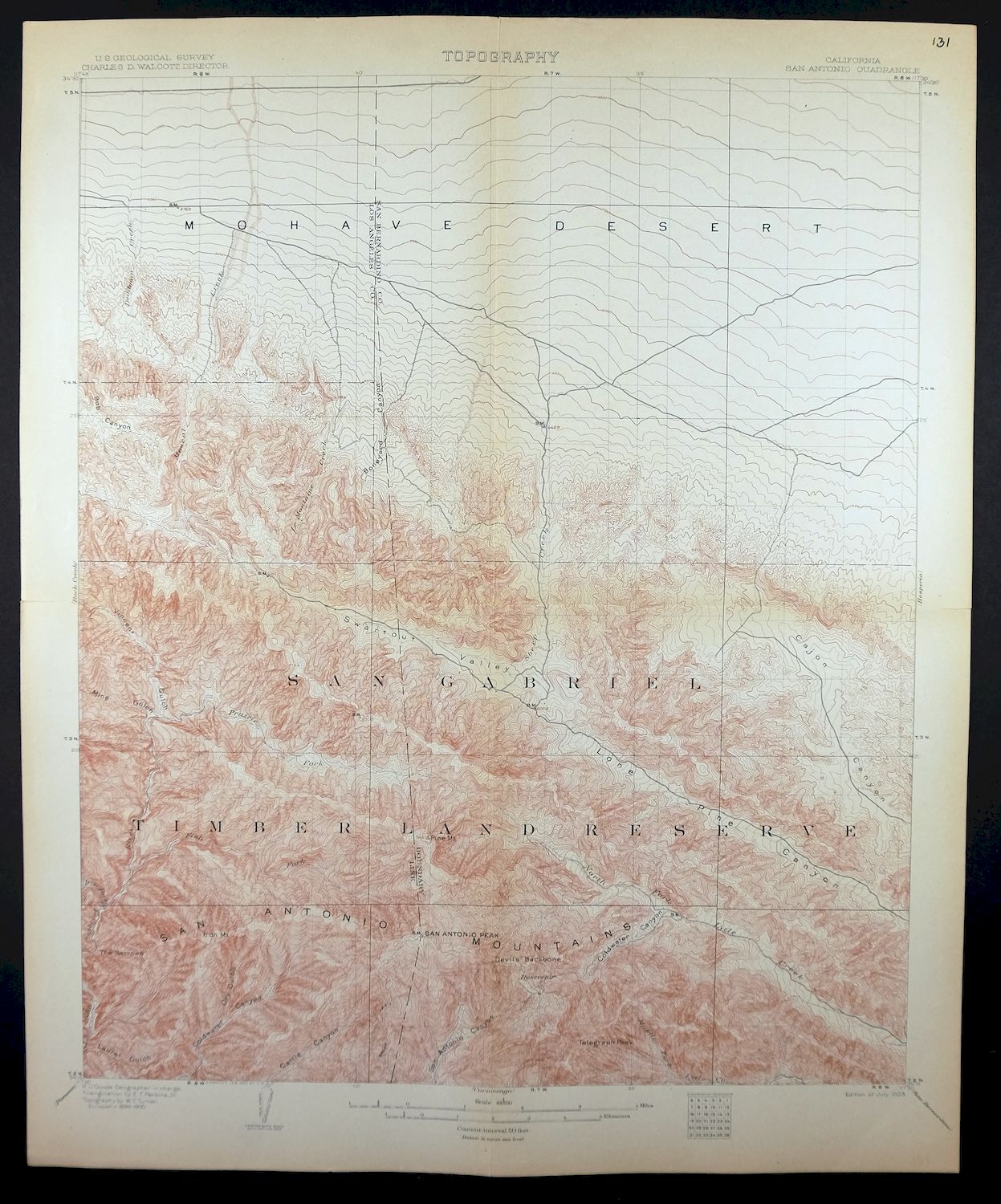
Printed in 1903, its year of first publication, this San Antonio sheet is a first-year print in very good condition, lightly handled with quarter-inch midsheet foldlines and some age-toning along them on thick stock. The quad sits in the San Gabriel Mountains northeast of Los Angeles, taking in the town of Wrightwood and crossing from Los Angeles into San Bernardino County, with portions of the Angeles and San Bernardino National Forests and the Sheep Mountain, San Gabriel, and Cucamonga Wilderness areas within its boundaries. Engraved in 1903 under geographer R.U. Goode and drawn from field survey work of 1899 and 1900, it records this stretch of high desert-facing mountain country as the USGS mapped it at the turn of the century, and the reverse carries printed reference material on reading the map.
In stock
This antique sheet is a 1903 edition of the San Antonio California USGS topographic map. It is an authentic 123-year-old United States Geological Survey print in very good condition.
HOW THIS MAP CAN BE USED
In addition to making a fascinating conversation piece, this sheet would look great in a frame or on display, make a unique and prized gift for anyone interested in this area, be perfect as a reference for genealogy studies or general historical research, or fill that missing piece in your collection.
FEATURES SHOWN ON THE MAP
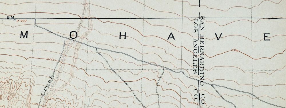
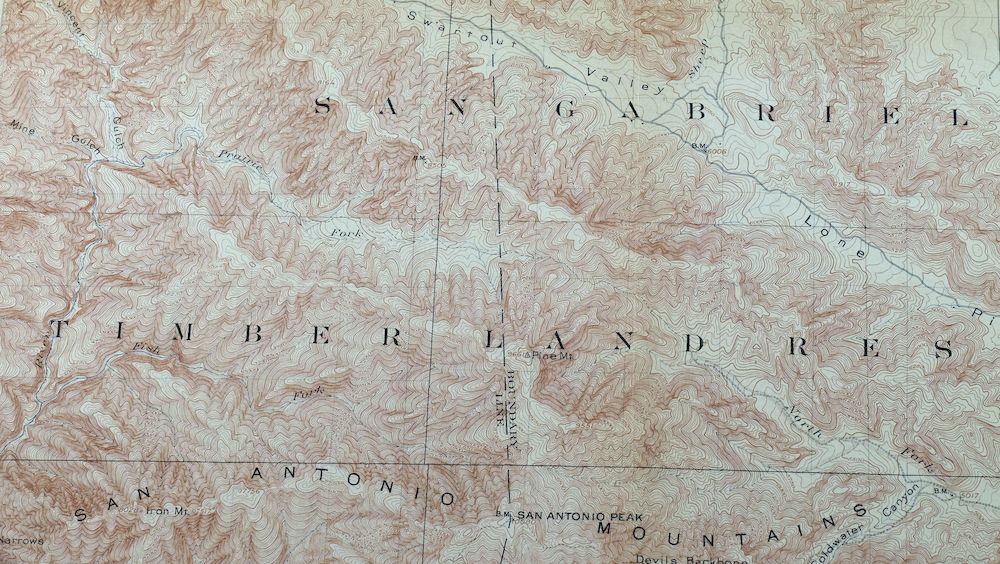
The San Antonio 15-minute map shows cities and towns, roads, railroads, rivers, creeks, elevation contour lines, public land survey lines, county, state, and other administrative boundaries as they existed at the time of the survey in 1899 and 1900. All known structures (houses, businesses, churches, schools, barns, cabins, etc) are also shown, with exceptions in some urban areas, where only landmark buildings may be shown.
A VALUABLE HISTORICAL RECORD
Maps from the 15-minute series for the continental United States are no longer produced or printed by the USGS and original prints are becoming increasingly difficult to find. They are a valuable historical record for an area, as they contain many placenames and features that have been dropped from more recent maps.
Nearby maps
-
Rock Creek California Angeles NF USGS Topo Map 1903 Antique
$52 Add to cart -
Shadow Mountains California El Mirage USGS Topo Map 1948
$28 Add to cart -
Cucamonga California Ontario Chino USGS Topographic Map 1917
$46 Add to cart -
Apple Valley California Bell Mountain USGS Topo Map 1968
$32 Add to cart -
Hemet California Valle Vista Valle Vista USGS Topo Map 1943
$48 Add to cart -
Riverside East California Edgemont USGS Topographic Map 1955
$40 Add to cart -
Orange Anaheim California Vintage USGS Topographic Map 1970
$36 Add to cart -

Anaheim California Santa Ana Garden Grove USGS Topo Map 1956
$39 Add to cart -

San Fernando California Angeles NF USGS Topographic Map 1955
$26 Add to cart -
Inglewood California Los Angeles Torrance USGS Topo Map 1965
$48 Add to cart -
Santa Susana California Brandeis USGS Topographic Map 1970
$42 Add to cart -

Temecula California Fallbrook Rainbow USGS Topo Map 1978
$38 Add to cart -
Moorpark California Somis USGS 7.5-Min Topo Map 1978 Vintage
$42 Add to cart -
Newbury Park California Camarillo USGS Topographic Map 1972
$45 Add to cart -

Emerald Mountain California USGS 15-Min Topographic Map 1943
$37 Add to cart -

Santa Catalina East California Avalon USGS Topo Map 1950
$35 Add to cart -
Santa Paula California Camarillo USGS Topo Map 1980 Vintage
$49 Add to cart -

Santa Catalina South California USGS Topo Map 1950 Vintage
$30 Add to cart -
Saticoy California El Rio Montalvo USGS Topographic Map 1968
$39 Add to cart -
Fairfax School California Lamont USGS Topographic Map 1939
$44 Add to cart -

Santiago Creek California USGS 7.5-Min Topo Map 1945 Vintage
$23 Add to cart -
Gosford California Bakersfield USGS Topo Map 1941 Antique
$43 Add to cart -
Gosford California Bakersfield USGS Topo Map 1970 Vintage
$30 Add to cart -
Oil Center California Bakersfield USGS Topo Map 1970 Vintage
$40 Add to cart