MAP DETAILS | |
|---|---|
| TITLE | Sunnyside |
| STATE | Utah |
| LOCATION | Vicinity of East Carbon, 80 miles southeast of Provo, UT |
| SERIES | 15-minute |
| SURVEYED | 1910 through 1913 Field Survey |
| GEOGRAPHER | R.B. Marshall |
| EDITION | 1915 |
| PRINTED | 1915 |
| PRINT NOTES | Thick paper stock, includes woodland tint (green to indicate vegetated areas) |
| SCALE | 1:62500 |
| CONTOUR INTERVAL | 50 feet |
| SHEET DIMENSIONS | 16 1/2 x 20 inches |
| MAP DIMENSIONS | 13 1/2 x 17 1/2 inches |
| COVERAGE AREA | 13 x 17 miles |
| SOURCE | A sheet from a decommissioned Arizona university library collection |
| SHEET CONDITION For maps of this vintage, effort is made to note all visible flaws, no matter how minor. | |
| OVERALL CONDITION | Excellent |
| SHEET NOTES | very lightly handled, never folded, evenly age-toned paper |
| MAP AREA | flawless map area |
| COLLARS | no wear or tears, no markings, no blemishes, ASU library stamp on lower collar |
| MAP COVERAGE Quadrangle extent overlaid on current basemap. | |
| BACKSIDE LEGEND | |
 A map summary is printed on the back side of the Sunnyside sheet similar to the one shown in the picture. It outlines the history, purpose, and status of the USGS mapping program at the time of the printing in 1915. It also provides instructions on how to read contour lines and a description of how they are used to depict the terrain. At the bottom of the page is a legend showing all of the symbols used to represent the cultural, relief, and water features found on the map. | |
| PLACENAMES Depending on map series and survey date, all of the features listed below may not be shown on this map. This list contains features that currently exist or historically existed within the area covered by the map. The list can be used as a reference to determine if this map covers your area of interest. Placenames are listed alphabetically next to each feature type. | |
| CITIES AND TOWNS (CURRENT) | Columbia, East Carbon, and Sunnyside |
| COUNTIES COVERED | Carbon |
| RIVERS AND STREAMS | Bear Creek, Dry Creek, Grassy Trail Creek, Icelander Creek, Jack Creek, Range Creek, and Rock Creek |
| WATER BODIES | Grassy Trail Reservoir |
| Locations: Willow Spring Cow Camp. Mountains, Peaks, and Summits: Mount Bartles, Patmos Head, and Range Valley Mountain. Valleys and Canyons: B Canyon, Bear Canyon, Beef Slide Canyon, Cold Spring Draw, Dalton Canyon, Fan Canyon, Graveyard Canyon, Hanging Rock Canyon, Left Fork A Canyon, Left Fork Whitmore Canyon, Little Spring Canyon, Mule Canyon, Number Two Canyon, Pasture Canyon, Pole Canyon, Right Fork A Canyon, Right Fork Cow Canyon, Right Fork Whitmore Canyon, Slaughter Canyon, South Patterfore Canyon, Spring Canyon, Trail Canyon, Water Canyon, and Whitmore Canyon. Mines: Sunnyside Mine. Churches: Good Shepherd Catholic Church, The Church of Jesus Christ of Latter Day Saints, and Trinity Episcopal Church. Dams: Grassy Trail Dam. Schools: East Carbon High School and Peterson School. Ridges: Bishop Ridge, Horse Ridge, Patmos Ridge, South Ridge, Twist Ridge, and West Ridge. Reservoirs and Tanks: Grassy Trail Reservoir. Flats: Bull Flat. Springs: Burnt Cabin Spring, Bus Spring, Cold Spring, Daddy Spring, Dalton Spring, Dancehall Spring, East Spring, Hanging Rock Spring, Mac Spring, Maverick Spring, North Spring, North Willow Spring, South Willow Spring, and Tidwell Spring. | |
| SHIPPING AND RETURNS | |
 This map sheet will be carefully rolled in a sturdy tube and shipped via the US Postal Service. If you find that the sheet you receive is not as described in the listing, you may ship it back to us for a refund of the purchase price. | |
Sunnyside Utah Book Cliffs East Carbon USGS Topo Map 1915
$54
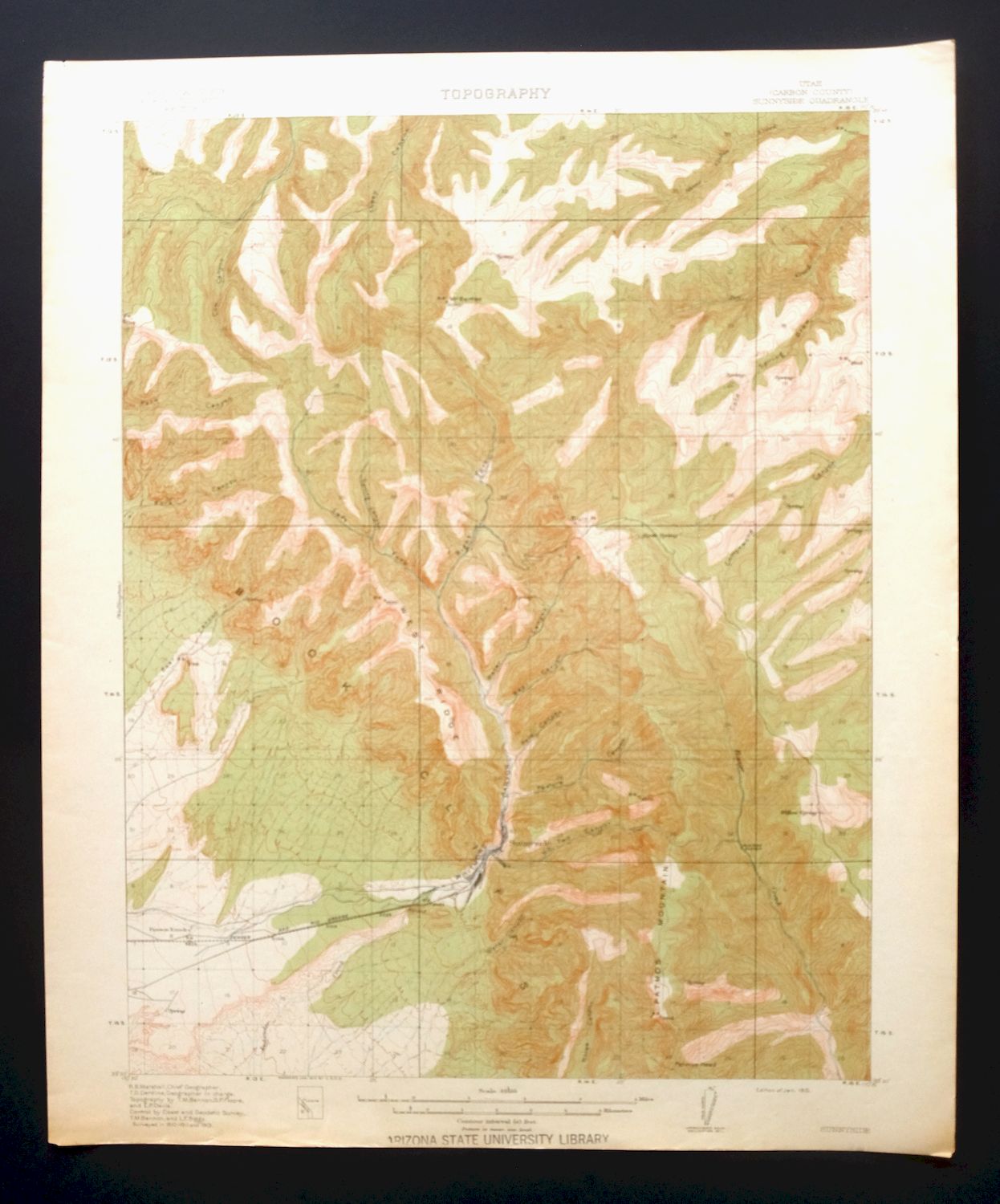
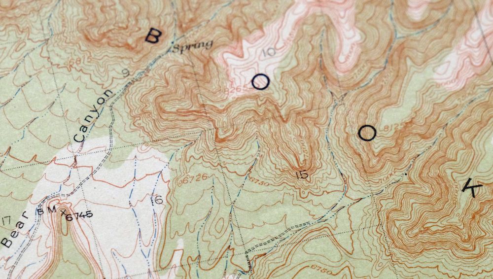
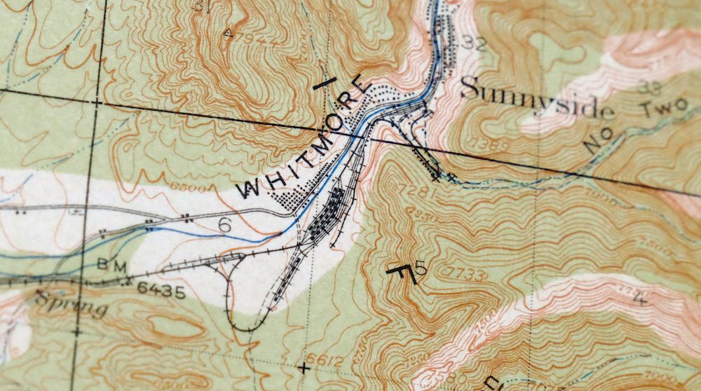
Printed in its first year of 1915, this USGS 15-minute topographic sheet is in excellent condition—very lightly handled, never folded, with evenly age-toned paper on thick stock and a flawless map area. It covers the Sunnyside quad in Carbon County, Utah, taking in the coal towns of Sunnyside and East Carbon along with Columbia, with the Book Cliffs and Whitmore Canyon defining the terrain. Drawn from a 1910 through 1913 field survey under geographer R.B. Marshall, it records the eastern Utah coal country as it stood a century ago, and the reverse carries printed reference material on reading the map. The sheet comes from a decommissioned Arizona university library collection and bears an ASU library stamp on the lower collar.
In stock
This antique sheet is a 1915 edition of the Sunnyside Utah USGS topographic map. It is an authentic 111-year-old United States Geological Survey print in excellent condition.
HOW THIS MAP CAN BE USED
In addition to making a fascinating conversation piece, this sheet would look great in a frame or on display, make a unique and prized gift for anyone interested in this area, be perfect as a reference for genealogy studies or general historical research, or fill that missing piece in your collection.
FEATURES SHOWN ON THE MAP
The Sunnyside 15-minute map shows cities and towns, roads, railroads, rivers, creeks, elevation contour lines, public land survey lines, county, state, and other administrative boundaries as they existed at the time of the survey in 1910 through 1913. All known structures (houses, businesses, churches, schools, barns, cabins, etc) are also shown, with exceptions in some urban areas, where only landmark buildings may be shown.
A VALUABLE HISTORICAL RECORD
Maps from the 15-minute series for the continental United States are no longer produced or printed by the USGS and original prints are becoming increasingly difficult to find. They are a valuable historical record for an area, as they contain many placenames and features that have been dropped from more recent maps.
Nearby maps
-
Woodside Utah Book Cliffs Cedar USGS Topographic Map 1973
$26 Add to cart -

Castle Gate Utah Price Helper USGS Topo Map 1968 Vintage
$44 Add to cart -

Castle Dale Utah Ferron Clawson USGS Topographic Map 1925
$45 Add to cart -
The Wickiup Utah Mexican Mountain WSA USGS Topo Map 1967
$20 Add to cart -

Moroni Utah Fountain Green USGS 15-Min Topo Map 1968 Vintage
$39 Add to cart -

Duchesne Utah Roosevelt Neola USGS Topo Map 1939 Antique
$36 Add to cart -

Jensen Utah Vernal Dinosaur USGS 30-Min Topographic Map 1910
$50 Add to cart -
Provo Utah Uinta NF Spanish Fork USGS Topo Map 1959 Vintage
$36 Add to cart -

Hayden Peak Utah Uinta Mountains USGS Topo Map 1946 Vintage
$45 Add to cart -
The Spur Utah Canyonlands USGS 15-Min Topo Map 1971 Vintage
$38 Add to cart -
Fiddler Butte Utah USGS 15-Min Topographic Map 1958 Vintage
$38 Add to cart -
Grand Junction Colorado Redlands USGS Topo Map 1964 Vintage
$58 Add to cart -

Roan Creek Colorado USGS 15-Min Topographic Map 1950 Vintage
$39 Add to cart -
Notom Capitol Reef NP Utah USGS 15-Min Topo Map 1958 Vintage
$46 Add to cart -

Hatch Rock Utah La Sal La Sal USGS Topo Map 1965 Vintage
$20 Add to cart -
Stockton Utah Tooele Rush Valley USGS Topo Map 1941 Antique
$32 Add to cart -
Fillmore Utah Kanosh Meadow USGS 15-Min Topographic Map 1975
$40 Add to cart -
Beaver Utah Dixie NF Fishlake NF USGS Topo Map 1921 Antique
$63 Add to cart -
Grand Hogback Colorado Rifle Silt USGS Topographic Map 1959
$35 Add to cart -
Blanding Utah Montezuma Canyon White Mesa USGS Topo Map 1964
$33 Add to cart -
Monument Butte Colorado Moffat Hamilton USGS Topo Map 1915
$49 Add to cart -

Daton Peak Colorado Routt NF Hayden USGS Topo Map 1965
$28 Add to cart -
Yellow Jacket Colorado Lewis USGS Topo Map 1968 Vintage
$32 Add to cart -
Cajon Mesa Utah Montezuma Creek USGS Topo Map 1965 Vintage
$34 Add to cart