MAP DETAILS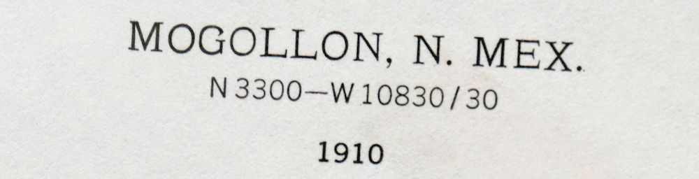 | |
|---|---|
| TITLE | Mogollon |
| STATE | New Mexico |
| LOCATION | 45 miles northwest of Silver City |
| SERIES | 30-minute |
| SURVEYED | 1909 and 1910 Field Survey |
| GEOGRAPHER | R.B. Marshall |
| EDITION | 1910 |
| PRINTED | 1964 |
| SCALE | 1:125000 |
| CONTOUR INTERVAL | 100 feet |
| SHEET DIMENSIONS | 17 x 21 inches |
| MAP DIMENSIONS | 14 5/8 x 17 1/2 inches |
| COVERAGE AREA | 29 x 35 miles |
| SOURCE | From the vintage map collection of Art Christiansen, Tempe, Arizona |
| MAP NOTES | An interesting historical record covering the rugged western escarpment of the Mogollon Mountains and the San Francisco River Valley, surveyed before the modern highway alignment, depicting the mining town of Mogollon when it had a population of 2,000. |
| SHEET CONDITION For maps of this vintage, effort is made to note all visible flaws, no matter how minor. | |
| OVERALL CONDITION | Excellent |
| SHEET NOTES | very lightly handled, never folded, smooth and flat |
| MAP AREA | flawless map area |
| COLLARS | no wear or tears, no markings |
| MAP COVERAGE Quadrangle extent overlaid on current basemap. | |
| PLACENAMES Depending on map series and survey date, all of the features listed below may not be shown on this map. This list contains features that currently exist or historically existed within the area covered by the map. The list can be used as a reference to determine if this map covers your area of interest. Placenames are listed alphabetically next to each feature type. | |
| CITIES AND TOWNS (CURRENT) | Buckhorn, Glenwood, Mule Creek, and Pleasanton |
| COUNTIES COVERED | Catron and Grant |
| FEDERAL LAND UNITS | Apache National Forest, Blue Range Wilderness, Gila National Forest, and Gila Wilderness |
| RIVERS AND STREAMS | Antelope Creek, Bear Creek, Bearwallow Creek, Big Dry Creek, Buckhorn Creek, Camp Creek, Clayton Creek, Copper Creek, Cub Creek, Deep Creek, Devils Creek, Duck Creek, East Fork Whitewater Creek, Fivemile Creek, Gila River, Gilita Creek, Indian Creek, Iron Creek, Little Deep Creek, Little Turkey Creek, Little Whitewater Creek, Mineral Creek, Mogollon Creek, Mule Creek, North Fork Devils Creek, North Fork Dry Creek, Pine Cienega Creek, Pine Creek, Pueblo Creek, Quaking Aspen Creek, Rain Creek, Rawmeat Creek, Sacaton Creek, San Francisco River, Sandy Wash, Sawmill Creek, Silver Creek, South Fork Mineral Creek, South Fork Mogollow Creek, South Fork Negrito Creek, South Fork Whitewater Creek, Spider Creek, Spruce Creek, Tennessee Creek, Turkey Creek, West Fork Gila River, West Fork Mogollon Creek, White Creek, Whitewater Creek, and Willow Creek |
| WATER BODIES | Adam Hoague Lake, George Clark Tank, Horse Lake, and Roberts Park Tank |
| Locations: Apache Cabin, B McKeen Ranch, Bearwallow Lookout, Ben Lilly Campground, Buckhorn Weather Station, Burns Well, Bursum Recreation Site, Deep Creek Ranch, E Spurgeon Ranch, Glenwood Ranger Station, Glenwood Weather Station, Golden Link Cabin, Grove Ranch, H Bar Y Ranch, Harkey Ranch, Henry Ranch, Hogan Cabin, Hollimon Cabin, Hollimon Well, Holt Guard Station, Hudsons Cow Camp, Indian Hill Well, John Windmill, Johnson Cabin, L H Ranch, Larremore Ranch, Mogollon Baldy Lookout, Mogollon Historic District, Mogollon Village Historic Site, Mogollon Weather Station, Moon Ranch, Morgan Windmill, N Bar Ranch, New Mexico State Fish Hatchery, Nine Hundred Sixteen Ranch, Oaks Ranch, Old Jackson Ranch, Pueblo Corral, Rice Ranch, Roberts Park Corral, SI Ranch, Seventy Four Ranch, Sheldon Canon Windmill, Snowlake Recreation Site, Spruce Creek Cabin, Stevenson, Taylor Ranch, Trailer Cabin, Twin Sister Corral, W Spurgeon Ranch, W-S Ranch, West Fork Corral, Whitewater Campground, Whitewater Canyon Pipeline Historic Site, Wilkinson Ranch, Willow Creek Campground, Willow Creek Guard Station, Willow Creek Lodge, Y Six Ranch, and Zumwalt Ranch. Areas: Potholes Country. Mountain Ranges: Sierra Aguilada, Mogollon Mountains, and Mule Mountains. Mountains, Peaks, and Summits: Angel Roost, Angels Roost, Bear Mountain, Bearwallow Mountain, Black Mountain, Brushy Mountain, Buck Mountain, Cardinal Gap, Center Baldy, Cooney Peak, Corner Mountain, Cradle Mesa, Cub Mesa, Cub Mountain, Fannie Hill, Gold Hill, Grouse Mountain, Hanna Mountain, Haystack Mountain, Holt Mountain, Indian Hill, Indian Peak, Iron Creek Mesa, Kings Crown, Little Round Mountain, Lone Pine Hill, Lookout Mountain, Lost Lake Mountain, Mogollon Baldy Peak, Nabours Mountain, Negrito Mountain, Negro Hill, Outlaw Mountain, Park Mountain, Queens Crown, Racetrack Mesa, Round Mountain, Sacaton Mountain, Seventyfour Mountain, Shelley Peak, Sheridan Mountain, Silver Peak, Snow Peak, Soldier Hill, Spring Mountain, Spurgeon Mesa, Stout Mesa, Sundial Mountain, Sunflower Mesa, Table Top, Turkeyfeather Mountain, Watson Mountain, West Baldy, Whitewater Baldy, Wilson Mountain, and Windy Point. Valleys and Canyons: Ant Spring Canyon, BS Canyon, Bathtub Canyon, Bear Canyon, Bear Valley, Beaver Canyon, Big Pat Canyon, Big Pine Canyon, Blue Bird Gulch, Boiling Canyon, Booger Canyon, Box Canyon, The Box, Brown Canyon, Brushy Canyon, Buchanan Canyon, Buckhorn Draw, Burnt Stump Canyon, Buzzard Canyon, Cactus Flat Draw, Canteen Canyon, Cave Canyon, Cherry Canyon, Coffee Gulch, Cooney Canyon, Cooper Canyon, Corral Canyon, Cottonwood Canyon, Davis Canyon, Deadman Canyon, Deadwood Gulch, Deepfreeze Canyon, Deer Park Canyon, Deloche Canyon, Dog Canyon, Dog Gulch, Doyle Canyon, Eliot Canyon, Fall Canyon, Foster Canyon, Garolen Gulch, Goat Basin Canyon, Goat Canyon, Goat Corral Canyon, Gobbler Canyon, Goddard Canyon, Gold Dust Gulch, Gooseberry Canyon, Graveyard Gulch, Guerrero Canyon, Harvey Gulch, Hells Hole, Henderson Canyon, High Lonesome Canyon, Hog Camp Canyon, Holt Gulch, Houston Canyon, Indian Canyon, Johnson Gulch, Judy Canyon, Keller Canyon, Lipsey Canyon, Little Pat Canyon, Little Pine Canyon, Log Canyon, Long Canyon, Lookout Canyon, Lost Grave Canyon, Lost Lake Canyon, Maldonado Canyon, Miller Canyon, Mineral Spring Canyon, Minton Canyon, Mogollon Canyon, Mud Spring Canyon, North Sawmill Canyon, Packsaddle Canyon, Pothole Canyon, Racetrack Canyon, Rainstorm Canyon, Red Canyon, Red Colt Canyon, Red Hair Canyon, Ringtail Canyon, Rough Canyon, Savage Canyon, Shelton Canyon, Sheridan Canyon, Sheridan Gulch, Sipes Canyon, Smith Canyon, Snare Canyon, South Dugway Canyon, Spar Canyon, Sprague Canyon, Spring Canyon, Squirrel Canyon, Tepee Canyon, Trail Canyon, Troffer Canyon, Turnbo Canyon, Vigil Canyon, Walnut Canyon, Water Canyon, White Rock Canyon, Whiteside Canyon, Whitetail Canyon, Winn Canyon, and Woodrow Canyon. Parks: Bearwallow Park, Hell Hole Wilderness Study Area, Leopold Vista, Lower San Francisco Wilderness Study Area, Mogollon Historical Marker, N Bar Park, and The Catwalk Historical Marker. Trails: BS Canyon Trail, Clayton Mesa Trail, Corner Mountain Trail, Crest Trail, Deloche Trail, East Fork Trail, Golden Link Trail, Hanging Rock Trail, Hogan Cabin Trail, Holt Apache Trail, Holt Mountain Trail, Little Whitewater Trail, Log Canyon Trail, Lookout Canyon Trail, McKenzie Trail, Middle Fork Trail, Mineral Creek Trail, Mogollon Creek Trail, North Fork Trail, Powerplant Road, Rain Creek Divide Trail, Red Canyon Trail, Sacaton Mountain Trail, Silver Drip Trail, Skeleton Ridge Trail, South Fork Trail, Straight Up Trail, Stub Trail, West Fork Trail, Whitewater Baldy Trail, and Whitewater Trail. Drainages: Bear Creek, Bearwallow Creek, Big Dry Creek, Buckhorn Creek, Camp Creek, Copper Creek, Cub Creek, Deep Creek, Devils Creek, East Fork Whitewater Creek, Fivemile Creek, Indian Creek, Little Deep Creek, Little Dry Creek, Little Turkey Creek, Little Whitewater Creek, Mineral Creek, Mogollon Creek, Mule Creek, North Fork Devils Creek, North Fork Dry Creek, North Fork Mineral Creek, Pine Cienega Creek, Pine Creek, Pueblo Creek, Rain Creek, Sacaton Creek, Sandy Wash, Sawmill Creek, Silver Creek, South Fork Mineral Creek, South Fork Mogollow Creek, South Fork Silver Creek, South Fork Whitewater Creek, Spider Creek, Spruce Creek, Tennessee Creek, Turkey Creek, Turkeyfeather Creek, West Fork Mogollon Creek, Whitewater Creek, and Willow Creek. Capes: Sandy Point. Mines: Alberta Group, Alberta Mine, Alexander Mine, Anna E. Group, Apache Group, Bearup Mine, Bismark Lode, Blackbird Lode, Blair Lode, Blue Bird Lode, Blue Rock Prospect, Braton Lode, Buffalo and Mountain View Prospect, Cedar Hill Prospect, Clifton Prospect, Comet Tunnel, Confidence Mine, Cooney Mine, Copper Glance Shaft, Cross Lode, Czar Mine, Dalton Lode, Deadwood Mine, Deep Down Mine, Deer Park Canyon Prospects, Deer Trail Tunnel, Deloche Trail Prospects, Duck 1-6, Dutch Boy Lode, Eberle Mine, Emperial Lode, Enterprise Mine, Eureka Mine, Fairview Mine and Vicinity, Fannie Mine, Floride Prospect, Free Milling Lode, Goat Corral Canyon Prospect, Goddard Canyon Prospects, Gold Bar, Gold Dust Group, Gold Dust Mine, Golden Bar Lode B, Golden Eagle Mine, Good Hope Lode, Goodhope Adit, Graveyard Gulch Mine, Great Western Mine, Hardscrabble Prospects, Haystack Mountain Area Working, Hightower Prospect, Holt Canyon Prospects, Holt Tunnel, Horace Lode, Huckleberry Spar Mine, Humming Bird Lode, Hustler Group, Ida Bell and Bessie Number One Prospect, Independence Mine, Iron Bar Prospect, Iron Clad Claims, Iron Group Mine, Jackpot Lode, John Brothers Mine, Johnson Group, Johnson Mine, Kirkpatrick Prospect, Kordic Claim, Last Attemp Lode, Last Chance Mine, Lauderbaugh Prospect, Leap Year Lode, Liberty Bell Number One Claim, Little Charlie Group, Little Charlie Mine, Little Fannie Mine, Little Spar Prospects, Lone Pine Mine, Lone Star Group Mine, Lone Star Lode, Lone Star Number Seven Prospect, Lower Little Dry Creek Working, Lucky Cuss Deposit, Mascot Lode, Maud S Mine, Maverick Prospect, Moose Group Mine, Morning Star Prospects, Mountain View Claim, New Eureka Adit, North Alpine Lode, Oaks Tunnel, Old Strike Lode, Old Tom Lode, Old Uncle John Mine, Pacific Mine, Phyllis, Pilgrim Camp Prospects, Point of Rock Prospect, Junior Prospect Hightower, Quartz Number One Prospect, Quartz Number Prospect, Queen Mine, Rainbow Prospect, Rainstorm Gulch Working, Red Bird Lode, Red Colt Canyon Prospects, Red Shaft, Red Shaft Propsect, Regal Adit, Reward Prospect, Royal Gorge Claim, Sacaton Mine, Seminole Group, Seventy Four Mountain Prospect, Shelton Canyon Prospects, Silver Bar Lode Number 2 Group, Silver Fountain Lode, Slayback Deposit, Socorro Group, South Alpine Mine, Spruce Creek Workings, The Kay L-1, The Lime Kiln Mine, Thunderhead Workings, Thurman Lode, Tip Top Lode, Top Lode, Trilby Mine, Uncle John Mine, Upper Big Dry Creek Prospects, Upper Little Dry Creek Working, Valentine Lode, Victoria Mine, Virginina Lode, Waldorf Lode, Western Big Dry Creek Property, Whitewater Campground Area Prospect, Whitney Lode, Wilcox Claims, Wilcox Peak Prospects, Wilcox Prospects, and Yellow Peril Adit. Churches: Glenwood Community Presbyterian Church, Hurley Community Congregational Church, and Santo Nino Catholic Church. Lakes and Ponds: Adam Hoague Lake, Horse Lake, Iron Creek Lake, Little Turkey Lake, and N Bar Lake. Buildings: Glenwood Community Center Library and Mogollon Theater Historic Site. Levees: The Dike. Dams: Clark Canyon Dam, Upper Gila Site Number 10 Dam, Upper Gila Site Number 11 Dam, Upper Gila Site Number Eight Dam, Upper Gila Site Number Nine Dam, Upper Gila Site Number Seven Dam, and Upper Gila Site Number Six Dam. Bluffs: Windy Point. Gaps: Camp Creek Saddle, Hummingbird Saddle, Silver Creek Divide, Simmons Saddle, Sled Saddle, Spider Saddle, Spruce Creek Saddle, Turkeyfeather Pass, West Fork Saddle, and Windy Gap. Basins: Barlow Basin, Buds Hole, Carcass Basin, and Goat Basin. Natural Arches: Needles Eye. Airports: Glenwood Airport, Glenwood Landing Strip, Sacaton Landing Strip, and Whitewater Mesa Ranch Airport. Schools: Glenwood Elementary School. Ridges: Come-alive Ridge, Gilita Ridge, and Skeleton Ridge. Reservoirs and Tanks: Airport Tank, Alexander Tank, Allotment Tank, Alma Flat Tank, Alma Tank, Alma Water Storage Tank, Ant Tank, Back of Pasture Tank, Balke Tank, Ball Park Tank, Barlow Basin Tank, Basin Tank, Basin Trail Tank, Big Pasture Tank, Big Pasture Tanks, Big Pine Tank, Bighorn Tank, Bill Lewis Tank, Bill Tank, Bills Hole Tank, Black Tail Tank, Blacktail Tanks, Bobcat Tank, Boiling Tank, Boundary Tank, Box Tank, Bradberry Tank, Brandy Tree Tank, Brushy Mountain Tank, Brushy Mountain Tank Number Two, Brushy Tank, Buck Tank, Buckhorn Tank, Bull Grass Tank, Bull Pasture Tank, Bull Run Tank, Burnt Cabin Tank, CCC Tank, Cactus Flat Tanks, Canyon Tank, Carcass Basin Number One, Carcass Basin Number Three, Cat Claw Tank, Cattle Guard Tank, Cave Tank, Cedar Tank, Chapel Tanks, Chub Tank, Cienega Tank, Clay Bank Tank, Condon Tank, Copper Creek Water Storage Tank, Copper Tank, Cottonwood Tank, Coyote Ridge Tank, Cub Tank, Dark Canyon Tank, Dead Steer Tank, Deadman Tank, Deep Tank, Ditch Tank, Doe Tank, Dozer Tank, Drift Fence Tank, East Stout Mesa Tank, East Tank, East Walnut Tank, Elk Tank, Ellis Tank, Eric Tank, Ewe Canyon Tank, Fawn Tank, Fence Tank, George Clark Tank, Gilita Ridge Tank, Gilita Tank, Goat Basin Tank, Goat Pen Tank, Goat Water Tank, Gold Dust Tank, Goodard Tank, Graham Tank, Hanging Rocks Tank, Hardluck Tank, Harve Gutch Windmill, Haynie Tank, Heifers Delight Tank, Hells Here Tank, Hick Water Storage Tank, Hicks Tank, Highway Tank, Hill Tank, Hines Tank, Hogwallow Pit Tank, Hollimon Tank, Horse Lake Tank, Horse Shoe Tank, Horseshoe Tank, Houston Gulch Tank, Hunter Water Tank, Hunters Tank, Indian Hill Tank, Indian Tank, J Lazy H Tank, Jeep Tank, Jerry Tank, Jim Tank, Joe Day Tank, Joe Tank, John Tank, Jones Draw Tank, Jug Tank, June Tank, Juniper Flat Tanks, Juniper Tank, Laney Tank, Leaky Tank, Lightning Mesa Tank, Little Field Tank, Little Pine Tank, Little Round Mountain Tank, Lollipop Tank, Long Canyon Tank, Long Canyon Water Storage Tank, Lost Lake Tank, Lost Tank, Lower Bull Run Tank, Lower Goat Canyon Tank, Lower Pasture Tank, Lower Tank, Lucky Saddle Tank, Lucky Tank, M T Tank, Mallet Pond, May Tank, McDonald Tank, Mesa Tank, Middle Tank, Morgan Tank, Mount Owens Tank, Mud Tank, Muddy Tank, Nedra Tank, Negrito Pasture Tank, Negro Saddle Tank, New Road Tank, New Tank, Norris Tank, Northwest Tank, Old Road Tank, Old Tank, One Horn Tank, PDQ Tank, Pan Tank, Park Tank, Pasture Tank, Pasture Trap Chute, Petmaker Tank, Pine Tank, Pipe Tank, Pipeline Tank, Polecat Tank, Porcupine Tanks, Pothole Tank, Powerline Tank, Racetrack Tank, Ranch Tank, Rattlesnake Tank, Red Tank, River Tank, Roadside Tank, Roberto Tank, Roberts Park Tank, Rock Tank, Rocker Tank, Rocky Point Tank, Rocky Tank, Rough Tank, Round Mountain Tank, SI Tank, Sacaton South Tank, Saddle Tank, Sandrock Tank, Scorpion Tank, Section 10 Tank, Section Five Tank, Section Thirty-six Tank, Section Three Tank, Section Twenty Tank, Section Two Tank, Seventyfour Mountain Tank, Sheridan Tank, Silt Tank, Silted Up Tank, Silver Peak Tank, Single Tree Tank, Smith Mountain Tank, Snow Tank, South Fork Tank, Sparaque Tank, Spring Tank, Steer Pasture Tank, Stout Mesa Tank, Sun Tank, Sunflower Tank, Sunshine Tank, Teacher Tank, Thompson Tank, Trail Tank, Turkey Basin Tank, Turkey Tank, Twin Sister Tank Number One, Twin Sister Tank Number Two, Twomile Tanks, Upper Barlow Tank, Upper Drift Fence Tank, Upper Goat Canyon Tank, Upper Park Tank, Water Development Tank, West Ant Tank, West Masonary Tank, West Side Tank, West Tank, Wetbank Tank, White Water Mesa Tank, Wilkinson Tank, Wylie Morgan Tank, and York Tank. Flats: Antelope Flat, Bill Lewis Cienega, Cactus Flat, California Park, Halfmoon Park, Hicks Pasture, Hudson Holding Pasture, Jackass Park, Juniper Flat, North Alkali Flat, Redstone Park, River Pasture, Roberts Park, Snow Park, Tennessee Meadow, Turkey Cienega, and Weedy Flat. Towers: Negrito Mountain Lookout. Wells: 10000 Water Well, 10008 Water Well, Black Steer Arroyo Well, Buckhorn Store Water Well, Cedar Breaks Well, Copper Creek Well, D-K Well, Devils Creek Well, Estes Well, HDQ Water Well, Miner Well, Mineral Creek Well, Morgan Well, Mule Creek Well, Red Colt Canyon Well, Ridge Well, Sawmill Well, and Schoolhouse Canyon Well. Springs: Alum Spring, Ant Spring, Apache Spring, Bead Spring, Bear Canyon Spring, Bearup Spring, Beaver Spring, Big Dry Box Spring, Black Mountain Spring, Black Tail Spring, Blue Jay Spring, Branding Tree Spring, Burns Spring, Burnt Cabin Cienega Spring, Cat Spring, Cave Spring, Cherry Spring, Chipmunk Spring, Clay Spring, Cold Spring, Dead Man Spring, Deer Park Spring, Dog Spring, Dripping Gold Spring, Dripping Spring, Fanny Spring, Frisco Hot Springs, Goat Spring, Gorilla Spring, Heil Spring, Hobo Spring, Hogan Spring, Holt Spring, Hummingbird Spring, Juniper Spring, Little Dry Spring, Little Hobo Spring, Lone Pine Spring, Long Canyon Spring, Lower Ant Spring, Lower Seridan Spring, Lucky Tank, Midnight Spring, Mud Spring, Mule Spring, Nabours Spring, Pasture Spring, Pine Spring, Rock Spring, San Francisco Hot Springs, Sheep Spring, Sipes Spring, Slaughterhouse Spring, Table Top Spring, Turkey Spring, Turkeyfeather Spring, Upper Sipes Spring, Vigil Spring, Walnut Spring, Water Canyon Spring, White Rocks Spring, and Whitetail Spring. | |
| SHIPPING AND RETURNS | |
 This map sheet will be carefully rolled in a sturdy tube and shipped via the US Postal Service. If you find that the sheet you receive is not as described in the listing, you may ship it back to us for a refund of the purchase price. | |



Mogollon New Mexico Pleasanton Mule Creek USGS Topo Map 1964
$54
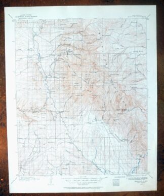
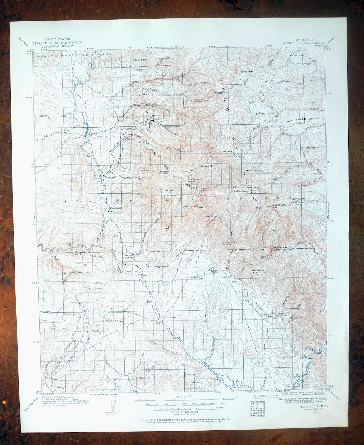
This is a 1910 edition of the Mogollon quad, printed in 1964, and the sheet is in excellent condition – very lightly handled, never folded, smooth and flat, with a flawless map area. Covering a 29-by-35-mile stretch of southwestern New Mexico about 45 miles northwest of Silver City, the quad takes in the rugged western escarpment of the Mogollon Mountains and the San Francisco River Valley, along with the communities of Glenwood, Pleasanton, Buckhorn, and Mule Creek and portions of the Gila and Apache National Forests and the Gila and Blue Range Wilderness areas. Based on a 1909 and 1910 field survey, it records the mining town of Mogollon when its population reached 2,000, before the modern highway alignment was built. From the vintage map collection of Art Christiansen, Tempe, Arizona.
In stock
This vintage sheet is a 1910 edition of the Mogollon New Mexico USGS topographic map. It is an original 62-year-old 1964 United States Geological Survey print in excellent condition.
HOW THIS MAP CAN BE USED
In addition to making a fascinating conversation piece, this sheet would look great in a frame or on display, make a unique and prized gift for anyone interested in this area, be perfect as a reference for genealogy studies or general historical research, or fill that missing piece in your collection. Maps of this vintage are printed on durable stock and are well-suited for outdoor activities and recreation of all kinds, including hiking, backpacking, hunting, rafting and kayaking, backcountry skiing, geocaching, general exploration, treasure hunting, etc.
FEATURES SHOWN ON THE MAP
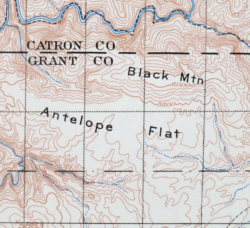
The Mogollon 30-minute map shows cities and towns, roads, railroads, utilities and energy infrastructure, rivers, creeks, elevation contour lines, public land survey lines, county, state, and other administrative boundaries as they existed at the time of the survey in 1909 and 1910.
A VALUABLE HISTORICAL RECORD
Maps from the USGS 30-minute series have been out of print for many years. They have never been common and original prints are increasingly difficult to find. For areas where the 30-minute map was produced, it is usually the first large-scale survey done by the USGS for that area. These are a valuable historical record, as they contain many placenames and features that have been dropped from more recent series’ and editions.
Nearby maps
-

Morenci Arizona Clifton Blue River USGS 30-Min Topo Map 1954
$64 Add to cart -

San Simon Arizona Bowie USGS 30-Min Topo Map 1948 Vintage
$55 Add to cart -
Pearce Arizona McNeal Gleeson USGS Topo Map 1948 Vintage
$55 Add to cart -
Blue Arizona Apache NF USGS 15-Min Topo Map 1963 Vintage
$52 Add to cart -
Hannagan Meadow Arizona Apache NF USGS Topo Map 1960 Vintage
$38 Add to cart -

Safford Arizona Thatcher Solomon USGS Topo Map 1980 Vintage
$44 Add to cart -
Bowie Arizona USGS 15-Min Topographic Map 1950 Vintage
$36 Add to cart -
Cochise Head Arizona USGS 15-Min Topo Map 1957 Vintage
$44 Add to cart -
Portal Arizona Rodeo USGS 15-Min Topo Map 1963 Vintage
$54 Add to cart -

Klondyke Arizona USGS 15-Min Topographic Map 1971 Vintage
$44 Add to cart -
Show Low Arizona Pinetop-Lakeside USGS Topo Map 1972 Vintage
$40 Add to cart -

Winchester Mountains Arizona The Mesas USGS Topo Map 1962
$35 Add to cart -
Cochise Arizona Willcox USGS 15-Min Topo Map 1963 Vintage
$43 Add to cart -
Chiricahua Peak Arizona Coronado NF USGS Topo Map 1962
$38 Add to cart -
Hunt Arizona USGS 15-Min Topographic Map 1974 Vintage
$30 Add to cart -
Hermanas New Mexico USGS 15-Min Topographic Map 1943 Vintage
$38 Add to cart -
Christmas Arizona USGS 15-Min Topographic Map 1917 Antique
$57 Add to cart -
Cibecue Arizona Sitgreaves NF USGS Topo Map 1963 Vintage
$32 Add to cart -
Animas Peak New Mexico Coronado NF USGS 15-Min Topo Map 1932
$38 Add to cart -
Globe Arizona Miami Claypool USGS Topo Map 1982 Vintage
$28 Add to cart -
Clay Springs Arizona Pinedale Aripine USGS Topo Map 1971
$34 Add to cart -
Aden New Mexico USGS 15-Min Topographic Map 1943 Vintage
$30 Add to cart -
Globe Arizona Miami Claypool USGS Topo Map 1955 Vintage
$54 Add to cart -
Chediski Peak Arizona Cibecue USGS Topo Map 1963 Vintage
$32 Add to cart