MAP DETAILS | |
|---|---|
| TITLE | Congress |
| STATE | Arizona |
| LOCATION | 70 miles northwest of Phoenix |
| SERIES | 30-minute |
| SURVEYED | 1902 and 1903 Field Survey |
| GEOGRAPHER | E.M. Douglas |
| EDITION | 1904 |
| PRINTED | 1948 |
| PRINT NOTES | Thick paper stock |
| SCALE | 1:125000 |
| CONTOUR INTERVAL | 100 feet |
| SHEET DIMENSIONS | 17 x 21 inches |
| MAP DIMENSIONS | 14 1/2 x 17 1/2 inches |
| COVERAGE AREA | 29 x 35 miles |
| MAP NOTES | Fascinating historical snapshot of the region from the Hassayampa northward to Skull Valley, including the Date Creek and Weaver Mountains, surveyed before the modern highway system was constructed, shows historical travel routes, rail lines, mining featu |
| SHEET CONDITION For maps of this vintage, effort is made to note all visible flaws, no matter how minor. | |
| OVERALL CONDITION | Very Good |
| SHEET NOTES | never folded |
| MAP AREA | no wear, no markings, no blemishes |
| COLLARS | very minor markings, no blemishes, moderate handling in bottom collar |
| MAP COVERAGE Quadrangle extent overlaid on current basemap. | |
| BACKSIDE LEGEND | |
 A map summary is printed on the back side of the Congress sheet similar to the one shown in the picture. It outlines the history, purpose, and status of the USGS mapping program at the time of the printing in 1948. It also provides instructions on how to read contour lines and a description of how they are used to depict the terrain. At the bottom of the page is a legend showing all of the symbols used to represent the cultural, relief, and water features found on the map. | |
| PLACENAMES Depending on map series and survey date, all of the features listed below may not be shown on this map. This list contains features that currently exist or historically existed within the area covered by the map. The list can be used as a reference to determine if this map covers your area of interest. Placenames are listed alphabetically next to each feature type. | |
| CITIES AND TOWNS (CURRENT) | Congress, Flores, Hillside, Kirkland, Kirkland Junction, Peeples Valley, Wagoner, Wilhoit, and Yarnell |
| COUNTIES COVERED | Maricopa and Yavapai |
| FEDERAL LAND UNITS | Hassayampa River Canyon Wilderness and Prescott National Forest |
| RIVERS AND STREAMS | Alkali Wash, Ally Wash, Antelope Creek, Arrastre Creek, Ash Creek, Aspen Creek, Blackwater Creek, Bland Creek, Blind Indian Creek, Blue Tank Wash, Board Creek, Buckhorn Creek, Buzzard Roost Creek, Buzzard Roost Wash, Calamity Wash, Castle Creek, Cellar Springs Creek, Cherry Creek, Copper Basin Wash, Copper Creek, Cottonwood Creek, Date Creek, Dead Mexican Creek, East Antelope Creek, East Fork Castle Creek, Eastwood Creek, Eddie Wash, Finch Wash, Granite Creek, Hassayampa River, Indian Creek, Kirkland Creek, Lawler Creek, Little Buckhorn Creek, Little Copper Creek, Mahoney Wash, Martin Creek, Martinez Creek, Martinez Wash, Mescal Creek, Middlewater Creek, Milk Creek, Miller Creek, Minnehaha Creek, Model Creek, Moonville Creek, North Fork Date Creek, Oak Creek, Orofino Wash, Park Creek, Poplar Wash, Quail Spring Wash, San Domingo Wash, Sheppard Wash, Skull Valley Wash, Slim Jim Creek, Sols Wash, South Fork Santa Maria River, South Fork Spring Creek, Spring Creek, Tank Wash, Waterman Creek, Weaver Creek, Whipsaw Creek, Woolsey Wash, and Yarnell Creek |
| WATER BODIES | Billingsley Reservoir Number Two, Gibson Tank, and Sullivan Tank |
| Locations: Arizona Highway Maintenance Peeples Valley Yard, Big Windmill, Box Canyon Windmill, Bricks Windmill, Camp Date Creek, Carter Ranch, Carter Windmill, Copper Camp, Copper Creek Windmill, Diamond Two Ranch, Divide, East Side Windmill, East Windmill, Finch Windmill, Forest Windmill, Hackberry Windmill, Hassayampa Windmill, Hays Ranch, Highway Windmill, Hodgkins Windmill, Homestead Windmill, Indian Camp Windmill, Indian Creek Campground, Jeffs Windmill, Kennedy Windmill, Kirkland Junction Substation, Lower French Gulch Windmill, Malipai Windmill, McCrea Windmill, Meadow Windmill, Middle Windmill, Middlewater Windmill, Millers Windmill, Minoto Ranch, Monte Cristo Substation, New Windmill, Orofino Windmill, Parker Mesa Windmill, Placerita, River Pasture, Road Camp Windmill, Roberts Camp, Section Fifteen Windmill, Sheppard Windmill, Sourgrass Flat Windmill, T K Bar Ranch, Telegraph Spring Windmill, Texas Windmill, Upper French Gulch Windmill, White Spar Windmill, Whitehead Ranch, and Young Windmill. Mountain Ranges: Date Creek Mountains, Kendrick Mountains, Weaver Mountains, and Wickenburg Mountains. Mountains, Peaks, and Summits: Antelope Peak, Bismarck Mesa, Bismark Mountain, Black Hill, Blowout Mountain, Black Hills, Black Mountain, Black Rock, Denver Hill, Fire Clay Hill, Mount Francis, Gabarina Hill, Genung Mountain, Grooms Hill, Hillside Peak, Kingsbury Mountain, Kirkland Peak, Lion Peak, McCloud Mountains, Morgan Butte, Parker Mesa, Quartz Mountain, Rich Hill, Ritter Peak, Rocky Boy Peak, Round Mountain, Sadies Peak, Sam Powell Peak, Seal Mountain, Squaw Peak, Sugarloaf Mountain, Swallow Mountain, Table Mountain, Tenderfoot Hill, Thompson Peak, Top of Pines, Wades Butte, Weaver Mountain, Weaver Peak, and Wild Horse Mesa. Valleys and Canyons: Amazon Gulch, Bells Canyon, Black Canyon, Box Canyon, Buckskin Canyon, Cottonwood Canyon, Crown Point Gulch, Dipper Canyon, Fools Canyon, Fools Gulch, French Gulch, Harper Canyon, Hawk Spring Gulch, Hodgkins Gulch, Jesus Canyon, King Solomon Gulch, Lion Canyon, Lower Kirkland Valley, Mocho Canyon, O'Brien Gulch, Peeples Valley, Placerita Gulch, Red Hills Canyon, Skull Valley, and Thompson Valley. Parks: Lounce Lookout, Saint Agatha Campground, and Tenderfoot Hill Park. Trails: Mount Francis Trail Forty Eight and Seal Mountain Trail. Drainages: Alkali Wash, Ally Wash, Antelope Creek, Arrastre Creek, Ash Creek, Blackwater Creek, Bland Creek, Blind Indian Creek, Board Creek, Buzzard Roost Wash, Cellar Springs Creek, Cherry Creek, Copper Basin Wash, Copper Creek, Cottonwood Creek, Dead Mexican Creek, East Antelope Creek, Eastwood Creek, Finch Wash, Hamlin Wash, Indian Creek, Lawler Creek, Little Copper Creek, Mahoney Wash, Martin Creek, Martinez Creek, Mescal Creek, Middlewater Creek, Milk Creek, Miller Creek, Minnehaha Creek, Model Creek, Moonville Creek, North Fork Date Creek, Oak Creek, Orofino Wash, Park Creek, Poplar Wash, Ritter Creek, Sheppard Wash, Skull Valley Wash, Slim Jim Creek, South Fork Date Creek, South Fork Spring Creek, Spring Creek, Weaver Creek, Wood Creek, and Yarnell Creek. Mines: Abe Lincoln Mine, Beehive Mine, Black Rock Mine, Blue Bucket Mine, Big Rebel Mine, Black Hills Mine, Buckhorn Mine, Camp B Mine, Climax Mine, Congress Mine, Continental Mine, Copper Crown Mine, Crown Point Mine, Cuba Mine, Devils Nest Mine, Gold Bar Mine, Johnson Mine, Keystone Mine, King Solomon Mine, Leviathan Mine, Mint Shaft, Mistake Mine, Monte Cristo Mine, Myers Mine, Octave Mine, Oro Grande Mine, Planet Saturn Mine, Rincon Mine, Senate Mine, Silver Crown Mine, Sinoski Mine, Swallow Mine, White Spar Mine, Yarnell Mine, and Zonia Mine. Buildings: Congress Railroad Station, Date Railroad Station, Flores Railroad Station, Grand View Railroad Station, Hawkins Railroad Station, Hillside Railroad Station, Industry Track Railroad Station and Siding, Kirkland Railroad Station, Piedmont Railroad Station, Skull Valley Railroad Station, and Yarnell Community Hall. Dams: Billingsley Number Four Dam, Billingsley Number Three Dam, Billingsley Number Two Dam, and Telephone Dam. Gaps: Merritt Pass and O'Neil Pass. Canals: McNary Siphon. Bends: Elephant Curve, The Hole, and View Points. Basins: Blowout, The Box, Burro Wallow, Copper Basin, and Wild Hog Basin. Airports: Cooper Ranch Airport and Moreton Airport. Schools: Congress School, Kirkland Elementary School, Peeples Valley School, Rincon School, Skull Valley Ranch School, Thompson Valley School, Walnut Grove School, and Yarnell Elementary School. Ridges: Mahoney Ridge. Reservoirs and Tanks: Barnett Tank, Billingsley Reservoir Number Four, Billingsley Reservoir Number Three, Billingsley Reservoir Number Two, Big Pemberton Tank, Big Tank, Black Hill Tank, Box Canyon Tank, Brahma Tank, Brick Tank, Burton Tank, Camel Tank, Carter Tank, Condon Tank, Dry Tank, Earis Tank, Elmer Tank, Fire Clay Tank, Fuel Tank, Gibson Tank, Grassy Tank, Hay Flat Tank, Henderson Tank, Hidden Tank, Holder Tank, Homestead Tank, Kay Tank, Knight Tank, Martinez Tank, Mesa Tank, Mesquite Tank, Mexican Joe Tank, Middle Tank, Mine Tank, Miners Tank, Nelson Tank, Number Thirtysix Tank, Orofino Tank, Phils Tank, Pitts Tank, Riggle Tank, Sawyer Tank, Shaw Tank, Sols Wash Tank, Spring Tank, Stockyard Tank, Sullivan Tank, Tin Can Tank, Wilhoit Tank, and Ziger Tank. Flats: Campbells Flat, Carter Flat, The Park, Sourgrass Flat, and Sunflower Flat. Towers: KTIM-FM (Wickenburg). Wells: Arrowhead Well, Boulder Well, Bucks Well, California Well, Carrol Well, Cecil Well, Charlie Well, Childers Well, Cort Well, Coyote Well, Deep Wells, Delia Well, Hog Ranch Well, Longort Well, Lower Ranch Well, Lowman Well, Newhall Well, Orofino Wash Well, Railroad Well, Sand Well, and Sweetwater Well. Pillars: The Needle. Springs: Amazon Spring, Antelope Spring, Ashe Springs, Bain Spring, Barrel Spring, Beech Spring, Bells Spring, Billingsley Spring, Blackjack Spring, Blackwater Spring, Board Creek Spring, Bootlegger Spring, Buckskin Spring, Buzzard Spring, Cameron Spring, Campbells Flat Spring, Canfield Spring, Carter Flat Spring, Chartz Spring, Collins Spring, Copper Basin Road Spring, Corner Spring, East Copper Spring, Genung Spring, Glen Oaks Spring, Goat Camp Spring, Government Spring, Head of Aspen Creek Spring, Hoover Dam Spring, Iron Spring, Jesus Spring, Juniper Spring, Kingsbury Spring, Laurel Spring, Lawler Spring, Lawrence Spring, Lee Spring, Lone Pine Spring, Longort Spring, Martin Spring, McAllister Spring, McCloud Spring, Mocho Spring, Moonshiner Spring, Moores Spring, Mud Spring, Pigeon Spring, Pole Spring, Quail Spring, Red Bank Spring, Round Mountain Spring, Sayer Spring, Seep Spring, Stove Spring, Stump Spring, Surveyor Spring, Telegraph Spring, Thousand Spring, Trap Corral Spring, Tunnel Spring, Upper Cook Spring, White Rock Water, Wild Horse Spring, Wilhoit Spring, Yarnell Spring, and Ziger Spring. | |
| SHIPPING AND RETURNS | |
 This map sheet will be carefully rolled in a sturdy tube and shipped via the US Postal Service. If you find that the sheet you receive is not as described in the listing, you may ship it back to us for a refund of the purchase price. | |
Congress Arizona Yarnell Wilhoit USGS Topo Map 1948 Vintage
$38
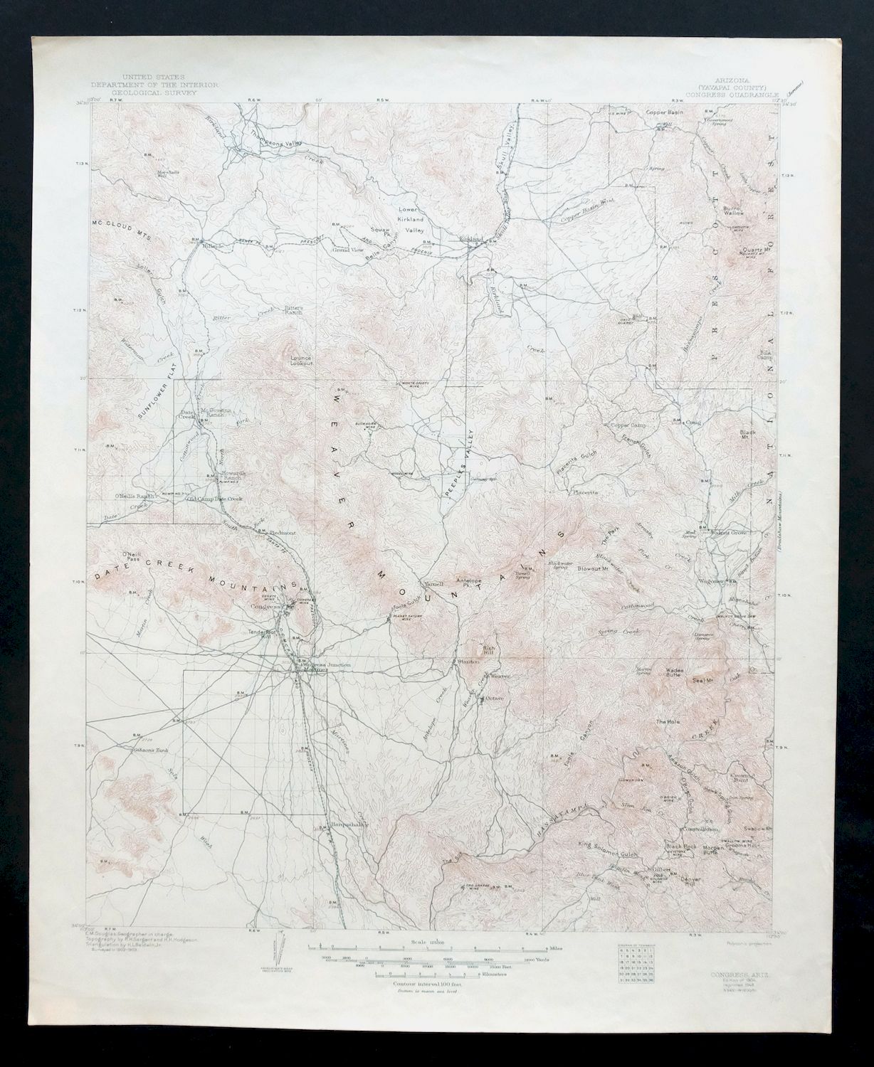
This USGS 30-minute topographic sheet is a 1904 edition printed in 1948, in very good condition on thick stock and never folded. Covering ground about 70 miles northwest of Phoenix, the quad takes in the towns of Congress, Yarnell, and Wilhoit, the communities of Peeples Valley, Kirkland, and Hillside, and part of Prescott National Forest along with the Hassayampa River Canyon Wilderness, spanning Maricopa and Yavapai counties. Based on a 1902-1903 field survey under geographer E.M. Douglas, it captures the region from the Hassayampa northward to Skull Valley across the Date Creek and Weaver Mountains, mapping the mining features, rail lines, and travel routes of the era before the modern highway system was built. The map area shows no wear or markings, with only minor markings and moderate handling noted in the bottom collar.
In stock
This vintage sheet is a 1904 edition of the Congress Arizona USGS topographic map. It is an original 78-year-old 1948 United States Geological Survey print in very good condition.
HOW THIS MAP CAN BE USED
In addition to making a fascinating conversation piece, this sheet would look great in a frame or on display, make a unique and prized gift for anyone interested in this area, be perfect as a reference for genealogy studies or general historical research, or fill that missing piece in your collection.
FEATURES SHOWN ON THE MAP
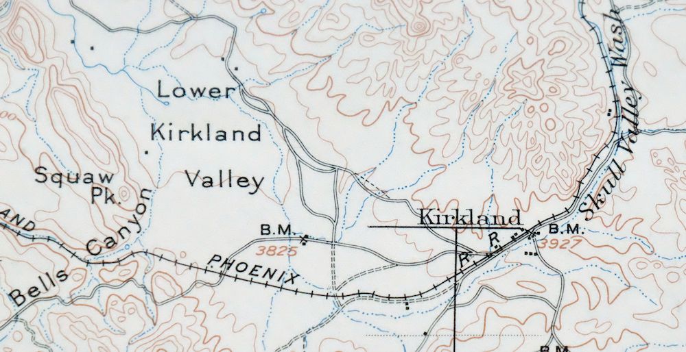
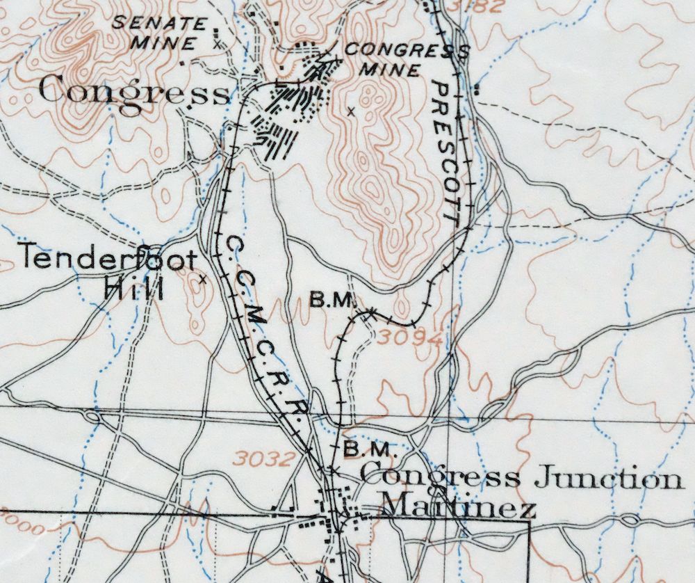
The Congress 30-minute map shows cities and towns, roads, railroads, rivers, creeks, elevation contour lines, public land survey lines, county, state, and other administrative boundaries as they existed at the time of the survey in 1902 and 1903.
A VALUABLE HISTORICAL RECORD
Maps from the USGS 30-minute series have been out of print for many years. They have never been common and original prints are increasingly difficult to find. For areas where the 30-minute map was produced, it is usually the first large-scale survey done by the USGS for that area. These are a valuable historical record, as they contain many placenames and features that have been dropped from more recent series’ and editions.
Nearby maps
-

Camp Verde Arizona Cottonwood Sedona USGS Topo Map 1965
$56 Add to cart -

Cave Creek Arizona Phoenix Mesa USGS Topo Map 1963 Vintage
$44 Add to cart -
Roosevelt Arizona Four Peaks Tonto Basin USGS Topo Map 1956
$52 Add to cart -

Florence Arizona Apache Junction Superior USGS Topo Map 1917
$70 Add to cart -
Crown King Arizona Prescott NF USGS Topo Map 1955 Vintage
$46 Add to cart -

Mount Union Arizona Prescott NF Mayer USGS Topo Map 1949
$34 Add to cart -
Mount Union Arizona Prescott NF Mayer USGS Topo Map 1964
$43 Add to cart -
Sheridan Mountain Arizona Sycamore Creek USGS Topo Map 1978
$35 Add to cart -

Prescott Arizona Chino Valley Williamson USGS Topo Map 1966
$52 Add to cart -

Gladden Arizona Aguila Valley USGS Topographic Map 1971
$30 Add to cart -
Camp Wood Arizona Prescott NF USGS Topographic Map 1949
$32 Add to cart -

Simmons Arizona Paulden Williamson USGS 15-Min Topo Map 1964
$42 Add to cart -
Mingus Mountain Arizona Cottonwood USGS Topographic Map 1970
$51 Add to cart -
Ives Peak Arizona USGS 15-Min Topographic Map 1967 Vintage
$34 Add to cart -

Clarkdale Arizona Cottonwood Jerome USGS Topo Map 1948
$44 Add to cart -
Glendale Arizona Phoenix Peoria USGS Topo Map 1975 Vintage
$37 Add to cart -
Buckeye Arizona Palo Verde USGS 15-Min Topo Map 1963 Vintage
$65 Add to cart -
Picacho Butte Arizona Chino Valley USGS 15-Min Topo Map 1950
$24 Add to cart -

Avondale Arizona Phoenix Goodyear USGS Topo Map 1965 Vintage
$55 Add to cart -
Ash Fork Arizona Kaibab NF Prescott NF USGS Topo Map 1978
$44 Add to cart -
Fowler Arizona Phoenix Tolleson USGS Topo Map 1957 Vintage
$41 Add to cart -
Castaneda Hills Arizona USGS 15-Min Topo Map 1967 Vintage
$30 Add to cart -
Hope Arizona Salome USGS 15-Min Topographic Map 1967 Vintage
$35 Add to cart -

Camelback Arizona Tonto NF Phoenix USGS 15-Min Topo Map 1948
$55 Add to cart
