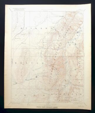
MAP DETAILS | |
|---|---|
| TITLE | Beaver |
| STATE | Utah |
| LOCATION | Vicinity of Richfield |
| SERIES | 60-minute |
| SURVEYED | 1876 through 1879 Field Survey |
| GEOGRAPHER | Powell and Wheeler Surveys |
| EDITION | 1885 |
| PRINTED | 1921 |
| PRINT NOTES | Thick paper stock |
| SCALE | 1:250000 |
| CONTOUR INTERVAL | 250 feet |
| SHEET DIMENSIONS | 16 1/2 x 20 inches |
| MAP DIMENSIONS | 13 3/4 x 17 1/2 inches |
| COVERAGE AREA | 54 x 69 miles |
| SOURCE | A sheet from a decommissioned Arizona university library collection |
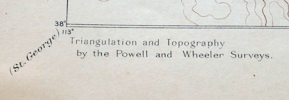
| MAP NOTES | This uncommon sheet was mapped during the historic Powell and Wheeler Surveys of the 1860s, 70s, and 80s. |
| SHEET CONDITION For maps of this vintage, effort is made to note all visible flaws, no matter how minor. | |
| OVERALL CONDITION | Excellent |
| SHEET NOTES | very lightly handled, never folded, evenly age-toned paper |
| MAP AREA | flawless map area |
| COLLARS | no markings, no blemishes, library stamp on lower collar, very minor edge tear repaired with transparent archival tape on backside of sheet |
| MAP COVERAGE Quadrangle extent overlaid on current basemap. | |
| BACKSIDE LEGEND | |
 A map summary is printed on the back side of the Beaver sheet similar to the one shown in the picture. It outlines the history, purpose, and status of the USGS mapping program at the time of the printing in 1921. It also provides instructions on how to read contour lines and a description of how they are used to depict the terrain. At the bottom of the page is a legend showing all of the symbols used to represent the cultural, relief, and water features found on the map. | |
| PLACENAMES Depending on map series and survey date, all of the features listed below may not be shown on this map. This list contains features that currently exist or historically existed within the area covered by the map. The list can be used as a reference to determine if this map covers your area of interest. Placenames are listed alphabetically next to each feature type. | |
| CITIES AND TOWNS (CURRENT) | Adamsville, Annabella, Antimony, Beaver, Black Rock, Circleville, Cove Fort, Elsinore, Fillmore, Flowell, Greenville, Hatton, Joseph, Junction, Kanosh, Kingston, Manderfield, Marysvale, Meadow, Milford, Minersville, Monroe, Richfield, Spry, and Sulphurdale |
| COUNTIES COVERED | Beaver, Garfield, Iron, Millard, Piute, and Sevier |
| FEDERAL LAND UNITS | Dixie National Forest, Fishlake National Forest, and Paiute Indian Reservation |
| RIVERS AND STREAMS | Beaver Creek, Beaver River, Big Slough, Big Twist Creek, Birch Creek, Birch Spring Creek, Blue Lake Creek, Bosman Creek, Box Creek, Brady Creek, Briggs Camp Creek, Briggs Creek, Bull Rush Creek, Bullberry Creek, Bullberry Slough, Cascade Creek, Central Utah Canal, Cherry Creek, Chokecherry Creek, City Creek, Clear Creek, Corn Creek, Cottonwood Creek, Cougar Creek, Cove Creek, Coyote Creek, Crazy Creek, Cullen Creek, Cummings Creek, Currant Creek, Deep Creek, Deer Creek, Devil Creek, Dog Valley Creek, Doxford Creek, Dry Creek, Duncan Creek, Durkee Creek, East Fork Sevier River, Ferguson Creek, First Creek, First Spring Creek, Fish Creek, Gold Creek, Gooseberry Creek, Gorrilla Creek, Grassy Creek, Hoodle Creek, Huncup Creek, Indian Creek, Iron Creek, Jareds Fork, Jim Reed Creek, Joe Lott Creek, Left Fork Sam Stowe Creek, Lion Creek, Little North Creek, Little Pine Creek, Little Twist Creek, Lousy Jim Creek, Manhard Creek, Manning Creek, Meadow Creek, Merchant Creek, Middle Creek, Middle Fork Box Creek, Middle Fork Mill Creek, Mill Creek, Mountain Spring Fork, North Creek, North Fork Box Creek, North Fork Chalk Creek, North Fork Cottonwood Creek, North Fork Deep Creek, North Fork Meadow Creek, North Fork North Creek, North Fork South Creek, North Fork Three Creeks, Norton Creek, Otter Creek, Pharo Creek, Pine Creek, Pioneer Creek, Poison Creek, Pole Creek, Reservoir Creek, Rocky Ford Creek, Sam Stowe Creek, Second Creek, Second Lefthand Fork, Serviceberry Creek, Sevier River, Shelly Baldy Creek, Shingle Creek, Skunk Creek, South Creek, South Fork Beaver River, South Fork Birch Creek, South Fork Box Creek, South Fork Chalk Creek, South Fork City Creek, South Fork North Creek, South Fork Pine Creek, South Fork Three Creeks, Straight Creek, Sulphur Creek, Sweetwater Creek, Swift Spring Creek, Tenmile Creek, Third Lefthand Fork, Thompson Creek, Three Creeks, Three Forks, Threemile Creek, Trappers Creek, Twomile Creek, West Fork Joe Lott Creek, White Pine Creek, Wildcat Creek, Willow Spring Creek, and Wilson Creek |
| WATER BODIES | Annabella Reservoir, Barney Lake, Birch Lake, Danish Reservoir, Duck Lake, Hepplers Ponds, Hunts Lakes, Manning Meadows Reservoir, Minersville Reservoir, Otter Creek Reservoir, Piute Reservoir, Puffer Lake, Scrub Flat Reservoir, and Three Creeks Reservoir |
| Locations: Adelaide Campground, Anderson Campground, Balsam Picnic Area, Bay Cabin, Beaver Creek Recreation Site, Beaver Fish Hatchery, Beaver Municide Power Plant, Briggs Camp, Belknap Ranger Station, Big Flat Guard Station, Black Rock, Buckskin Charley Picnic Area, Butler Beck Cabin, Castle Rock Campground, Circleville District Ranger Station, City Creek Campground, Jones Corral Guard Station, KOA Campground, Kents Lake Campground, Copleys Cove Picnic Area, Coxs Ranch, Deer Creek Guard Station, Delano Ranger Station, Delano Trailer Park, Dry Creek Guard Station, Durkee Springs Recreation Site, Elbow Ranch, Elk Meadows Ski Area, Forshea Trough, Fullmers Cabins, Herbert Ranch, Indian Springs Guard Station, Jackson County Hill, Little Cottonwood Campground, Little Reservoir Campground, Lower Power Plant, Mahogany Cove Campground, Meadow Creek Campground, Minersville Campground, Monrovian Park Campground, Mount Holly Ski Area, Ogden Cabin, Otter Creek Campground, Pahvant Guard Station, Park Crest Village Center, Parker Ranch, Pavant Ranger Station, Pine Creek, Pistol Rock Picnic Area, Piute Campground, Ponderosa Park, Poverty Flat Ranch, Redview Forest Service Station, Redview Guard Station, Robbers Roost, Rock Corral, Rockwood Ranger Station, Ryan Ranch, Sams Cabin, Sevier County Fairground, Shingle Creek Ranger Station, Shingle Mill Picnic Area, Solitude Guard Station, The Gates, Wagons West RV Campground, and White Pine Cabins. Areas: Anderson Dairy, Browns Dairy, Jass Dairy, Deer Pasture, and Deer Study Plot. Mountain Ranges: Bald Knolls, Black Mountains, Gray Hills, Mineral Mountains, Pahvant Range, and Tushar Mountains. Reserves: Kanosh Indian Reservation. Mountains, Peaks, and Summits: Anderson Mountain, Antelope Mountain, Antelope Range, Bailey Mountain, Mount Baldy, Battle Mountain, Bean Hill, Bearskin Mountain, Beehive Peak, Big Rock Candy Mountain, Black Rock Volcano, Mount Belknap, Big Table, Birch Creek Mountain, Black Mountain, Black Point, Blue Ribbon Summit, Bradshaw Mountain, Mount Brigham, Bull Rush Peak, Bull Claim Hill, Burnt Peak, Mount Catherine, Cedar Knoll, Chipman Peak, Chokecherry Peak, Circleville Mountain, City Creek Peak, Johnson Peak, Joseph Peak, Copper Belt Peak, Crater Knoll, Deer Trail Mountain, Delano Peak, Devils Dutch Oven, Dog Valley Mountain, Dog Valley Peak, Dry Willow Peak, Mount Dutton, East Mountain, Edna Peak, Forshea Mountain, Fourmile Knoll, Gillies Hill, Glenwood Mountain, Gold Mountain, Granddad Peak, Granite Knolls, Granite Peak, Green Hill, Halfway Hill, Harkley Mountain, Hennessy Point, Hogback, Mount Holly, Hoover Peak, Horse Heaven, Horse Valley Peak, Indian Peak, Jack Henry Knoll, Jacks Peak, Lake Peak, Langdon, Langdon Mountain, Leavitts Peak, Lion Peak, Lion Rock, Little Bald Hill, Little Bearskin Mountain, Little Dog Valley Peak, Little Shelly, Little Table, Mahogany Knoll, Malmsten Peak, Marbletop, Marys Nipple, Marys Nipples, Marysvale Peak, Middle Mountain, Mine Camp Peak, Monroe Peak, Monument Hill, Muddy Hill, North Twin Flat Mountain, North Twin Peak, Oscars Vision, Phonolite Hill, Mount Pierson, Pioneer Peak, Poison Mountain, Pole Hill, Pole Mountain, The Pyramids, Rattlesnake Peak, Red Hills, Red Knoll, Sargent Mountain, Shelly Baldy Peak, Showalter Mountain, Signal Peak, South Edna Peak, South Hills, South Mountain, South Twin Flat Mountain, South Twin Peak, Sugarloaf Mountain, Sulphur Peak, Sunset Peak, Swayback Knoll, Tabernacle Hill, Table Mountain, Tanner Mountain, Tip Top, Trail Mountain, Twin Peaks, White Hills, White Mountain, White Pine Peak, Wildhorse Mountain, Willow Creek Peak, Winkler Point, Wittwer Hill, Woodtick Hill, and Yellow Mountain. Valleys and Canyons: Albinus Canyon, Amos Canyon, Anderson Canyon, Antelope Valley, Baker Canyon, Bartons Hollow, Bean Canyon, Bear Canyon, Bear Hollow, Beaumont Canyon, Big Sage Valley, Briggs Hollow, Bell Spring Hollow, Bellyache Canyon, Bertlesen Canyon, Big Cottonwood Canyon, Big Hollow, Big Oaks Hollow, Big Wash, Black Hollow, Blue Valley, Bone Hollow, Boulder Canyon, Broad Canyon, Broadmouth Canyon, Browns Canyon, Brush Hollow, Brush Hollow Canyon, Buck Hollow, Bucket Hollow, Buckskin Valley, Buckskin Wash, Bull Hollow, Bullion Canyon, Burned Point Canyon, Burnt Hollow, California Gulch, California Hollow, Callings Hollow, Camel Hollow, Cat Canyon, Cave Canyon, Cave Hollow, Cedar Springs Canyon, Chalk Hollow, Charlesworth Valley, Chokecherry Hollow, Circle Valley, Circleville Canyon, Clear Creek Canyon, Cliff Canyon, Coates Hollow, Jensen Canyon, Jockeys Canyon, Johnson Hollow, Jones Corral Draw, Kane Canyon, Kanosh Canyon, Kennedy Fork, Kingston Canyon, Kirk Canyon, Copley Canyon, Corner Spring Canyon, Corral Canyon, Cottonwood Canyon, Cougar Canyon, The Cove, Cow Hollow, Crazy Hollow, Cunningham Wash, Dameron Canyon, Dead Horse Canyon, Death Canyon, Deer Canyon, Deer Creek Canyon, Deer Spring Canyon, Dell Lott Hollow, Dennis Hollow, Dog Valley, Doubleup Hollow, Drag Hollow, Dry Canyon, Dry Creek Canyon, Dry Hollow, Dry Wash, Dyches Draw, East Fork Baker Canyon, Echard Canyon, Elephant Hollow, Fall Canyon, First Spring Hollow, Flat Canyon, Flood Gulch, Fortuna Canyon, Fourmile Canyon, Fox Hollow, Fremont Canyon, Gardner Hollow, Georges Valley, Gold Gulch, Granite Canyon, Grass Valley, Grassy Canyon, Graveyard Hollow, Guyo Canyon, Hardscrabble Canyon, Hawkins Canyon, Hell Canyon, Hell Hole, Hell Hole Canyon, Herb Eyre Hollow, Hickman Canyon, Hop Canyon, Horse Hollow, Horse Valley, Horseflat Canyon, Indian Hollow, Jacks Twist, Lake Hollow, Last Chance Hollow, Leavitts Canyon, Lees Spring Wash, Left Fork Ranch Canyon, Left Fork Sam Stowe Canyon, Left Fork Wildhorse Canyon, Lewis Hollow, Limekiln Canyon, Lincoln Gulch, Line Canyon, Little Cottonwood Canyon, Little Dog Valley, Little Grass Valley, Little Sage Valley, Little Valley, Little Valley Hollow, Live Oak Canyon, Lockjaw Hollow, Log Hollow, Lone Pine Canyon, Long Valley, Lost Canyon, Lums Canyon, Magpie Canyon, Maple Hollow, Maple Spring Hollow, Marysvale Canyon, Marysvale Valley, Mason Gulch, McCardy Canyon, Merchant Hollow, Middle Canyon, Middle Fork Amos Canyon, Middle Spring Wash, Mill Canyon, Mill Hollow, Miller Hollow, Mortensen Canyon, Mountain Sheep Canyon, Mud Hollow, Mud Spring Draw, Mud Spring Hollow, The Narrows, Negro Hollow, Negro Mag Wash, Nephi Canyon, Nevershine Hollow, Newts Canyon, Nielsen Canyon, North Cedar Ridge Canyon, North Fork Baker Canyon, North Fork Kane Canyon, North Fork Kanosh Canyon, North Fork Rock Canyon, North Fork Willow Creek Canyon, Oak Basin Canyon, Oak Basin Draw, Oak Hollow, Oak Spring Hollow, Oak Springs Canyon, Order Canyon, Order Dugway Canyon, Paradise Canyon, Parowan Canyon, Patterson Hollow, Pauls Canyon, Peavine Hollow, Penney Hollow, Pete Ritts Hollow, Pine Hollow, Pole Canyon, Poorman Ranch Canyon, Porcupine Canyon, Pot Gut, Ranch Canyon, Raphaelsen Canyon, Red Butte Canyon, Red Canyon, Red Narrows, Reece Canyon, Revenue Gulch, Right Fork Ranch Canyon, Road Hollow, Rock Canyon, Rocky Canyon, Rocky Ford Hollow, Rocky Hollow, Rose Hollow, Rudd Hollow, Sackett Hollow, Salt Hollow, Sam Stowe Canyon, Sand Canyon, Sand Hollow, Scrabble Canyon, Sevier Canyon, Shag Hollow, Shannon Hollow, Sheeprock Canyon, Shingle Mill Canyon, Sid Carter Hollow, Sims Canyon, Six Patch Draw, Skinner Canyon, Skinner Hollow, Smith Canyon, Snow Canyon, Snowslide Gulch, Solomons Hollow, South Cedar Ridge Canyon, South Fork Baker Canyon, South Fork Kane Canyon, South Fork Willow Creek Canyon, Spring Gulch, Steens Canyon, Straight Canyon, Strawberry Canyon, Sunnyside Hollow, Sunset Canyon, Suprise Gulch, Sway Hollow, Sweetwater Canyon, Tanner Hollow, Teddys Valley, Teeples Wash, Third Spring Hollow, Thompson Hollow, Thousand Dollar Gulch, Tibadore Canyon, Trail Canyon, Trail Mountain Hollow, Trail Spring Canyon, Trough Canyon, Tuft Draw, Tungsten Hollow, Turner Wash, Twitchell Canyon, Van Fleet Hollow, Wades Canyon, Wales Canyon, Warnick Gulch, Water Canyon, Wet Hollow, Wide Mouth Wash, Widemouth Canyon, Wildcat Hollow, Wildhorse Canyon, Willow Creek Canyon, Wine Hollow Canyon, Winget Canyon, and Wycroft Canyon. Woods: Cedar Grove, North Cedars, and Uncle Benneys Orchard. Parks: Black Cedar Hill Wildlife Management Area, Butch Cassidy Home, Cemetery Wildlife Management Area, City Creek Park, Kanosh Wildlife Management Area, Corn Creek Wildlife Management Area, Fishermans Bench Recreation Site, Fremont Indian State Park, Halfway Hill Wildlife Management Area, Minersville Reservation Recreation Site, Minersville State Park, Monroe Hot Springs Resort, North Creek Recreation Site, Otter Creek State Park, Piute Lake State Park, Rock Corral Recreation Site, Sevier River Bend Recreation Site, and United Beaver Camperland. Trails: Bullion Trail, Burnt Hollow Trail, Koosharem Guard Station Scrub Flat Trail, Copes Dugway, Copper Belt Trail, Deer Creek Trail, Pipeline Trail, Rattlesnake Trail, Rocky Ford Trail, Rocky Trail, Second Lefthand Fork Trail, Serviceberry Trail, Skyline National Recreation Trail, Smith Canyon Trail, Third Lefthand Fork Trail, Tushar Trail, and Winkel Bob Trail. Drainages: Al Gay Creek, Beaver Creek, Beetle Creek, Big Slough, Briggs Camp Creek, Briggs Creek, Big Twist Creek, Birch Creek, Birch Spring Creek, Blue Lake Creek, Bosman Creek, Brady Creek, Bull Rush Creek, Bullberry Creek, Bullberry Slough, Cascade Creek, Chalk Creek, Cherry Creek, Chokecherry Creek, City Creek, Clear Creek, Coldwater Creek, Jareds Fork, Jim Reed Creek, Joe Lott Creek, Copley Creek, Corn Creek, Cottonwood Creek, Cougar Creek, Cove Creek, Coyote Creek, Coyote Hollow Creek, Crazy Creek, Cullen Creek, Cummings Creek, Currant Creek, Deep Creek, Deer Creek, Devil Creek, Dog Valley Creek, Doxford Creek, Dry Creek, Duncan Creek, Durkee Creek, East Fork, East Fork Corn Creek, East Fork Fish Creek, East Fork Sevier River, Echard Creek, Ferguson Creek, First Creek, First Lefthand Fork, First Spring Creek, Fish Creek, Gill Creek, Gold Creek, Gooseberry Creek, Gorrilla Creek, Grass Creek, Grassy Creek, Griffith Creek, Herdhouse Wash, Hi Hunt Creek, Hoodle Creek, Huncup Creek, Hy Hunt Creek, Iant Creek, Indian Creek, Iron Creek, Jackass Creek, Lake Stream, Langdon Creek, LeBaron Creek, Left Fork Dry Creek, Left Fork Sam Stowe Creek, Lion Creek, Little Meadows Creek, Little North Creek, Little Pine Creek, Little Twist Creek, Lost Creek, Lousy Jim Creek, Magpie Creek, Manhard Creek, Manning Creek, Maple Creek, Meadow Creek, Merchant Creek, Middle Creek, Middle Fork Birch Creek, Middle Fork Mill Creek, Middle Fork South Creek, Middle Pine Creek, Mill Creek, Miry Creek, Misery Creek, Monk Spring Creek, Monkey Fork Dry Canyon, Monroe Creek, Mortensen Creek, Mountain Spring Fork, Mud Spring Creek, North Creek, North Fork Birch Creek, North Fork Box Creek, North Fork Chalk Creek, North Fork Corn Creek, North Fork Cottonwood Creek, North Fork Deep Creek, North Fork Meadow Creek, North Fork North Creek, North Fork South Creek, North Fork Three Creeks, North Fork Willow Creek, North South Creek, North Wildcat Creek, Norton Creek, Oak Flat Creek, Paradise Creek, Park Creek, Parowan Canyon Wash, Picnic Creek, Pine Creek, Poison Creek, Pole Creek, Reservoir Creek, Rocky Creek, Rocky Ford Creek, Rosebud Creek, Rudd Spring Creek, Sam Stowe Creek, Sawmill Fork, Second Creek, Second Lefthand Fork, Second Spring Creek, Senseball Creek, Serviceberry Creek, Shelly Baldy Creek, Shingle Creek, Skunk Creek, South Creek, South Fork Beaver River, South Fork Birch Creek, South Fork Chalk Creek, South Fork City Creek, South Fork Deep Creek, South Fork Monroe Creek, South Fork North Creek, South Fork Pine Creek, South Fork South Creek, South Fork Three Creeks, South Fork Willow Creek, Straight Creek, Sulphur Creek, Sweetwater Creek, Swift Spring Creek, Tenmile Creek, Third Lefthand Fork, Thompson Creek, Three Creeks, Three Forks, Threemile Creek, Trappers Creek, Tribune Creek, Twomile Creek, Vale Creek, Walker Creek, Waterfull Creek, West Fork Corn Creek, West Fork Joe Lott Creek, West Fork Merchant Creek, Whiskey Spring Creek, White Pine Creek, Wildcat Creek, Willow Creek, Willow Spring Creek, and Wilson Creek. Capes: Limestone Point and Telegraph Point. Mines: Antelope Mine, BW and H Mine, Beaver View Mine, Blackbird Mine, Blue Ribbon Mine, Blue Star Mine, Cave Mine, Jewkes Mine, Creole Mine, Cudahy Mine, Deer Trail Mine, Fortune Mine, Glider Mine, Goules Mine, Grasshopper Mine, Harriet Mine, Harris Mine, Hecla Mine, Honey Bov Mine, Lincoln Mine, Lower Kimberly Mine, Prospector Mine, Pumice Hole Mine, Purple Sage Mine, Rainbow Mine, Rob Roy Mine, Rock Corral Quarry, Schoo Mine, Sevier Mine, Sheeprock Mine, Silver King Mine, Sunday Mine, The Iron Mine, Upper Kimbaberly Mine, VCA Mine, White Cliff Mine, White Mine, Whitehorse Mine, and Yellow Cougar Mine. Churches: Assembly of God Church, First Baptist Church, Good Shepherd Lutheran Church, Saint Elizabeth Catholic Church, The Church of Jesus Christ of Latter Day Saints, Trinity Baptist Church, and Valley Community Presbyterian Church. Hospitals: Beaver Valley Hospital, Fillmore Community Medical Center, and Sevier Valley Hospital. Lakes and Ponds: Bendder Pond, Birch Lake, Burnt Spot Pond, Burnt Tree Pond, CCC Pond, Cedar Pond, Chalk Hollow Pond, Joes Pond, Coyote Lake, Coyote Pond, Cys Cache, Deer Lake, District Pond, Dry Lake, Granite Pond, Hepplers Ponds, Hi Low Lake, Hidden Lake, Hodgsen Pond, Horseshoe Pond, Howards Pond, Hunts Lakes, The Lakes, Little Dry Lake, Lower Hunts Lake, Lower Kents Lake, Marks Pond, Middle Spring Lake, Mirror Lake, Morris Pond, Mud Lake, Otter Lake, Penney Hollow Pond, Rock Lake, Ruths Pond, Ryan Ponds, Sargent Lake, Senseball Lake, Taylor Pond, Tebbs Pond, Twin Lake, Twin Lakes, Voyles Pond, Willow Lake, and Wood Lake. Buildings: Old State Capitol, Power Plant Number 2, and Telluride Cabin. Dams: Anderson Meadow Dam, Annabella Dam, Barney Lake Reservoir Dam, Big Wash Debris Basin Dam, Blainies Dam, Blue Lake Dam, Indian Creek Dam, LaBaron Creek, Little Reservoir Dam, Manderfield Dam, Manning Meadows Dam, Middle Kents Lake Number Two Dam, Otter Creek Dam, Piute Dam, Puffer Lake Dam, Robinson-Tanner Dam, Rocky Ford Dam, Three Creeks Dam, Upper Box Creek Dam, and Upper Kents Lake Number One Dam. Bluffs: Muley Point and Snowbank. Gaps: Cedar Pass, Coalbed Pass, Cove Fort Dog Valley Pass, Fremont Pass, The Gates, Georges Pass, Government Pass, Hole-in-the-Rock, The Narrows, The Narrows, Pinnacle Pass, Red Pass, and Soldier Pass. Craters: Cinder Crater and Tabernacle Crater. Canals: 2D Northwest Ditch, Aberdare Canal, Almond Ditch, Annabella Canal, Barton Ditch, Bertlesen Ditch, Brooklyn Canal, Carter Ditch, City Ditch, Kingston Canal, County Road Drain, Dalley Ditch, Elisnore Canal, Furnace Ditch, Harris Ditch, High Line Canal, Imperial Avenue Canal, Last Chance Canal, Lost Creek Canal, Low Line Canal, Mammoth Canal, Manderfield Ditch, Minersville Canal, Monroe Canal, North Ditch, North Dotson Gillins Ditch, Old Manderfield Ditch, Owens Ditch, Patterson Ditch, Prattsville Canal, Richfield Canal, Sevier Valley Canal, Sink Ditch, South Bend Canal, South Field Ditch, State Canal, Taylor Ditch, The Mile Ditch, Trans River Canal, Utopia Ditch, West Canal, Willis Ditch, and Woods James Ditch. Bayous and Sloughs: Greenwood Slough and Spring Branch Slough. Bends: The Elbow and The Elbow. Basins: Bear Hole, Big Cedar Cove, Big Cove, Bull Valley, Copes Basin, Cottonwood Basin, Crystal Basin, The Devils Armchair, Dog Valley, Granite Valley, Little Basin, Little Cedar Cove, Little Valley, Oak Basin, The Pocket, Prince Valley, Rocky Basin, The Sinks, and Wards Cache. Lava Fields: The Cinders. Airports: Beaver Municipal Airport, Junction Airport, Fillmore Airport, Fillmore Community Medical Center Heliport, Richfield Municipal Airport, and Sevier Valley Hospital Heliport. Swamps: Duck Lake. Schools: Ashman School, Beaver High School, Belknap School, Circleville School, Fillmore, Fillmore Middle School, Millard High School, Minersville School, Monroe School, Oscarson School, Pahvant School, Piute High School, Red Hills Middle School, and South Sevier Middle School. Ridges: Alunite Ridge, Bailey Ridge, Bald Ridges, Baldwin Ridge, Beecher Ridge, Beaver Ridge, Briggs Ridge, Black Ridge, Blue Ridge, Bosman Ridge, Buck Ridge, Cork Ridge, Cougar Ridge, Fourmile Ridge, Grizzly Ridges, Hans Ridge, The Hogback, The Hogs Back, Iant Ridge, Lava Ridge, Mahogany Ridge, Middle Ridge, Miners Ridge, Monkey Flat Ridge, Mud Spring Ridge, Nightgown Ridge, Rattlesnake Ridge, Red Butte Hills, Red Ridge, Rock Springs Ridge, Sand Ridge, Sand Rock Ridge, Sawmill Ridge, South Ridge, Teeples Ridge, Thompson Ridge, Tushar Ridge, Whiterock Hump, Willow Creek Ridge, Windy Ridge, and Woolsey Ridge. Reservoirs and Tanks: Anderson Meadow Reservoir, Annabella Reservoir, Barney Lake, Big Sage Reservoir, Big Flat Reservoir, Big Wash Debris Basin Reservoir, Black Point Reservoir, Bloom Trail Reservoir, Blue Lake, Borden Basin Reservoir, Bucket Hollow Reservoir, Burnt Flat Reservoir, Cat Canyon Reservoir, Chokecherry Reservoir, Clear Spot Reservoirs, Jims Reservoir, Jones Corral Reservoir, Kents Lake, Corral Flat Reservoir, Danish Reservoir, Dead Horse Reservoir, Durkee Reservoir, Gardner Hollow Reservoirs, Georges Reservoir, Granite Peak Reservoir, Halls Double Reservoir, Hell Hole Reservoir, Hole-in-the-Rock Reservoir, Indian Creek Reservoir, LeBaron Lake, Little Reservoir, Manderfield Reservoir, Manning Meadows Reservoir, Middle Kents Lake Number Two, Minersville Reservoir, Mule Flat Reservoir, Mumford Reservoir, Otter Creek Reservoir, Piute Reservoir, Pole Canyon Reservoir, Puffer Lake, Rim Reservoir, Road Hollow Reservoir, Robinson-Tanner Reservoir, Rock Canyon Reservoir, Rocky Ford Reservoir, Rocky Reservoir, Salt Cove Reservoir, Scrub Flat Reservoir, Smiths Reservoir, South Horse Hollow Reservoir, Three Creeks Reservoir, Tuft Reservoir, Upper Box Creek Reservoir, Upper Kents Lake, Washburn Reservoir, and Willis Reservoir. Flats: Al Gay Flat, Bagley Meadows, Bear Flat, Bearskin Flat, Betenson Flat, Big Flat, Big John Flat, Big Meadow, Brindley Flat, Britts Meadows, Buck Pastures, Buckhorn Flat, Bullion Pasture, Burnt Flat, Burnt Hollow, Clay Flat, Clear Spot Flat, Jeans Pasture, Joseph Flats, Kays Meadow, Corral Flat, Coyote Flat, Dandelion Flat, Deer Flat, Devils Dance Floor, Dry Lake, Eagle Flat, East Horse Flat, Ezras Flat, Fish Creek Meadows, Fitzgeral Park, Forked Flat, Forshea Pasture, Frogs Flat, Grassy Flat, Grindstone Flat, Gunsight Flat, Harmony Park, Horse Flat, Indian Flat, Jackass Flat, LeBaron Meadows, Lion Flat, Little Meadow, Little Meadows, Little Park, Long Flat, Manning Meadows, Maple Flats, Monroe Meadows, Monrovian Park, Mud Flat, Mud Flats, Mud Lake, Mud Spring Flat, Mule Flat, Oak Flat, The Park, Peterson Flat, Porkies Pasture, Poverty Flat, Ranger Pasture, Rigger Park, Round Flat, Sage Flat, Sagebrush Flat, Sand Flat, Sawmill Flat, Scrub Flat, Shingle Creek Meadows, Skull Flat, Staley Pasture, Steens Meadow, Strawberry Flat, Table Grounds, Tie Flat, White Sage Flat, Wildcat Fields, and Winnemucca Flat. Towers: KBBD-FM (Beaver), KKWZ-FM (Richfield), and KSVC-AM (Richfield). Plains and Plateaus: Sevier Plateau. Wells: Black Rock Well, Goodman Well, Jacobs Well, and Ogden Well. Pillars: Milford Needle. Springs: Adobe Yard Spring, Alkali Spring, Allred Spring, Antelope Spring, Bailey Spring, Baker Spring, Balsam Spring, Bear Hollow Spring, Black Spring, Black Springs, Bell Spring, Bettie Spring, Big Maple Spring, Big Spring, Big Swamp Springs, Birch Spring, Black Cedar Hills Spring, Blind Spring, Blood Mine Spring, Bone Hollow Spring, Boulder Spring, Brindley Spring, Bull Rush Spring, Bull Valley Spring, Bullberry Spring, Buckhorn Spring, Bumblebee Springs, Burnt Spring, Butler Spring, Candland Spring, Carlyle Spring, Cave Spring, Cherry Creek Spring, Chimney Spring, Chipman Seep, Cold Spring, Cold Springs, Jensen Spring, Jimmy Jones Spring, Joads Spring, John Watts Spring, Jones Corral Spring, Kane Spring, Kaufman Seep, Kents Spring, King Spring, Kirk Spring, Corn Creek Bench Spring, Cottonwood Spring, Cougar Spring, Cove Spring, Cowboy Spring, Cox Springs, Coyote Spring, Crazy Hollow Spring, Cricket Seeps, Dead Cow Spring, Decker Spring, Deer Springs, Dipping Vat Spring, Dock Spring, Don Spring, Drag Hollow Spring, Dripping Spring, Dual Springs, Durkee Springs, Ferguson Spring, First Creek Spring, First Spring, Forshea Spring, Fourmile Spring, Fox Hollow Spring, Frank Barney Spring, Fremont Spring, Gibbs Spring, Granite Rock Spring, Granite Spring, Griffith Spring, Guyman Seep, Guyo Spring, Hawks Nest Spring, Hodge Ranch Spring, Hot Spring, Hot Springs, Hunter Spring, Indian Spring, Indian Springs, Jack Henry Seep, Jackrabbit Spring, Leavitts Spring, Lees Spring, Limestone Spring, Lister Spring, Little Maple Spring, Little Valley Spring, Lone Pine Spring, Maple Spring, Mathew Spring, McCardy Spring, McEwen Spring, Middle Spring, Monk Spring, Mortensen Spring, Mud Spring, Murrays Spring, North Kane Spring, North Spring, Number Three Spring, Number Two Spring, Oak Spring, Old Indian Spring, Pine Hen Spring, Pine Spring, Plunge Spring, Pole Line Spring, Pond Spring, Price Spring, Red Cedar Spring, Redcedar Spring, Robb Spring, Rock Corral Spring, Rock Spring, Ryan Spring, Sage Hill Spring, Salt Spring, Sand Cliff Spring, Sawmill Spring, The Seeps, Sevy Spring, Shearing Corral Spring, Shingle Mill Spring, Skinner Spring, South Spring, Squidike Spring, Stag Spring, Staples Spring, Stewart Spring, Swift Spring, Teeples Spring, Tie House Spring, Trail Spring, Turner Timber Spring, Twin Peaks Spring, Upper Bailey Spring, V Spring, Walker Spring, Washburn Spring, Watercrest Spring, West Park Spring, Whiskey Spring, White Ledge Spring, Wildhorse Spring, Willow Creek Spring, Willow Spring, Willow Springs, Wills Reservoir, Winnemucca Spring, Wire Grass Spring, Wiregrass Spring, and Wycroft Spring. Slopes: The Elbow and Shimhi. | |
| SHIPPING AND RETURNS | |
 This map sheet will be carefully rolled in a sturdy tube and shipped via the US Postal Service. If you find that the sheet you receive is not as described in the listing, you may ship it back to us for a refund of the purchase price. | |
Beaver Utah Dixie NF Fishlake NF USGS Topo Map 1921 Antique
$63
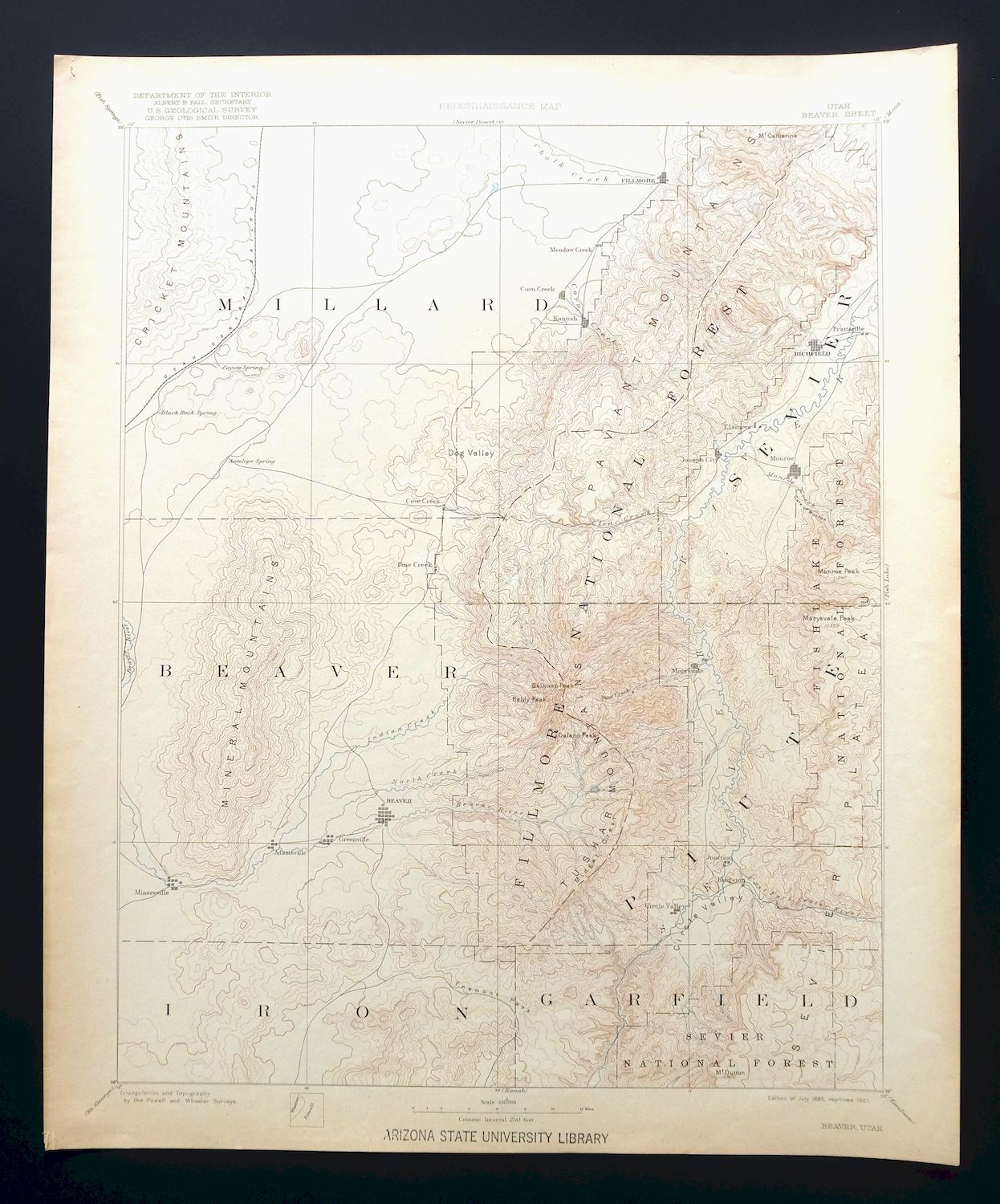
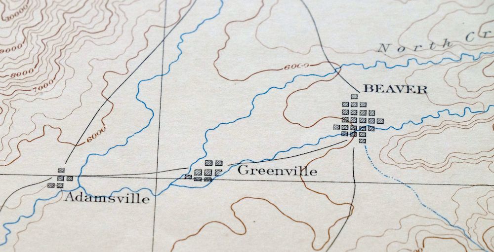
This USGS Reconnaissance Topo Map is an 1885 edition of the Beaver 60-minute quad, printed in 1921 on thick stock and graded excellent – very lightly handled, never folded, with a flawless map area. Covering a broad stretch of south-central Utah, the quad area takes in Richfield, Beaver, Fillmore, Milford, and Marysvale, along with parts of Fishlake and Dixie National Forests and the Paiute Indian Reservation across six counties. This uncommon sheet was mapped during the historic Powell and Wheeler Surveys of the 1860s, 70s, and 80s, and the reverse carries printed reference material on the mapping program and how to read the terrain. It comes from a decommissioned Arizona university library collection and carries a library stamp on the lower collar, with a very minor edge tear repaired with transparent archival tape on the backside.
In stock
This antique sheet is an 1885 edition of the Beaver Utah USGS topographic map. It is an authentic 105-year-old 1921 United States Geological Survey print in excellent condition.
HOW THIS MAP CAN BE USED
In addition to making a fascinating conversation piece, this sheet would look great in a frame or on display, make a unique and prized gift for anyone interested in this area, be perfect as a reference for genealogy studies or general historical research, or fill that missing piece in your collection.
FEATURES SHOWN ON THE MAP
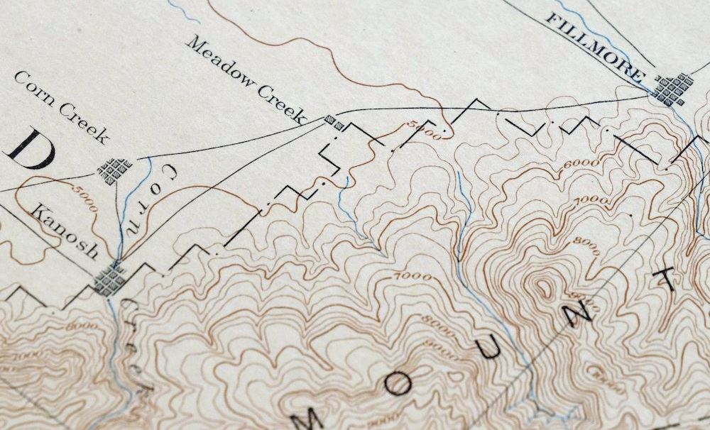
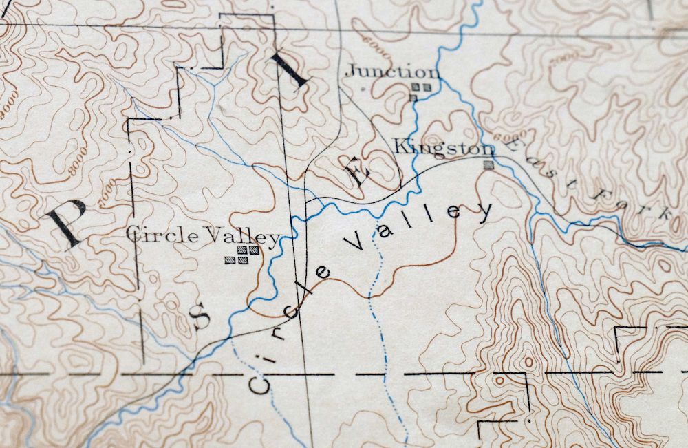
The Beaver 60-minute map shows cities and towns, roads, railroads, rivers, creeks, elevation contour lines, public land survey lines, county, state, and other administrative boundaries as they existed at the time of the survey in 1876 through 1879.
A VALUABLE HISTORICAL RECORD
Maps from the 60-minute series have been out of print for many years. They have never been common and original prints are increasingly difficult to find. Only about 85 quadrangles (covering about 10% of the continental US) were mapped in this series, all in western states. For the limited areas where the 60-minute map was produced, it was generally a product of the very first USGS survey done for that area. These quadrangles are a valuable historical record, as they contain many placenames and features that have been dropped from more recent series’ and editions.
Nearby maps
-
Echo Cliffs Arizona Tuba City Page USGS 60-Min Topo Map 1913
$48 Add to cart -
Marsh Pass Arizona Kayenta Pinon USGS Topo Map 1922 Antique
$74 Add to cart -

Diamond Creek Arizona Grand Canyon Nelson USGS Topo Map 1927
$130 Add to cart -

Tusayan Arizona Winslow Dilkon USGS Topo Map 1901 Antique
$65 Add to cart -
Camp Mohave Arizona El Dorado WSA Kingman USGS Topo Map 1920
$74 Add to cart -
Marysvale Utah Piute Reservoir Junction USGS Topo Map 1947
$50 Add to cart -
Fillmore Utah Kanosh Meadow USGS 15-Min Topographic Map 1975
$40 Add to cart -
Notom Capitol Reef NP Utah USGS 15-Min Topo Map 1958 Vintage
$46 Add to cart -

Castle Dale Utah Ferron Clawson USGS Topographic Map 1925
$45 Add to cart -

Moroni Utah Fountain Green USGS 15-Min Topo Map 1968 Vintage
$39 Add to cart -
New Harmony Utah La Verkin Leeds USGS Topographic Map 1960
$47 Add to cart -
Kanab Utah Fredonia Orderville USGS Topo Map 1960 Vintage
$37 Add to cart -
The Wickiup Utah Mexican Mountain WSA USGS Topo Map 1967
$20 Add to cart -
Nipple Butte Utah Wahweap WSA Big Water USGS Topo Map 1962
$36 Add to cart -
1957 USGS Topo Map: Scofield, Clear Creek, Utah (Wattis)
$49 Add to cart -
Shinarump Arizona Kaibab USGS 15-Min Topo Map 1964 Vintage
$35 Add to cart -
Colorado City Arizona Moccasin Kaibab USGS Topo Map 1975
$37 Add to cart -
House Rock Spring Arizona USGS 15-Min Topo Map 1972 Vintage
$40 Add to cart -

Castle Gate Utah Price Helper USGS Topo Map 1968 Vintage
$44 Add to cart -

Paria Plateau Arizona Vermillion Cliffs USGS Topo Map 1978
$42 Add to cart -
Fiddler Butte Utah USGS 15-Min Topographic Map 1958 Vintage
$38 Add to cart -
Soldier Summit Utah Gilluly Colton USGS Topographic Map 1942
$50 Add to cart -
Provo Utah Uinta NF Spanish Fork USGS Topo Map 1959 Vintage
$36 Add to cart -
Cummings Mesa Utah USGS 15-Min Topographic Map 1978 Vintage
$40 Add to cart