MAP DETAILS | |
|---|---|
| TITLE | Matterhorn Peak |
| STATE | California |
| LOCATION | 40 miles northwest of Mammoth Lakes |
| SERIES | 15-minute |
| SURVEYED | 1955 and 1956 Aerial and Field Survey |
| EDITION | 1956 |
| PRINTED | 1971 |
| PRINT NOTES | Thick paper stock, includes woodland tint (green to indicate vegetated areas) |
| SCALE | 1:62500 |
| CONTOUR INTERVAL | 80 feet |
| SHEET DIMENSIONS | 18 x 22 inches |
| MAP DIMENSIONS | 13 3/4 x 17 1/2 inches |
| COVERAGE AREA | 14 x 17 miles |
| SHEET CONDITION For maps of this vintage, effort is made to note all visible flaws, no matter how minor. | |
| OVERALL CONDITION | Excellent |
| SHEET NOTES | very lightly handled, never folded, smooth and flat |
| MAP AREA | flawless map area |
| COLLARS | no wear or tears, no markings, no blemishes |
| MAP COVERAGE Quadrangle extent overlaid on current basemap. | |
| PLACENAMES Depending on map series and survey date, all of the features listed below may not be shown on this map. This list contains features that currently exist or historically existed within the area covered by the map. The list can be used as a reference to determine if this map covers your area of interest. Placenames are listed alphabetically next to each feature type. | |
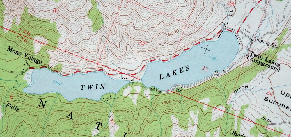
| NOTABLE PLACES | Yosemite National Park, Twin Lakes, and Virginia Lakes |
| COUNTIES COVERED | Mono and Tuolumne |
| FEDERAL LAND UNITS | Hoover Wilderness, Inyo National Forest, Toiyabe National Forest, and Yosemite Wilderness |
| RIVERS AND STREAMS | Big Meadow Creek, Blacksmith Creek, Buckeye Creek, Camp Creek, Cattle Creek, Dunderberg Creek, East Fork Green Creek, East Walker River, Green Creek, Labrosse Creek, Little Walker River, McCabe Creek, Mill Creek, Molybdenite Creek, Piute Creek, Rancheria Creek, Return Creek, Robinson Creek, Rock Creek, Spiller Creek, Summers Creek, Virginia Creek, and Wilson Creek |
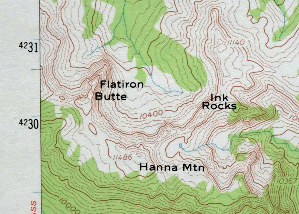
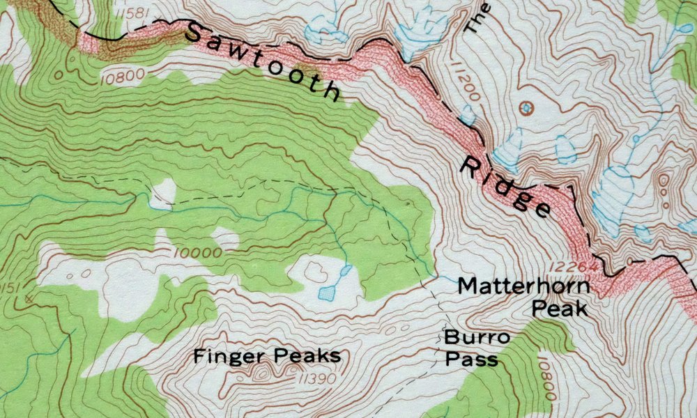
| Locations: Bogards Camp, Buckeye Campground, Docand Als Resort, Eagle Nest Summer Home Area, Green Creek Campground, Green Creek Summer Home Area, Honeymoon Flat Campground, Hunewill Hills Electronic, Hunewill Ranch, Lower Twin Lakes Resort, McMillan Cabin, Mono Village Resort, Paho Campground, Robinson Creek Campground, Sawmill Campground, Snow Cabin, Trumbull Campground, Trumbull Lake Campground, Twin Lakes Campground, Upper Twin Lakes Summer Home Area, and Virginia Lakes Resort. Mountains, Peaks, and Summits: Bath Mountain, Black Mountain, Camiaca Peak, Center Mountain, Cirque Mountain, Crater Crest, Crown Point, Doghead Peak, Dunderberg Peak, Eagle Peak, Epidote Peak, Excelsior Mountain, Finger Peaks, Flatiron Butte, Gabbro Peak, Grey Butte, Grouse Mountain, Hanna Mountain, Hunewill Peak, Kettle Peak, Matterhorn Peak, Page Peaks, Quarry Peak, Robinson Peak, Mount Scowden, Shepherd Crest, Slide Mountain, Stanton Peak, Twin Peaks, Victoria Peak, Virginia Peak, Volunteer Peak, Walker Mountain, and Whorl Mountain. Valleys and Canyons: Cameron Canyon, Crazy Mule Gulch, Deep Canyon, Glines Canyon, Little Slide Canyon, Piute Canyon, Rock Canyon, and Slide Canyon. Parks: Hoover Wilderness. Drainages: Big Meadow Creek, Blacksmith Creek, Camp Creek, Cattle Creek, Eagle Creek, East Fork Green Creek, Horse Creek, Labrosse Creek, McCabe Creek, North Fork Buckeye Creek, Rock Creek, South Fork Buckeye Creek, Summers Creek, Tamarack Creek, West Fork Green Creek, and Wilson Creek. Mines: May Lundy Mine and Tamarack Mine. Lakes and Ponds: Avalanche Lake, Barney Lake, Bergona Lake, Big Valley Lake, Blue Lake, Burro Lake, Cooney Lake, Crown Lake, Doe Lake, East Lake, Lake Frances, Frog Lakes, Gilman Lake, Glacier Lake, Glenberry Lake, Green Lake, Lake Helen, Hoover Lakes, Hunewill Lake, Ice Lake, Little Lake, Little Valley, Maltby Lake, McMillan Lake, Moat Lake, Nutter Lake, Onion Lake, Par Value Lakes, Peeler Lake, Red Lake, Return Lake, Robinson Lakes, Rock Island Lake, Shamrock Lake, Shepherd Lake, Sister Lake, Smedberg Lake, Snow Lake, Soldier Lake, Spiller Lake, Summit Lake, Surprise Lake, Tallulah Lake, Tamarack Lake, Trumbull Lake, Turquoise Lake, Twin Lakes, Virginia Lakes, and West Lake. Waterfalls: Horsetail Falls. Dams: Lower Twin Lake 531-002 Dam and Upper Twin Lake 531 Dam. Gaps: Benson Pass, Buckeye Pass, Burro Pass, Mule Pass, Rock Island Pass, and Virginia Pass. Ridges: Buckeye Ridge, The Cleaver, Flatiron Ridge, Hanging Valley Ridge, Hunewill Hills, Kavanaugh Ridge, Monument Ridge, Sawmill Ridge, Sawtooth Ridge, and Suicide Ridge. Rapids: The Roughs. Flats: Big Meadow, Kerrick Meadow, Lower Summers Meadows, and Upper Summers Meadows. Pillars: Ink Rocks. Springs: Buckeye Hot Spring. Slopes: The Slide. | |
| SHIPPING AND RETURNS | |
 This map sheet will be carefully rolled in a sturdy tube and shipped via the US Postal Service. If you find that the sheet you receive is not as described in the listing, you may ship it back to us for a refund of the purchase price. | |
1971 USGS Topo Map: Matterhorn Peak, California
$46
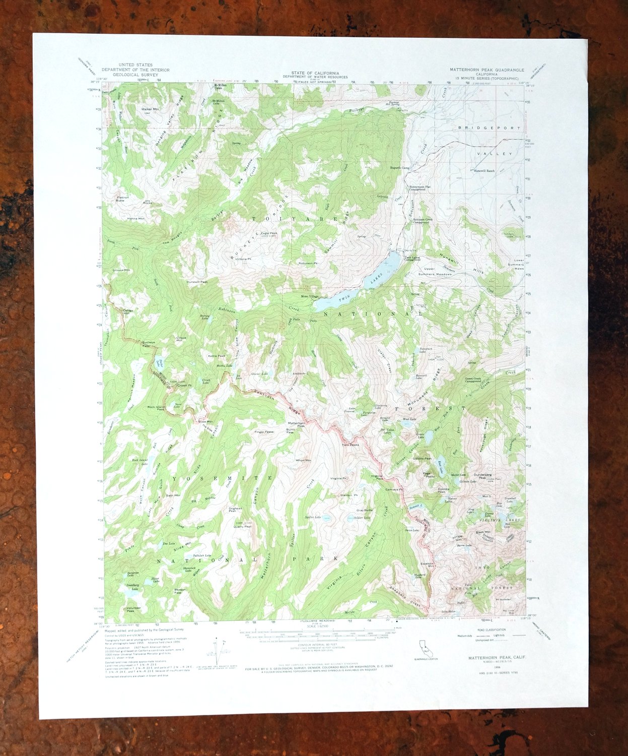
This USGS topographic map of the Matterhorn Peak quadrangle is a 1956 edition printed in 1971, at the 1:62,500 scale of the 15-minute series, with a green woodland tint marking vegetated country. It covers rugged High Sierra terrain along the Mono–Tuolumne county line about 40 miles northwest of Mammoth Lakes, taking in Twin Lakes, Virginia Lakes, and the northeastern edge of Yosemite National Park, with parts of the Hoover and Yosemite Wildernesses. Matterhorn Peak itself rises above 12,000 feet. Never folded, on thick stock, and flat enough to frame.
In stock
This vintage sheet is a 1956 edition of the Matterhorn Peak California USGS topographic map. It is an original 55-year-old 1971 United States Geological Survey print in excellent condition.
HOW THIS MAP CAN BE USED
In addition to making a fascinating conversation piece, this sheet would look great in a frame or on display, make a unique and prized gift for anyone interested in this area, be perfect as a reference for genealogy studies or general historical research, or fill that missing piece in your collection. Maps of this vintage are printed on durable stock and are well-suited for outdoor activities and recreation of all kinds, including hiking, backpacking, hunting, rafting and kayaking, backcountry skiing, geocaching, general exploration, treasure hunting, etc.
FEATURES SHOWN ON THE MAP
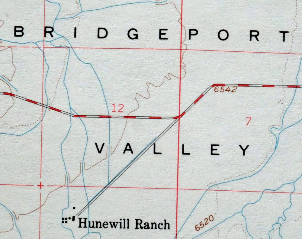
The Matterhorn Peak 15-minute map shows cities and towns, roads, railroads, utilities and energy infrastructure, rivers, creeks, elevation contour lines, public land survey lines, county, state, and other administrative boundaries as they existed at the time of the survey in 1955 and 1956. All known structures (houses, businesses, churches, schools, barns, cabins, etc) are also shown.
A VALUABLE HISTORICAL RECORD
Maps from the 15-minute series for the continental United States are no longer produced or printed by the USGS and original prints are becoming increasingly difficult to find. They are a valuable historical record for an area, as they contain many placenames and features that have been dropped from more recent maps.
Nearby maps
-
Tower Peak California USGS 15-Min Topo Map 1972 Vintage
$40 Add to cart -
1973 USGS Topo Map: Tuolumne Meadows, California
$48 Add to cart -
Fales Hot Springs California USGS Topo Map 1971 Vintage
$20 Add to cart -
Hetch Hetchy Reservoir California USGS Topo Map 1973 Vintage
$39 Add to cart -
1964 Cowtrack Mountain California USGS Topo Map: Mono Lake
$45 Add to cart -
Mount Morrison California Mammoth Lakes USGS Topo Map 1974
$52 Add to cart -
1975 USGS Topo Map: Casa Diablo Mountain, California
$40 Add to cart -
1973 USGS Topo Map: Mount Abbot, Sierra Nevada, California
$43 Add to cart -

1968 USGS Topo Map: Mount Tom, Paradise, California
$45 Add to cart -

Kinsley California USGS 7.5-Min Topographic Map 1949 Vintage
$32 Add to cart -

Jawbone Ridge California Buck Meadows USGS Topo Map 1949
$27 Add to cart -
1973 USGS Topo Map: Shaver Lake, Meadow Lakes, California
$42 Add to cart -
Huntington Lake California Shaver Lake USGS Topo Map 1968
$43 Add to cart -
Blackcap Mountain California USGS Topo Map 1972 Vintage
$40 Add to cart -

Raynor Creek California Chowchilla River USGS Topo Map 1947
$30 Add to cart -

Merced California Planada USGS 15-Min Topo Map 1963 Vintage
$18 Add to cart -
Bishop California West Bishop Laws USGS Topographic Map 1969
$40 Add to cart -

Le Grand California Madera Chowchilla USGS Topo Map 1963
$14 Add to cart -
Kismet California Madera USGS 7.5-Min Topo Map 1948 Vintage
$32 Add to cart -

Cressey California Livingston Delhi USGS Topo Map 1948
$23 Add to cart -

Chowchilla California Le Grand El Nido USGS Topo Map 1962
$20 Add to cart -
1952 USGS Topo Map: Big Pine, California
$44 Add to cart -
Kentucky Well California USGS 7.5-Min Topo Map 1948 Vintage
$32 Add to cart -

Salida California Modesto Ripon USGS Topo Map 1915 Antique
$57 Add to cart