MAP DETAILS | |
|---|---|
| TITLE | Helena |
| STATE | California |
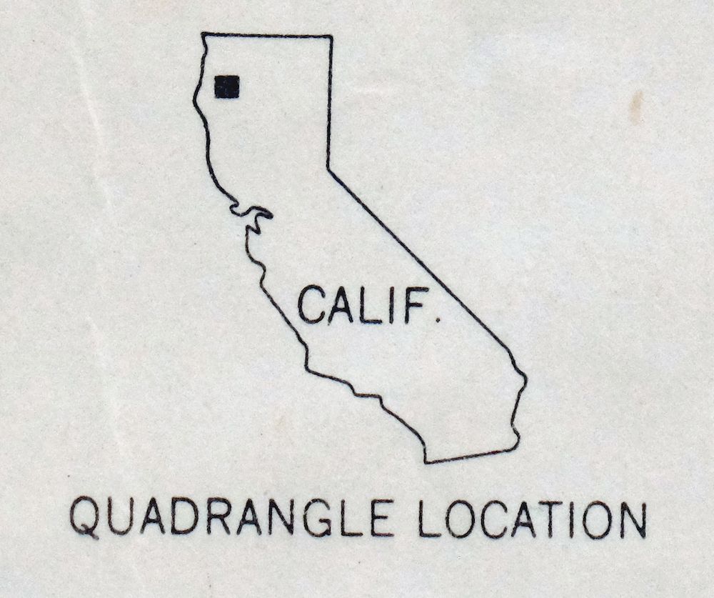
| LOCATION | Vicinity of Weaverville, 45 miles northwest of Redding |
| SERIES | 15-minute |
| SURVEYED | 1947 and 1951 Aerial and Field Survey |
| EDITION | 1951 |
| PRINTED | 1953 |
| PRINT NOTES | Thick paper stock |
| SCALE | 1:62500 |
| CONTOUR INTERVAL | 100 feet |
| SHEET DIMENSIONS | 17 x 21 inches |
| MAP DIMENSIONS | 13 1/4 x 17 1/2 inches |
| COVERAGE AREA | 13 x 17 miles |
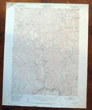
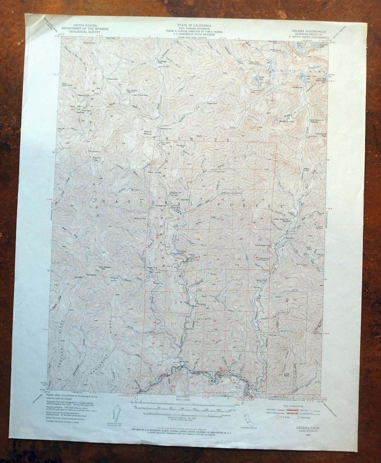
| MAP NOTES | This sheet covers mountainous terrain from Helena on the Trinity River in the south to the high peaks of the Trinity Alps in the northeast. |
| SHEET CONDITION For maps of this vintage, effort is made to note all visible flaws, no matter how minor. | |
| OVERALL CONDITION | Good |
| SHEET NOTES | moderately handled, never folded |
| MAP AREA | no wear, no blemishes, pencilled mile markers along the Trinity River |
| COLLARS | minor wear or tears, no markings, no blemishes |
| MAP COVERAGE Quadrangle extent overlaid on current basemap. | |
| PLACENAMES Depending on map series and survey date, all of the features listed below may not be shown on this map. This list contains features that currently exist or historically existed within the area covered by the map. The list can be used as a reference to determine if this map covers your area of interest. Placenames are listed alphabetically next to each feature type. | |
| CITIES AND TOWNS (CURRENT) | Helena and Weaverville |
| COUNTIES COVERED | Trinity |
| FEDERAL LAND UNITS | Trinity Alps Wilderness and Trinity National Forest |
| RIVERS AND STREAMS | Backbone Creek, Bear Creek, Big East Fork Canyon Creek, Big French Creek, Boulder Creek, Canyon Creek, China Creek, Conner Creek, Eagle Creek, East Branch East Fork North Fork Trinity River, East Fork Big French Creek, East Fork North Fork Trinity River, Gas Creek, Indian Creek, Little East Fork Canyon Creek, Little French Creek, Manzanita Creek, Middle Fork Rattlesnake Creek, Miller Creek, North Fork Trinity River, Prairie Creek, Rattlesnake Creek, South Fork East Fork New River, Treloar Creek, Trinity River, Whites Creek, and Yellow Jacket Creek |
| WATER BODIES | Canyon Creek Lakes, Mirror Lake, Papoose Lake, and Sapphire Lake |
| Locations: Backbone Ridge Lookout, Bear Valley Meadows Camp, Bear Wallow Camp, Canyon City, Canyon Creek Trailhead Parking, Coleridge, Dedrick Lookout, Enos Camp, Helena, Hobo Gulch Campground, Hunters Camp, Jakes Upper Camp, Ladder Camp, Long Ranch, McKay Camp, Pigeon Point Campground, Pony Camp, Rattlesnake Camp, Ripstein Campground, Russell Cabin, Stonehouse, Strunce Cabin, Todd Cabin, and Weaver Bally Lookout. Areas: Bear Valley Meadows, Bear Wallow Meadows, Keystone Meadows, and Pony Mountain Meadows. Mountain Ranges: Trinity Alps. Mountains, Peaks, and Summits: Dedrick Point, Mount Hilton, Little Bally, Pony Mountain, Red Hill, Sawtooth Mountain, Thurston Peaks, Twin Sisters Mountain, and Wedding Cake. Valleys and Canyons: Barney Gulch, Baxter Gulch, Bear Gulch, Brock Gulch, China Springs Gulch, Conrad Gulch, Crumpy Gulch, Cutthroat Gulch, East Fork Clear Gulch, East Valdor Gulch, Ellen Gulch, Fisher Gulch, Fox Gulch, French Gulch, Gwin Gulch, Hobo Gulch, Jones Gulch, Little Ripstein Gulch, Logan Gulch, Martin Gulch, Mosquito Hollow, Noonan Gulch, North Fork Gulch, Norway Gulch, Pear Tree Gulch, Rarick Gulch, Rich Gulch, Ripstein Gulch, Squaw Gulch, Stonehouse Gulch, Store Gulch, Thurston Gulch, West Branch Clear Gulch, West Valdor Gulch, and Wheel Gulch. Parks: Helena Historic District. Drainages: Backbone Creek, Bear Creek, Big East Fork Canyon Creek, Boulder Creek, China Creek, Conner Creek, Eagle Creek, East Branch East Fork North Fork Trinity River, East Fork North Fork Trinity River, Gas Creek, Indian Creek, Little East Fork Canyon Creek, Miller Creek, North Fork Trinity River, Rattlesnake Creek, Whites Creek, and Yellow Jacket Creek. Mines: Alaska Mine, Chloride Mine, Ellen Mine, Enterprise Mine, Lone Jack Mine, Maple Mine, Mason and Thayer Mine, McClaron Mine, Ozark Mine, Ralston Group, Red Hill Mine, Silver Grey Mine, and Yellowstone Mine. Lakes and Ponds: Boulder Creek Lakes, Canyon Creek Lakes, Forbidden Lakes, Kalmia Lake, L Lake, Little Lake, McCartneys Pond, Mirror Lake, Papoose Lake, and Whites Creek Lake. Waterfalls: Canyon Creek Falls. Crossings: Waldorf Crossing. Gaps: Stoveleg Gap. Bars: Coopers Bar and Idaho Bar. Ridges: Backbone Ridge, Blue Ridge, Limestone Ridge, Manzanita Ridge, Treloar Ridge, and Tunnel Ridge. Flats: Blacks Flat, Digger Pine Flat, Grasshopper Flat, Keystone Flat, Lower Canyon Creek Meadows, Manzanita Flat, Raymond Flat, and Upper Canyon Creek Meadows. Springs: Buck Spring, China Springs, and Marble Springs. | |
| SHIPPING AND RETURNS | |
 This map sheet will be carefully rolled in a sturdy tube and shipped via the US Postal Service. If you find that the sheet you receive is not as described in the listing, you may ship it back to us for a refund of the purchase price. | |
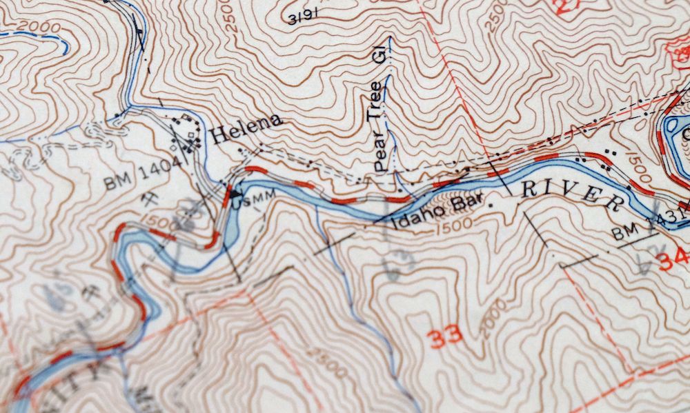
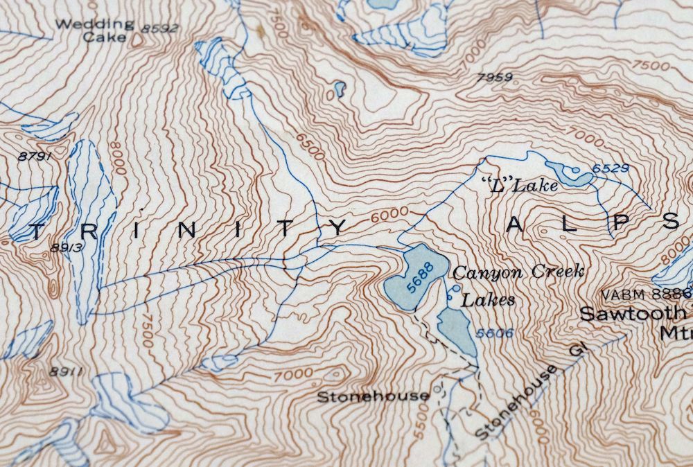
1953 USGS Topo Map: Helena, California
$34
This sheet covers mountainous terrain from Helena on the Trinity River in the south to the high peaks of the Trinity Alps in the northeast. It is a USGS 15-minute topographic map, a 1951 edition printed in 1953 on thick paper at a scale of 1:62,500 with 100-foot contours. The quad sits in Trinity County northwest of Weaverville, taking in portions of the Trinity National Forest and the Trinity Alps Wilderness across rugged country about 45 miles northwest of Redding.
In stock
This vintage sheet is a 1951 edition of the Helena California USGS topographic map. It is an original 73-year-old 1953 United States Geological Survey print in good condition.
HOW THIS MAP CAN BE USED
In addition to making a fascinating conversation piece, this sheet would look great in a frame or on display, make a unique and prized gift for anyone interested in this area, be perfect as a reference for genealogy studies or general historical research, or fill that missing piece in your collection. Maps of this vintage are printed on durable stock and are well-suited for outdoor activities and recreation of all kinds, including hiking, backpacking, hunting, rafting and kayaking, backcountry skiing, geocaching, general exploration, treasure hunting, etc.
FEATURES SHOWN ON THE MAP
The Helena 15-minute map shows cities and towns, roads, railroads, utilities and energy infrastructure, rivers, creeks, elevation contour lines, public land survey lines, county, state, and other administrative boundaries as they existed at the time of the survey in 1947 and 1951. All known structures (houses, businesses, churches, schools, barns, cabins, etc) are also shown.
A VALUABLE HISTORICAL RECORD
Maps from the 15-minute series for the continental United States are no longer produced or printed by the USGS and original prints are becoming increasingly difficult to find. They are a valuable historical record for an area, as they contain many placenames and features that have been dropped from more recent maps.
Nearby maps
-
1974 Cecilville California USGS Topo Map: Trinity Alps
$34 Add to cart -
Lamoine California Shasta Lake USGS Topo Map 1974 Vintage
$42 Add to cart -
Shasta California McCloud USGS 15-Min Topo Map 1968 Vintage
$40 Add to cart -

Preston Peak California Klamath NF USGS 15-Min Topo Map 1962
$28 Add to cart -
1954 USGS Topo Map: Copco, Agar, California (Original Print)
$40 Add to cart -
Piercy California USGS 15-Min Topographic Map 1971 Vintage
$33 Add to cart -
Manzanita Lake California Viola USGS Topo Map 1974 Vintage
$39 Add to cart -
Panther Spring California USGS 15-Min Topo Map 1970 Vintage
$36 Add to cart -
1950 Dorris California USGS Topo Map: Somerset
$40 Add to cart -
Fruto California Stony Creek Nye Creek USGS Topo Map 1944
$30 Add to cart -

Richardson Springs California Chico Nord USGS Topo Map 1966
$35 Add to cart -
1978 USGS Topo Map: Mount Harkness, California
$36 Add to cart -
Stonyford California USGS 15-Min Topo Map 1967 Vintage
$39 Add to cart -
Glenblair California Comptche USGS Topo Map 1943 Vintage
$38 Add to cart -
1968 Chico California USGS Topo Map: Sacramento River
$41 Add to cart -
Tulelake California USGS 15-Min Topographic Map 1970 Vintage
$33 Add to cart -
Lakeport California Lucerne Nice USGS Topo Map 1977 Vintage
$46 Add to cart -
Westwood California USGS 15-Min Topographic Map 1961 Vintage
$38 Add to cart -
1967 USGS Topo Map: Clearlake Oaks, California
$40 Add to cart -
Gridley California Oroville Live Oak USGS Topo Map 1959
$37 Add to cart -
Fredonyer Peak California USGS 15-Min Topo Map 1972 Vintage
$32 Add to cart -
Susanville California Janesville USGS Topo Map 1966 Vintage
$39 Add to cart -
Big Sage Reservoir California Alturas USGS Topo Map 1972
$40 Add to cart -
Litchfield California Susanville USGS Topo Map 1972 Vintage
$40 Add to cart