MAP DETAILS | |
|---|---|
| TITLE | Staunton |
| STATE | Virginia, West Virginia |
| LOCATION | 60 miles north of Lynchburg |
| SERIES | 30-minute |
| SURVEYED | 1886 and 1887 Field Survey |
| GEOGRAPHER | Henry Gannett |
| EDITION | 1894 |
| PRINTED | 1913 |
| PRINT NOTES | Thick paper stock |
| SCALE | 1:125000 |
| CONTOUR INTERVAL | 100 feet |
| SHEET DIMENSIONS | 16 1/2 x 20 inches |
| MAP DIMENSIONS | 13 3/4 x 17 1/2 inches |
| COVERAGE AREA | 27 x 35 miles |
| SOURCE | From an uncommonly well-preserved collection |
| MAP NOTES | A fascinating historical snapshot surveyed before the modern highway system, showing historic overland travel routes, rail lines, and early placenames. |
| SHEET CONDITION For maps of this vintage, effort is made to note all visible flaws, no matter how minor. | |
| OVERALL CONDITION | Excellent |
| SHEET NOTES | very lightly handled, never folded, smooth and flat, attractively age-toned paper |
| MAP AREA | flawless map area |
| COLLARS | no wear or tears, no markings, no blemishes, hole punches along left collar |
| MAP COVERAGE Quadrangle extent overlaid on current basemap. | |
| BACKSIDE LEGEND | |
 A map summary is printed on the back side of the Staunton sheet similar to the one shown in the picture. It outlines the history, purpose, and status of the USGS mapping program at the time of the printing in 1913. It also provides instructions on how to read contour lines and a description of how they are used to depict the terrain. At the bottom of the page is a legend showing all of the symbols used to represent the cultural, relief, and water features found on the map. | |
| PLACENAMES Depending on map series and survey date, all of the features listed below may not be shown on this map. This list contains features that currently exist or historically existed within the area covered by the map. The list can be used as a reference to determine if this map covers your area of interest. Placenames are listed alphabetically next to each feature type. | |
| CITIES AND TOWNS (CURRENT) | Augusta Springs, Churchville, Craigsville, Deerfield, Fishersville, Greenville, Jolivue, McDowell, Middlebrook, Mount Solon, Spring Creek, Staunton, Stuarts Draft, and Verona |
| COUNTIES COVERED | Augusta, Bath, Highland, Pendleton, Rockbridge, Rockingham, and Staunton |
| FEDERAL LAND UNITS | George Washington National Forest and Ramseys Draft Wilderness |
| RIVERS AND STREAMS | Back Creek, Barterbrook Branch, Beaver Creek, Bell Creek, Benson Run, Big Run, Black Run, Blackthorn Creek, Briery Branch, Brushy Fork, Buffalo Branch, Bullpasture River, Calfpasture River, Christians Creek, Clayton Mill Creek, Coles Run, Cove Run, Cowpasture River, Crab Run, Daddy Run, Dry River, East Dry Branch, Eidson Creek, Falling Spring Run, Folly Mills Creek, Fridley Branch, Goose Creek, Goshen Branch, Hamilton Branch, Hays Creek, Hone Quarry Run, Johns Run, Laurel Branch, Lewis Creek, Little Calfpasture River, Little Mill Creek, Little River, Loves Run, McKittricks Branch, Middle River, Mill Creek, Moffatts Creek, Montgomery Run, Mossy Creek, North Fork Naked Creek, North River, Pine Run, Poague Run, Skidmore Fork, Smith Creek, South Branch Potomac River, South Fork South Branch Potomac River, South River, Spring Creek, Still Run, Stony Run, Tizzle Branch, Whisky Creek, and Wolf Run |
| WATER BODIES | Braley Pond, Briery Branch Reservoir, Elkhorn Lake, Hearthstone Lake, Hone Quarry Reservoir, Lake Wilda, Smithleigh Lake, Staunton Reservoir, and Walace Lake |
| Virginia Locations: Augusta Springs YCC Camp, Braley Pond Camp Site, Briery Branch Overlook, Broadmoor Plaza Shopping Center, Camp Flather, Camp Shenandoah, Camp Todd, Chestnut Hill Shopping Center, Commerce Square Business Park, Confederate Breastworks, Country Club of Staunton, Deerfield Guard Station, Deerfield Information Center, Estaline Furnace, Greenhill Industrial Park, Head Waters, Hone Quarry Recreation Site, Ingleside Resort and Golf Club, La Grange, Mossy Creek, Mountain House Camp Site, North Point Commerce Business Park, North River Campground, North River Picnic Area, Orchard Hill Square Shopping Center, Sexton Shelter, Statler Crossing Shopping Center, Statler Square Shopping Center, Staunton Mall Shopping Center, Terry Court Shopping Center, Todd Lake Camp Site, Todd Lake Recreation Area, Towers, Whites Store, and Windmill Square Shopping Center. Administrative Boundaries: Ashby Magisterial District, Beverley Manor Magisterial District, North River Magisterial District, Pastures Magisterial District, Riverheads Magisterial District, Staunton, and Stonewall Magisterial District. Mountain Ranges: Little North Mountain and Walker Mountain. Mountains, Peaks, and Summits: Archer Knob, Bald Rock, Big Bald Knob, Betsey Bell, Bettys Hill, Big Hill, Big Knob, Black Oak Hill, Dyers Knob, Elkhorn Mountain, Elliott Knob, Brushy Hill, Brushy Ridge, Buck Hill, Buck Mountain, Buffalo Knob, Bullpasture Mountain, The Bump, Byrd Knob, Castle Hill, Cedar Knob, Chestnut Oak Knob, Coalpit Knob, Cooper Mountain, Crawford Knob, Crawford Mountain, Gordons Peak, Great North Mountain, Grindstone Mountain, Gwin Mountain, Hankey Mountain, Hardscrabble Knob, Haycock Knob, Hogback, Huckleberry Hill, Hulls Hill, Little Bald Knob, Little North Mountain, Lookout Mountain, Maple Knob, Mary Gray, Middle Mountain, Narrow Back Mountain, Oak Knob, The Peak, The Pinnacle, Pond Knob, Prospect Knob, Reddish Knob, Round Hill, Sand Spring Mountain, Sheep Knob, Sideling Hill, Signal Corps Knob, Sittlington Hill, Stony Hill, Sugarloaf, Tearjacket Knob, Tims Knob, and Trimble Mountain. Valleys and Canyons: Alier Hollow, Back Draft, Baker Draft, Bear Draft, Beason Hollow, Black Gum Draft, Botkin Hollow, Bridge Hollow, Briery Draft, Broad Draft, Broad Hollow, Dunlap Hollow, East Branch Dowells Draft, Cabin Hollow, Chair Draft, Chapin Draft, Chestnut Lick Hollow, Chimney Hollow, Church Hollow, Clover Lick Hollow, Daggy Camp Hollow, Deerfield Valley, Devrick Hollow, Dorsey Hollow, Dowells Draft, Estaline Valley, Falls Hollow, Fanny Hollow, Farrow Hollow, Ferris Hollow, Fish Hollow, Fox Hollow, Frames Draft, Freezland Hollow, Fridley Cove, Georgia Camp Hollow, Glade Valley, Grassy Field Hollow, Gum Corner Hollow, Gum Lick Hollow, Guy Hollow, Hamilton Draft, Harris Hollow, Haywood Hollow, Hickory Log Hollow, Hiner Hollow, Hite Hollow, Hodges Draft, Holloway Draft, Hoop Hole Hollow, Horse Trough Hollow, Horsehole Hollow, Huffman Hollow, Ingram Draft, Jehu Hollow, Jenny Gwin Draft, Jerry Hollow, Jim Hollow, John Hollow, Johnson Draft, Jonas Draft, Kennedy Draft, Kirtz Hollow, Kiser Hollow, Left Fork Holloway Draft, Left Fork Tims Draft, Left Prong Ramseys Draft, Leslie Lick Hollow, Locust Hollow, Lynn Hollow, Madison Hollow, Mays Hollow, Meadow Hollow, Mill Hollow, Mortons Draft, Muddy Hollow, Mudlick Draft, Opossum Hollow, Phillips Hollow, Possum Hollow, Ramsey Draft, Ramseys Draft, Reubens Draft, Right Fork Tims Draft, Right Prong Ramseys Draft, Road Hollow, Salthouse Hollow, Scott Hollow, Shaffer Hollow, Sinclair Hollow, Sites Hollow, Snead Hollow, Sprouse Hollow, Stamping Ground Hollow, Staples Hollow, Starey Draft, Steel Lick Draft, Stillhouse Hollow, Stuples Hollow, Sulphur Spring Hollow, Sweet Spring Hollow, Taylor Hollow, Thackers Hollow, Tims Draft, Tom Lee Draft, Tunnel Hollow, Wallace Draft, Wallowhole Hollow, Wheelberger Hollow, White Oak Draft, Wide Draft, Wildcat Hollow, Wilson Hollow, Wolfe Draft, Wolfpen Draft, Wood Draft, and Yancey Hollow. Parks: Betsy Bell Park, Beverley Historic District, Gospel Hill Historic District, Gypsy Hill Park, Little North Mountain Wildlife Management Ar, Middlebrook Historic District, Montgomery Hall Park, Natural Chimneys Regional Park, Newtown Historic District, Ramsey's Draft Wilderness, Schneider Community Park, Stuart Addition Historic District, Wharf Area Historic District, and Wilson Park. Trails: Bald Knob Trail, Bald Ridge Trail, Bear Draft Trail, Benson Run Trail, Big Hollow Trail, Elliott Knob Trail, Buck Mountain Trail, California Ridge Trail, Chestnut Ridge Trail, Chimney Hollow Trail, Crawford Knob Trail, Crawford Mountain Trail, Dividing Ridge Trail, Grooms Ridge Trail, Hankey Mountain Trail, Hone Quarry Ridge Trail, Jerrys Run Trail, Jones Trail, Little North Mountain Trail, Little Skidmore Trail, Lookout Mountain Trail, Mines Run Trail, Mud Pond Gap Trail, Narrow Back Trail, Narrow Buck Trail, North Mountain Trail, North River Gorge Trail, Ramseys Draft Trail, Sand Spring Mountain Trail, Shenandoah Mountain Trail, Shillings Trail, Slate Springs Trail A, Slate Springs Trail AA, Slate Springs Trail B, Timber Ridge Trail, Trimbles Mill Trail, Walker Mountain Trail, West Augusta Trail, and White Oak Draft Trail. Drainages: Allen Creek, Als Run, Archer Run, Asylum Creek, Back Creek, Barn Lick Branch, Barterbrook Branch, Beaver Creek, Bell Creek, Benson Run, Big Run, Body Lick Branch, Braley Branch, Briery Branch, Broad Run, Broadhead Creek, Earhart Creek, East Dry Branch, Eidson Creek, Elephant Creek, Elk Run, Elliott Springs Run, Buffalo Branch, Byrd Spring Creek, Carroll Draft, Charlie Lick Branch, Clayton Mill Creek, Coal Run, Coalpit Run, Coles Run, Corbett Branch, Cove Run, Crab Run, Daddy Run, Daniel Run, Davidson Creek, Deep Pond Run, Double Lick, Fall Branch, Falling Rock Creek, Falling Spring Run, Ferrol Creek, Flat Run, Folly Mills Creek, Freemason Run, Fridley Branch, Glover Run, Goose Creek, Grassy Run, Hamilton Branch, Hog Run, Hone Quarry Run, Hughart Run, Jeff Run, Jennings Branch, Jerkemtight Branch, Jerrys Run, Johns Run, Laurel Branch, Left Fork, Left Prong Benson Run, Lick Run, Liptrap Run, Little River, Little Shingle Run, Little Skidmore Fork, Locust Fork, Loves Run, Lower Mountain Lick, McKittricks Branch, McMannaway Run, Mill Run, Mines Run, Mitchell Branch, Moffett Creek, Montgomery Run, Mossy Creek, Mountain Run, Mud Lick, North Fork Little River, North Fork McKittricks Branch, Phillips Lick, Pine Run, Poague Run, Poor Creek, Rattlesnake Run, Redbanks Run, Right Prong Benson Run, Roaring Run, Rock Lick, Rocky Run, Shaws Fork, Shingle Run, Sixteenmile Branch, Skidmore Fork, Smith Creek, Smoky Row Creek, South Fork Little River, South Fork White Rock Branch, Spring Creek, Spring Run, Spruce Lick Branch, Staples Run, Still Run, Stillhouse Run, Stony Lick, Stony Run, Stoutameyer Branch, Swoope Run, Thorny Branch, Tizzle Branch, Toma Run, Trout Branch, Trout Run, Union Springs Run, Upper Mountain Lick, West Dry Branch, Whisky Creek, White Oak Run, White Rock Branch, Whiteman Run, Whites Run, and Wolf Run. Mines: Allen Mine and Harris Mine. Churches: Allen Chapel African Methodist Episcopal Church, Augusta Street Methodist Church, Arbor Hill Church, Beverly Street Methodist Church, Beaver Creek Church, Belmont Church, Bethel Church, Bethlehem Church, Beverly Manor Church, Ebenezer Baptist Church, Edgewood Seventh Day Adventist Church, Elk Run Church, Emanuel Episcopal Church, Emanuel Pilgrim Holiness Church, Emmanuel Church, Calvary Church, Central United Methodist Church, Cherryvale United Methodist Church, Church of Christ, Church of the Nazarene, Cochran Church, College of the Holy Child Jesus, Faith Lutheran Church, Finley Memorial Church, First Baptist Church, First Church of God in Christ, First Presbyterian Church, Good Shepherd Church, Grace Church, Greenmonte Church, Greenville Baptist Church, Greenville United Methodist Church, Griffin Church, Hammond Church, Hattons Church, Headwaters Presbyterian Church, Hebron Church, Hiner Church, Holy Trinity Church, Jerusalem Church, Lebanon Church, Little River Church, Loch Willow Church, Lynn Rock Church, Marquis Memorial Methodist Church, McKendree Church, Miller Memorial Church, Mint Spring United Methodist Church, Mossy Creek Church, Mount Airey Church, Mount Bethel Church, Mount Olive Church, Mount Olivet Church, Mount Salem Baptist Church, Mount Solon Church, Mount Tabor Church, Mount View Church, Mount Zion Baptist Church, Mount Zion Church, Oak Grove Church, Old Trinity Church, Olivet Church, Paynes Chapel, Peak Church, Pleasant View Church, Ray Memorial Church, Reeds Chapel, Rocky Spring Church, Saint Francis Roman Catholic Church, Saint Johns Church, Saint Johns Methodist Church, Saint Pauls Church, Saint Pauls United Brethren Church, Saint Stephens Methodist Church, Second Presbyterian Church, Shemariah Church, Smoky Row Church, Spring Creek Church, Spring Valley Church, Stonewall Church, Temple House of Israel, Third Presbyterian Church, Trinity Episcopal Church, Union Church, Valley View Church, Verona United Methodist Church, West August Church, and Zetta Chapel. Forests: Paul State Forest. Hospitals: De Jarnette State Sanatorium, Kings Daughters Hospital, and Western State Hospital. Lakes and Ponds: Barger Pond, Hattons Pond, Mud Pond, Puffenbarger Pond, and Stark Pond. Buildings: Augusta Art Center, Augusta County Courthouse, Central Fire Station, King Memorial Auditorium and Gymnasium, Martha S Grafton Library, Museum of American Frontier Culture, Statler Brothers Museum, Staunton City Hall, Staunton Correctional Center, Staunton Public Library, and Woodrow Wilson Birthplace. Dams: Braley Dam, Briery Branch Dam, Camp Shenandoah Dam, Hone Quarry Dam, Lower North River Number 78 Dam, Lower North River Number 80 Dam, Lower North River Number 83 Dam, Lower Wallace Dam, Smithleigh Dam, South River Number Seven Dam, Staunton Dam, Union Springs Dam, Upper North Number 77 Dam, Upper North River Number 10 Dam, Upper North River Number 76 Dam, Upper Wallace Dam, and Wood Dam. Crossings: Interchange 213, Interchange 217, Interchange 220, Interchange 221, Interchange 222, and Interchange 225. Bluffs: Trinity Point. Gaps: Briery Branch Gap, Byrd Gap, Dry Branch Gap, Halfmoon Gap, Jennings Gap, Kings Gap, Mud Pond Gap, North River Gap, Pond Gap, and Ramsey Gap. Bridges: Wilson Bridge. Airports: Echols Airport. Schools: Bessie Weller Elementary School, Booker T Washington High School, Bridgewater College, Dunsmore Business College, Edmunds School, Elm School, Buffalo Gap High School, Central Augusta High School, Churchville Elementary School, Columbia Union College Biological Station, Craigsville Elementary School, Davis School, Deerfield Elementary School, Grace Christian School, Hunter McGuire Elementary School, Mary Baldwin College, McDowell High School, North River Junior High School, Northside School, Ottobine School, Richards School, Riverheads Elementary School, Riverheads High School, Robert E Lee High School, Saint Francis School, Shelburne Junior High School, State School For Deaf And Blind, Staunton Military Academy, Stuart Hall School, Stuarts Draft High School, Stuarts Draft Middle School, Thomas Jefferson School, Thomas W Dixon Elementary School, Walker School, and Westside School. Ridges: Bald Ridge, Big Ridge, Brown Ridge, Dunkard Ridge, Brushy Ridge, California Ridge, Camp Ridge, Chestnut Ridge, Dividing Ridge, Fox Ridge, Grooms Ridge, Hearthstone Ridge, Hone Quarry Ridge, Lead-Off Ridge, Littlefield Ridge, Mad Lick Ridge, McKittricks Ridge, Middle Ridge, Path Ridge, Shaws Ridge, Springhouse Ridge, Timber Ridge, and Wolf Ridge. Reservoirs and Tanks: Boy Scout Lake, Braley Pond, Briery Branch Reservoir, Elkhorn Lake, Craigsville Reservoir, Hearthstone Lake, Hone Quarry Reservoir, Lake Wilda, Massie Pond, Nders Pond, Smithleigh Lake, Staunton Reservoir, Todd Lake, Union Spring Hollow Lake, Walace Lake, and Wilda Lake. Flats: Broadway, Freezland Flat, and Tizzle Flats. Towers: Elliot Knob Lookout Tower, WBOP-FM (Churchville), WKCY-FM (Harrisonburg), WKDW-AM (Staunton), WNLR-AM (Churchville), WSGM-FM (Staunton), WSKO-FM (Buffalo Gap), WTON-AM (Staunton), WTON-FM (Staunton), and WVPT-TV (Staunton). Pillars: Natural Chimneys. Springs: Buffalo Spring, Castle Spring, Chestnut Flat Spring, Cockran Spring, Cold Spring, Fowler Spring, Hiner Spring, Phillips Spring, Red Oak Spring, Rock Lick Spring, and Rocky Spring. | |
| West Virginia Locations: Heiliger Kanzel Overlook, Shenadoah Mountain Picnic Area, Shenandoah Mountain Campsite, and Stony Run Overlook. Mountains, Peaks, and Summits: Ale Mountain, Brushy Hill, Dyers Knob, Eye Hill, Frye Knob, High Knob, Reddish Knob, Simmons Mountain, and Ugly Mountain. Valleys and Canyons: Varner Hollow. Drainages: Broad Run, Brushy Fork, Crummett Run, Flesher Run, Gammel Run, New Road Run, Panther Run, and Plum Run. Churches: Brushy Fork Church, Crummett Church, Totten Chapel, and Wilfong Church. Dams: Dam Number 18, Dam Number 32, Dam Number 35, Dam Number 36, South Fork Structure Number 18 Dam, South Fork Structure Number 32 Dam, South Fork Structure Number 33 Dam, South Fork Structure Number 35 Dam, and South Fork Structure Number 36 Dam. Gaps: Briery Branch Gap. Ridges: Jack Mountain, Shaws Ridge, and Thorn Mountain. Springs: Crummett Spring, Hiner Springs, Judy Spring, Sanders Farm Spring, and Warren Rexrode Spring. | |
| SHIPPING AND RETURNS | |
 This map sheet will be carefully rolled in a sturdy tube and shipped via the US Postal Service. If you find that the sheet you receive is not as described in the listing, you may ship it back to us for a refund of the purchase price. | |
Staunton Virginia Stuarts Draft USGS Topographic Map 1913
$90
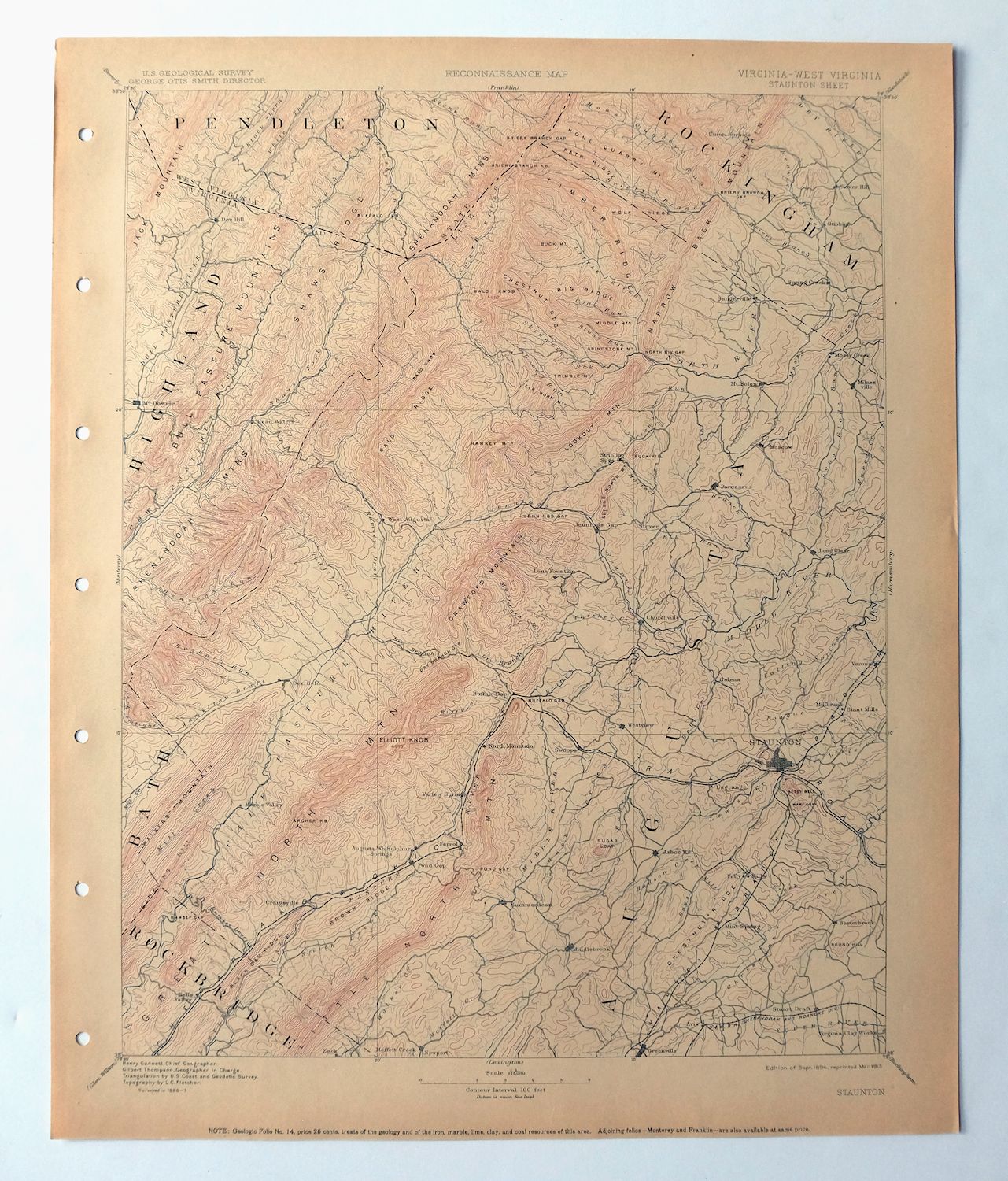
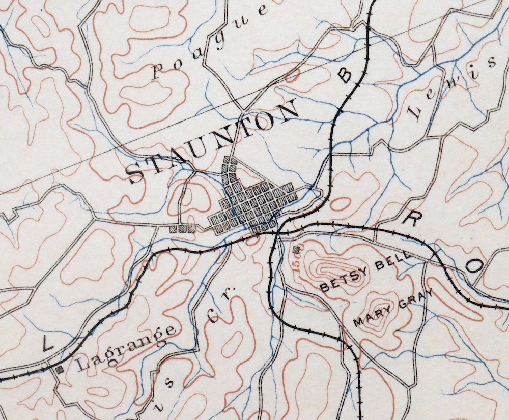
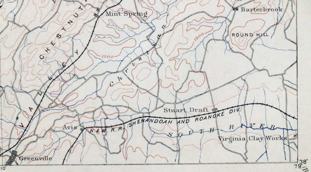
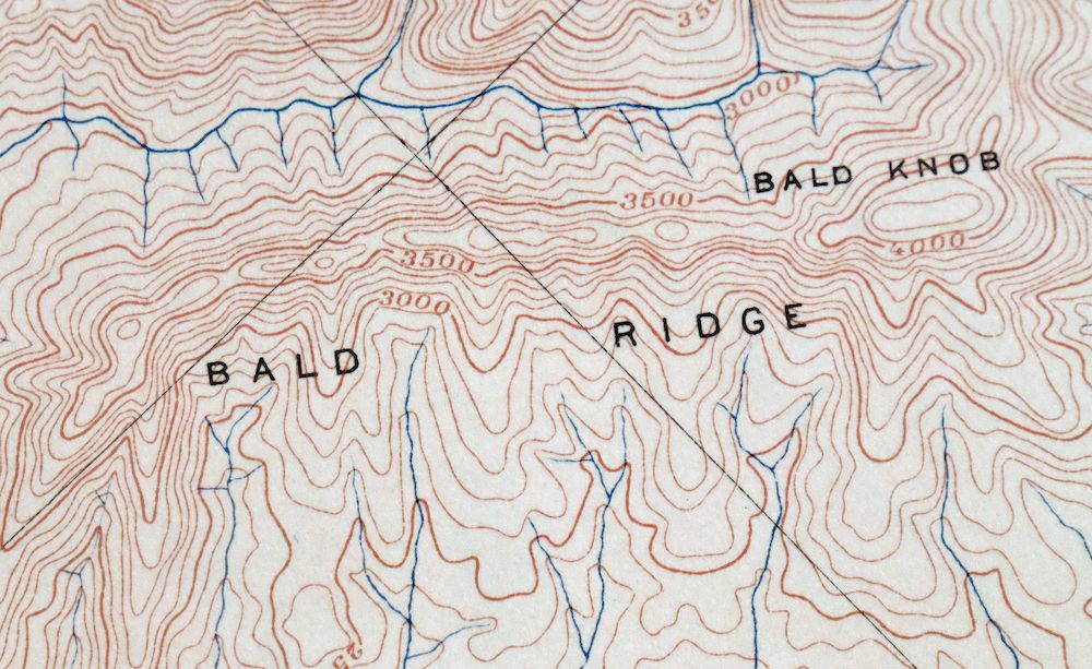
This USGS reconnaissance topographic sheet is a 30-minute quad, first published in 1894 and printed in 1913, in excellent condition on thick stock; never folded, it is smooth and flat with attractively age-toned paper and a flawless map area, from an uncommonly well-preserved collection. The quad spans the Virginia–West Virginia line and takes in the city of Staunton along with Fishersville, Verona, Stuarts Draft, and Craigsville, while the Shenandoah Mountains rise across the western portion and part of George Washington National Forest and the Ramseys Draft Wilderness fall within its boundaries. Surveyed in 1886 and 1887 under geographer Henry Gannett and printed decades before the modern highway system, it records overland travel routes, rail lines, and early placenames as they stood in that era, and the reverse carries printed reference material on reading the map.
In stock
This antique sheet is an 1894 edition of the Staunton Virginia USGS topographic map. It is an authentic 113-year-old 1913 United States Geological Survey print in excellent condition.
HOW THIS MAP CAN BE USED
In addition to making a fascinating conversation piece, this sheet would look great in a frame or on display, make a unique and prized gift for anyone interested in this area, be perfect as a reference for genealogy studies or general historical research, or fill that missing piece in your collection.
FEATURES SHOWN ON THE MAP
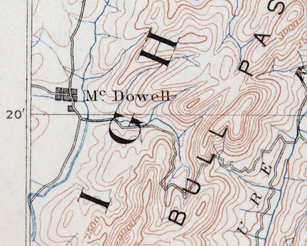
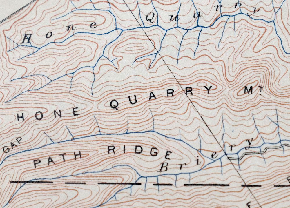
The Staunton 30-minute map shows cities and towns, roads, railroads, rivers, creeks, elevation contour lines, public land survey lines, county, state, and other administrative boundaries as they existed at the time of the survey in 1886 and 1887.
A VALUABLE HISTORICAL RECORD
Maps from the USGS 30-minute series have been out of print for many years. They have never been common and original prints are increasingly difficult to find. For areas where the 30-minute map was produced, it is usually the first large-scale survey done by the USGS for that area. These are a valuable historical record, as they contain many placenames and features that have been dropped from more recent series’ and editions.
Nearby maps
-

Franklin West Virginia Petersburg Onego USGS Topo Map 1914
$49 Add to cart -

Natural Bridge Virginia Covington Selma USGS Topo Map 1911
$62 Add to cart -

Luray Virginia Front Royal Stanley USGS Topographic Map 1910
$115 Add to cart -

Palmyra Virginia Lake Monticello Dillwyn USGS Topo Map 1907
$75 Add to cart -

Romney West Virginia Keyser Delray USGS Topographic Map 1909
$80 Add to cart -
Appomattox Virginia Brookneal Toga USGS Topographic Map 1912
$55 Add to cart -

Nicholas West Virginia Summersville Cowen USGS Topo Map 1912
$54 Add to cart -

Winchester Virginia Middletown Inwood USGS Topo Map 1916
$82 Add to cart -
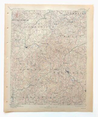
Farmville Virginia Blackstone Rice USGS Topographic Map 1914
$55 Add to cart -

Sutton West Virginia Glenville Elk River USGS Topo Map 1907
$75 Add to cart -
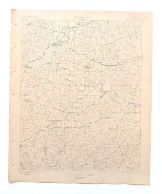
Amelia Virginia Richmond Bon Air USGS Topo Map 1904 Antique
$74 Add to cart -

Mount Vernon Virginia Washington Accokeek USGS Topo Map 1912
$200 Add to cart -

Raleigh West Virginia Beckley Oak Hill USGS Topo Map 1901
$135 Add to cart -

Hyndman Pennsylvania Buffalo Mills USGS 15-Min Topo Map 1967
$40 Add to cart -

Clearville Pennsylvania USGS 15-Min Topo Map 1945 Vintage
$42 Add to cart -

Needmore Pennsylvania Crystal Spring USGS Topo Map 1947
$44 Add to cart -

Saint Marys West Virginia Ellenboro Pike USGS Topo Map 1916
$47 Add to cart -

Charleston West Virginia Cross Lanes Rand USGS Topo Map 1914
$68 Add to cart -

Peytona West Virginia Marmet Belle USGS Topographic Map 1911
$42 Add to cart -

Bald Knob West Virginia Mallory USGS Topo Map 1923 Antique
$50 Add to cart -

Charleston West West Virginia Dunbar USGS Topo Map 1978
$22 Add to cart -

Pocatalico West Virginia Dunbar USGS Topographic Map 1977
$30 Add to cart -

Bedford Pennsylvania Schellsburg USGS Topo Map 1958 Vintage
$42 Add to cart -

Brownsville Pennsylvania Monessen Donora USGS Topo Map 1954
$38 Add to cart