MAP DETAILS | |
|---|---|
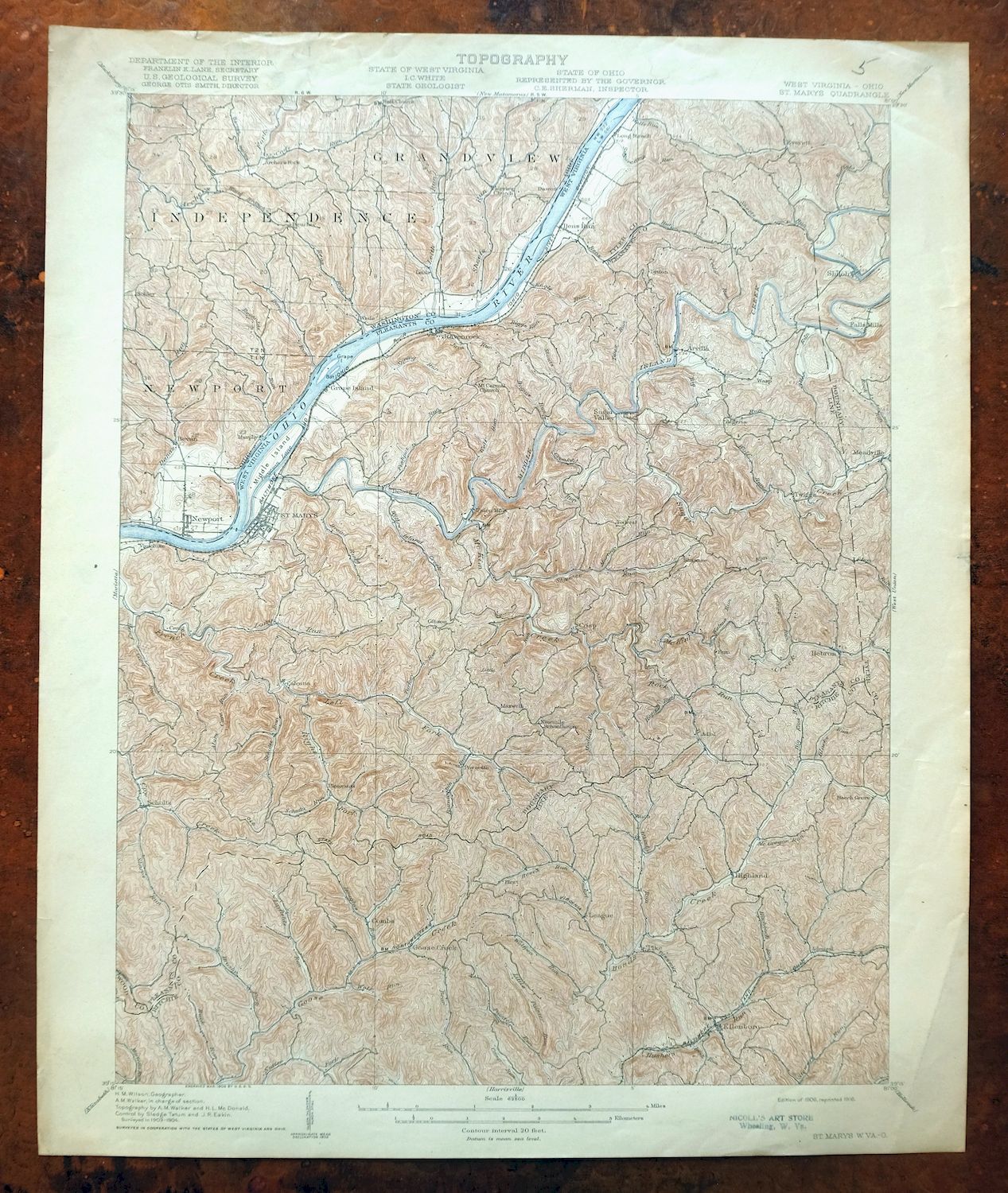
| TITLE | Saint Marys |
| STATE | West Virginia, Ohio |
| LOCATION | 20 miles east of Marietta, OH |
| SERIES | 15-minute |
| SURVEYED | 1903 and 1904 Field Survey |
| GEOGRAPHER | H.M. Wilson |
| ENGRAVED | 1906 |
| EDITION | 1906 |
| PRINTED | 1916 |
| PRINT NOTES | Thick paper stock |
| SCALE | 1:62500 |
| CONTOUR INTERVAL | 20 feet |
| SHEET DIMENSIONS | 16 1/2 x 20 inches |
| MAP DIMENSIONS | 13 1/2 x 17 1/2 inches |
| COVERAGE AREA | 13 x 17 miles |
| MAP NOTES | Surveyed before the modern highway and interstate system, showing historic travel routes, rail lines, and placenames. |
| SHEET CONDITION For maps of this vintage, effort is made to note all visible flaws, no matter how minor. | |
| OVERALL CONDITION | Good |
| SHEET NOTES | moderately handled, never folded |
| MAP AREA | no wear, no markings, no blemishes |
| COLLARS | minor wear or tears, age discoloration along top collar, pencilled notation in upper right collar corner, small inventory stamp in bottom right collar |
| MAP COVERAGE Quadrangle extent overlaid on current basemap. | |
| BACKSIDE LEGEND | |
 A map summary is printed on the back side of the Saint Marys sheet similar to the one shown in the picture. It outlines the history, purpose, and status of the USGS mapping program at the time of the printing in 1916. It also provides instructions on how to read contour lines and a description of how they are used to depict the terrain. At the bottom of the page is a legend showing all of the symbols used to represent the cultural, relief, and water features found on the map. | |
| PLACENAMES Depending on map series and survey date, all of the features listed below may not be shown on this map. This list contains features that currently exist or historically existed within the area covered by the map. The list can be used as a reference to determine if this map covers your area of interest. Placenames are listed alphabetically next to each feature type. | |
| CITIES AND TOWNS (CURRENT) | Bens Run, Ellenboro, Newport, Pennsboro, Pike, Saint Marys, Schultz, and St. Marys |
| COUNTIES COVERED | Pleasants, Ritchie, Tyler, Washington, and Wood |
| FEDERAL LAND UNITS | Wayne National Forest |
| RIVERS AND STREAMS | Alum Cave Run, Archers Fork, Bear Run, Beech Run, Bens Run, Big Knot Run, Big Run, Blacks Run, Bogart Run, Bonds Creek, Broad Run, Brush Run, Brushy Fork, Buck Run, Buffalo Run, Bukey Run, Buky Run, Bull Creek, Bunnell Run, Burntcabin Run, Cady Run, Camp Run, Cave Run, Cedar Run, Coal Run, Comfort Run, Cow Creek, Crooked Run, Cunningham Run, Danas Run, Davis Run, Douglas Run, Elk Run, Elliotts Run, Ferguson Run, Fishpot Run, French Creek, Goose Creek, Gough Run, Hushers Run, Java Run, Kesselring Run, Layfields Run, Leith Run, Little Muskingum River, Little Painter Run, Little Panther Run, Long Run, Lost Run, Martins Run, McGregor Run, McKim Creek, Middle Island Creek, Mudlick Run, Nutter Fork, Ohio River, Oxbow Run, Panther Run, Reas Run, Reynolds Run, Rock Run, Schultz Run, Shawnee Run, Sheets Run, South Fork Rock Run, Spring Run, Stewart Run, Stouts Run, Sugar Creek, Sugarcamp Run, Tackets Run, Walnut Run, Ward Branch, Whiskey Run, Willow Island Creek, Wolf Run, Wolfpen Run, and Wrights Run |
| West Virginia Locations: Combs and Henry Camp. Areas: Furgeson Lane. Administrative Boundaries: District B Magisterial District, District C Magisterial District, and District D Magisterial District. Valleys and Canyons: Brooks Hollow and Church Hollow. Drainages: Little Painter Run, Little Panther Run, Allen Run, Alum Cave Run, Bens Run, Beech Run, Layfields Run, Left Fork French Creek, Big Knot Run, Big Run, Blacks Run, Bogart Run, Broad Run, Brush Run, Brushy Fork, Buck Run, Buffalo Run, Bukey Run, Burntcabin Run, Carney Run, Cave Run, Cedar Run, Cole Run, Comfort Run, Crooked Run, Douglas Run, Earleys Run, Engle Run, Fishpot Run, Grimes Run, Henry Camp Run, Hitchcock Run, Hogpen Run, Irish Run, Java Run, Long Run, Martins Run, McGregor Run, McKim Creek, Meadow Run, Middle Island Creek, Mudlick Run, Painter Run, Panther Run, Riggs Run, Right Fork French Creek, Rock Run, Schultz Run, Sharps Run, Shawnee Run, Sheets Run, South Fork Rock Run, Spice Run, Spring Run, Stouts Run, Sugar Creek, Sugarcamp Run, Tackets Run, The Thoroughfare, Turkey Run, Walnut Run, Wells Run, Whiskey Run, Willow Island Creek, Wolf Run, Wolfpen Run, and Wrights Run. Islands: Grape Island and Middle Island. Churches: Bear Run Church, Beech Run Church, Calcutta United Methodist Church, Clay Point Church, Cloverdale Church, Eddy Chapel, French Creek Church, George Street Church of Christ, Glendale Church, Highland Church, Hurshers Church, Ingram Church, Maple Lane Church, Mount Carmel Church, Mount Nebo Church, Mount Olivet Church, Mount Pleasant Church, Mount Welcome Church, Mount Zion Church, Needmore Church, Ninemile Church, Oak Grove Church, Pilgrim Church, Pine Grove Church, Pleasant Valley Church, Point Lookout Church, Raven Rock United Methodist Church, Saint Marys Church of the Nazarene, Saint Marys First Baptist Church, Saint Marys United Presbyterian Church, Shawnee United Methodist Church, Union Chapel, and Zoar Church. Lakes and Ponds: Forest City Lake. Buildings: Pleasants County Courthouse and Pleasants County Public Library. Dams: Chemical Landfill Dam and Lock and Dam Number 16. Bridges: Hi Carpenter Memorial Bridge. Airports: Saint Marys Seaplane Base. Schools: Ellenboro Elementary School, Park School, Saint Marys Elementary School, Saint Marys High School, and West Virginia State Training School. Ridges: Kings Ridge, Federal Ridge, Mount Carmel Ridge, Oak Grove Ridge, Pigskin Ridge, and Pleasant Ridge. Flats: Pickens Bottom. Towers: WRRR-FM (Saint Marys) and WVVW-AM (Saint Marys). Springs: Bradfield Cliff Spring and Hanlin Spring. | |
| Ohio Locations: Dawes Landing, Hawes Landing, Independence Landing, Leith Run Recreation Site, Murphys Landing, Reynolds Landing, and Schoosters Landing. Valleys and Canyons: Barnes Hollow. Parks: Leith Run Recreation Area. Trails: River Trail. Drainages: Cady Run, Coal Run, Danas Run, Davis Run, Elephant Run, Elk Run, Ferguson Run, Jollys Run, Kesselring Run, Leith Run, Martins Run, Oxbow Run, Reas Run, Reynolds Run, Sheets Run, and Ward Branch. Churches: Bethel Chapel, Fairview Church, Independence Chapel, Mount Hope Church, and Valley Church. Buildings: Independence Township Hall. Channels: Long Reach. Bridges: Hi Carpenter Memorial Bridge. Bars: Sheets Ripple. Schools: Newport Elementary School. Ridges: Bell Ridge, Eddy Ridge, and Pine Ridge. | |
| SHIPPING AND RETURNS | |
 This map sheet will be carefully rolled in a sturdy tube and shipped via the US Postal Service. If you find that the sheet you receive is not as described in the listing, you may ship it back to us for a refund of the purchase price. | |
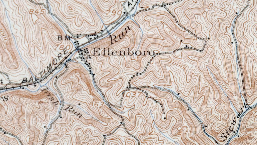
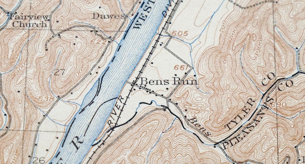
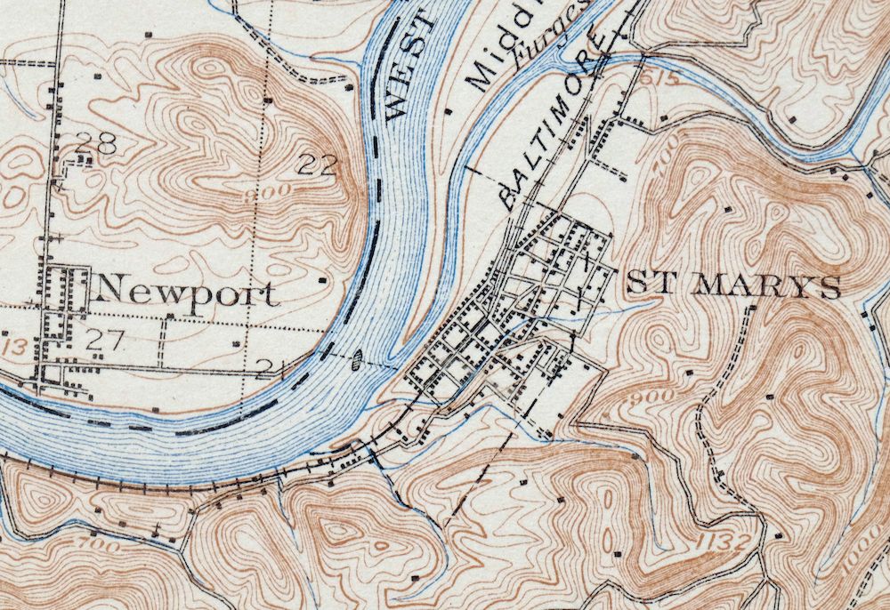
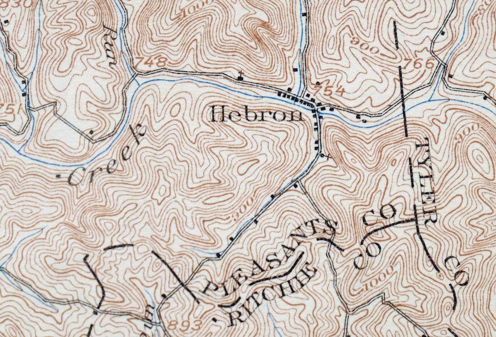
Saint Marys West Virginia Ellenboro Pike USGS Topo Map 1916
$47
A 1906 edition printed in 1916, this USGS 15-minute topographic sheet is in good condition, with a map area that shows no wear, no markings, and no blemishes; the sheet was never folded but is moderately handled, with age discoloration along the top collar, a pencilled notation in the upper right collar corner, and a small inventory stamp in the bottom right. Surveyed in 1903 and 1904 under geographer H.M. Wilson and engraved in 1906, it takes in a stretch of the Ohio River valley where West Virginia meets Ohio, with the quad area including Saint Marys and Pennsboro on the West Virginia side, the communities of Bens Run and Newport, and part of Wayne National Forest across the river in Ohio. Drawn before the modern highway and interstate system, it records the era’s rail lines, travel routes, and placenames across a landscape that once moved by river and railroad. Printed on thick stock, the sheet has real heft for a print now 110 years old.
In stock
This antique sheet is a 1906 edition of the Saint Marys West Virginia USGS topographic map. It is an authentic 110-year-old 1916 United States Geological Survey print in good condition.
HOW THIS MAP CAN BE USED
In addition to making a fascinating conversation piece, this sheet would look great in a frame or on display, make a unique and prized gift for anyone interested in this area, be perfect as a reference for genealogy studies or general historical research, or fill that missing piece in your collection.
FEATURES SHOWN ON THE MAP
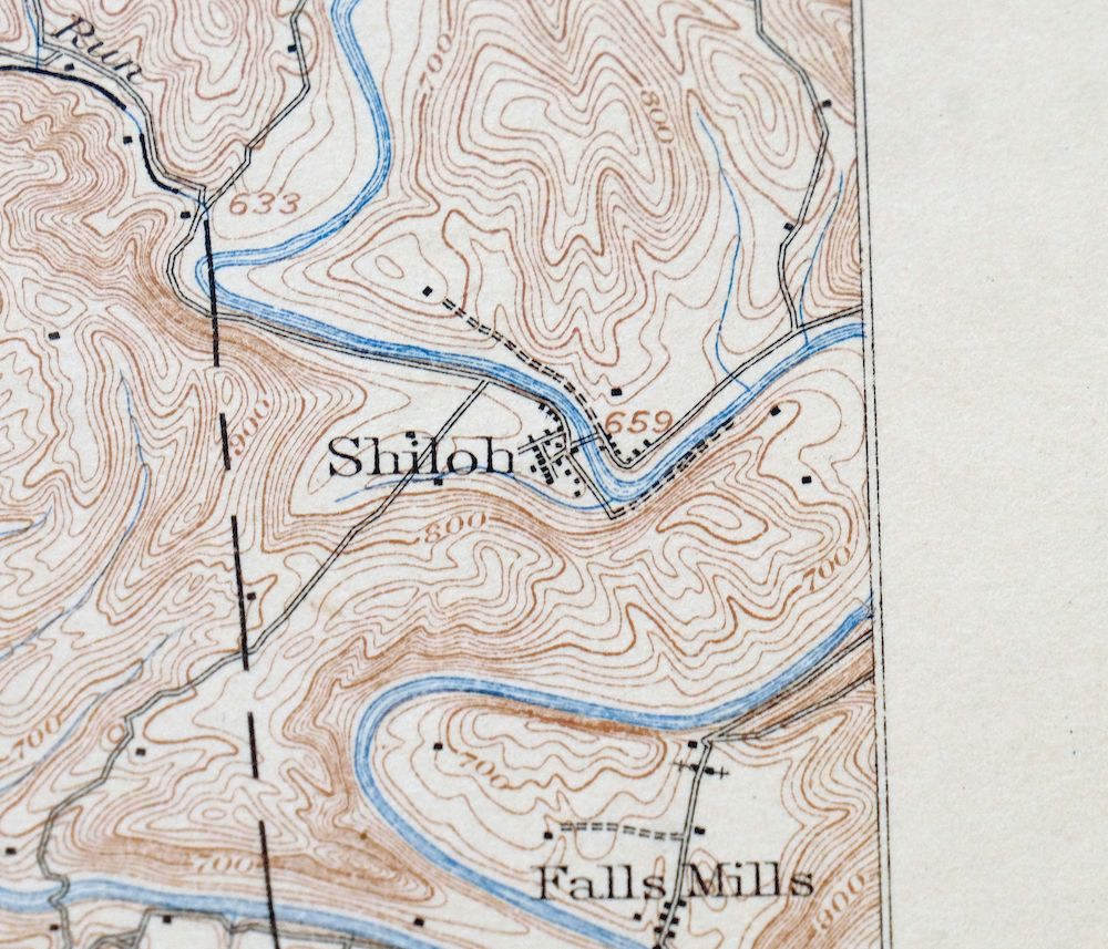
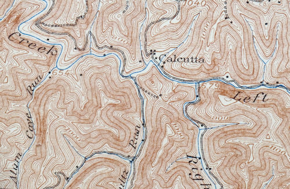
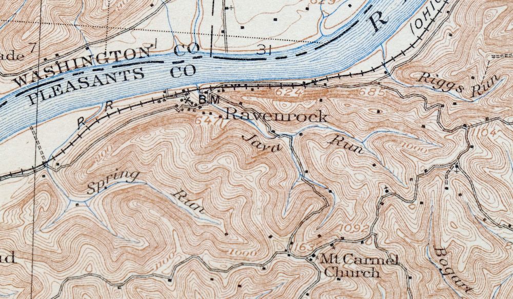
The Saint Marys 15-minute map shows cities and towns, roads, railroads, rivers, creeks, elevation contour lines, public land survey lines, county, state, and other administrative boundaries as they existed at the time of the survey in 1903 and 1904. All known structures (houses, businesses, churches, schools, barns, cabins, etc) are also shown, with exceptions in some urban areas, where only landmark buildings may be shown.
A VALUABLE HISTORICAL RECORD
Maps from the 15-minute series for the continental United States are no longer produced or printed by the USGS and original prints are becoming increasingly difficult to find. They are a valuable historical record for an area, as they contain many placenames and features that have been dropped from more recent maps.
Nearby maps
-

Marietta Ohio Wayne NF Devola USGS Topo Map 1912 Antique
$62 Add to cart -

Parkersburg Ohio Marietta Vienna USGS Topo Map 1912 Antique
$63 Add to cart -

Ravenswood West Virginia New Haven Evans USGS Topo Map 1908
$40 Add to cart -

Pomeroy Ohio Middleport Mason USGS Topo Map 1907 Antique
$37 Add to cart -

Point Pleasant West Virginia Middleport USGS Topo Map 1908
$25 Add to cart -

Winfield West Virginia Bancroft Southside USGS Topo Map 1908
$37 Add to cart -

Sutton West Virginia Glenville Elk River USGS Topo Map 1907
$110 Add to cart -

Pocatalico West Virginia Dunbar USGS Topographic Map 1977
$30 Add to cart -

Charleston West Virginia Cross Lanes Rand USGS Topo Map 1914
$75 Add to cart -

Charleston West West Virginia Dunbar USGS Topo Map 1978
$22 Add to cart -
Burgettstown Pennsylvania Midway USGS Topographic Map 1958
$47 Add to cart -

Saint Albans West Virginia Dunbar USGS Topographic Map 1909
$37 Add to cart -

Nicholas West Virginia Summersville Cowen USGS Topo Map 1912
$54 Add to cart -

Brownsville Pennsylvania Monessen Donora USGS Topo Map 1954
$38 Add to cart -

Carnegie Pennsylvania Pittsburgh Dormont USGS Topo Map 1954
$48 Add to cart -

Peytona West Virginia Marmet Belle USGS Topographic Map 1911
$42 Add to cart -
Beaver Pennsylvania Aliquippa Carnot-Moon USGS Topo Map 1958
$44 Add to cart -

Bald Knob West Virginia Mallory USGS Topo Map 1923 Antique
$50 Add to cart -

Era Ohio South Bloomfield Williamsport USGS Topo Map 1913
$40 Add to cart -
New Kensington Pennsylvania Plum USGS Topographic Map 1956
$44 Add to cart -

Wayne West Virginia Dunlow Cove Gap USGS Topo Map 1909
$42 Add to cart -

Franklin West Virginia Petersburg Onego USGS Topo Map 1914
$49 Add to cart -

Raleigh West Virginia Beckley Oak Hill USGS Topo Map 1901
$95 Add to cart -

Kenova Kentucky Louisa Grayson USGS Topo Map 1912 Antique
$54 Add to cart
