MAP DETAILS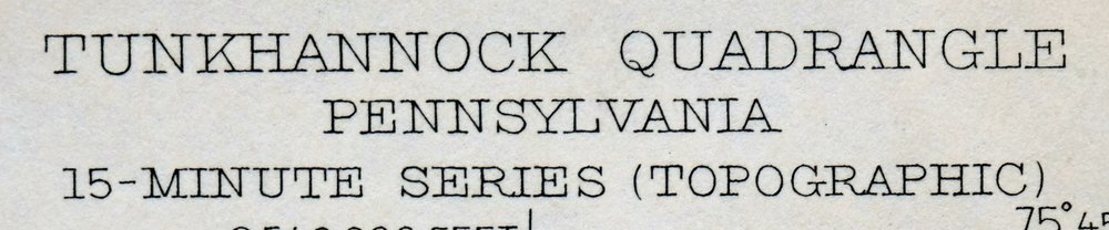 | |
|---|---|
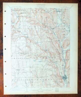
| TITLE | Tunkhannock |
| STATE | Pennsylvania |
| LOCATION | 20 miles northwest of Scranton |
| SERIES | 15-minute |
| SURVEYED | 1942 and 1946 Aerial and Field Survey |
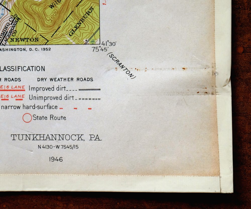
| EDITION | 1946 |
| PRINTED | 1952 |
| PRINT NOTES | Thick paper stock, includes woodland tint (green to indicate vegetated areas) |
| SCALE | 1:62500 |
| CONTOUR INTERVAL | 20 feet |
| SHEET DIMENSIONS | 17 x 21 inches |
| MAP DIMENSIONS | 13 1/8 x 17 1/2 inches |
| COVERAGE AREA | 13 x 17 miles |
| SHEET CONDITION For maps of this vintage, effort is made to note all visible flaws, no matter how minor. | |
| OVERALL CONDITION | Very Good |
| SHEET NOTES | lightly handled, never folded |
| MAP AREA | flawless map area |
| COLLARS | no markings, minor paperclip residue in lower right collar corner, edge protectors applied, no edge tears, library stamp in right collar |
 | |
| MAP COVERAGE Quadrangle extent overlaid on current basemap. | |
| PLACENAMES Depending on map series and survey date, all of the features listed below may not be shown on this map. This list contains features that currently exist or historically existed within the area covered by the map. The list can be used as a reference to determine if this map covers your area of interest. Placenames are listed alphabetically next to each feature type. | |
| CITIES AND TOWNS (CURRENT) | Dalton, Factoryville, Glenburn, Hop Bottom, Nicholson, Springville, and Tunkhannock |
| COUNTIES COVERED | Lackawanna, Susquehanna, and Wyoming |
| RIVERS AND STREAMS | Billings Mill Brook, Bowman Creek, Burdick Creek, Dry Creek, East Branch Field Brook, Elk Lake Stream, Field Brook, Horton Creek, Little Meshoppen Creek, Martins Creek, Meshoppen Creek, Monroe Creek, North Branch Meshoppen Creek, Osterhout Creek, Oxbow Creek, Oxbow Inlet, Pond Brook, South Branch Tunkhannock Creek, Stevens Creek, Sugar Hollow Creek, Susquehanna River, Swale Brook, Taques Creek, Thomas Creek, Tunkhannock Creek, West Creek, White Creek, and Willow Brook |
| WATER BODIES | Bartron Pond, Broadhead Pond, Lake Carey, Clark Pond, Cord Pond, Cruver Pond, Flow Pond, Gardners Pond, Hall Pond, Lake Carey, Lake Walter, Lake Winola, Lakeside Pond, Lord Pond, Oxbow Lake, Pollywog Pond, Schooley Pond, Lake Sheridan, Shibley Pond, Spencer Pond, Sweeny Pond, and Thomas Pond |
| Populated Place: Aldovin, Auburn Four Corners, Avery, Bardwell, Brookside, Carpenter Hollow, Cooper Corners, Deckertown, Dimock, Dixon, East Lemon, East Lynn, Eatonville, Factoryville, Hillsdale, Hop Bottom, Kaiserville, La Plume, Lake Carey, Lake Winola, Lemon, Lindaville, Lymanville, Lynn, Marcy, Nicholson, Oakley, Osterhout, Parkvale, Pine Grove, Rosengrant, Springville, Starkville, Tunkhannock, Tyler, Walls Corners, West Nicholson, and Woodhouse. Locations: Community Grove, Creekside Grove, Bennett Corners, Charles Brothers Plaza, Dimock Station, Dixon, Factoryville Station, Kasson Corners, Lemon, Lynn Station, Niven Corners, Route 6 Plaza, Saint Andrews Camp, Schlessers Corners, Shadow Brook Golf Course, Towne Plaza, and Village Center. Administrative Boundaries: Borough of Factoryville, Borough of Hop Bottom, Borough of Nicholson, Borough of Tunkhannock, Township of Clinton, Township of Dimock, Township of Eaton, Township of La Plume, Township of Lathrop, Township of Lemon, Township of Nicholson, Township of Overfield, Township of Springville, Township of Tunkhannock, and Township of West Abington. Mountains, Peaks, and Summits: Avery Hill, Avery Mountain, Bunker Hill, Casterline Hill, Cedar Ledge, Coon Hill, Craig Hill, Dam Hill, Dean Hill, East Mountain, Ellsworth Hill, Fish Hill, German Hill, Gobblers Knob, Greenwood Hill, Jennings Hill, Kintner Hill, Lake Sheridan Hill, Luce Hill, Meachem Hill, Middle Mountain, Miller Hill, Mitchell Hill, Mount Airy, Mulligan Hill, Nicholson Hill, Oak Hill, Osterhout Mountain, Pompey Hill, Prospect Hill, Round Hill, Round Top, Seely Hill, Sheldon Hill, Shupp Hill, Squire Hill, Strickland Hill, Taylor Hill, Thayer Hill, Thomas Hill, Tunnel Hill, Tyler Hill, Valentine Hill, Vargo Hill, Wallace Hill, Wilbur Hill, Wright Hill, and Yahmer Hill. Valleys and Canyons: Benson Hollow, Dark Hollow, Lithia Valley, Negro Hollow, Sugar Hollow, and Whippoorwill Hollow. Parks: Christy Mathewson Field, Moore Hall Alumni Garden, and Ned Boehm Field. Drainages: Garrison Creek, Billings Mill Brook, Bowman Creek, Burdick Creek, Dry Creek, East Branch Field Brook, Field Brook, Hop Bottom Creek, Horton Creek, Jackson Creek, Kern Glen Creek, Martins Creek, Meade Brook, Mill Run, Monroe Creek, North Branch Meshoppen Creek, Oxbow Creek, Oxbow Inlet, Pond Brook, South Branch Tunkhannock Creek, Stevens Creek, Sugar Hollow Creek, Swale Brook, Taques Creek, Thomas Creek, Trout Brook, Tunkhannock Creek, Utley Brook, West Creek, and White Creek. Islands: First Island, La Grange Island, Second Island, and Third Island. Churches: Grace Lutheran Church, Eaton Church, Lake Winola Church, Marcy Church, Union Chapel, and Union Church. Post Office: Dimock Post Office, Factoryville Post Office, Hop Bottom Post Office, La Plume Post Office, Nicholson Post Office, Springville Post Office, Tunkhannock Post Office, and Lake Winola Post Office. Hospitals: Tyler Memorial Hospital. Lakes and Ponds: Bartron Pond, Broadhead Pond, Carpenter Pond, Clark Pond, Cord Pond, Creamery Pond, Cruver Pond, Gardners Pond, Hall Pond, Holley Pond, Lake Carey, Lake Crystella, Lake Sheridan, Lakeside Pond, Lord Pond, Mud Pond, Oxbow Lake, Pollywog Pond, Racavitch Pond, States Mill Pond, and Tanner Pond. Buildings: Academic Affairs Center, Alumni Hall - Keystone College, Capwell Science Hall, Frear/Reynolds Residence Hall, Gambal Athletic Center, Hedgewood House, Hibbard Campus Center, Hollinshead Residence Hall, Holman Design Studio, Keystone Commons Residence Hall, Koelsch House, Lackawanna Hall, Moffat Residence Hall, Patrick Hall, Sabiston Hall, Seaman's Farmhouse, Sickler Hall, Tewksbury Residence Hall, The Sugar Shack, Wyoming Hall, Elk Lake Volunteer Fire Company, Factoryville Fire Company, Hop Bottom Fire Company, Lake Carey Volunteer Fire Company, Lake Winola Volunteer Fire Company 1, Nicholson Fire Company Station 7, Springville Volunteer Fire Company, Triton Hose Fire Company, Tunkhannock Ambulance Service, Tunkhannock Township Police Department, and Foster Station. Dams: Lake Carey Dam, Lake Sheridan Dam, Lake Walter Dam, Lakeside Pond Dam, Pa-Rc and D-105 Dam, Ross Dam, Saddle Lake Dam, Stevens Lake Dam, Sweeney Dam, and Winola Mill Pond Dam. Basins: Kern Glen. Airports: Seamans Field and Skyhaven Airport. Swamps: Broadbent Swamp, Brown Swamp, Gallager Swamp, Helman Swamp, Jenkins Swamp, Kinney Swamp, Loomis Swamp, Phelps Swamp, Round Swamp, Stantontown Swamp, and Stark Swamp. Census: Lake Winola Census Designated Place. Schools: Castle School, Eatonville School, Glen School, Keystone College, Roslund Elementary School, Squier Hill School, Tunkhannock High School, Tunkhannock Middle School, Tunnel Hill School, and Wallace Hill School. Reservoirs and Tanks: Flow Pond, Lake Walter, Lake Winola, Pedrick Pond, Schooley Pond, Shibley Pond, Spencer Pond, Stevens Lake, Sweeny Pond, and Thomas Pond. Cemetery: Bethel Cemetery, Radle Family Cemetery, Seamans Family Cemetery, Bunnell Cemetery, Button Cemetery, Clark Cemetery, Deckertown Cemetery, Dennis Cemetery, Dixon Cemetery, East Lemon Cemetery, Fairview Cemetery, Jackson Cemetery, Lathrop - Squier Cemetery, Lynn Cemetery, Oakley Cemetery, Pedrick Cemetery, Quick Cemetery, Russell - Prevost Cemetery, Saint Patricks Cemetery, Stark Cemetery, Strickland Hill Cemetery, Sunnyside Cemetery, and Tyler Hill Cemetery. | |
| SHIPPING AND RETURNS | |
 This map sheet will be carefully rolled in a sturdy tube and shipped via the US Postal Service. If you find that the sheet you receive is not as described in the listing, you may ship it back to us for a refund of the purchase price. | |
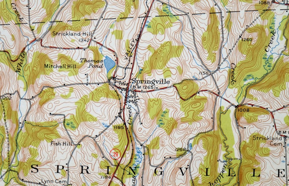
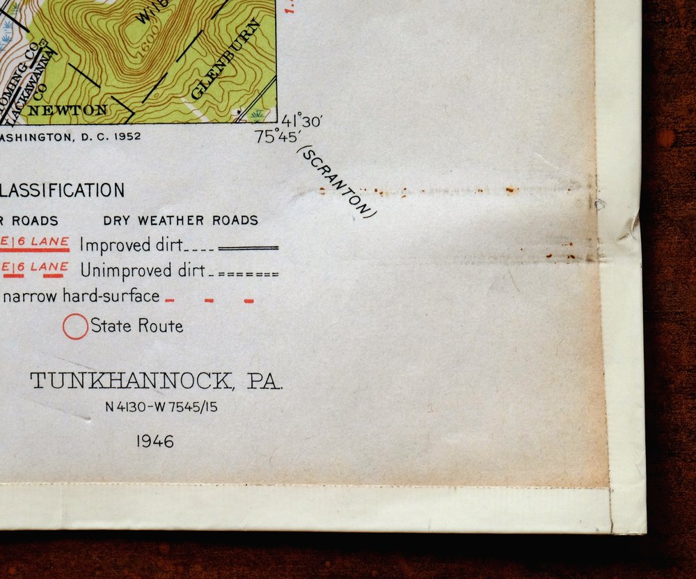
Tunkhannock Pennsylvania Dalton Glenburn USGS Topo Map 1952
$40
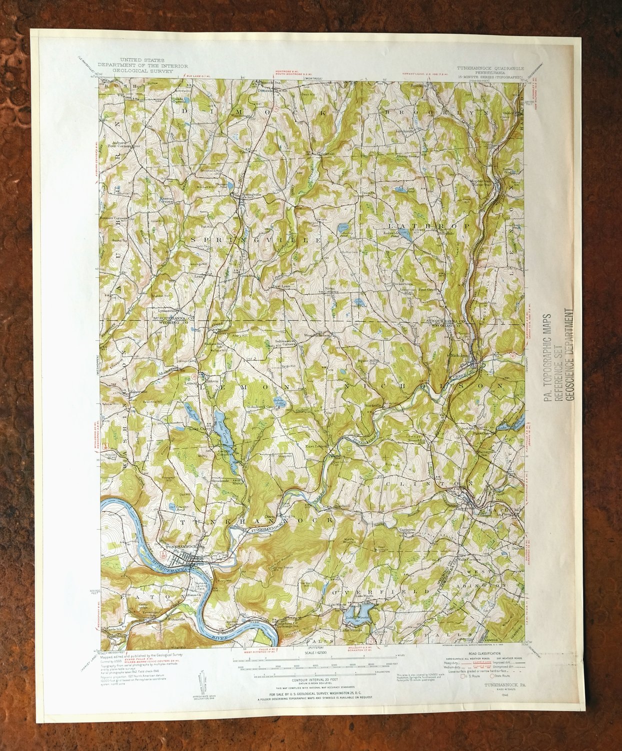
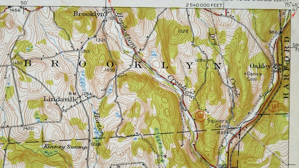
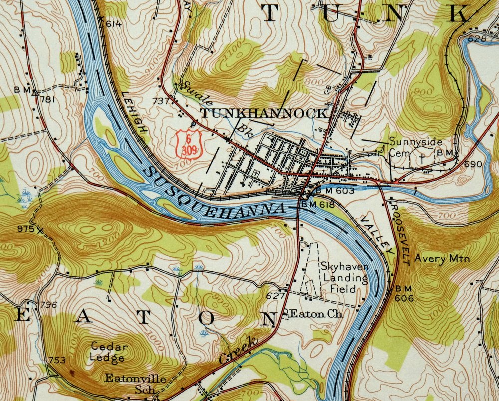
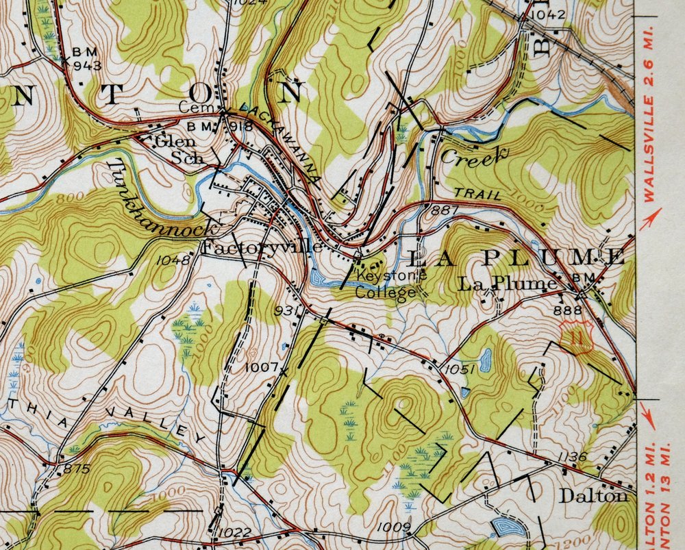
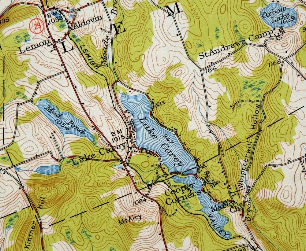
This USGS 15-minute topographic map is a 1946 edition printed in 1952, in very good condition on thick stock, lightly handled and never folded with a flawless map area. Covering a stretch of northeastern Pennsylvania about 20 miles northwest of Scranton, the quad takes in the borough of Tunkhannock along with Factoryville, Nicholson, Dalton, Glenburn, and the smaller communities of Hop Bottom and Springville across Wyoming, Lackawanna, and Susquehanna counties. Drawn from a 1942 and 1946 aerial and field survey with 20-foot contours, it maps the rolling hill country and stream valleys of this corner of the state in close detail, and the never-folded sheet has been kept flat with edge protectors applied.
In stock
This vintage sheet is a 1946 edition of the Tunkhannock Pennsylvania USGS topographic map. It is an original 74-year-old 1952 United States Geological Survey print in very good condition.
HOW THIS MAP CAN BE USED
In addition to making a fascinating conversation piece, this sheet would look great in a frame or on display, make a unique and prized gift for anyone interested in this area, be perfect as a reference for genealogy studies or general historical research, or fill that missing piece in your collection. Maps of this vintage are printed on durable stock and are well-suited for outdoor activities and recreation of all kinds, including hiking, backpacking, hunting, rafting and kayaking, backcountry skiing, geocaching, general exploration, treasure hunting, etc.
FEATURES SHOWN ON THE MAP
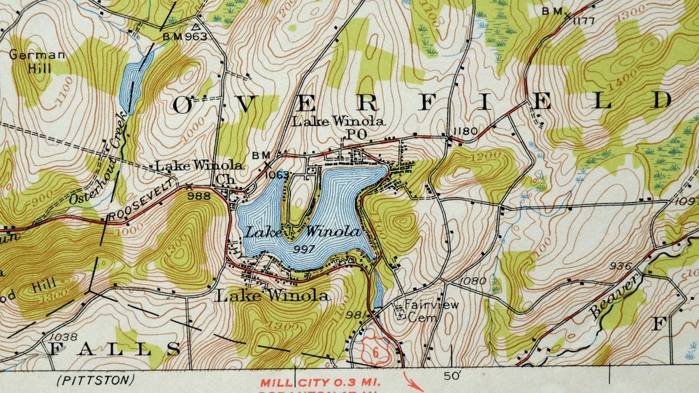
The Tunkhannock 15-minute map shows cities and towns, roads, railroads, utilities and energy infrastructure, rivers, creeks, elevation contour lines, public land survey lines, county, state, and other administrative boundaries as they existed at the time of the survey in 1942 and 1946. All known structures (houses, businesses, churches, schools, barns, cabins, etc) are also shown.
A VALUABLE HISTORICAL RECORD
Maps from the 15-minute series for the continental United States are no longer produced or printed by the USGS and original prints are becoming increasingly difficult to find. They are a valuable historical record for an area, as they contain many placenames and features that have been dropped from more recent maps.
Nearby maps
-
Susquehanna Pennsylvania Hallstead USGS 15-Min Topo Map 1959
$46 Add to cart -
Le Raysville Pennsylvania Little Meadows USGS Topo Map 1965
$41 Add to cart -
Honesdale Pennsylvania Carbondale Waymart USGS Topo Map 1945
$49 Add to cart -
Towanda Pennsylvania Rome USGS 15-Min Topo Map 1960 Vintage
$43 Add to cart -
Starrucca Pennsylvania Hancock Lakewood USGS Topo Map 1964
$40 Add to cart -

Damascus Pennsylvania Honesdale USGS Topo Map 1964 Vintage
$35 Add to cart -
Eagles Mere Pennsylvania Laporte USGS Topographic Map 1961
$36 Add to cart -
Hawley Pennsylvania Tafton USGS 15-Min Topo Map 1964 Vintage
$44 Add to cart -

Canton Pennsylvania Alba Ralston USGS Topo Map 1958 Vintage
$20 Add to cart -

Hazleton Pennsylvania Lansford Tamaqua USGS Topo Map 1956
$48 Add to cart -

Hughesville Pennsylvania Millville Iola USGS Topo Map 1962
$42 Add to cart -
Oxford New York Coventry Chenango River USGS Topo Map 1913
$54 Add to cart -

Milford Pennsylvania Lackawaxen Pond Eddy USGS Topo Map 1915
$58 Add to cart -
Warrensville Pennsylvania Barbours USGS Topographic Map 1962
$42 Add to cart -

Catawissa Pennsylvania Bloomsburg Ashland USGS Topo Map 1960
$45 Add to cart -

Tioga Pennsylvania Mansfield USGS Topo Map 1903 Antique
$68 Add to cart -
Olyphant Pennsylvania Scranton Dunmore USGS Topo Map 1960
$37 Add to cart -
Kingston Pennsylvania Wilkes-Barre USGS Topographic Map 1959
$39 Add to cart -
Wilkes-barre West Pennsylvania Nanticoke USGS Topo Map 1958
$30 Add to cart -

Wilkes-barre East Pennsylvania Laurel Run USGS Topo Map 1959
$36 Add to cart -

Hazleton Pennsylvania McAdoo Jeddo USGS Topographic Map 1962
$47 Add to cart -
Catatonk New York Ithaca Endicott USGS Topo Map 1908 Antique
$65 Add to cart -
Pitcher New York South Otselic USGS Topo Map 1910 Antique
$55 Add to cart -
Norwich New York Sherburne Smyrna USGS Topographic Map 1910
$90 Add to cart
